

9 products
-
 A Map of the Most Inhabited Part of New England, Containing the Provinces of Massachusets Bay and New Hampshire, With the Colonies of Conecticut and Rhode Island, Divided Into Counties and Townships; the Whole Composed from Actual Surveys and Its Situ...A Map of the Most Inhabited Part of New England, Containing the Provinces of Massachusets Bay and New Hampshire, With the Colonies of Conecticut and Rhode Island, Divided Into Counties and Townships; the Whole Composed from Actual Surveys and Its Situ...
- Regular price
-
$54.95 $176.95 - Regular price
-
$38.95 - Sale price
-
$54.95 $176.95
-
 A Map of the Most Inhabited Part of New England, Containing the Provinces of Massachusets Bay and New Hampshire With the Colonies of Conecticut and Rhode Island Divided Into Counties and Townships, the Whole Composed From Actual Surveys and Its Situat...A Map of the Most Inhabited Part of New England, Containing the Provinces of Massachusets Bay and New Hampshire With the Colonies of Conecticut and Rhode Island Divided Into Counties and Townships, the Whole Composed From Actual Surveys and Its Situat...
- Regular price
-
$54.95 $126.95 - Regular price
-
$38.95 - Sale price
-
$54.95 $126.95
-
 The British Colonies In North America from the North American Atlas, Selected from the Most Authentic Maps, Charts, Plans, &c. Hitherto Published. 1777The British Colonies In North America from the North American Atlas, Selected from the Most Authentic Maps, Charts, Plans, &c. Hitherto Published. 1777
- Regular price
-
$54.95 $217.95 - Regular price
-
$38.95 - Sale price
-
$54.95 $217.95
-
 Bowles's New Pocket Map of the Most Inhabited Part of New England; Comprehending the Provinces of Massachusets Bay and New Hampshire; With the Colonies of Connecticut & Rhode Island; Divided Into Their Counties, Townships, &c. Together With an Accurat...Bowles's New Pocket Map of the Most Inhabited Part of New England; Comprehending the Provinces of Massachusets Bay and New Hampshire; With the Colonies of Connecticut & Rhode Island; Divided Into Their Counties, Townships, &c. Together With an Accurat...
- Regular price
-
$54.95 $83.95 - Regular price
-
$38.95 - Sale price
-
$54.95 $83.95
-
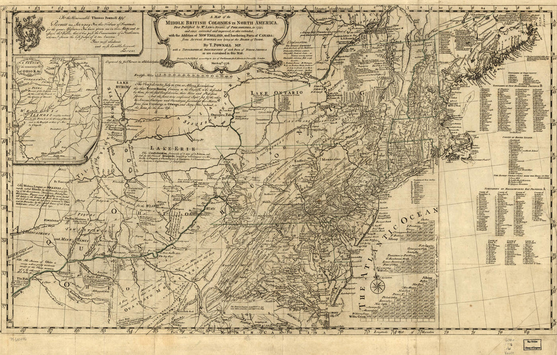 A Map of the Middle British Colonies In North America. First Published by Lewis Evans, of Philadelphia, In 1755; and Since Corrected and Improved, As Also Extended, With the Addition of New England, and Bordering Parts of Canada; From Actual Surveys N...A Map of the Middle British Colonies In North America. First Published by Lewis Evans, of Philadelphia, In 1755; and Since Corrected and Improved, As Also Extended, With the Addition of New England, and Bordering Parts of Canada; From Actual Surveys N...
- Regular price
-
$58.95 $99.95 - Regular price
-
$41.95 - Sale price
-
$58.95 $99.95
-
 A Map of the British Empire In America With the French, Spanish and the Dutch Settlements Adjacent Thereto (Carte Particulière De L'Amérique Septentrionale) 1741A Map of the British Empire In America With the French, Spanish and the Dutch Settlements Adjacent Thereto (Carte Particulière De L'Amérique Septentrionale) 1741
- Regular price
-
$54.95 $204.95 - Regular price
-
$38.95 - Sale price
-
$54.95 $204.95
-
 Sketch of the Engagement at Trenton, Given On the 26th of December 1776 Betwixt the American Troops Under Command of General Washington, and Three Hessian Regiments Under Command of Colonell Rall, In Which the Latter a Part Surrendert Themselves Priso...Sketch of the Engagement at Trenton, Given On the 26th of December 1776 Betwixt the American Troops Under Command of General Washington, and Three Hessian Regiments Under Command of Colonell Rall, In Which the Latter a Part Surrendert Themselves Priso...
- Regular price
-
$49.95 $99.95 - Regular price
-
$34.95 - Sale price
-
$49.95 $99.95
-
 A Map of the British Empire In America With the French and Spanish Settlements Adjacent Thereto (America Septentrionalis) 1733A Map of the British Empire In America With the French and Spanish Settlements Adjacent Thereto (America Septentrionalis) 1733
- Regular price
-
$54.95 $121.95 - Regular price
-
$38.95 - Sale price
-
$54.95 $121.95
-
 Historical Map of the United States Indicating Battlefields, Names of Commanders, Number of Troops Engaged, Number of Killed and Captured During French and Indian and Revolutionary Wars, Mexican War, and the Late Civil War 1890Historical Map of the United States Indicating Battlefields, Names of Commanders, Number of Troops Engaged, Number of Killed and Captured During French and Indian and Revolutionary Wars, Mexican War, and the Late Civil War 1890
- Regular price
-
$51.95 $206.95 - Regular price
-
$32.95 - Sale price
-
$51.95 $206.95


