

36 products
-
 Charleston Harbor S.C. Bombardment of Fort Sumter 1861Charleston Harbor S.C. Bombardment of Fort Sumter 1861
- Regular price
-
$49.95 $99.95 - Regular price
-
$29.95 - Sale price
-
$49.95 $99.95
-
 Sketch of Sea Coast of South Carolina and Georgia from Bull's Bay to Ossabaw Sound 1863Sketch of Sea Coast of South Carolina and Georgia from Bull's Bay to Ossabaw Sound 1863
- Regular price
-
$58.95 $99.95 - Regular price
-
$41.95 - Sale price
-
$58.95 $99.95
-
 A Plan of the Town and Harbour of Boston and the Country Adjacent With the Road from Boston to Concord, Shewing the Place of the Late Engagement Between the King's Troops & the Provincials, Together With the Several Encampments of Both Armies In & Abo...A Plan of the Town and Harbour of Boston and the Country Adjacent With the Road from Boston to Concord, Shewing the Place of the Late Engagement Between the King's Troops & the Provincials, Together With the Several Encampments of Both Armies In & Abo...
- Regular price
-
$49.95 $83.95 - Regular price
-
$34.95 - Sale price
-
$49.95 $83.95
-
 Sketch of a Part of the Coast of Georgia from Savannah River to Ossabaw Sound Showing the Relative Positions of the U.S. Iron Clad Steamer Montauk & the Rebel Fort McAllister During the Bombardment of Feb 1st 1863Sketch of a Part of the Coast of Georgia from Savannah River to Ossabaw Sound Showing the Relative Positions of the U.S. Iron Clad Steamer Montauk & the Rebel Fort McAllister During the Bombardment of Feb 1st 1863
- Regular price
-
$49.95 $83.95 - Regular price
-
$29.95 - Sale price
-
$49.95 $83.95
-
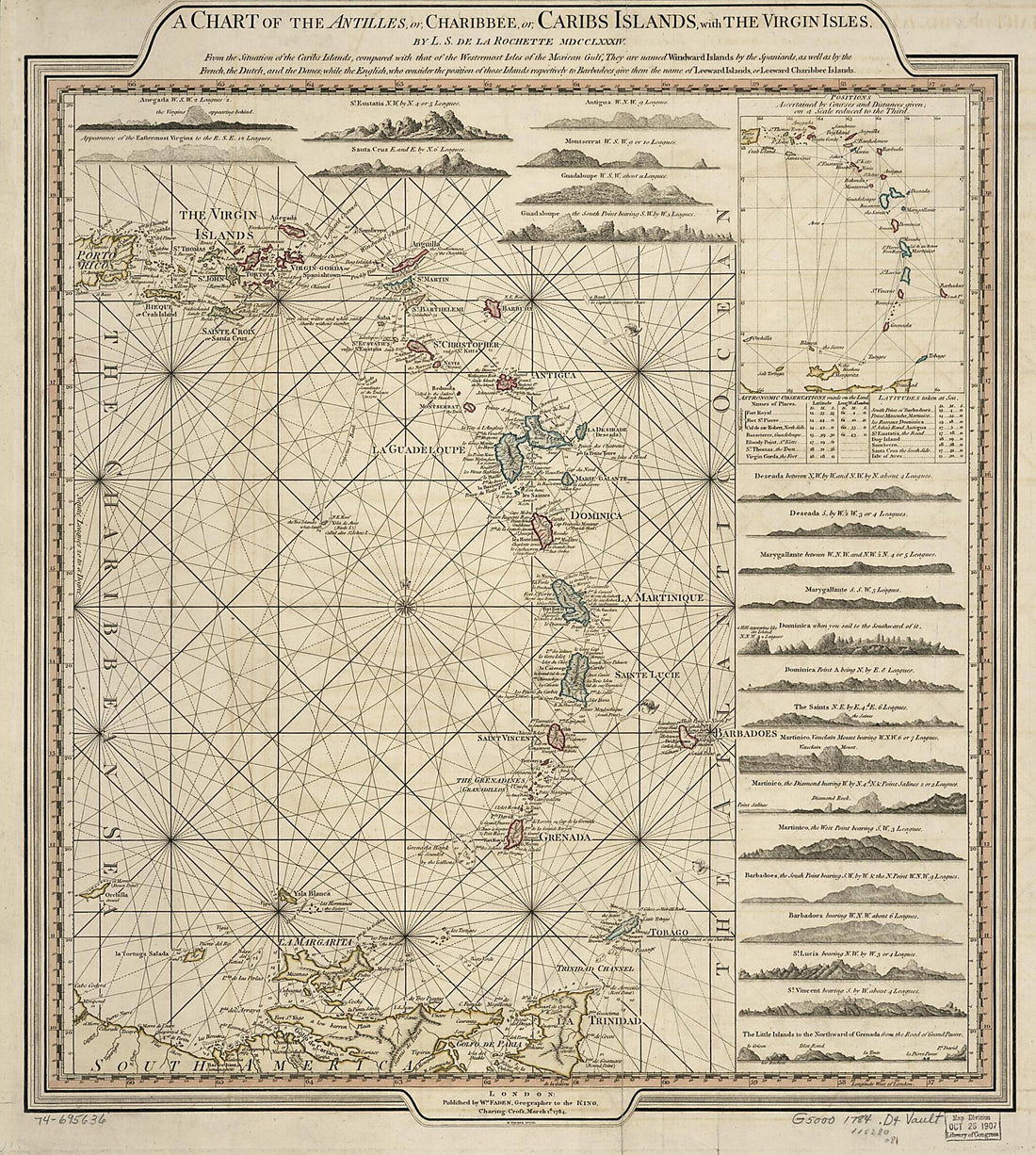 A Chart of the Antilles, Or, Charibbee, Or, Caribs Islands, With the Virgin Isles 1784A Chart of the Antilles, Or, Charibbee, Or, Caribs Islands, With the Virgin Isles 1784
- Regular price
-
$49.95 $162.95 - Regular price
-
$34.95 - Sale price
-
$49.95 $162.95
-
 Coast of North Carolina & Virginia 1863Coast of North Carolina & Virginia 1863
- Regular price
-
$58.95 $126.95 - Regular price
-
$41.95 - Sale price
-
$58.95 $126.95
-
 View of Johnson's Island, Near Sandusky City, Ohio 1865View of Johnson's Island, Near Sandusky City, Ohio 1865
- Regular price
-
$58.95 $99.95 - Regular price
-
$41.95 - Sale price
-
$58.95 $99.95
-
 New Brunswick, Nova Scotia, Newfoundland, & Prince Edward Island from Family Atlas 1862New Brunswick, Nova Scotia, Newfoundland, & Prince Edward Island from Family Atlas 1862
- Regular price
-
$49.95 $94.95 - Regular price
-
$29.95 - Sale price
-
$49.95 $94.95
-
 A Plan of the Island of St. John from the North American Atlas, Selected from the Most Authentic Maps, Charts, Plans, &c. Hitherto Published. 1777A Plan of the Island of St. John from the North American Atlas, Selected from the Most Authentic Maps, Charts, Plans, &c. Hitherto Published. 1777
- Regular price
-
$50.95 $172.95 - Regular price
-
$41.95 - Sale price
-
$50.95 $172.95
-
 Map of BoothBay and Adjacent Islands from Colby's Atlas of Maine, 1887Map of BoothBay and Adjacent Islands from Colby's Atlas of Maine, 1887
- Regular price
-
$49.95 $68.95 - Regular price
-
$34.95 - Sale price
-
$49.95 $68.95
-
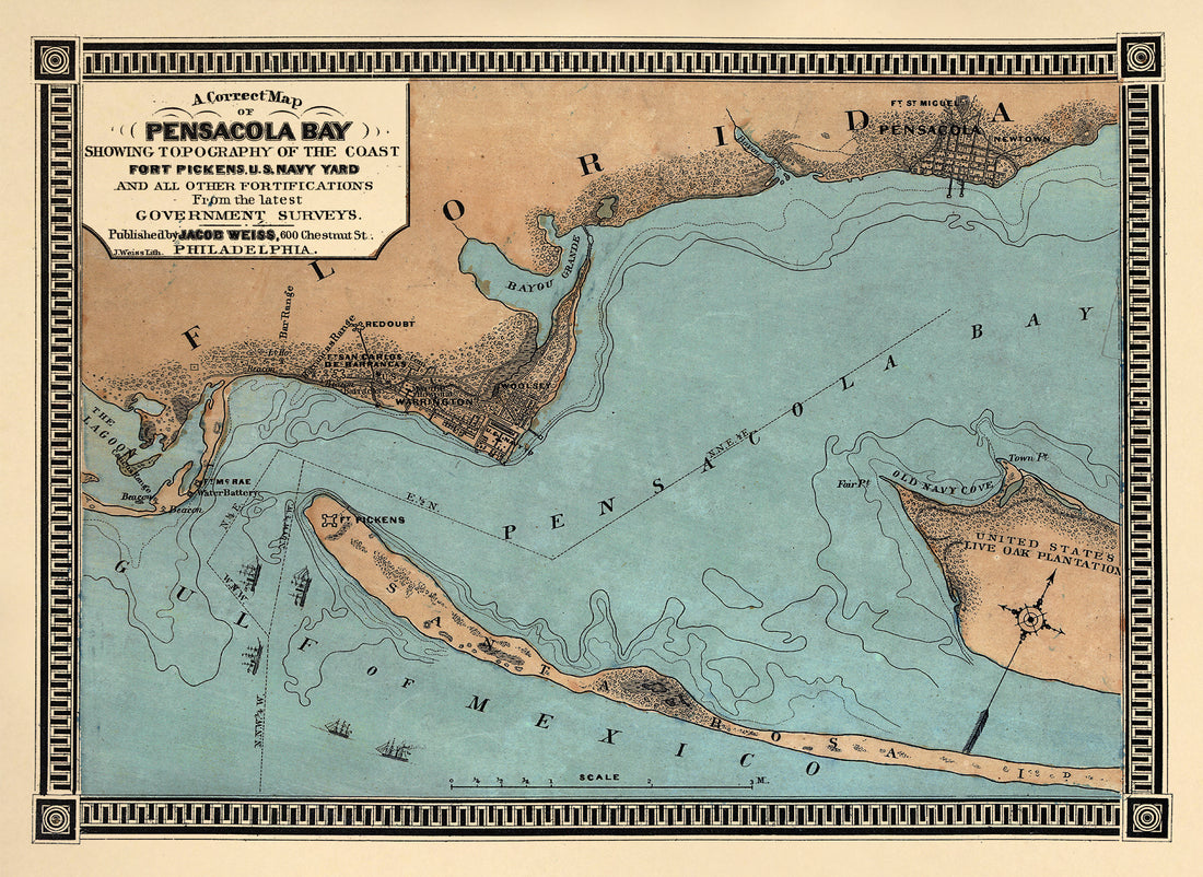 A Correct Map of Pensacola Bay Showing Topography of the Coast, Fort Pickens, U.S. Navy Yard, and All Other Fortifications from the Latest Government Surveys 1860A Correct Map of Pensacola Bay Showing Topography of the Coast, Fort Pickens, U.S. Navy Yard, and All Other Fortifications from the Latest Government Surveys 1860
- Regular price
-
$49.95 $88.95 - Regular price
-
$34.95 - Sale price
-
$49.95 $88.95
-
 Coast of South Carolina from Charleston to Hilton Head 1862Coast of South Carolina from Charleston to Hilton Head 1862
- Regular price
-
$58.95 $99.95 - Regular price
-
$41.95 - Sale price
-
$58.95 $99.95


