Quick links
11037 products
-
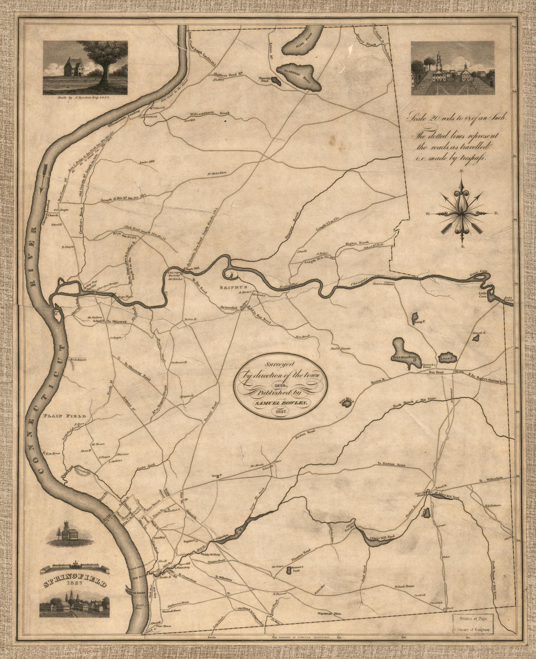 Springfield, 1827 : Surveyed by Direction of the Town, 1826Springfield, 1827 : Surveyed by Direction of the Town, 1826
- Regular price
-
$39.95 $83.95 - Regular price
-
$34.95 - Sale price
-
$39.95 $83.95
-
 A Plan of the Town of New Haven : With All the Buildings In 1748 Taken by the Hon. Gen. Wadsworth of Durham to Which Are Added the Names and Professions of the Inhabitants at That Period : Also the Location of Lots to Many of the First Grantees 1806A Plan of the Town of New Haven : With All the Buildings In 1748 Taken by the Hon. Gen. Wadsworth of Durham to Which Are Added the Names and Professions of the Inhabitants at That Period : Also the Location of Lots to Many of the First Grantees 1806
- Regular price
-
$43.95 $102.95 - Regular price
-
$32.95 - Sale price
-
$43.95 $102.95
-
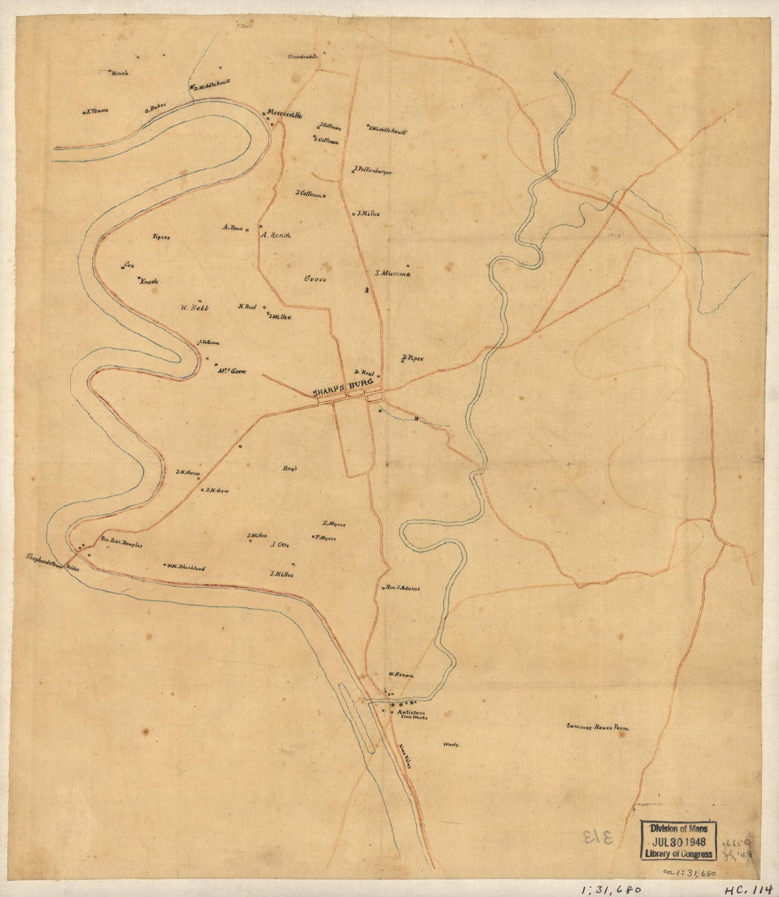 Preliminary Map of the Antietam Battlefield Area, Including Sharpsburg and the Adjacent Territory 1895Preliminary Map of the Antietam Battlefield Area, Including Sharpsburg and the Adjacent Territory 1895
- Regular price
-
$39.95 $83.95 - Regular price
-
$29.95 - Sale price
-
$39.95 $83.95
-
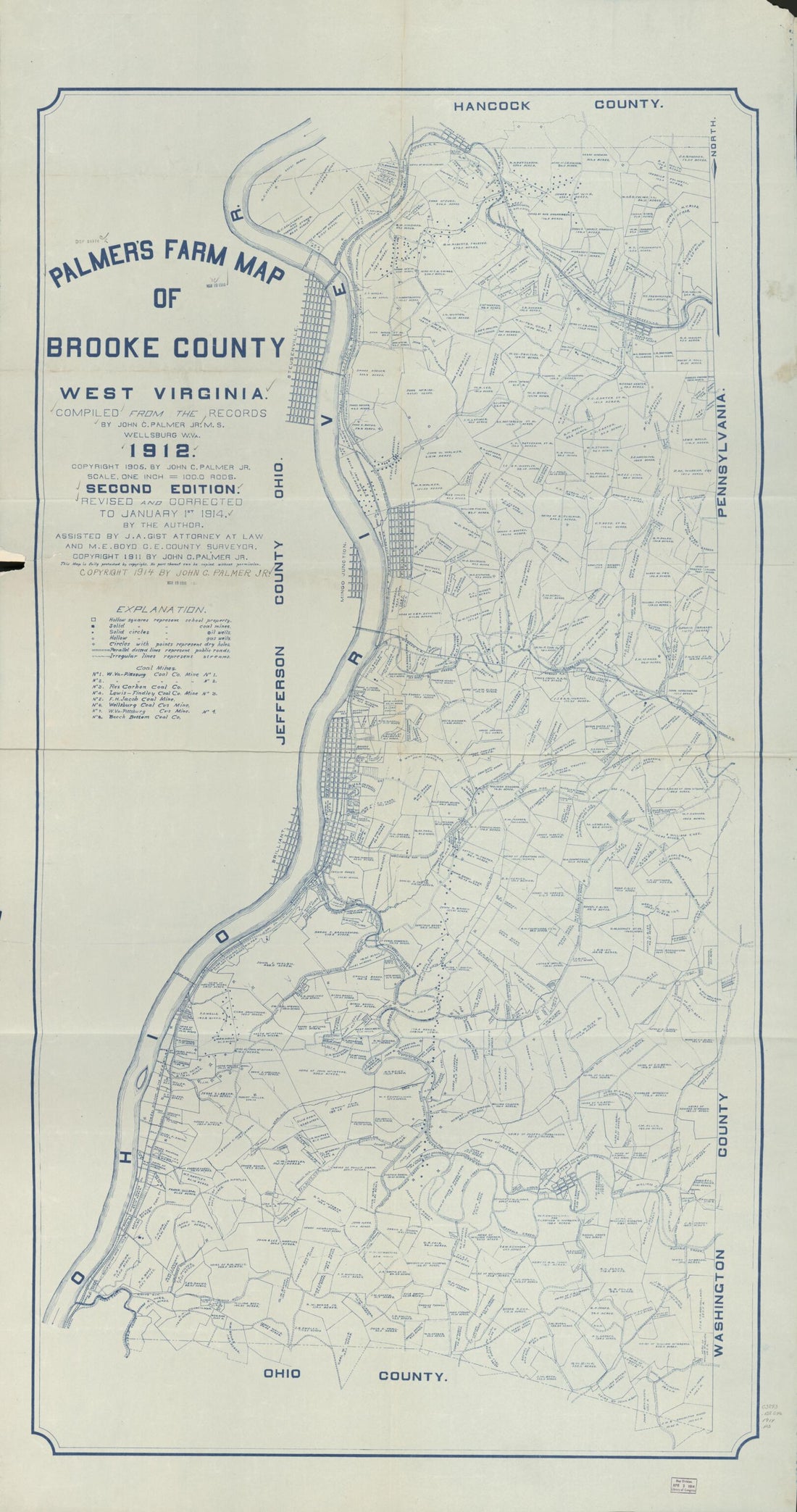 Palmer's Farm Map of Brooke County, West Virginia (Farm Map of Brooke County, West Virginia) 1914Palmer's Farm Map of Brooke County, West Virginia (Farm Map of Brooke County, West Virginia) 1914
- Regular price
-
$46.95 $201.95 - Regular price
-
$41.95 - Sale price
-
$46.95 $201.95
-
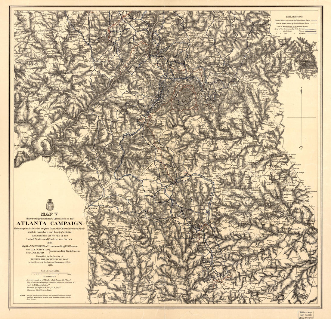 Maps Illustrating the Military Operations of the Atlanta Campaign ... 1864 1875Maps Illustrating the Military Operations of the Atlanta Campaign ... 1864 1875
- Regular price
-
$39.95 $223.95 - Regular price
-
$34.95 - Sale price
-
$39.95 $223.95
-
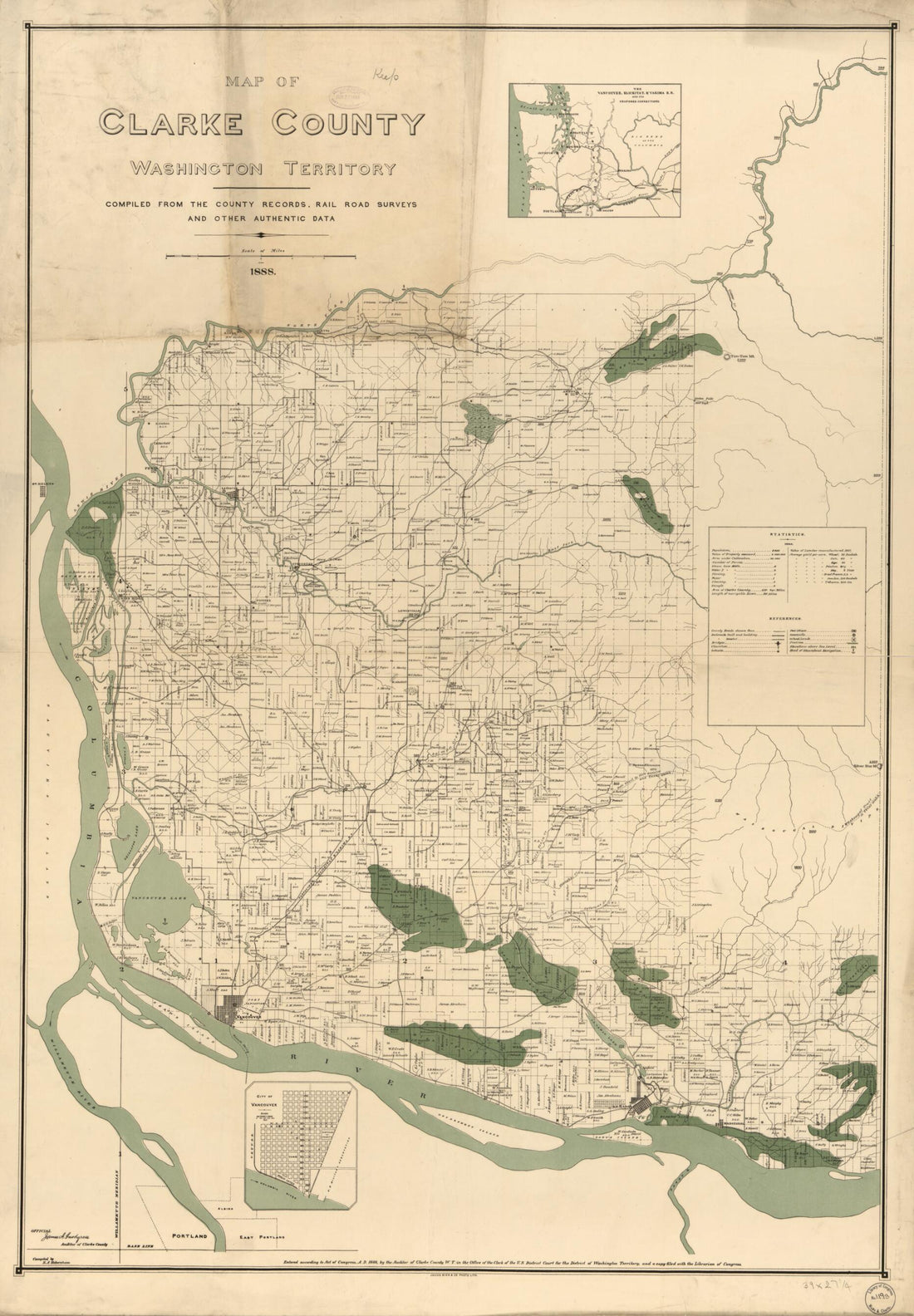 Map of Clarke County, Washington Territory : Compiled from the County Records, Rail Road Surveys, and Other Authentic Data 1888Map of Clarke County, Washington Territory : Compiled from the County Records, Rail Road Surveys, and Other Authentic Data 1888
- Regular price
-
$46.95 $124.95 - Regular price
-
$41.95 - Sale price
-
$46.95 $124.95
-
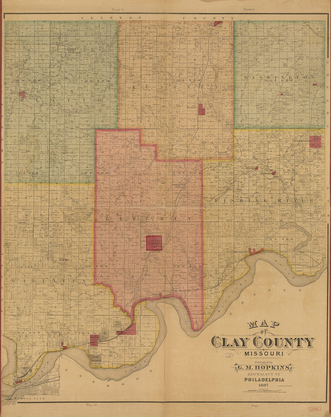 Map of Clay County, Missouri 1887Map of Clay County, Missouri 1887
- Regular price
-
$39.95 $327.95 - Regular price
-
$34.95 - Sale price
-
$39.95 $327.95
-
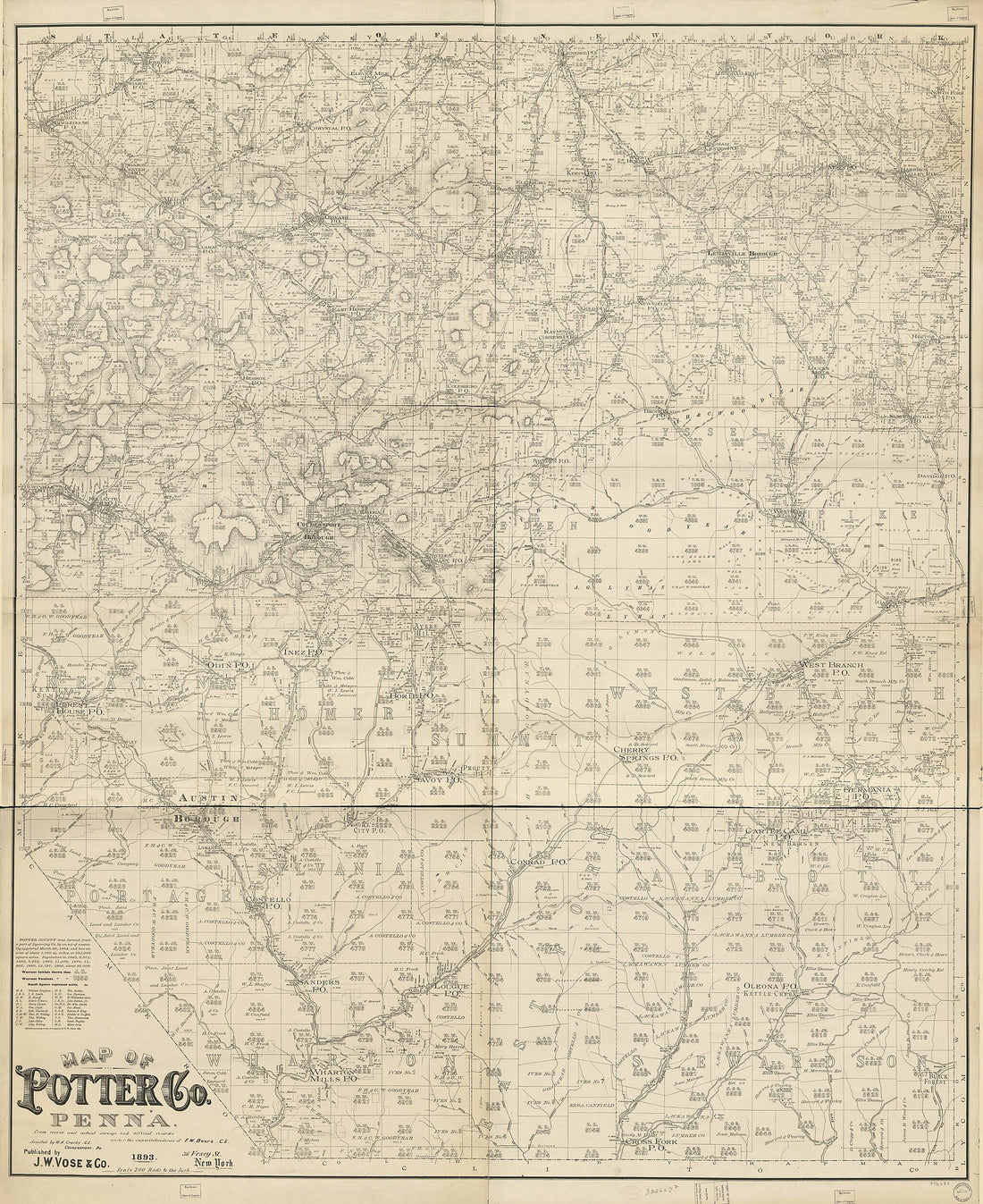 Map of Potter County, Penna. : from Recent and Actual Surveys and Official Records 1893Map of Potter County, Penna. : from Recent and Actual Surveys and Official Records 1893
- Regular price
-
$39.95 $324.95 - Regular price
-
$34.95 - Sale price
-
$39.95 $324.95
-
 Topographical Map of Centre Co., Pennsylvania : from Actual Surveys 1861Topographical Map of Centre Co., Pennsylvania : from Actual Surveys 1861
- Regular price
-
$39.95 $221.95 - Regular price
-
$34.95 - Sale price
-
$39.95 $221.95
-
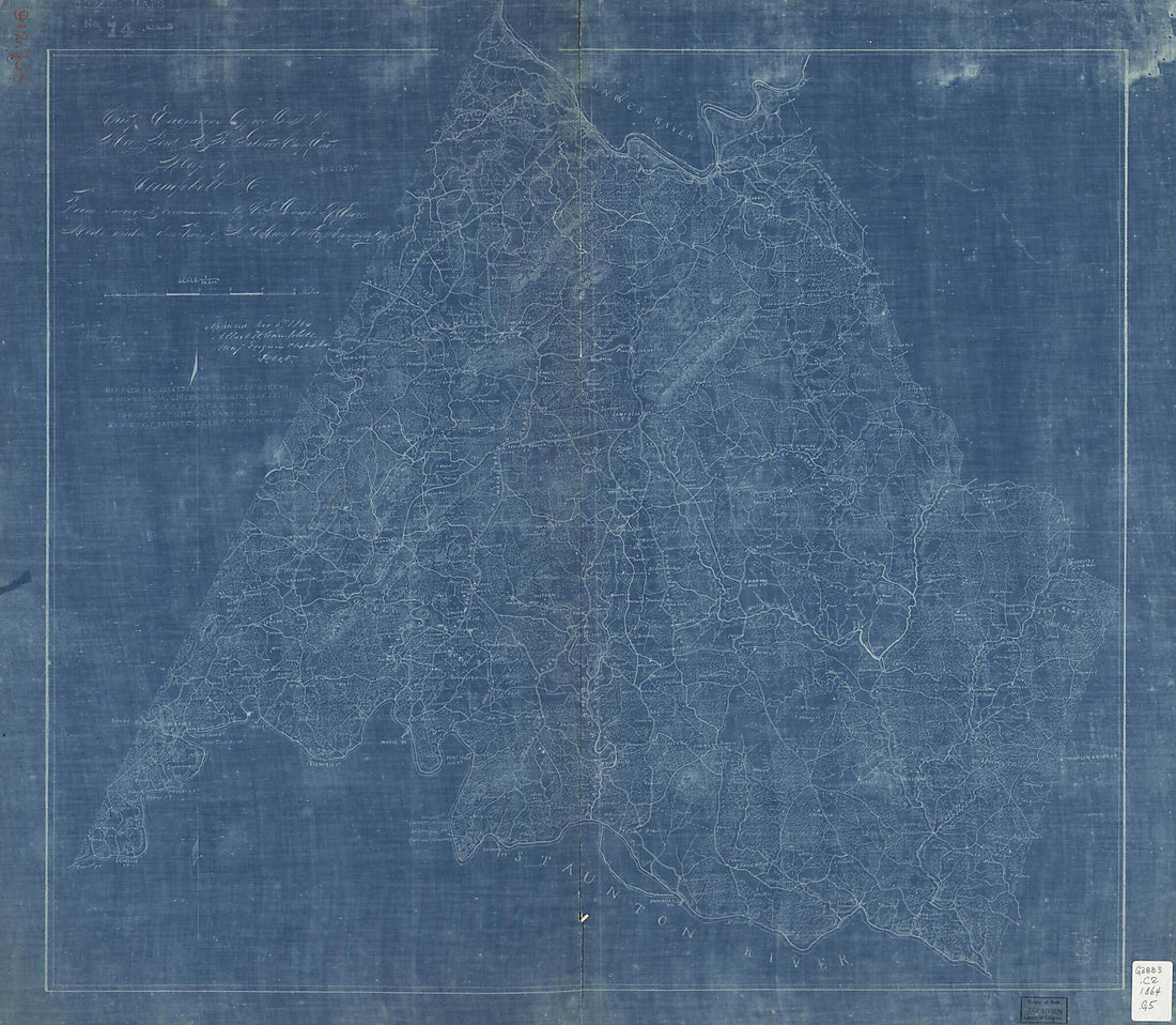 Map of Campbell County (Map of Campbell County, Chief Engineer's Office, D.N.V., Maj. Gen. J.F. Gilmer, Chief Engineer) 1864Map of Campbell County (Map of Campbell County, Chief Engineer's Office, D.N.V., Maj. Gen. J.F. Gilmer, Chief Engineer) 1864
- Regular price
-
$39.95 $174.95 - Regular price
-
$34.95 - Sale price
-
$39.95 $174.95
-
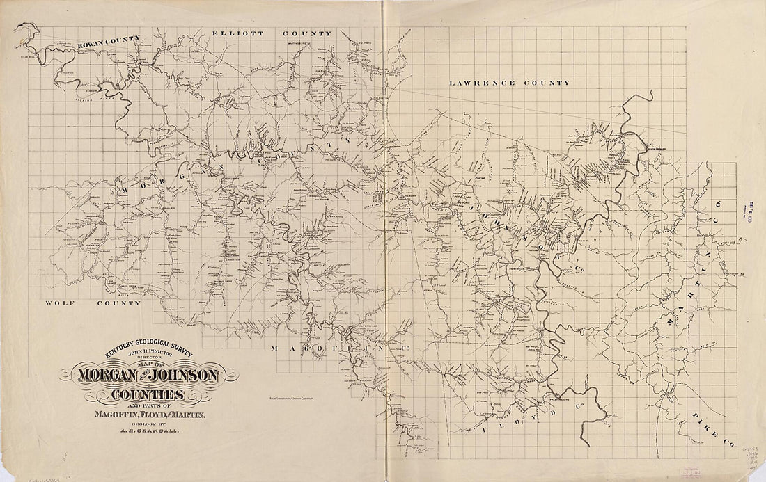 Map of Morgan and Johnson Counties and Parts of Magofin, Floyd and Martin 1880Map of Morgan and Johnson Counties and Parts of Magofin, Floyd and Martin 1880
- Regular price
-
$46.95 $213.95 - Regular price
-
$41.95 - Sale price
-
$46.95 $213.95
-
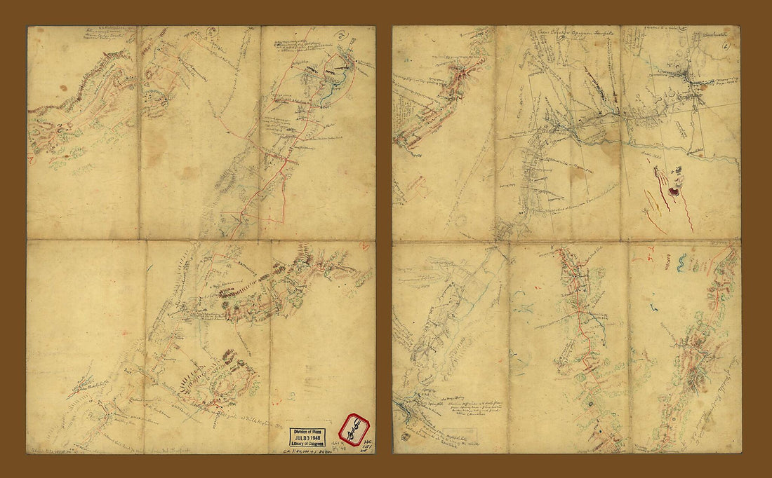 Sketches of Roads In the Shenandoah Valley Between Winchester and Woodstock, Virginia 1863Sketches of Roads In the Shenandoah Valley Between Winchester and Woodstock, Virginia 1863
- Regular price
-
$46.95 $194.95 - Regular price
-
$41.95 - Sale price
-
$46.95 $194.95


