1264 products
-
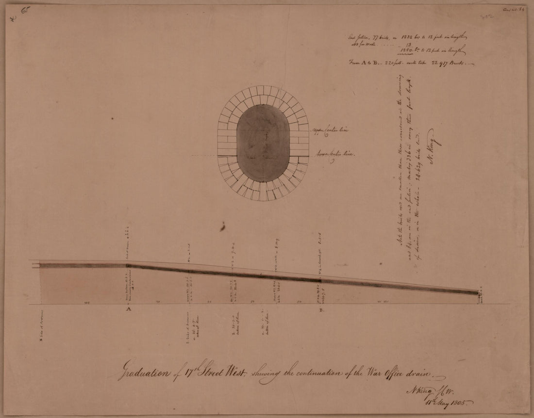 Graduation of 17th Street West Shewing the Continuation of the War Office Drain : Washington D.C. 1805Graduation of 17th Street West Shewing the Continuation of the War Office Drain : Washington D.C. 1805
- Regular price
-
$39.95 $83.95 - Regular price
-
$34.95 - Sale price
-
$39.95 $83.95
-
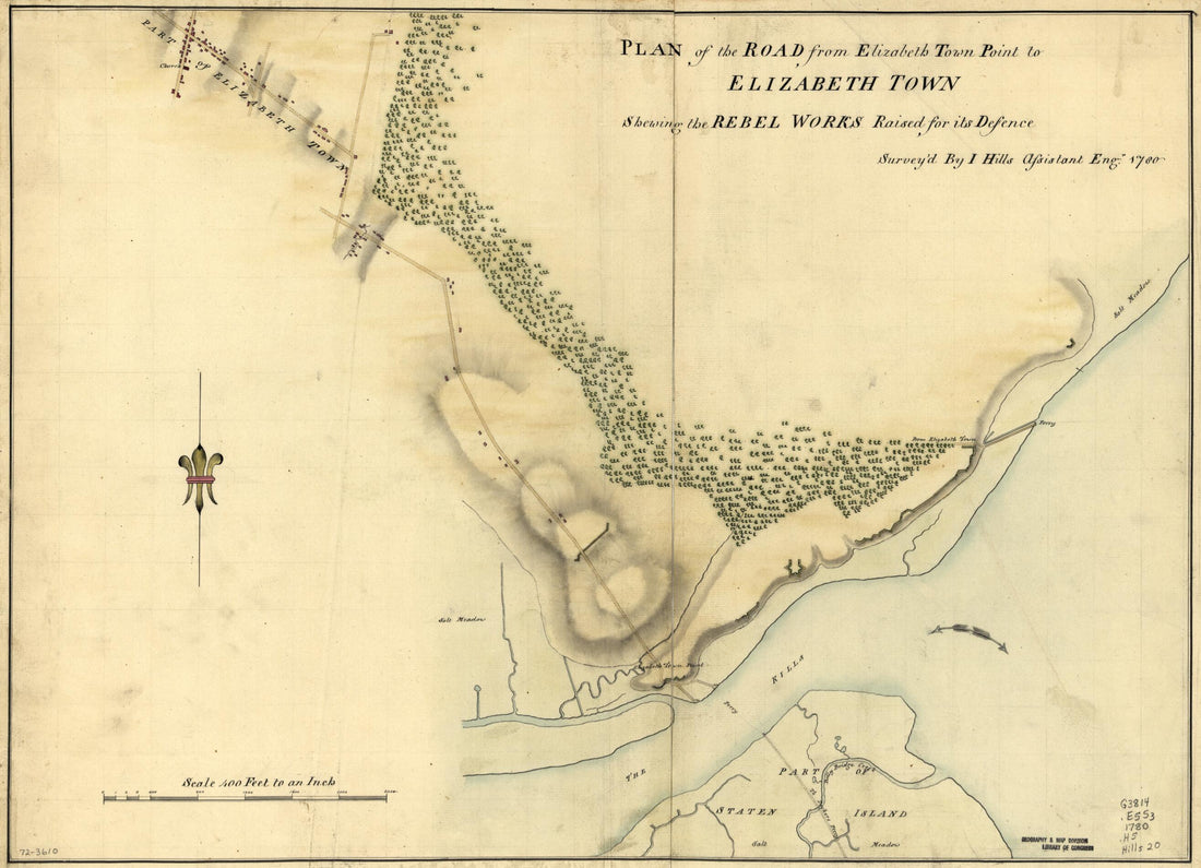 Plan of the Road from Elizabeth Town Point to Elizabeth Town : Shewing the Rebel Works Raised for Its Defence 1780Plan of the Road from Elizabeth Town Point to Elizabeth Town : Shewing the Rebel Works Raised for Its Defence 1780
- Regular price
-
$43.95 $88.95 - Regular price
-
$32.95 - Sale price
-
$43.95 $88.95
-
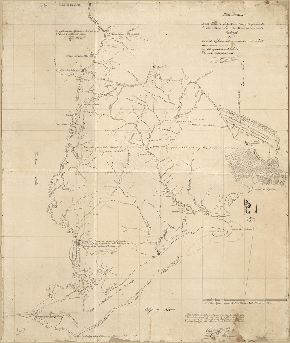 Plano Borrador De Las Posesiones Los Señores Forbes Y Compañia Entre Los Rios Apalachicola Y San Marcos En La Florida Occidental 1817Plano Borrador De Las Posesiones Los Señores Forbes Y Compañia Entre Los Rios Apalachicola Y San Marcos En La Florida Occidental 1817
- Regular price
-
$39.95 $92.95 - Regular price
-
$34.95 - Sale price
-
$39.95 $92.95
-
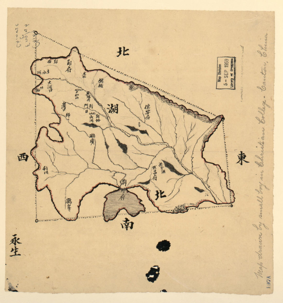 Hubei Sheng Tu. (湖北省图, Map of Hubei Province) 1900Hubei Sheng Tu. (湖北省图, Map of Hubei Province) 1900
- Regular price
-
$39.95 $83.95 - Regular price
-
$29.95 - Sale price
-
$39.95 $83.95
-
 Plano De La Cala De Tomaseo Cituada En La Costa Septeentrional sic Del Estrecho De Magallans. Pr. Lattd. S. De 53⁰27 1/2ʹ Y Longd. De 66⁰45ʹ Occidental De Cádiz 1700Plano De La Cala De Tomaseo Cituada En La Costa Septeentrional sic Del Estrecho De Magallans. Pr. Lattd. S. De 53⁰27 1/2ʹ Y Longd. De 66⁰45ʹ Occidental De Cádiz 1700
- Regular price
-
$43.95 $88.95 - Regular price
-
$32.95 - Sale price
-
$43.95 $88.95
-
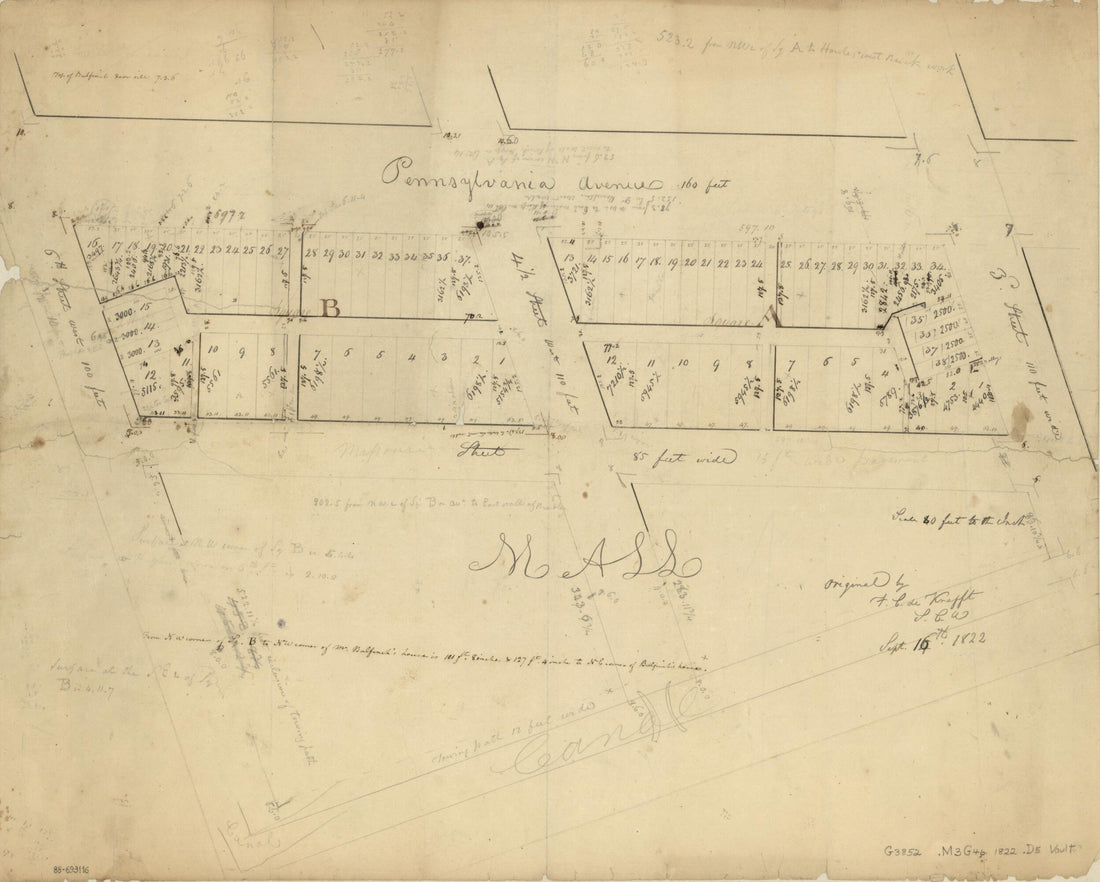 Cadastral Survey Map of Squares a and B Adjacent to Pennsylvania Avenue, N.W., Washington D.C. : New Part of the Mall 1822Cadastral Survey Map of Squares a and B Adjacent to Pennsylvania Avenue, N.W., Washington D.C. : New Part of the Mall 1822
- Regular price
-
$39.95 $83.95 - Regular price
-
$34.95 - Sale price
-
$39.95 $83.95
-
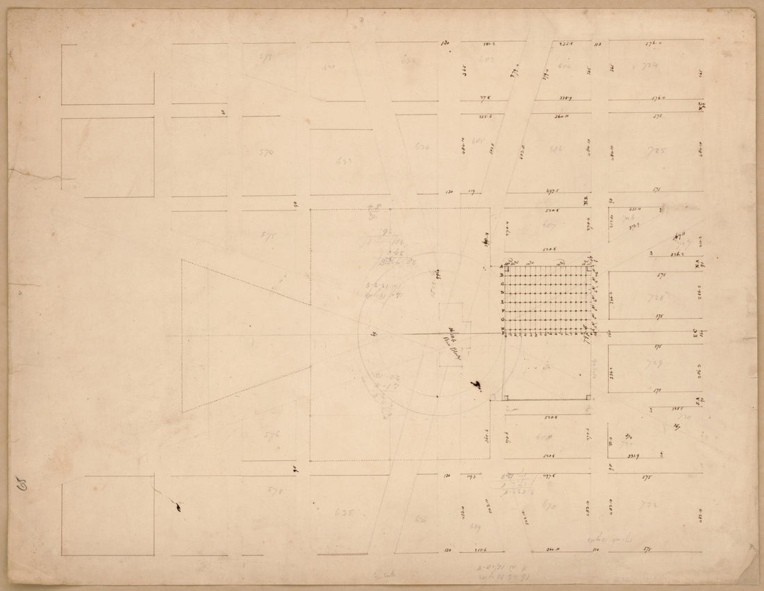 Map of the Capitol Grounds and Surrounding Squares, Washington D.C. 1800Map of the Capitol Grounds and Surrounding Squares, Washington D.C. 1800
- Regular price
-
$39.95 $83.95 - Regular price
-
$34.95 - Sale price
-
$39.95 $83.95
-
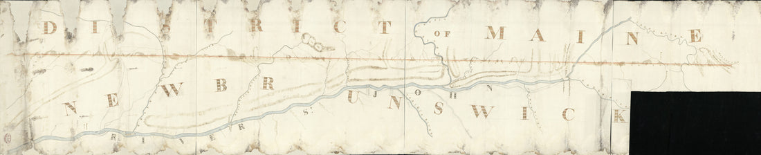 Survey of the Boundary Between the District of Maine and the Province of New Brunswick From the Saint Croix River to the Wagansis River in 1817Survey of the Boundary Between the District of Maine and the Province of New Brunswick From the Saint Croix River to the Wagansis River in 1817
- Regular price
-
$46.95 $208.95 - Regular price
-
$41.95 - Sale price
-
$46.95 $208.95
-
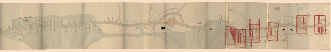 運加捕上下泉六廳光绪九年搶修工程咨估圖, the Grand Canal Embankment Repair Cost Map for Yunjiabu in 1883運加捕上下泉六廳光绪九年搶修工程咨估圖, the Grand Canal Embankment Repair Cost Map for Yunjiabu in 1883
- Regular price
-
$46.95 $210.95 - Regular price
-
$41.95 - Sale price
-
$46.95 $210.95
-
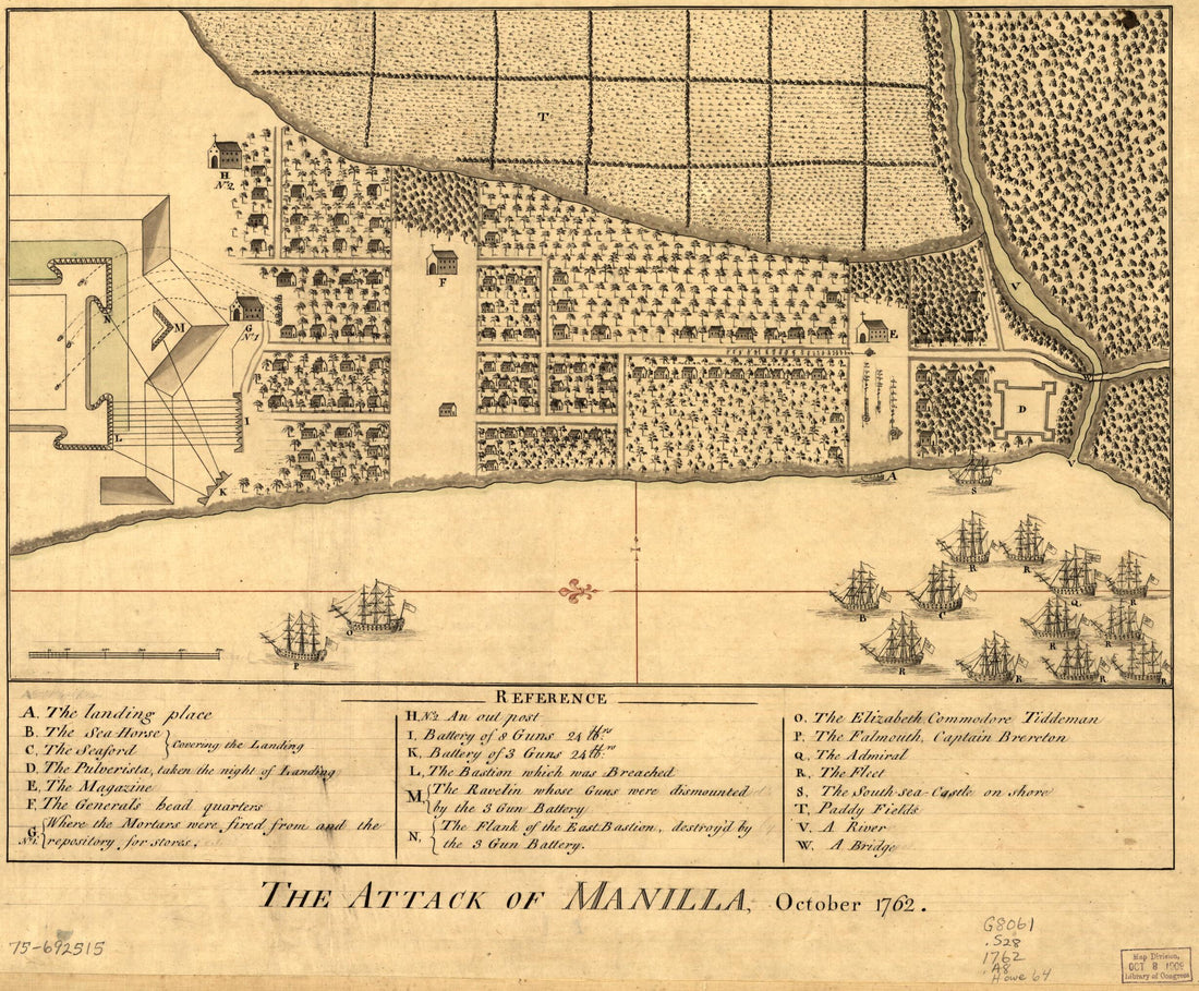 The Attack of Manilla, October 1762The Attack of Manilla, October 1762
- Regular price
-
$39.95 $83.95 - Regular price
-
$29.95 - Sale price
-
$39.95 $83.95
-
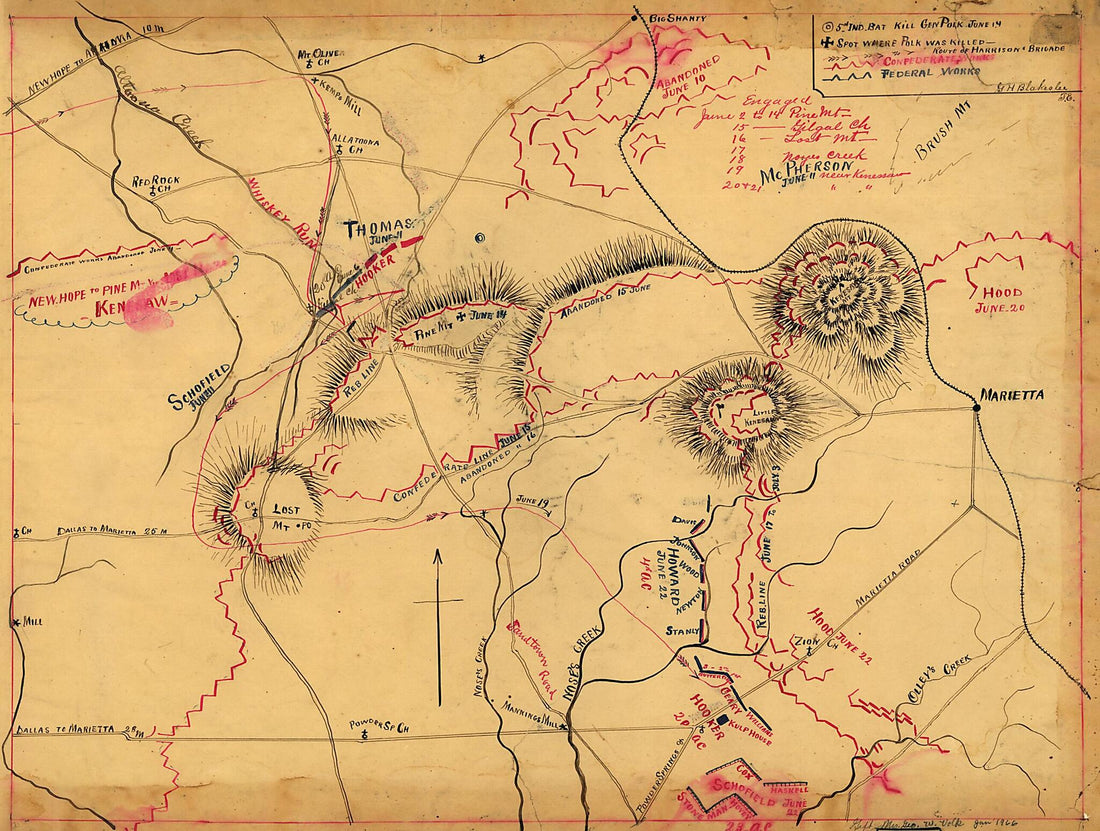 Map of the Environs of Pine Mountain, Lost Mountain, Kenesaw Mountain, and Little Kenesaw Mountain 1864Map of the Environs of Pine Mountain, Lost Mountain, Kenesaw Mountain, and Little Kenesaw Mountain 1864
- Regular price
-
$43.95 $88.95 - Regular price
-
$32.95 - Sale price
-
$43.95 $88.95
-
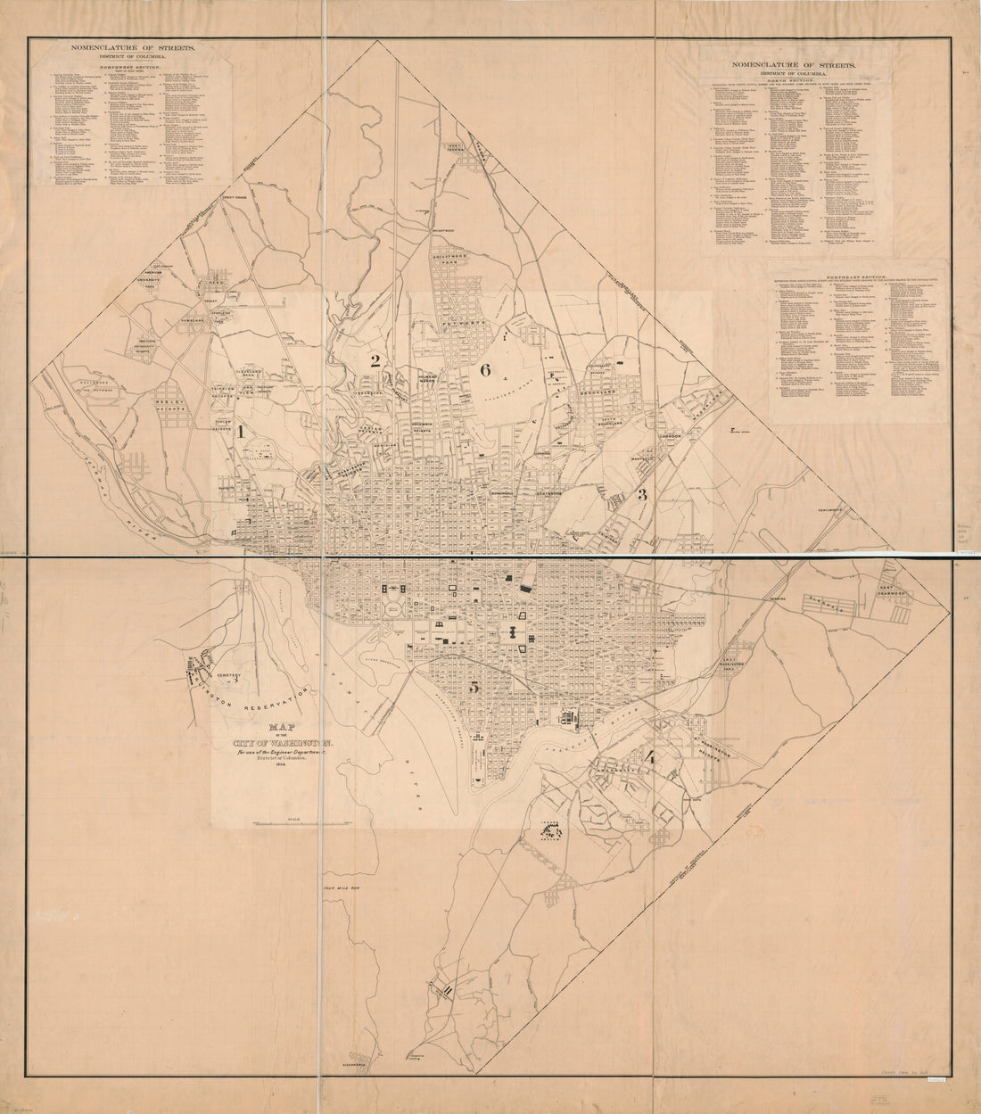 Map of the City of Washington : for Use of the Engineer Department, District of Columbia in 1904Map of the City of Washington : for Use of the Engineer Department, District of Columbia in 1904
- Regular price
-
$39.95 $221.95 - Regular price
-
$34.95 - Sale price
-
$39.95 $221.95


