106 products
-
Diagram of the South Part of Shaker Village, Canterbury, NH 1849
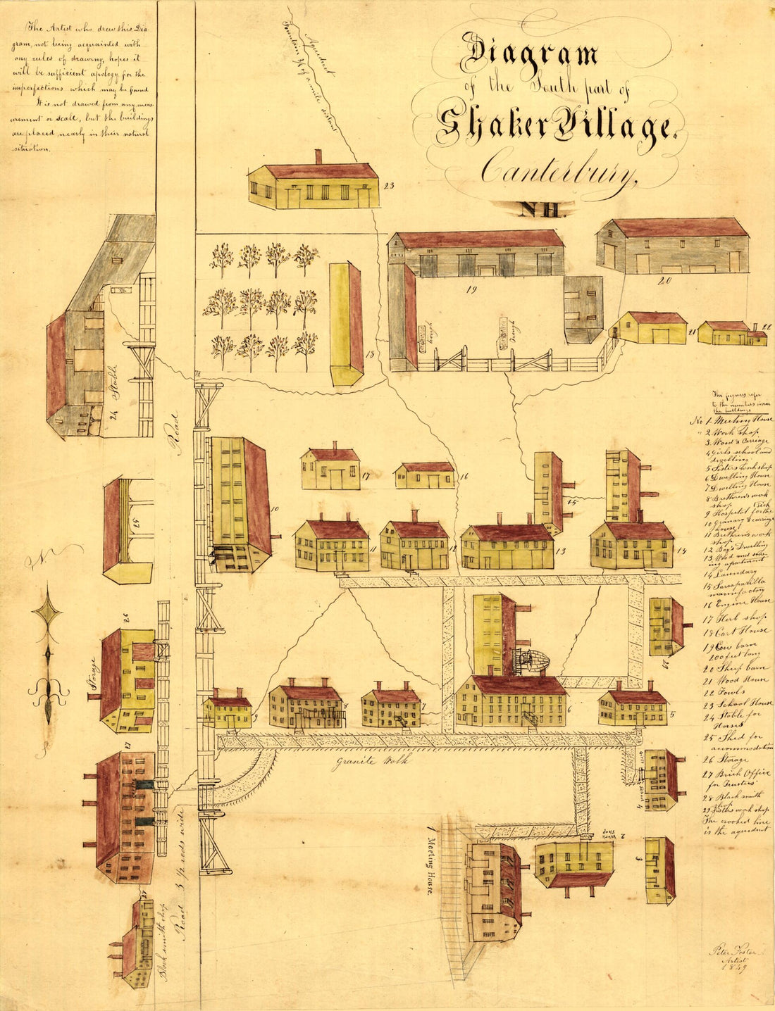 Diagram of the South Part of Shaker Village, Canterbury, NH 1849
- Regular price
-
From
$20.95 - Regular price
-
$32.95 - Sale price
-
From
$20.95
-
Map of the Timber Lands In Oxford and Franklin Counties, Maine, Coos County, New Hampshire : Showing the Different Townships With Their Allotments, in 1899
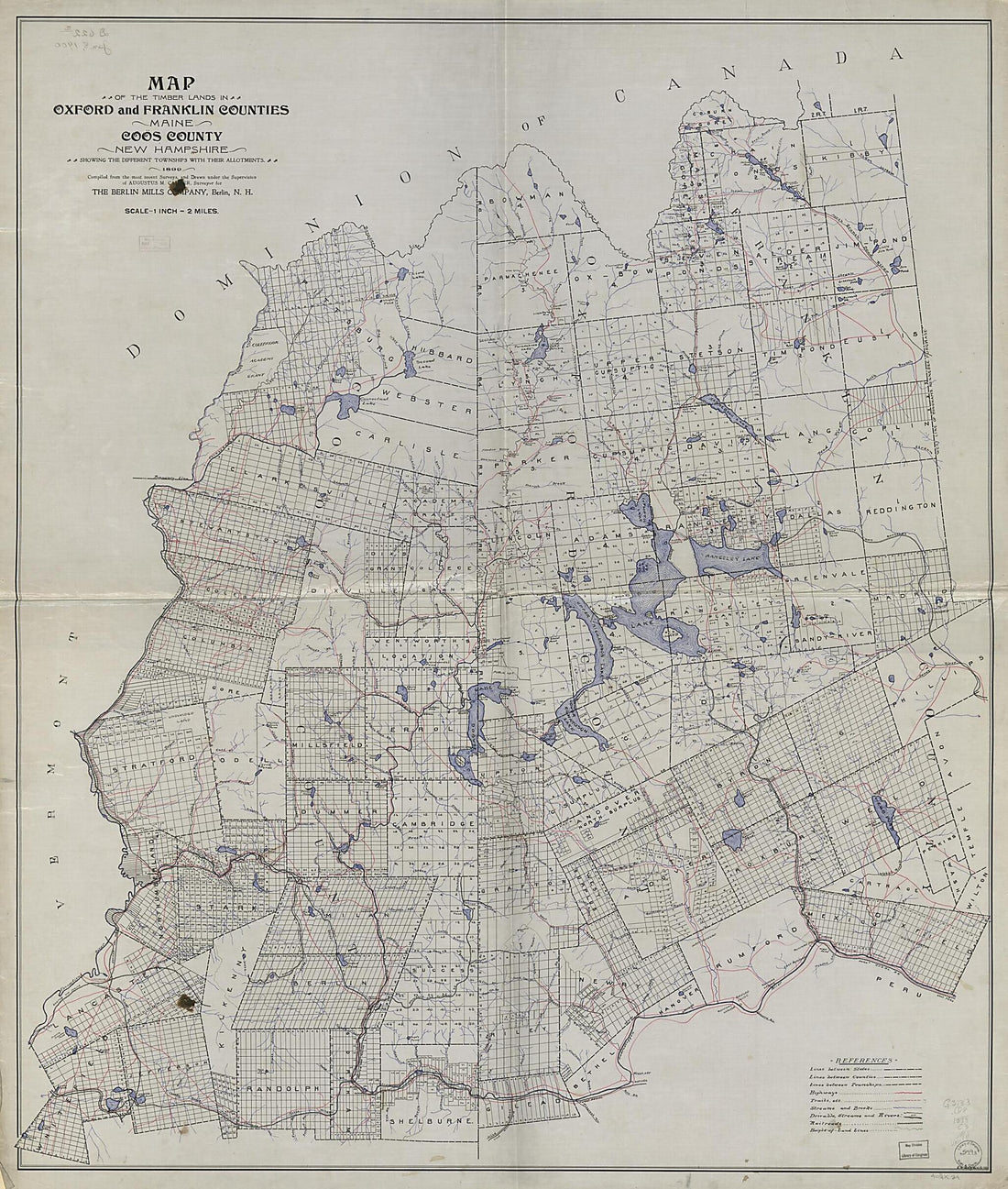 Map of the Timber Lands In Oxford and Franklin Counties, Maine, Coos County, New Hampshire : Showing the Different Townships With Their Allotments, in 1899
- Regular price
-
From
$34.95 - Regular price
-
$49.99 - Sale price
-
From
$34.95
-
Map of Strafford County, New Hampshire in 1856
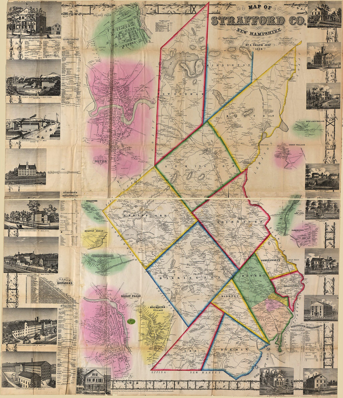 Map of Strafford County, New Hampshire in 1856
- Regular price
-
From
$34.95 - Regular price
-
$49.99 - Sale price
-
From
$34.95
-
A Topographical Map of the Province of New Hampshire in 1784
 A Topographical Map of the Province of New Hampshire in 1784
- Regular price
-
From
$41.95 - Regular price
-
$66.99 - Sale price
-
From
$41.95
-
Map of the White Mountains of New Hampshire from Walling's Large Map of the State, 1881. (Walling's Map of White Mountains)
 Map of the White Mountains of New Hampshire from Walling's Large Map of the State, 1881. (Walling's Map of White Mountains)
- Regular price
-
From
$34.95 - Regular price
-
$49.99 - Sale price
-
From
$34.95
-
Map of New Hampshire, 1890
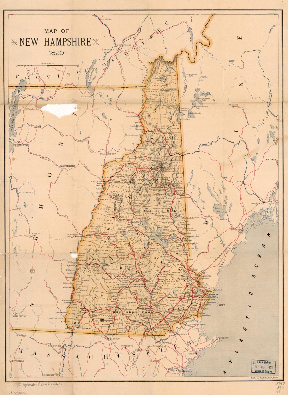 Map of New Hampshire, 1890
- Regular price
-
From
$32.95 - Regular price
-
$51.99 - Sale price
-
From
$32.95
-
Hampshire In New England, Taken from Actual Surveys of All the Inhabited Part, and from the Best Information of What Is Uninhabited, Together With the Adjacent Countries, Which Exhibits the Theatre of This War In That Part of the World 1761
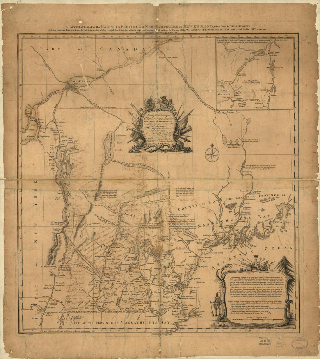 Hampshire In New England, Taken from Actual Surveys of All the Inhabited Part, and from the Best Information of What Is Uninhabited, Together With the Adjacent Countries, Which Exhibits the Theatre of This War In That Part of the World 1761
- Regular price
-
From
$34.95 - Regular price
-
$49.99 - Sale price
-
From
$34.95
-
Map of Part of New Hampshire and Massachusetts, Showing the Location of the Wilton and Other Railroads 1847
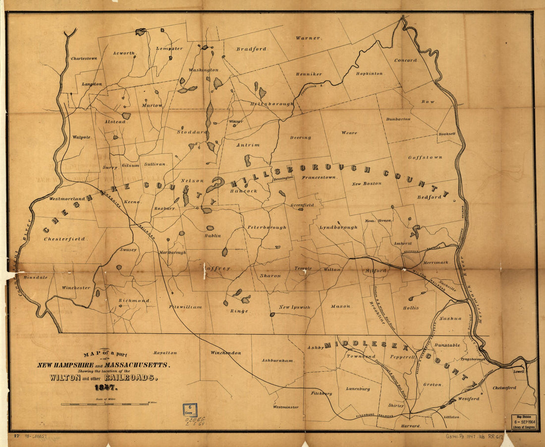 Map of Part of New Hampshire and Massachusetts, Showing the Location of the Wilton and Other Railroads 1847
- Regular price
-
From
$34.95 - Regular price
-
$49.99 - Sale price
-
From
$34.95
-
Isles of Shoals 1837
 Isles of Shoals 1837
- Regular price
-
From
$19.95 - Regular price
-
$29.95 - Sale price
-
From
$19.95
-
Map of Manchester, New Hampshire / Compiled by Joseph B. Sawyer, C.E. (Map of Manchester, New Hampshire) 1879
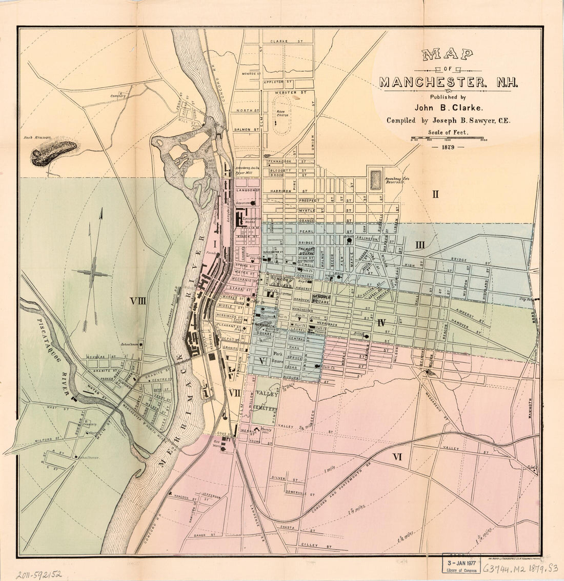 Map of Manchester, New Hampshire / Compiled by Joseph B. Sawyer, C.E. (Map of Manchester, New Hampshire) 1879
- Regular price
-
From
$34.95 - Regular price
-
$49.99 - Sale price
-
From
$34.95
-
Carter's New Hampshire Diagraphical Chart of Senatorial Districts 1878
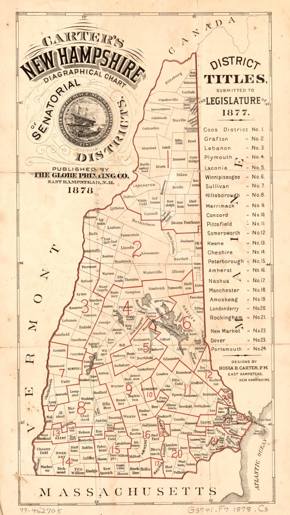 Carter's New Hampshire Diagraphical Chart of Senatorial Districts 1878
- Regular price
-
From
$19.95 - Regular price
-
$29.95 - Sale price
-
From
$19.95
-
Bird's Eye View from Summit of Mt. Washington, White Mountains, New-Hampshire 1908
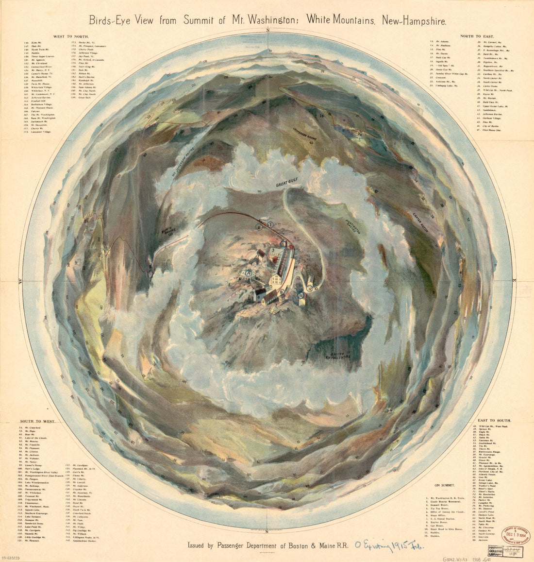 Bird's Eye View from Summit of Mt. Washington, White Mountains, New-Hampshire 1908
- Regular price
-
From
$34.95 - Regular price
-
$49.99 - Sale price
-
From
$34.95


