181 products
-
 A New Map of North & South Carolina, & Georgia (A New Map of North and South Carolina, and Georgia, New Map of North and South Carolina, and Georgia) 1765A New Map of North & South Carolina, & Georgia (A New Map of North and South Carolina, and Georgia, New Map of North and South Carolina, and Georgia) 1765
- Regular price
-
$39.95 $83.95 - Regular price
-
$34.95 - Sale price
-
$39.95 $83.95
-
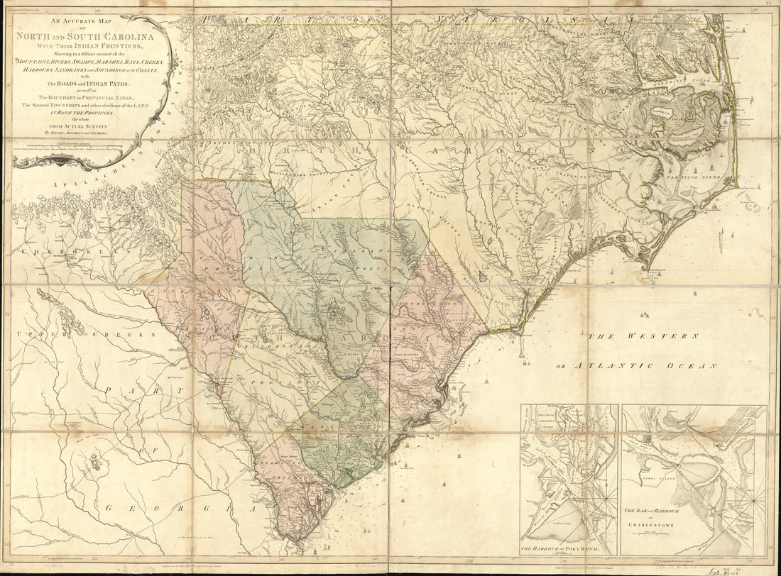 An Accurate Map of North and South Carolina With Their Indian Frontiers, Shewing In a Distinct Manner All the Mountains, Rivers, Swamps, Marshes, Bays, Creeks, Harbours, Sandbanks and Soundings On the Coasts; With the Roads and Indian Paths; As Well A...An Accurate Map of North and South Carolina With Their Indian Frontiers, Shewing In a Distinct Manner All the Mountains, Rivers, Swamps, Marshes, Bays, Creeks, Harbours, Sandbanks and Soundings On the Coasts; With the Roads and Indian Paths; As Well A...
- Regular price
-
$43.95 $217.95 - Regular price
-
$38.95 - Sale price
-
$43.95 $217.95
-
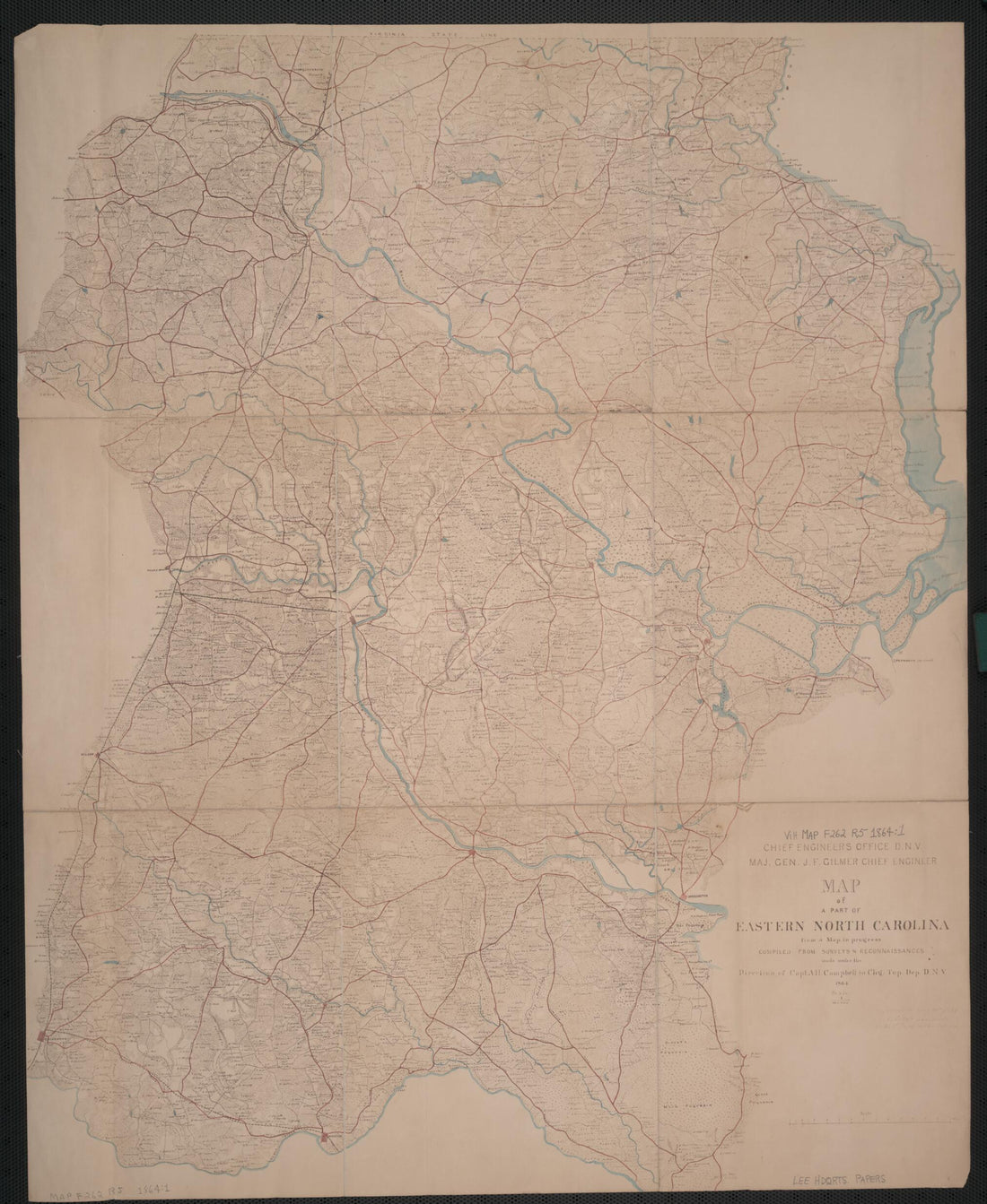 Map of a Part of Eastern North Carolina from a Map In Progress 1864Map of a Part of Eastern North Carolina from a Map In Progress 1864
- Regular price
-
$43.95 $87.95 - Regular price
-
$38.95 - Sale price
-
$43.95 $87.95
-
 A Plan of That Part of the Boundary Between the States of North and South Carolina, Lying Between That Part of Said Boundary Marked In 1764 and the Old Cherokee Boundary Line. Fixed and Marked by Commissioners Appointed by Each Respective Colony, Now ...A Plan of That Part of the Boundary Between the States of North and South Carolina, Lying Between That Part of Said Boundary Marked In 1764 and the Old Cherokee Boundary Line. Fixed and Marked by Commissioners Appointed by Each Respective Colony, Now ...
- Regular price
-
$43.95 $88.95 - Regular price
-
$38.95 - Sale price
-
$43.95 $88.95
-
 Map of Virginia and North Carolina from the Coast to the Blue Ridge 1865Map of Virginia and North Carolina from the Coast to the Blue Ridge 1865
- Regular price
-
$39.95 $99.95 - Regular price
-
$34.95 - Sale price
-
$39.95 $99.95
-
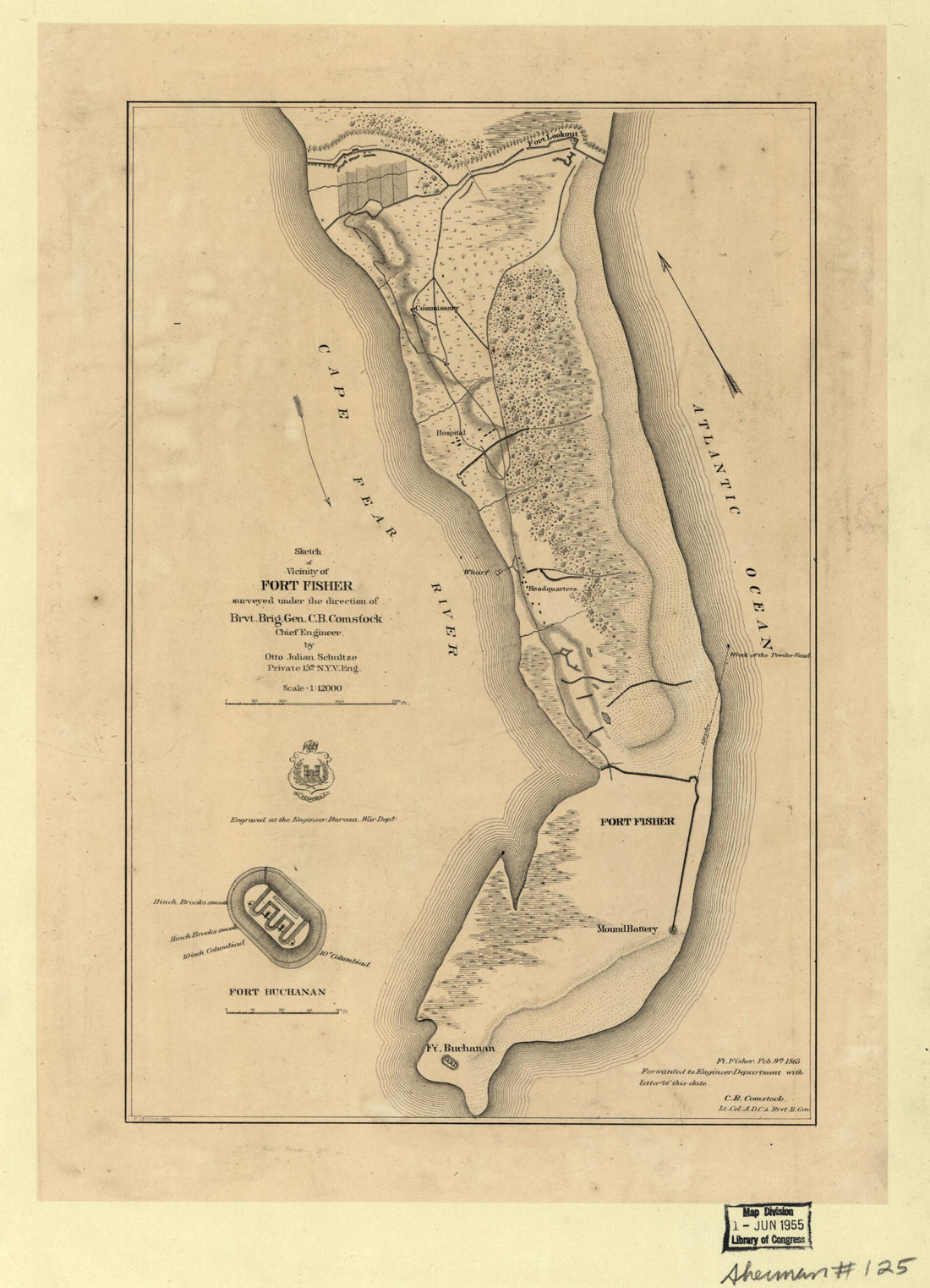 Sketch of Vicinity of Fort Fisher 1865Sketch of Vicinity of Fort Fisher 1865
- Regular price
-
$39.95 $88.95 - Regular price
-
$34.95 - Sale price
-
$39.95 $88.95
-
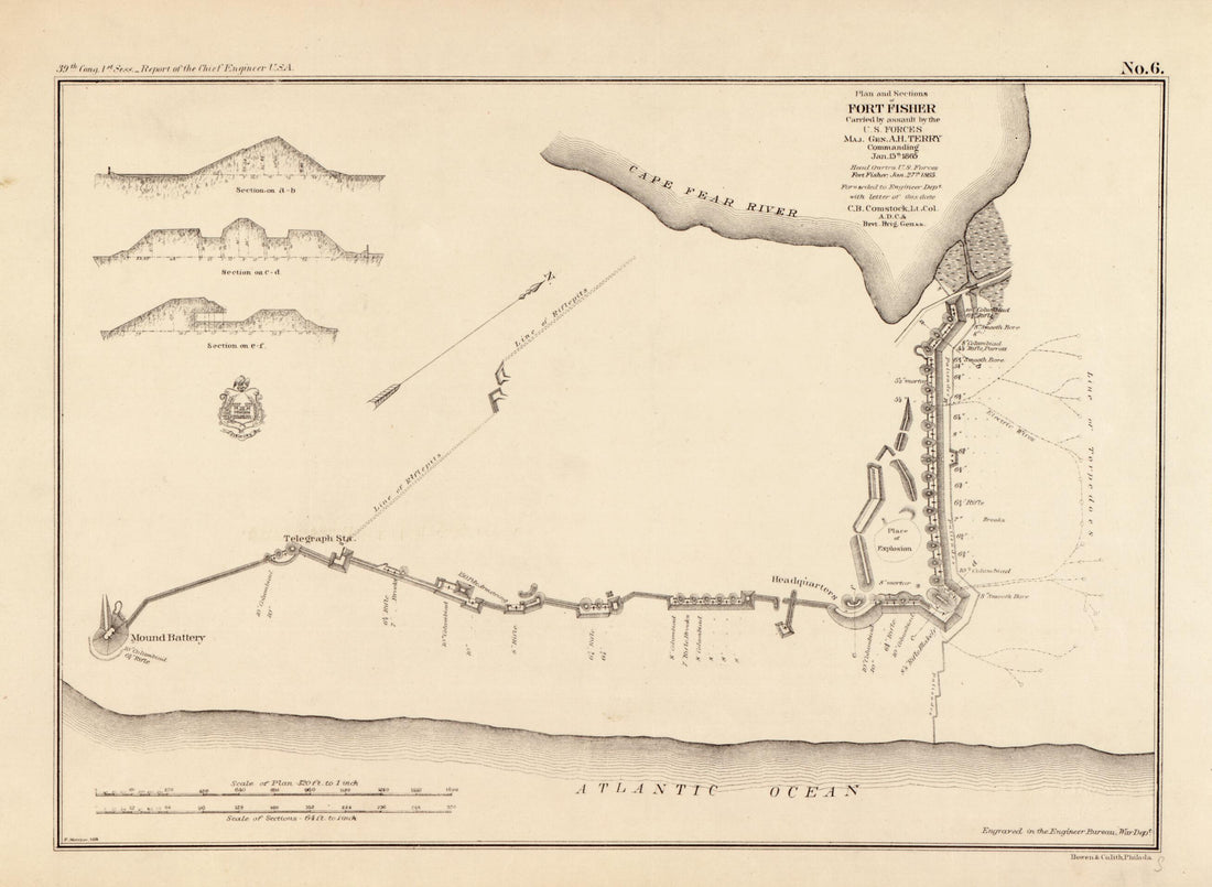 Plan and Sections of Fort Fisher : Carried by Assault by the U.S. Forces Maj. Gen. A. H. Terry, Commanding, Jan. 15th, 1865Plan and Sections of Fort Fisher : Carried by Assault by the U.S. Forces Maj. Gen. A. H. Terry, Commanding, Jan. 15th, 1865
- Regular price
-
$39.95 $88.95 - Regular price
-
$34.95 - Sale price
-
$39.95 $88.95
-
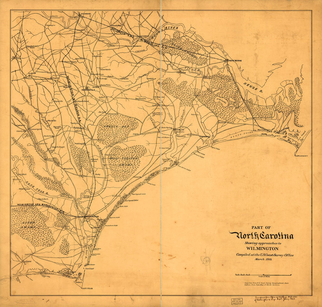 Part of North Carolina Showing Approaches to Wilmington 1864Part of North Carolina Showing Approaches to Wilmington 1864
- Regular price
-
$43.95 $86.95 - Regular price
-
$38.95 - Sale price
-
$43.95 $86.95
-
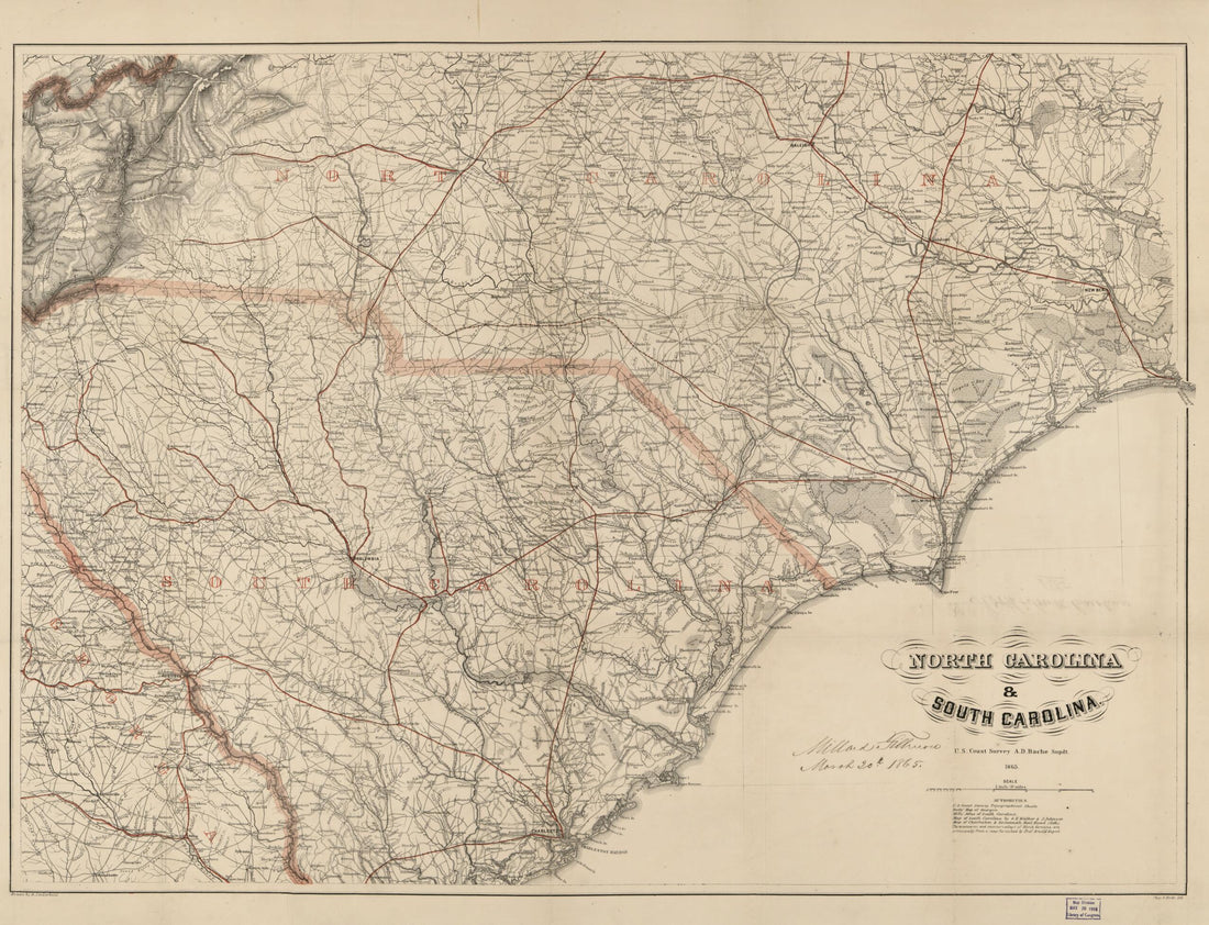 North Carolina & South Carolina 1865North Carolina & South Carolina 1865
- Regular price
-
$43.95 $103.95 - Regular price
-
$38.95 - Sale price
-
$43.95 $103.95
-
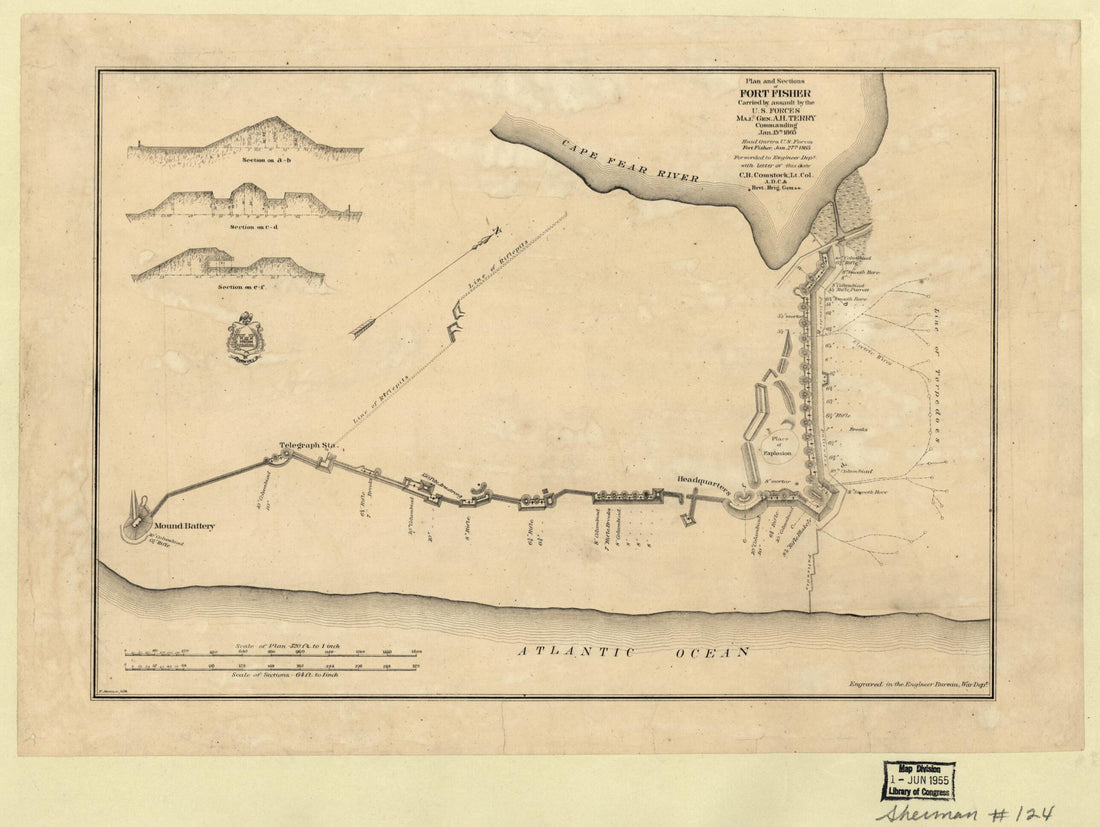 Plan and Sections of Fort Fisher, Carried by Assault by the U.S. Forces, Maj. Gen. A.H. Terry Commanding, Jan. 15th, 1865Plan and Sections of Fort Fisher, Carried by Assault by the U.S. Forces, Maj. Gen. A.H. Terry Commanding, Jan. 15th, 1865
- Regular price
-
$39.95 $88.95 - Regular price
-
$34.95 - Sale price
-
$39.95 $88.95
-
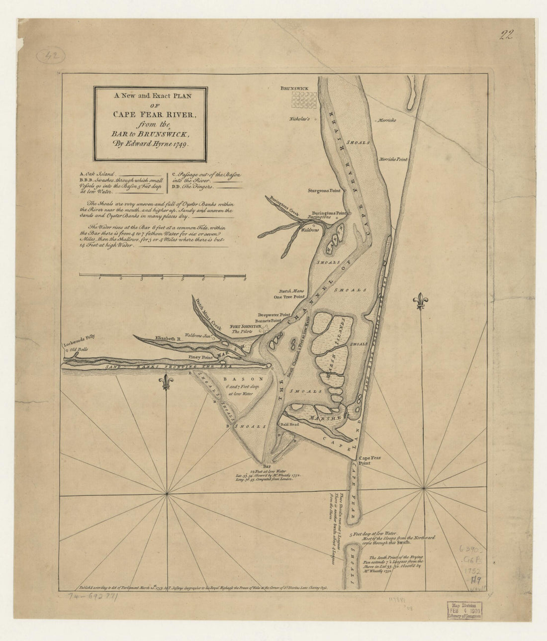 A New and Exact Plan of Cape Fear River, from the Bar to Brunswick 1753A New and Exact Plan of Cape Fear River, from the Bar to Brunswick 1753
- Regular price
-
$43.95 $83.95 - Regular price
-
$38.95 - Sale price
-
$43.95 $83.95
-
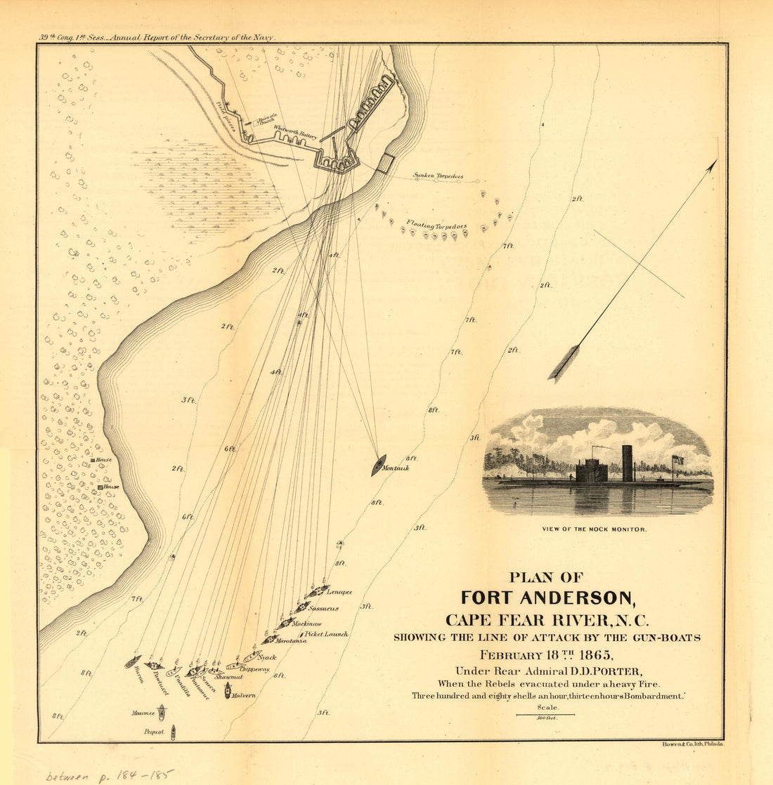 Boats February 18th 1865Boats February 18th 1865
- Regular price
-
$39.95 $83.95 - Regular price
-
$34.95 - Sale price
-
$39.95 $83.95


