155 products
-
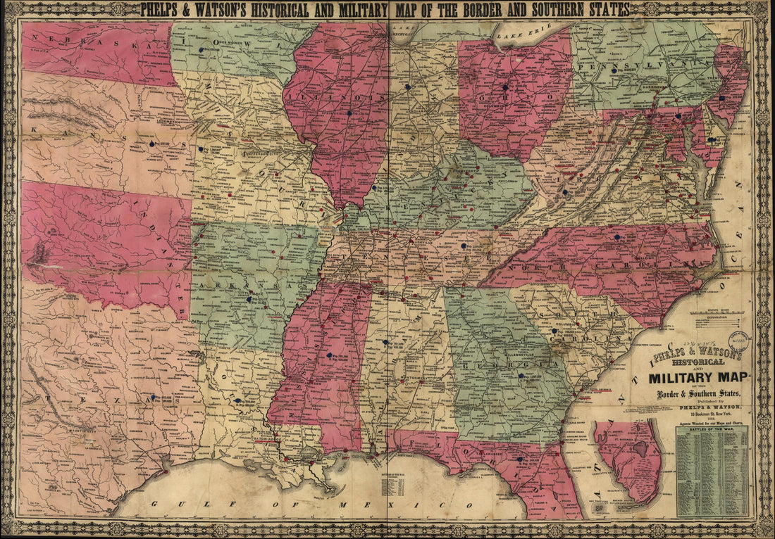 Phelps & Watson's Historical and Military Map of the Border & Southern States 1864Phelps & Watson's Historical and Military Map of the Border & Southern States 1864
- Regular price
-
$46.95 $99.95 - Regular price
-
$41.95 - Sale price
-
$46.95 $99.95
-
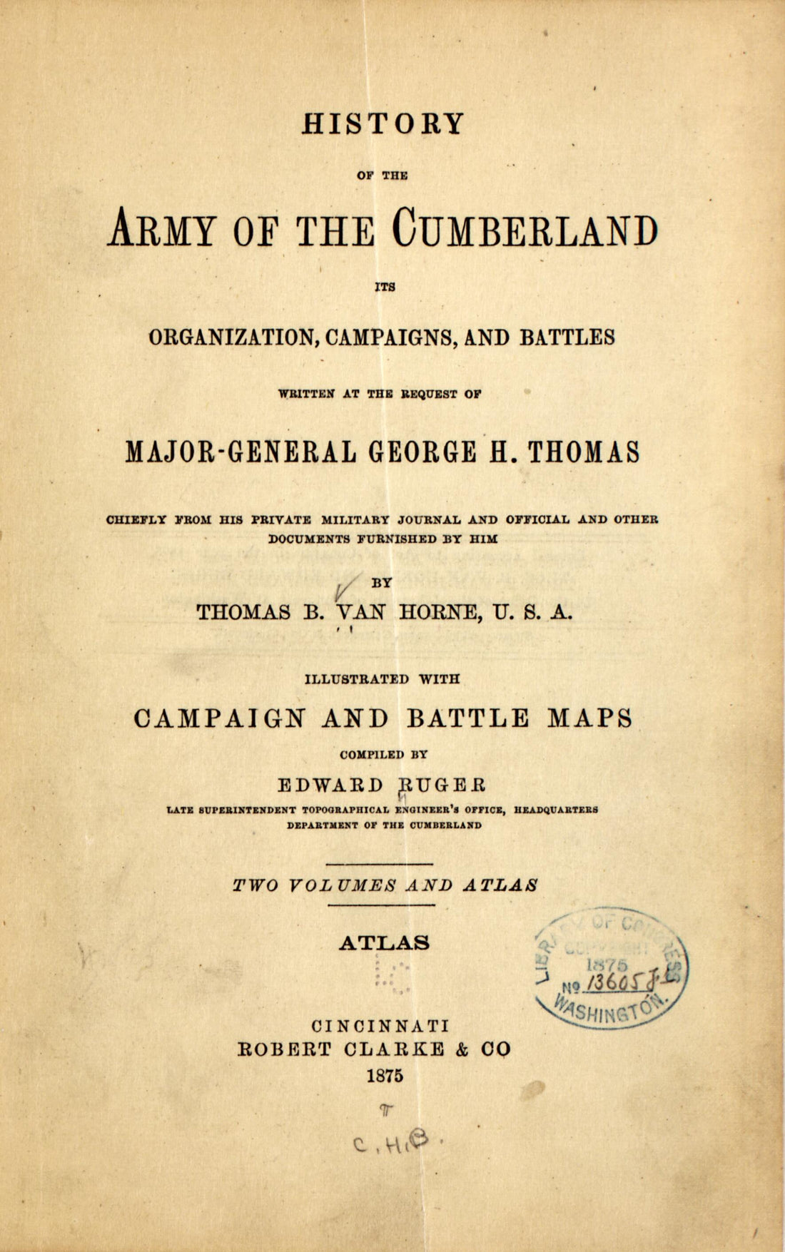 General George H. Thomas Chiefly from His Private Military Journal and Official and Other Documents Furnished by Him (-atlas) 1875General George H. Thomas Chiefly from His Private Military Journal and Official and Other Documents Furnished by Him (-atlas) 1875
- Regular price
-
$39.95 $99.95 - Regular price
-
$29.95 - Sale price
-
$39.95 $99.95
-
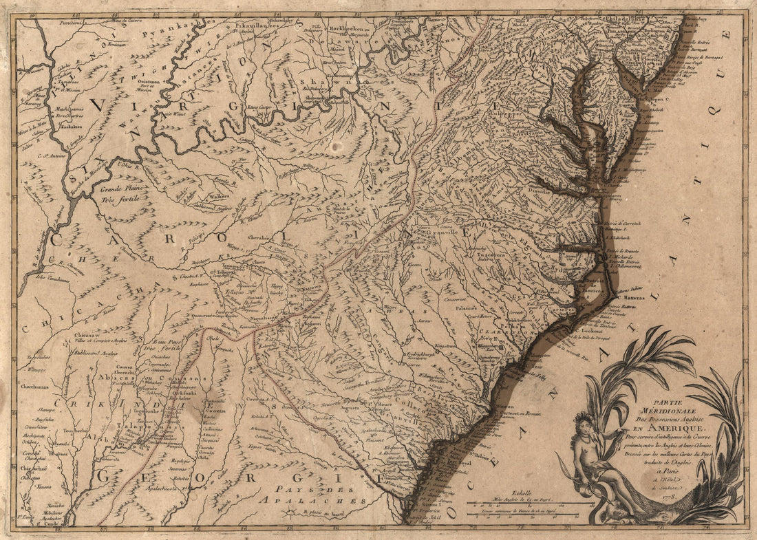 Partie Méridionale Des Possessions Angloise sic En Amérique : Pour Servir D'intelligence à La Guerre Présente Entre Les Anglois Et Leurs Colonies 1778Partie Méridionale Des Possessions Angloise sic En Amérique : Pour Servir D'intelligence à La Guerre Présente Entre Les Anglois Et Leurs Colonies 1778
- Regular price
-
$43.95 $88.95 - Regular price
-
$32.95 - Sale price
-
$43.95 $88.95
-
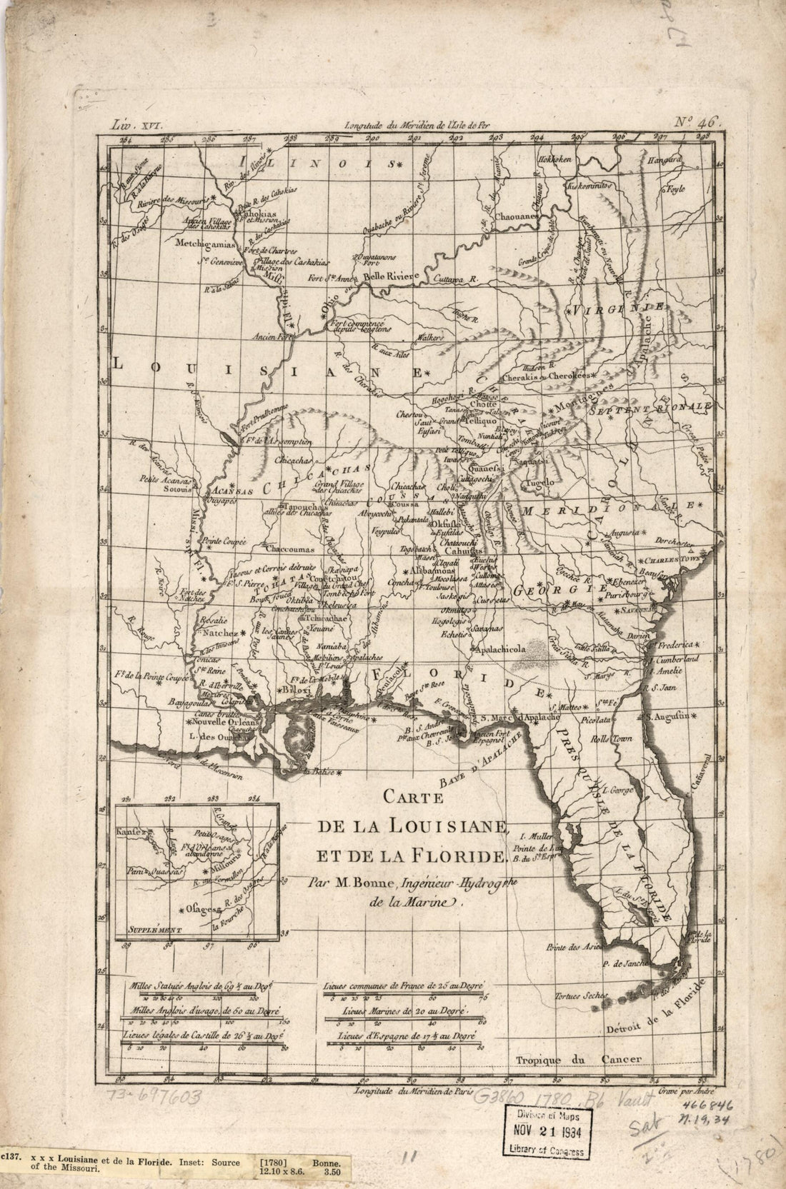 Carte De La Louisiane, Et De La Floride 1780Carte De La Louisiane, Et De La Floride 1780
- Regular price
-
$43.95 $99.95 - Regular price
-
$31.95 - Sale price
-
$43.95 $99.95
-
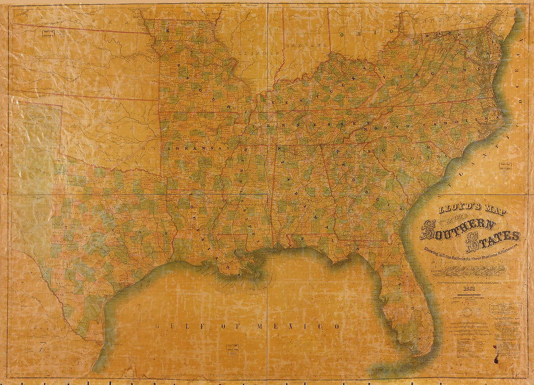 Lloyd's Map of the Southern States : Showing All the Railroads, Their Stations & Distances, Also the Counties, Towns, Villages, Harbors, Rivers, and Forts in 1861Lloyd's Map of the Southern States : Showing All the Railroads, Their Stations & Distances, Also the Counties, Towns, Villages, Harbors, Rivers, and Forts in 1861
- Regular price
-
$43.95 $196.95 - Regular price
-
$32.95 - Sale price
-
$43.95 $196.95
-
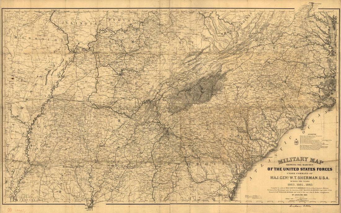 Military Map Showing the Marches of the United States Forces Under Command of Maj. Genl. W. T. Sherman, U.S.A., During the Years 1863, 1864, in 1865Military Map Showing the Marches of the United States Forces Under Command of Maj. Genl. W. T. Sherman, U.S.A., During the Years 1863, 1864, in 1865
- Regular price
-
$46.95 $136.95 - Regular price
-
$41.95 - Sale price
-
$46.95 $136.95
-
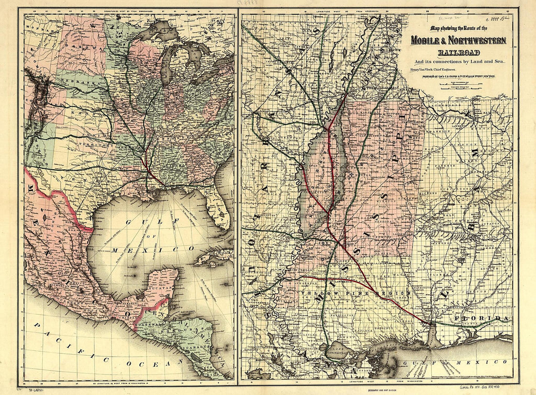 Map Showing the Route of the Mobile & North Western Railroad, and Its Connections by Land and Sea; Henry Van Vleck Chief Engineer 1871Map Showing the Route of the Mobile & North Western Railroad, and Its Connections by Land and Sea; Henry Van Vleck Chief Engineer 1871
- Regular price
-
$43.95 $207.95 - Regular price
-
$32.95 - Sale price
-
$43.95 $207.95
-
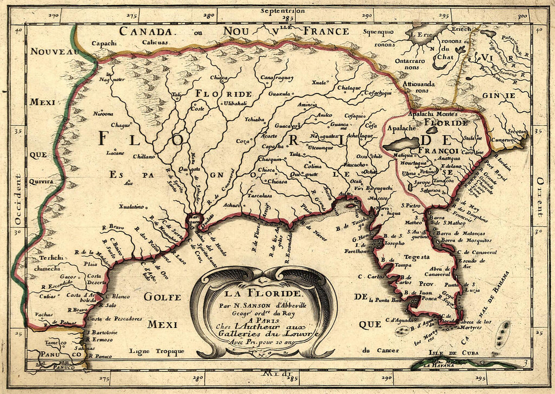 La Floride 1657La Floride 1657
- Regular price
-
$39.95 $88.95 - Regular price
-
$29.95 - Sale price
-
$39.95 $88.95
-
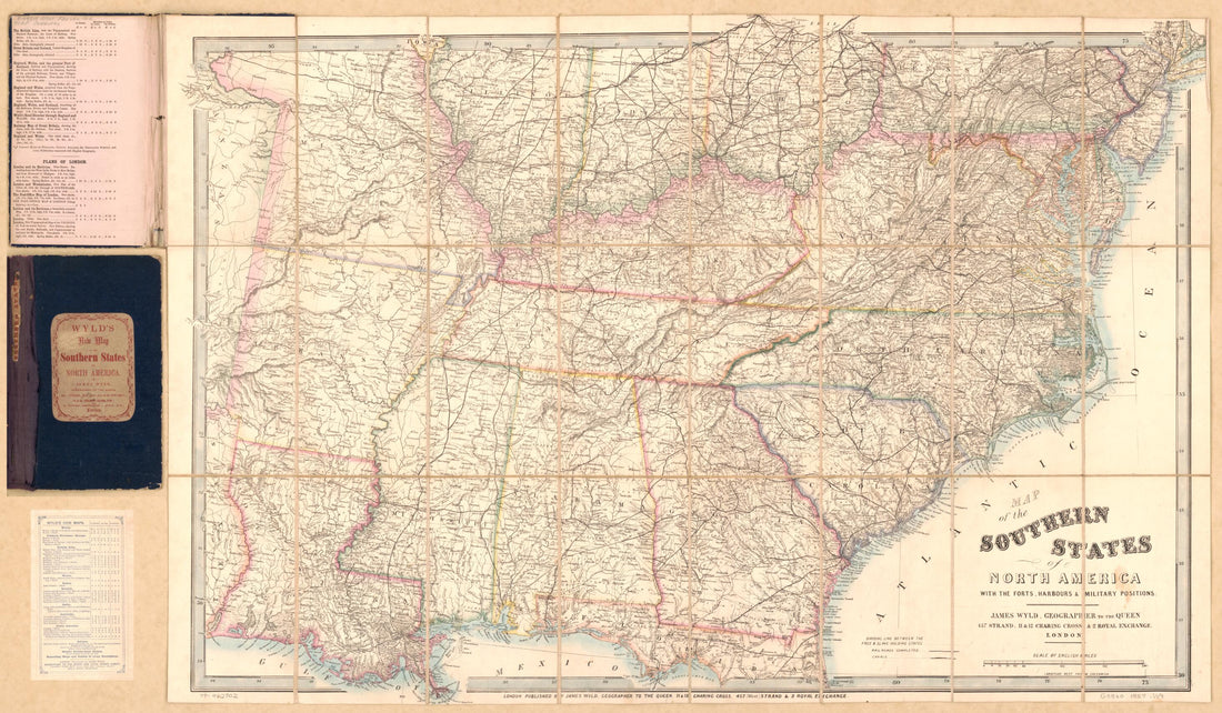 Map of the Southern States of North America : With the Forts, Harbours & Military Positions. (Wyld's New Map of the Southern States of North America, Southern States) 1857Map of the Southern States of North America : With the Forts, Harbours & Military Positions. (Wyld's New Map of the Southern States of North America, Southern States) 1857
- Regular price
-
$46.95 $135.95 - Regular price
-
$41.95 - Sale price
-
$46.95 $135.95
-
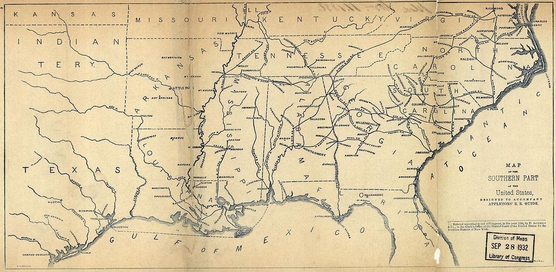 Map of the Southern Part of the United States, Designed to Accompany Appletons' Railroad Guide 1856Map of the Southern Part of the United States, Designed to Accompany Appletons' Railroad Guide 1856
- Regular price
-
$39.95 $99.95 - Regular price
-
$29.95 - Sale price
-
$39.95 $99.95
-
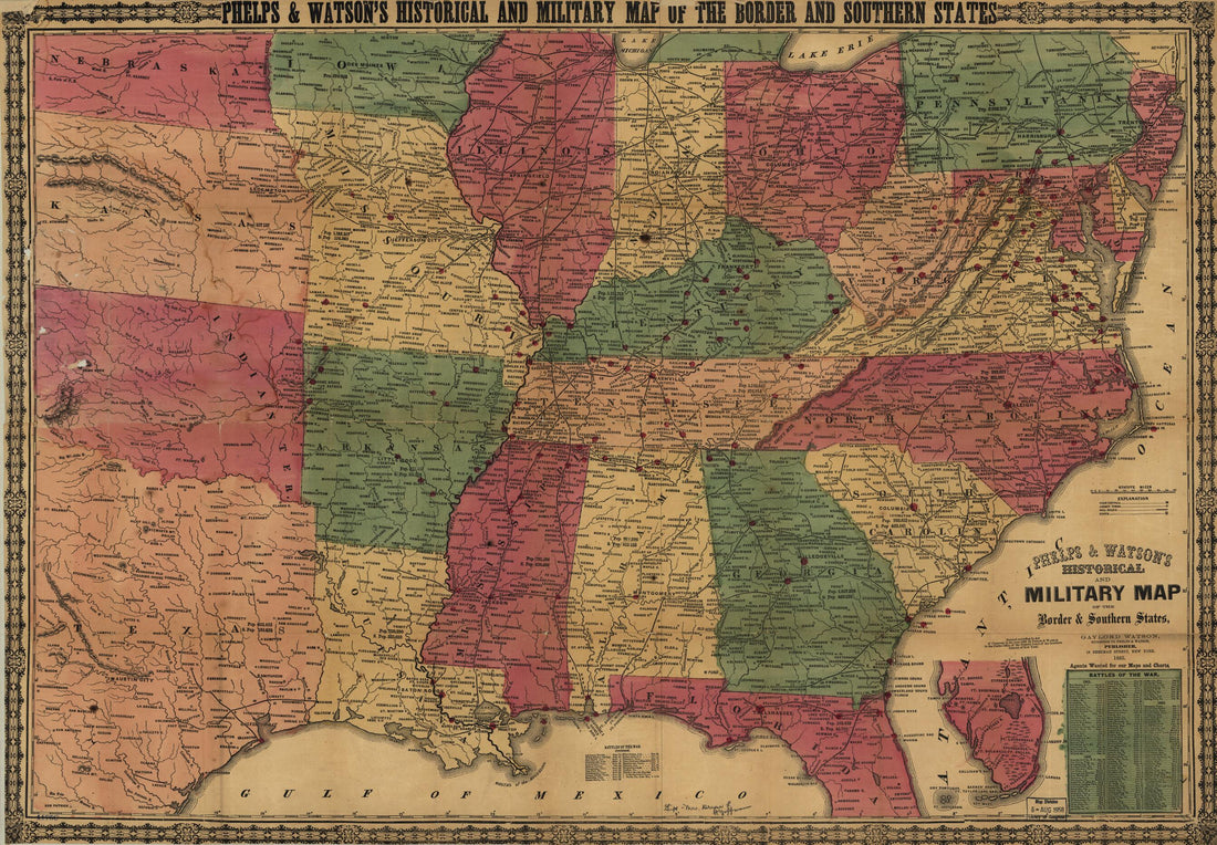 Phelps & Watson's Historical and Military Map of the Border & Southern States 1865Phelps & Watson's Historical and Military Map of the Border & Southern States 1865
- Regular price
-
$46.95 $99.95 - Regular price
-
$41.95 - Sale price
-
$46.95 $99.95
-
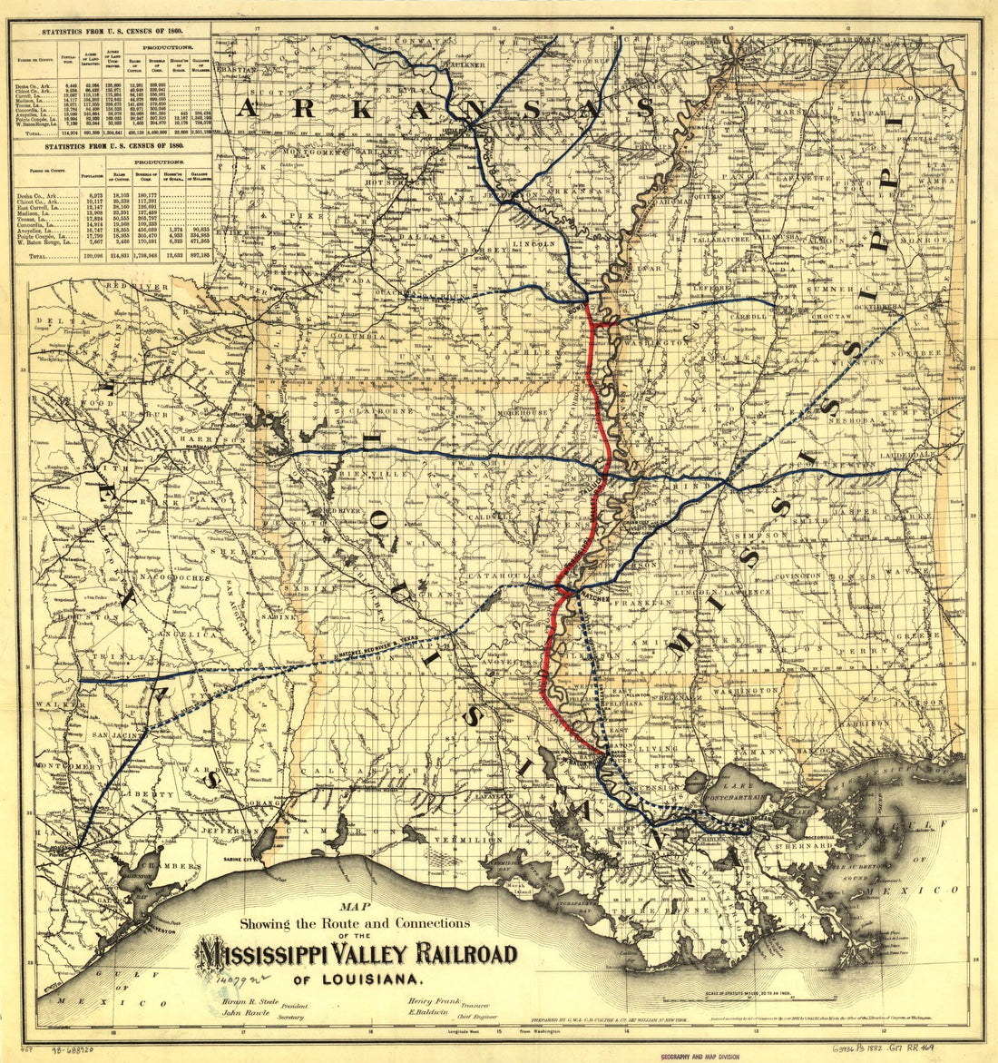 Map Showing the Route and Connections of the Mississippi Valley Railroad of Louisiana; E. Baldwin, Chief Engineer 1882Map Showing the Route and Connections of the Mississippi Valley Railroad of Louisiana; E. Baldwin, Chief Engineer 1882
- Regular price
-
$39.95 $83.95 - Regular price
-
$34.95 - Sale price
-
$39.95 $83.95


