890 products
-
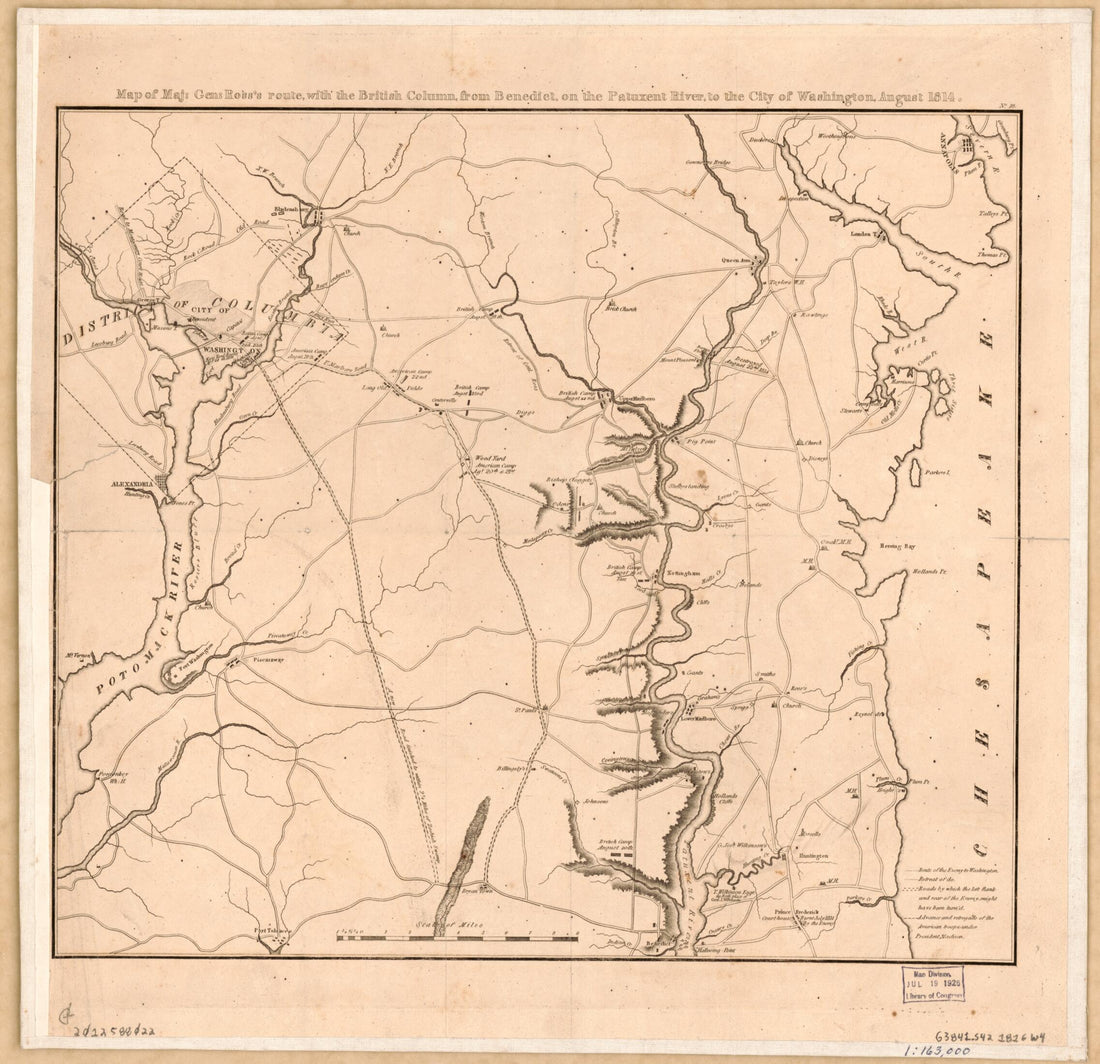 Map of Maj. Gen. Ross's Route With the British Column From Benedict On the Patuxent River to the City of Washington August in 1814Map of Maj. Gen. Ross's Route With the British Column From Benedict On the Patuxent River to the City of Washington August in 1814
- Regular price
-
$39.95 $83.95 - Regular price
-
$32.95 - Sale price
-
$39.95 $83.95
-
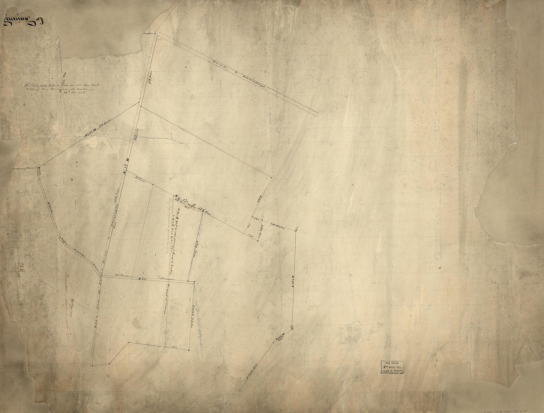 Cadastral Survey Map of Land Tracts In Washington D.C. Near the Junction of Bladensburg and Benning Roads N.E. 1855Cadastral Survey Map of Land Tracts In Washington D.C. Near the Junction of Bladensburg and Benning Roads N.E. 1855
- Regular price
-
$43.95 $138.95 - Regular price
-
$32.95 - Sale price
-
$43.95 $138.95
-
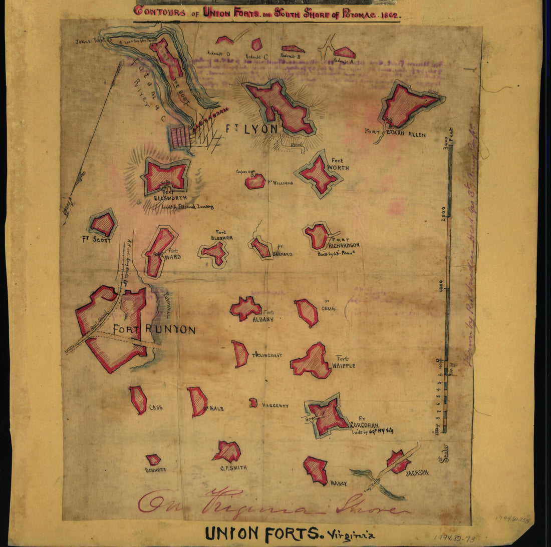 Contours of Union Forts On South Side of Potomac, in 1862 mapContours of Union Forts On South Side of Potomac, in 1862 map
- Regular price
-
$39.95 $83.95 - Regular price
-
$29.95 - Sale price
-
$39.95 $83.95
-
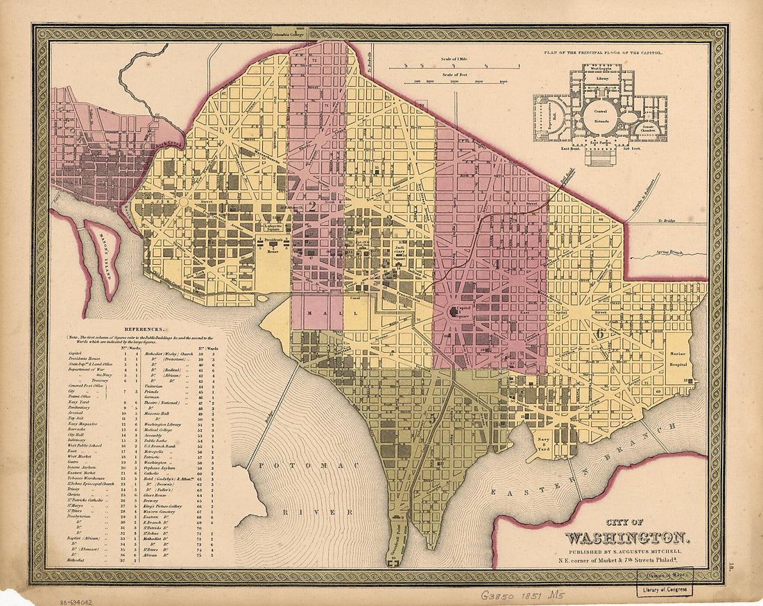 City of Washington 1851City of Washington 1851
- Regular price
-
$39.95 $83.95 - Regular price
-
$29.95 - Sale price
-
$39.95 $83.95
-
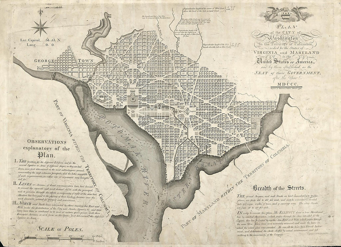 Plan of the City of Washington In the Territory of Columbia : Ceded by the States of Virginia and Maryland to the United States of America, and by Them Established As the Seat of Their Government, After the Year MDCCC 1792Plan of the City of Washington In the Territory of Columbia : Ceded by the States of Virginia and Maryland to the United States of America, and by Them Established As the Seat of Their Government, After the Year MDCCC 1792
- Regular price
-
$43.95 $224.95 - Regular price
-
$32.95 - Sale price
-
$43.95 $224.95
-
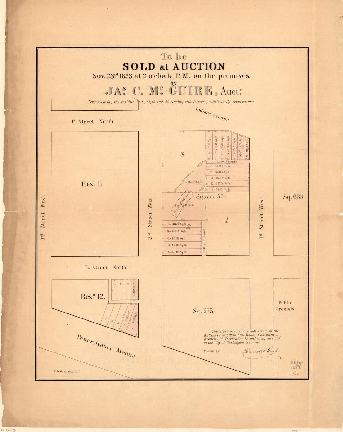 To Be Sold at Auction, Nov. 23rd in 1853, at 2 O'clock P.M. On the Premises, by Jas. C. Mc. Guire, Auct'r : part of N.W. Washington D.C.To Be Sold at Auction, Nov. 23rd in 1853, at 2 O'clock P.M. On the Premises, by Jas. C. Mc. Guire, Auct'r : part of N.W. Washington D.C.
- Regular price
-
$39.95 $83.95 - Regular price
-
$34.95 - Sale price
-
$39.95 $83.95
-
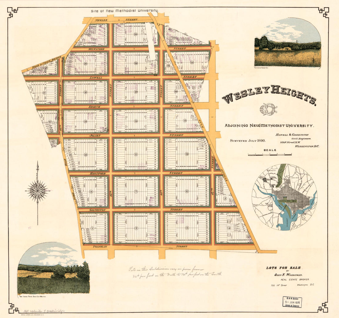 Wesley Heights, Adjoining New Methodist University in 1890Wesley Heights, Adjoining New Methodist University in 1890
- Regular price
-
$39.95 $83.95 - Regular price
-
$34.95 - Sale price
-
$39.95 $83.95
-
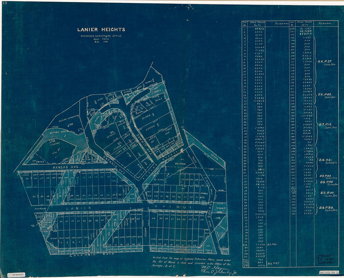 Lanier Heights : Recorded, Surveyor's Office, Book G.S., Page 174 1893Lanier Heights : Recorded, Surveyor's Office, Book G.S., Page 174 1893
- Regular price
-
$39.95 $153.95 - Regular price
-
$34.95 - Sale price
-
$39.95 $153.95
-
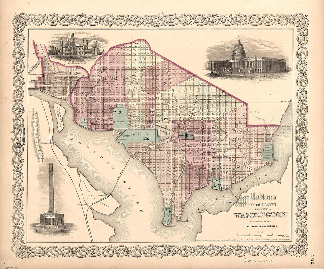 Colton's Georgetown and the City of Washington : the Capital of the United States of America 1863Colton's Georgetown and the City of Washington : the Capital of the United States of America 1863
- Regular price
-
$39.95 $83.95 - Regular price
-
$29.95 - Sale price
-
$39.95 $83.95
-
 Cadastral Map of Part of the West End, Washington D.C. 1800Cadastral Map of Part of the West End, Washington D.C. 1800
- Regular price
-
$39.95 $83.95 - Regular price
-
$29.95 - Sale price
-
$39.95 $83.95
-
 Map of Washington, D.C., and Environs : With Marginal Numbers and Measuring Tape Attachment for Instantly Locating Points of Interest Within a Radius of Twenty Miles from the Capitol 1887Map of Washington, D.C., and Environs : With Marginal Numbers and Measuring Tape Attachment for Instantly Locating Points of Interest Within a Radius of Twenty Miles from the Capitol 1887
- Regular price
-
$39.95 $125.95 - Regular price
-
$34.95 - Sale price
-
$39.95 $125.95
-
 Exhibit Chart Showing Streets & Avenues of the Cities of Washington and Georgetown, Improved Under the Board of Public Works, D.C. : Nov. 1st 1873 : SewersExhibit Chart Showing Streets & Avenues of the Cities of Washington and Georgetown, Improved Under the Board of Public Works, D.C. : Nov. 1st 1873 : Sewers
- Regular price
-
$39.95 $93.95 - Regular price
-
$34.95 - Sale price
-
$39.95 $93.95


