890 products
-
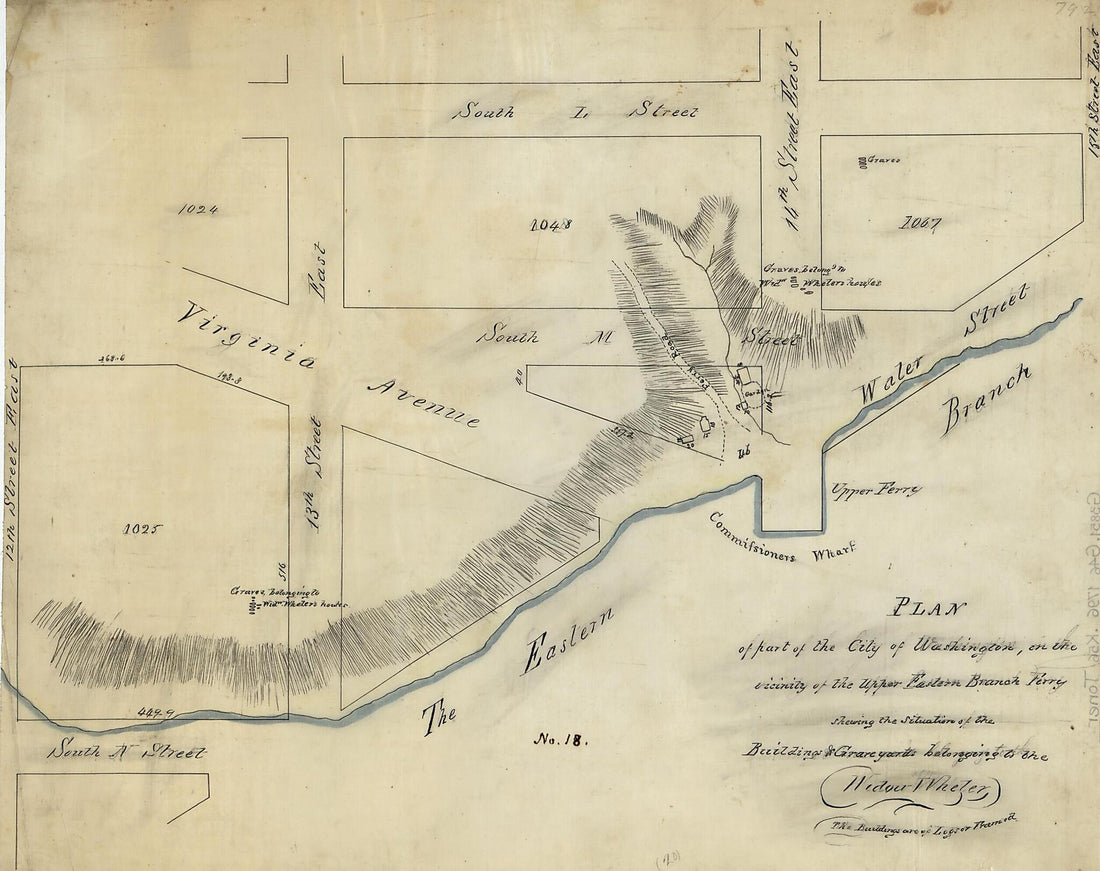 Plan of Part of the City of Washington, In the Vicinity of the Upper Eastern Branch Ferry, Shewing the Situation of the Buildings & Grave Yards Belonging to the Widow Wheler 1796Plan of Part of the City of Washington, In the Vicinity of the Upper Eastern Branch Ferry, Shewing the Situation of the Buildings & Grave Yards Belonging to the Widow Wheler 1796
- Regular price
-
$39.95 $83.95 - Regular price
-
$29.95 - Sale price
-
$39.95 $83.95
-
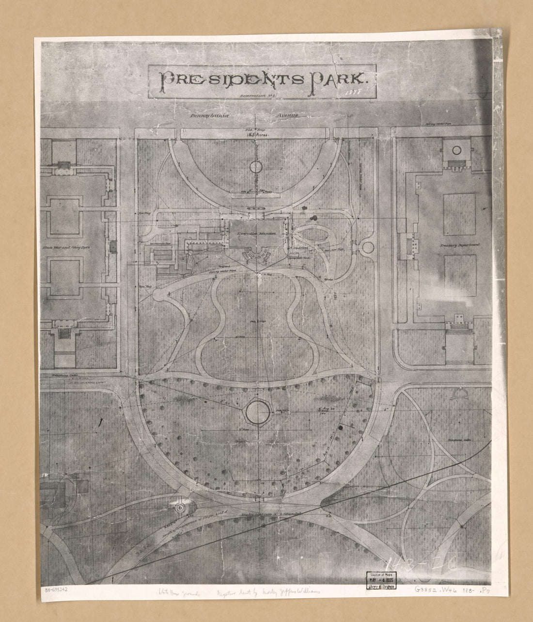 Presidents Park, Reservation No. 1 : Washington D.C. 1880Presidents Park, Reservation No. 1 : Washington D.C. 1880
- Regular price
-
$39.95 $83.95 - Regular price
-
$34.95 - Sale price
-
$39.95 $83.95
-
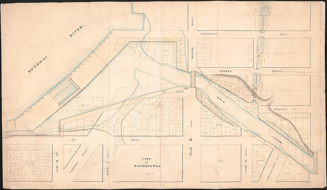 Cadastral Map of Part of Central Washington and Georgetown at the Mouth of Rock Creek in 1830Cadastral Map of Part of Central Washington and Georgetown at the Mouth of Rock Creek in 1830
- Regular price
-
$46.95 $158.95 - Regular price
-
$41.95 - Sale price
-
$46.95 $158.95
-
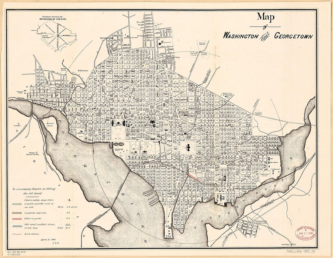 Map of Washington and Georgetown : to Accompany Report On Filling the Old Canal 1880Map of Washington and Georgetown : to Accompany Report On Filling the Old Canal 1880
- Regular price
-
$39.95 $93.95 - Regular price
-
$34.95 - Sale price
-
$39.95 $93.95
-
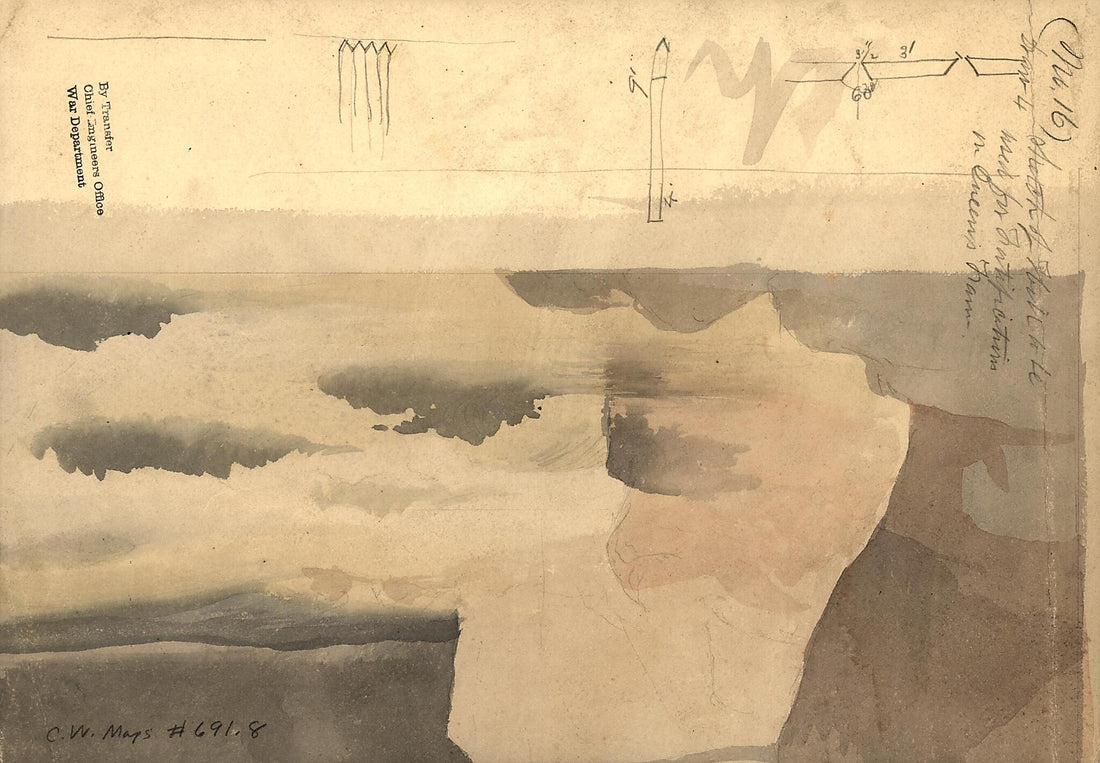 Sketch of Hill to Be Used for Gov't Fortification On Queen's Farm : Washington D.C. 1860Sketch of Hill to Be Used for Gov't Fortification On Queen's Farm : Washington D.C. 1860
- Regular price
-
$39.95 $99.95 - Regular price
-
$29.95 - Sale price
-
$39.95 $99.95
-
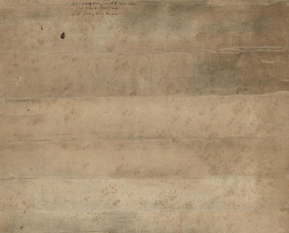 No. 1. County Land from N.E. Mile Stone & John C. Rives' Farm : Washington D.C. and Prince Georges County, Md. ; No. 2. Part of Long Meadows : Washington D.C. 1840No. 1. County Land from N.E. Mile Stone & John C. Rives' Farm : Washington D.C. and Prince Georges County, Md. ; No. 2. Part of Long Meadows : Washington D.C. 1840
- Regular price
-
$39.95 $83.95 - Regular price
-
$34.95 - Sale price
-
$39.95 $83.95
-
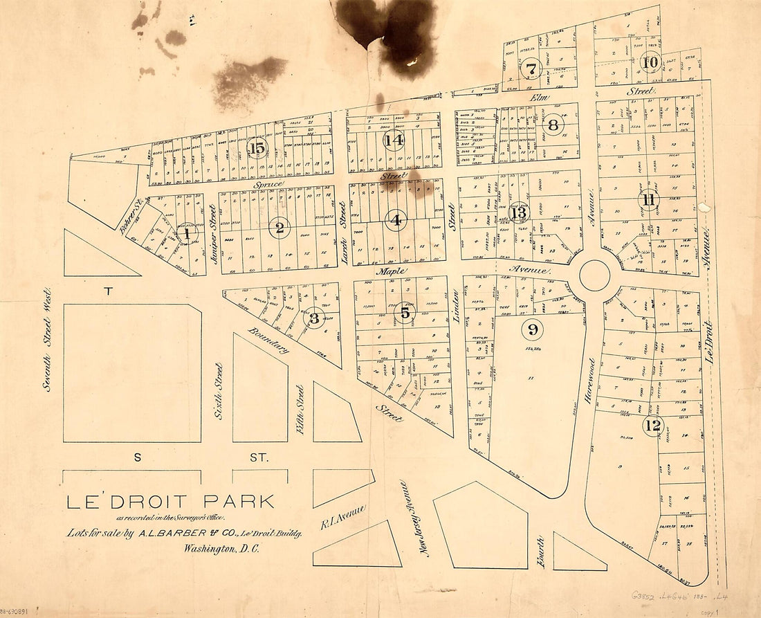 Le'Droit Park As Recorded In the Surveyor's Office : Washington D.C. 1880Le'Droit Park As Recorded In the Surveyor's Office : Washington D.C. 1880
- Regular price
-
$39.95 $104.95 - Regular price
-
$34.95 - Sale price
-
$39.95 $104.95
-
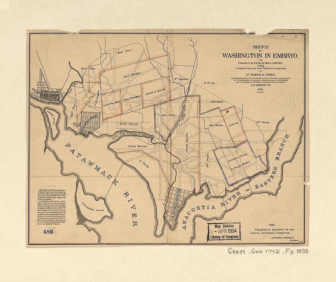 Sketch of Washington In Embryo : Viz., Previous to Its Survey by Major L'Enfant, 1792Sketch of Washington In Embryo : Viz., Previous to Its Survey by Major L'Enfant, 1792
- Regular price
-
$39.95 $83.95 - Regular price
-
$29.95 - Sale price
-
$39.95 $83.95
-
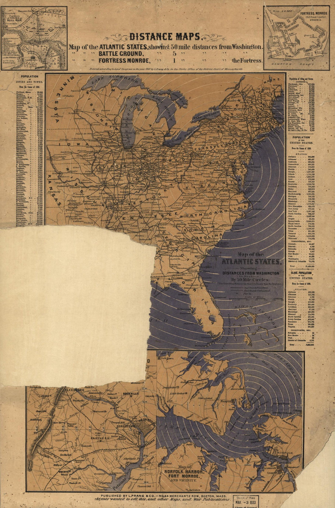 Distance Maps. Map of the Atlantic States, Showing 50 Mile Distances from Washington. Map of the Battleground at Manassas Showing 5 Mile Distances from Washington. Map of the Fortress Monroe, Showing 1 Mile Distances from the Fortress 1861Distance Maps. Map of the Atlantic States, Showing 50 Mile Distances from Washington. Map of the Battleground at Manassas Showing 5 Mile Distances from Washington. Map of the Fortress Monroe, Showing 1 Mile Distances from the Fortress 1861
- Regular price
-
$42.95 $99.95 - Regular price
-
$37.95 - Sale price
-
$42.95 $99.95
-
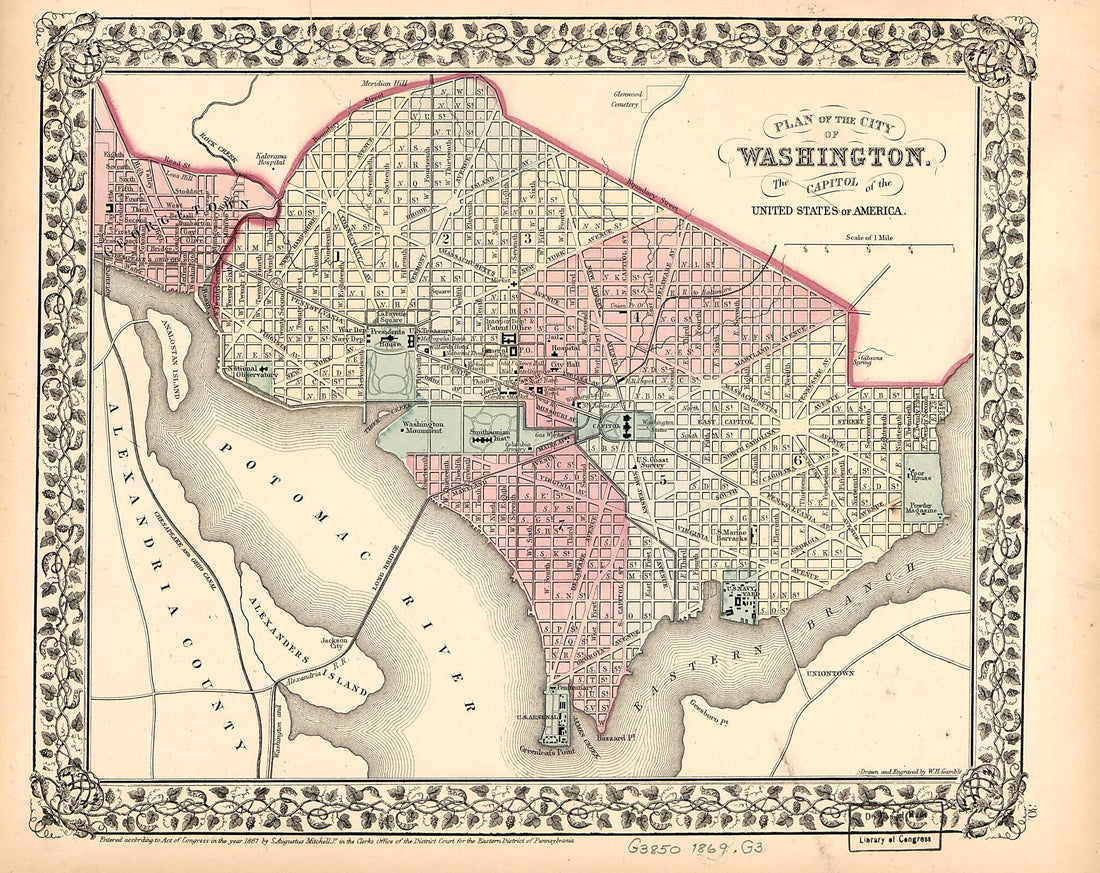 Plan of the City of Washington : the Capitol sic of the United States of America 1869Plan of the City of Washington : the Capitol sic of the United States of America 1869
- Regular price
-
$39.95 $83.95 - Regular price
-
$29.95 - Sale price
-
$39.95 $83.95
-
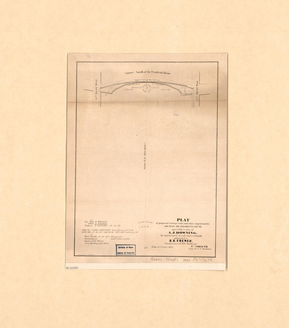 Plat of Proposed Carriage Road and Other Improvements South of the President's House : Agreeably to Plan of A.J. Downing for Improvement of Said Roads & Grounds 1854Plat of Proposed Carriage Road and Other Improvements South of the President's House : Agreeably to Plan of A.J. Downing for Improvement of Said Roads & Grounds 1854
- Regular price
-
$39.95 $83.95 - Regular price
-
$31.95 - Sale price
-
$39.95 $83.95
-
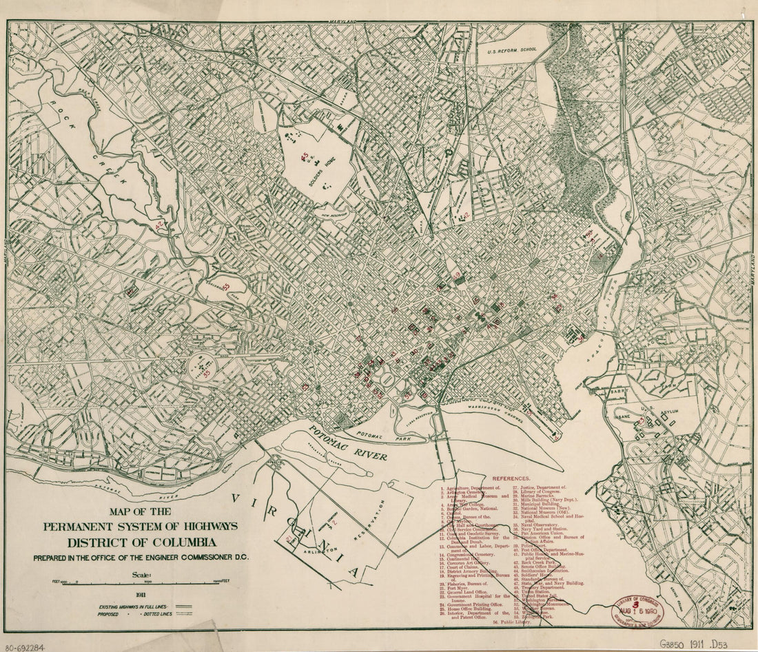 Map of the Permanent System of Highways, District of Columbia 1911Map of the Permanent System of Highways, District of Columbia 1911
- Regular price
-
$39.95 $83.95 - Regular price
-
$34.95 - Sale price
-
$39.95 $83.95


