428 products
-
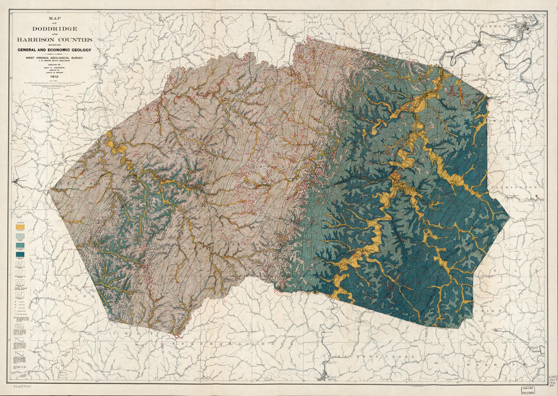 Map of Doddridge and Harrison Counties Showing General and Economic Geology in 1912Map of Doddridge and Harrison Counties Showing General and Economic Geology in 1912
- Regular price
-
$51.95 $175.95 - Regular price
-
$38.95 - Sale price
-
$51.95 $175.95
-
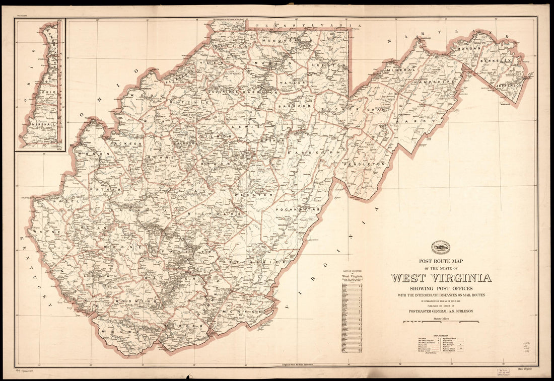 Post Route Map of the State of West Virginia : Showing Post Offices With the Intermediate Distances On Mail Routes In Operation On the 1st of July in 1918Post Route Map of the State of West Virginia : Showing Post Offices With the Intermediate Distances On Mail Routes In Operation On the 1st of July in 1918
- Regular price
-
$58.95 $169.95 - Regular price
-
$41.95 - Sale price
-
$58.95 $169.95
-
 Randolph County, Rich Mountain Region, West Virginia 1861Randolph County, Rich Mountain Region, West Virginia 1861
- Regular price
-
$49.95 $99.95 - Regular price
-
$34.95 - Sale price
-
$49.95 $99.95
-
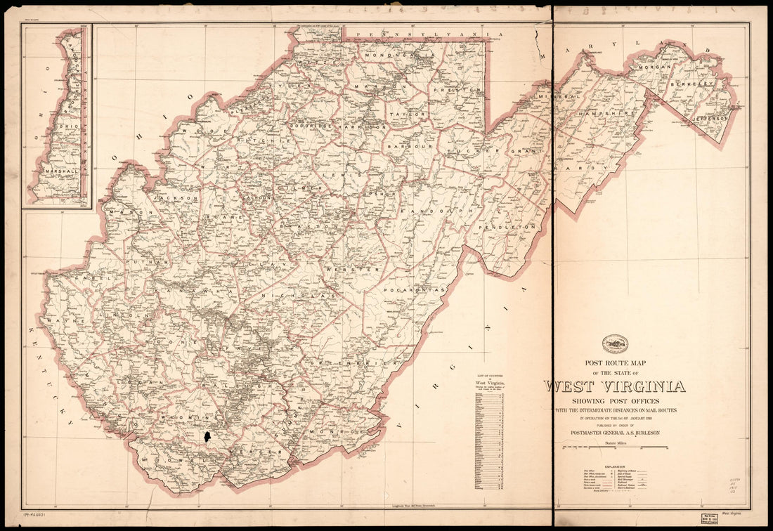
 Post Route Map of the State of West Virginia : Showing Post Offices With the Intermediate Distances On Mail Routes In Operation On the 1st of January 1921 (West Virginia)Post Route Map of the State of West Virginia : Showing Post Offices With the Intermediate Distances On Mail Routes In Operation On the 1st of January 1921 (West Virginia)
- Regular price
-
$58.95 $164.95 - Regular price
-
$41.95 - Sale price
-
$58.95 $164.95
-
 Map of Raleigh County and Western Part of Summers County Showing Topography in 1916Map of Raleigh County and Western Part of Summers County Showing Topography in 1916
- Regular price
-
$54.95 $148.95 - Regular price
-
$38.95 - Sale price
-
$54.95 $148.95
-
 Post Route Map of the State of West Virginia : Showing Post Offices With the Intermediate Distances On Mail Routes In Operation On the 1st of January 1918 (West Virginia)Post Route Map of the State of West Virginia : Showing Post Offices With the Intermediate Distances On Mail Routes In Operation On the 1st of January 1918 (West Virginia)
- Regular price
-
$58.95 $171.95 - Regular price
-
$41.95 - Sale price
-
$58.95 $171.95
-
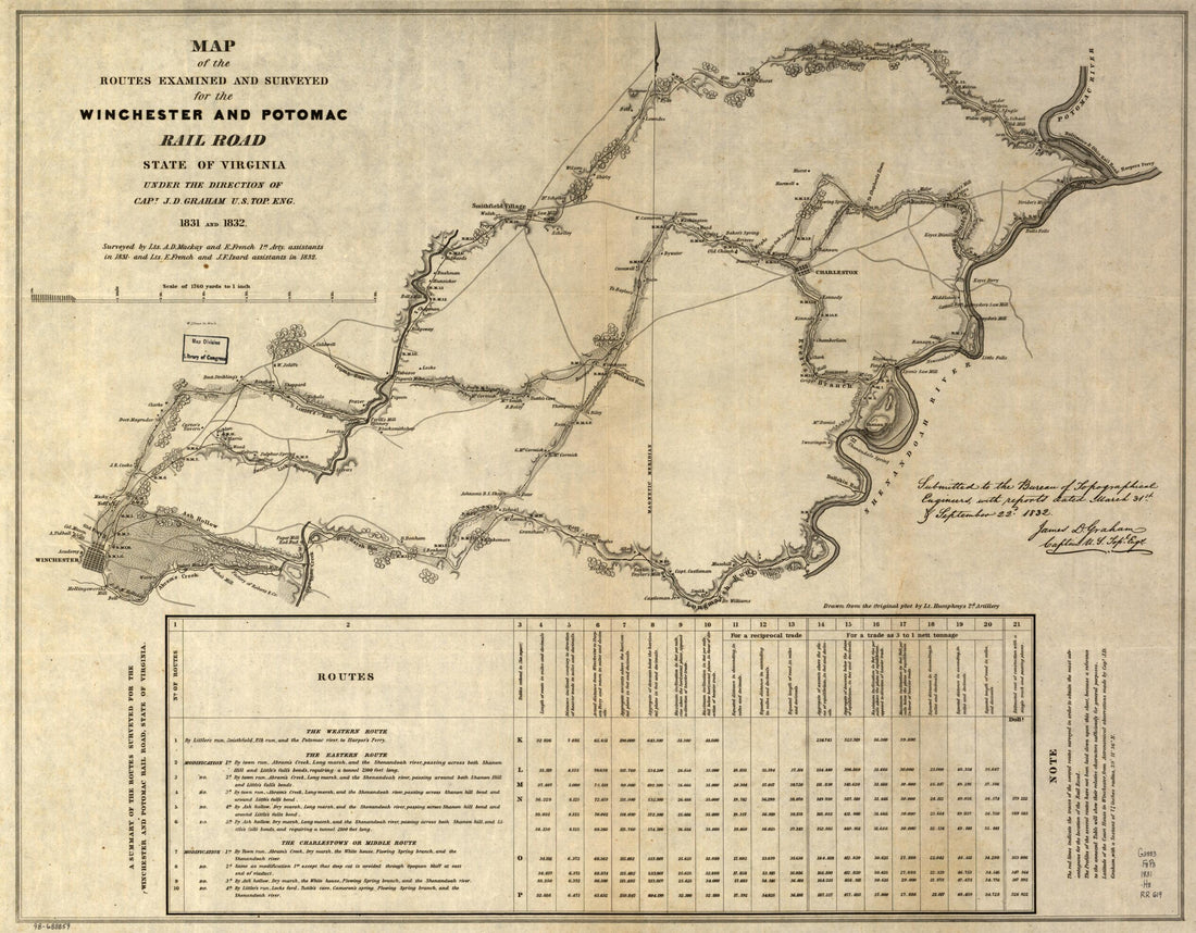 Map of the Routes Examined and Surveyed for the Winchester and Potomac Rail Road, State of Virginia, Under the Direction of Capt. J. D. Graham, U.S. Top. Eng., 1831 and 1832; Surveyed by Lts. A. D. Mackay and E. French, 1st Arty., Assistants In 1831, ...Map of the Routes Examined and Surveyed for the Winchester and Potomac Rail Road, State of Virginia, Under the Direction of Capt. J. D. Graham, U.S. Top. Eng., 1831 and 1832; Surveyed by Lts. A. D. Mackay and E. French, 1st Arty., Assistants In 1831, ...
- Regular price
-
$54.95 $83.95 - Regular price
-
$38.95 - Sale price
-
$54.95 $83.95
-
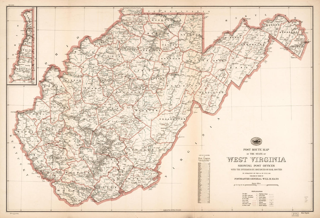
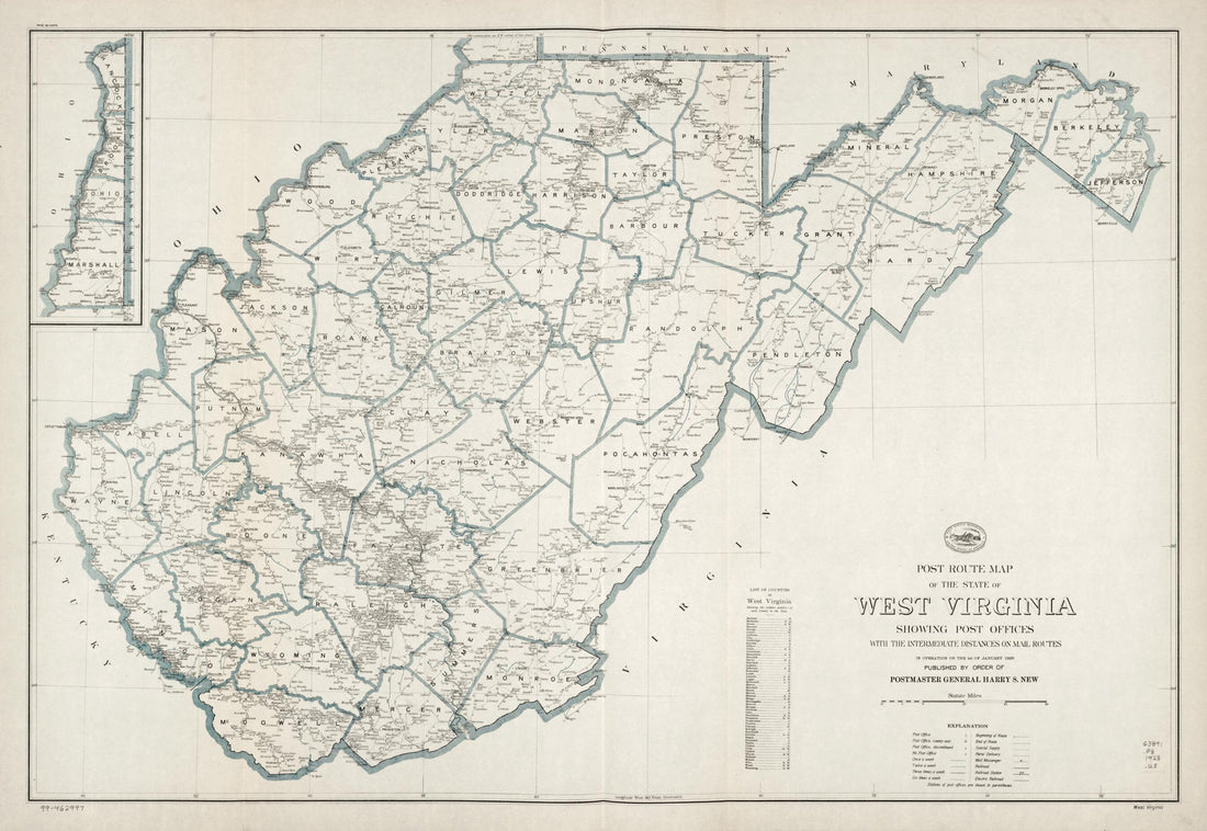 Post Route Map of the State of West Virginia : Showing Post Offices With the Intermediate Distances On Mail Routes In Operation On the 1st of January in 1928Post Route Map of the State of West Virginia : Showing Post Offices With the Intermediate Distances On Mail Routes In Operation On the 1st of January in 1928
- Regular price
-
$58.95 $167.95 - Regular price
-
$41.95 - Sale price
-
$58.95 $167.95
-
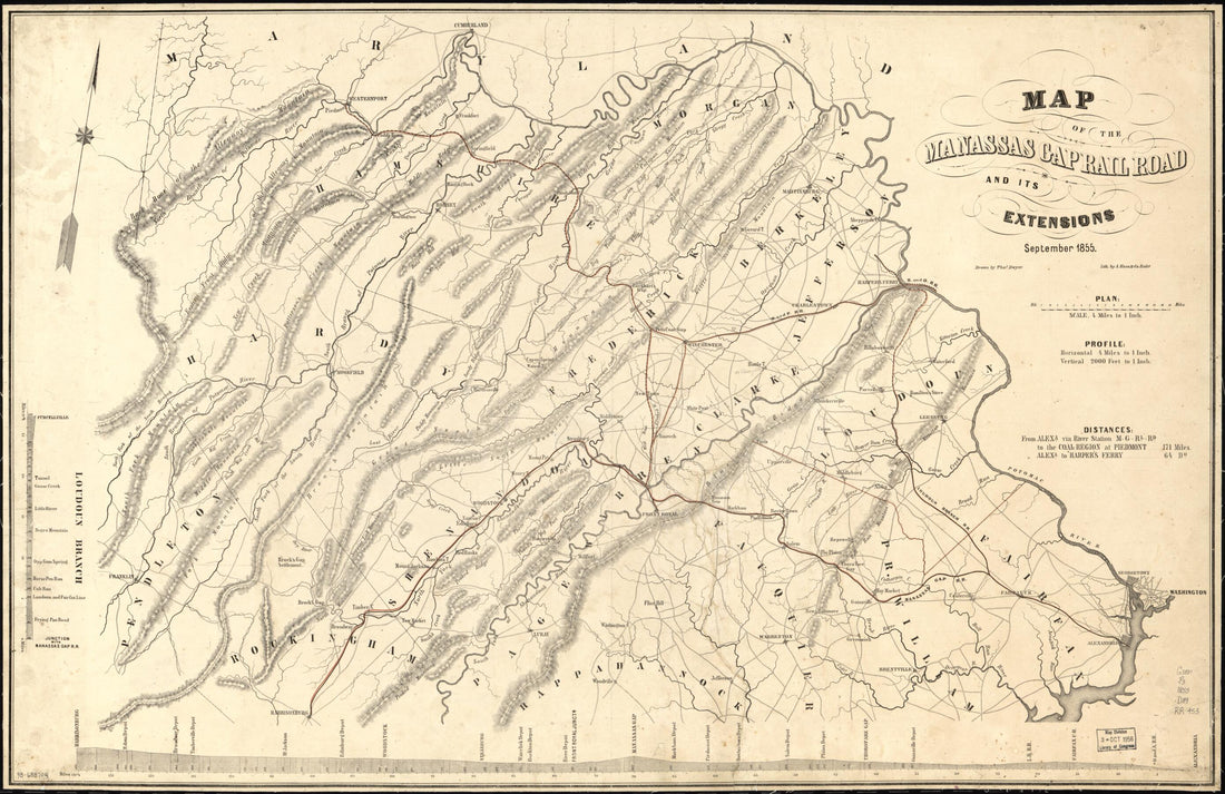 Map of the Manassas Gap Railroad and Its Extensions; September, 1855Map of the Manassas Gap Railroad and Its Extensions; September, 1855
- Regular price
-
$58.95 $99.95 - Regular price
-
$41.95 - Sale price
-
$58.95 $99.95
-
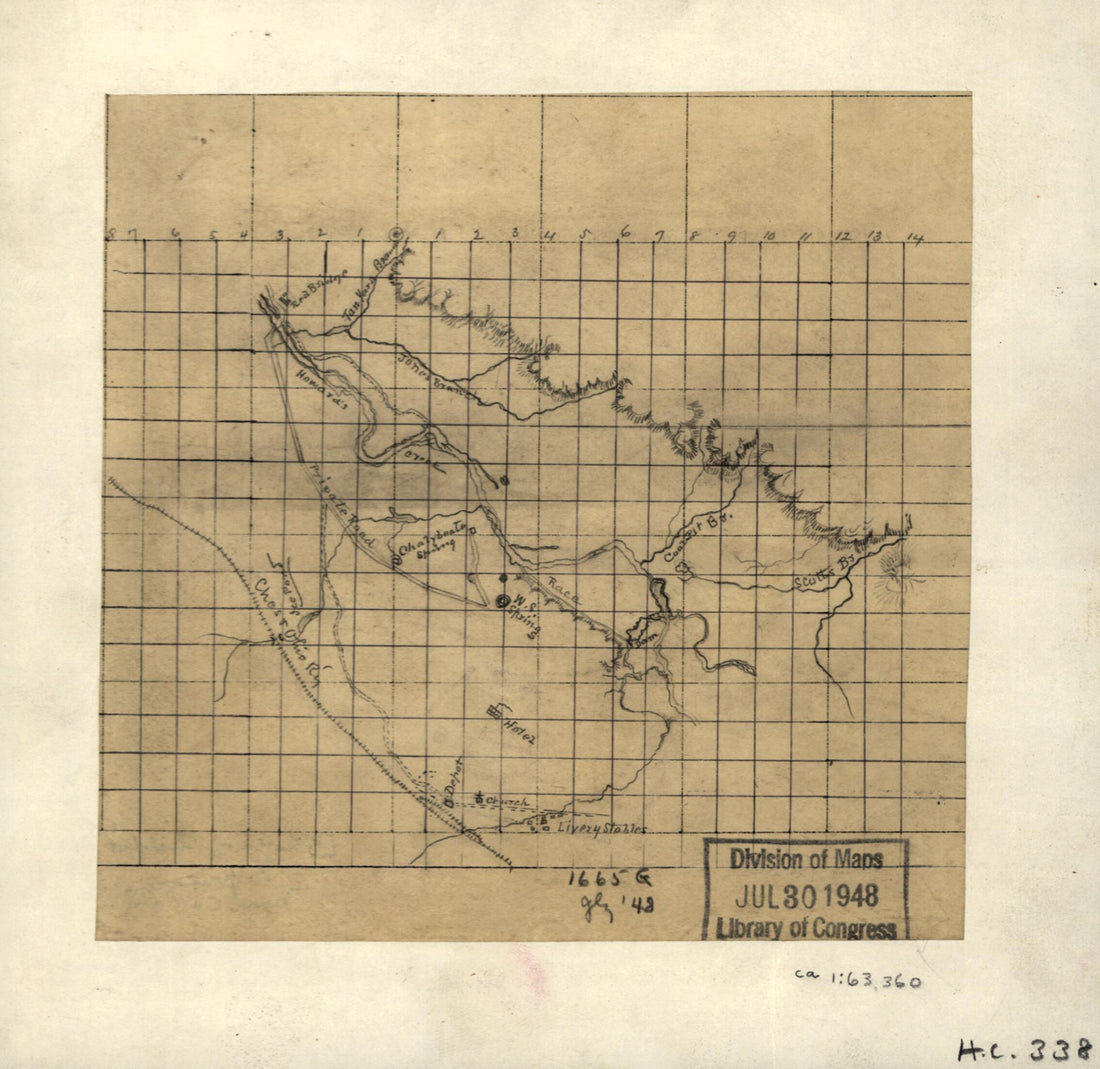 Sketch of White Sulphur Springs, W. Va. and Chalybeate Springs Near C. & O. R. R 1880Sketch of White Sulphur Springs, W. Va. and Chalybeate Springs Near C. & O. R. R 1880
- Regular price
-
$49.95 $83.95 - Regular price
-
$34.95 - Sale price
-
$49.95 $83.95
-
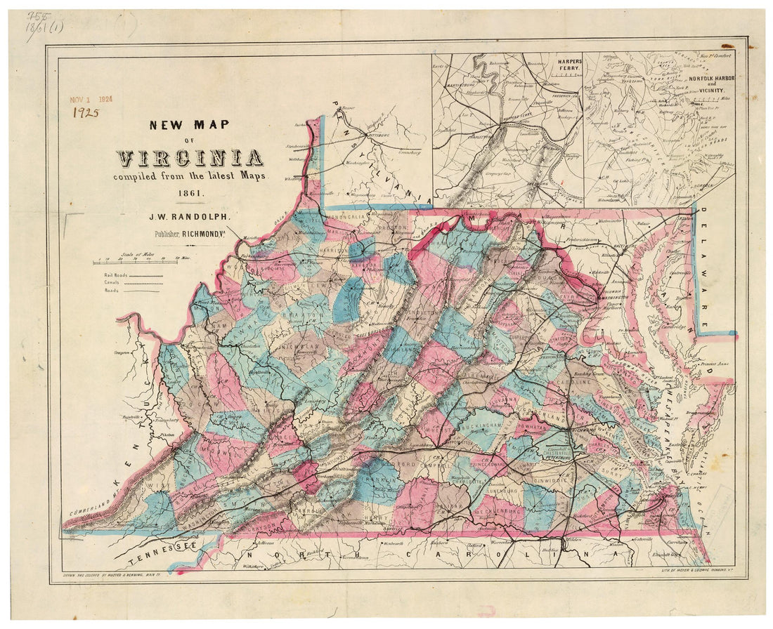 New Map of Virginia : Compiled from the Latest Maps 1861New Map of Virginia : Compiled from the Latest Maps 1861
- Regular price
-
$49.95 $83.95 - Regular price
-
$34.95 - Sale price
-
$49.95 $83.95
-
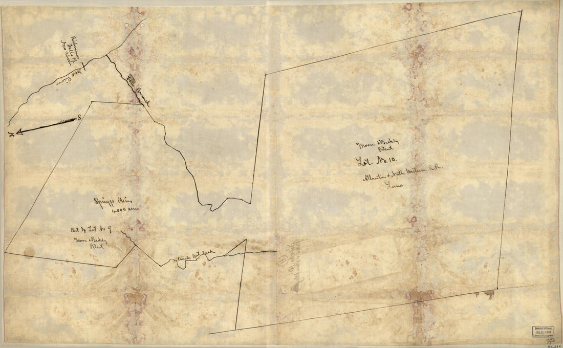 Moore & Beckly i.e. Beckley Patent, Lot No. 10, Atlantic & North Western R.R. Land. (Moore and Beckley Patent, Lot Number 10, Atlantic and North Western R.R. Land) 1880Moore & Beckly i.e. Beckley Patent, Lot No. 10, Atlantic & North Western R.R. Land. (Moore and Beckley Patent, Lot Number 10, Atlantic and North Western R.R. Land) 1880
- Regular price
-
$58.95 $99.95 - Regular price
-
$41.95 - Sale price
-
$58.95 $99.95


