428 products
-
 Atlas, Illustrated, Containing Large Scale Copper Plate Maps of Each State and Territory of the United States, and the Provinces of Canada, Together With a Complete Reference Map of the World, Topographical and Railroad Map of the United States, Thirt...Atlas, Illustrated, Containing Large Scale Copper Plate Maps of Each State and Territory of the United States, and the Provinces of Canada, Together With a Complete Reference Map of the World, Topographical and Railroad Map of the United States, Thirt...
- Regular price
-
$49.95 $99.95 - Regular price
-
$30.95 - Sale price
-
$49.95 $99.95
-
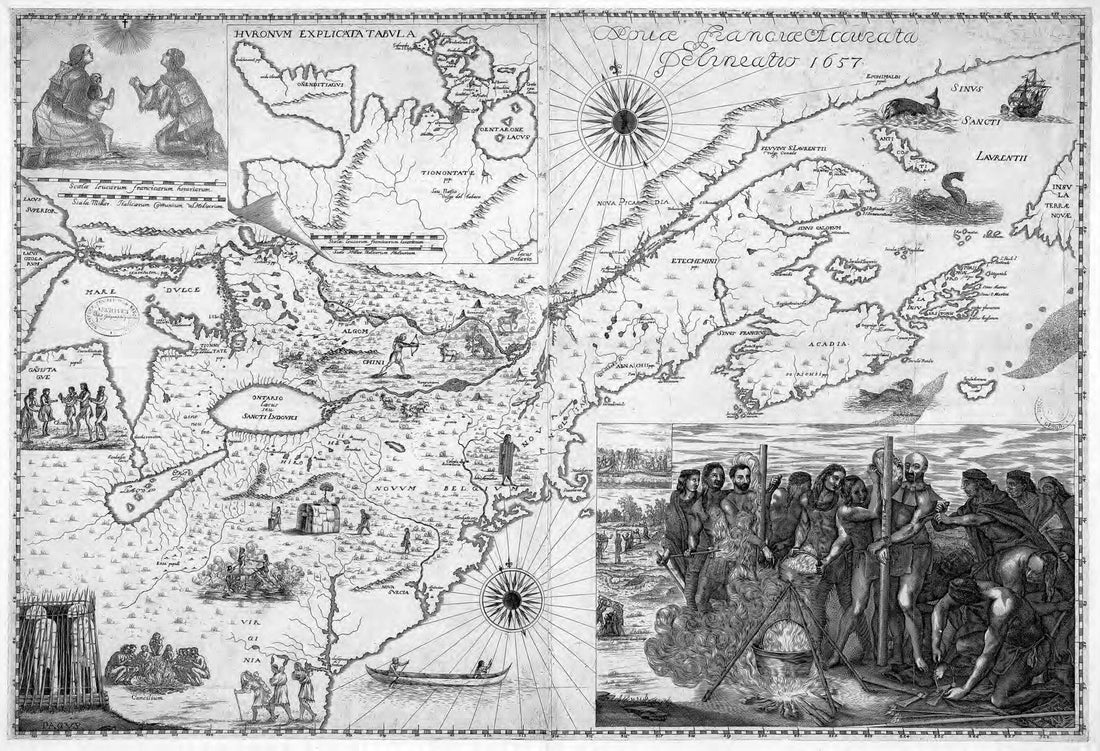 An Accurate Depiction of New France, 1657. (Novae Franciae Accurata Delineatio, 1657)An Accurate Depiction of New France, 1657. (Novae Franciae Accurata Delineatio, 1657)
- Regular price
-
$54.95 $99.95 - Regular price
-
$31.95 - Sale price
-
$54.95 $99.95
-
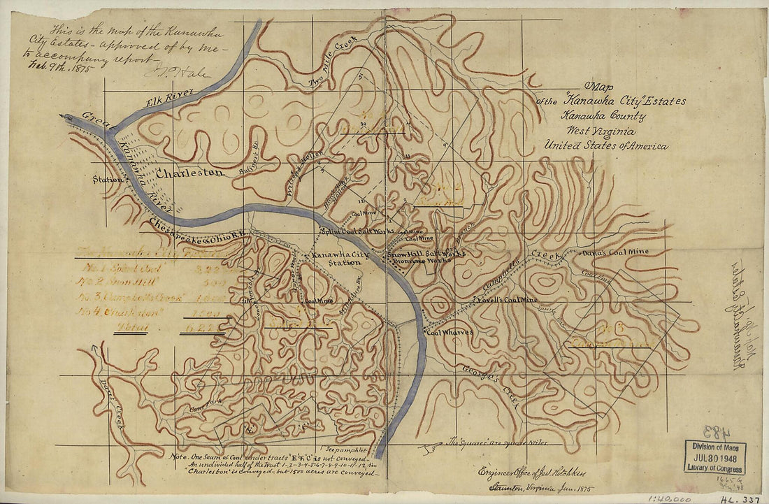 Map of the Kanawha City Estates, Kanawha County, West Virginia, United States of America 1875Map of the Kanawha City Estates, Kanawha County, West Virginia, United States of America 1875
- Regular price
-
$49.95 $99.95 - Regular price
-
$34.95 - Sale price
-
$49.95 $99.95
-
 Military Map Showing the Topographical Features of the Country Adjacent to Harper's Ferry, Va.; Including Maryland, Loudoun, and Bolivar Heights, and Portions of South and Short Mountains, With the Positions of the Defensive Works, Also the Junction o...Military Map Showing the Topographical Features of the Country Adjacent to Harper's Ferry, Va.; Including Maryland, Loudoun, and Bolivar Heights, and Portions of South and Short Mountains, With the Positions of the Defensive Works, Also the Junction o...
- Regular price
-
$54.95 $89.95 - Regular price
-
$38.95 - Sale price
-
$54.95 $89.95
-
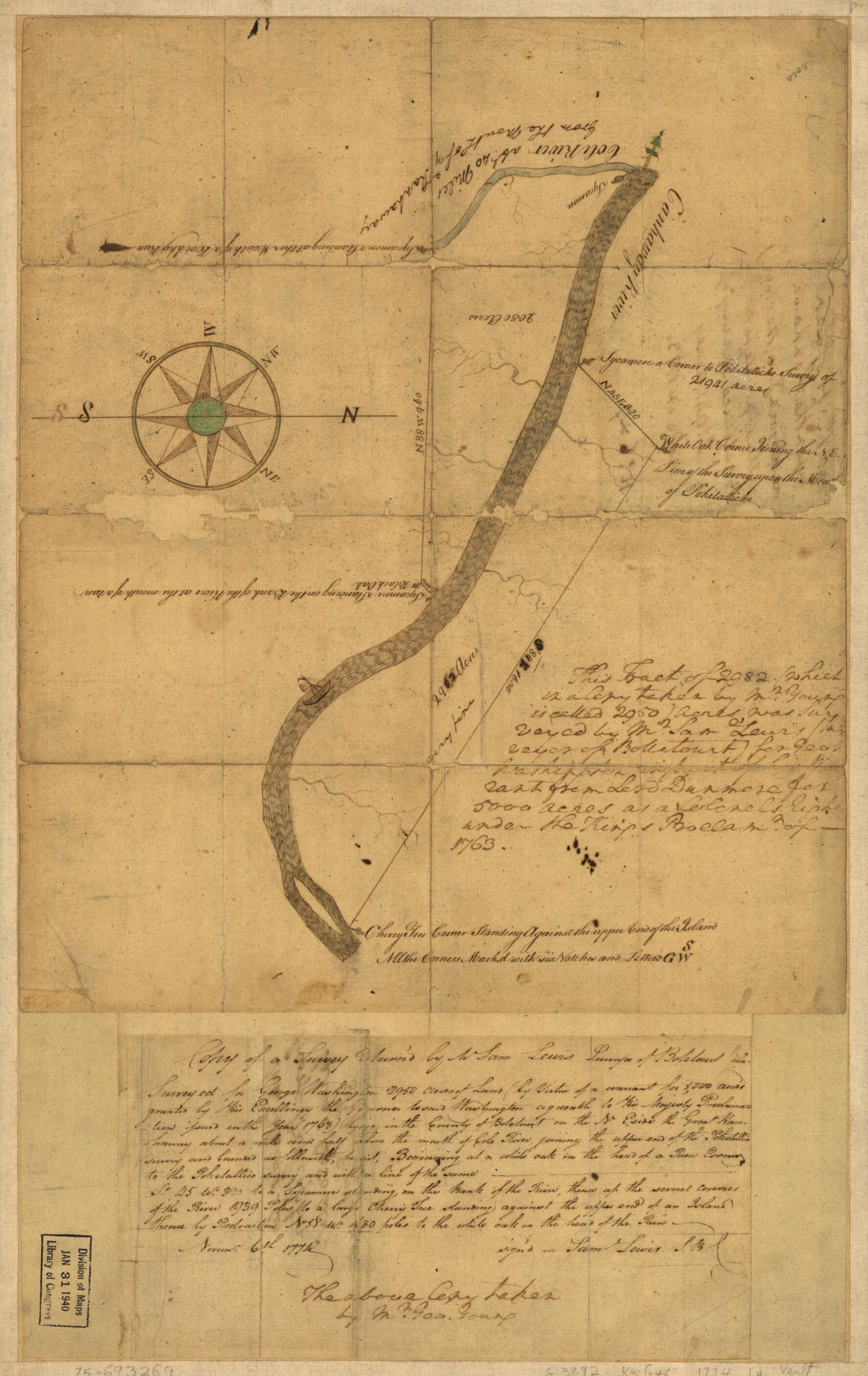 Copy of a Survey Return'd by Mr. Sam Lewis, Surveyor of Botetourt County. Surveyed for George Washington 2950 Acres of Land (by Virtue of a Warrant for 5,000 Acres Granted by His Excellency the Governor to Said Washington Agreeable to His Majesty Proc...Copy of a Survey Return'd by Mr. Sam Lewis, Surveyor of Botetourt County. Surveyed for George Washington 2950 Acres of Land (by Virtue of a Warrant for 5,000 Acres Granted by His Excellency the Governor to Said Washington Agreeable to His Majesty Proc...
- Regular price
-
$49.95 $99.95 - Regular price
-
$34.95 - Sale price
-
$49.95 $99.95
-
 Map Showing Location of the Gallego Forty Thousand Acres of Coal and Timber Lands, Fayette County, W. Va 1885Map Showing Location of the Gallego Forty Thousand Acres of Coal and Timber Lands, Fayette County, W. Va 1885
- Regular price
-
$49.95 $83.95 - Regular price
-
$34.95 - Sale price
-
$49.95 $83.95
-
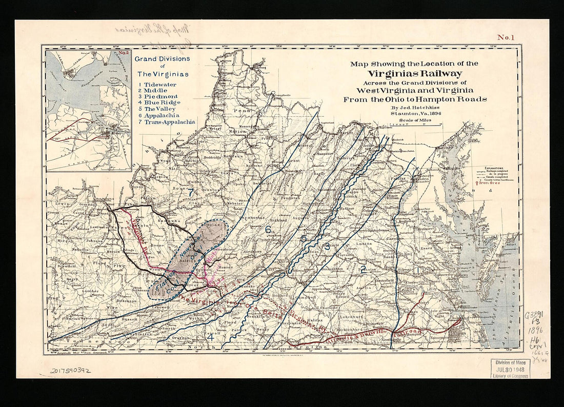 Map Showing the Location of the Virginias Railway Across the Grand Divisions of West Virginia and Virginia from the Ohio to Hampton Roads (Virginias Railway Across the Grand Divisions of West Virginia and Virginia from the Ohio to Hampton Roads) 1896Map Showing the Location of the Virginias Railway Across the Grand Divisions of West Virginia and Virginia from the Ohio to Hampton Roads (Virginias Railway Across the Grand Divisions of West Virginia and Virginia from the Ohio to Hampton Roads) 1896
- Regular price
-
$51.95 $88.95 - Regular price
-
$30.95 - Sale price
-
$51.95 $88.95
-
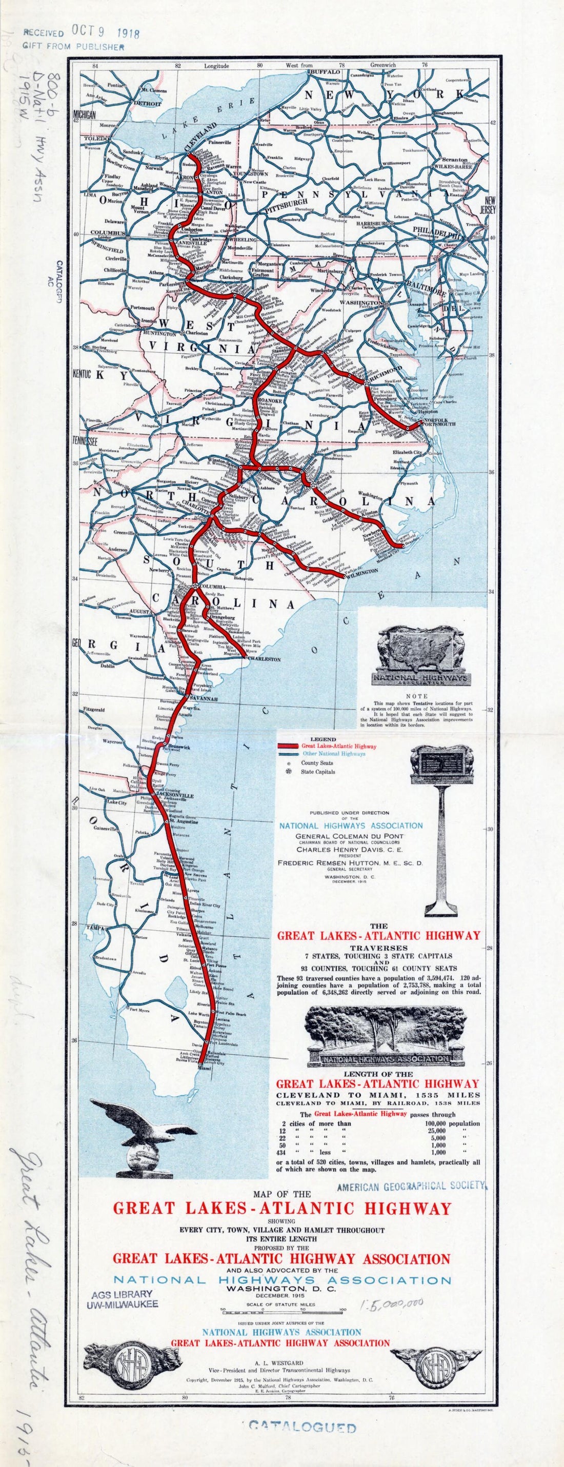 Atlantic Highway: Showing Every City, Town, Village and Hamlet Throughout Its Entire Length in 1915Atlantic Highway: Showing Every City, Town, Village and Hamlet Throughout Its Entire Length in 1915
- Regular price
-
$49.95 $99.95 - Regular price
-
$34.95 - Sale price
-
$49.95 $99.95
-
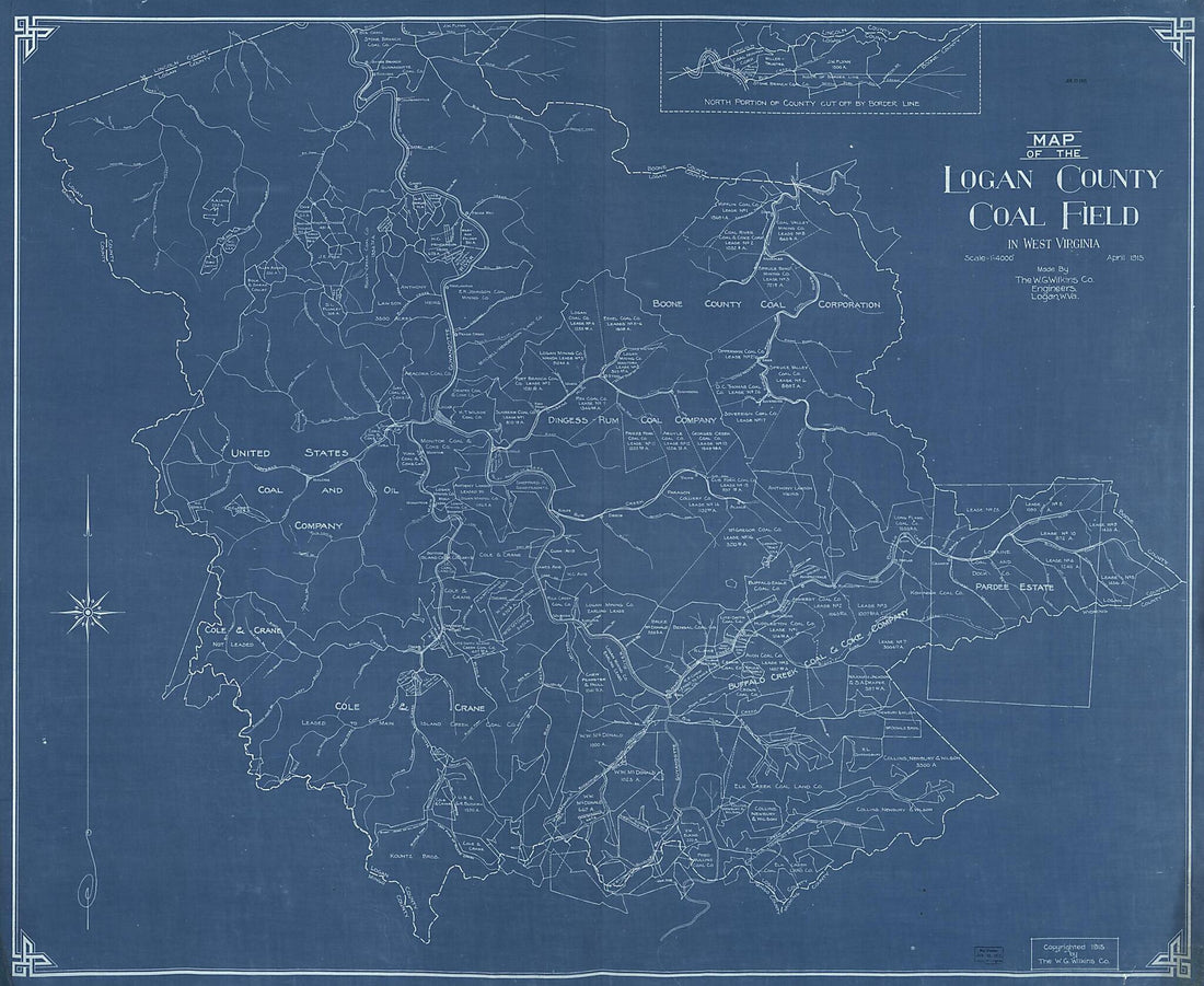 Map of the Logan County Coal Field In West Virginia 1915Map of the Logan County Coal Field In West Virginia 1915
- Regular price
-
$54.95 $158.95 - Regular price
-
$38.95 - Sale price
-
$54.95 $158.95
-
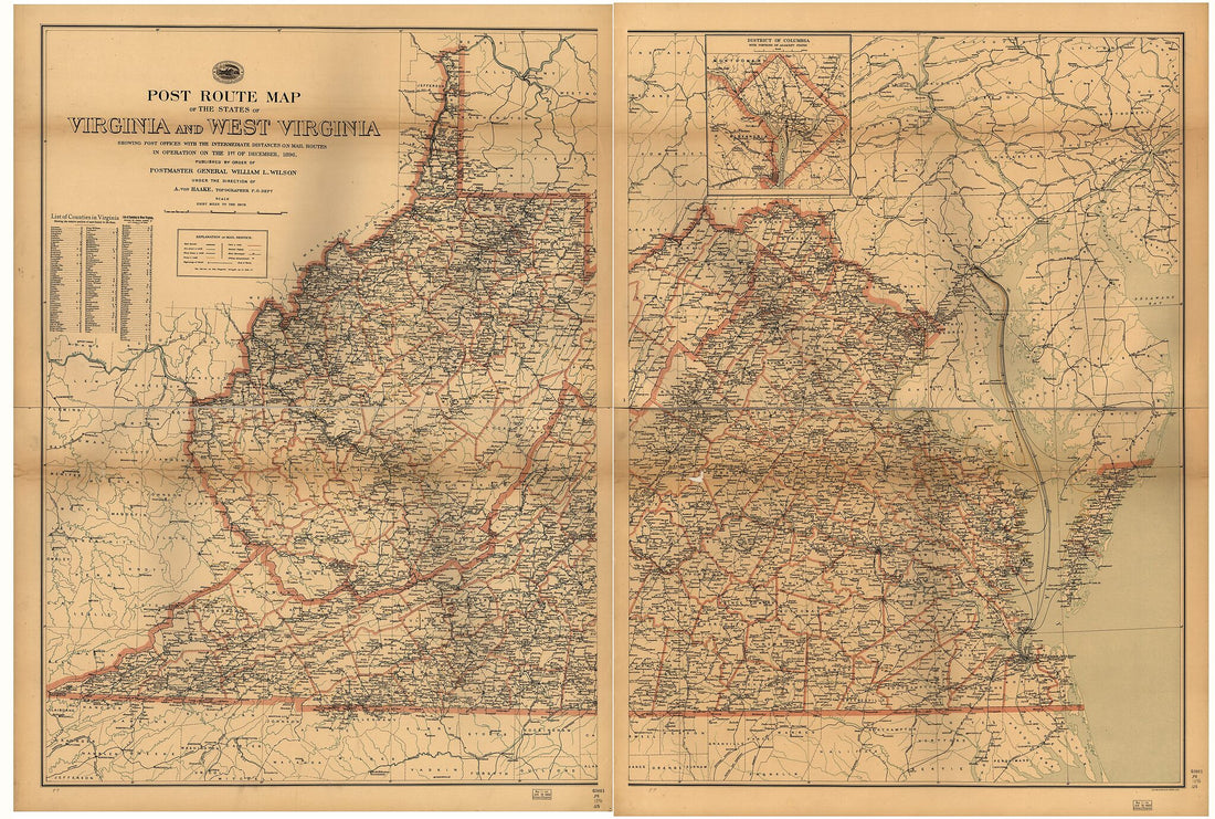 Post Route Map of the States of Virginia and West Virginia : Showing Post Offices With the Intermediate Distances and Mail Routes In Operation On the 1st of September, in 1896Post Route Map of the States of Virginia and West Virginia : Showing Post Offices With the Intermediate Distances and Mail Routes In Operation On the 1st of September, in 1896
- Regular price
-
$58.95 $262.95 - Regular price
-
$41.95 - Sale price
-
$58.95 $262.95
-
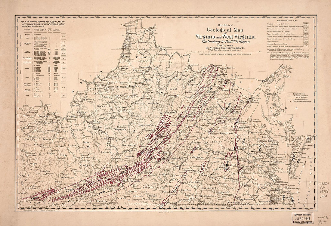 Hotchkiss' Geological Map of Virginia and West Virginia 1885Hotchkiss' Geological Map of Virginia and West Virginia 1885
- Regular price
-
$54.95 $99.95 - Regular price
-
$38.95 - Sale price
-
$54.95 $99.95
-
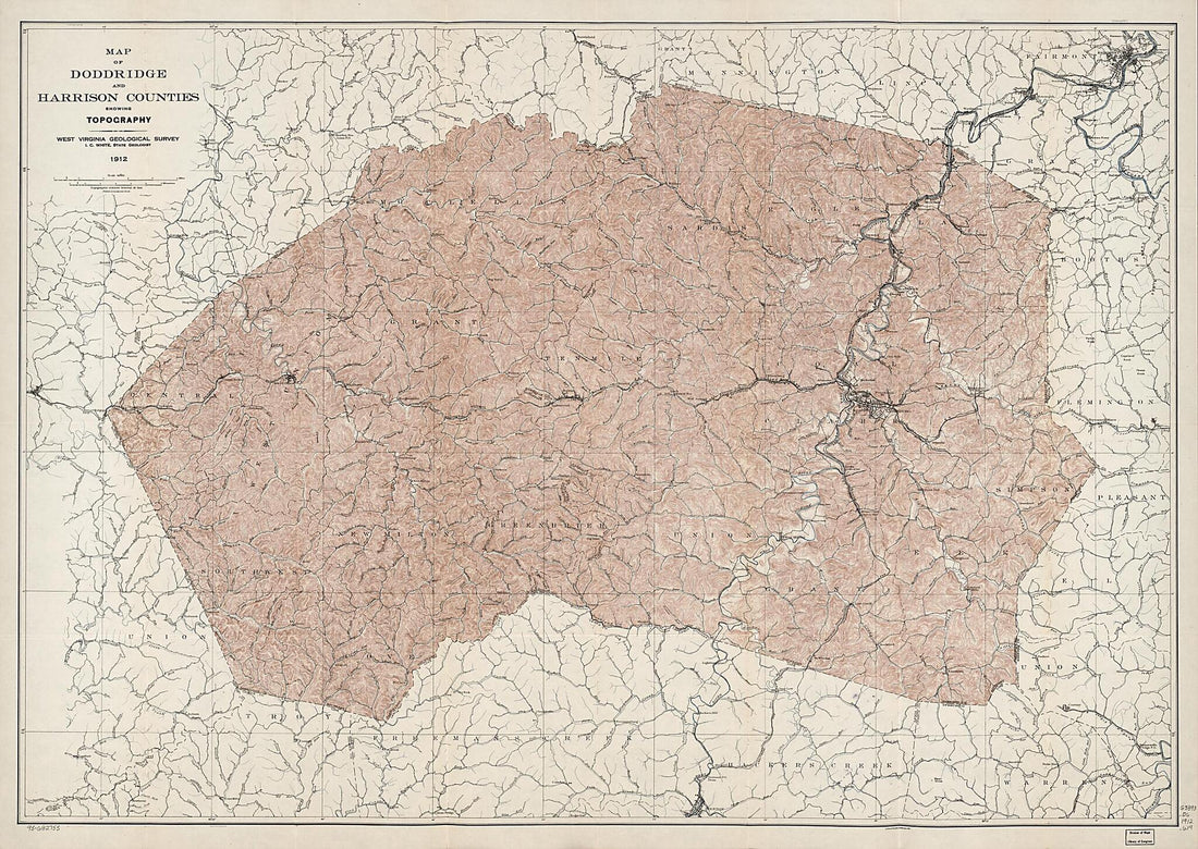 Map of Doddridge and Harrison Counties Showing Topography 1912Map of Doddridge and Harrison Counties Showing Topography 1912
- Regular price
-
$58.95 $158.95 - Regular price
-
$41.95 - Sale price
-
$58.95 $158.95


