Quick links
19716 products
-
Sketch of the Road from Paulus Hook and Hobocken to New Bridge 1778
 Sketch of the Road from Paulus Hook and Hobocken to New Bridge 1778
- Regular price
-
From
$34.95 - Regular price
-
$49.99 - Sale price
-
From
$34.95
-
Sketch of Forts Clinton & Montgomery, Stormed the 6th Octob. 1777 by the Troops Under the Command of Sir Henry Clinton, K.B., Lt. General of H. Maj. Forces and Commander In Chief of New Yorck and Its Dependencies 1776
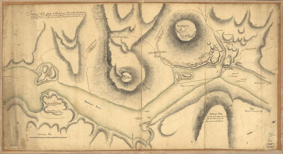 Sketch of Forts Clinton & Montgomery, Stormed the 6th Octob. 1777 by the Troops Under the Command of Sir Henry Clinton, K.B., Lt. General of H. Maj. Forces and Commander In Chief of New Yorck and Its Dependencies 1776
- Regular price
-
From
$41.95 - Regular price
-
$66.99 - Sale price
-
From
$41.95
-
Map of Coleman Co. (Map of Coleman County) 1879
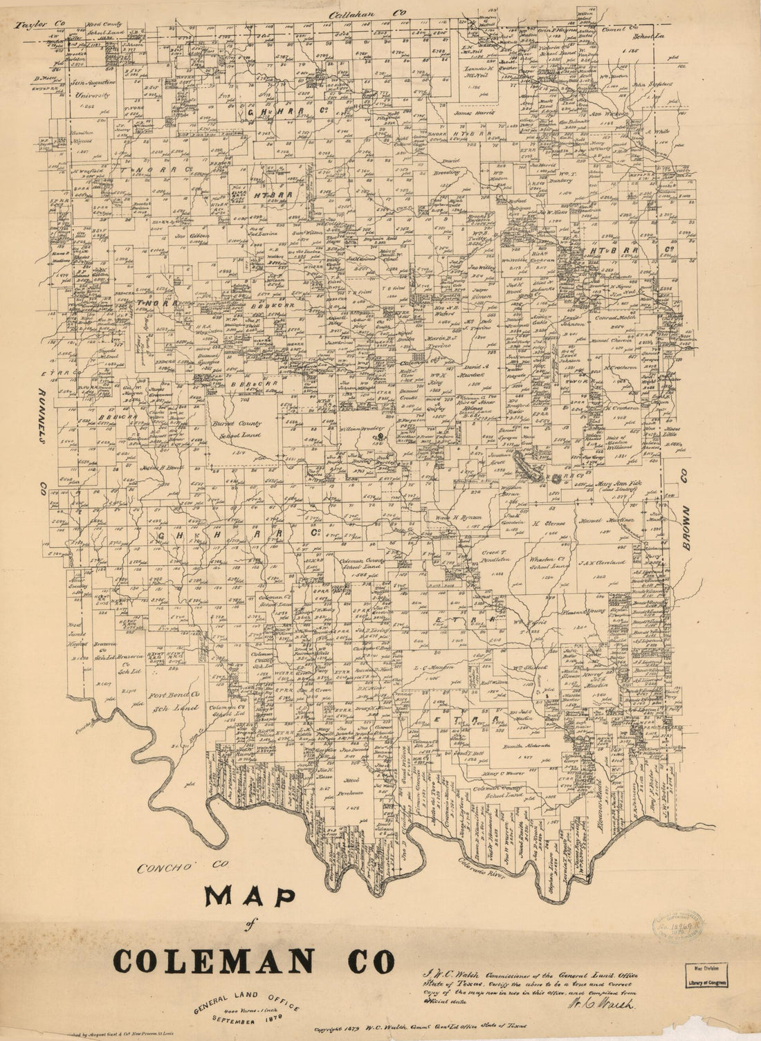 Map of Coleman Co. (Map of Coleman County) 1879
- Regular price
-
From
$32.95 - Regular price
-
$51.99 - Sale price
-
From
$32.95
-
A Plan of Fort Pike at Sackets Harbour : On a Scale of Ten Yards to an Inch, Sackets Harbour June 20th 1814
 A Plan of Fort Pike at Sackets Harbour : On a Scale of Ten Yards to an Inch, Sackets Harbour June 20th 1814
- Regular price
-
From
$34.95 - Regular price
-
$49.99 - Sale price
-
From
$34.95
-
Map of Stark, Billings, and Part of Mercer Counties, 1897
 Map of Stark, Billings, and Part of Mercer Counties, 1897
- Regular price
-
From
$41.95 - Regular price
-
$66.99 - Sale price
-
From
$41.95
-
Map of the United States : Compiled From the Latest Authorities in 1842
 Map of the United States : Compiled From the Latest Authorities in 1842
- Regular price
-
From
$34.95 - Regular price
-
$49.99 - Sale price
-
From
$34.95
-
浙江沿海要口全图 /, Map of Coast Forts In Zhejiang Province in 1906
 浙江沿海要口全图 /, Map of Coast Forts In Zhejiang Province in 1906
- Regular price
-
From
$41.95 - Regular price
-
$66.99 - Sale price
-
From
$41.95
-
Mount Desert Island and Neighboring Coast of Maine 1776
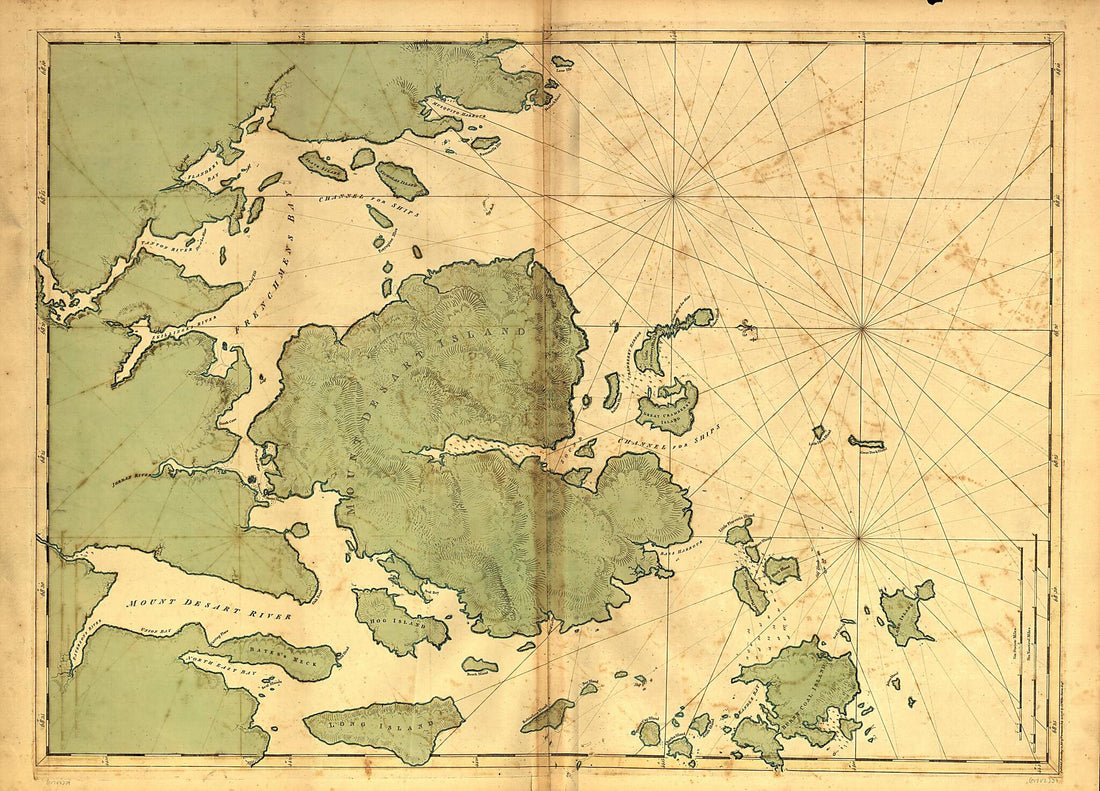 Mount Desert Island and Neighboring Coast of Maine 1776
- Regular price
-
From
$32.95 - Regular price
-
$51.99 - Sale price
-
From
$32.95
-
Gettysburg and Vicinity, Showing the Position of the Troops July 1st and 3rd, 1863, and the Land Purchased and Dedicated to the Public by General S. Wylie Crawford and the Gettysburg Battlefield Memorial Association
 Gettysburg and Vicinity, Showing the Position of the Troops July 1st and 3rd, 1863, and the Land Purchased and Dedicated to the Public by General S. Wylie Crawford and the Gettysburg Battlefield Memorial Association
- Regular price
-
From
$23.95 - Regular price
-
$37.95 - Sale price
-
From
$23.95
-
Map of the Battlefield of Perryville, Ky 1877
 Map of the Battlefield of Perryville, Ky 1877
- Regular price
-
From
$19.95 - Regular price
-
$29.95 - Sale price
-
From
$19.95
-
United States: Map Showing Loyal States In Green, What the Rebels Still Hold In Red, and What the Union Soldiers Have Wrested from Them In Yellow 1864
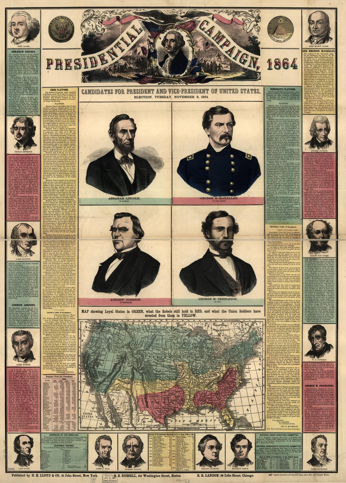 United States: Map Showing Loyal States In Green, What the Rebels Still Hold In Red, and What the Union Soldiers Have Wrested from Them In Yellow 1864
- Regular price
-
From
$32.95 - Regular price
-
$51.99 - Sale price
-
From
$32.95
-
General Chart of the Coast. No. IV, from Cape May to Cape Henry. from a Trigonometrical Survey Under the Direction of F. R. Hassler and A. D. Bache, Superintendents of the Survey of the Coast of the United States 1862
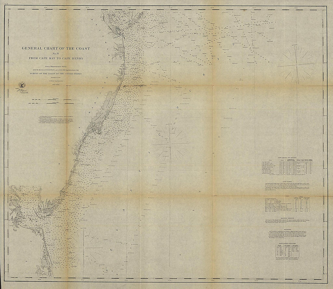 General Chart of the Coast. No. IV, from Cape May to Cape Henry. from a Trigonometrical Survey Under the Direction of F. R. Hassler and A. D. Bache, Superintendents of the Survey of the Coast of the United States 1862
- Regular price
-
From
$34.95 - Regular price
-
$49.99 - Sale price
-
From
$34.95


