Quick links
19716 products
-
Galante in 1764
![This hand drawn illustration (map) of Galante in from 1764 was created by Jacques Nicolas] [Bellin, P. Croisey in 1764](//relicmaps.com/cdn/shop/products/74691009.jpg?v=1762970534&width=1100) Galante in 1764
Galante in 1764- Regular price
-
From
$19.95 - Regular price
-
$29.95 - Sale price
-
From
$19.95
-
The West Indies Exhibiting the English, French, Spanish, Dutch & Danish Settlements in 1760
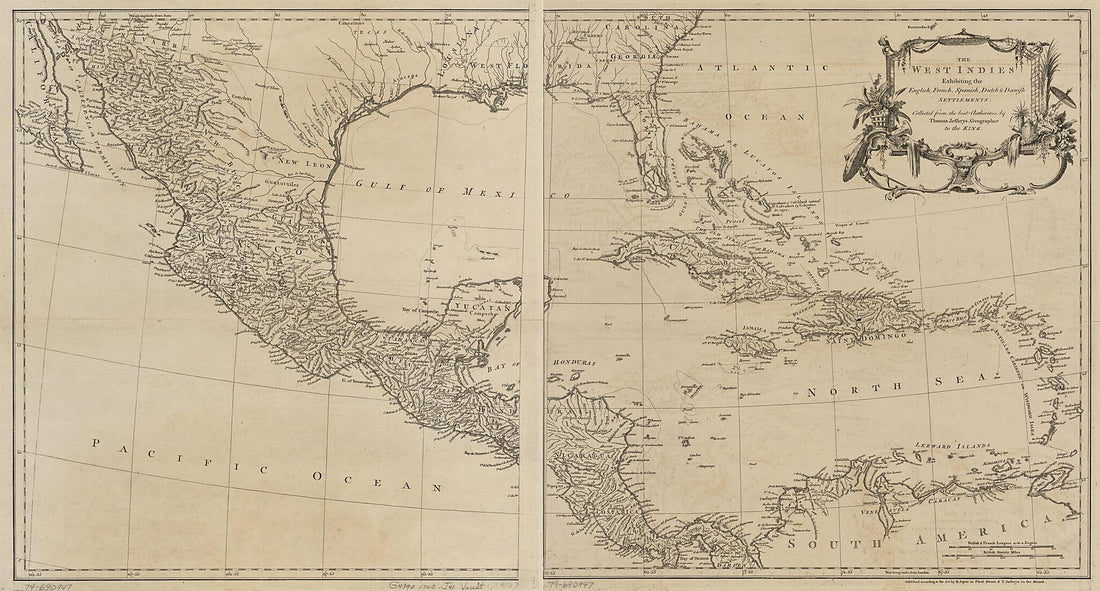 The West Indies Exhibiting the English, French, Spanish, Dutch & Danish Settlements in 1760
- Regular price
-
From
$41.95 - Regular price
-
$66.99 - Sale price
-
From
$41.95
-
Plano Borrador Del Límite Comun á Las Dos Floridas Y De Los Territorios De Ambas Provincias Adyacentes á El in 1815
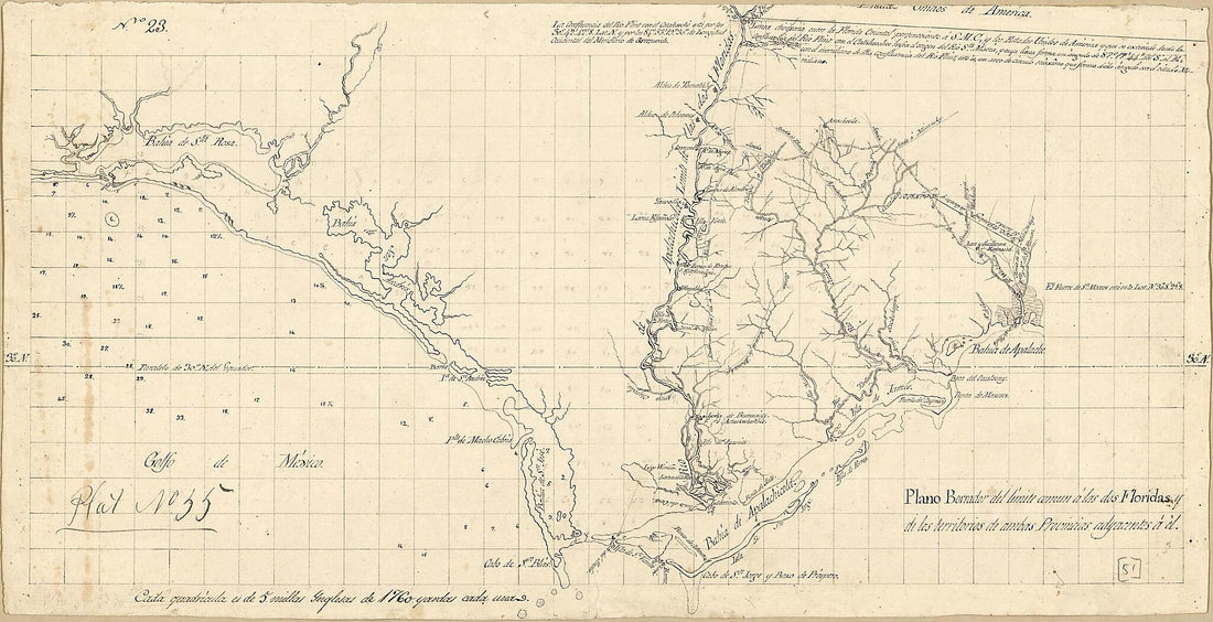 Plano Borrador Del Límite Comun á Las Dos Floridas Y De Los Territorios De Ambas Provincias Adyacentes á El in 1815
- Regular price
-
From
$28.95 - Regular price
-
$44.95 - Sale price
-
From
$28.95
-
Map of Area of Spanish West Florida Bounded by the Comite River On the West and the Amite River On the East in 1805
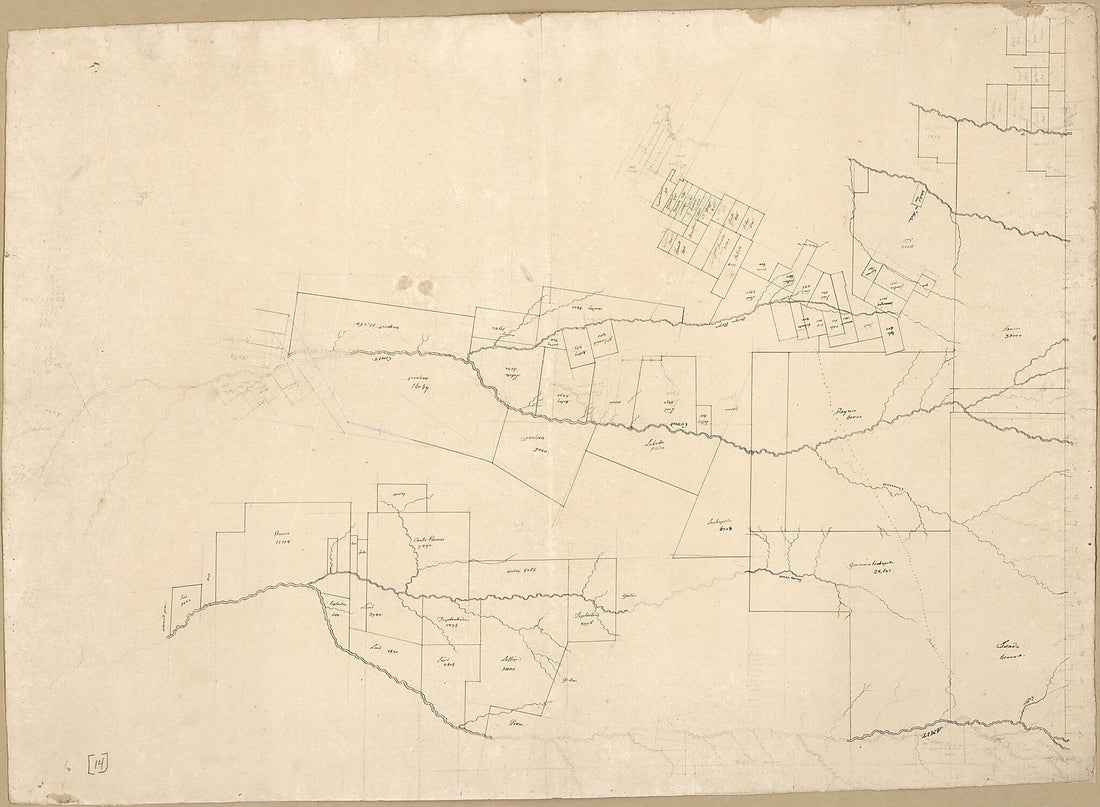 Map of Area of Spanish West Florida Bounded by the Comite River On the West and the Amite River On the East in 1805
- Regular price
-
From
$32.95 - Regular price
-
$51.99 - Sale price
-
From
$32.95
-
The State of Ohio, With Part of Upper Canada, &c in 1810
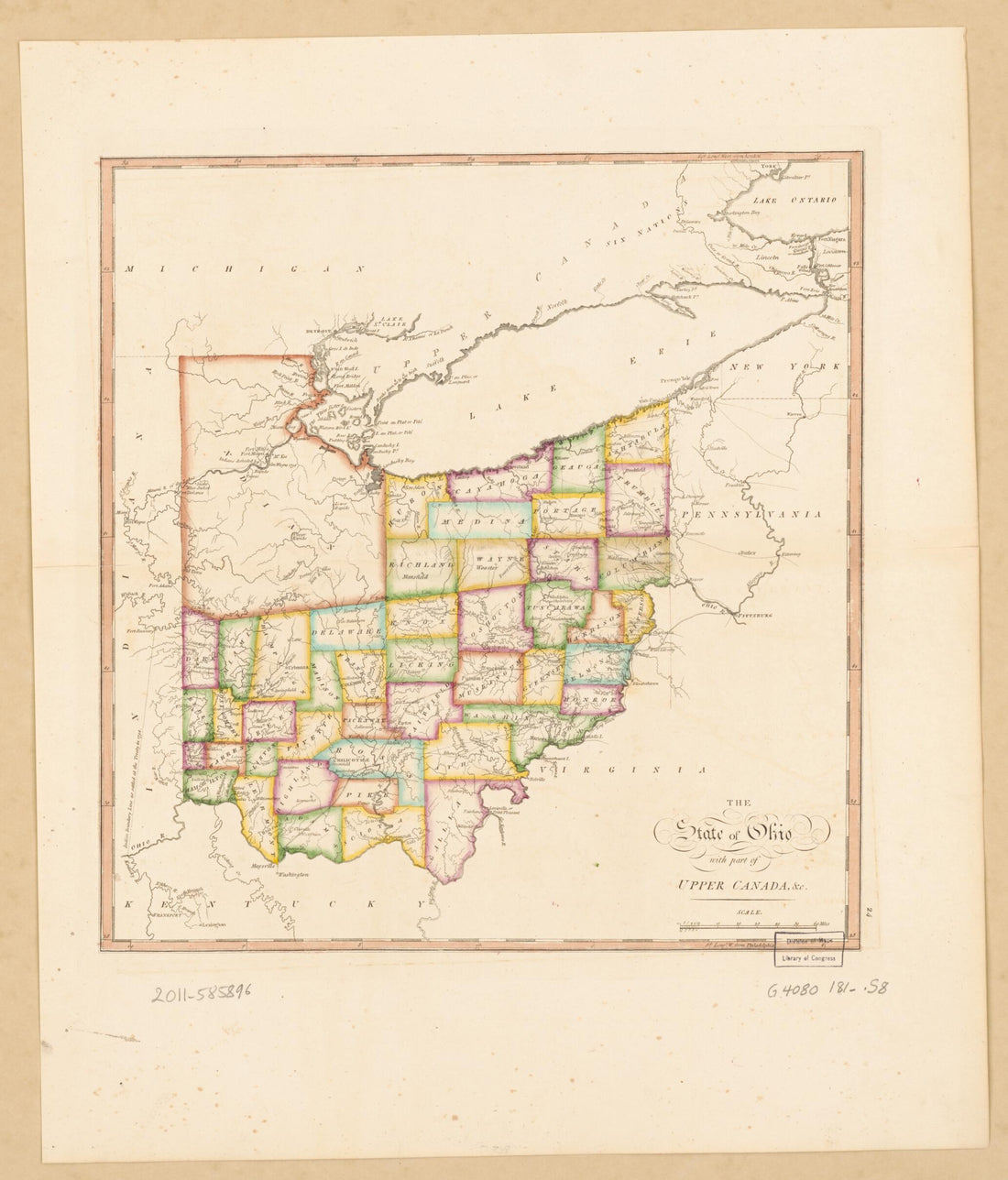 The State of Ohio, With Part of Upper Canada, &c in 1810
- Regular price
-
From
$34.95 - Regular price
-
$49.99 - Sale price
-
From
$34.95
-
Croquis De L'Afrique Équatoriale : Contenant Les Dernier Renseignements Recueillis Par Les Agents De L'Association Internationale Du Congo in 1884
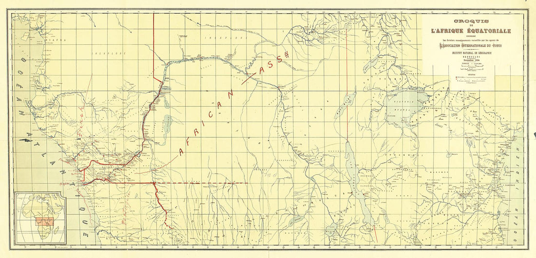 Croquis De L'Afrique Équatoriale : Contenant Les Dernier Renseignements Recueillis Par Les Agents De L'Association Internationale Du Congo in 1884
- Regular price
-
From
$41.95 - Regular price
-
$66.99 - Sale price
-
From
$41.95
-
Five Sketches Along the Valley Pike In the Vicinity of Fishers Hill, Strasburg, Cottontown, Mount Hope, Toms Brook, Etc. in 1860
 Five Sketches Along the Valley Pike In the Vicinity of Fishers Hill, Strasburg, Cottontown, Mount Hope, Toms Brook, Etc. in 1860
- Regular price
-
From
$26.95 - Regular price
-
$42.95 - Sale price
-
From
$26.95
-
Northrup Handy Map of Central America in 1902
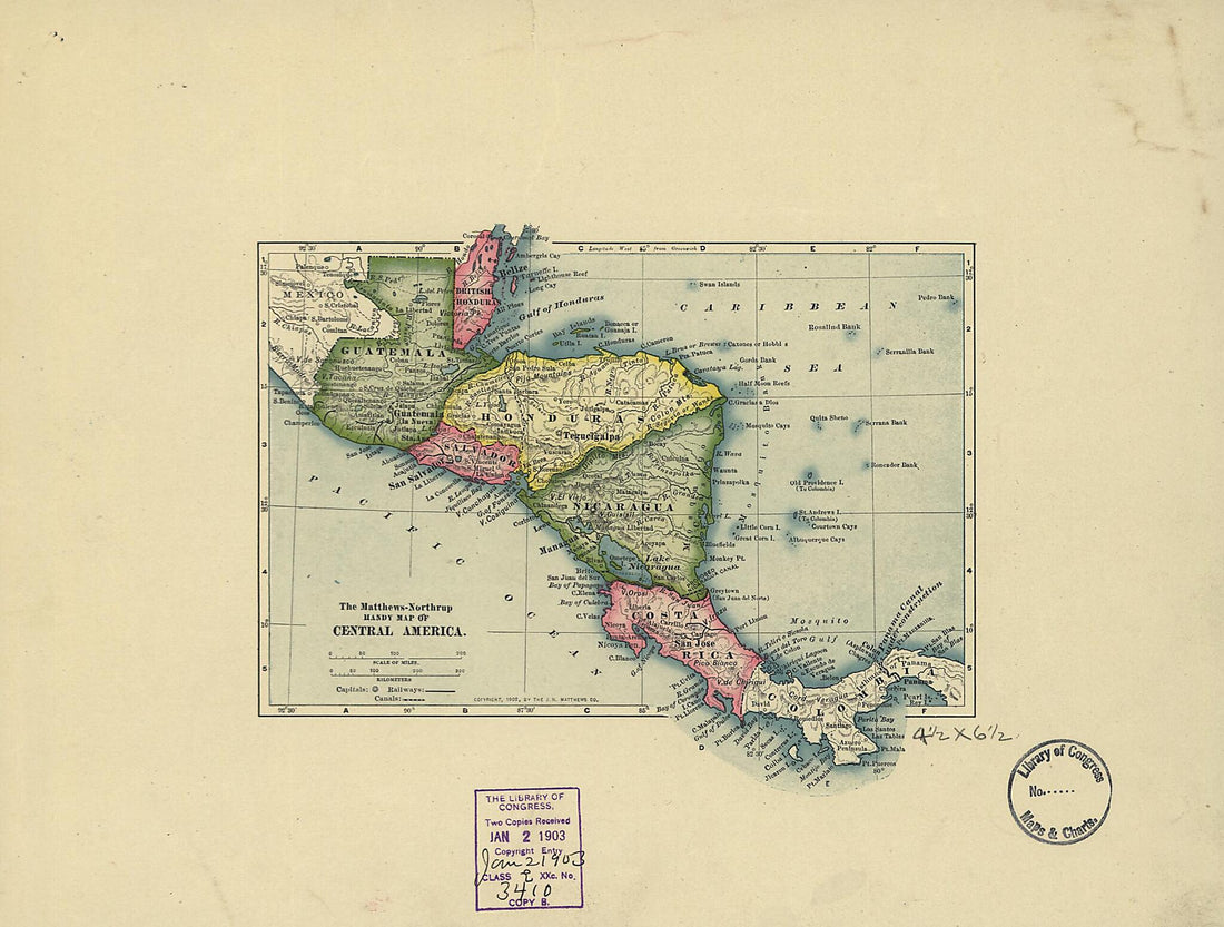 Northrup Handy Map of Central America in 1902
- Regular price
-
From
$19.95 - Regular price
-
$29.95 - Sale price
-
From
$19.95
-
Preliminary Chart of Port Royal Entrance, Beaufort, Broad and Chechessee Rivers, South Carolina in 1862
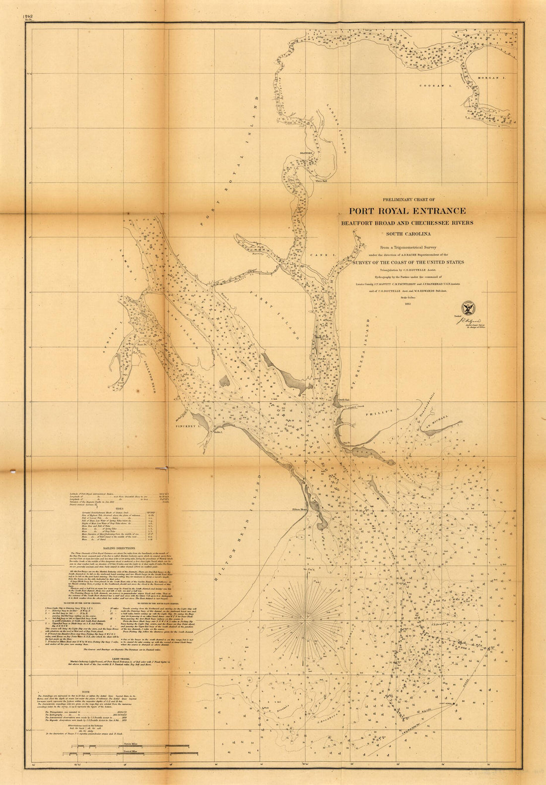 Preliminary Chart of Port Royal Entrance, Beaufort, Broad and Chechessee Rivers, South Carolina in 1862
- Regular price
-
From
$41.95 - Regular price
-
$66.99 - Sale price
-
From
$41.95
-
Map of Army Operations Atlanta Campaign Between Cassville and Mariette and Vicinity in 1864
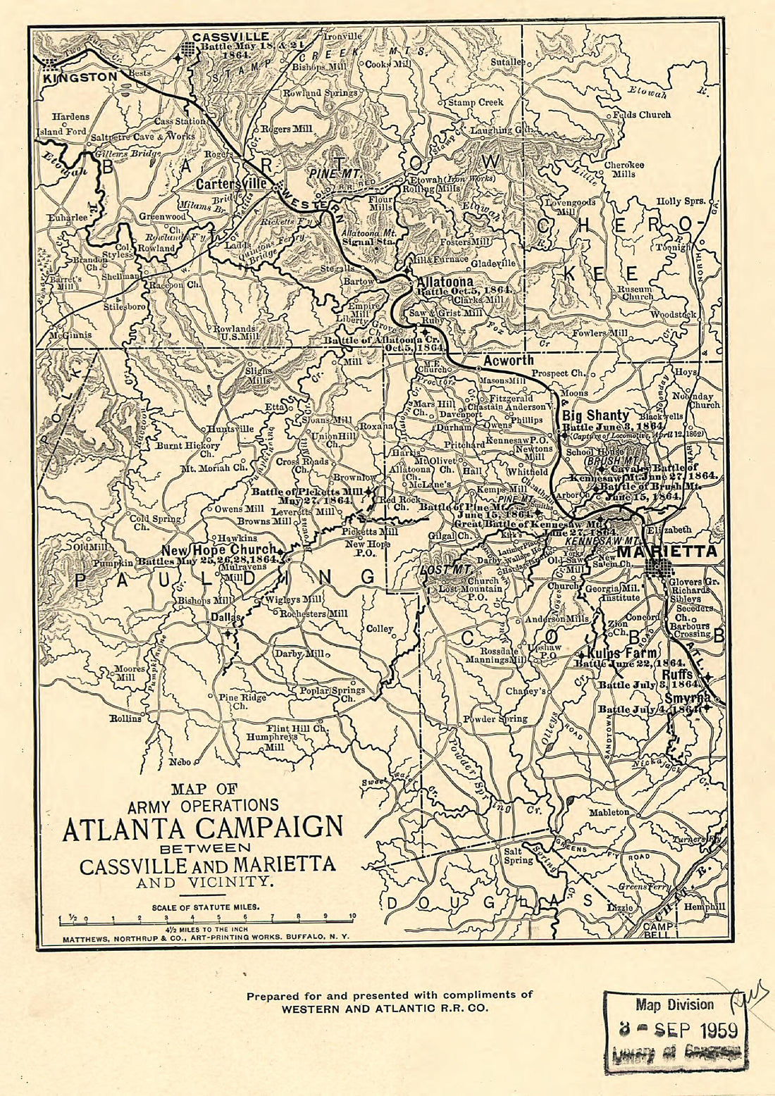 Map of Army Operations Atlanta Campaign Between Cassville and Mariette and Vicinity in 1864
- Regular price
-
From
$19.95 - Regular price
-
$29.95 - Sale price
-
From
$19.95
-
Gulf Coast of the United States; Key West to Rio Grande in 1863
 Gulf Coast of the United States; Key West to Rio Grande in 1863
- Regular price
-
From
$41.95 - Regular price
-
$66.99 - Sale price
-
From
$41.95
-
Historical Sketch of the Rebellion. May in 1862
 Historical Sketch of the Rebellion. May in 1862
- Regular price
-
From
$34.95 - Regular price
-
$49.99 - Sale price
-
From
$34.95
![This hand drawn illustration (map) of Galante in from 1764 was created by Jacques Nicolas] [Bellin, P. Croisey in 1764](http://relicmaps.com/cdn/shop/products/74691009.jpg?v=1762970534&width=1100)


