Quick links
19716 products
-
This Survey of the River Patapsco and Part of Chesapeake Bay in 1819
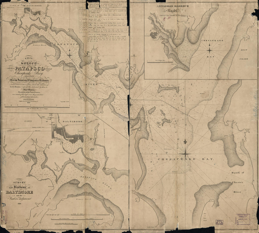 This Survey of the River Patapsco and Part of Chesapeake Bay in 1819
- Regular price
-
From
$34.95 - Regular price
-
$49.99 - Sale price
-
From
$34.95
-
Road Map of Massachusetts in 1922
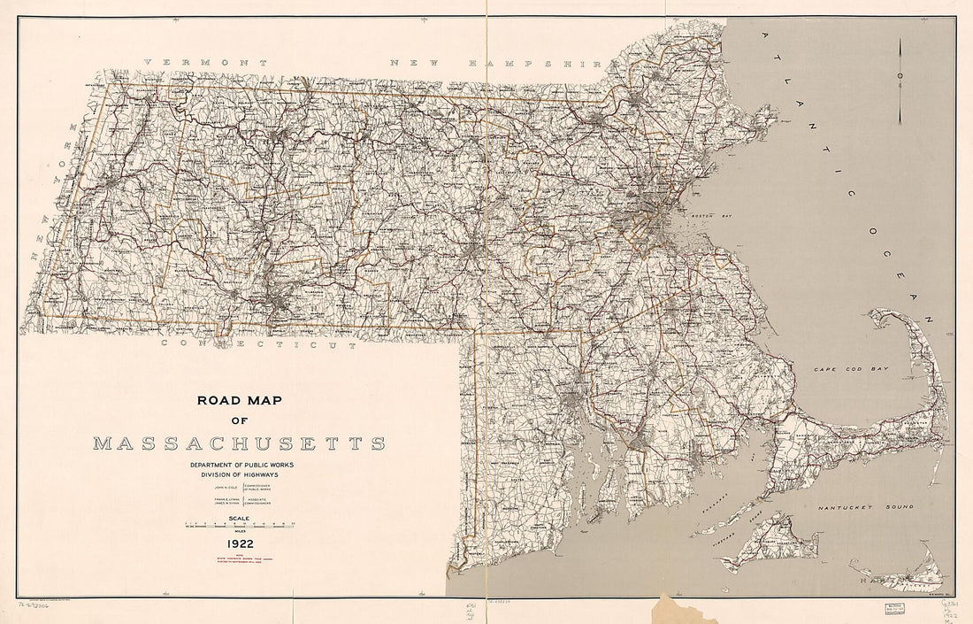 Road Map of Massachusetts in 1922
- Regular price
-
From
$41.95 - Regular price
-
$66.99 - Sale price
-
From
$41.95
-
Plan of St. Lucia, In the West Indies: Shewing the Positions of the English and French Forces With the Attacks Made at Its Reduction In Decr. in 1778
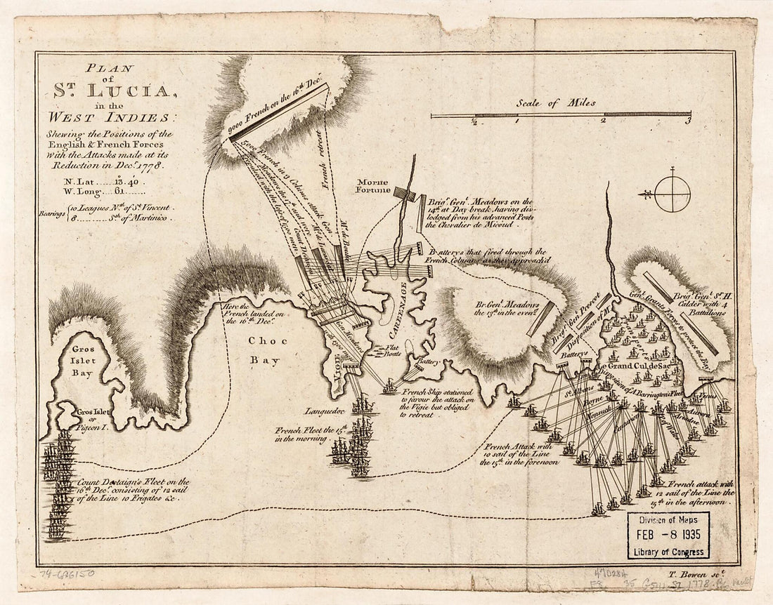 Plan of St. Lucia, In the West Indies: Shewing the Positions of the English and French Forces With the Attacks Made at Its Reduction In Decr. in 1778
- Regular price
-
From
$19.95 - Regular price
-
$29.95 - Sale price
-
From
$19.95
-
Amérique Septentrionale in 1789
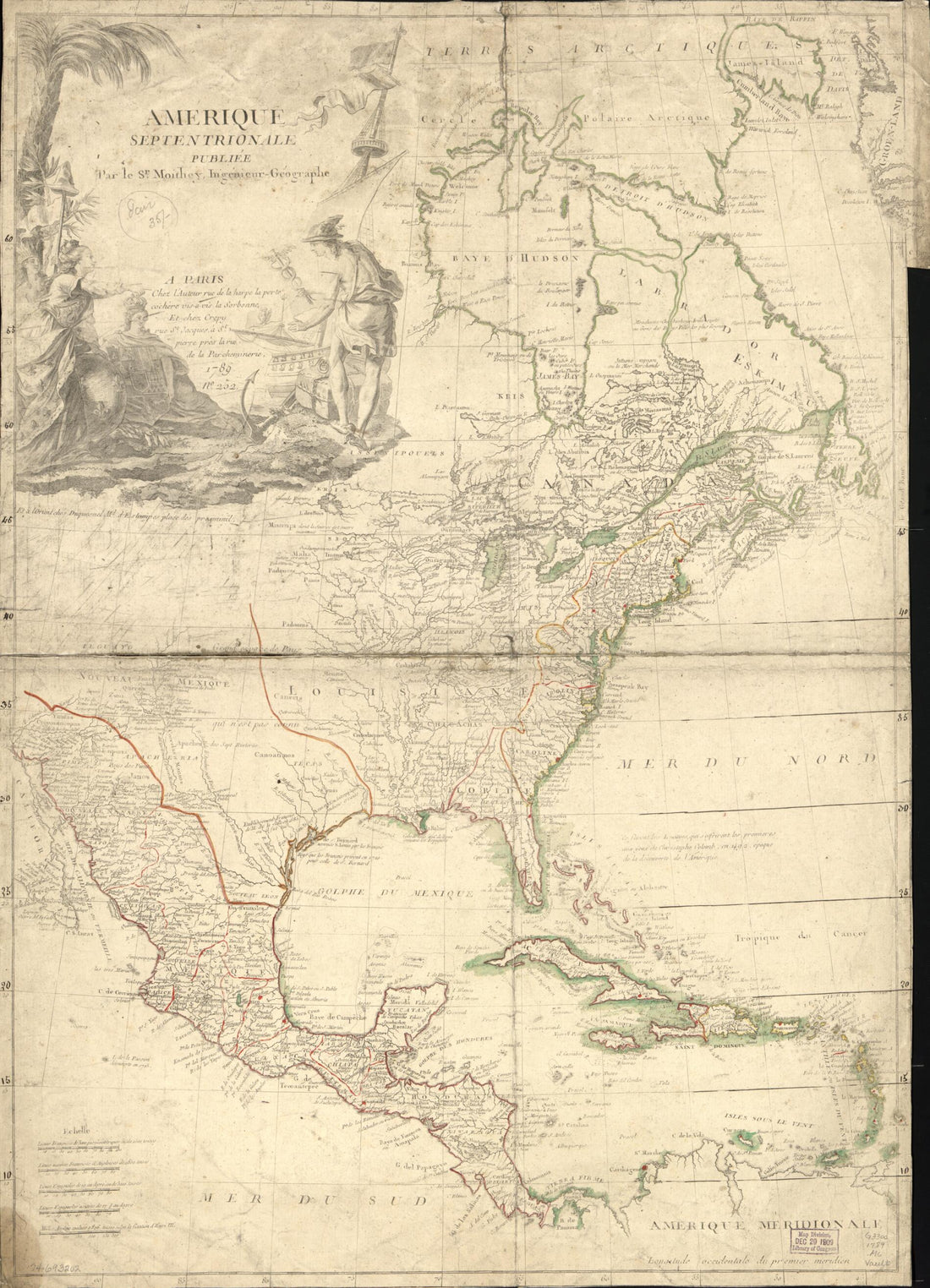 Amérique Septentrionale in 1789
- Regular price
-
From
$32.95 - Regular price
-
$51.99 - Sale price
-
From
$32.95
-
Isle De Curacao Ou Corassol in 1764
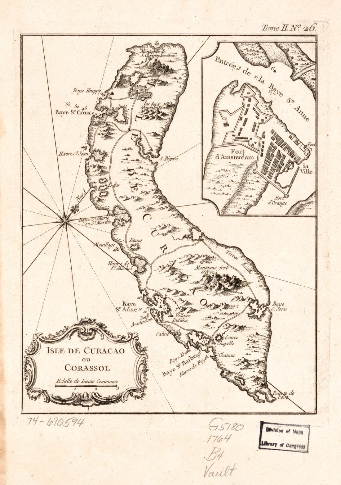 Isle De Curacao Ou Corassol in 1764
- Regular price
-
From
$19.95 - Regular price
-
$29.95 - Sale price
-
From
$19.95
-
Connecticut, From Actual Survey in 1813
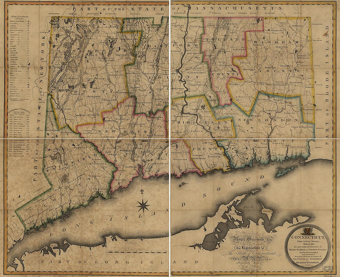 Connecticut, From Actual Survey in 1813
- Regular price
-
From
$34.95 - Regular price
-
$49.99 - Sale price
-
From
$34.95
-
Map of a Part of the City of Richmond Showing the Burnt Districts in 1865
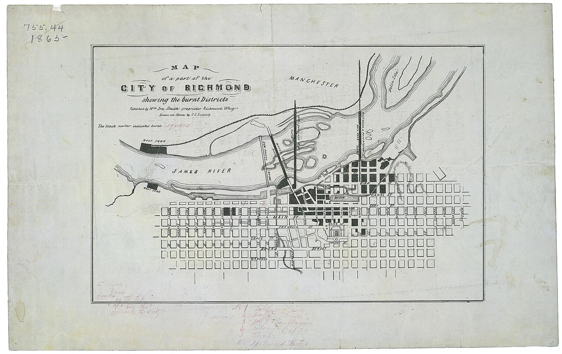 Map of a Part of the City of Richmond Showing the Burnt Districts in 1865
- Regular price
-
From
$20.95 - Regular price
-
$32.95 - Sale price
-
From
$20.95
-
Plan Der Belagerung Von Maynz : Nebst Den Vorhergegangenen Positionen Bey Wickert Und Hochheim Im Jahr 1793 (Environs of Mayenz)
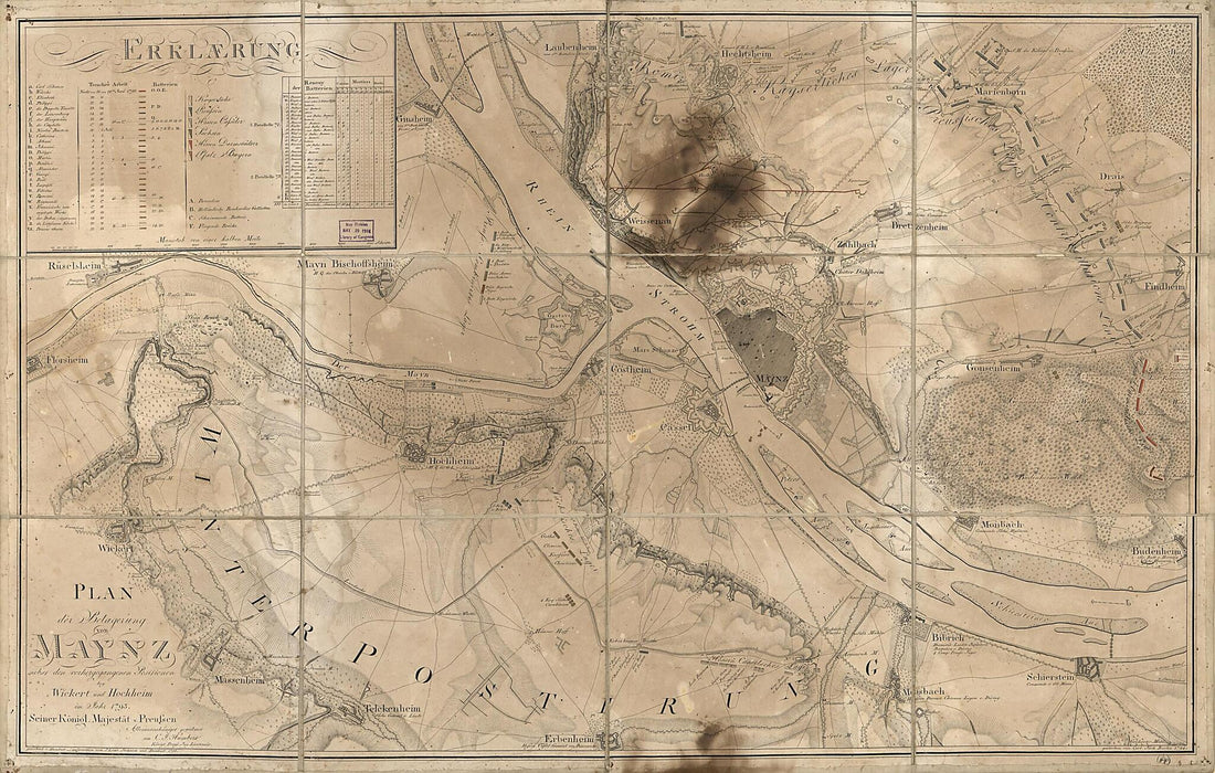 Plan Der Belagerung Von Maynz : Nebst Den Vorhergegangenen Positionen Bey Wickert Und Hochheim Im Jahr 1793 (Environs of Mayenz)
- Regular price
-
From
$41.95 - Regular price
-
$66.99 - Sale price
-
From
$41.95
-
Map of the State of Oregon and Washington Territory in 1859
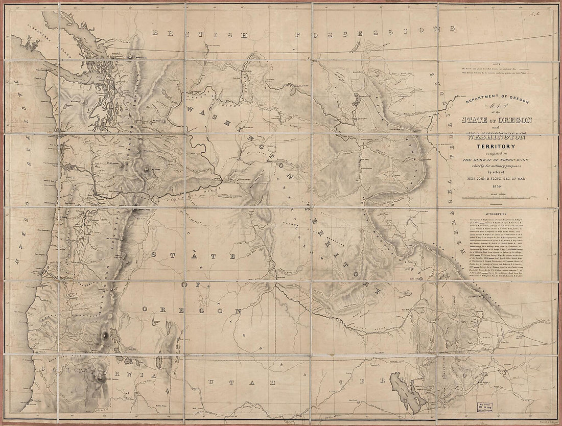 Map of the State of Oregon and Washington Territory in 1859
- Regular price
-
From
$32.95 - Regular price
-
$51.99 - Sale price
-
From
$32.95
-
Map of Spanish East and West Florida From Mobile Bay to Apalache Bay Bounded by the United States Boundary On the North in 1815
 Map of Spanish East and West Florida From Mobile Bay to Apalache Bay Bounded by the United States Boundary On the North in 1815
- Regular price
-
From
$41.95 - Regular price
-
$66.99 - Sale price
-
From
$41.95
-
Topographical Map of Pike County, Pennsylvania : From Recent and Actual Surveys and Records in 1872
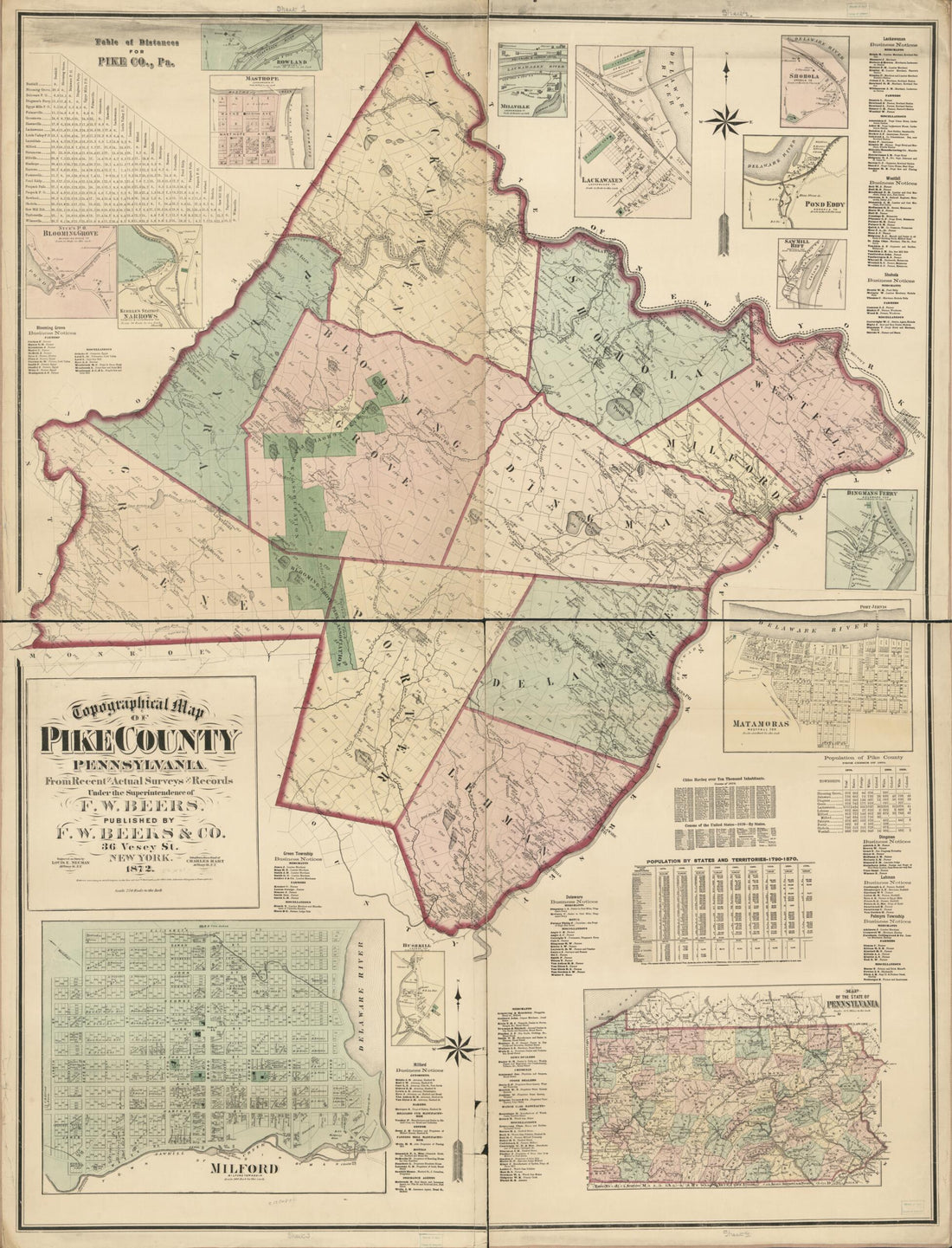 Topographical Map of Pike County, Pennsylvania : From Recent and Actual Surveys and Records in 1872
- Regular price
-
From
$32.95 - Regular price
-
$51.99 - Sale price
-
From
$32.95
-
Map of Ellis County in 1889
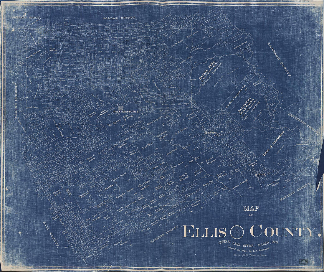 Map of Ellis County in 1889
- Regular price
-
From
$34.95 - Regular price
-
$49.99 - Sale price
-
From
$34.95


