Quick links
19716 products
-
Map Showing the Operations of the Army of the Potomac Under Command of Mag. sic Gen. George G. Meade, : From March 29th to April 9th, in 1865
 Map Showing the Operations of the Army of the Potomac Under Command of Mag. sic Gen. George G. Meade, : From March 29th to April 9th, in 1865
- Regular price
-
From
$41.95 - Regular price
-
$66.99 - Sale price
-
From
$41.95
-
Colton's New Sectional Map of the State of Colorado in 1878
 Colton's New Sectional Map of the State of Colorado in 1878
- Regular price
-
From
$32.95 - Regular price
-
$51.99 - Sale price
-
From
$32.95
-
Plan De La Ville Et Du Port De Macao in 1764
 Plan De La Ville Et Du Port De Macao in 1764
- Regular price
-
From
$19.95 - Regular price
-
$29.95 - Sale price
-
From
$19.95
-
A Map of the United States of North America in 1811
 A Map of the United States of North America in 1811
- Regular price
-
From
$34.95 - Regular price
-
$49.99 - Sale price
-
From
$34.95
-
Southwest, Or No. 2, Sheet of Preliminary Map of Antietam (Sharpsburg) Battlefield. Enlarged From Michler Map of the War Records Atlas With Corrections and Additions in 1895"
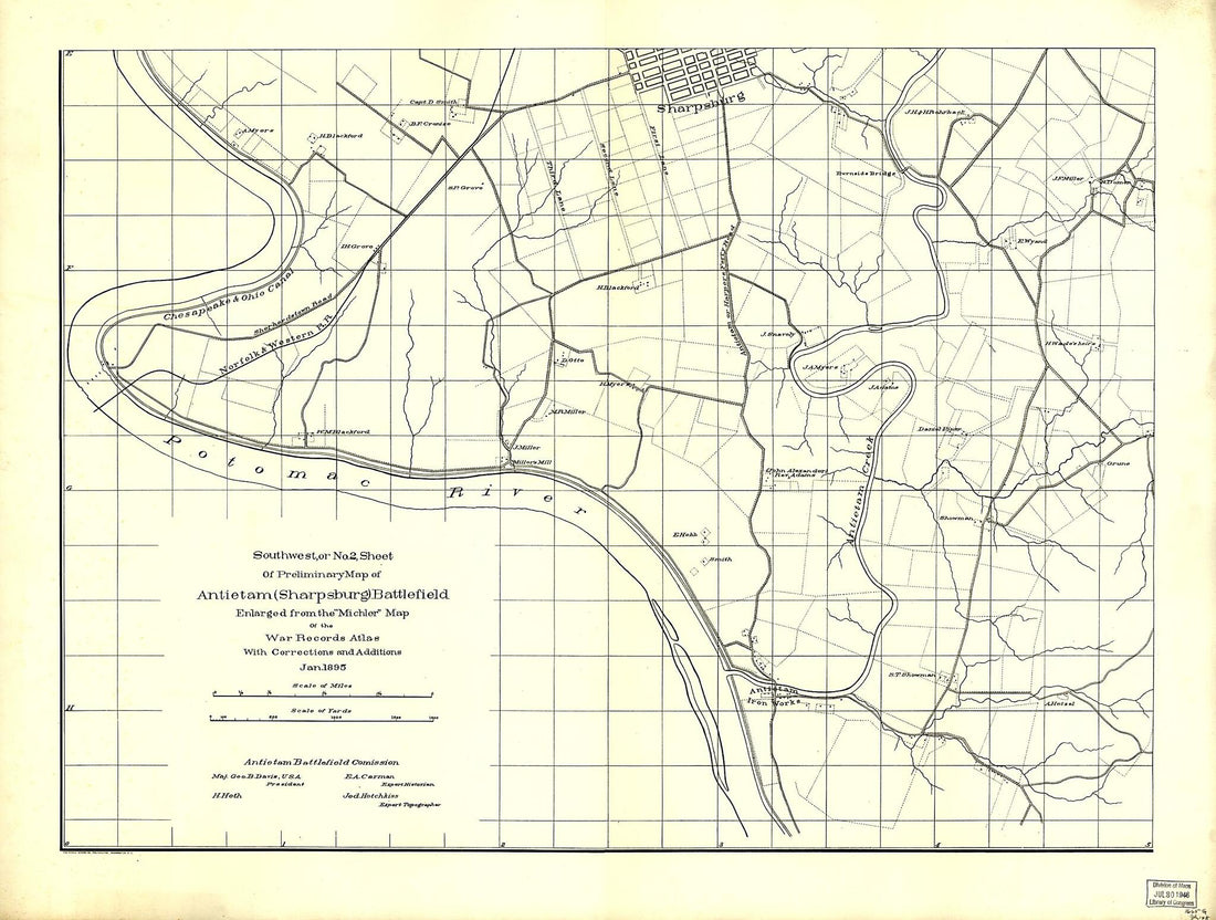 Southwest, Or No. 2, Sheet of Preliminary Map of Antietam (Sharpsburg) Battlefield. Enlarged From Michler Map of the War Records Atlas With Corrections and Additions in 1895"
- Regular price
-
From
$32.95 - Regular price
-
$51.99 - Sale price
-
From
$32.95
-
Haven Rail Road With Its Branches and Extension to Ashland; Surveyed and Drawn by Henry W. Poole, Civl. Topl. Ming. Engr. Pottsville, Pennsylvania Dec. in 1854, to Accompany the Report to the Stockholders
 Haven Rail Road With Its Branches and Extension to Ashland; Surveyed and Drawn by Henry W. Poole, Civl. Topl. Ming. Engr. Pottsville, Pennsylvania Dec. in 1854, to Accompany the Report to the Stockholders
- Regular price
-
From
$34.95 - Regular price
-
$49.99 - Sale price
-
From
$34.95
-
Map Showing Coast of Portobelo Region 1700
 Map Showing Coast of Portobelo Region 1700
- Regular price
-
From
$41.95 - Regular price
-
$66.99 - Sale price
-
From
$41.95
-
Map of Tiber Creek, from Its Mouth to the Extent of Tide Water : Washington D.C. 1800
 Map of Tiber Creek, from Its Mouth to the Extent of Tide Water : Washington D.C. 1800
- Regular price
-
From
$29.95 - Regular price
-
$46.95 - Sale price
-
From
$29.95
-
A Plan Exhibiting the Squares On Which Robert Peter's Buildings Stood On the Tract of Land Called Mexico, Within the City of Washington 1796
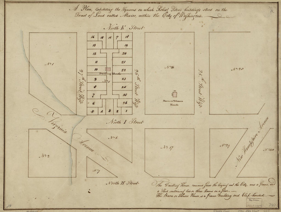 A Plan Exhibiting the Squares On Which Robert Peter's Buildings Stood On the Tract of Land Called Mexico, Within the City of Washington 1796
- Regular price
-
From
$27.95 - Regular price
-
$43.95 - Sale price
-
From
$27.95
-
Topographical Map of the Original District of Columbia and Environs Showing the Fortifications Around the City of Washington 1862
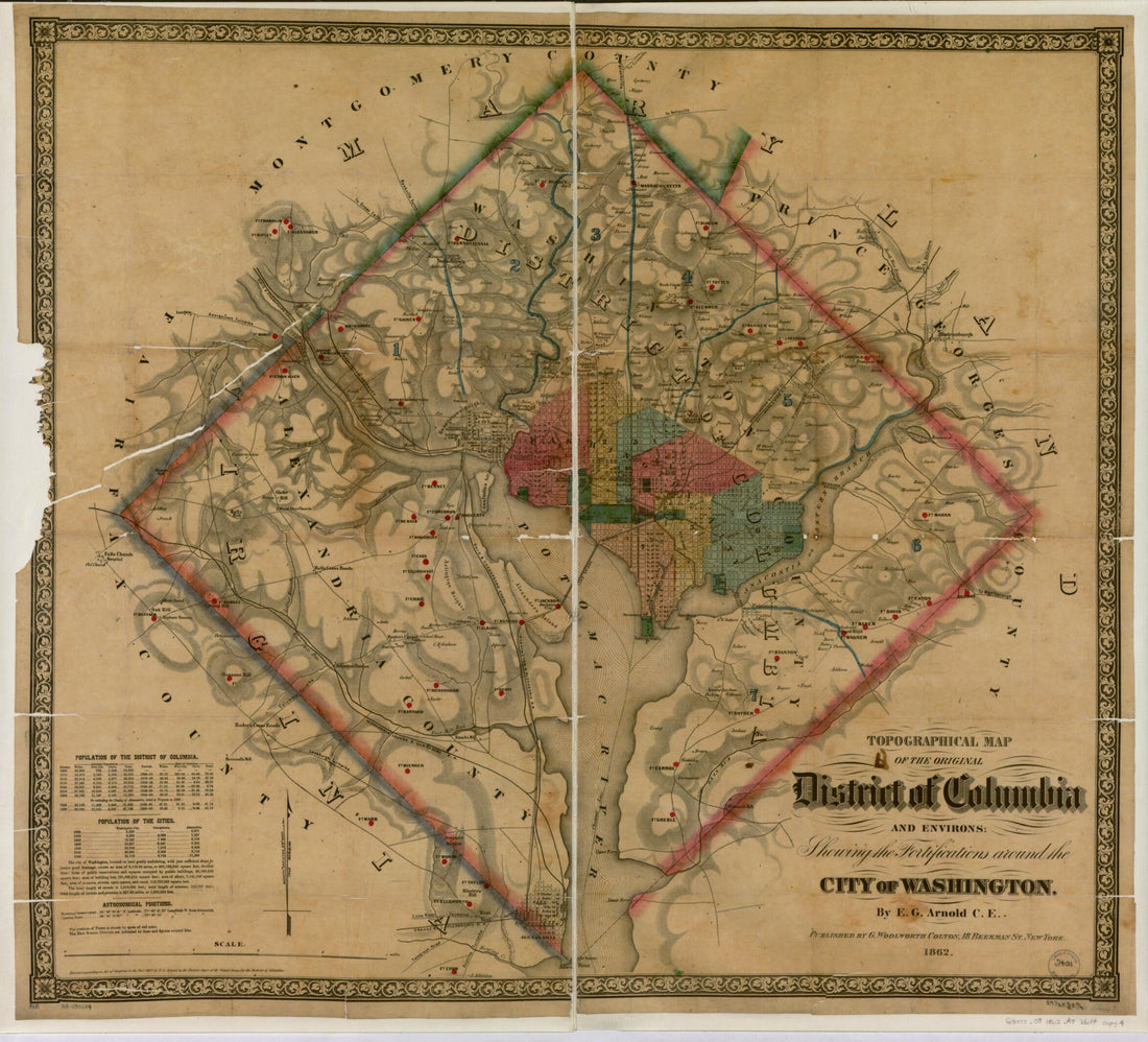 Topographical Map of the Original District of Columbia and Environs Showing the Fortifications Around the City of Washington 1862
- Regular price
-
From
$34.95 - Regular price
-
$49.99 - Sale price
-
From
$34.95
-
Map of the City of Washington Showing Water Mains and Fire Hydrants : January 15th in 1900
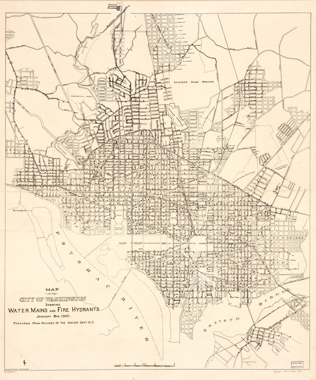 Map of the City of Washington Showing Water Mains and Fire Hydrants : January 15th in 1900
- Regular price
-
From
$34.95 - Regular price
-
$49.99 - Sale price
-
From
$34.95