39 products
-
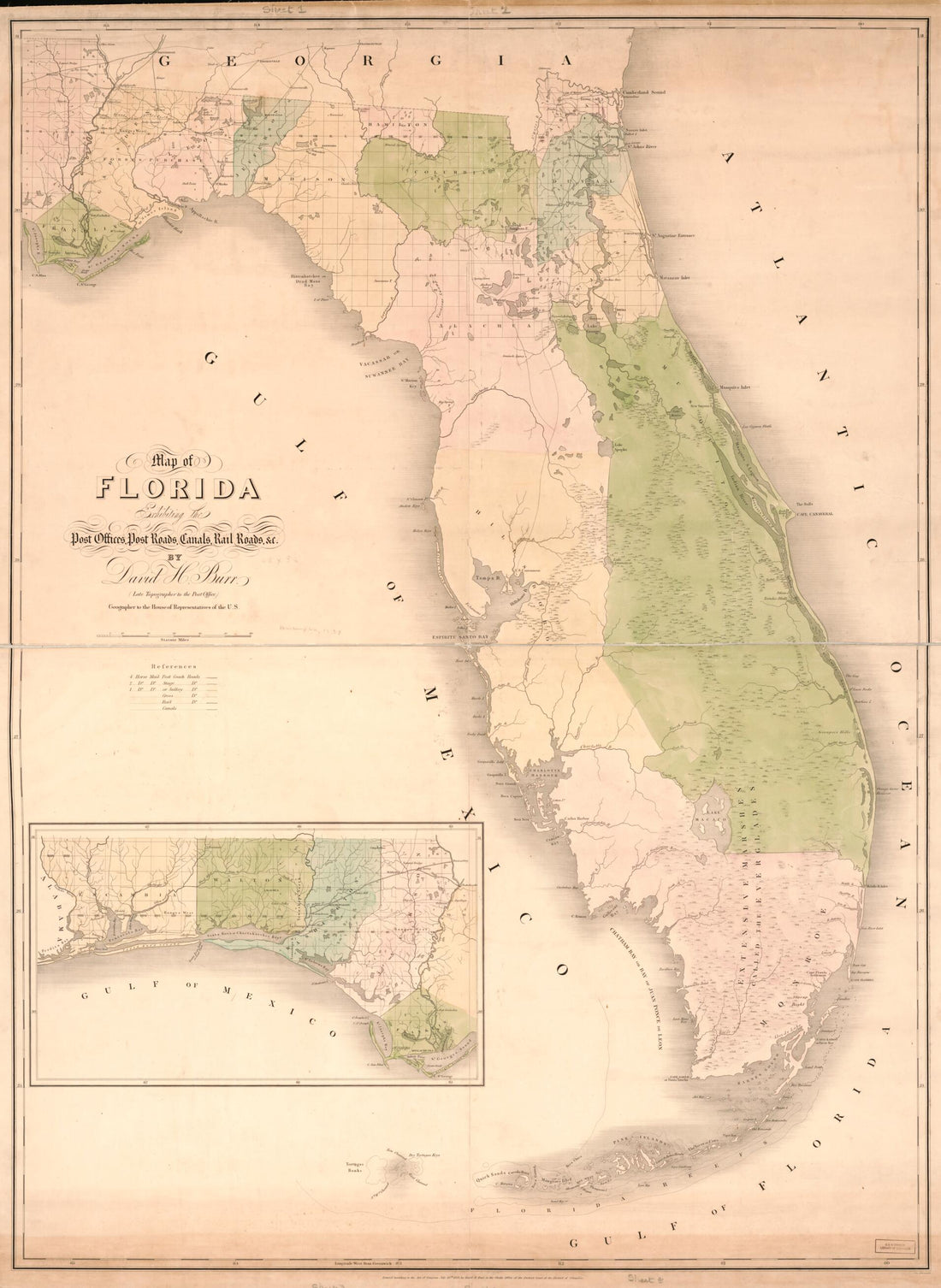 Map of Florida : Exhibiting the Post Offices, Post Roads, Canals, Rail Roads, &c 1839Map of Florida : Exhibiting the Post Offices, Post Roads, Canals, Rail Roads, &c 1839
- Regular price
-
$43.95 $185.95 - Regular price
-
$38.95 - Sale price
-
$43.95 $185.95
-
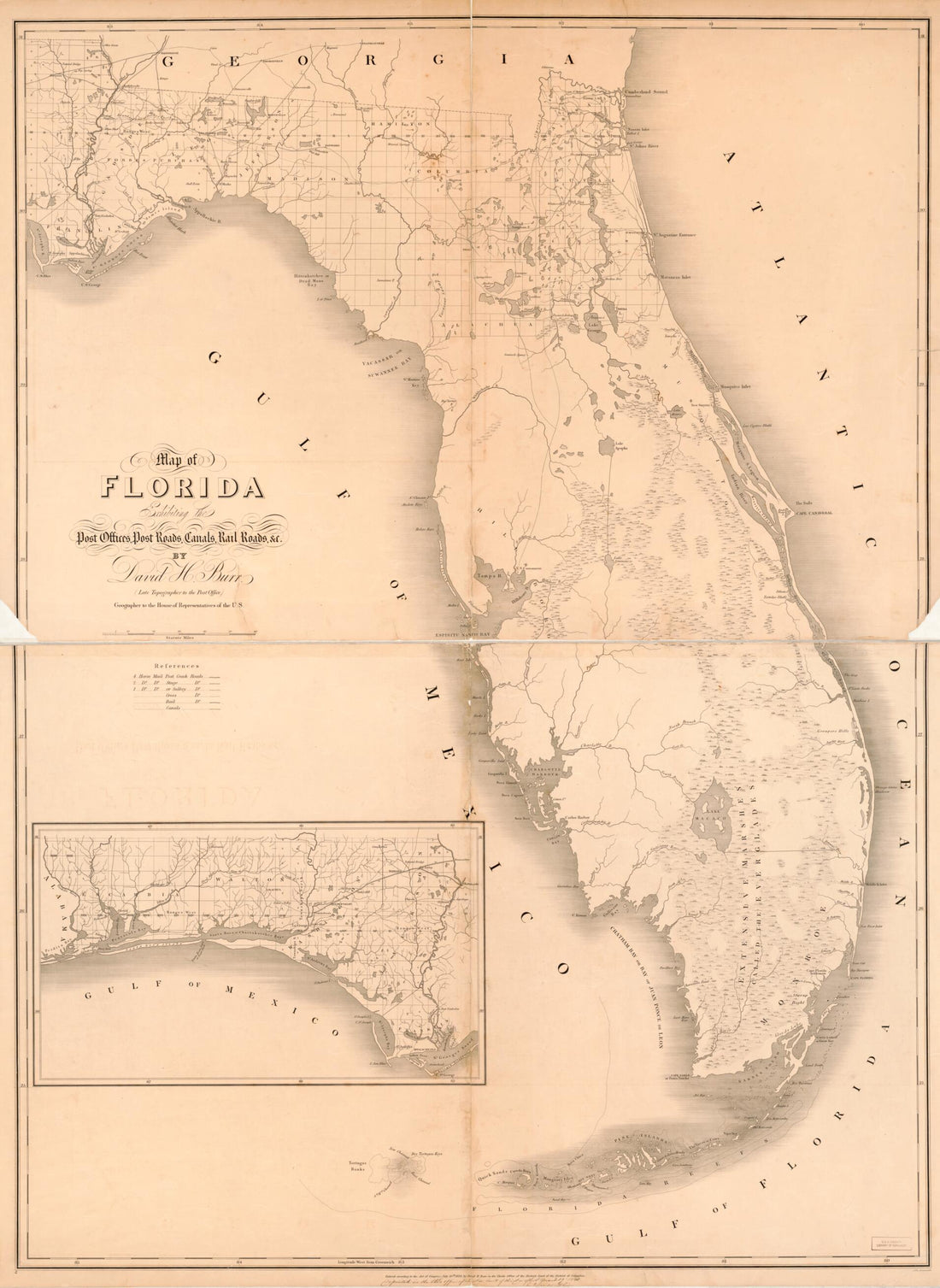 Map of Florida : Exhibiting the Post Offices, Post Roads, Canals, Rail Roads, &c in 1841Map of Florida : Exhibiting the Post Offices, Post Roads, Canals, Rail Roads, &c in 1841
- Regular price
-
$43.95 $186.95 - Regular price
-
$38.95 - Sale price
-
$43.95 $186.95
-
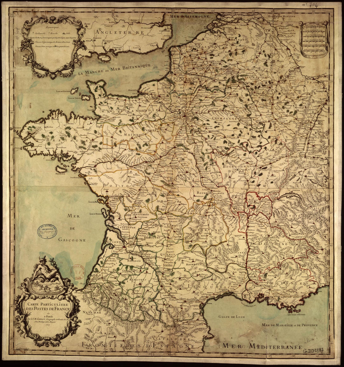 Map of France's Post Offices. (Carte Particulière Des Postes De France) 1690Map of France's Post Offices. (Carte Particulière Des Postes De France) 1690
- Regular price
-
$39.95 $83.95 - Regular price
-
$34.95 - Sale price
-
$39.95 $83.95
-
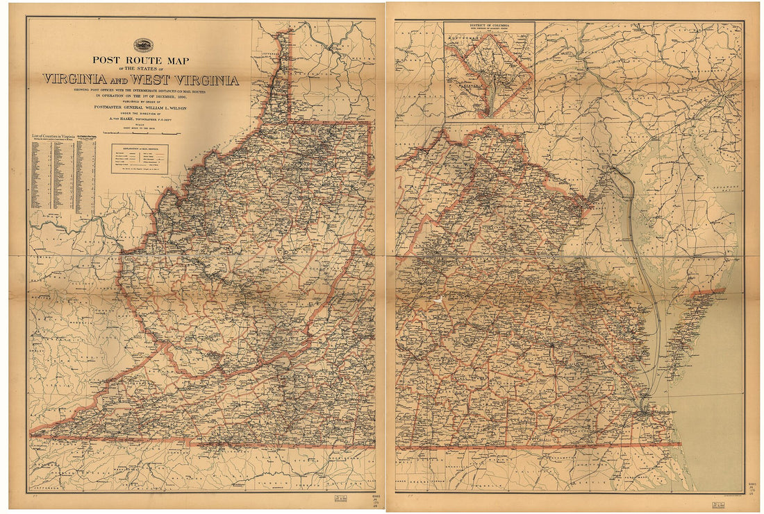 Post Route Map of the States of Virginia and West Virginia : Showing Post Offices With the Intermediate Distances and Mail Routes In Operation On the 1st of September, in 1896Post Route Map of the States of Virginia and West Virginia : Showing Post Offices With the Intermediate Distances and Mail Routes In Operation On the 1st of September, in 1896
- Regular price
-
$46.95 $262.95 - Regular price
-
$41.95 - Sale price
-
$46.95 $262.95
-
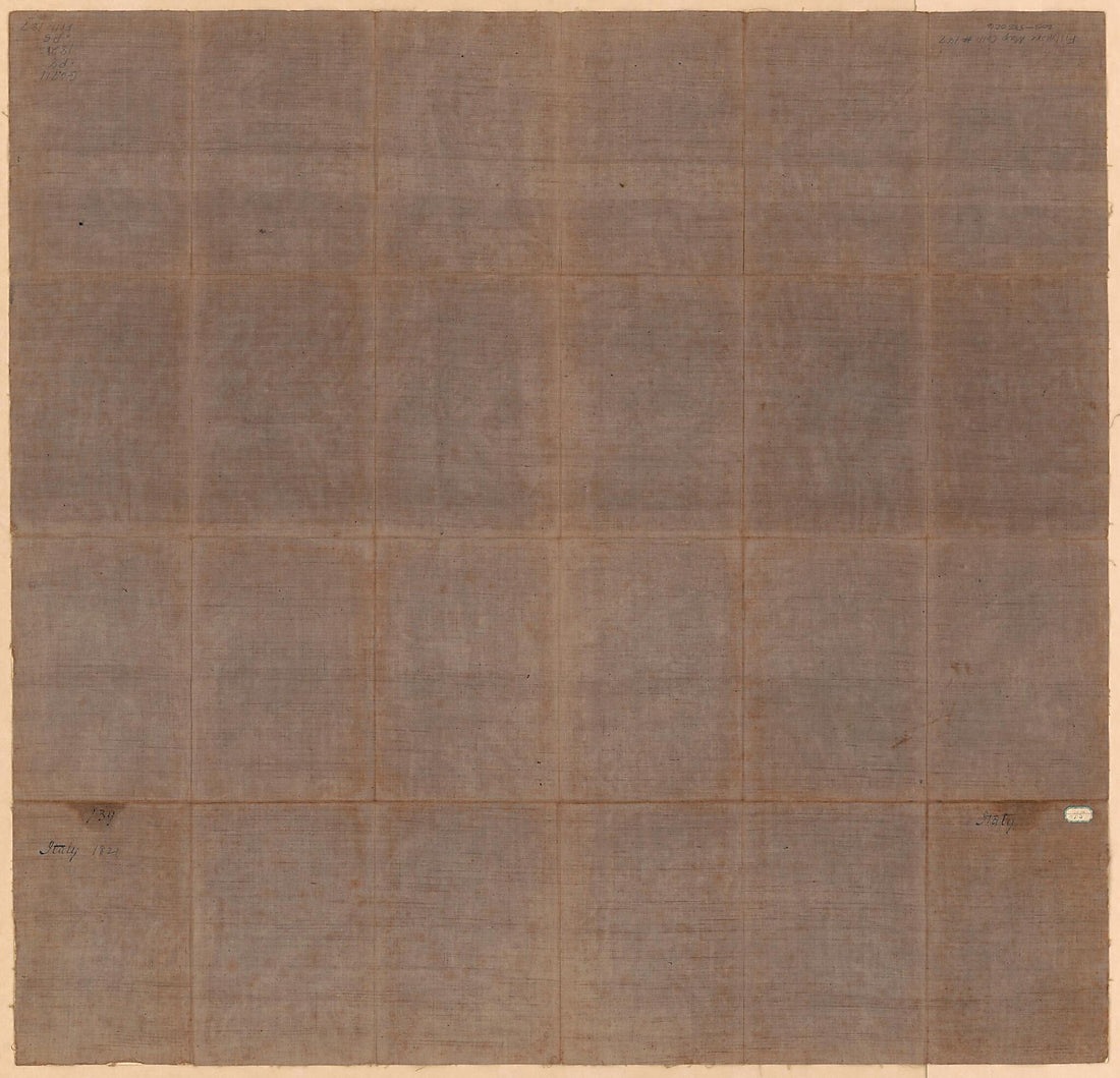 Carta Postale E Stradale Dell'Italia 1821Carta Postale E Stradale Dell'Italia 1821
- Regular price
-
$43.95 $99.95 - Regular price
-
$38.95 - Sale price
-
$43.95 $99.95
-
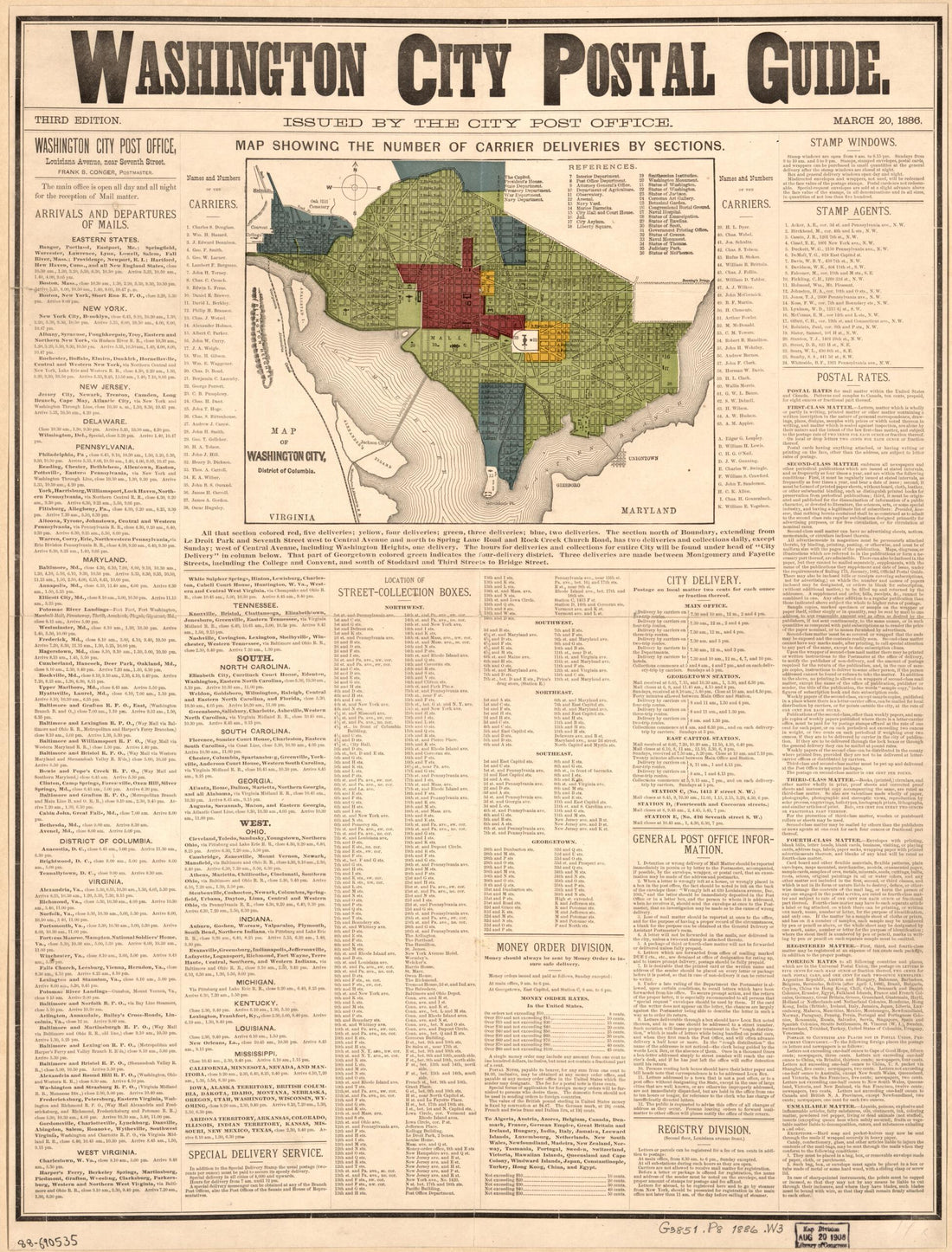 Washington City Postal Guide : Map Showing the Number of Carrier Deliveries by Sections in 1886Washington City Postal Guide : Map Showing the Number of Carrier Deliveries by Sections in 1886
- Regular price
-
$43.95 $88.95 - Regular price
-
$38.95 - Sale price
-
$43.95 $88.95
-
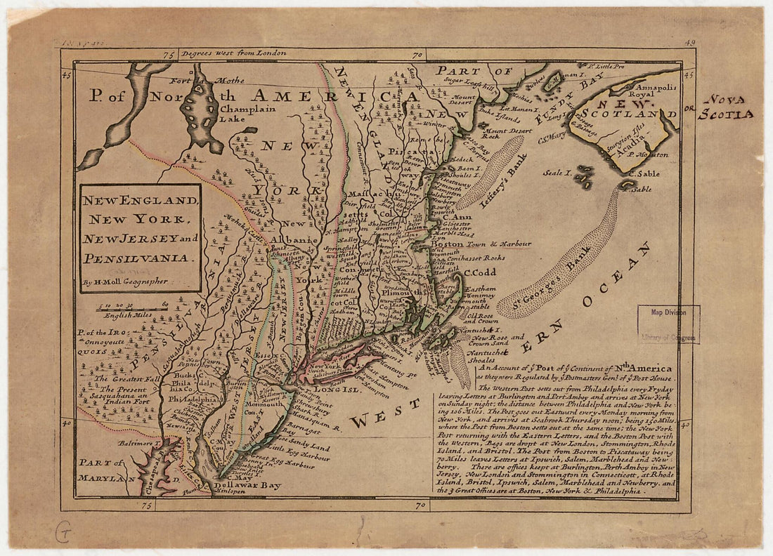 New England, New York, New Jersey and Pensilvania 1736New England, New York, New Jersey and Pensilvania 1736
- Regular price
-
$39.95 $88.95 - Regular price
-
$30.95 - Sale price
-
$39.95 $88.95
-
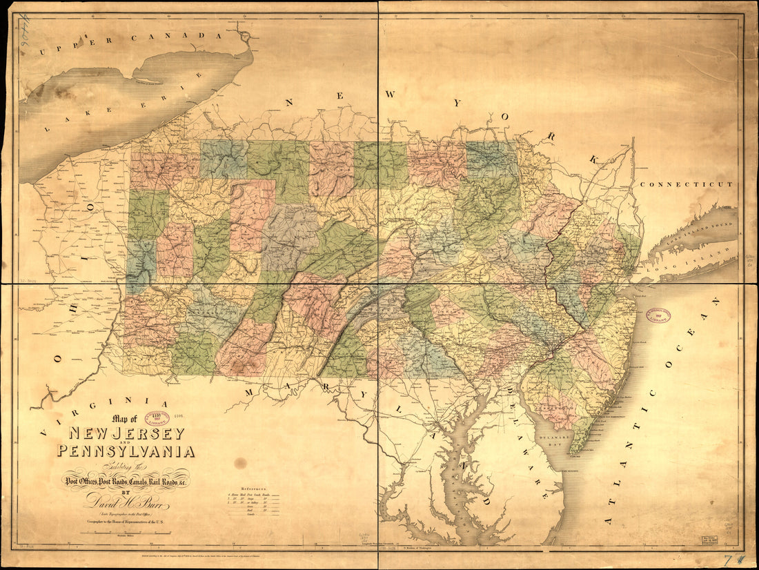 Map of New Jersey and Pennsylvania Exhibiting the Post Offices, Post Roads, Canals, Railroads, & C in 1839Map of New Jersey and Pennsylvania Exhibiting the Post Offices, Post Roads, Canals, Railroads, & C in 1839
- Regular price
-
$43.95 $178.95 - Regular price
-
$38.95 - Sale price
-
$43.95 $178.95
-
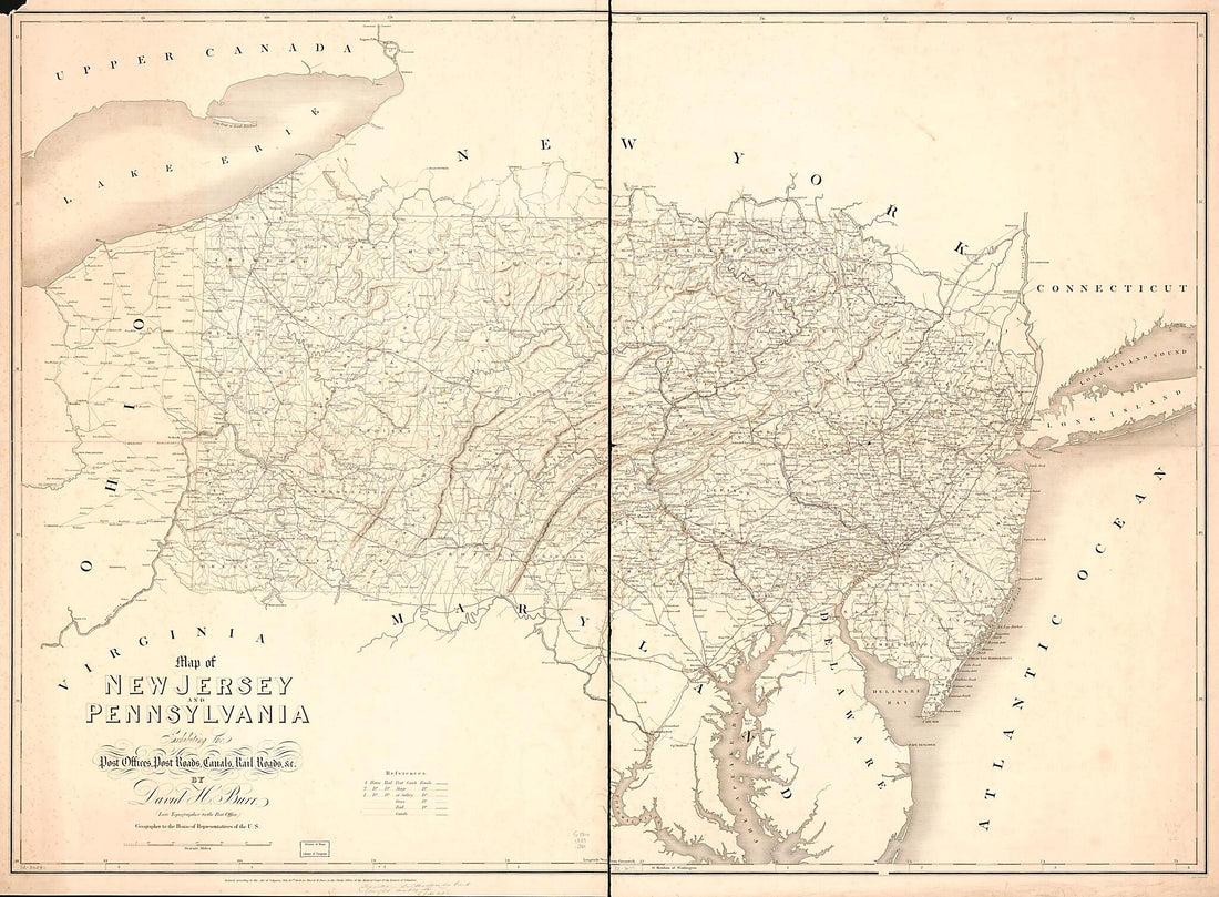 Map of New Jersey and Pennsylvania Exhibiting the Post Offices, Post Roads, Canals, Rail Roads, &c in 1839Map of New Jersey and Pennsylvania Exhibiting the Post Offices, Post Roads, Canals, Rail Roads, &c in 1839
- Regular price
-
$43.95 $178.95 - Regular price
-
$38.95 - Sale price
-
$43.95 $178.95
-
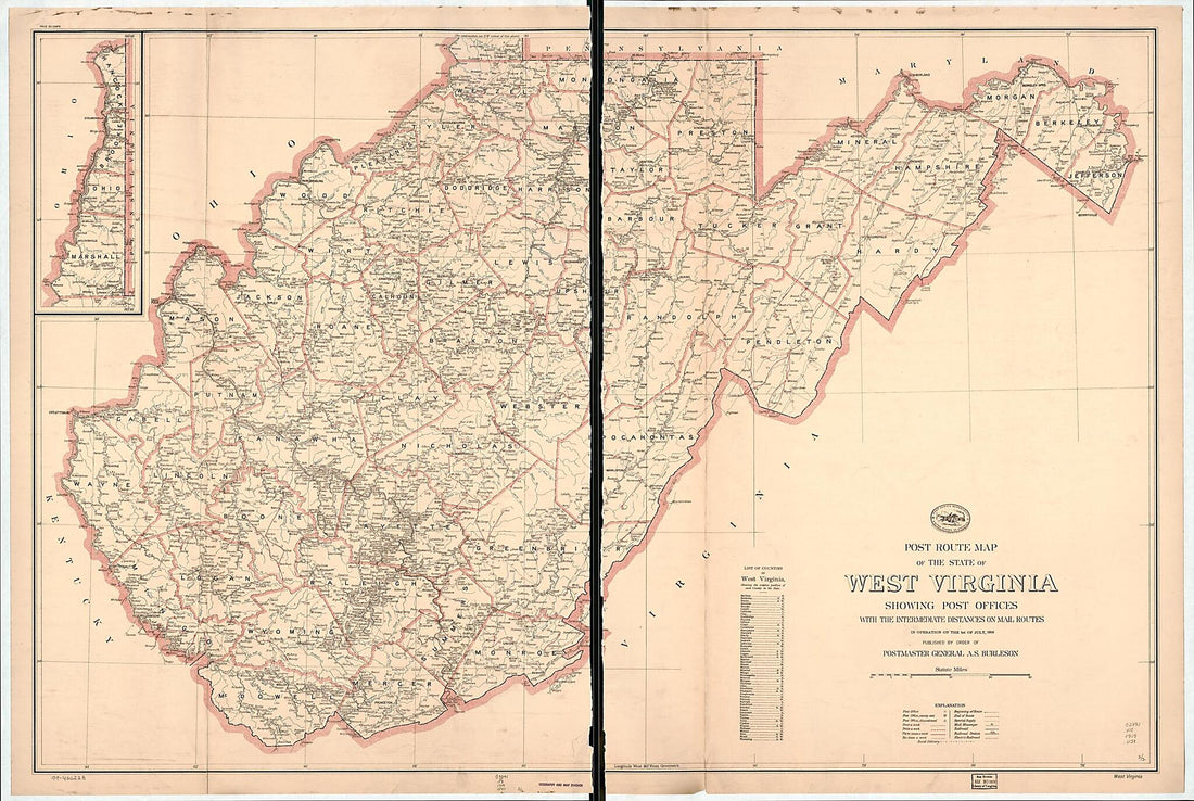 Post Route Map of the State of West Virginia : Showing Post Offices With the Intermediate Distances On Mail Routes In Operation On the 1st of July 1919 (West Virginia)Post Route Map of the State of West Virginia : Showing Post Offices With the Intermediate Distances On Mail Routes In Operation On the 1st of July 1919 (West Virginia)
- Regular price
-
$46.95 $145.95 - Regular price
-
$41.95 - Sale price
-
$46.95 $145.95
-
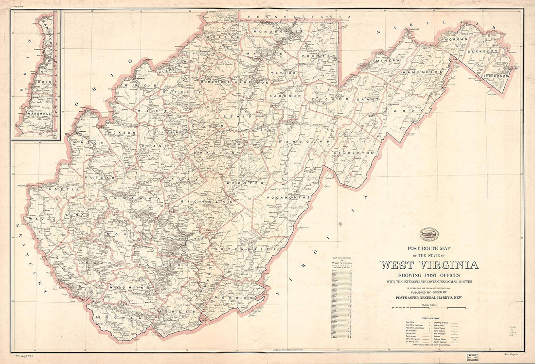 Post Route Map of the State of West Virginia : Showing Post Offices With the Intermediate Distances On Mail Routes In Operation On the 1st of January 1924 (West Virginia)Post Route Map of the State of West Virginia : Showing Post Offices With the Intermediate Distances On Mail Routes In Operation On the 1st of January 1924 (West Virginia)
- Regular price
-
$46.95 $145.95 - Regular price
-
$41.95 - Sale price
-
$46.95 $145.95
-
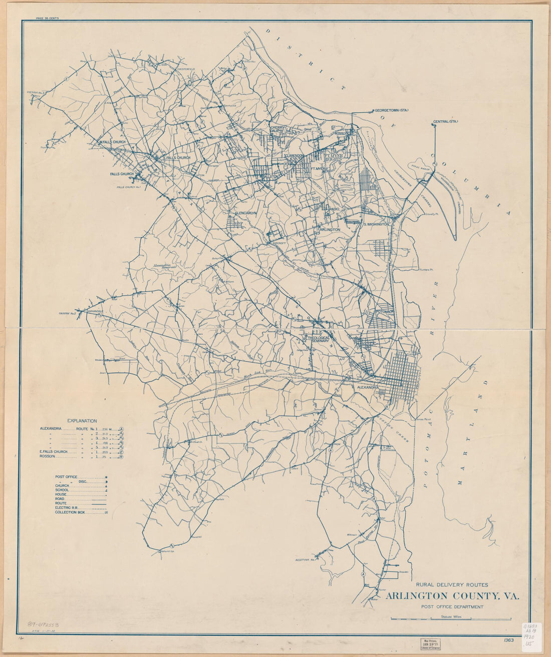 Rural Delivery Routes, Arlington County, Va 1920Rural Delivery Routes, Arlington County, Va 1920
- Regular price
-
$43.95 $168.95 - Regular price
-
$38.95 - Sale price
-
$43.95 $168.95


