598 products
-
Rand, Mc.Nally & Co's Official Railroad Map of the United States With Portions of the Dominion of Canada, the Republic of Mexico, and the West Indies. Compiled from Government Surveys, and Official Tracings and Operating Time Tables of All Railroads 1893
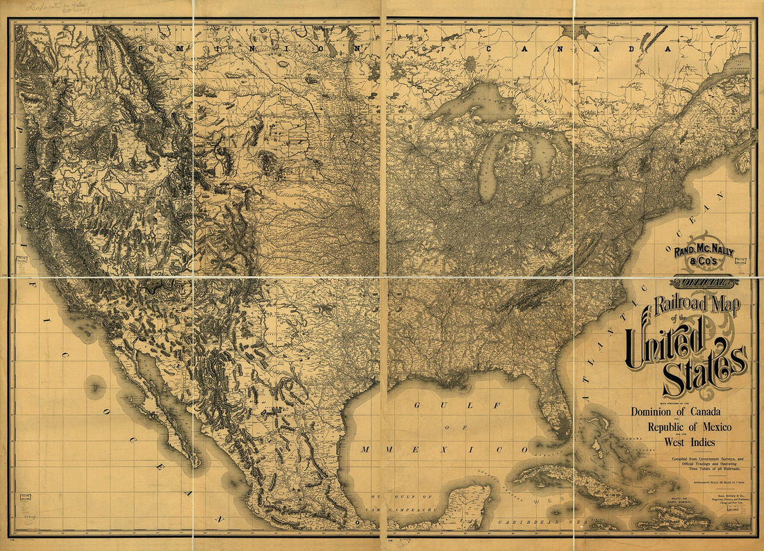 Rand, Mc.Nally & Co's Official Railroad Map of the United States With Portions of the Dominion of Canada, the Republic of Mexico, and the West Indies. Compiled from Government Surveys, and Official Tracings and Operating Time Tables of All Railroads 1893
- Regular price
-
From
$32.95 - Regular price
-
$51.99 - Sale price
-
From
$32.95
-
Battlefield In Front of Franklin, Tennessee Where the United States Forces, Consisting of the 4th & 23rd Corps and the Cavalry Corps M.D.M., All Under the Command of Maj. Gen'l. J. M. Schofield, Severely Repulsed the Confederate Army, Commanded by Lt....
 Battlefield In Front of Franklin, Tennessee Where the United States Forces, Consisting of the 4th & 23rd Corps and the Cavalry Corps M.D.M., All Under the Command of Maj. Gen'l. J. M. Schofield, Severely Repulsed the Confederate Army, Commanded by Lt....
- Regular price
-
From
$41.95 - Regular price
-
$66.99 - Sale price
-
From
$41.95
-
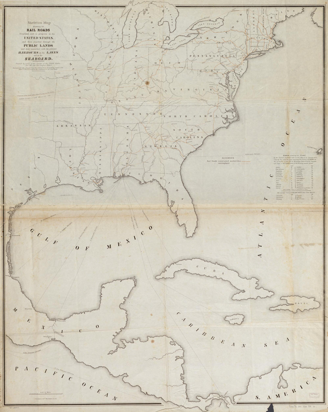
Skeleton Map Showing the Rail Roads Completed and In Progress In the United States and Their Connection As Proposed With the Harbor of Pensacola, and Its Relative Position to the Various Important Ports On the Gulf of Mexico, the Atlantic Coast and In...
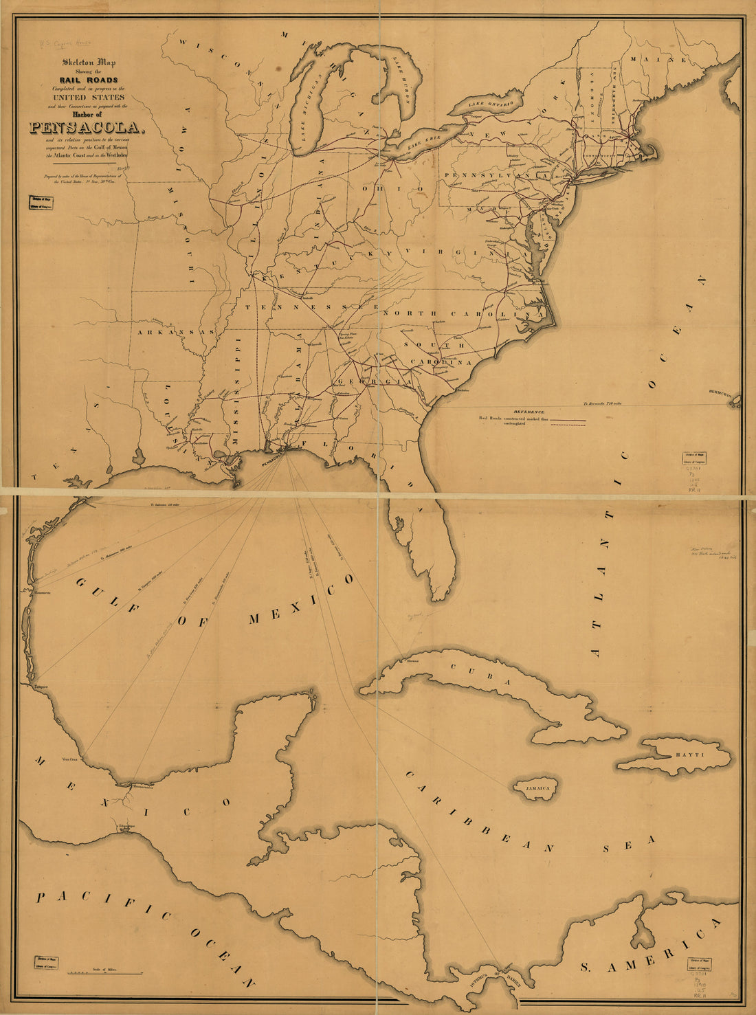 Skeleton Map Showing the Rail Roads Completed and In Progress In the United States and Their Connection As Proposed With the Harbor of Pensacola, and Its Relative Position to the Various Important Ports On the Gulf of Mexico, the Atlantic Coast and In...
- Regular price
-
From
$32.95 - Regular price
-
$51.99 - Sale price
-
From
$32.95
-
Plan of the City of Washington In the District of Columbia : Established As the Permanent Seat of the Government of the United States, Extended to Embrace Its Suburban Towns, Villages, &c. and the City of Georgetown and Showing Original and Other Valu...
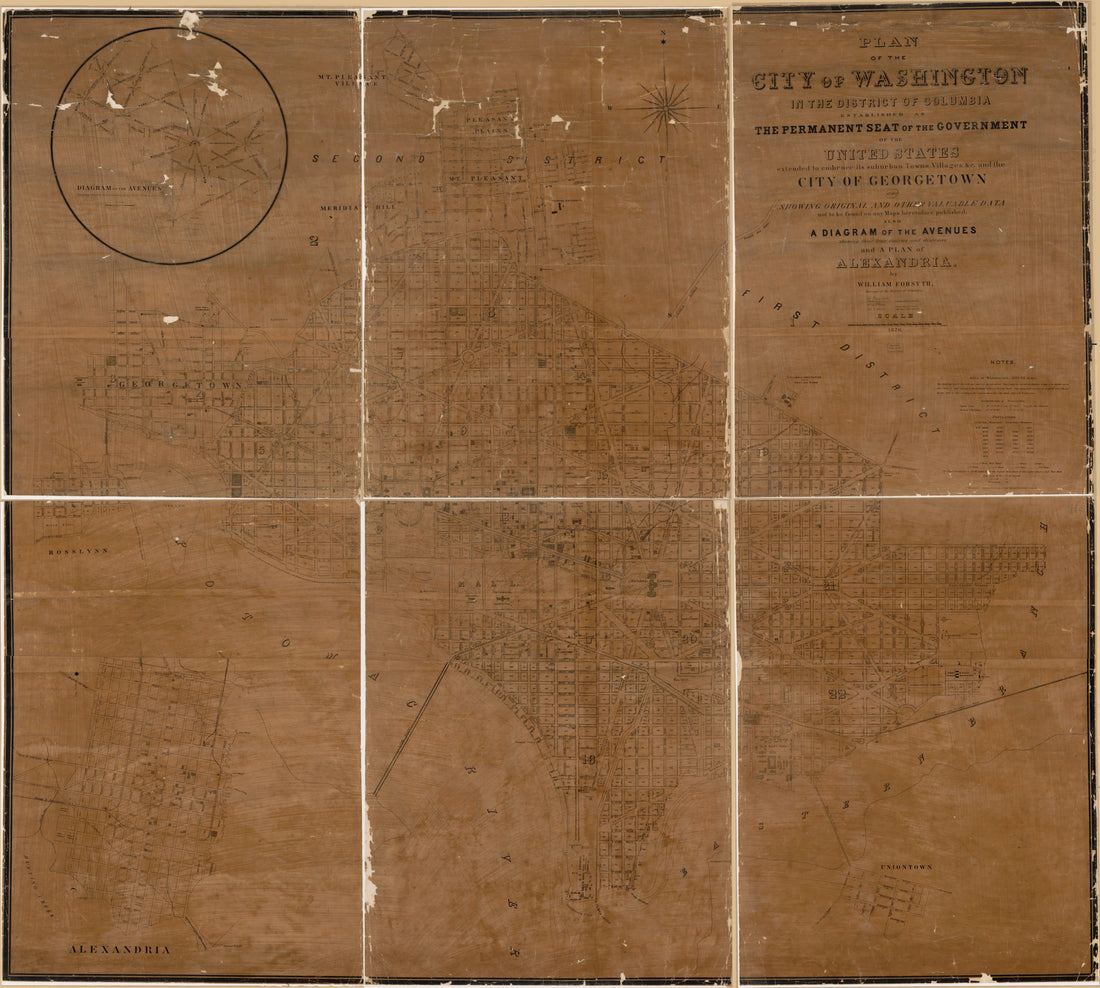 Plan of the City of Washington In the District of Columbia : Established As the Permanent Seat of the Government of the United States, Extended to Embrace Its Suburban Towns, Villages, &c. and the City of Georgetown and Showing Original and Other Valu...
- Regular price
-
From
$34.95 - Regular price
-
$49.99 - Sale price
-
From
$34.95
-
Bowles's New Pocket Map of the United States of America; the British Possessions of Canada, Nova Scotia, and Newfoundland, With the French and Spanish Territories of Louisiana and Florida, As Settled by the Preliminary Articles of Peace Signed at Vers...
 Bowles's New Pocket Map of the United States of America; the British Possessions of Canada, Nova Scotia, and Newfoundland, With the French and Spanish Territories of Louisiana and Florida, As Settled by the Preliminary Articles of Peace Signed at Vers...
- Regular price
-
From
$34.95 - Regular price
-
$49.99 - Sale price
-
From
$34.95
-
Map of the River Sabine from Logan's Ferry to 32nd Degree of North Latitude : Shewing the Boundary Between the United States of America and the Republic of Texas Between Said Points, As Marked and Laid Down by Survey In 1841, Under the Direction of th...
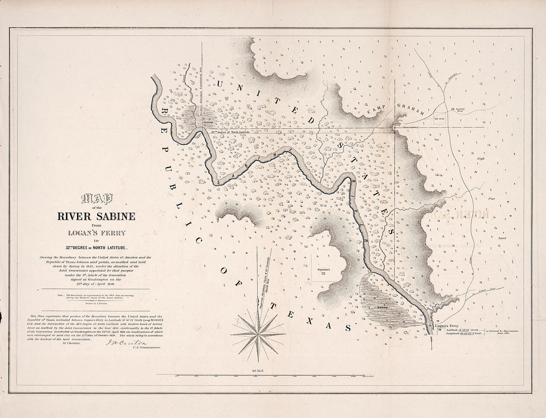 Map of the River Sabine from Logan's Ferry to 32nd Degree of North Latitude : Shewing the Boundary Between the United States of America and the Republic of Texas Between Said Points, As Marked and Laid Down by Survey In 1841, Under the Direction of th...
- Regular price
-
From
$32.95 - Regular price
-
$51.99 - Sale price
-
From
$32.95
-
Rand, McNally & Co.'s Map of the United States Showing, In Six Degrees the Density of Population, 1890 in 1892
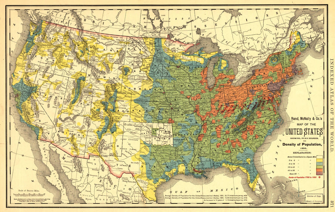 Rand, McNally & Co.'s Map of the United States Showing, In Six Degrees the Density of Population, 1890 in 1892
- Regular price
-
From
$28.95 - Regular price
-
$45.99 - Sale price
-
From
$28.95
-
Mitchell's Map of the United States : Showing the Principal Travelling Turnpike and Common Roads, On Which Are Given the Distances In Miles From One Place to Another, Also the Courses of the Canals & Rail Roads Throughout the Country, Carefully Compil...
 Mitchell's Map of the United States : Showing the Principal Travelling Turnpike and Common Roads, On Which Are Given the Distances In Miles From One Place to Another, Also the Courses of the Canals & Rail Roads Throughout the Country, Carefully Compil...
- Regular price
-
From
$34.95 - Regular price
-
$49.99 - Sale price
-
From
$34.95
-
United States in 1848
 United States in 1848
- Regular price
-
From
$34.95 - Regular price
-
$49.99 - Sale price
-
From
$34.95
-
Map of the Parish of Tensas, Louisiana : From United States Surveys in 1860
 Map of the Parish of Tensas, Louisiana : From United States Surveys in 1860
- Regular price
-
From
$32.95 - Regular price
-
$51.99 - Sale price
-
From
$32.95
-
Topographical Sketch of the Battlefield of Stone's River Near Murfreesboro, Tennessee, December 31st, 1862 to Jan. 3d, 1863 : Major General W.S. Rosecrans, Commanding of the Forces of the United States : General Braxton Bragg, Commanding the Enemy's F...
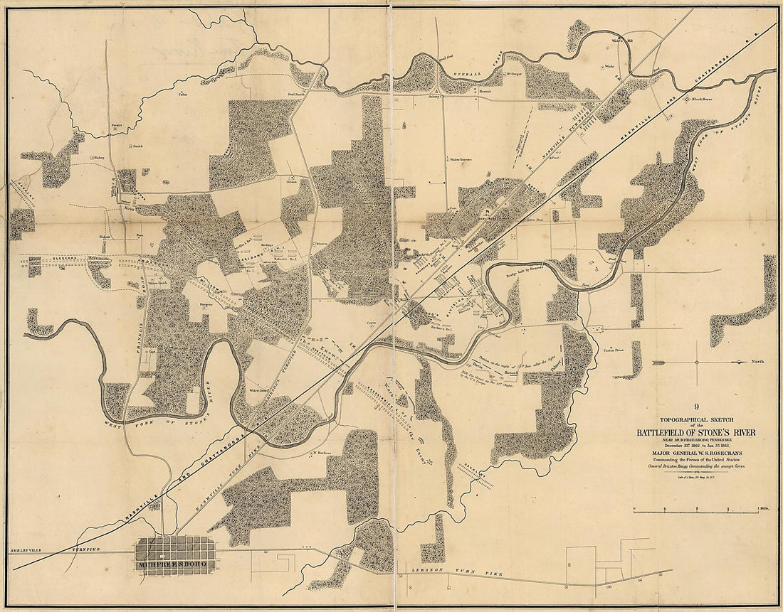 Topographical Sketch of the Battlefield of Stone's River Near Murfreesboro, Tennessee, December 31st, 1862 to Jan. 3d, 1863 : Major General W.S. Rosecrans, Commanding of the Forces of the United States : General Braxton Bragg, Commanding the Enemy's F...
- Regular price
-
From
$34.95 - Regular price
-
$49.99 - Sale price
-
From
$34.95
-
Map of the Territory of the United States From the Mississippi River to the Pacific Ocean : Ordered by Jeff' Davis, Secretary of War to Accompany the Reports of the Explorations for a Railroad Route in 1858
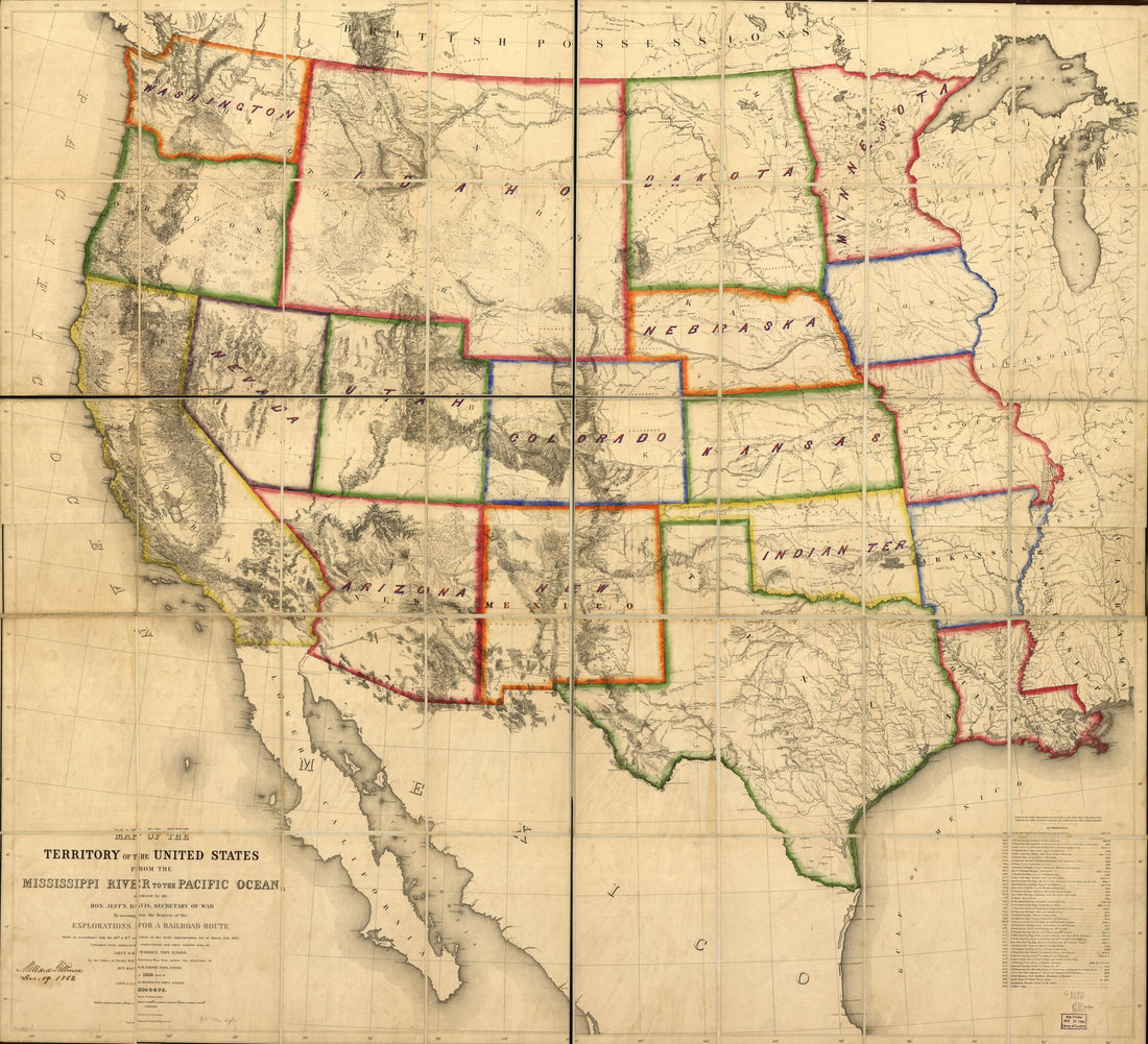 Map of the Territory of the United States From the Mississippi River to the Pacific Ocean : Ordered by Jeff' Davis, Secretary of War to Accompany the Reports of the Explorations for a Railroad Route in 1858
- Regular price
-
From
$34.95 - Regular price
-
$49.99 - Sale price
-
From
$34.95


