598 products
-
Ohio Boundary, No. 111. South Bend of Lake Erie: Map Exhibiting the Position Occupied In the Determination of the Most Southwardly Point of the Boundary Line Between the United States & Canada in 1835
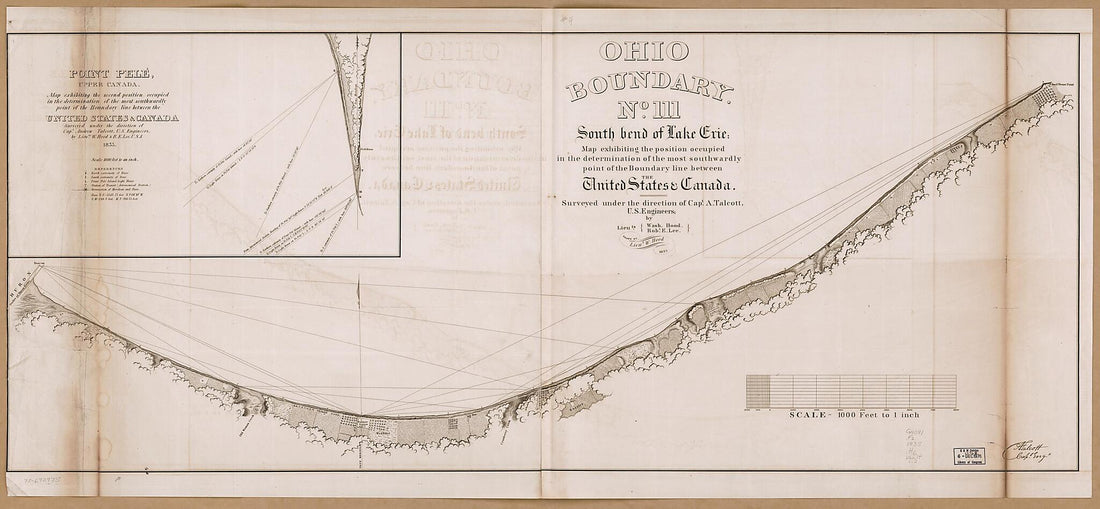 Ohio Boundary, No. 111. South Bend of Lake Erie: Map Exhibiting the Position Occupied In the Determination of the Most Southwardly Point of the Boundary Line Between the United States & Canada in 1835
- Regular price
-
From
$41.95 - Regular price
-
$66.99 - Sale price
-
From
$41.95
-
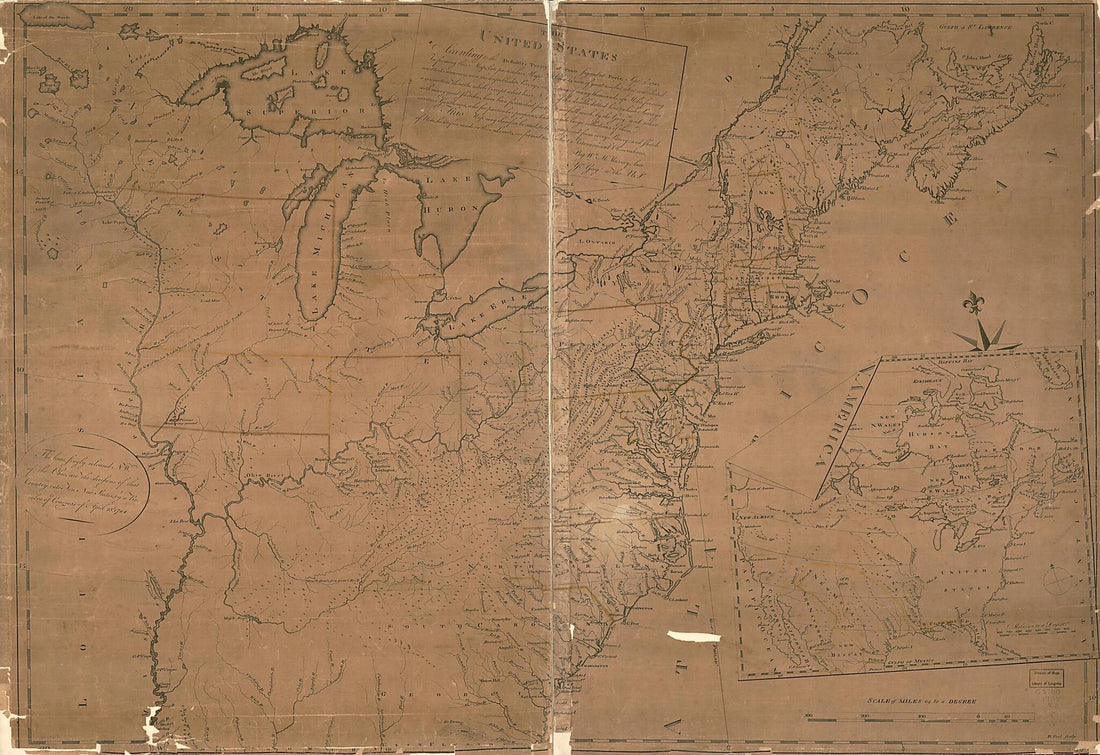
United States of America 1818
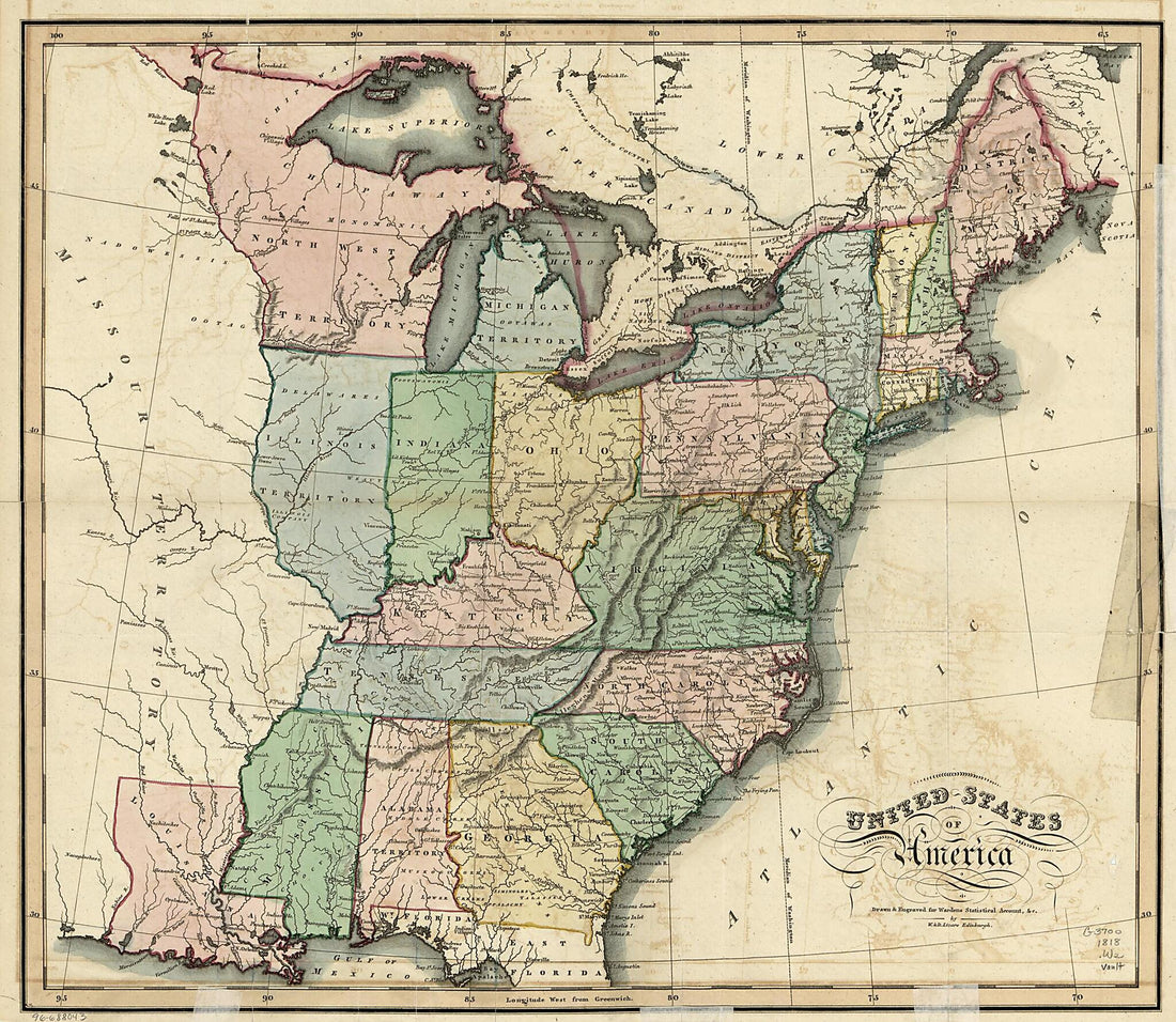 United States of America 1818
- Regular price
-
From
$31.95 - Regular price
-
$48.95 - Sale price
-
From
$31.95
-
Dissected Map of the United States 1900
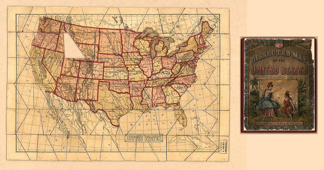 Dissected Map of the United States 1900
- Regular price
-
From
$41.95 - Regular price
-
$66.99 - Sale price
-
From
$41.95
-
Creek & Seminole Nations, Indian Territory : Compiled from the United States Survey (Creek and Seminole Nations, Indian Territory) 1902
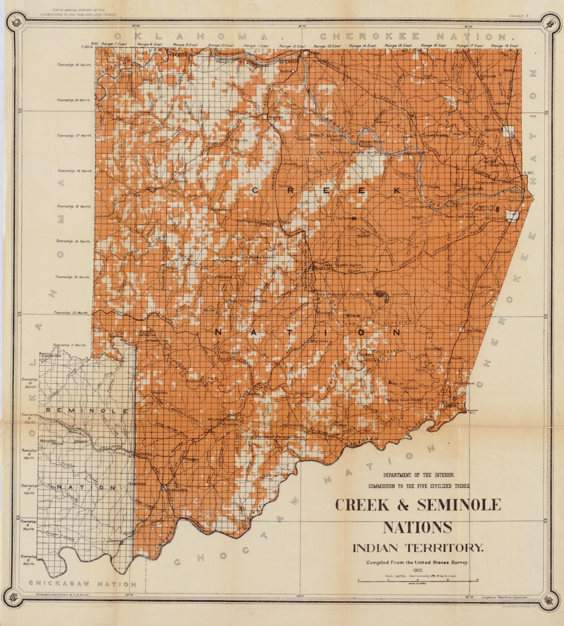 Creek & Seminole Nations, Indian Territory : Compiled from the United States Survey (Creek and Seminole Nations, Indian Territory) 1902
- Regular price
-
From
$34.95 - Regular price
-
$49.99 - Sale price
-
From
$34.95
-
The American Union Railroad Map of the United States, British Possessions, West Indies, Mexico and Central America in 1872
 The American Union Railroad Map of the United States, British Possessions, West Indies, Mexico and Central America in 1872
- Regular price
-
From
$41.95 - Regular price
-
$66.99 - Sale price
-
From
$41.95
-
Map of All the Railroads In the United States In Operation and Progress 1854
 Map of All the Railroads In the United States In Operation and Progress 1854
- Regular price
-
From
$34.95 - Regular price
-
$49.99 - Sale price
-
From
$34.95
-
The United States According to the Definitive Treaty of Peace Signed at Paris Sept. 3d. 1783 1784
 The United States According to the Definitive Treaty of Peace Signed at Paris Sept. 3d. 1783 1784
- Regular price
-
From
$41.95 - Regular price
-
$66.99 - Sale price
-
From
$41.95
-
Map of the Canals & Rail Roads of the United States Reduced from the Large Map of the U.S 1830
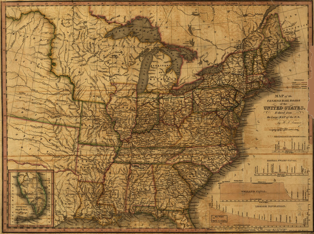 Map of the Canals & Rail Roads of the United States Reduced from the Large Map of the U.S 1830
- Regular price
-
From
$32.95 - Regular price
-
$51.99 - Sale price
-
From
$32.95
-
Northwestern America Showing the Territory Ceded by Russia to the United States 1867
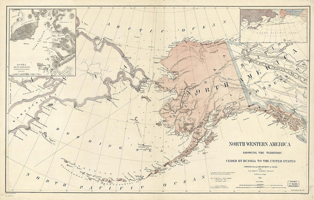 Northwestern America Showing the Territory Ceded by Russia to the United States 1867
- Regular price
-
From
$41.95 - Regular price
-
$66.99 - Sale price
-
From
$41.95
-
Map of the United States of America : With the Contiguous British and Spanish Possessions in 1816
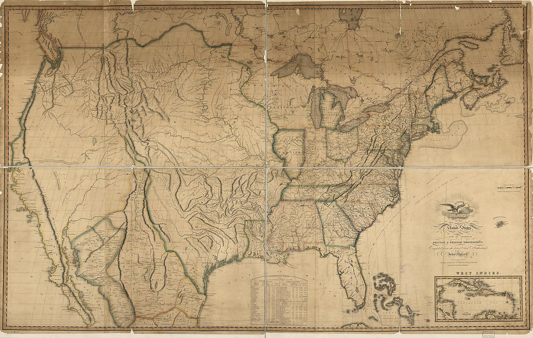 Map of the United States of America : With the Contiguous British and Spanish Possessions in 1816
- Regular price
-
From
$41.95 - Regular price
-
$66.99 - Sale price
-
From
$41.95
-
Coltons Railroad Map of Part of the United States North of the 37th Parallel Embracing the Country Between the Atlantic Ocean and the 96th Meridian of Longitude 1883
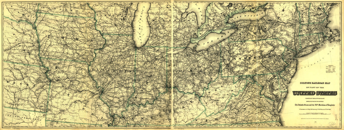 Coltons Railroad Map of Part of the United States North of the 37th Parallel Embracing the Country Between the Atlantic Ocean and the 96th Meridian of Longitude 1883
- Regular price
-
From
$41.95 - Regular price
-
$66.99 - Sale price
-
From
$41.95
-
Map of the United States of America, the British Provinces, Mexico, the West Indies and Central America, With Part of New Granada and Venezuela 1849
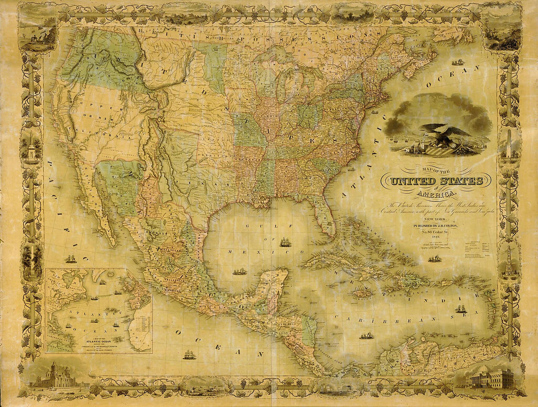 Map of the United States of America, the British Provinces, Mexico, the West Indies and Central America, With Part of New Granada and Venezuela 1849
- Regular price
-
From
$32.95 - Regular price
-
$51.99 - Sale price
-
From
$32.95


