


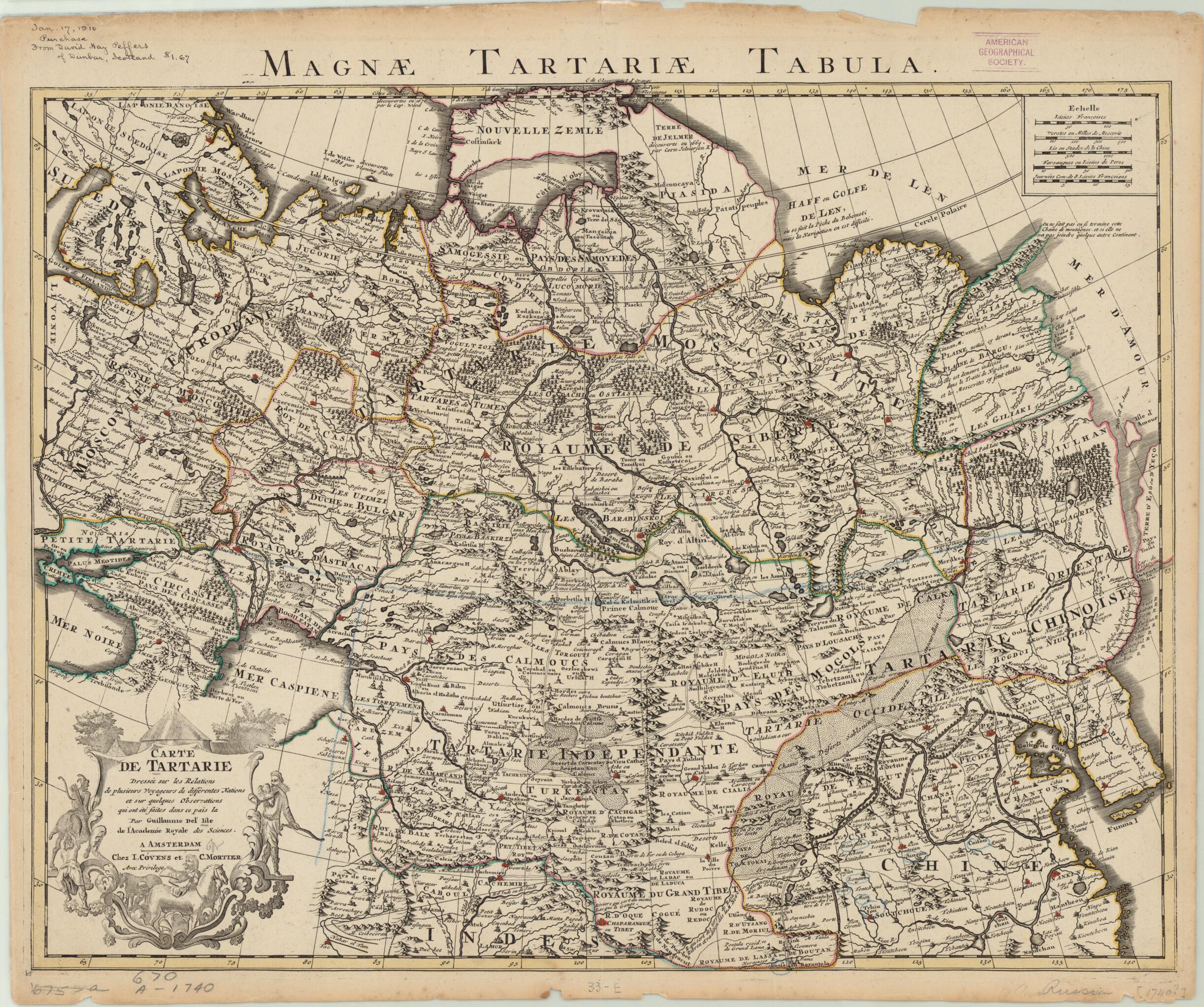
Map of the Great Tartary. Established Upon the Accounts of Several Travelers from Various Nations and Several Observations Made In That Country. (Carte De Tartarie: Dressée Sur Les Relations De Plusieurs Voyageurs De Différentes Nations Et Sur Quelq...
- Regular price
-
$62.95 - Regular price
-
$57.95 - Sale price
-
$62.95
Buy one map, get any other map in our collection for 50% OFF! Add to cart to see discount.
Couldn't load pickup availability
About This Map
Discover the timeless beauty of our fine art quality printed reproduction of this antique map. Perfect for history enthusiasts, collectors, and interior decorators.
Restored with meticulous attention to detail by our team with over a decade of experience, this stunning reproduction captures the intricate artistry and historical significance of the original map.
Whether you're a collector or seeking a unique decor piece, this archival-quality map reproduction is a timeless addition to any space. Order now to bring history to life!
1726) was admitted into the French Académie Royale des Sciences when he was 27 years old and subsequently became the first person to receive the title Premier Géographe du Roi (principal geographer to the king). At the time de l'Isle was engaged in cartographic research, the prestige of a cartographer and the authority of his maps were gauged by the veracity of the cartographer's sources, i.e., the explorers and travelers who reported details of their travels to geographers and cartographers in Europe. De l'Isle's map covers much of Asia as well as portions of Scandinavia and of Russia east of the Ural Mountains. Vast areas depicted in the map, such as Siberia and the regions north of the Arctic Circle in Asia, were only visited by European explorers starting in the 17th century. Many of de l'Isle's maps were reissued by the publishing house of Cornelis Mortier and Johannes Coven in Amsterdam in their Atlas Nouveau, which was published in multiple editions, the earliest of which dates to 1733. The map shown here is a later version of a map that was published in 1706, during de l'Isle's lifetime. The map shows forested areas, drainage, and other natural features, as well as the Great Wall of China, roads, and political boundaries. Distance scales are given in French, Russian, Chinese, and Persian units of measurement. The decorative title cartouche features native male figures and horses.Created by Johannes Cóvens, Guillaume De L'isle, Corneille Mortier in 1757.
- Title devised, in English, by Library staff.
- "Scale around 1:11,000,000"--Note extracted from World Digital Library.
- Original resource extent: 1 map : hand color ; 47 x 61 centimeters.
- Original resource at: University of Wisconsin-Milwaukee Libraries.
- Content in French.
- Description based on data extracted from World Digital Library, which may be extracted from partner institutions.
- For the best legibility, order your map in the original size or larger. Most maps have intricate detail and small text that is best appreciated when the print size hasn't been reduced.
- Sizes labeled "Fits a Standard Frame" will drop right into any frame that you purchase in that size. The sizes that we offer are commonly available online and at most retail stores.
- Our standard sizes are recommendations based on the aspect ratio of the original map, but still may require some added "white space" in one dimension to fit.
- Non-standard sizes will require custom framing, and we suggest taking your print to the frame shop of your choice after you receive it for the best results.
- Custom sizes are available, simply contact us for a quote.
Below is an approximation of the scale of a few standard sizes, and how they might appear in your space.

