


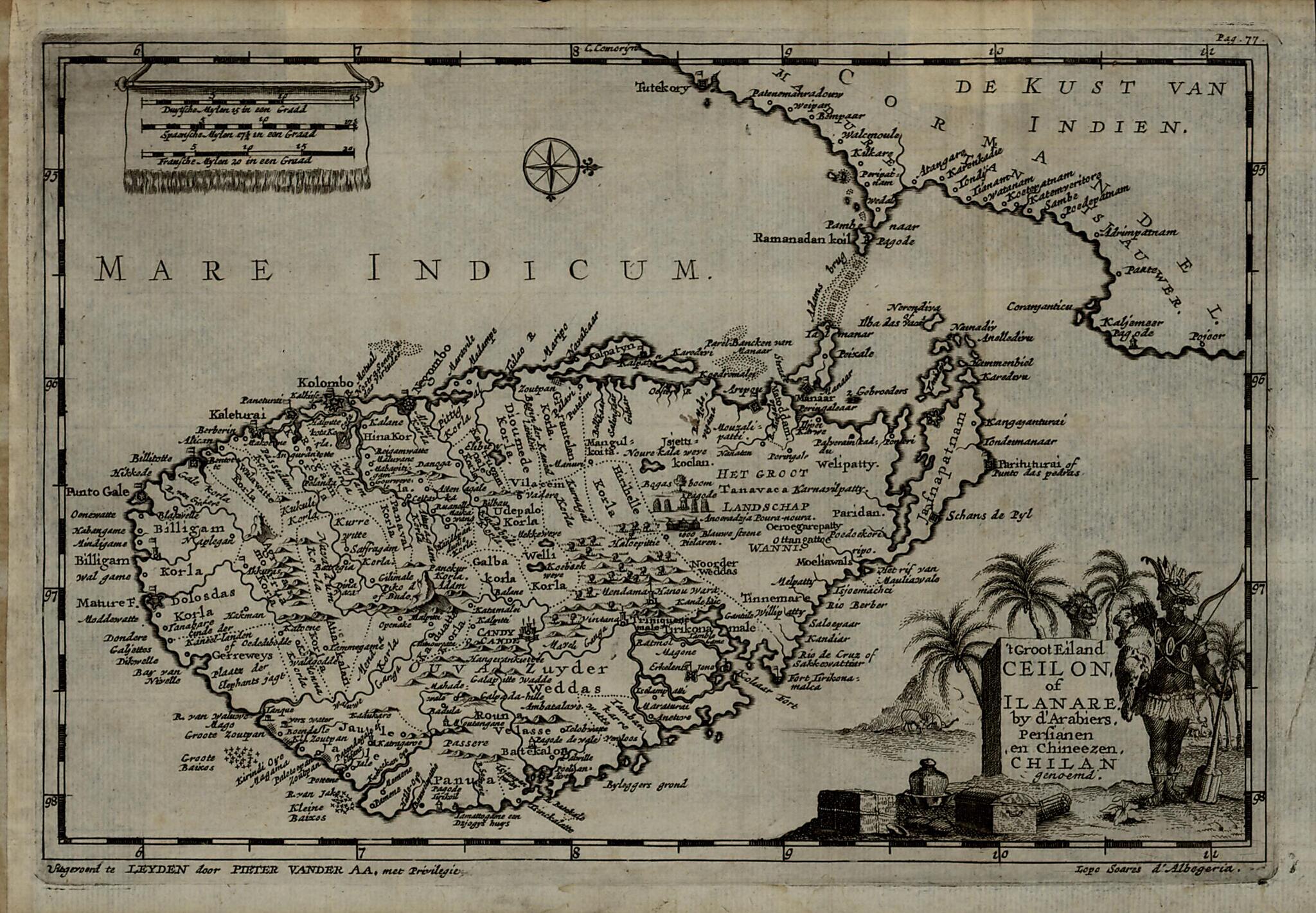
The Big Island of Ceylon, Or Ilanare, Called Chilan by the Arabs, Persians and Chinese. (t Groot Eiland Ceilon, of Ilanare, by D'Arabiers, Persianen En Chineezen, Chilan Genoemd) 1707
- Regular price
-
$49.95 - Regular price
-
$34.95 - Sale price
-
$49.95
Buy one map, get any other map in our collection for 50% OFF! Add to cart to see discount.
Couldn't load pickup availability
About This Map
Discover the timeless beauty of our fine art quality printed reproduction of this antique map. Perfect for history enthusiasts, collectors, and interior decorators.
Restored with meticulous attention to detail by our team with over a decade of experience, this stunning reproduction captures the intricate artistry and historical significance of the original map.
Whether you're a collector or seeking a unique decor piece, this archival-quality map reproduction is a timeless addition to any space. Order now to bring history to life!
Old map of Sri Lanka.day Sri Lanka) was originally drawn to illustrate an account by the Portuguese historian João de Barros (1496-1570) of the voyage to Asia that Lopo Soares de Albergaria (circa 1453-circa 1532) made in 1515 on behalf of King Manuel I of Portugal. Relief is shown pictorially, north is oriented to the right, and scale is given in Dutch, Spanish, and French miles. The Portuguese established a foothold in Ceylon in the early 1500s, but it was only in 1517 that Lopo Soares, the third governor of Portuguese India, obtained permission from the local authorities to build a fortress at Colombo (marked Kolombo on the map). The Portuguese dominated the coastal areas of the island until they were expelled by the Dutch in 1658. The map shows Candy (present-day Kandy), Jafnapatnam (present-day Jaffna), and Fort Tirikonamalea (present-day Trincomalee). The edition of the map presented here was published in 1720 by Pieter Van der Aa (1659-1733), a publisher, editor, and bookseller in Leiden, Netherlands, who reproduced many rare maps by earlier travelers.
Created by Pieter Van Der Aa, João De Barros in 1707.
- Title devised, in English, by Library staff.
- "Scale approximately 1:2,800,000"--Note extracted from World Digital Library.
- Original resource extent: 1 map : 36 x 45 centimeters.
- Original resource at: Qatar National Library.
- Content in Dutch.
- Description based on data extracted from World Digital Library, which may be extracted from partner institutions.
Map Subjects
Approximately 1532
Exploration And Encounters
Sri Lanka
Pieter Van Der Aa
João De Barros
1707
- For the best legibility, order your map in the original size or larger. Most maps have intricate detail and small text that is best appreciated when the print size hasn't been reduced.
- Sizes labeled "Fits a Standard Frame" will drop right into any frame that you purchase in that size. The sizes that we offer are commonly available online and at most retail stores.
- Our standard sizes are recommendations based on the aspect ratio of the original map, but still may require some added "white space" in one dimension to fit.
- Non-standard sizes will require custom framing, and we suggest taking your print to the frame shop of your choice after you receive it for the best results.
- Custom sizes are available, simply contact us for a quote.
Below is an approximation of the scale of a few standard sizes, and how they might appear in your space.

