Quick links
25001 products
-
Redding and Watson's Map of Walworth County, Wisconsin in 1857
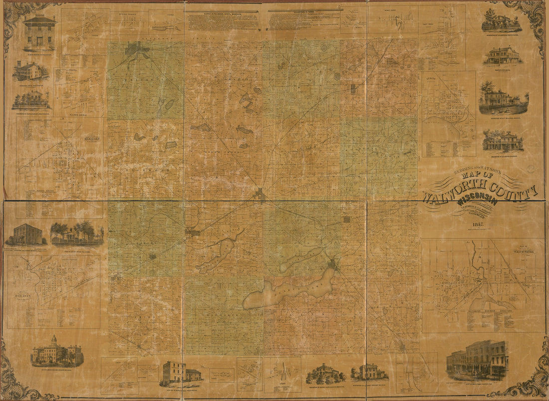 Redding and Watson's Map of Walworth County, Wisconsin in 1857
- Regular price
-
From
$32.95 - Regular price
-
$51.99 - Sale price
-
From
$32.95
-
Map of Wayne County, Michigan 1860
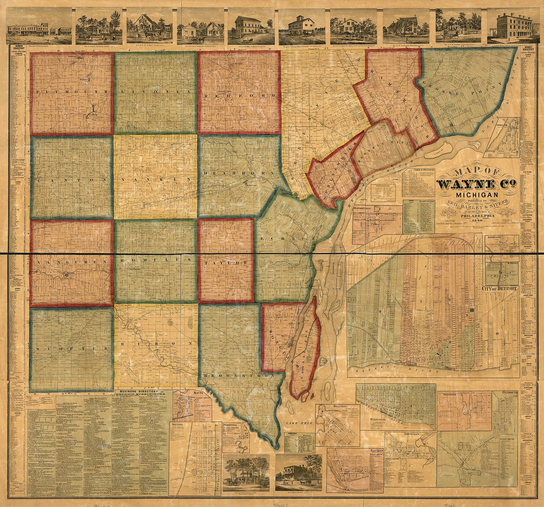 Map of Wayne County, Michigan 1860
- Regular price
-
From
$34.95 - Regular price
-
$49.99 - Sale price
-
From
$34.95
-
Topographical Map of Carroll County, New Hampshire 1861
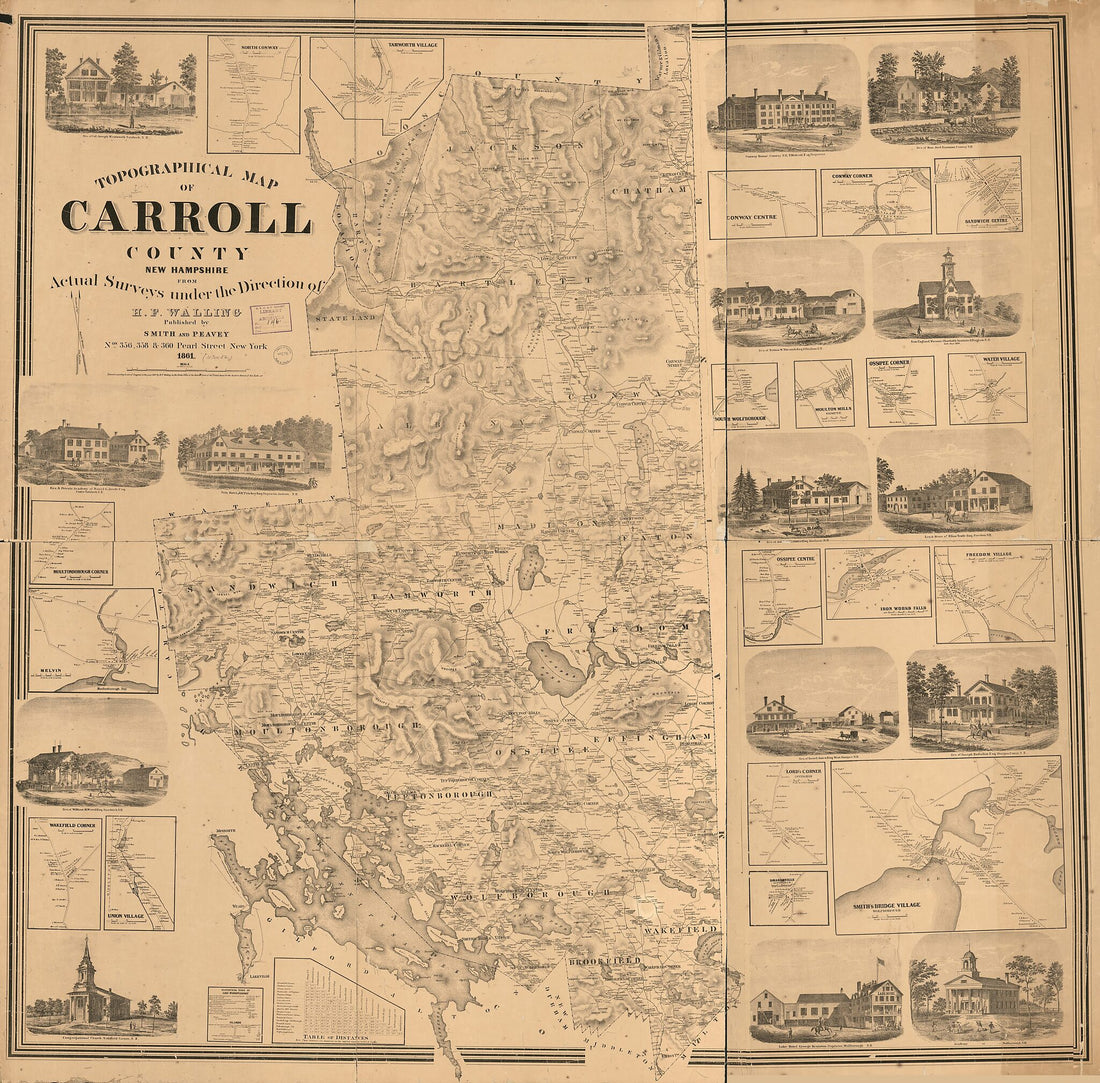 Topographical Map of Carroll County, New Hampshire 1861
- Regular price
-
From
$34.95 - Regular price
-
$49.99 - Sale price
-
From
$34.95
-
Carte Des Courones Du Nord Qui Comprend Les Royaumes De Danemark, Suede, & Norwege in 1700
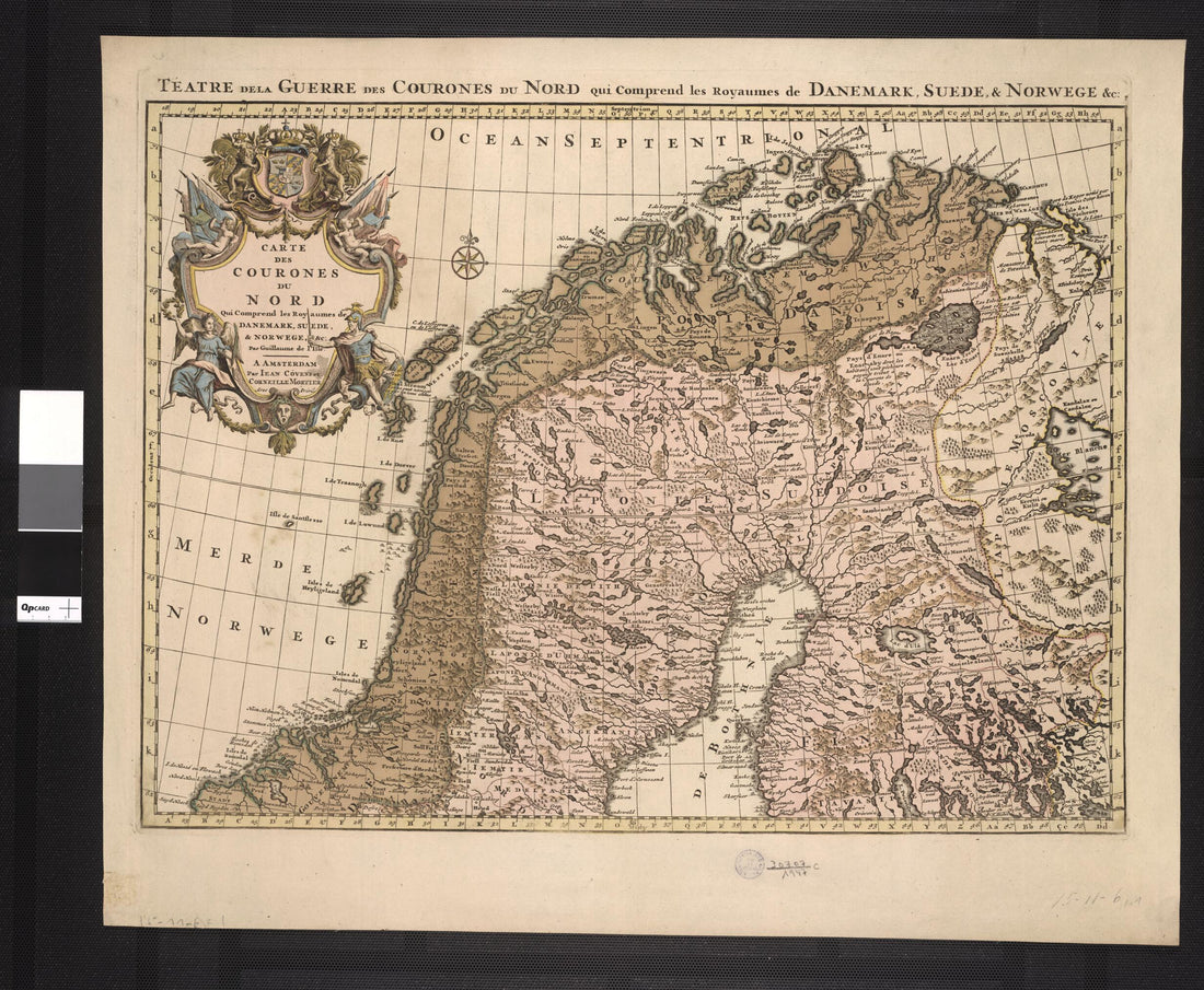 Carte Des Courones Du Nord Qui Comprend Les Royaumes De Danemark, Suede, & Norwege in 1700
- Regular price
-
From
$34.95 - Regular price
-
$49.99 - Sale price
-
From
$34.95
-
La Région Du Haut Nil 1897
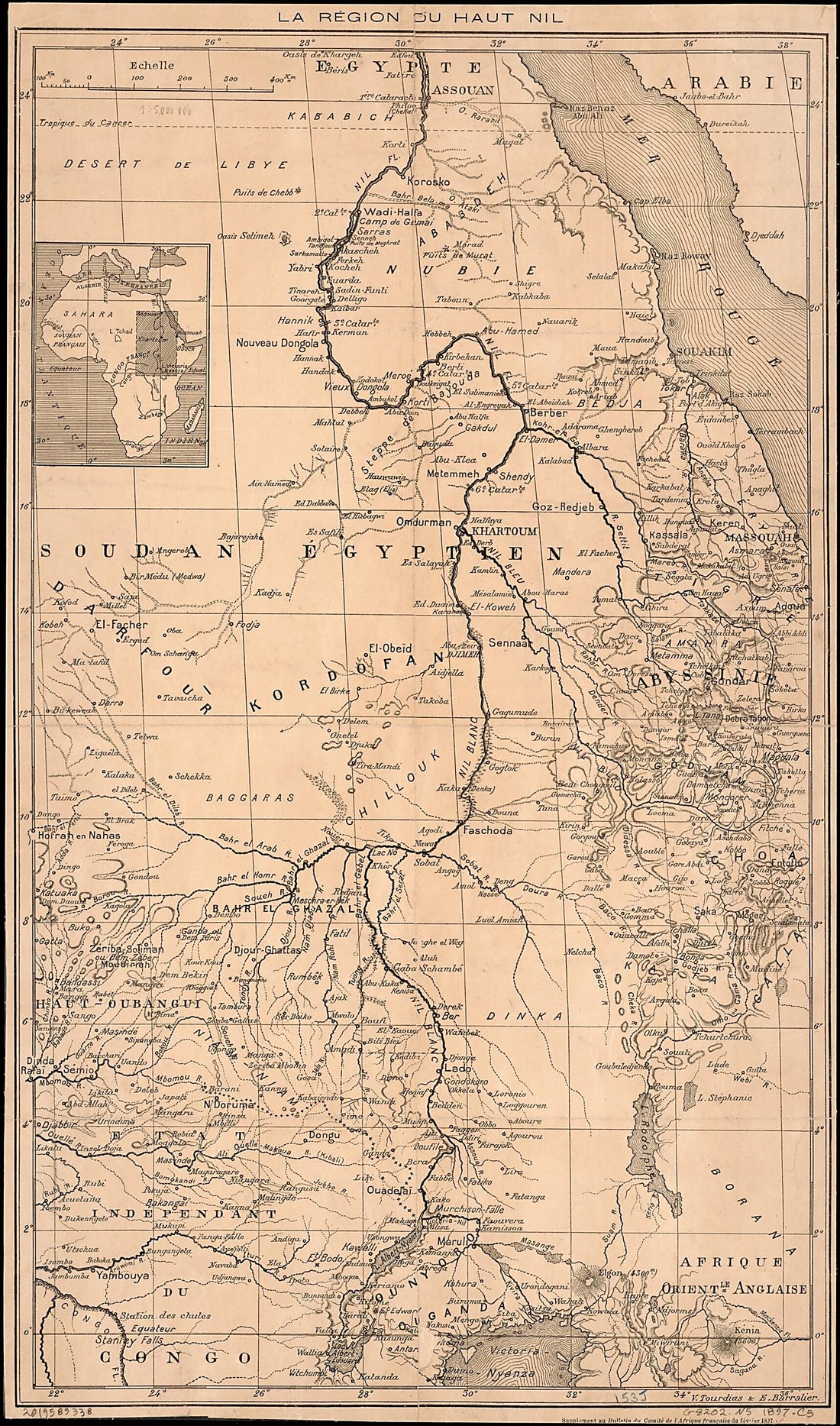 La Région Du Haut Nil 1897
- Regular price
-
From
$41.95 - Regular price
-
$64.95 - Sale price
-
From
$41.95
-
Karta Zabaĭkal'skoĭ Oblasti. (Карта Забайкальской области.) 1893
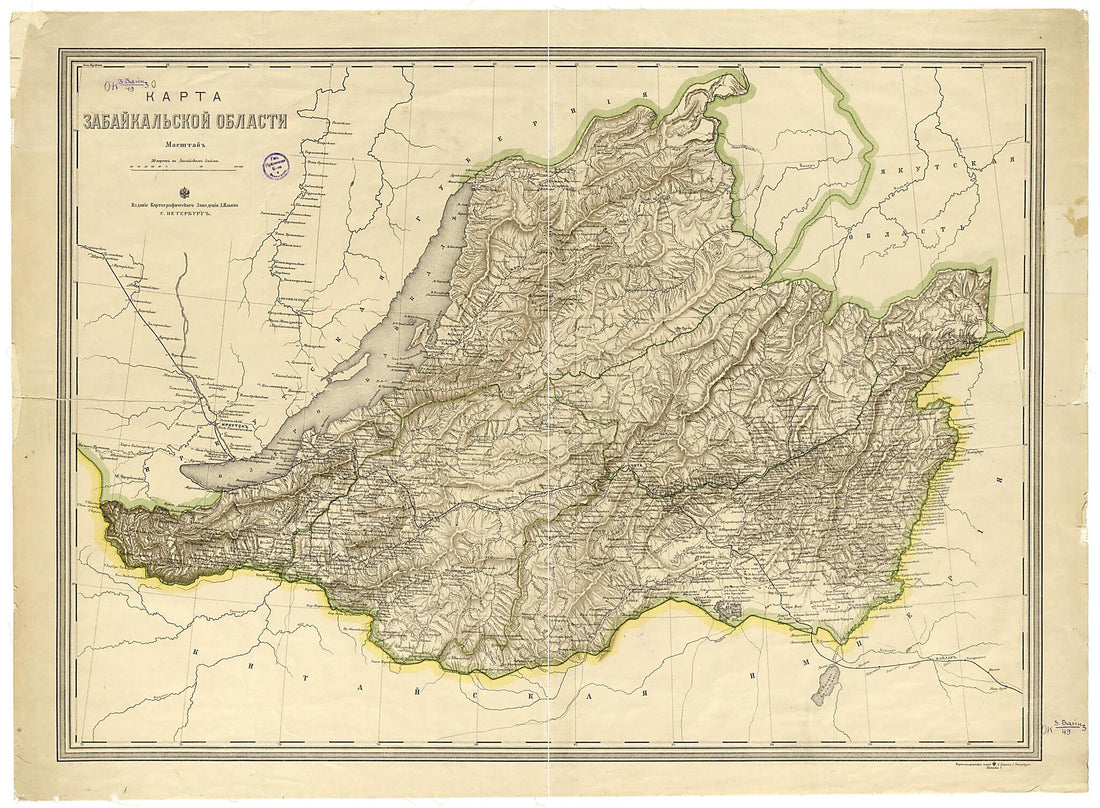 Karta Zabaĭkal'skoĭ Oblasti. (Карта Забайкальской области.) 1893
- Regular price
-
From
$32.95 - Regular price
-
$51.99 - Sale price
-
From
$32.95
-
Карта острова Кодьяка и пролива Шелехова. in 1826
 Карта острова Кодьяка и пролива Шелехова. in 1826
- Regular price
-
From
$41.95 - Regular price
-
$64.95 - Sale price
-
From
$41.95
-
Delaware and Maryland 1857
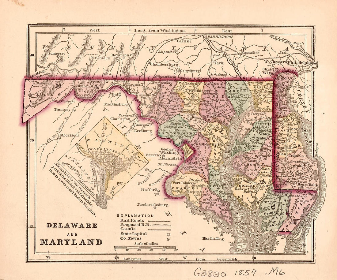 Delaware and Maryland 1857
- Regular price
-
From
$19.95 - Regular price
-
$29.95 - Sale price
-
From
$19.95
-
Herald Despatch Premium Map of Christian County, Illinois in 1893
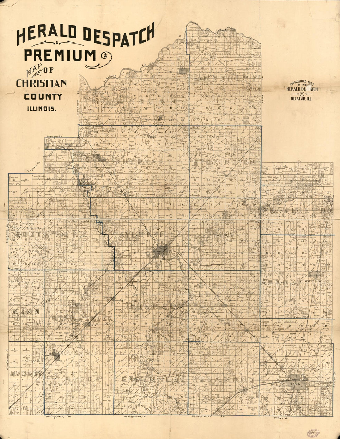 Herald Despatch Premium Map of Christian County, Illinois in 1893
- Regular price
-
From
$32.95 - Regular price
-
$51.99 - Sale price
-
From
$32.95
-
The Model War Map Giving the Southern & Middle States, With All Their Water & Railroad Connections. Compiled From the Best Authorities & Latest Surveys by L. Prang & Co., Lithographers & Publishers in 1862
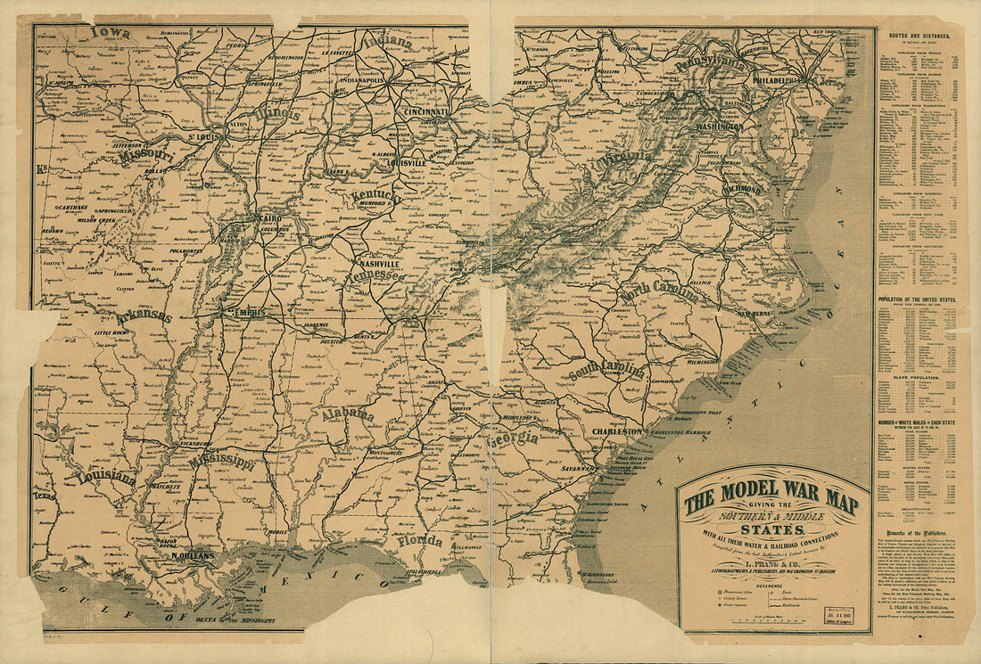 The Model War Map Giving the Southern & Middle States, With All Their Water & Railroad Connections. Compiled From the Best Authorities & Latest Surveys by L. Prang & Co., Lithographers & Publishers in 1862
- Regular price
-
From
$41.95 - Regular price
-
$66.99 - Sale price
-
From
$41.95
-
Phelps's National Map of the United States : a Traveller's Guide : Embracing the Principal Rail Roads, Canals, Steam Boat & Stage Routes, Throughout the Union in 1852
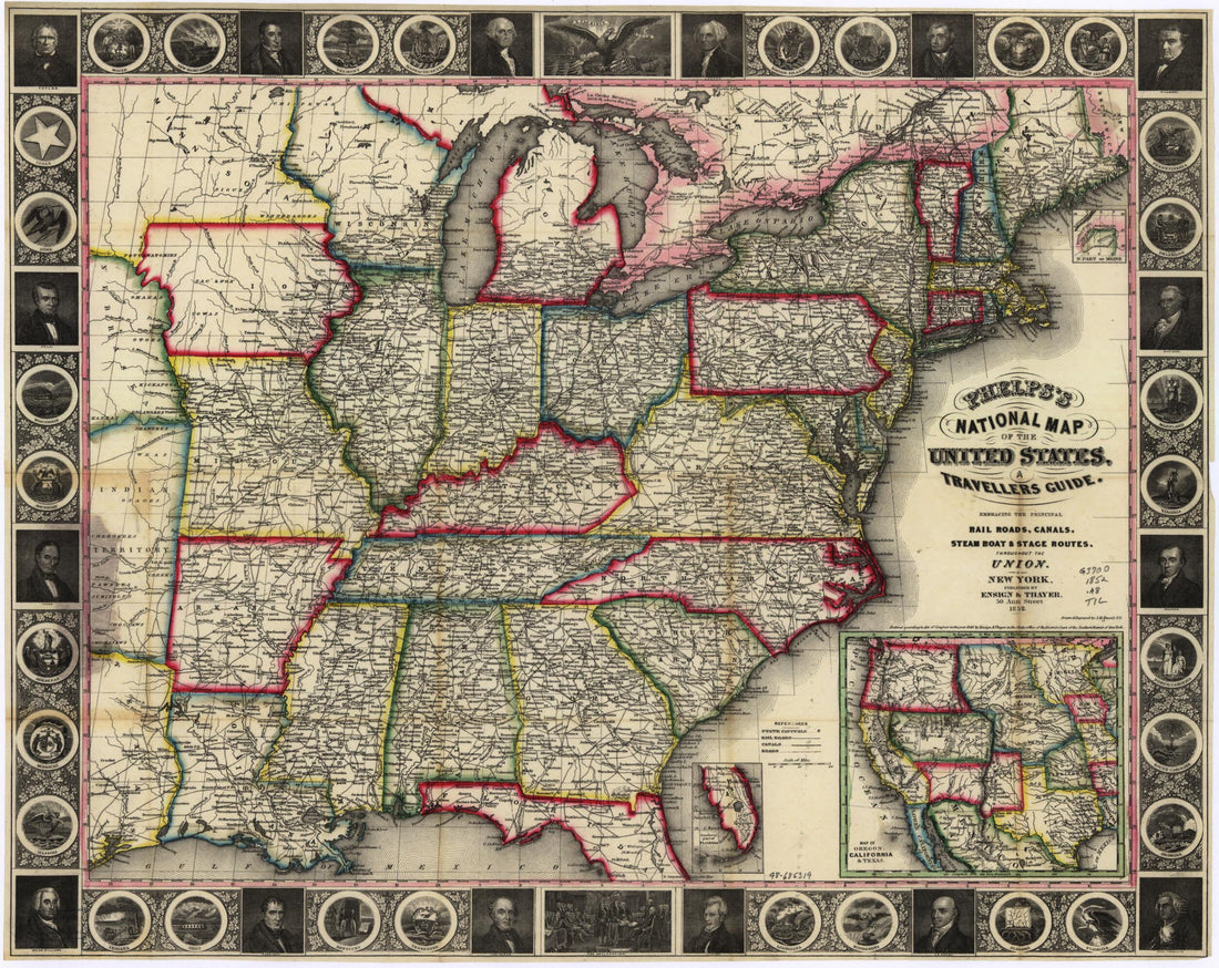 Phelps's National Map of the United States : a Traveller's Guide : Embracing the Principal Rail Roads, Canals, Steam Boat & Stage Routes, Throughout the Union in 1852
- Regular price
-
From
$34.95 - Regular price
-
$49.99 - Sale price
-
From
$34.95
-
Map of the Situation of the Three Main Fortresses On the Inlet Entrance of Rio De Janeiro. (Plano Da Cituação Das Tres Principaes Fortalezas Da Entrada Da Barra Do Rio De Janeiro) 1764
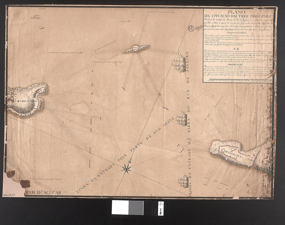 Map of the Situation of the Three Main Fortresses On the Inlet Entrance of Rio De Janeiro. (Plano Da Cituação Das Tres Principaes Fortalezas Da Entrada Da Barra Do Rio De Janeiro) 1764
- Regular price
-
From
$29.95 - Regular price
-
$46.95 - Sale price
-
From
$29.95


