Quick links
25001 products
-
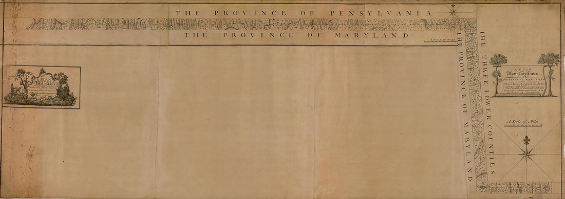 A Plan of the West Line Or Parallel of Latitude, Which Is the Boundary Between the Provinces of Maryland and Pensylvania : a Plan of the Boundary Lines Between the Province of Maryland and the Three Lower Counties On Delaware With Part of the Parallel...A Plan of the West Line Or Parallel of Latitude, Which Is the Boundary Between the Provinces of Maryland and Pensylvania : a Plan of the Boundary Lines Between the Province of Maryland and the Three Lower Counties On Delaware With Part of the Parallel...
- Regular price
-
$46.95 $358.95 - Regular price
-
$41.95 - Sale price
-
$46.95 $358.95
-
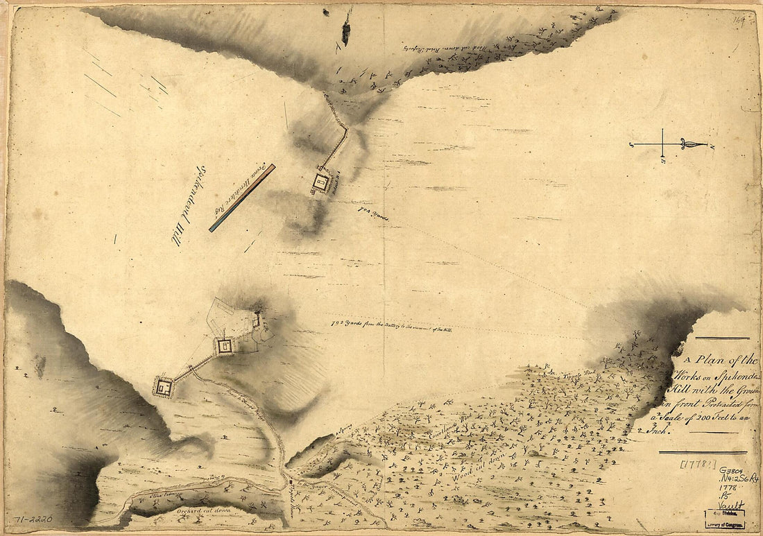 A Plan of the Works On Spikendevil Hill With the Ground In Front, Protracted from a Scale of 200 Feet to an Inch 1778A Plan of the Works On Spikendevil Hill With the Ground In Front, Protracted from a Scale of 200 Feet to an Inch 1778
- Regular price
-
$39.95 $99.95 - Regular price
-
$34.95 - Sale price
-
$39.95 $99.95
-
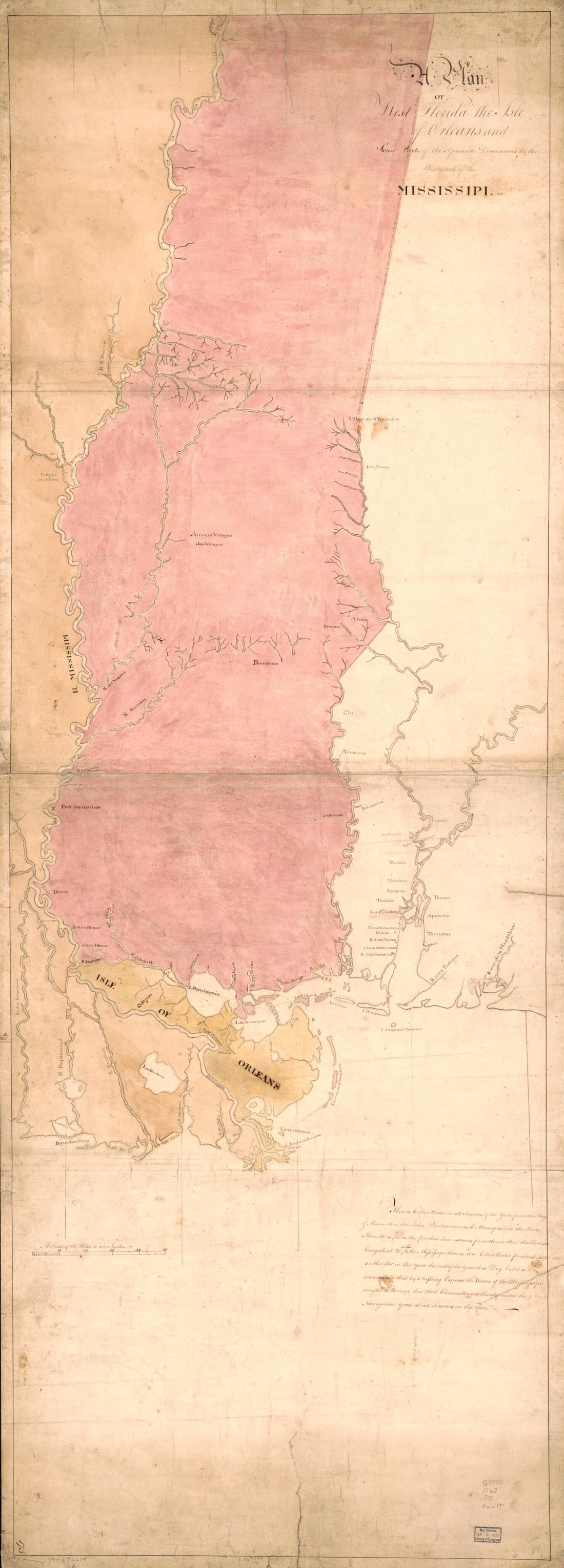 A Plan of West Florida, the Isle of Orleans, and Some Parts of the Spanish Dominions to the Westward of the Mississipi 1763A Plan of West Florida, the Isle of Orleans, and Some Parts of the Spanish Dominions to the Westward of the Mississipi 1763
- Regular price
-
$46.95 $126.95 - Regular price
-
$41.95 - Sale price
-
$46.95 $126.95
-
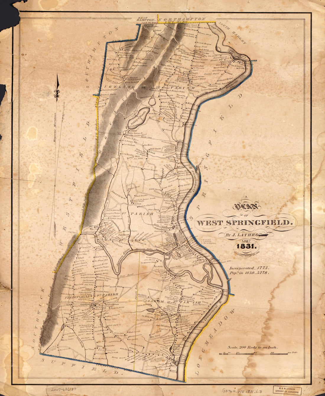 A Plan of West Springfield : Massachusetts 1831A Plan of West Springfield : Massachusetts 1831
- Regular price
-
$39.95 $83.95 - Regular price
-
$34.95 - Sale price
-
$39.95 $83.95
-
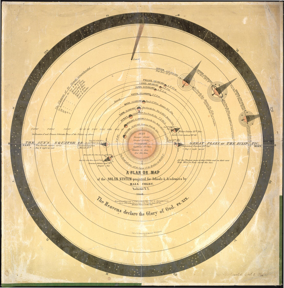 A Plan Or Map of the Solar System Projected for Schools & Academies 1846A Plan Or Map of the Solar System Projected for Schools & Academies 1846
- Regular price
-
$43.95 $83.95 - Regular price
-
$38.95 - Sale price
-
$43.95 $83.95
-
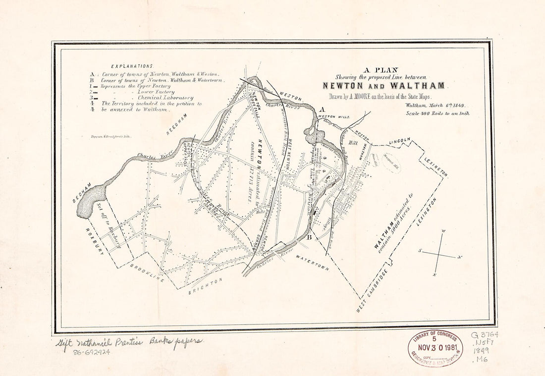 A Plan Showing the Proposed Line Between Newton and Waltham 1849A Plan Showing the Proposed Line Between Newton and Waltham 1849
- Regular price
-
$39.95 $99.95 - Regular price
-
$29.95 - Sale price
-
$39.95 $99.95
-
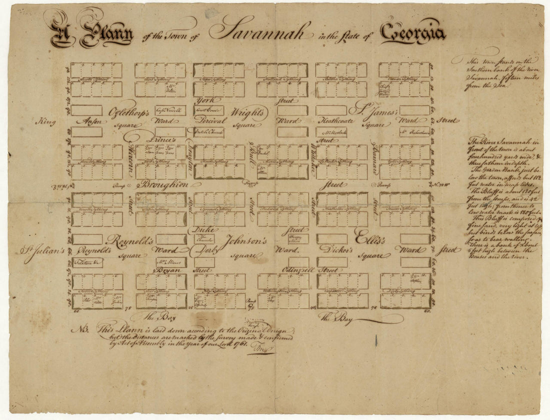 A Plann of the Town of Savannah In the State of Georgia 1761A Plann of the Town of Savannah In the State of Georgia 1761
- Regular price
-
$43.95 $88.95 - Regular price
-
$38.95 - Sale price
-
$43.95 $88.95
-
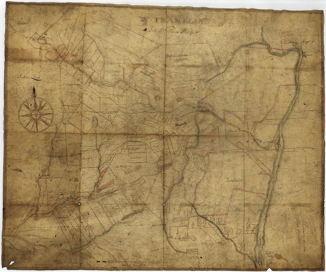 A Portion of New York from the Hudson River West to the Unadilla Branch of the Susquehanna River; from the Delaware River North to Fort Stanwix 1700A Portion of New York from the Hudson River West to the Unadilla Branch of the Susquehanna River; from the Delaware River North to Fort Stanwix 1700
- Regular price
-
$39.95 $103.95 - Regular price
-
$34.95 - Sale price
-
$39.95 $103.95
-
 A Portion of Our Patrons from an Illustrated Historical Atlas Map of Holt County, Mo. : Carefully Compiled from Personal Examinations and Surveys 1877A Portion of Our Patrons from an Illustrated Historical Atlas Map of Holt County, Mo. : Carefully Compiled from Personal Examinations and Surveys 1877
- Regular price
-
$39.95 $92.95 - Regular price
-
$36.95 - Sale price
-
$39.95 $92.95
-
 A Portion of Our Patrons from an Illustrated Historical Atlas Map of Randolph County, Ills. : Carefully Compiled from Personal Examinations and Surveys 1875A Portion of Our Patrons from an Illustrated Historical Atlas Map of Randolph County, Ills. : Carefully Compiled from Personal Examinations and Surveys 1875
- Regular price
-
$39.95 $83.95 - Regular price
-
$10.95 - Sale price
-
$39.95 $83.95
-
 A Portion of Our Patrons from Illustrated Atlas Map of Cass County, Illinois : Carefully Compiled from Personal Examinations and Surveys 1874A Portion of Our Patrons from Illustrated Atlas Map of Cass County, Illinois : Carefully Compiled from Personal Examinations and Surveys 1874
- Regular price
-
$39.95 $83.95 - Regular price
-
$9.95 - Sale price
-
$39.95 $83.95
-
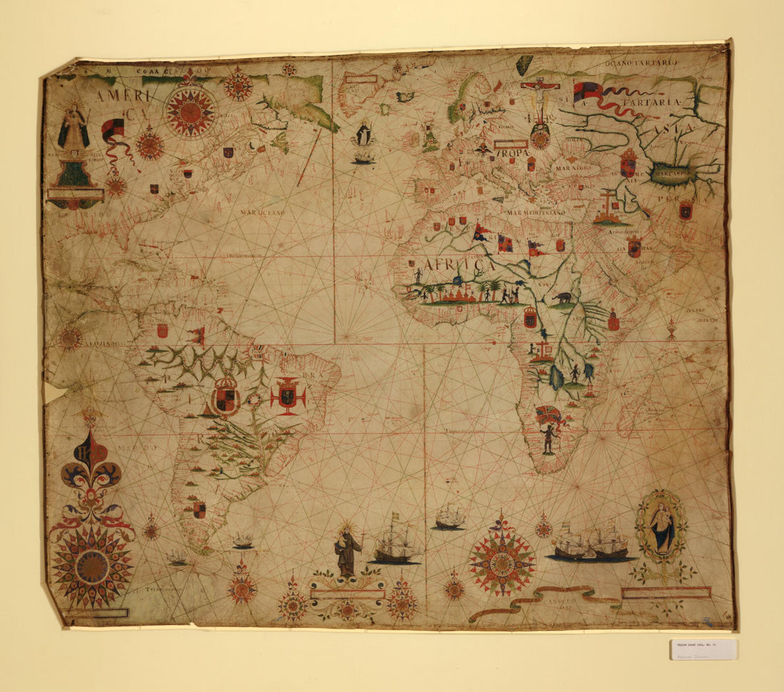 A Portolan Chart of the Atlantic Ocean and Adjacent Continents 1633A Portolan Chart of the Atlantic Ocean and Adjacent Continents 1633
- Regular price
-
$39.95 $171.95 - Regular price
-
$34.95 - Sale price
-
$39.95 $171.95


