467 products
-
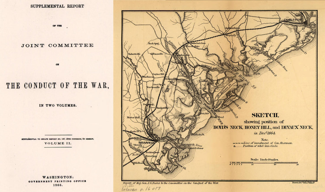 Sketch Showing Position of Boyd's Neck, Honey Hill, and Devaux' Neck, In Decr. 1864 1866Sketch Showing Position of Boyd's Neck, Honey Hill, and Devaux' Neck, In Decr. 1864 1866
- Regular price
-
$39.95 $99.95 - Regular price
-
$29.95 - Sale price
-
$39.95 $99.95
-
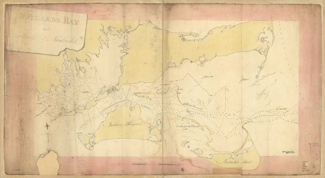 Buzzards Bay and Shoals of Nantucket 1778Buzzards Bay and Shoals of Nantucket 1778
- Regular price
-
$46.95 $99.95 - Regular price
-
$41.95 - Sale price
-
$46.95 $99.95
-
 Plano De Puerto Cavello Situado En La Costa De Caracas En La Lattd. De 10 Gs. 26 Ms. Norte Y En La Longd. De 308 Gs. 37 Ms. Segn. El Merido. De Tenerife 1784Plano De Puerto Cavello Situado En La Costa De Caracas En La Lattd. De 10 Gs. 26 Ms. Norte Y En La Longd. De 308 Gs. 37 Ms. Segn. El Merido. De Tenerife 1784
- Regular price
-
$39.95 $83.95 - Regular price
-
$29.95 - Sale price
-
$39.95 $83.95
-
 Sketch of Portions of Seacoast of South Carolina & Georgia 1862Sketch of Portions of Seacoast of South Carolina & Georgia 1862
- Regular price
-
$46.95 $159.95 - Regular price
-
$41.95 - Sale price
-
$46.95 $159.95
-
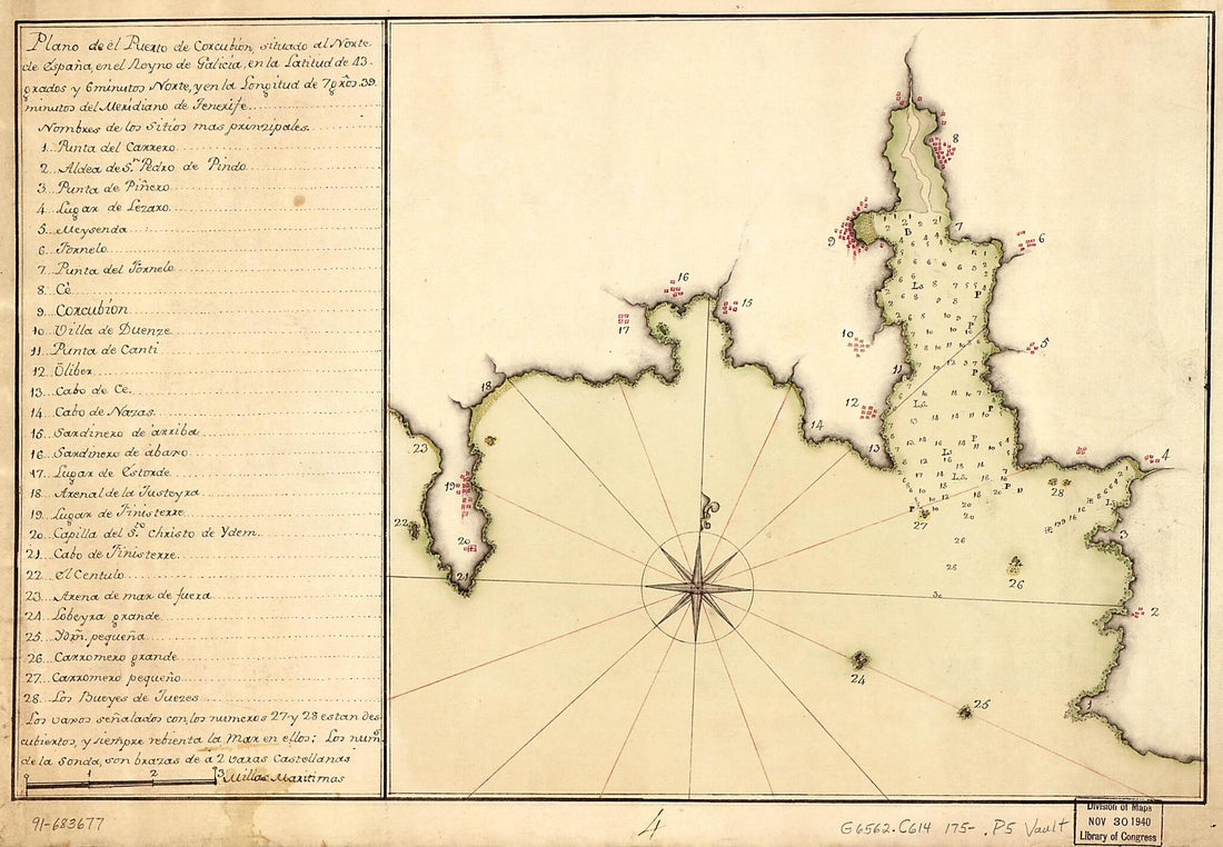 Plano De El Puerto De Corcubión Situado Al Norte De España En El Reyno De Galicia En La Latitud De 43 Grados Y 6 Minutos Norte Y En La Longitud De 7 Gros. 39 Minutos Del Meridiano De Tenerife 1750Plano De El Puerto De Corcubión Situado Al Norte De España En El Reyno De Galicia En La Latitud De 43 Grados Y 6 Minutos Norte Y En La Longitud De 7 Gros. 39 Minutos Del Meridiano De Tenerife 1750
- Regular price
-
$39.95 $99.95 - Regular price
-
$29.95 - Sale price
-
$39.95 $99.95
-
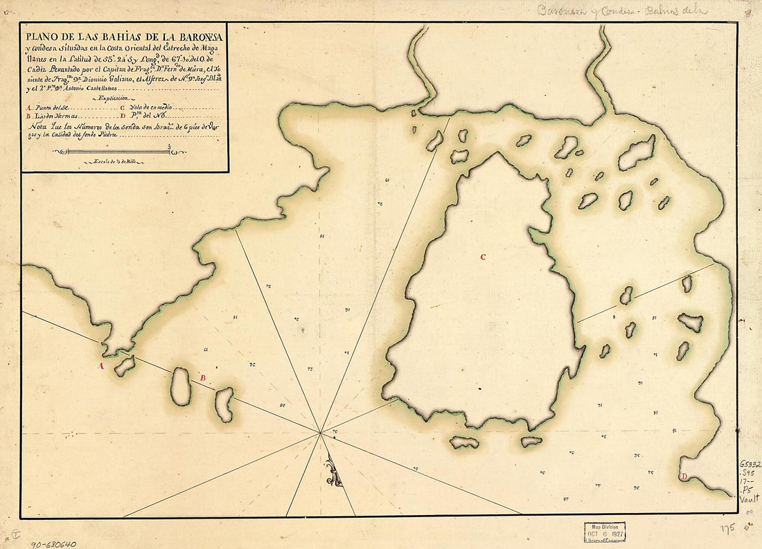 Plano De Las Bahías De La Baronesa Y Condesa Situadas En La Costa Oriental Del Estrecho De Magallanes En La Latitud De 53⁰24ʹS Y Longd. De 67⁰10ʹ Del O. De Cádiz 1700Plano De Las Bahías De La Baronesa Y Condesa Situadas En La Costa Oriental Del Estrecho De Magallanes En La Latitud De 53⁰24ʹS Y Longd. De 67⁰10ʹ Del O. De Cádiz 1700
- Regular price
-
$39.95 $88.95 - Regular price
-
$29.95 - Sale price
-
$39.95 $88.95
-
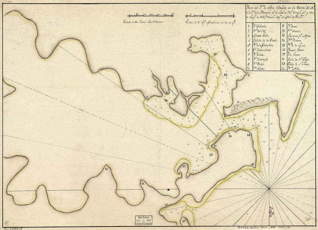 Plano Del Pto. De Nipe Situado En La Costa Del N. De La Ya. De La Havana Pr. La Lattd. De 21 Gs. 10 Mins. N. Y En La Longd. De 301 Gs. 33 Mins. Segn. El Mero. De Thene 1700Plano Del Pto. De Nipe Situado En La Costa Del N. De La Ya. De La Havana Pr. La Lattd. De 21 Gs. 10 Mins. N. Y En La Longd. De 301 Gs. 33 Mins. Segn. El Mero. De Thene 1700
- Regular price
-
$39.95 $88.95 - Regular price
-
$29.95 - Sale price
-
$39.95 $88.95
-
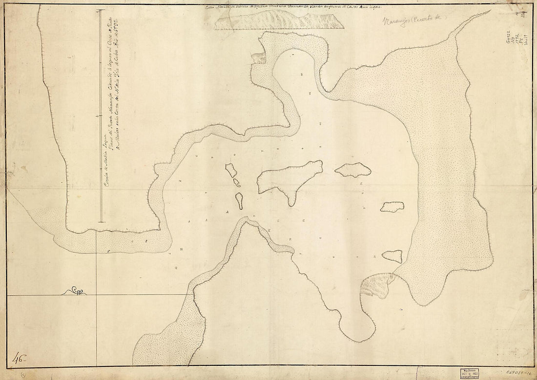 Plano Del Puerto Naranjos Cituado 4 Leguas Al Oeste De Punta De Mulas En La Costa Del N. De La Ysla De Cuba 1792Plano Del Puerto Naranjos Cituado 4 Leguas Al Oeste De Punta De Mulas En La Costa Del N. De La Ysla De Cuba 1792
- Regular price
-
$43.95 $139.95 - Regular price
-
$32.95 - Sale price
-
$43.95 $139.95
-
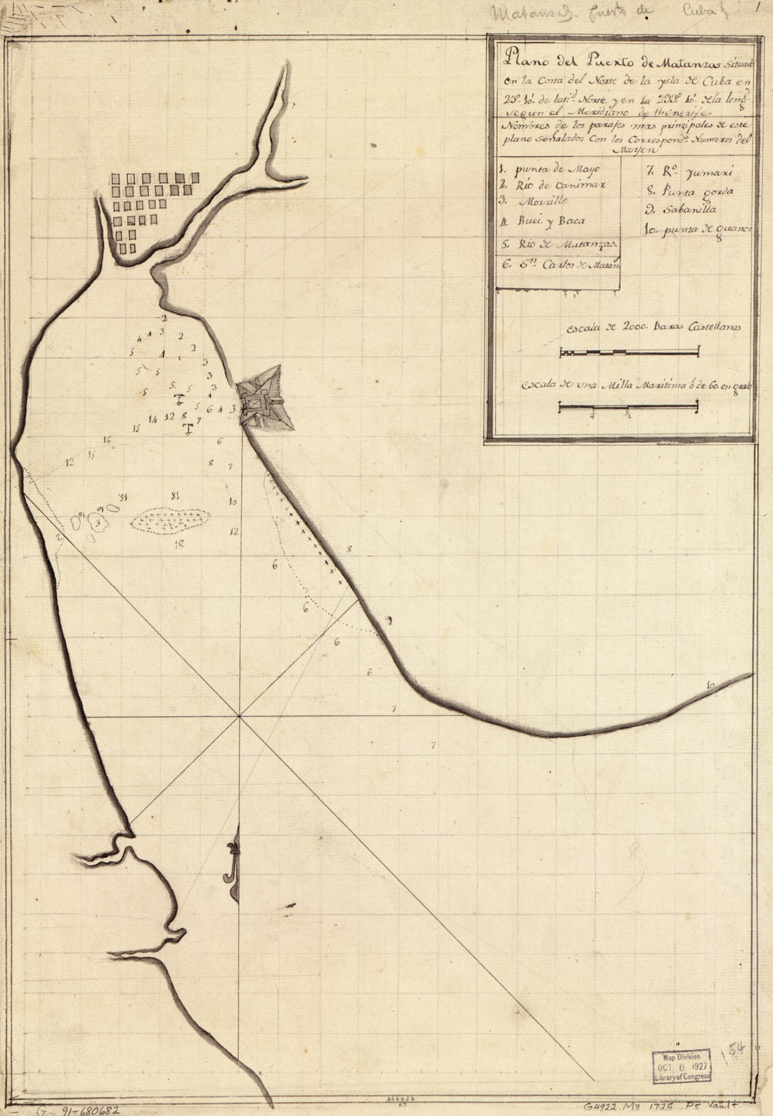 Plano Del Puerto De Matanzas Situado En La Costa Del Norte De La Ysla De Cuba En 23⁰10ʹ De Latid. Norte Y En La 293⁰40ʹ De La Longd. Segun El Meridiano De Thenerife in 1725Plano Del Puerto De Matanzas Situado En La Costa Del Norte De La Ysla De Cuba En 23⁰10ʹ De Latid. Norte Y En La 293⁰40ʹ De La Longd. Segun El Meridiano De Thenerife in 1725
- Regular price
-
$39.95 $99.95 - Regular price
-
$29.95 - Sale price
-
$39.95 $99.95
-
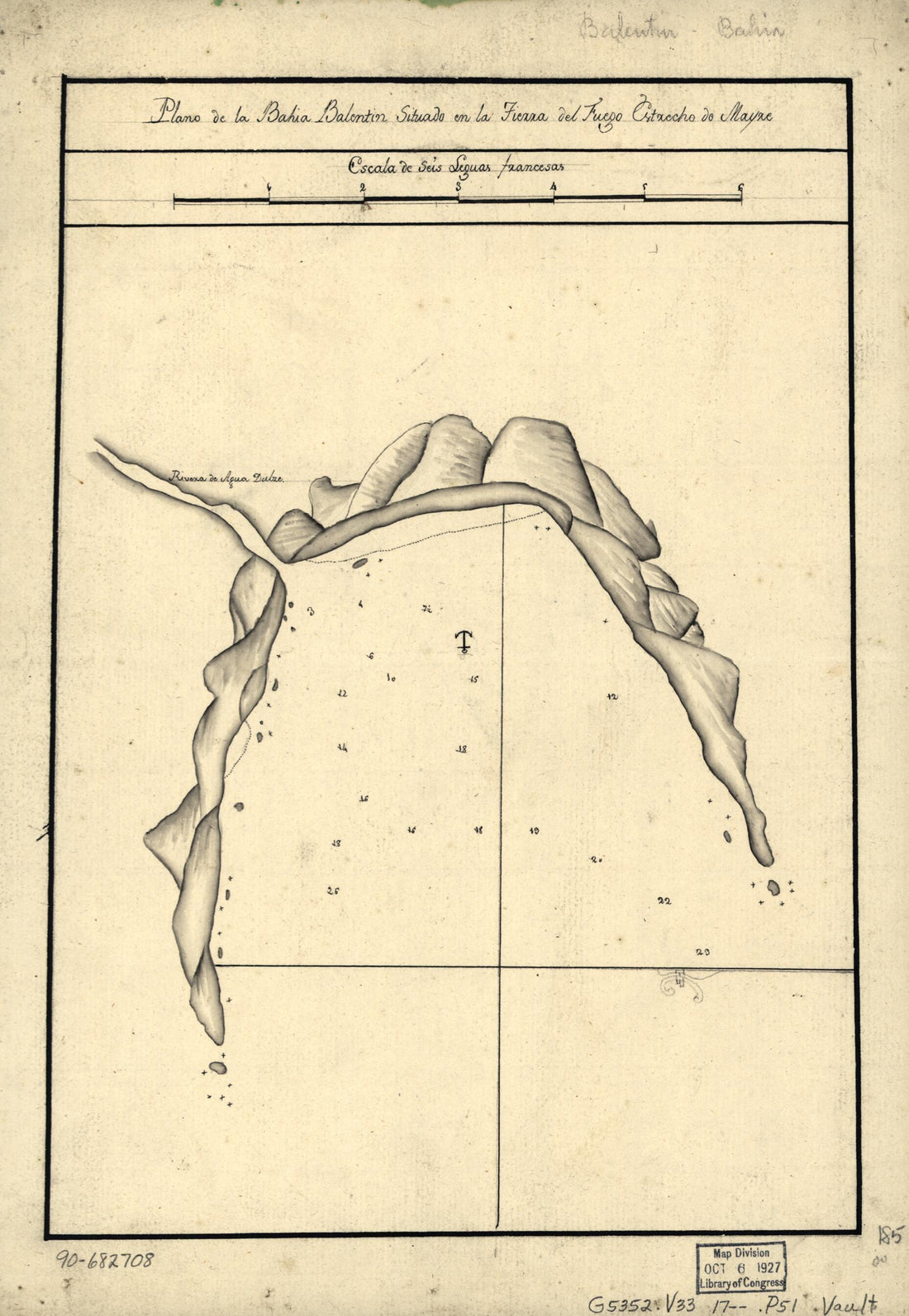 Plano De La Bahía Balentín Situado En La Tierra Del Fuego, Estrecho De Mayre in 1700Plano De La Bahía Balentín Situado En La Tierra Del Fuego, Estrecho De Mayre in 1700
- Regular price
-
$39.95 $99.95 - Regular price
-
$29.95 - Sale price
-
$39.95 $99.95
-
 Plano Del Puerto Y Ciudad De Vera Cruz En La Costa Occidental Del Reyno De Nueva España, Situada En La Lattd. N. De 19⁰13ʹ Y En 278⁰40ʹ De Longd. Del Mro. De Tenerife 1777Plano Del Puerto Y Ciudad De Vera Cruz En La Costa Occidental Del Reyno De Nueva España, Situada En La Lattd. N. De 19⁰13ʹ Y En 278⁰40ʹ De Longd. Del Mro. De Tenerife 1777
- Regular price
-
$46.95 $219.95 - Regular price
-
$41.95 - Sale price
-
$46.95 $219.95
-
 Map Showing Coast of Northwestern Portion of Vancouver Island in 1786Map Showing Coast of Northwestern Portion of Vancouver Island in 1786
- Regular price
-
$39.95 $83.95 - Regular price
-
$34.95 - Sale price
-
$39.95 $83.95


