1264 products
-
 Camp a Contorbery from Amérique Campagne 1782Camp a Contorbery from Amérique Campagne 1782
- Regular price
-
$39.95 $99.95 - Regular price
-
$18.95 - Sale price
-
$39.95 $99.95
-
 Camp a Blanden'sburg from Amérique Campagne 1782Camp a Blanden'sburg from Amérique Campagne 1782
- Regular price
-
$39.95 $99.95 - Regular price
-
$19.95 - Sale price
-
$39.95 $99.95
-
 Camp a Dumphris sic from Amérique Campagne 1782Camp a Dumphris sic from Amérique Campagne 1782
- Regular price
-
$39.95 $99.95 - Regular price
-
$19.95 - Sale price
-
$39.95 $99.95
-
 Camp a Colchester from Amérique Campagne 1782Camp a Colchester from Amérique Campagne 1782
- Regular price
-
$39.95 $99.95 - Regular price
-
$18.95 - Sale price
-
$39.95 $99.95
-
 Camp a Waterman's Tavern Camp a Providence Camp a Providence Sur Le Chemin D from Amérique Campagne 1782Camp a Waterman's Tavern Camp a Providence Camp a Providence Sur Le Chemin D from Amérique Campagne 1782
- Regular price
-
$39.95 $99.95 - Regular price
-
$18.95 - Sale price
-
$39.95 $99.95
-
 Camp a Lower Ferry from Amérique Campagne 1782Camp a Lower Ferry from Amérique Campagne 1782
- Regular price
-
$39.95 $99.95 - Regular price
-
$19.95 - Sale price
-
$39.95 $99.95
-
 Camp a Garrot's Tavern Peyton's Tavern from Amérique Campagne 1782Camp a Garrot's Tavern Peyton's Tavern from Amérique Campagne 1782
- Regular price
-
$39.95 $99.95 - Regular price
-
$19.95 - Sale price
-
$39.95 $99.95
-
 Camp a Bush Town from Amérique Campagne 1782Camp a Bush Town from Amérique Campagne 1782
- Regular price
-
$39.95 $99.95 - Regular price
-
$19.95 - Sale price
-
$39.95 $99.95
-
 Camp a Alexandrie sic from Amérique Campagne 1782Camp a Alexandrie sic from Amérique Campagne 1782
- Regular price
-
$39.95 $99.95 - Regular price
-
$19.95 - Sale price
-
$39.95 $99.95
-
 Camp a Spurier's Tavern from Amérique Campagne 1782Camp a Spurier's Tavern from Amérique Campagne 1782
- Regular price
-
$39.95 $99.95 - Regular price
-
$19.95 - Sale price
-
$39.95 $99.95
-
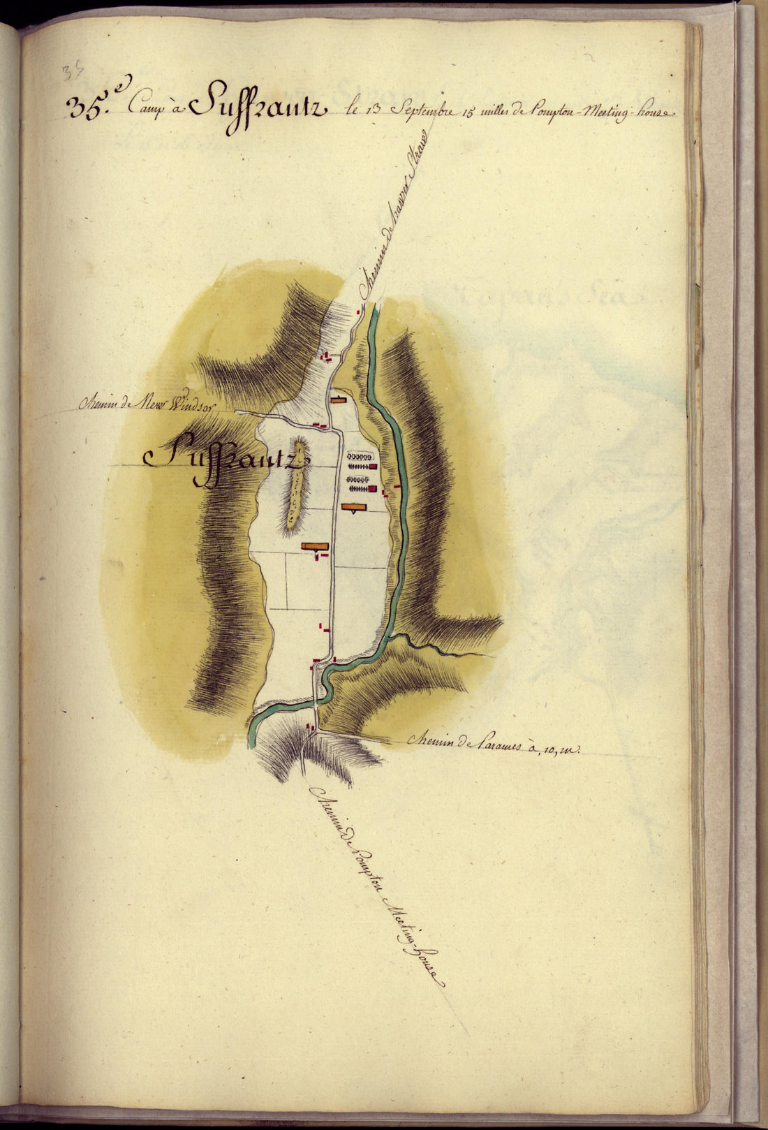 Camp a Suffrantz sic from Amérique Campagne 1782Camp a Suffrantz sic from Amérique Campagne 1782
- Regular price
-
$39.95 $99.95 - Regular price
-
$18.95 - Sale price
-
$39.95 $99.95
-
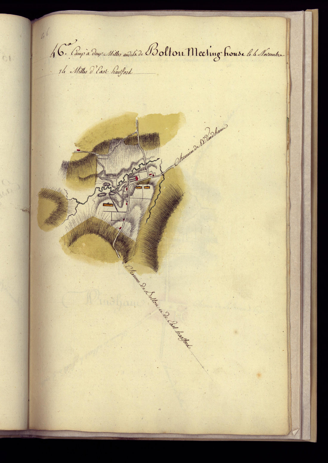 Camp a Bolton Meeting House from Amérique Campagne 1782Camp a Bolton Meeting House from Amérique Campagne 1782
- Regular price
-
$39.95 $88.95 - Regular price
-
$22.95 - Sale price
-
$39.95 $88.95


