2306 products
-
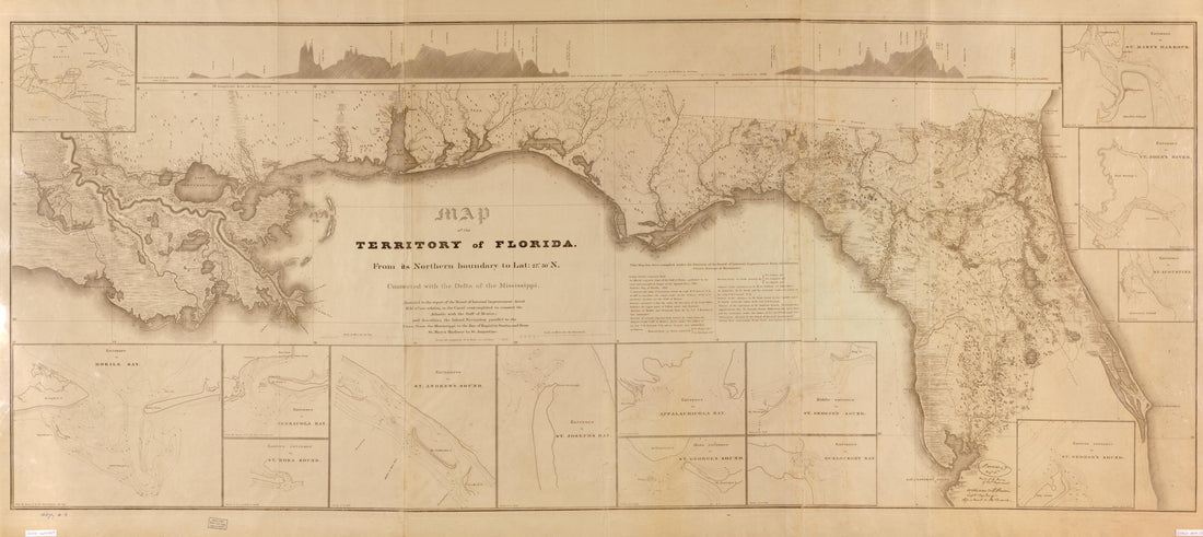 Map of the Territory of Florida, from Its Northern Boundary to Lat. 27⁰30ʹN, Connected With the Delta of the Mississippi : Annexed to the Report of the Board of Internal Improvement Dated Febr. 19th, 1829, Relating to the Canal Contemplated to Conn...Map of the Territory of Florida, from Its Northern Boundary to Lat. 27⁰30ʹN, Connected With the Delta of the Mississippi : Annexed to the Report of the Board of Internal Improvement Dated Febr. 19th, 1829, Relating to the Canal Contemplated to Conn...
- Regular price
-
$46.95 $201.95 - Regular price
-
$41.95 - Sale price
-
$46.95 $201.95
-
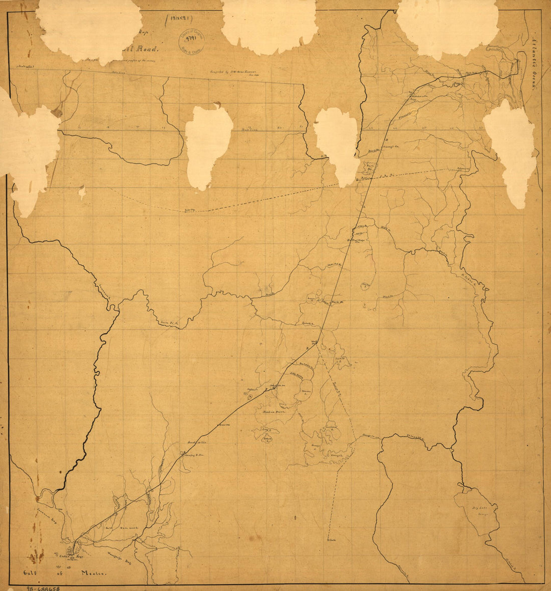 Sketch Map of Northeastern Florida Showing the Florida Railroad and Proposed Connections Jan. 1860Sketch Map of Northeastern Florida Showing the Florida Railroad and Proposed Connections Jan. 1860
- Regular price
-
$43.95 $83.95 - Regular price
-
$38.95 - Sale price
-
$43.95 $83.95
-
 The Coast of West Florida and Louisiana. the Peninsula and Gulf of Florida Or Channel of Bahama With the Bahama Islands 1776The Coast of West Florida and Louisiana. the Peninsula and Gulf of Florida Or Channel of Bahama With the Bahama Islands 1776
- Regular price
-
$46.95 $101.95 - Regular price
-
$41.95 - Sale price
-
$46.95 $101.95
-
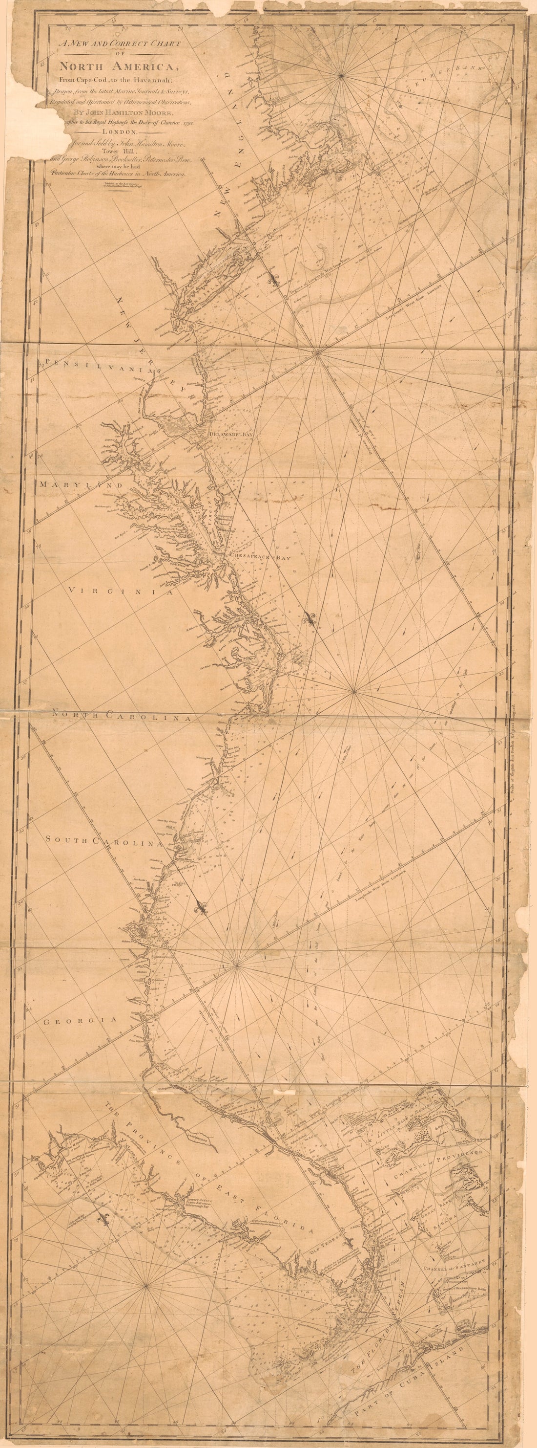 A New and Correct Chart of North America From Cape Cod to the Havannah in 1796A New and Correct Chart of North America From Cape Cod to the Havannah in 1796
- Regular price
-
$46.95 $200.95 - Regular price
-
$41.95 - Sale price
-
$46.95 $200.95
-
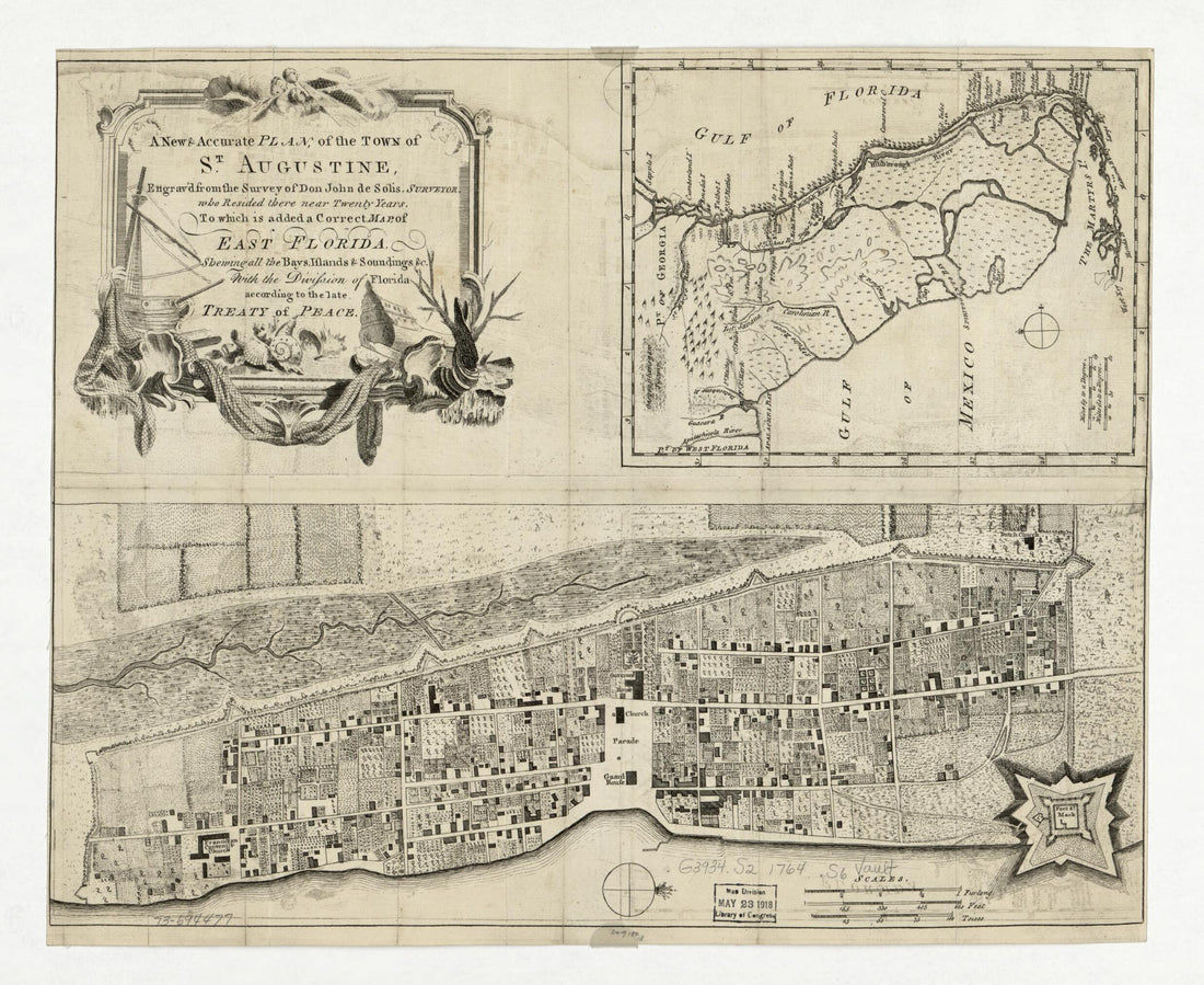 A New & Accurate Plan, of the Town of St. Augustine 1764A New & Accurate Plan, of the Town of St. Augustine 1764
- Regular price
-
$40.95 $83.95 - Regular price
-
$35.95 - Sale price
-
$40.95 $83.95
-
 Map of Landowners Between Escambia Bay and Governor Or Mulata River 1810Map of Landowners Between Escambia Bay and Governor Or Mulata River 1810
- Regular price
-
$43.95 $83.95 - Regular price
-
$38.95 - Sale price
-
$43.95 $83.95
-
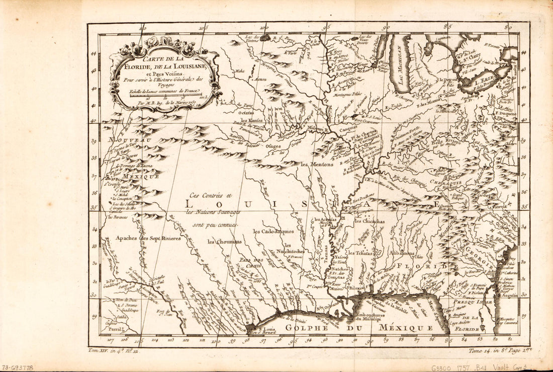 Carte De La Florida, De La Louisiane, Et Pays Voisins : Pour Servir à L'Histoire Générale Des Voyages 1780Carte De La Florida, De La Louisiane, Et Pays Voisins : Pour Servir à L'Histoire Générale Des Voyages 1780
- Regular price
-
$39.95 $99.95 - Regular price
-
$34.95 - Sale price
-
$39.95 $99.95
-
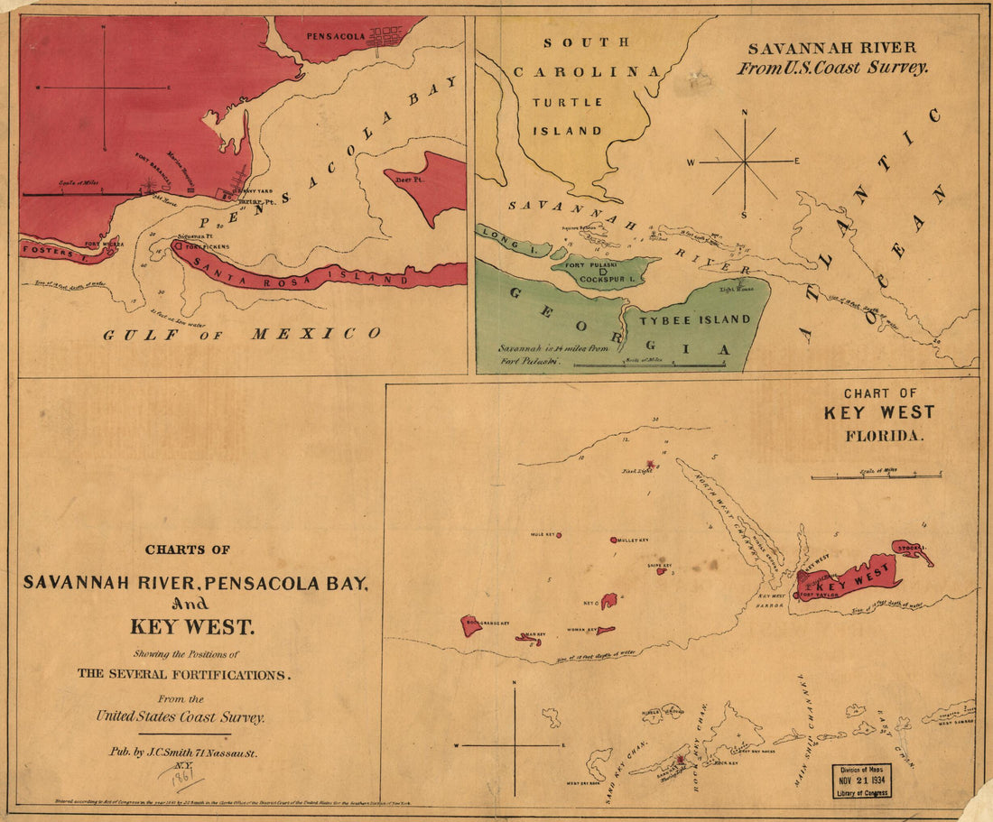 Charts of Savannah River, Pensacola Bay, and Key West. Showing the Positions of the Several Fortifications. from the United States Coast Survey 1861Charts of Savannah River, Pensacola Bay, and Key West. Showing the Positions of the Several Fortifications. from the United States Coast Survey 1861
- Regular price
-
$39.95 $83.95 - Regular price
-
$34.95 - Sale price
-
$39.95 $83.95
-
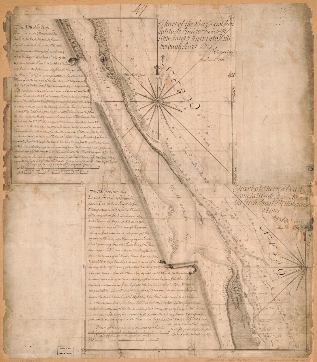 Charts of the Coast of Florida 1765Charts of the Coast of Florida 1765
- Regular price
-
$43.95 $83.95 - Regular price
-
$38.95 - Sale price
-
$43.95 $83.95
-
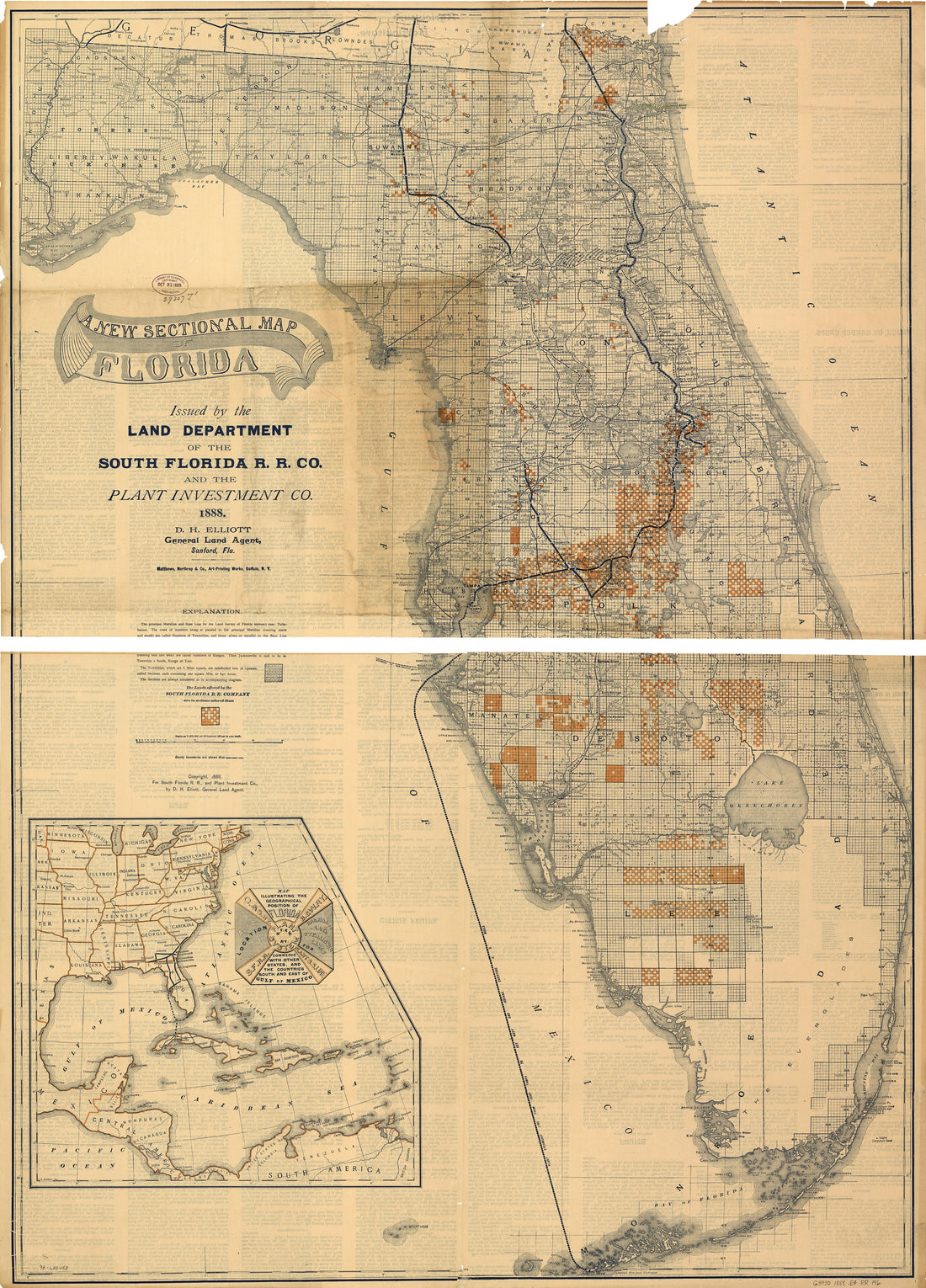 A New Sectional Map of Florida Issued by the Land Department of the South Florida R. R. Co. and the Plant Investment Co 1888A New Sectional Map of Florida Issued by the Land Department of the South Florida R. R. Co. and the Plant Investment Co 1888
- Regular price
-
$43.95 $149.95 - Regular price
-
$38.95 - Sale price
-
$43.95 $149.95
-
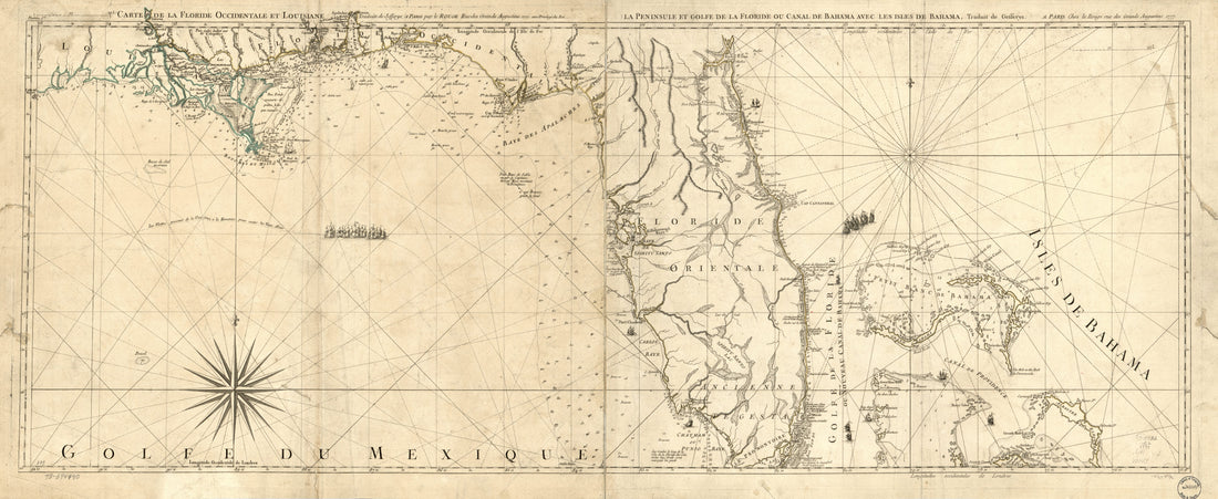 Carte De La Floride Occidentale Et Louisiane. La Peninsule Et Golfe De La Floride Ou Canal De Bahama Avec Les Isles De Bahama 1778Carte De La Floride Occidentale Et Louisiane. La Peninsule Et Golfe De La Floride Ou Canal De Bahama Avec Les Isles De Bahama 1778
- Regular price
-
$46.95 $104.95 - Regular price
-
$41.95 - Sale price
-
$46.95 $104.95
-
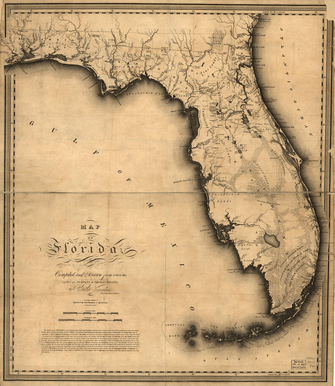 Map of Florida 1823Map of Florida 1823
- Regular price
-
$43.95 $83.95 - Regular price
-
$38.95 - Sale price
-
$43.95 $83.95


