2306 products
-
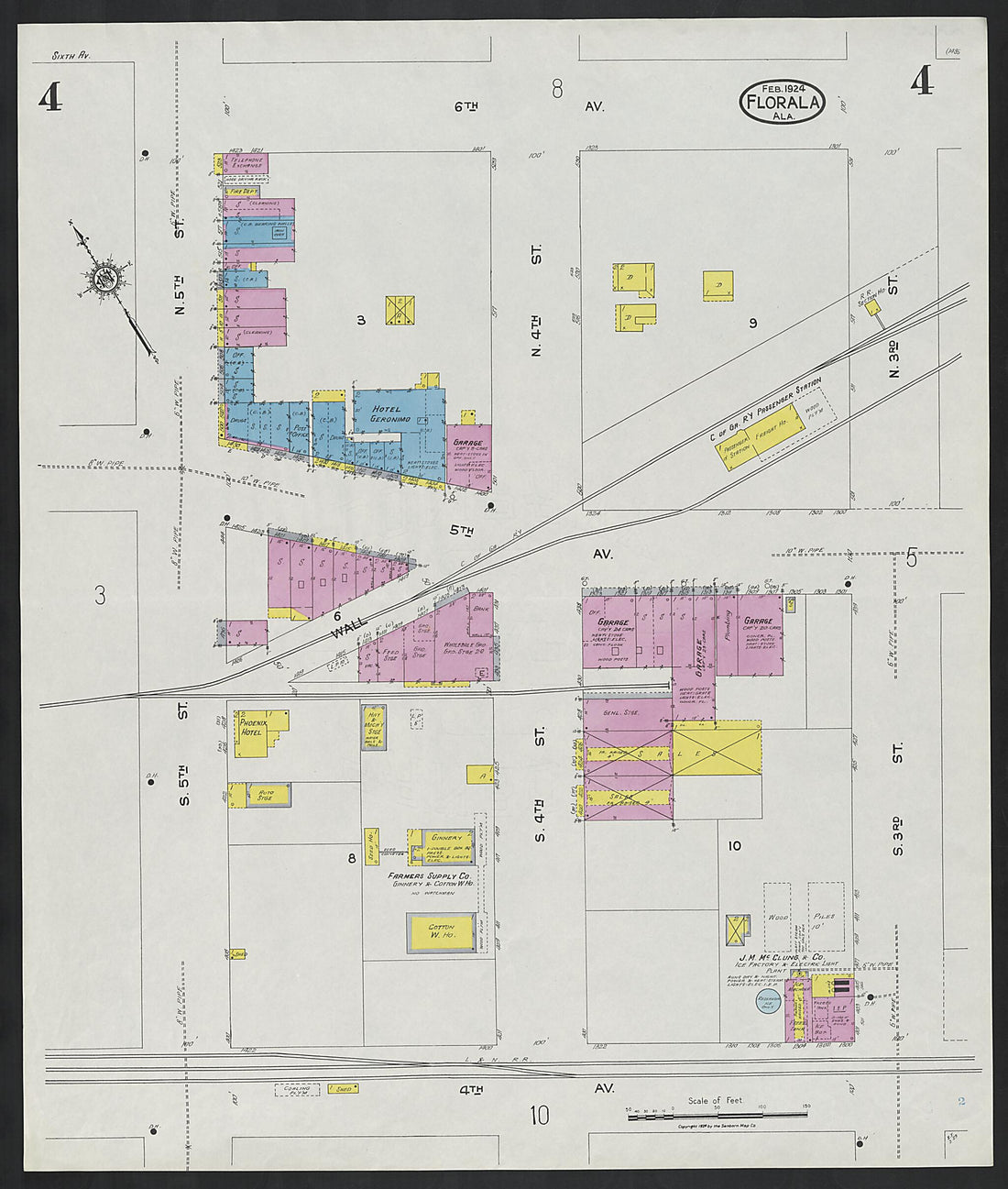 Florala, Covington County, Alabama 1924 (Sheet 4)Florala, Covington County, Alabama 1924 (Sheet 4)
- Regular price
-
$39.95 $83.95 - Regular price
-
$34.95 - Sale price
-
$39.95 $83.95
-
 Florala, Covington County, Alabama 1924 (Sheet 3)Florala, Covington County, Alabama 1924 (Sheet 3)
- Regular price
-
$39.95 $83.95 - Regular price
-
$34.95 - Sale price
-
$39.95 $83.95
-
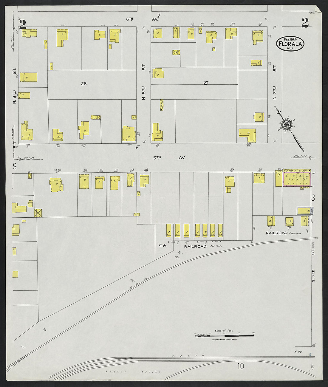 Florala, Covington County, Alabama 1924 (Sheet 2)Florala, Covington County, Alabama 1924 (Sheet 2)
- Regular price
-
$39.95 $83.95 - Regular price
-
$34.95 - Sale price
-
$39.95 $83.95
-
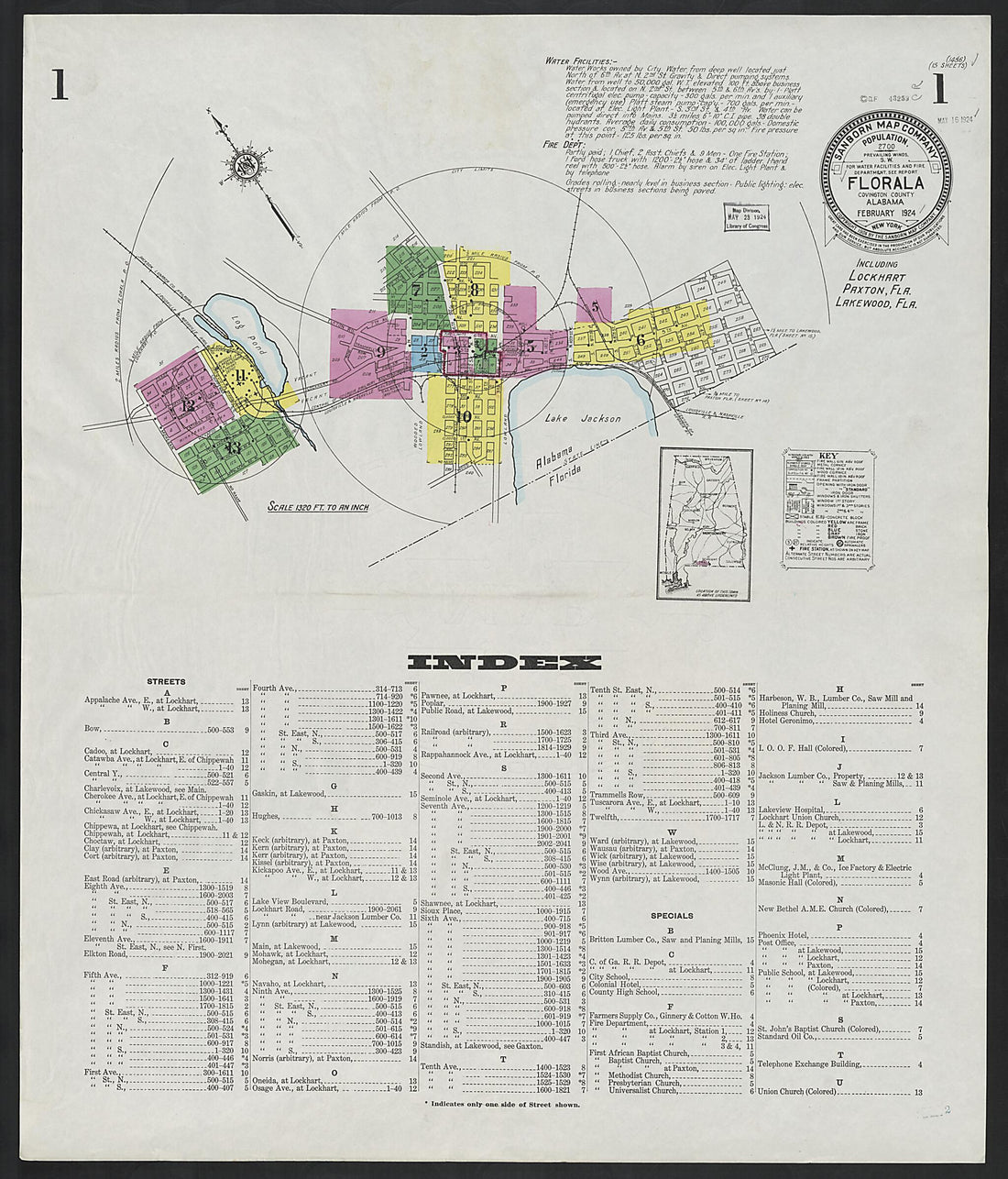 Florala, Covington County, Alabama 1924 (Sheet 1)Florala, Covington County, Alabama 1924 (Sheet 1)
- Regular price
-
$39.95 $83.95 - Regular price
-
$34.95 - Sale price
-
$39.95 $83.95
-
 Tabula Indiae Orientalis Et Regnorum Adjacentium in 1726Tabula Indiae Orientalis Et Regnorum Adjacentium in 1726
- Regular price
-
$43.95 $162.95 - Regular price
-
$38.95 - Sale price
-
$43.95 $162.95
-
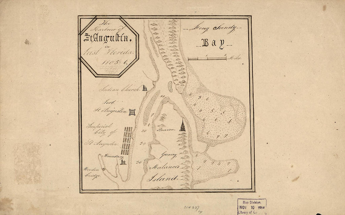 The Harbour of St. Augustín In East Florida. (Harbour of Saint Augustín In East Florida) 1805The Harbour of St. Augustín In East Florida. (Harbour of Saint Augustín In East Florida) 1805
- Regular price
-
$39.95 $99.95 - Regular price
-
$34.95 - Sale price
-
$39.95 $99.95
-
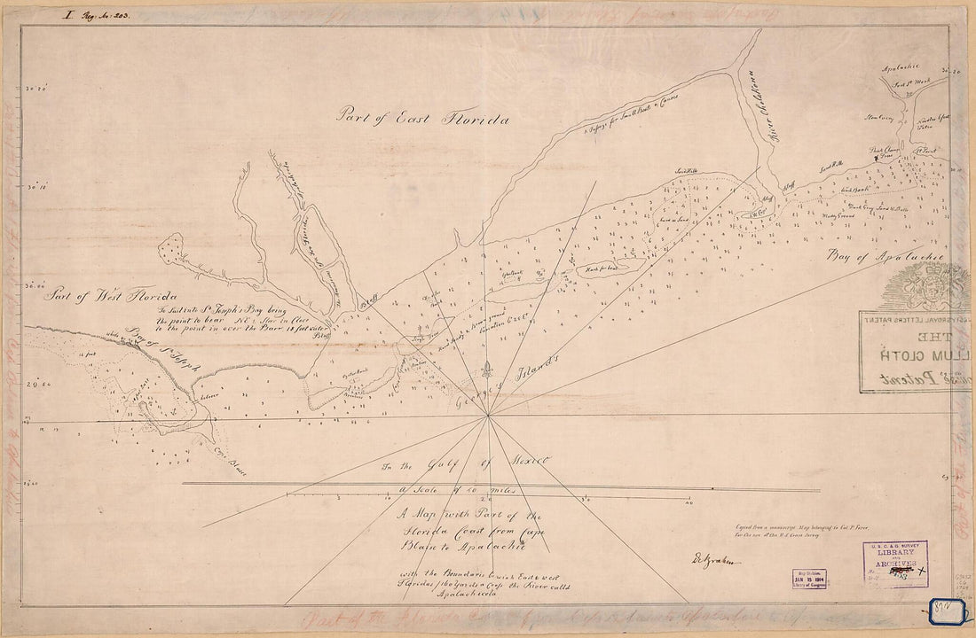 A Map With Part of the Florida Coast from Cape Blaise to Apalachie : With the Boundaries Bewixh East & West Floridas : 160 Yards Across the River Calld Apalachicola. (Florida Coast from Cape Blaise to Apalachie) 1769A Map With Part of the Florida Coast from Cape Blaise to Apalachie : With the Boundaries Bewixh East & West Floridas : 160 Yards Across the River Calld Apalachicola. (Florida Coast from Cape Blaise to Apalachie) 1769
- Regular price
-
$46.95 $135.95 - Regular price
-
$41.95 - Sale price
-
$46.95 $135.95
-
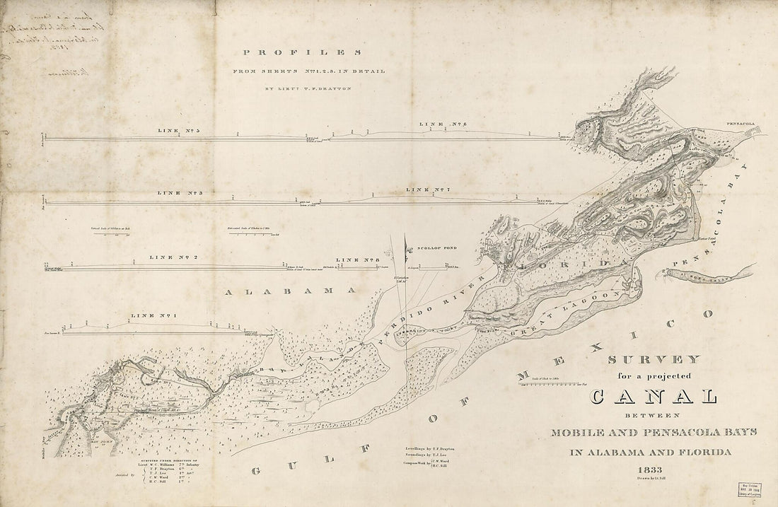 Survey for a Projected Canal Between Mobile and Pensacola Bays In Alabama and Florida 1833Survey for a Projected Canal Between Mobile and Pensacola Bays In Alabama and Florida 1833
- Regular price
-
$46.95 $183.95 - Regular price
-
$41.95 - Sale price
-
$46.95 $183.95
-
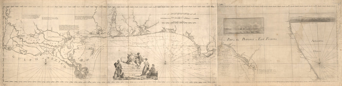 Maps of East and West Florida in 1781Maps of East and West Florida in 1781
- Regular price
-
$46.95 $220.95 - Regular price
-
$41.95 - Sale price
-
$46.95 $220.95
-
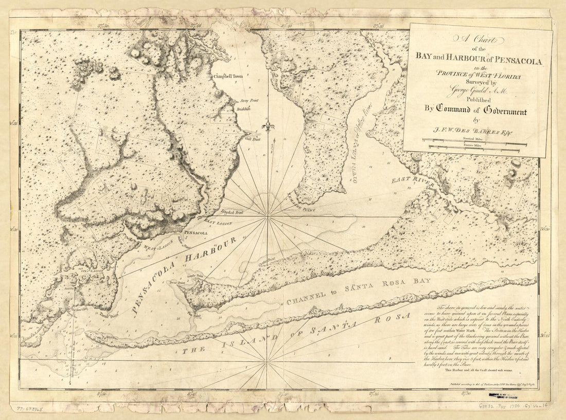 A Chart of the Bay and Harbour of Pensacola In the Province of West Florida 1780A Chart of the Bay and Harbour of Pensacola In the Province of West Florida 1780
- Regular price
-
$43.95 $88.95 - Regular price
-
$38.95 - Sale price
-
$43.95 $88.95
-
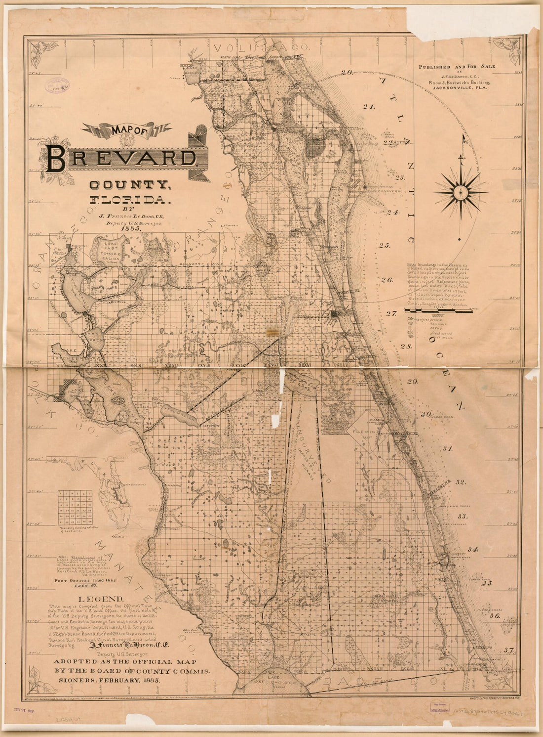 Map of Brevard County, Florida 1885Map of Brevard County, Florida 1885
- Regular price
-
$43.95 $143.95 - Regular price
-
$38.95 - Sale price
-
$43.95 $143.95
-
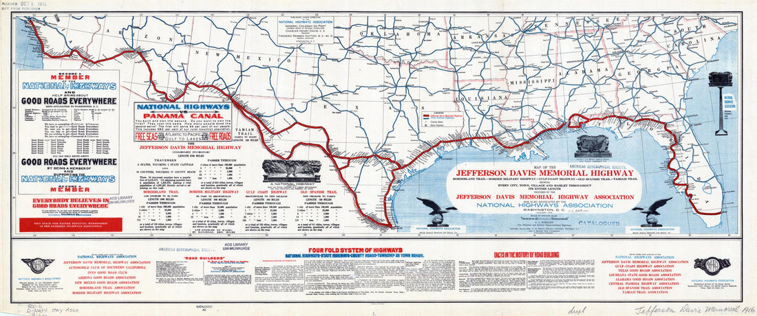 Map of the Jefferson Davis Memorial Highway. (Border Military Highway - Gulf-Coast Highway - Old Spanish Trail - Tamiam Trail, Showing Every City, Town, Village and Hamlet Throughout Its Entire Length) 1916Map of the Jefferson Davis Memorial Highway. (Border Military Highway - Gulf-Coast Highway - Old Spanish Trail - Tamiam Trail, Showing Every City, Town, Village and Hamlet Throughout Its Entire Length) 1916
- Regular price
-
$46.95 $99.95 - Regular price
-
$41.95 - Sale price
-
$46.95 $99.95


