1310 products
-
 Lloyd's Map of the Southern States Showing All the Railroads, Their Stations & Distances, Also the Counties, Towns, Villages, Harbors, Rivers, and Forts in 1862Lloyd's Map of the Southern States Showing All the Railroads, Their Stations & Distances, Also the Counties, Towns, Villages, Harbors, Rivers, and Forts in 1862
- Regular price
-
$43.95 $210.95 - Regular price
-
$32.95 - Sale price
-
$43.95 $210.95
-
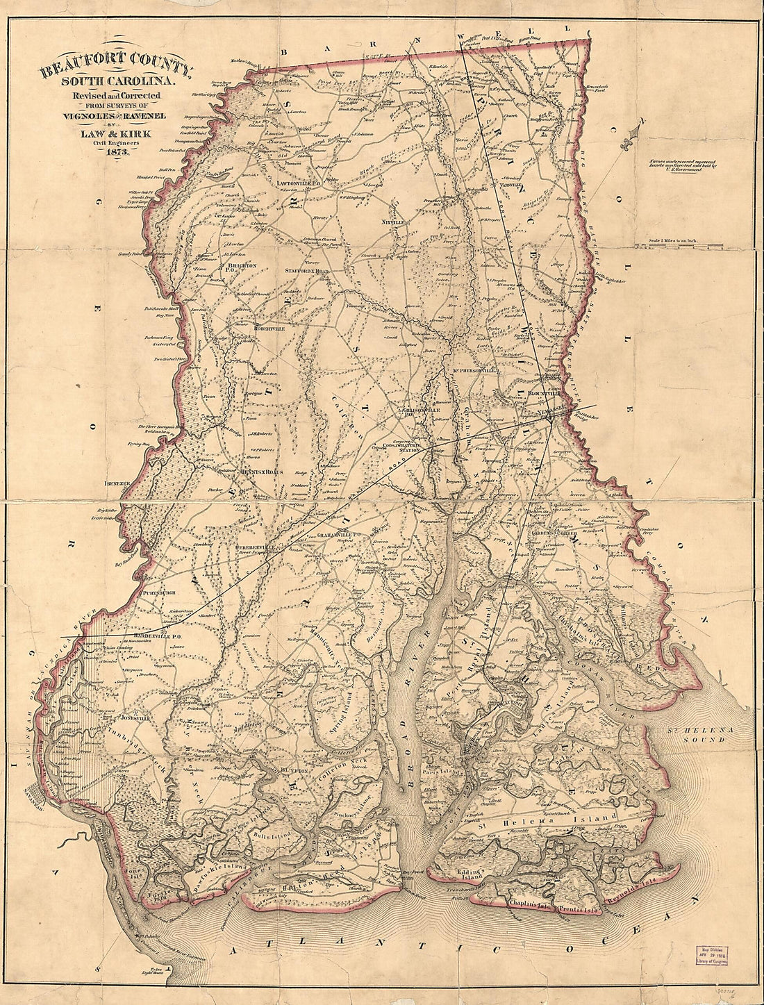 Beaufort County, South Carolina 1873Beaufort County, South Carolina 1873
- Regular price
-
$43.95 $190.95 - Regular price
-
$38.95 - Sale price
-
$43.95 $190.95
-
 Sketch of a Part of the Coast of Georgia from Savannah River to Ossabaw Sound Showing the Relative Positions of the U.S. Iron Clad Steamer Montauk & the Rebel Fort McAllister During the Bombardment of Feb 1st 1863Sketch of a Part of the Coast of Georgia from Savannah River to Ossabaw Sound Showing the Relative Positions of the U.S. Iron Clad Steamer Montauk & the Rebel Fort McAllister During the Bombardment of Feb 1st 1863
- Regular price
-
$39.95 $83.95 - Regular price
-
$29.95 - Sale price
-
$39.95 $83.95
-
 Fortifications Around Charleston, H.B. 1863Fortifications Around Charleston, H.B. 1863
- Regular price
-
$39.95 $83.95 - Regular price
-
$29.95 - Sale price
-
$39.95 $83.95
-
 Charleston Harbor S.C. Bombardment of Fort Sumter 1861Charleston Harbor S.C. Bombardment of Fort Sumter 1861
- Regular price
-
$39.95 $99.95 - Regular price
-
$29.95 - Sale price
-
$39.95 $99.95
-
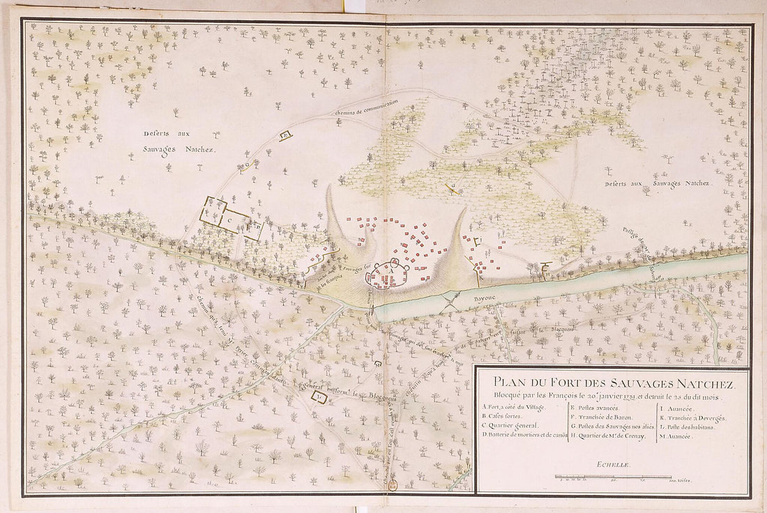 Plan of the Natchez Fort, Blockaded by the French On January 20, 1731, and Destroyed On the 25th of Said Month. (Plan Du Fort Des Sauvages Natchez Blocqué Par Les François Le 20e Janvier 1731 Et Détruit Le 25 Du Dit Mois)Plan of the Natchez Fort, Blockaded by the French On January 20, 1731, and Destroyed On the 25th of Said Month. (Plan Du Fort Des Sauvages Natchez Blocqué Par Les François Le 20e Janvier 1731 Et Détruit Le 25 Du Dit Mois)
- Regular price
-
$39.95 $99.95 - Regular price
-
$34.95 - Sale price
-
$39.95 $99.95
-
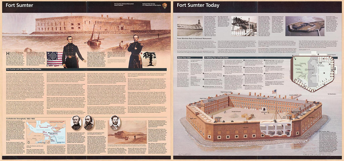 Fort Sumter National Monument 1861Fort Sumter National Monument 1861
- Regular price
-
$46.95 $124.95 - Regular price
-
$41.95 - Sale price
-
$46.95 $124.95
-
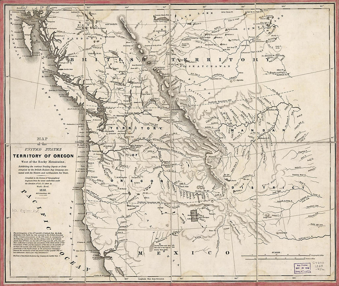 Map of the United States, Territory of Oregon, West of the Rocky Mountains : Exhibiting the Various Trading Depots Or Forts Occupied by the British Hudson Bay Company, Connected With the Western and Northwestern Fur Trade 1838Map of the United States, Territory of Oregon, West of the Rocky Mountains : Exhibiting the Various Trading Depots Or Forts Occupied by the British Hudson Bay Company, Connected With the Western and Northwestern Fur Trade 1838
- Regular price
-
$43.95 $89.95 - Regular price
-
$38.95 - Sale price
-
$43.95 $89.95
-
 Plan of the Attack On Fort William Henry and Ticonderoga; Showing the Road from Fort Edward, Montcalm's Camp and Wharf of Landing, &c 1757Plan of the Attack On Fort William Henry and Ticonderoga; Showing the Road from Fort Edward, Montcalm's Camp and Wharf of Landing, &c 1757
- Regular price
-
$39.95 $99.95 - Regular price
-
$29.95 - Sale price
-
$39.95 $99.95
-
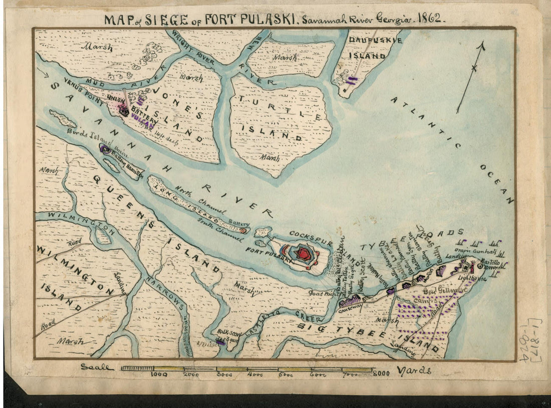 Map of Siege of Fort Pulaski : Savannah River Georgia. 1862Map of Siege of Fort Pulaski : Savannah River Georgia. 1862
- Regular price
-
$39.95 $88.95 - Regular price
-
$29.95 - Sale price
-
$39.95 $88.95
-
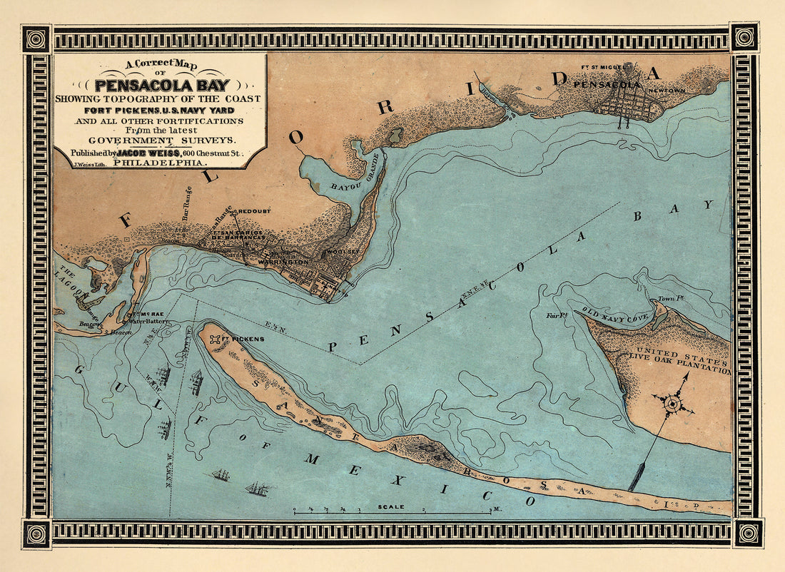 A Correct Map of Pensacola Bay Showing Topography of the Coast, Fort Pickens, U.S. Navy Yard, and All Other Fortifications from the Latest Government Surveys 1860A Correct Map of Pensacola Bay Showing Topography of the Coast, Fort Pickens, U.S. Navy Yard, and All Other Fortifications from the Latest Government Surveys 1860
- Regular price
-
$39.95 $88.95 - Regular price
-
$34.95 - Sale price
-
$39.95 $88.95
-
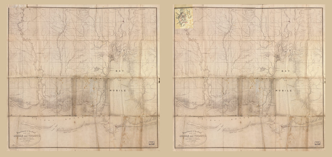 Mobile and Vicinity in 1863Mobile and Vicinity in 1863
- Regular price
-
$46.95 $243.95 - Regular price
-
$41.95 - Sale price
-
$46.95 $243.95


