1310 products
-
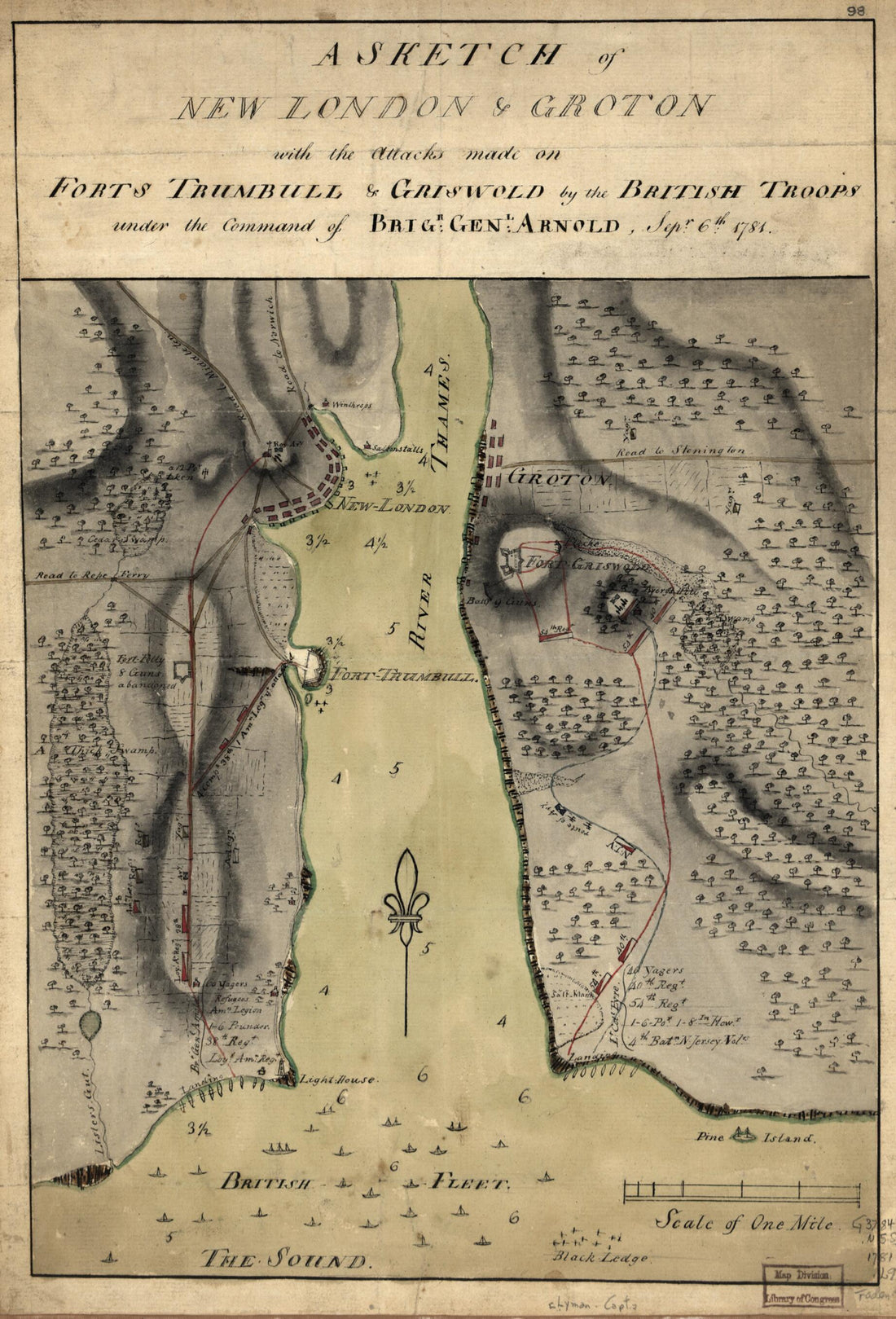 A Sketch of New London & Groton With the Attacks Made On Forts Trumbull & Griswold by the British Troops Under the Command of Brigr. Genl. Arnold, Sept. 6th. 1781A Sketch of New London & Groton With the Attacks Made On Forts Trumbull & Griswold by the British Troops Under the Command of Brigr. Genl. Arnold, Sept. 6th. 1781
- Regular price
-
$39.95 $99.95 - Regular price
-
$29.95 - Sale price
-
$39.95 $99.95
-
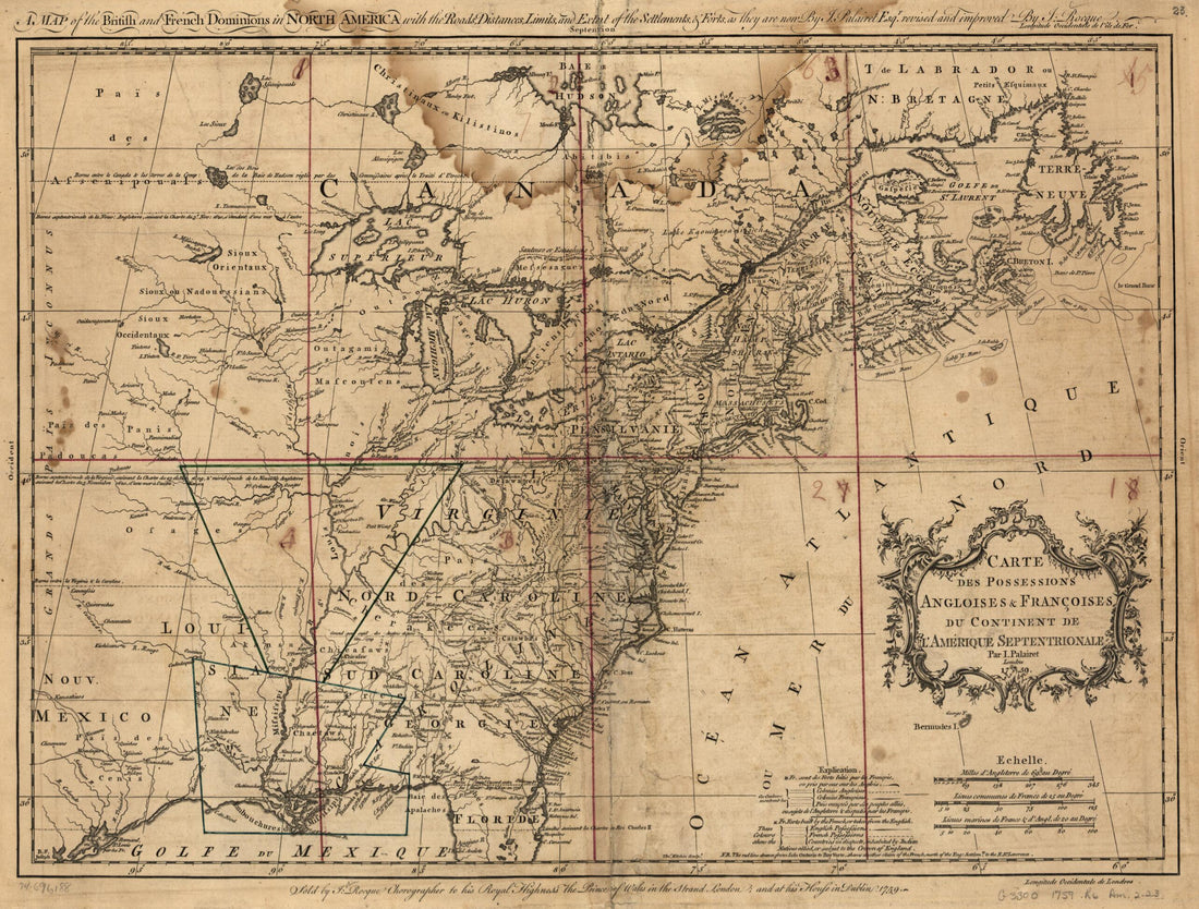 A Map of the British and French Dominions In North America With the Roads, Distances, Limits, and Extent of the Settlements, & Forts, As They Are Now 1759A Map of the British and French Dominions In North America With the Roads, Distances, Limits, and Extent of the Settlements, & Forts, As They Are Now 1759
- Regular price
-
$43.95 $88.95 - Regular price
-
$32.95 - Sale price
-
$43.95 $88.95
-
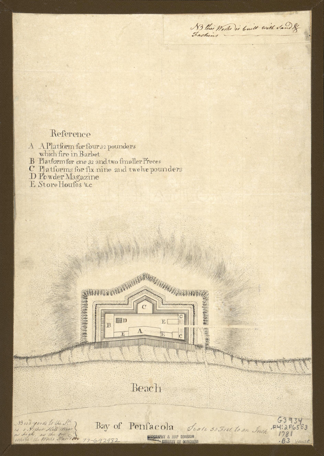 Bay of Pensacola, Fortification 1781Bay of Pensacola, Fortification 1781
- Regular price
-
$39.95 $88.95 - Regular price
-
$29.95 - Sale price
-
$39.95 $88.95
-
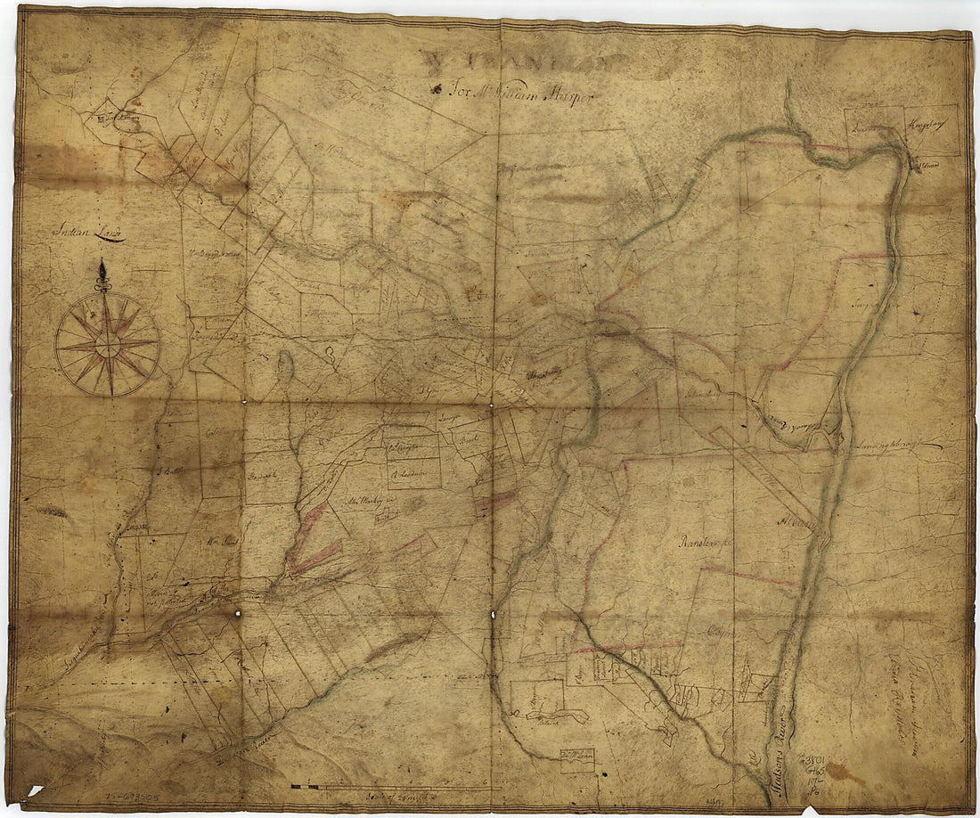 A Portion of New York from the Hudson River West to the Unadilla Branch of the Susquehanna River; from the Delaware River North to Fort Stanwix 1700A Portion of New York from the Hudson River West to the Unadilla Branch of the Susquehanna River; from the Delaware River North to Fort Stanwix 1700
- Regular price
-
$39.95 $103.95 - Regular price
-
$34.95 - Sale price
-
$39.95 $103.95
-
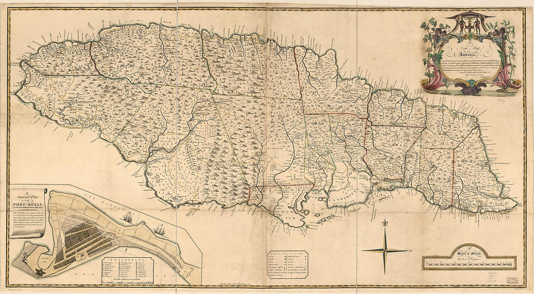 A New Map of Jamaica; In Which the Several Towns, Forts, and Settlements, Are Accurately Laid Down As Well As Ye Situations & Depts. of Ye Most Noted Harbours & Anchoring Places 1755A New Map of Jamaica; In Which the Several Towns, Forts, and Settlements, Are Accurately Laid Down As Well As Ye Situations & Depts. of Ye Most Noted Harbours & Anchoring Places 1755
- Regular price
-
$46.95 $300.95 - Regular price
-
$41.95 - Sale price
-
$46.95 $300.95
-
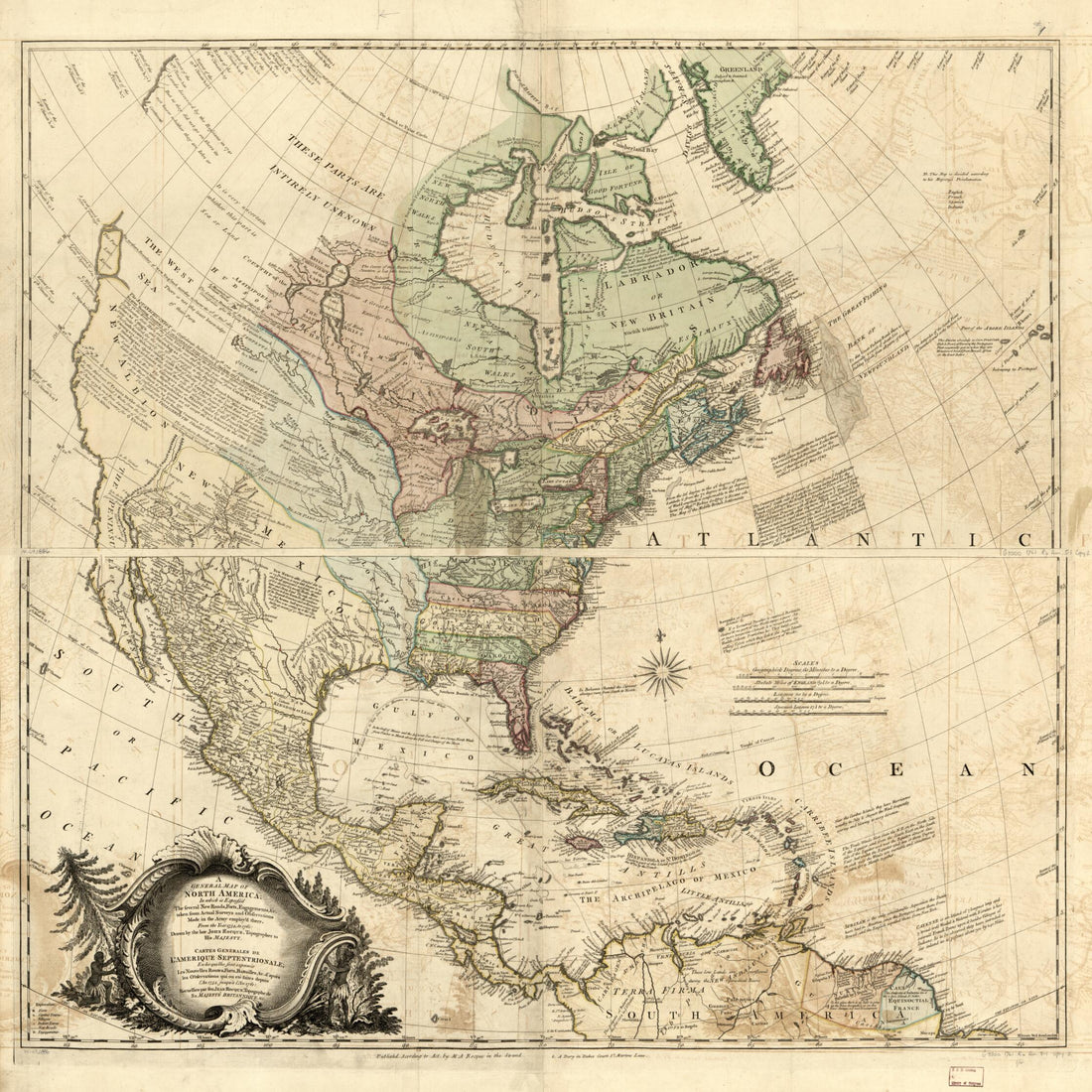 A General Map of North America; In Which Is Express'd the Several New Roads, Forts, Engagements, &c. Taken from Actual Surveys and Observations Made In the Army Employ'd There, from the Year 1754, to 1761:A General Map of North America; In Which Is Express'd the Several New Roads, Forts, Engagements, &c. Taken from Actual Surveys and Observations Made In the Army Employ'd There, from the Year 1754, to 1761:
- Regular price
-
$39.95 $142.95 - Regular price
-
$34.95 - Sale price
-
$39.95 $142.95
-
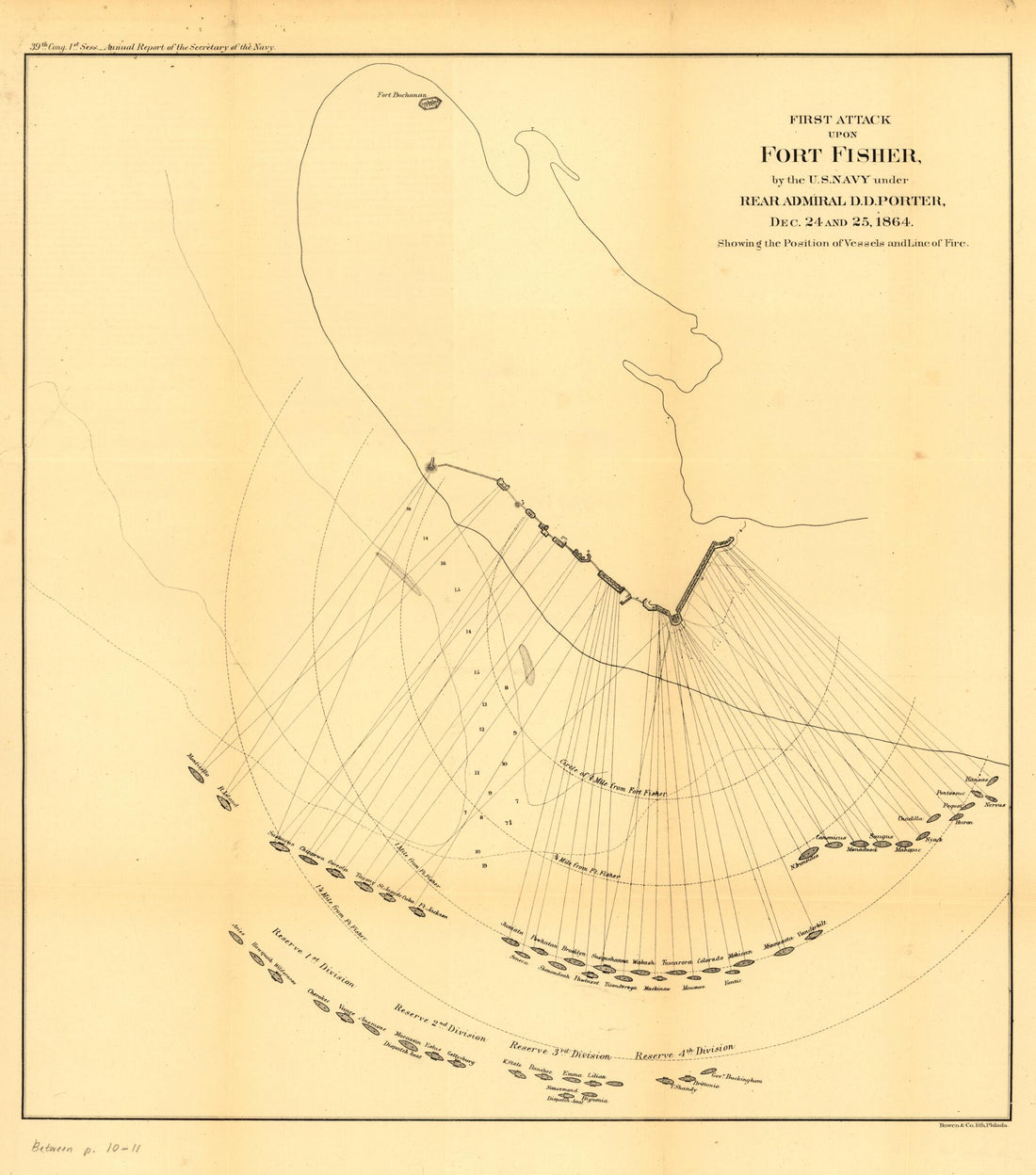 First Attack Upon Fort Fisher, by the U.S. Navy Under Rear Admiral D. D. Porter, Dec. 24 and 25, 1864. Showing the Position of Vessels and Line of Fire 1865First Attack Upon Fort Fisher, by the U.S. Navy Under Rear Admiral D. D. Porter, Dec. 24 and 25, 1864. Showing the Position of Vessels and Line of Fire 1865
- Regular price
-
$39.95 $83.95 - Regular price
-
$34.95 - Sale price
-
$39.95 $83.95
-
 A New and Accurate Map of the Island of Antigua Or Antego, Taken from Surveys, and Adjusted by Astronl. Observations. Containing All the Towns, Parish Churches, Forts, Castles, Windmills, Roads, &c 1752A New and Accurate Map of the Island of Antigua Or Antego, Taken from Surveys, and Adjusted by Astronl. Observations. Containing All the Towns, Parish Churches, Forts, Castles, Windmills, Roads, &c 1752
- Regular price
-
$39.95 $99.95 - Regular price
-
$29.95 - Sale price
-
$39.95 $99.95
-
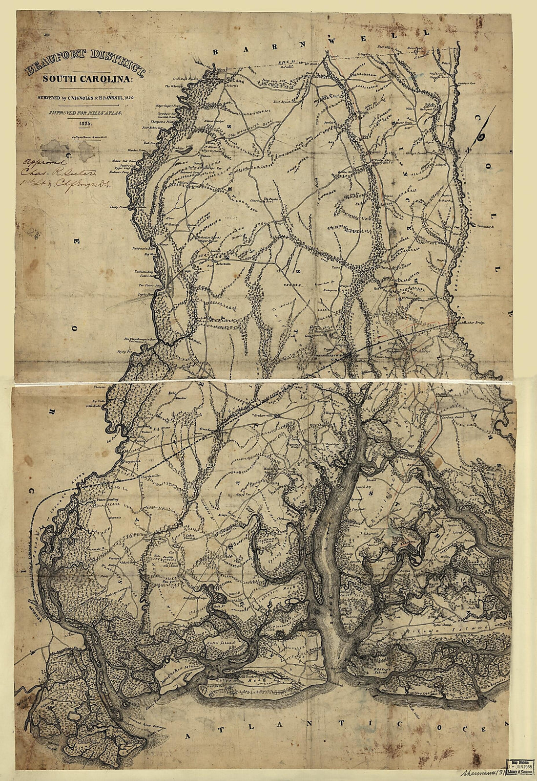 Beaufort District, South Carolina 1825Beaufort District, South Carolina 1825
- Regular price
-
$46.95 $181.95 - Regular price
-
$41.95 - Sale price
-
$46.95 $181.95
-
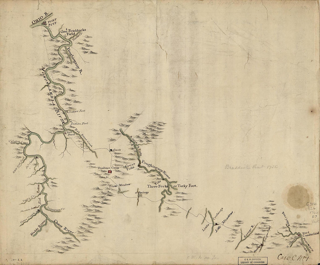 Braddock's Route, 1755, Fort Cumberland to Fort Pitt 1760Braddock's Route, 1755, Fort Cumberland to Fort Pitt 1760
- Regular price
-
$39.95 $83.95 - Regular price
-
$29.95 - Sale price
-
$39.95 $83.95
-
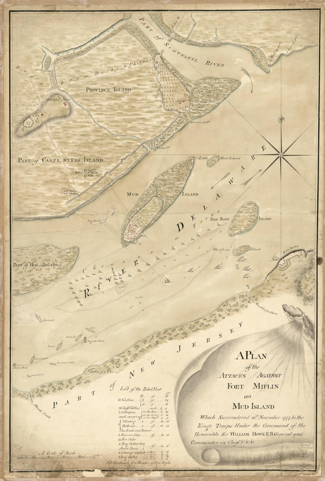 A Plan of the Attacks Against Fort Miflin On Mud Island Which Surrendered 16th, November 1777 to the Kings Troops Under the Command of the Honorable Sir William Howe K.B. General and Commander In Chief &c., &cA Plan of the Attacks Against Fort Miflin On Mud Island Which Surrendered 16th, November 1777 to the Kings Troops Under the Command of the Honorable Sir William Howe K.B. General and Commander In Chief &c., &c
- Regular price
-
$46.95 $99.95 - Regular price
-
$41.95 - Sale price
-
$46.95 $99.95
-
 An Exact Chart of the River St. Laurence, from Fort Frontenac to the Island of Anticosti Shewing the Soundings, Rocks, Shoals &c With Views of the Lands and All Necessary Instructions for Navigating That River to Quebec 1775An Exact Chart of the River St. Laurence, from Fort Frontenac to the Island of Anticosti Shewing the Soundings, Rocks, Shoals &c With Views of the Lands and All Necessary Instructions for Navigating That River to Quebec 1775
- Regular price
-
$46.95 $208.95 - Regular price
-
$41.95 - Sale price
-
$46.95 $208.95


