1310 products
-
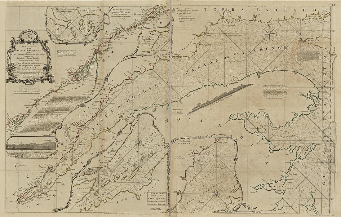 An Exact Chart of the River St. Laurence, from Fort Frontenac to the Island of Anticosti Shewing the Soundings, Rocks, Shoals &c With Views of the Lands and All Necessary Instructions for Navigating That River to Quebec 1771An Exact Chart of the River St. Laurence, from Fort Frontenac to the Island of Anticosti Shewing the Soundings, Rocks, Shoals &c With Views of the Lands and All Necessary Instructions for Navigating That River to Quebec 1771
- Regular price
-
$46.95 $216.95 - Regular price
-
$41.95 - Sale price
-
$46.95 $216.95
-
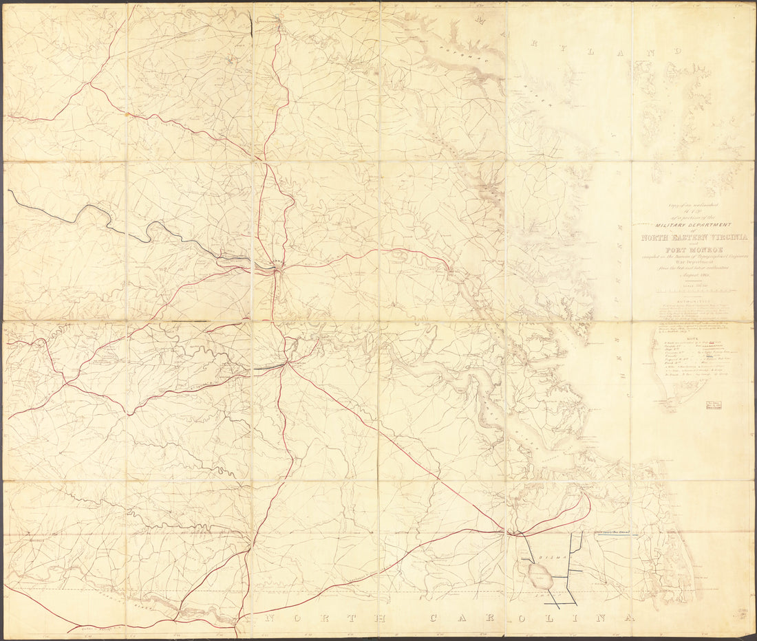 Copy of an Unfinished Map of a Portion of the Military Department of North Eastern Virginia and Fort Monroe in 1861Copy of an Unfinished Map of a Portion of the Military Department of North Eastern Virginia and Fort Monroe in 1861
- Regular price
-
$39.95 $206.95 - Regular price
-
$34.95 - Sale price
-
$39.95 $206.95
-
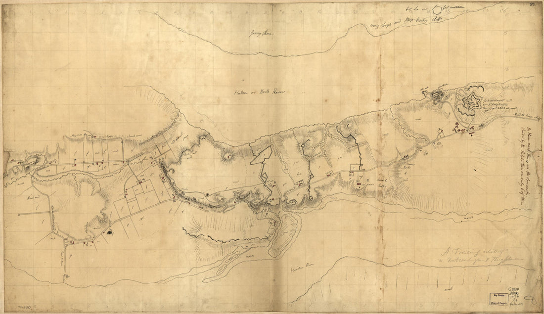 A Tracing Relating to Fort Washington Or Knyphausen 1776A Tracing Relating to Fort Washington Or Knyphausen 1776
- Regular price
-
$46.95 $99.95 - Regular price
-
$41.95 - Sale price
-
$46.95 $99.95
-
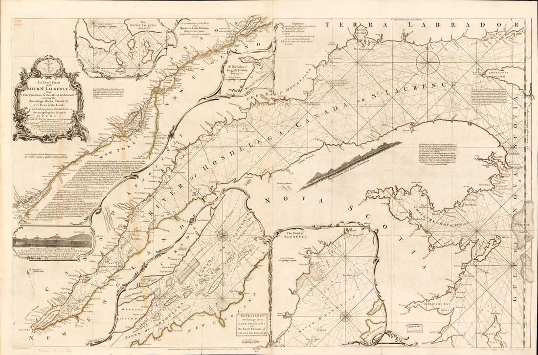 An Exact Chart of the River St. Laurence, from Fort Frontenac to the Island of Anticosti Shewing the Soundings, Rocks, Shoals &c With Views of the Lands and All Necessary Instructions for Navigating That River to Quebec 1782An Exact Chart of the River St. Laurence, from Fort Frontenac to the Island of Anticosti Shewing the Soundings, Rocks, Shoals &c With Views of the Lands and All Necessary Instructions for Navigating That River to Quebec 1782
- Regular price
-
$46.95 $101.95 - Regular price
-
$41.95 - Sale price
-
$46.95 $101.95
-
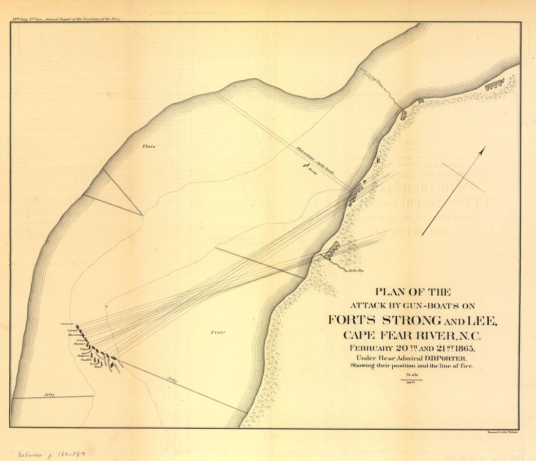 Boats On Forts Strong and Lee, Cape Fear River, N.C. February 20th and 21st 1865Boats On Forts Strong and Lee, Cape Fear River, N.C. February 20th and 21st 1865
- Regular price
-
$39.95 $83.95 - Regular price
-
$29.95 - Sale price
-
$39.95 $83.95
-
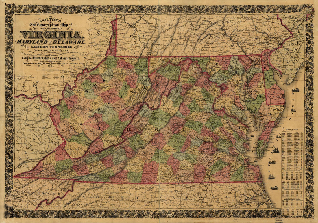 Colton's New Topographical Map of the States of Virginia, Maryland and Delaware, Showing Also Eastern Tennessee & Parts of Other Adjoining States, All the Fortifications, Military Stations, Rail Roads, Common Roads and Other Internal Improvements in 1864Colton's New Topographical Map of the States of Virginia, Maryland and Delaware, Showing Also Eastern Tennessee & Parts of Other Adjoining States, All the Fortifications, Military Stations, Rail Roads, Common Roads and Other Internal Improvements in 1864
- Regular price
-
$46.95 $146.95 - Regular price
-
$41.95 - Sale price
-
$46.95 $146.95
-
 Approaches to Fort Hindman, Arkansas Post, On the Arkansas River : Captured by the U.S. Mississippi Squadron, Under Command of Act'g. Rear Admiral David D. Porter, U.S.N., January 11th, 1863Approaches to Fort Hindman, Arkansas Post, On the Arkansas River : Captured by the U.S. Mississippi Squadron, Under Command of Act'g. Rear Admiral David D. Porter, U.S.N., January 11th, 1863
- Regular price
-
$39.95 $99.95 - Regular price
-
$29.95 - Sale price
-
$39.95 $99.95
-
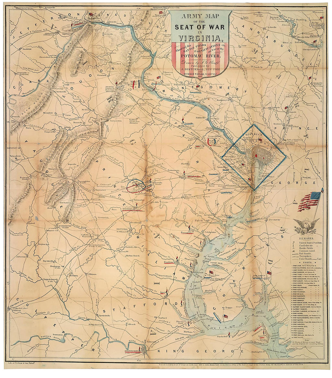 Army Map of the Seat of War In Virginia : Showing the Battle Fields, Fortifications Etc. On & Near the Potomac River 1862Army Map of the Seat of War In Virginia : Showing the Battle Fields, Fortifications Etc. On & Near the Potomac River 1862
- Regular price
-
$39.95 $166.95 - Regular price
-
$34.95 - Sale price
-
$39.95 $166.95
-
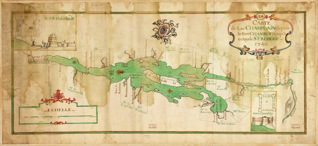 Carte Du Lac Champlain Depuis Le Fort Chambly Jusqu'a Celuyde St. Fréderic 1740Carte Du Lac Champlain Depuis Le Fort Chambly Jusqu'a Celuyde St. Fréderic 1740
- Regular price
-
$46.95 $99.95 - Regular price
-
$41.95 - Sale price
-
$46.95 $99.95
-
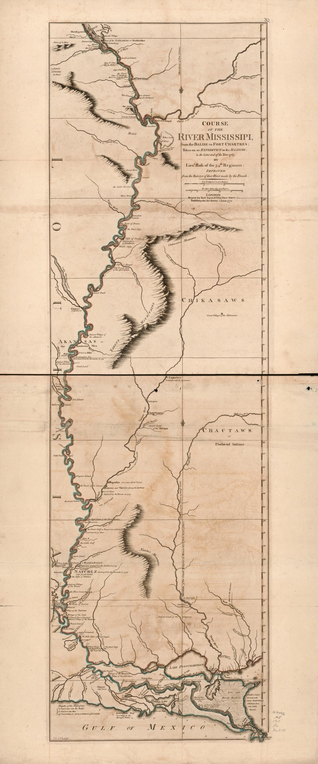 Course of the River Mississippi, From the Balise to Fort Chartres; Taken On an Expedition to the Illinois, In the Latter End of the Year in 1765Course of the River Mississippi, From the Balise to Fort Chartres; Taken On an Expedition to the Illinois, In the Latter End of the Year in 1765
- Regular price
-
$46.95 $99.95 - Regular price
-
$41.95 - Sale price
-
$46.95 $99.95
-
 An Accurate Map of the Island of Barbadoes. Drawn from an Actual Survey Containing All the Towns, Churches, Fortifications, Roads, Paths, Plantations &c 1752An Accurate Map of the Island of Barbadoes. Drawn from an Actual Survey Containing All the Towns, Churches, Fortifications, Roads, Paths, Plantations &c 1752
- Regular price
-
$39.95 $83.95 - Regular price
-
$30.95 - Sale price
-
$39.95 $83.95
-
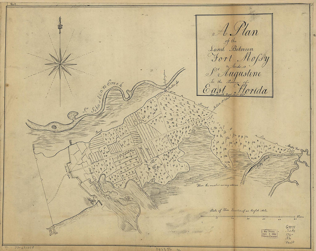 A Plan of the Land Between Fort Mossy and St. Augustine In the Province of East Florida 1760A Plan of the Land Between Fort Mossy and St. Augustine In the Province of East Florida 1760
- Regular price
-
$39.95 $83.95 - Regular price
-
$29.95 - Sale price
-
$39.95 $83.95


