174 products
-
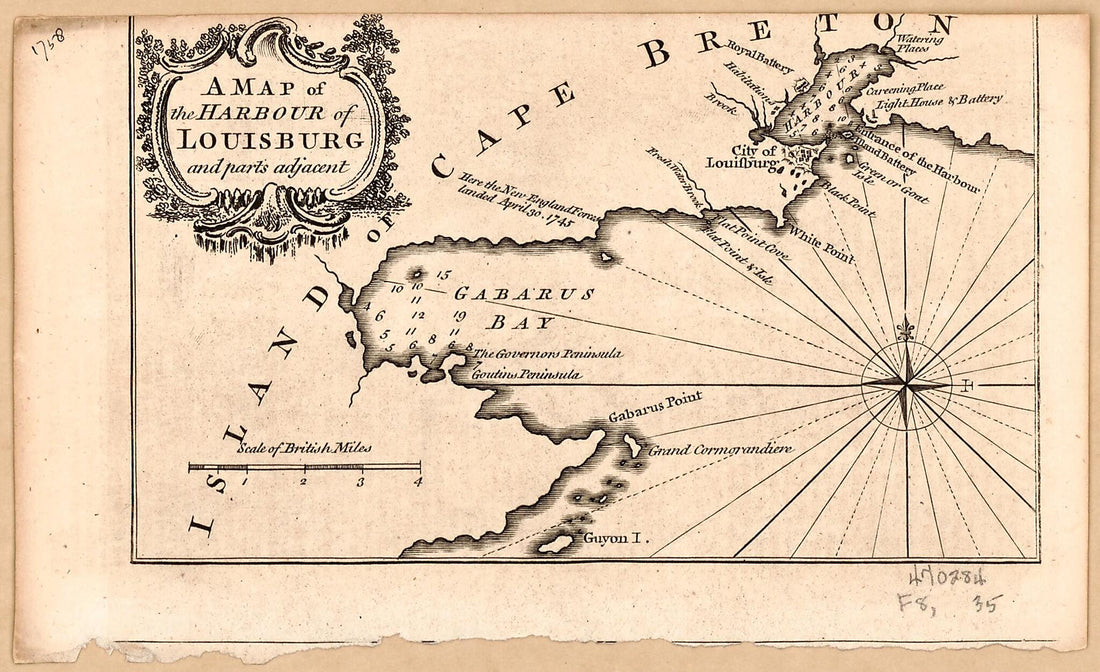 A Map of the Harbour of Louisburg and Parts Adjacent 1758A Map of the Harbour of Louisburg and Parts Adjacent 1758
- Regular price
-
$39.95 $99.95 - Regular price
-
$34.95 - Sale price
-
$39.95 $99.95
-
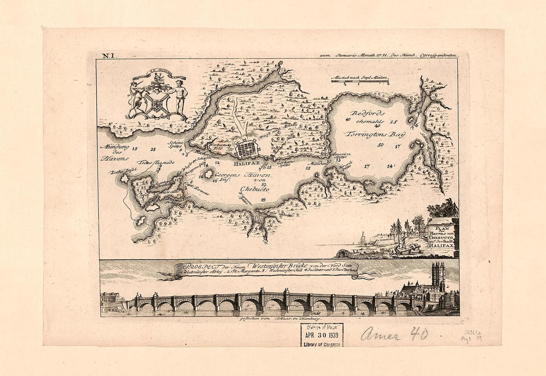 Plan Des Havens Von Chebucto Und Der Stadt Halifax 1751Plan Des Havens Von Chebucto Und Der Stadt Halifax 1751
- Regular price
-
$39.95 $99.95 - Regular price
-
$34.95 - Sale price
-
$39.95 $99.95
-
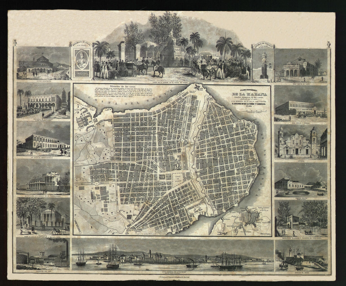 Picturesque Map of Havana With House Numbers. (Plano Pintoresco De La Habana Con Los Números De Las Casas) 1849Picturesque Map of Havana With House Numbers. (Plano Pintoresco De La Habana Con Los Números De Las Casas) 1849
- Regular price
-
$43.95 $83.95 - Regular price
-
$38.95 - Sale price
-
$43.95 $83.95
-
 A Plan of the Harbour and Town of Louisbourg In the Island of Cape Breton 1758A Plan of the Harbour and Town of Louisbourg In the Island of Cape Breton 1758
- Regular price
-
$39.95 $99.95 - Regular price
-
$34.95 - Sale price
-
$39.95 $99.95
-
 Chart of the Head of Navigation of the Potomac River Shewing the Route of the Alexandria Canal : Made In Pursuance of a Resolution of the Alex'a Canal Company Oct. 1838Chart of the Head of Navigation of the Potomac River Shewing the Route of the Alexandria Canal : Made In Pursuance of a Resolution of the Alex'a Canal Company Oct. 1838
- Regular price
-
$46.95 $99.95 - Regular price
-
$41.95 - Sale price
-
$46.95 $99.95
-
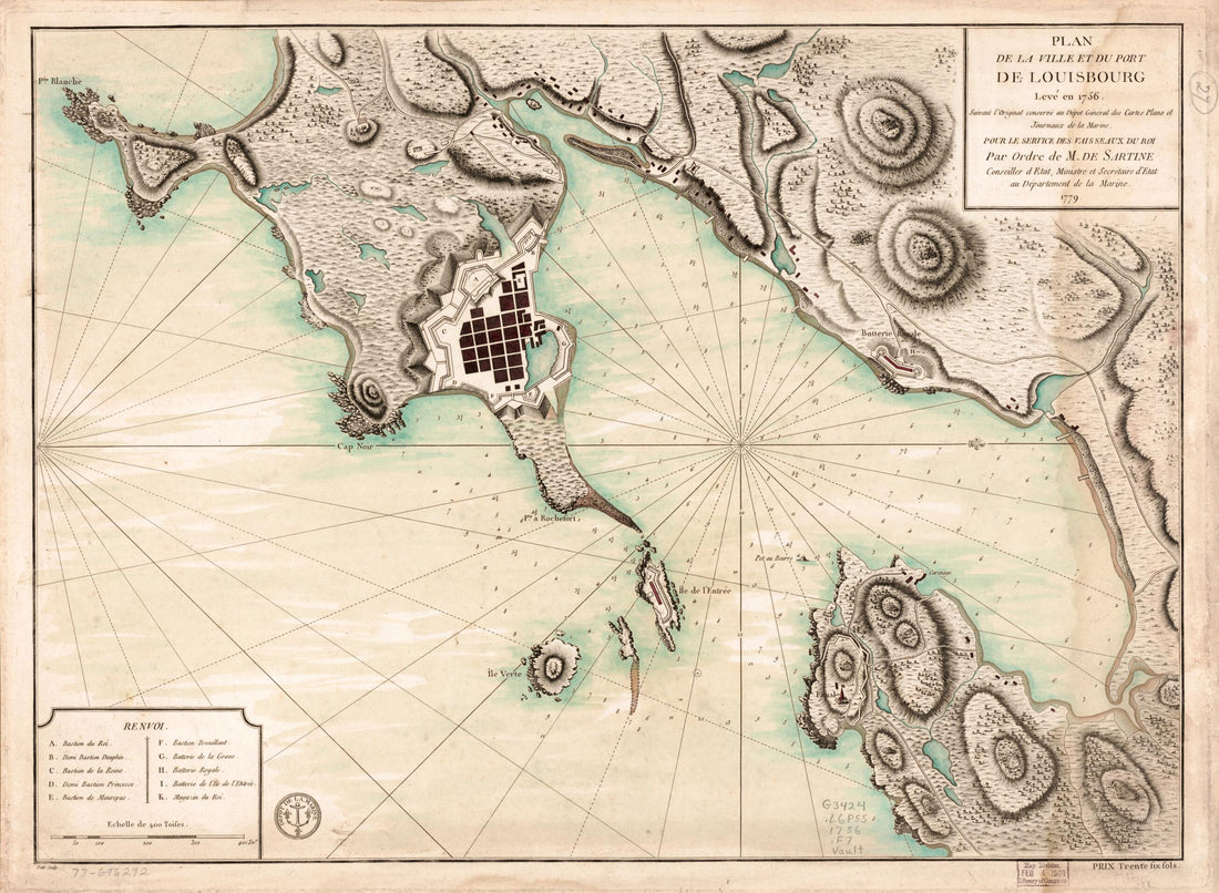 Plan De La Ville De Du Port De Louisbourg Levé En 1756 1779Plan De La Ville De Du Port De Louisbourg Levé En 1756 1779
- Regular price
-
$43.95 $88.95 - Regular price
-
$38.95 - Sale price
-
$43.95 $88.95
-
 The Harbor of Annapolis 1846The Harbor of Annapolis 1846
- Regular price
-
$43.95 $83.95 - Regular price
-
$33.95 - Sale price
-
$43.95 $83.95
-
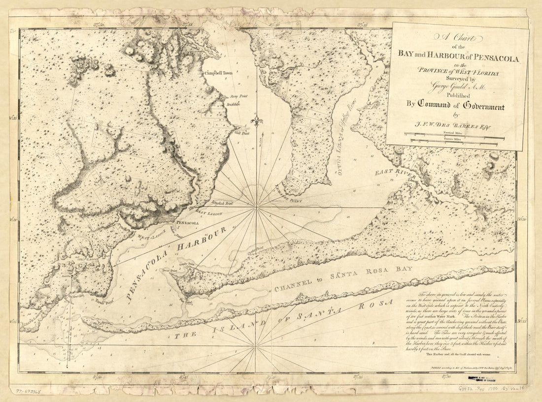 A Chart of the Bay and Harbour of Pensacola In the Province of West Florida 1780A Chart of the Bay and Harbour of Pensacola In the Province of West Florida 1780
- Regular price
-
$43.95 $88.95 - Regular price
-
$38.95 - Sale price
-
$43.95 $88.95
-
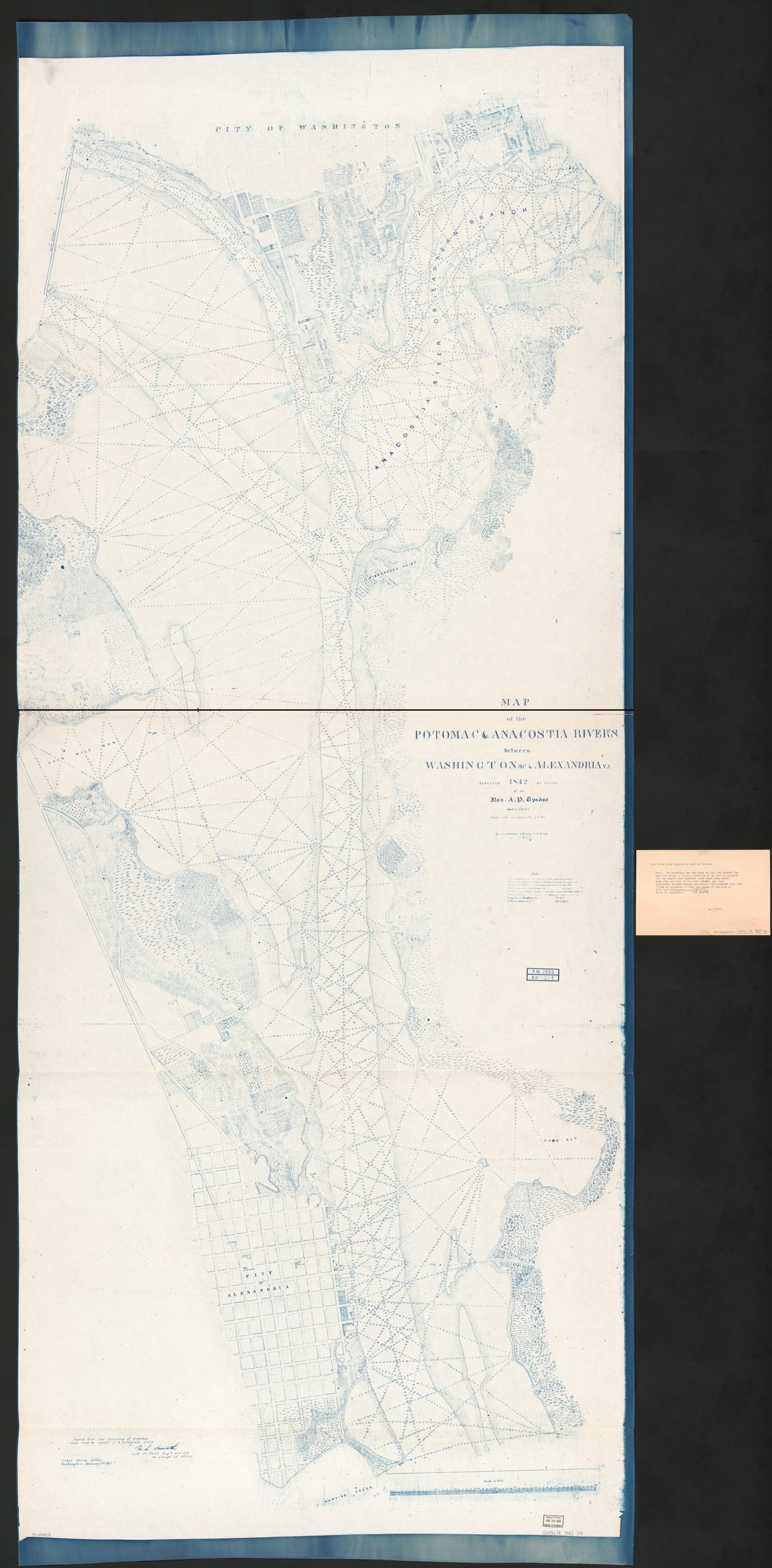 Map of the Potomac & Anacostia Rivers Between Washington D.C. & Alexandria Va in 1842Map of the Potomac & Anacostia Rivers Between Washington D.C. & Alexandria Va in 1842
- Regular price
-
$46.95 $319.95 - Regular price
-
$41.95 - Sale price
-
$46.95 $319.95
-
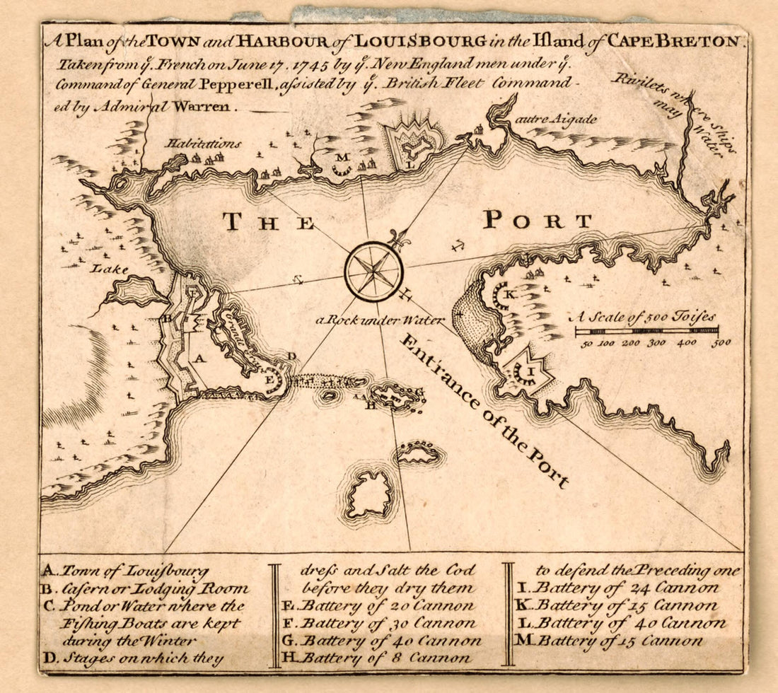 A Plan of the Town and Harbour of Louisbourg In the Island of Cape Breton : Taken from Ye French On June 17 1745 by Ye New England Men Under Ye Command of General Pepperell, Assisted by Ye British Fleet Commanded by Admiral Warren 1752A Plan of the Town and Harbour of Louisbourg In the Island of Cape Breton : Taken from Ye French On June 17 1745 by Ye New England Men Under Ye Command of General Pepperell, Assisted by Ye British Fleet Commanded by Admiral Warren 1752
- Regular price
-
$39.95 $83.95 - Regular price
-
$34.95 - Sale price
-
$39.95 $83.95
-
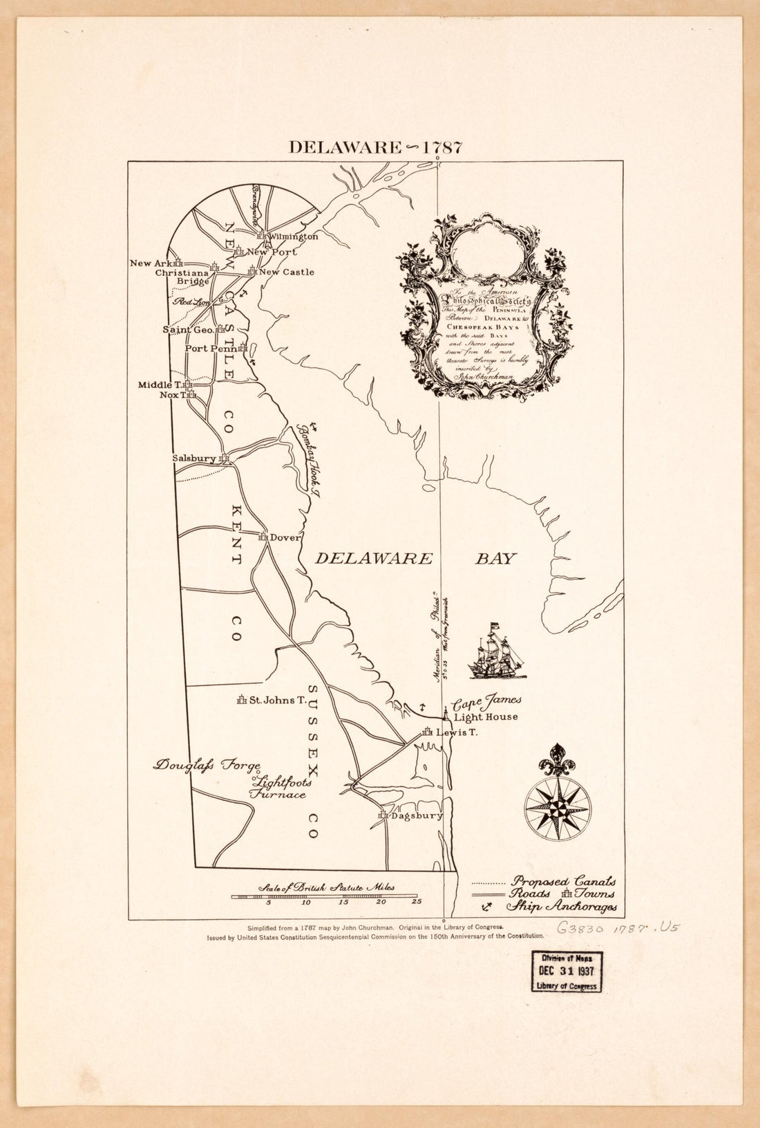 Delaware, Delaware Bay, New Jersey 1787Delaware, Delaware Bay, New Jersey 1787
- Regular price
-
$39.95 $99.95 - Regular price
-
$34.95 - Sale price
-
$39.95 $99.95
-
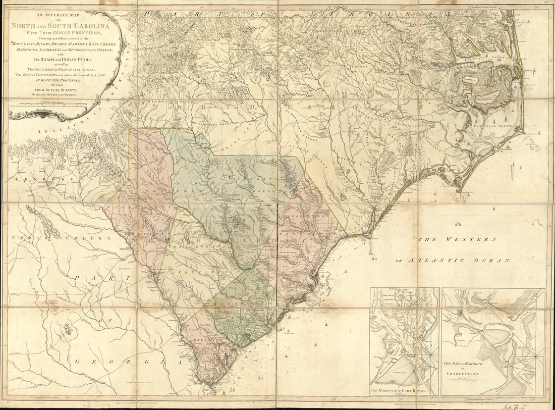 An Accurate Map of North and South Carolina With Their Indian Frontiers, Shewing In a Distinct Manner All the Mountains, Rivers, Swamps, Marshes, Bays, Creeks, Harbours, Sandbanks and Soundings On the Coasts; With the Roads and Indian Paths; As Well A...An Accurate Map of North and South Carolina With Their Indian Frontiers, Shewing In a Distinct Manner All the Mountains, Rivers, Swamps, Marshes, Bays, Creeks, Harbours, Sandbanks and Soundings On the Coasts; With the Roads and Indian Paths; As Well A...
- Regular price
-
$43.95 $217.95 - Regular price
-
$38.95 - Sale price
-
$43.95 $217.95


