725 products
-
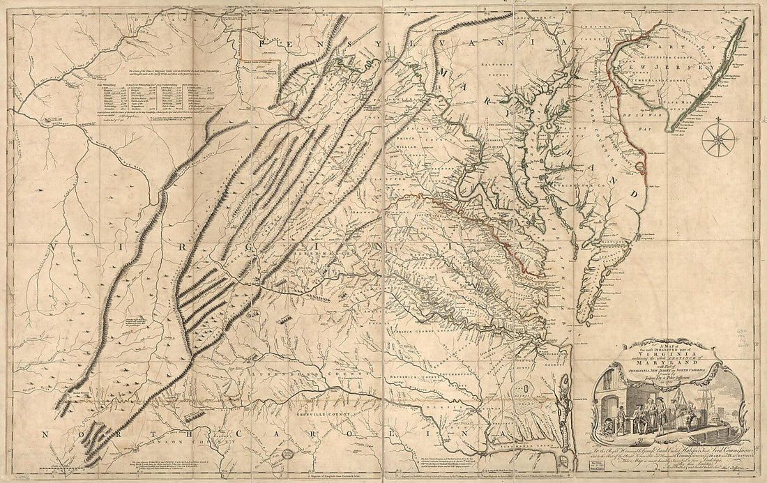 A Map of the Most Inhabited Part of Virginia Containing the Whole Province of Maryland With Part of Pensilvania, New Jersey and North Carolina 1755A Map of the Most Inhabited Part of Virginia Containing the Whole Province of Maryland With Part of Pensilvania, New Jersey and North Carolina 1755
- Regular price
-
$46.95 $255.95 - Regular price
-
$41.95 - Sale price
-
$46.95 $255.95
-
 A New and Accurate Map of Virginia & Maryland : Laid Down from Surveys and Regulated Astronl. Observatns 1752A New and Accurate Map of Virginia & Maryland : Laid Down from Surveys and Regulated Astronl. Observatns 1752
- Regular price
-
$39.95 $88.95 - Regular price
-
$29.95 - Sale price
-
$39.95 $88.95
-
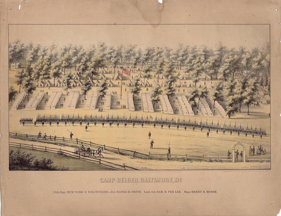 Baltimore, Camp Belger, Camp Belger (Baltimore), Maryland - Col. Elisha B. Smith, Lieut. Col. Sam. R. Per Lee, Major Henry B. Morse 1862Baltimore, Camp Belger, Camp Belger (Baltimore), Maryland - Col. Elisha B. Smith, Lieut. Col. Sam. R. Per Lee, Major Henry B. Morse 1862
- Regular price
-
$43.95 $101.95 - Regular price
-
$32.95 - Sale price
-
$43.95 $101.95
-
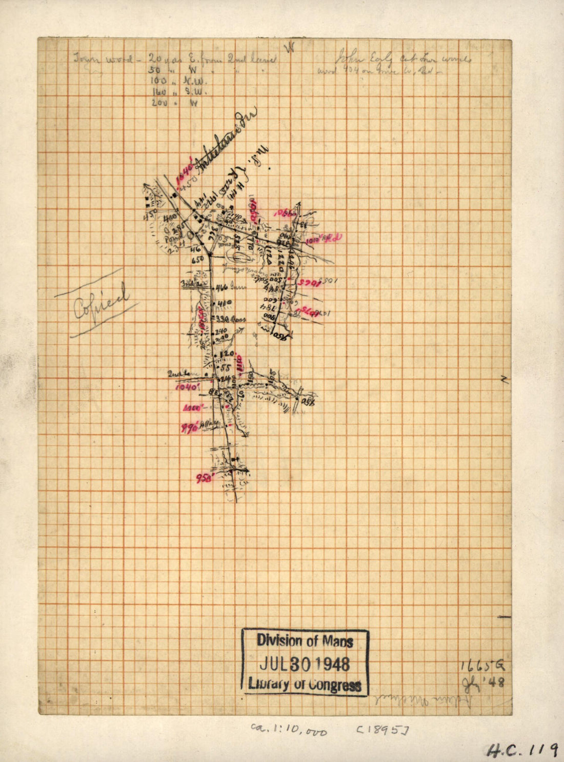 Preliminary Field Sketch of Part of the Shepherdstown Road East of Sharpsburg 1895Preliminary Field Sketch of Part of the Shepherdstown Road East of Sharpsburg 1895
- Regular price
-
$39.95 $88.95 - Regular price
-
$29.95 - Sale price
-
$39.95 $88.95
-
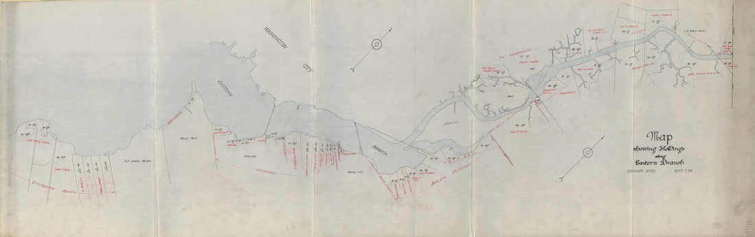 Map Showing Holdings Along Eastern Branch 1909Map Showing Holdings Along Eastern Branch 1909
- Regular price
-
$46.95 $228.95 - Regular price
-
$41.95 - Sale price
-
$46.95 $228.95
-
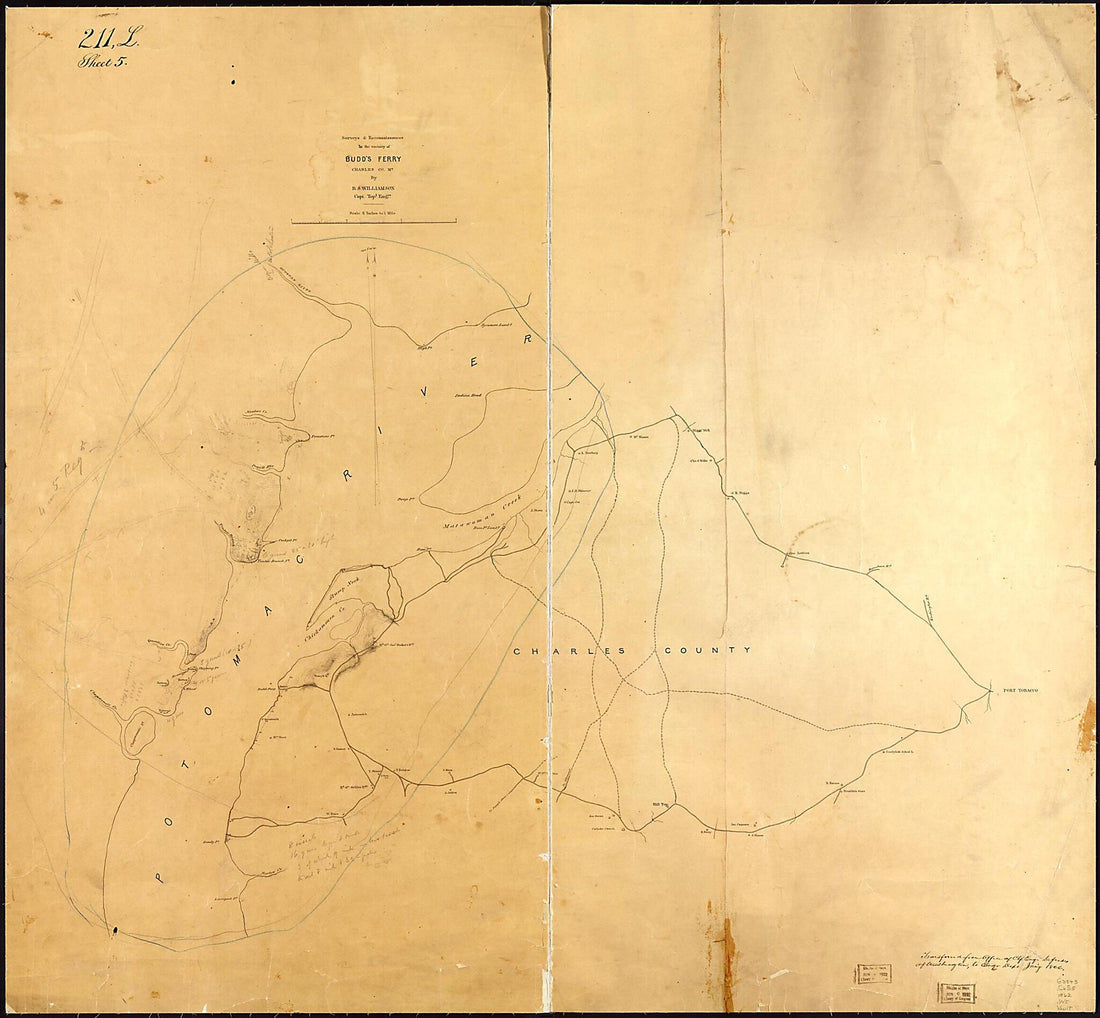 Surveys & Reconnaissances In the Vicinity of Budd's Ferry, Charles County, Md 1862Surveys & Reconnaissances In the Vicinity of Budd's Ferry, Charles County, Md 1862
- Regular price
-
$39.95 $155.95 - Regular price
-
$34.95 - Sale price
-
$39.95 $155.95
-
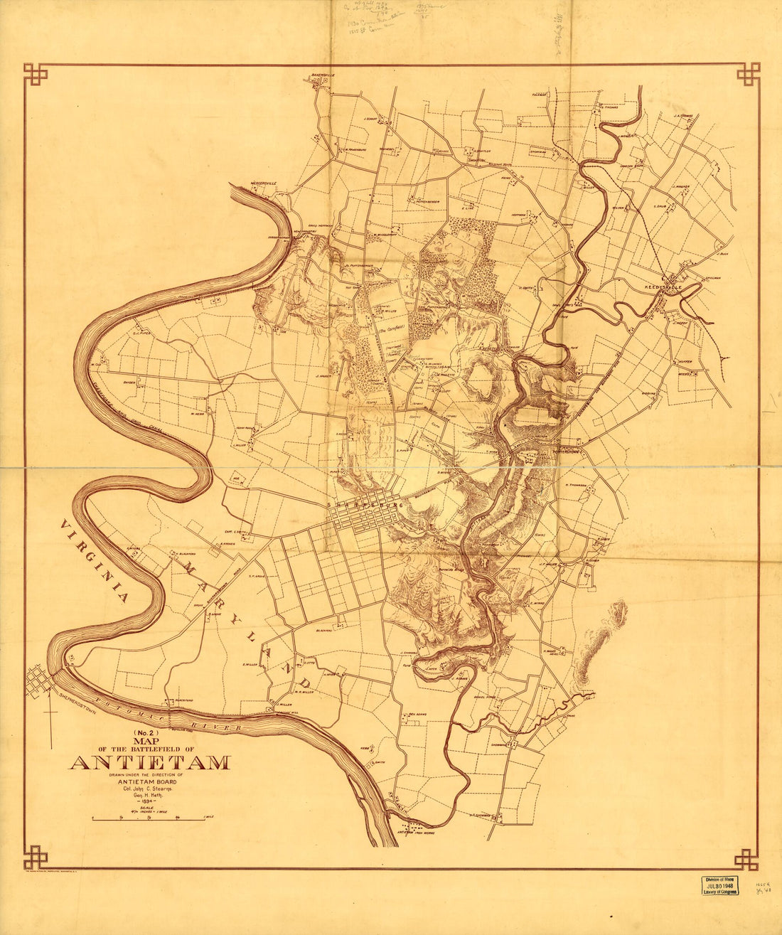 (No. 2) Map of the Battlefield of Antietam 1894(No. 2) Map of the Battlefield of Antietam 1894
- Regular price
-
$39.95 $112.95 - Regular price
-
$34.95 - Sale price
-
$39.95 $112.95
-
 Rough Plan of the Defences of the Harbour of Annapolis In Maryland (Plan of the Works for the Defense of Annapolis) 1814Rough Plan of the Defences of the Harbour of Annapolis In Maryland (Plan of the Works for the Defense of Annapolis) 1814
- Regular price
-
$46.95 $185.95 - Regular price
-
$41.95 - Sale price
-
$46.95 $185.95
-
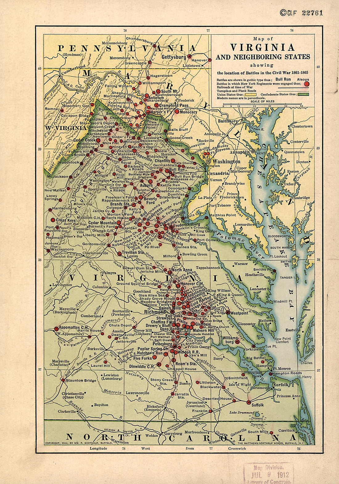 Maryland, North Carolina, Pennsylvania, Virginia, West Virginia 1912Maryland, North Carolina, Pennsylvania, Virginia, West Virginia 1912
- Regular price
-
$39.95 $99.95 - Regular price
-
$29.95 - Sale price
-
$39.95 $99.95
-
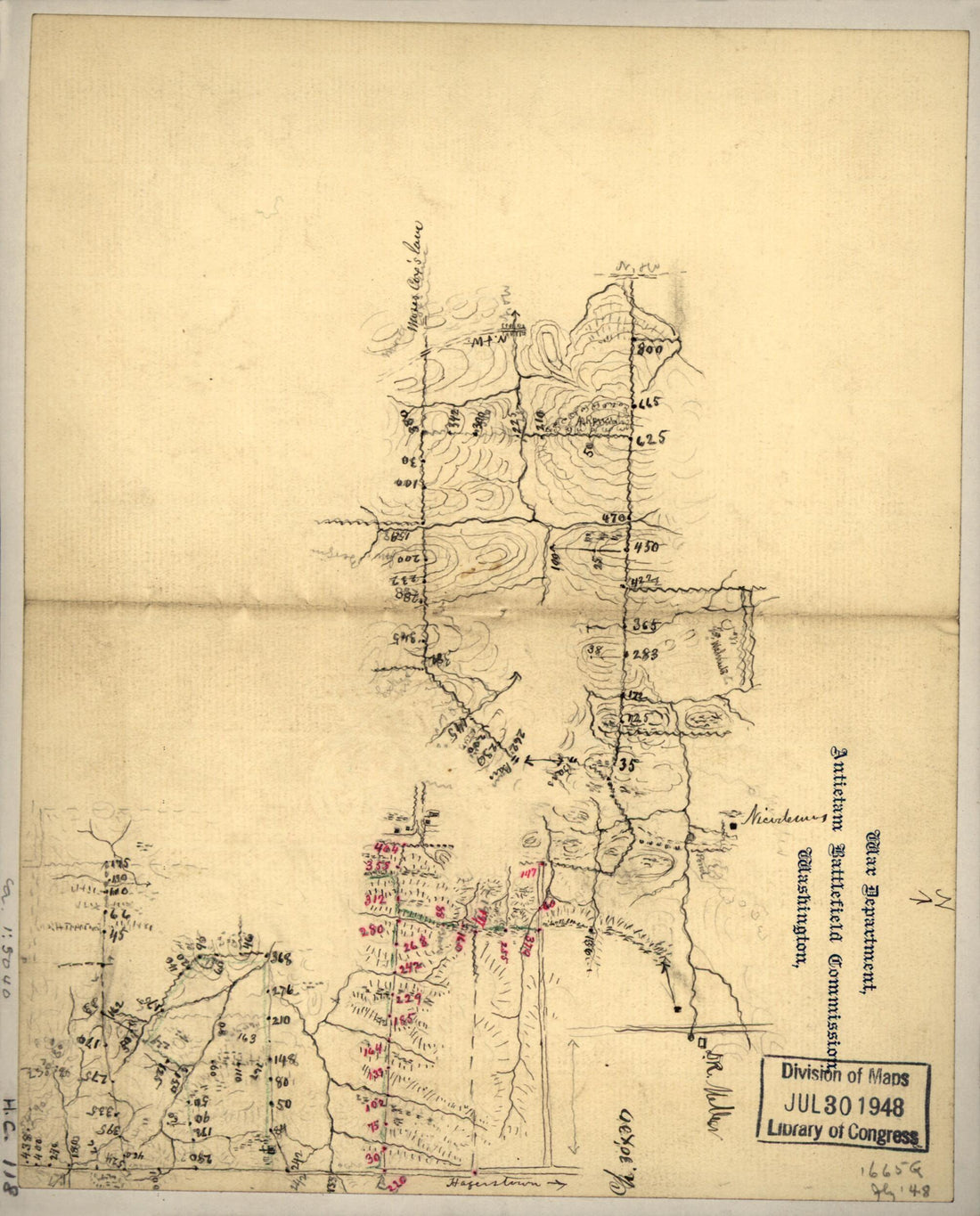 Preliminary Field Sketch of Part of the Antietam Battlefield, In the Area North of Sharpsburg 1895Preliminary Field Sketch of Part of the Antietam Battlefield, In the Area North of Sharpsburg 1895
- Regular price
-
$39.95 $83.95 - Regular price
-
$29.95 - Sale price
-
$39.95 $83.95
-
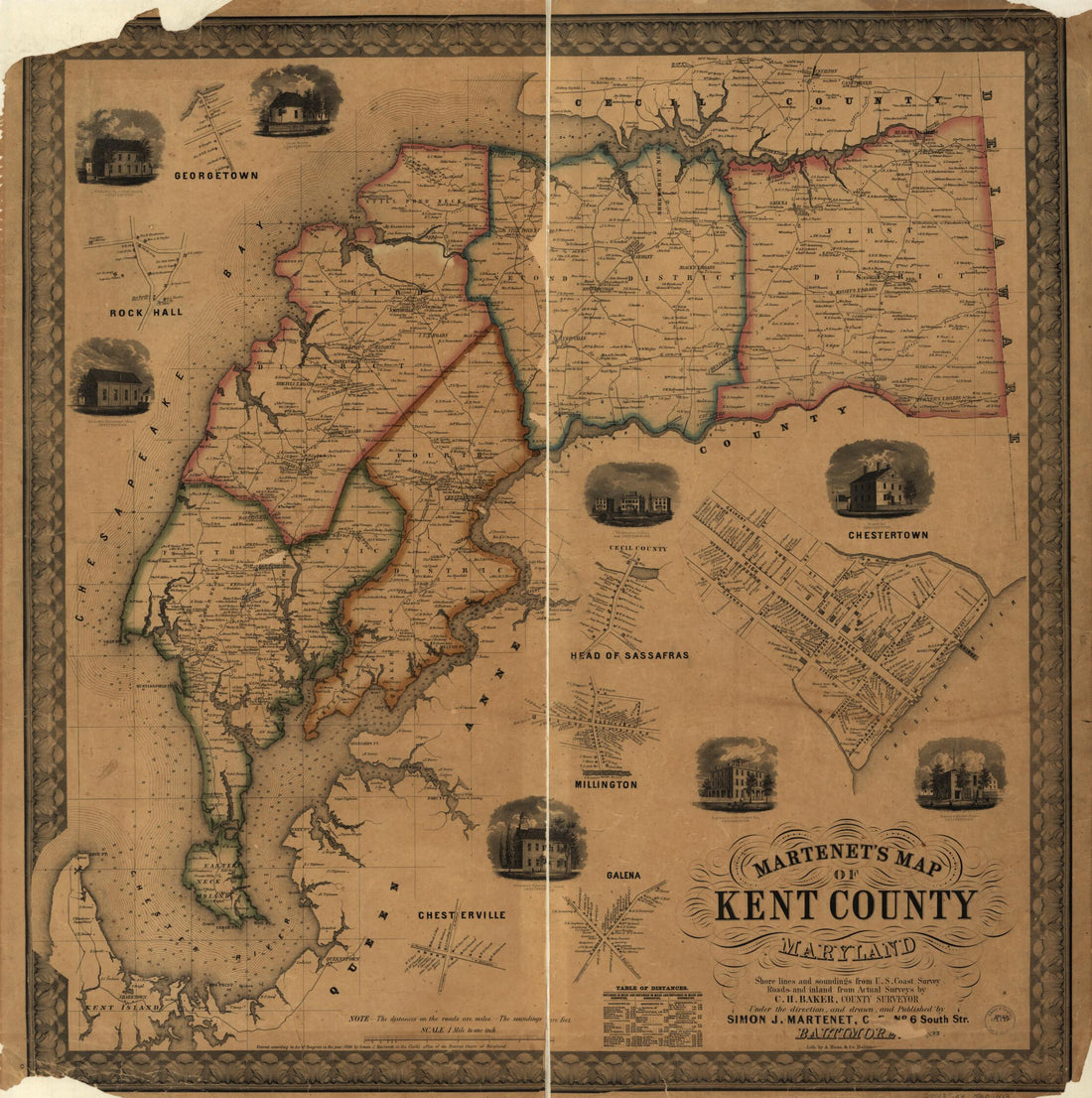 Martenet's Map of Kent County, Maryland ; Shore Lines and Soundings from U.S. Coast Survey, Roads and Inland from Actual Surveys by C.H. Baker, County Surveyor, Under the Direction, and Drawn, and Published by Simon J. Martenet 1860Martenet's Map of Kent County, Maryland ; Shore Lines and Soundings from U.S. Coast Survey, Roads and Inland from Actual Surveys by C.H. Baker, County Surveyor, Under the Direction, and Drawn, and Published by Simon J. Martenet 1860
- Regular price
-
$39.95 $123.95 - Regular price
-
$34.95 - Sale price
-
$39.95 $123.95
-
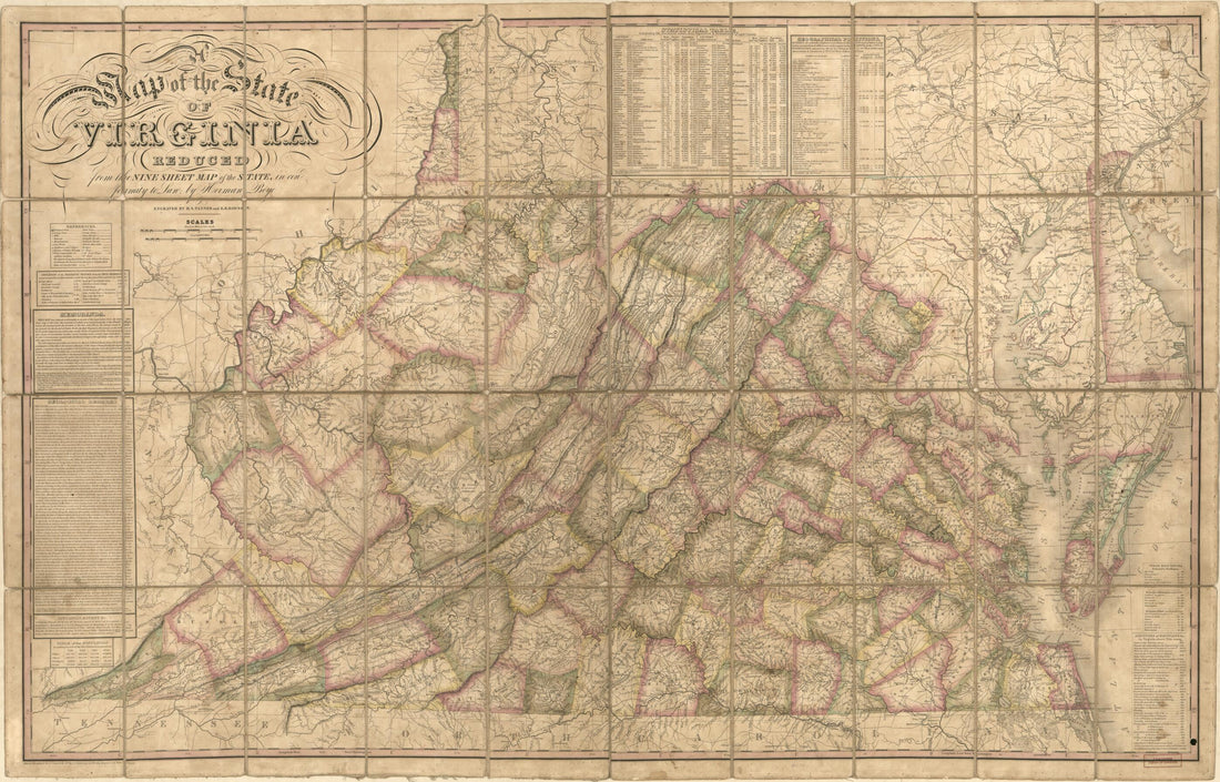 A Map of the State of Virginia : Reduced from the Nine Sheet Map of the State In Conformity to Law (Map of Virginia) 1827A Map of the State of Virginia : Reduced from the Nine Sheet Map of the State In Conformity to Law (Map of Virginia) 1827
- Regular price
-
$46.95 $162.95 - Regular price
-
$41.95 - Sale price
-
$46.95 $162.95


