100 products
-
 Part of the United States In 1777 1910Part of the United States In 1777 1910
- Regular price
-
$39.95 $99.95 - Regular price
-
$34.95 - Sale price
-
$39.95 $99.95
-
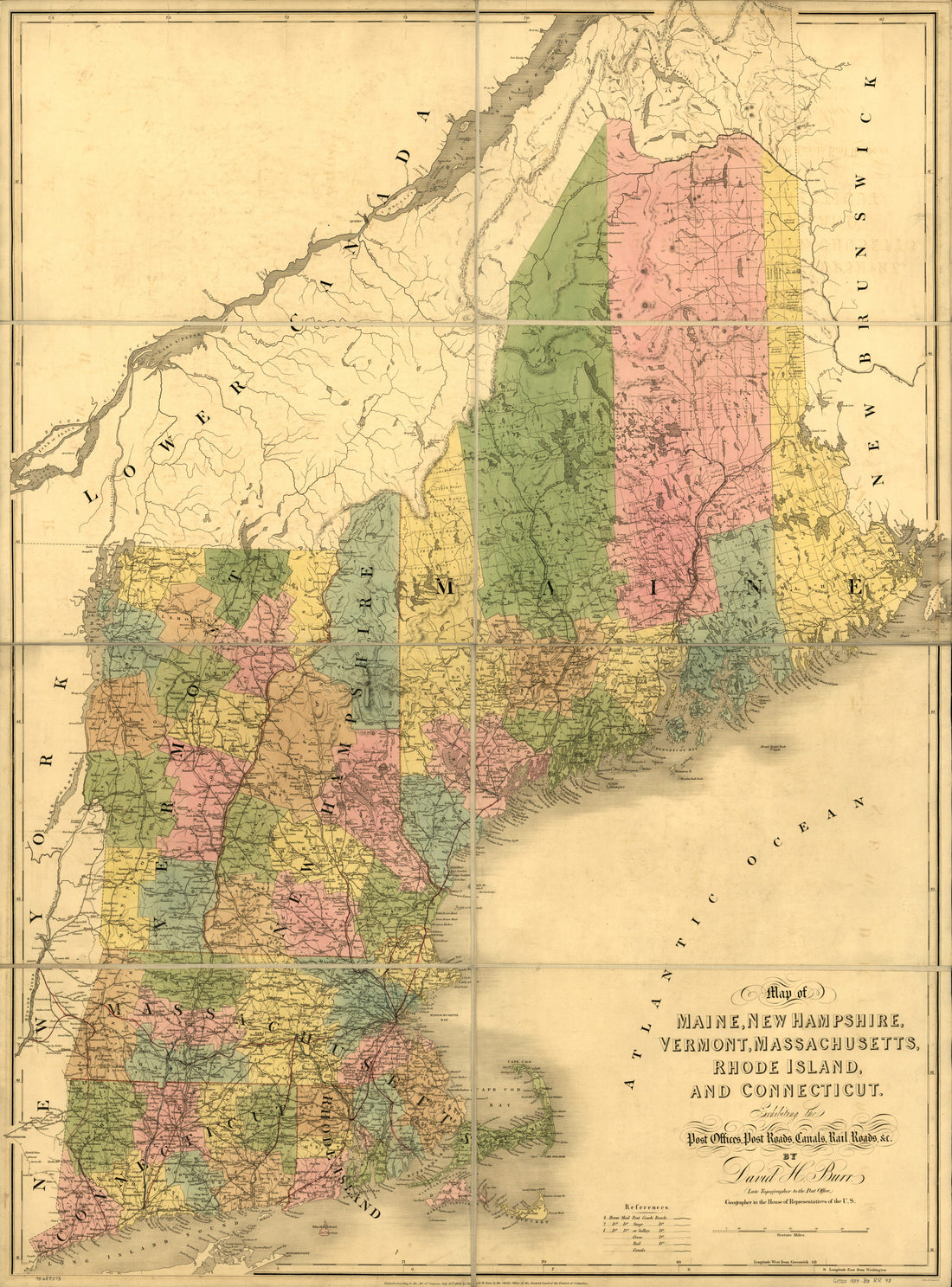 Map of Maine, New Hampshire, Vermont, Massachusetts, Rhode Island, and Connecticut Exhibiting the Post Offices, Post Roads, Canals, Rail Roads, &c 1839Map of Maine, New Hampshire, Vermont, Massachusetts, Rhode Island, and Connecticut Exhibiting the Post Offices, Post Roads, Canals, Rail Roads, &c 1839
- Regular price
-
$43.95 $186.95 - Regular price
-
$38.95 - Sale price
-
$43.95 $186.95
-
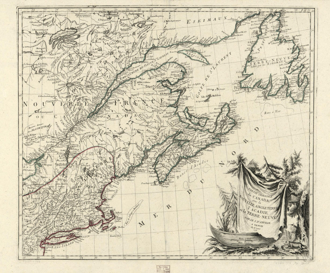 Neuve 1776Neuve 1776
- Regular price
-
$43.95 $83.95 - Regular price
-
$38.95 - Sale price
-
$43.95 $83.95
-
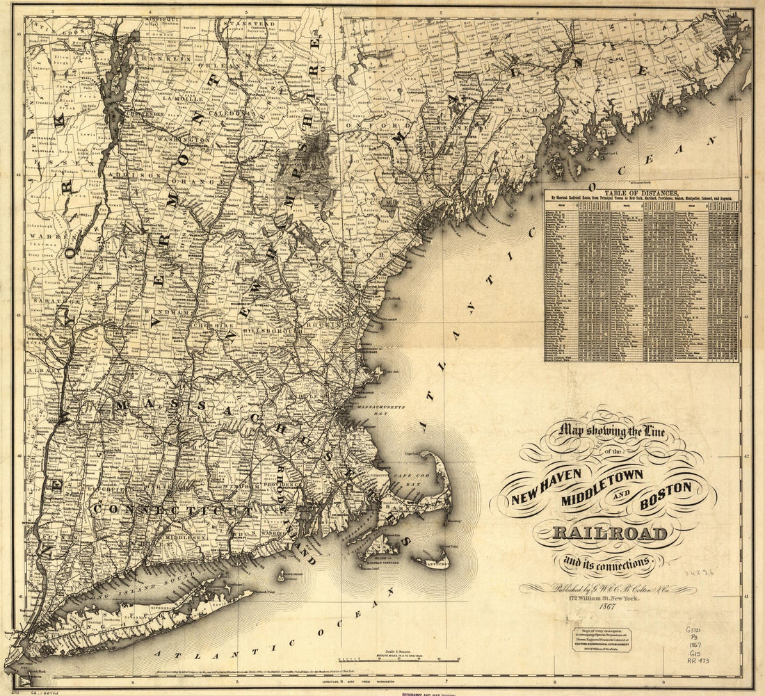 Map Showing the Line of the New Haven, Middletown, and Boston Railroad and Its Connections 1867Map Showing the Line of the New Haven, Middletown, and Boston Railroad and Its Connections 1867
- Regular price
-
$43.95 $83.95 - Regular price
-
$38.95 - Sale price
-
$43.95 $83.95
-
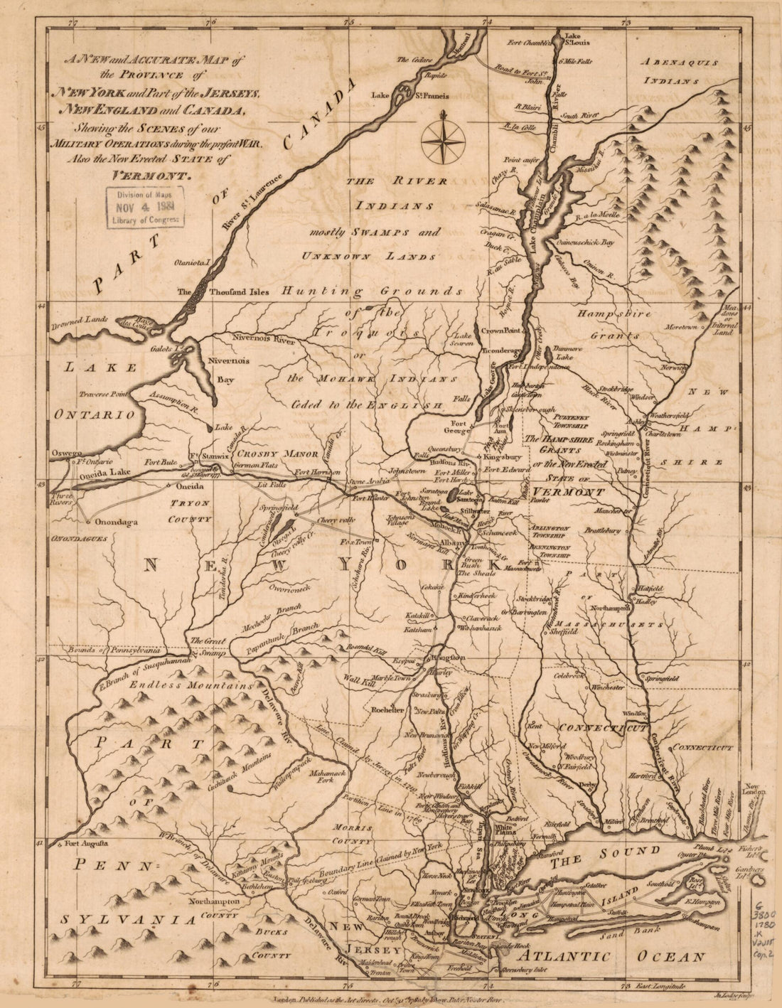 A New and Accurate Map of the Province of New York and Part of the Jerseys, New England and Canada, Shewing the Scenes of Our Military Operations During the Present War : Also the New Erected State of Vermont 1780A New and Accurate Map of the Province of New York and Part of the Jerseys, New England and Canada, Shewing the Scenes of Our Military Operations During the Present War : Also the New Erected State of Vermont 1780
- Regular price
-
$39.95 $88.95 - Regular price
-
$34.95 - Sale price
-
$39.95 $88.95
-
 An Actual Survey of the Sea Coast From New York to the I. Cape Brition, With Tables of the Direct and Thwart Courses & Distances From Place to Place in 1775An Actual Survey of the Sea Coast From New York to the I. Cape Brition, With Tables of the Direct and Thwart Courses & Distances From Place to Place in 1775
- Regular price
-
$46.95 $100.95 - Regular price
-
$41.95 - Sale price
-
$46.95 $100.95
-
 Maps Showing the Boston Hoosac Tunnel and Western Railway With Its Eastern and Western Connections 1881Maps Showing the Boston Hoosac Tunnel and Western Railway With Its Eastern and Western Connections 1881
- Regular price
-
$46.95 $99.95 - Regular price
-
$41.95 - Sale price
-
$46.95 $99.95
-
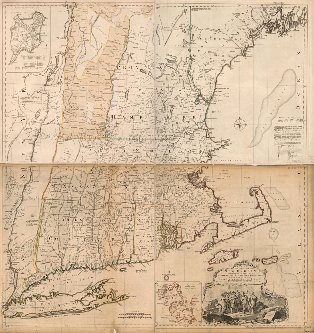 A Map of the Most Inhabited Part of New England, Containing the Provinces of Massachusets Bay and New Hampshire, With the Colonies of Conecticut and Rhode Island, Divided Into Counties and Townships: the Whole Composed from Actual Surveys and Its Situ...A Map of the Most Inhabited Part of New England, Containing the Provinces of Massachusets Bay and New Hampshire, With the Colonies of Conecticut and Rhode Island, Divided Into Counties and Townships: the Whole Composed from Actual Surveys and Its Situ...
- Regular price
-
$43.95 $171.95 - Regular price
-
$38.95 - Sale price
-
$43.95 $171.95
-
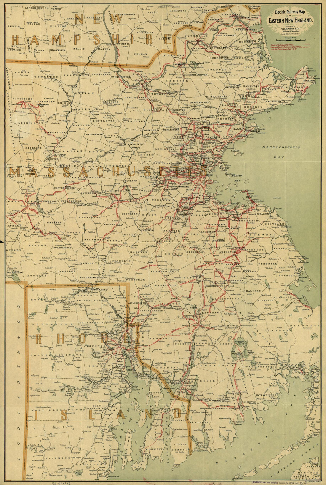 Electric Railway Map of Eastern New England 1898Electric Railway Map of Eastern New England 1898
- Regular price
-
$46.95 $99.95 - Regular price
-
$41.95 - Sale price
-
$46.95 $99.95
-
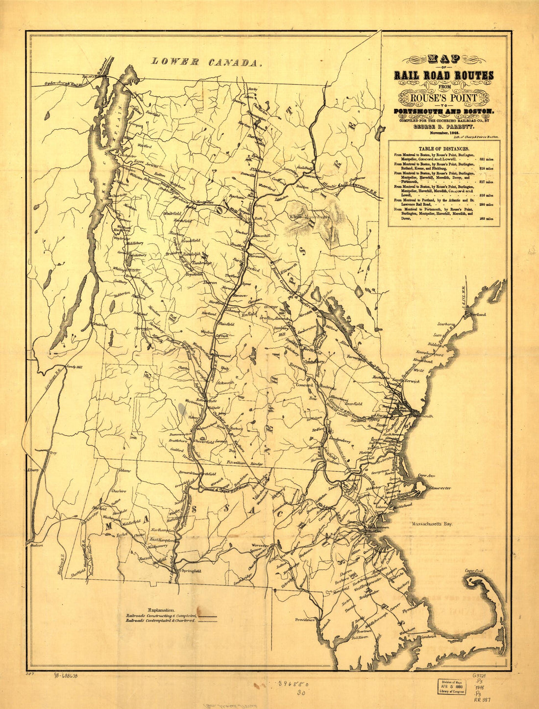 Map of Rail Road Routes from Rouse's Point to Portsmouth and Boston; Compiled for the Cocheco Railroad Co. November, 1848Map of Rail Road Routes from Rouse's Point to Portsmouth and Boston; Compiled for the Cocheco Railroad Co. November, 1848
- Regular price
-
$43.95 $88.95 - Regular price
-
$38.95 - Sale price
-
$43.95 $88.95
-
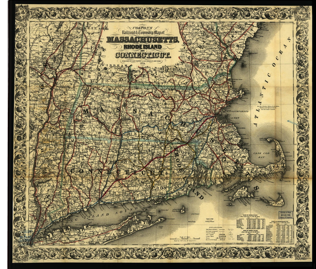 Colton's Railroad & Township Map of Massachusetts, Rhode Island, and Connecticut 1853Colton's Railroad & Township Map of Massachusetts, Rhode Island, and Connecticut 1853
- Regular price
-
$43.95 $83.95 - Regular price
-
$38.95 - Sale price
-
$43.95 $83.95
-
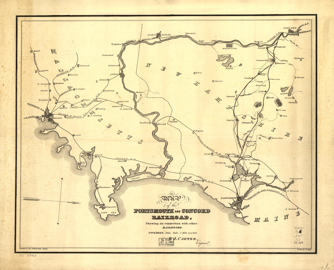 Map of the Portsmouth and Concord Railroad, Shewing Its Connection With Other Railroads 1845Map of the Portsmouth and Concord Railroad, Shewing Its Connection With Other Railroads 1845
- Regular price
-
$43.95 $83.95 - Regular price
-
$38.95 - Sale price
-
$43.95 $83.95


