100 products
-
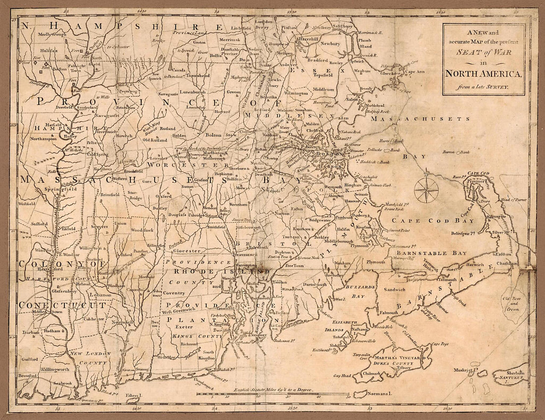 A New and Accurate Map of the Present Seat of War In North America from a Late Survey 1775A New and Accurate Map of the Present Seat of War In North America from a Late Survey 1775
- Regular price
-
$39.95 $88.95 - Regular price
-
$34.95 - Sale price
-
$39.95 $88.95
-
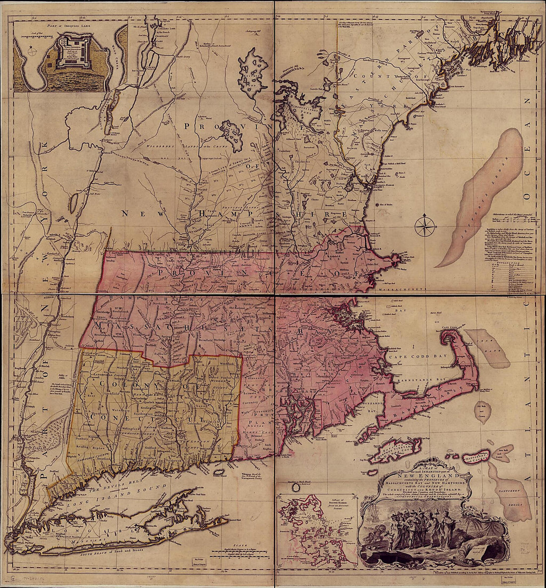
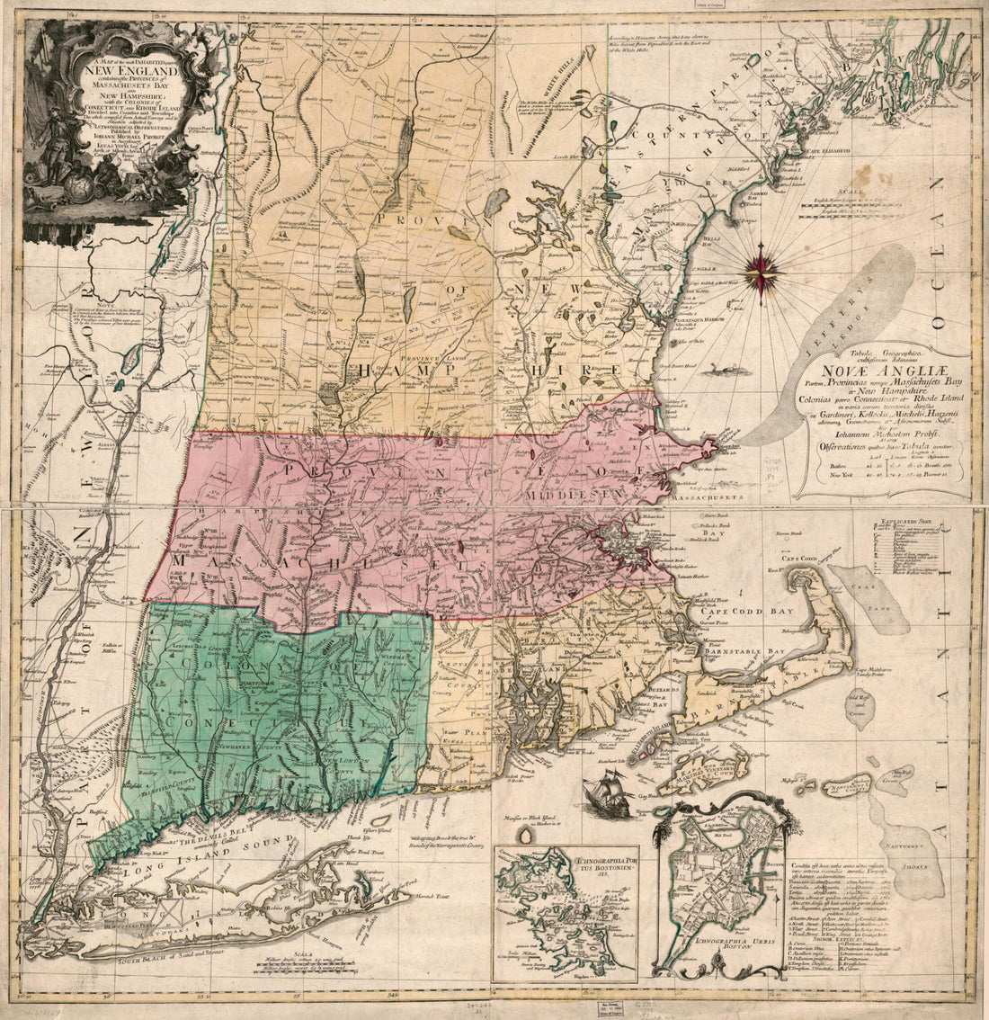
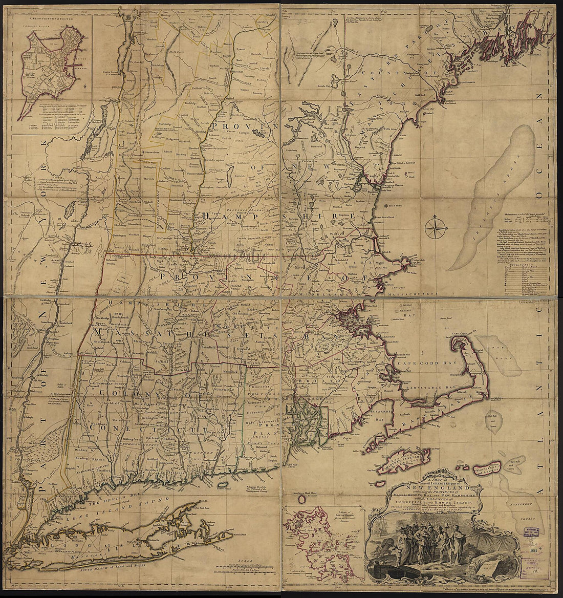 A Map of the Most Inhabited Part of New England, Containing the Provinces of Massachusets Bay and New Hampshire, With the Colonies of Conecticut and Rhode Island, Divided Into Counties and Townships: the Whole Composed from Actual Surveys and Its Situ...A Map of the Most Inhabited Part of New England, Containing the Provinces of Massachusets Bay and New Hampshire, With the Colonies of Conecticut and Rhode Island, Divided Into Counties and Townships: the Whole Composed from Actual Surveys and Its Situ...
- Regular price
-
$43.95 $170.95 - Regular price
-
$38.95 - Sale price
-
$43.95 $170.95
-
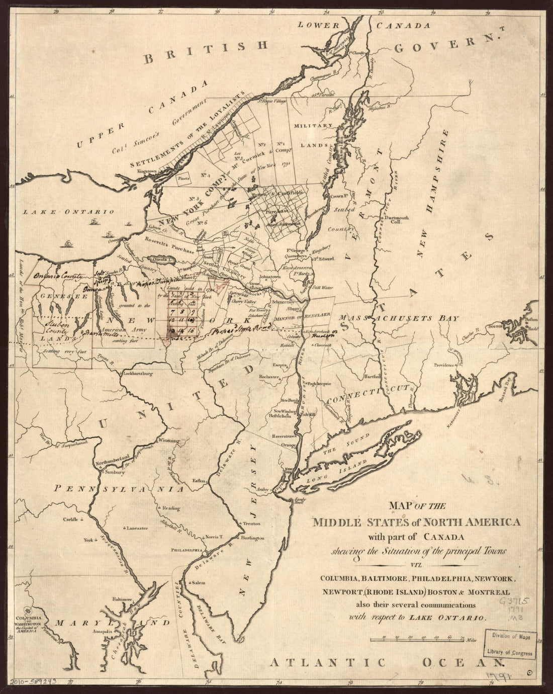 Map of the Middle States of North America With Part of Canada Shewing the Situation of the Principal Towns, Viz. Columbia i.e. Washington, D.C., Baltimore, Philadelphia, New York, Newport, Rhode Island, Boston & Montreal, Also Their Several Communicat...Map of the Middle States of North America With Part of Canada Shewing the Situation of the Principal Towns, Viz. Columbia i.e. Washington, D.C., Baltimore, Philadelphia, New York, Newport, Rhode Island, Boston & Montreal, Also Their Several Communicat...
- Regular price
-
$42.95 $83.95 - Regular price
-
$37.95 - Sale price
-
$42.95 $83.95
-
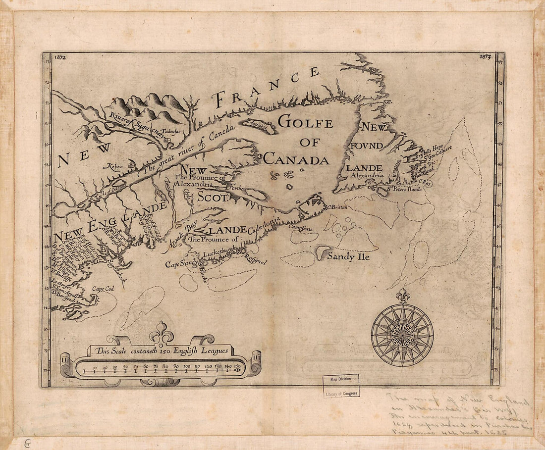 New England, Nova Scotia, and Newfoundland 1624New England, Nova Scotia, and Newfoundland 1624
- Regular price
-
$39.95 $83.95 - Regular price
-
$34.95 - Sale price
-
$39.95 $83.95
-
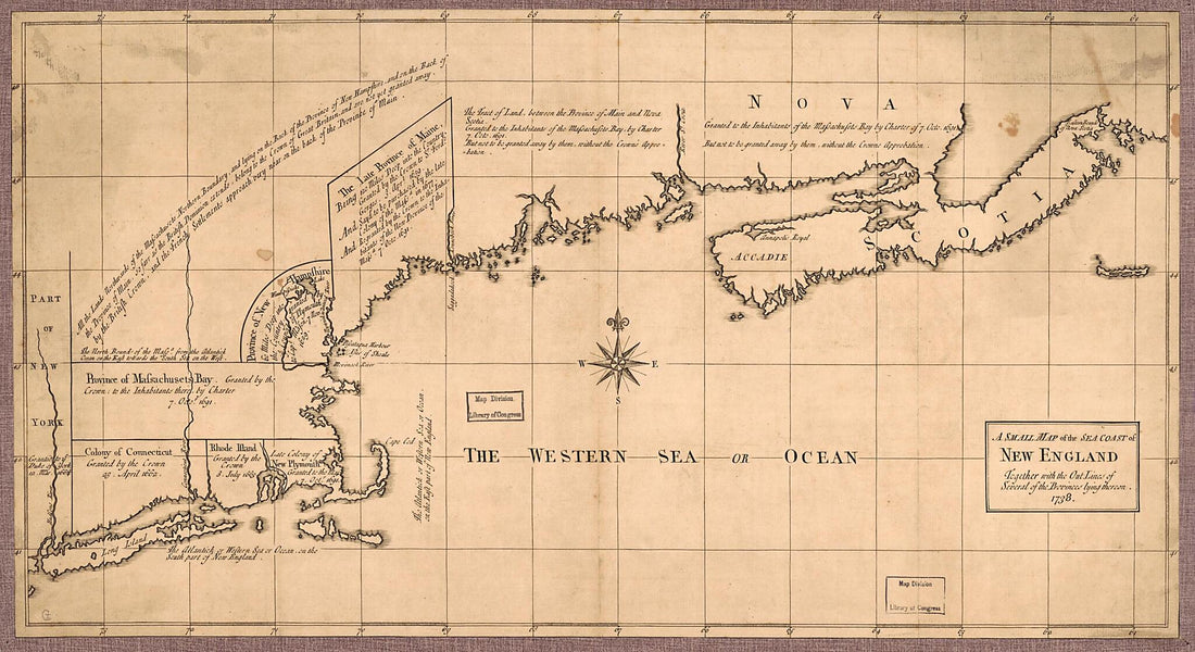 A Small Map of the Sea Coast of New England Together With the Out Lines of Several of the Provinces Lying Thereon 1738A Small Map of the Sea Coast of New England Together With the Out Lines of Several of the Provinces Lying Thereon 1738
- Regular price
-
$39.95 $99.95 - Regular price
-
$34.95 - Sale price
-
$39.95 $99.95
-
 A Map of the Most Inhabited Part of New England : Containing the Provinces of Massachusets Bay and New Hampshire, With the Colonies of Conecticut and Rhode Island, Divided Into Counties and Townships : the Whole Composed from Actual Surveys and Its Si...A Map of the Most Inhabited Part of New England : Containing the Provinces of Massachusets Bay and New Hampshire, With the Colonies of Conecticut and Rhode Island, Divided Into Counties and Townships : the Whole Composed from Actual Surveys and Its Si...
- Regular price
-
$43.95 $174.95 - Regular price
-
$38.95 - Sale price
-
$43.95 $174.95
-
 A Map of the Most Inhabited Part of New England : Containing the Provinces of Massachusets Bay and New Hampshire, With the Colonies of KoneKtikut and Rhode Island, Divided Into Counties and Townships : the Whole Composed from Actual Surveys and Its Si...A Map of the Most Inhabited Part of New England : Containing the Provinces of Massachusets Bay and New Hampshire, With the Colonies of KoneKtikut and Rhode Island, Divided Into Counties and Townships : the Whole Composed from Actual Surveys and Its Si...
- Regular price
-
$43.95 $182.95 - Regular price
-
$38.95 - Sale price
-
$43.95 $182.95
-
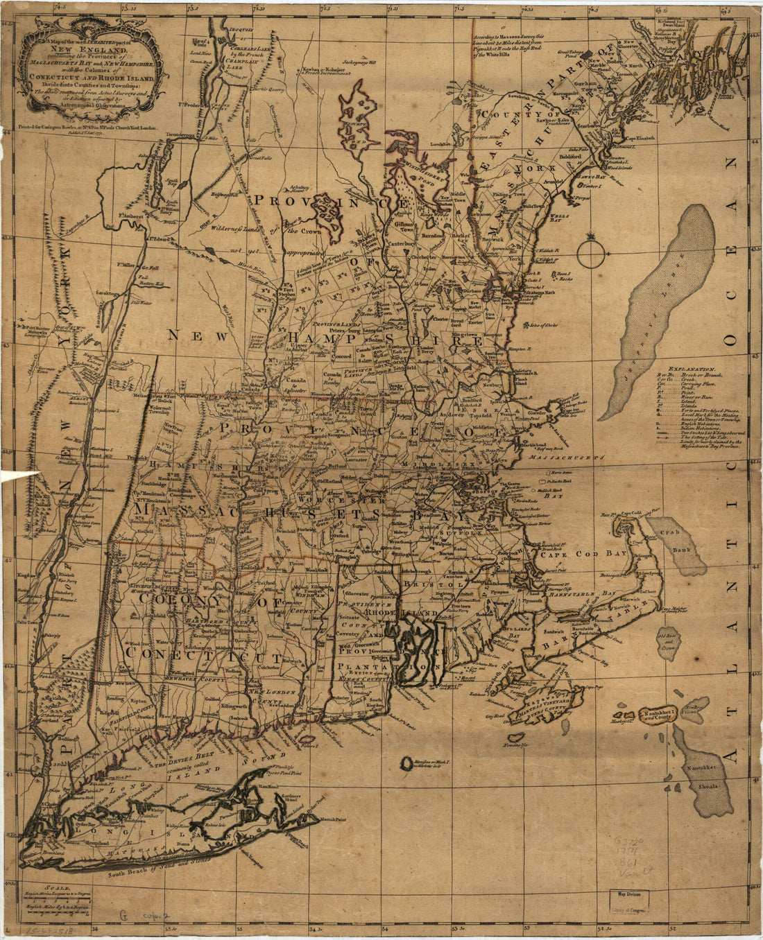 A Map of the Most Inhabited Part of New England, Containing the Provinces of Massachusets Bay and New Hampshire, With the Colonies of Conecticut and Rhode Island, Divided Into Counties and Townships: the Whole Composed from Actual Surveys and Its Situ...A Map of the Most Inhabited Part of New England, Containing the Provinces of Massachusets Bay and New Hampshire, With the Colonies of Conecticut and Rhode Island, Divided Into Counties and Townships: the Whole Composed from Actual Surveys and Its Situ...
- Regular price
-
$43.95 $83.95 - Regular price
-
$38.95 - Sale price
-
$43.95 $83.95
-
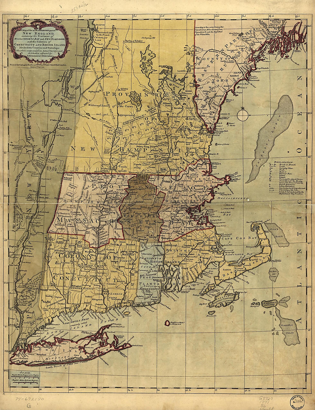 A Map of the Most Inhabited Part of New England, Containing the Provinces of Massachusets Bay and New Hampshire, With the Colonies of Conecticut and Rhode Island, Divided Into Counties and Townships: the Whole Composed from Actual Surveys and Its Situ...A Map of the Most Inhabited Part of New England, Containing the Provinces of Massachusets Bay and New Hampshire, With the Colonies of Conecticut and Rhode Island, Divided Into Counties and Townships: the Whole Composed from Actual Surveys and Its Situ...
- Regular price
-
$43.95 $131.95 - Regular price
-
$38.95 - Sale price
-
$43.95 $131.95
-
 A Map of the Most Inhabited Part of New England, Containing the Provinces of Massachusets Bay and New Hampshire, With the Colonies of Conecticut and Rhode Island, Divided Into Counties and Townships; the Whole Composed from Actual Surveys and Its Situ...A Map of the Most Inhabited Part of New England, Containing the Provinces of Massachusets Bay and New Hampshire, With the Colonies of Conecticut and Rhode Island, Divided Into Counties and Townships; the Whole Composed from Actual Surveys and Its Situ...
- Regular price
-
$43.95 $161.95 - Regular price
-
$38.95 - Sale price
-
$43.95 $161.95
-
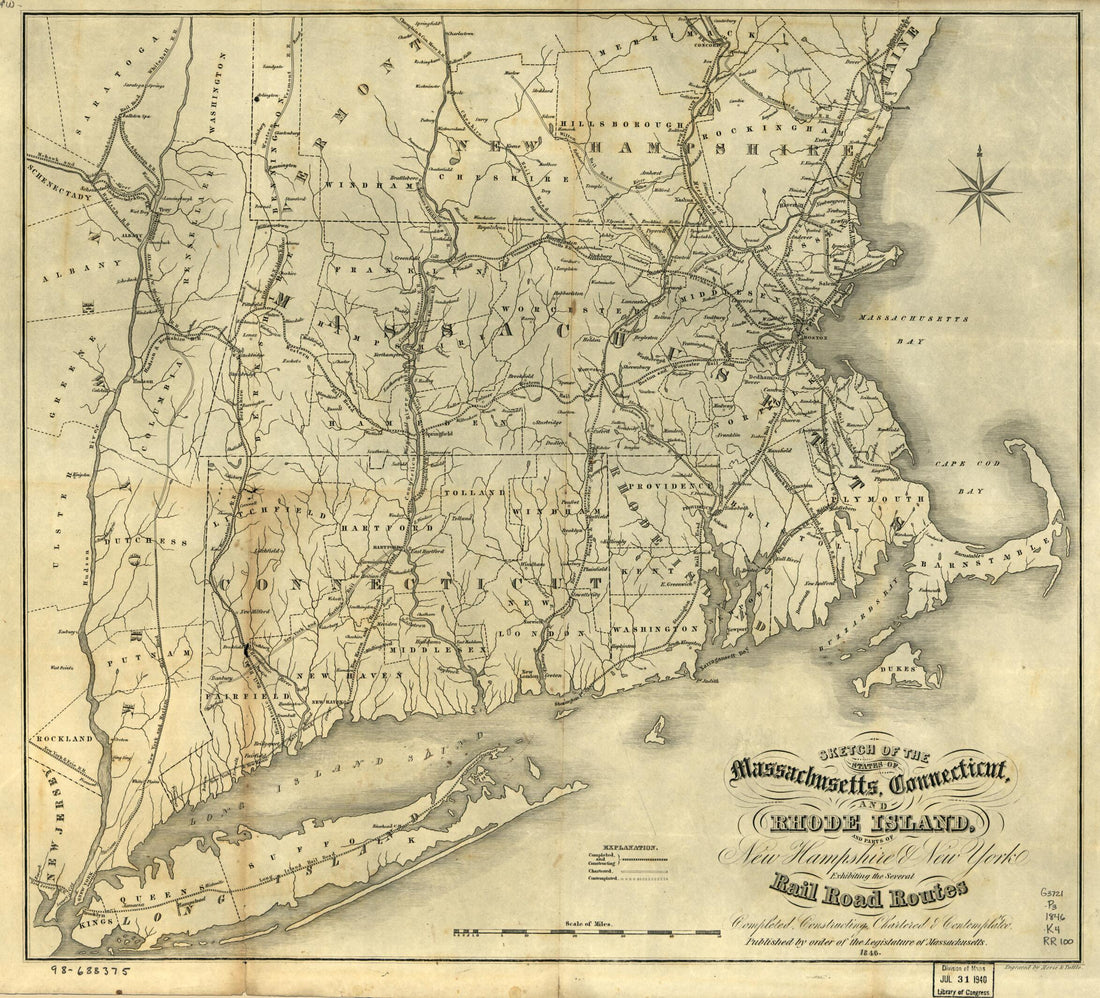 Sketch of the States of Massachusetts, Connecticut, and Rhode Island, and Parts of New Hampshire & New York Exhibiting the Several Rail Road Routes Completed, Constructing, Chartered & Contemplated; Published by Order of the Legislature of Massachuset...Sketch of the States of Massachusetts, Connecticut, and Rhode Island, and Parts of New Hampshire & New York Exhibiting the Several Rail Road Routes Completed, Constructing, Chartered & Contemplated; Published by Order of the Legislature of Massachuset...
- Regular price
-
$43.95 $83.95 - Regular price
-
$38.95 - Sale price
-
$43.95 $83.95
-
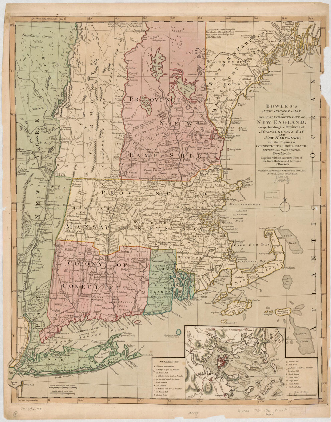 Bowles's New Pocket Map of the Most Inhabited Part of New England; Comprehending the Provinces of Massachusets Bay and New Hampshire; With the Colonies of Connecticut & Rhode Island; Divided Into Their Counties, Townships, &c. Together With an Accurat...Bowles's New Pocket Map of the Most Inhabited Part of New England; Comprehending the Provinces of Massachusets Bay and New Hampshire; With the Colonies of Connecticut & Rhode Island; Divided Into Their Counties, Townships, &c. Together With an Accurat...
- Regular price
-
$43.95 $83.95 - Regular price
-
$38.95 - Sale price
-
$43.95 $83.95


