181 products
-
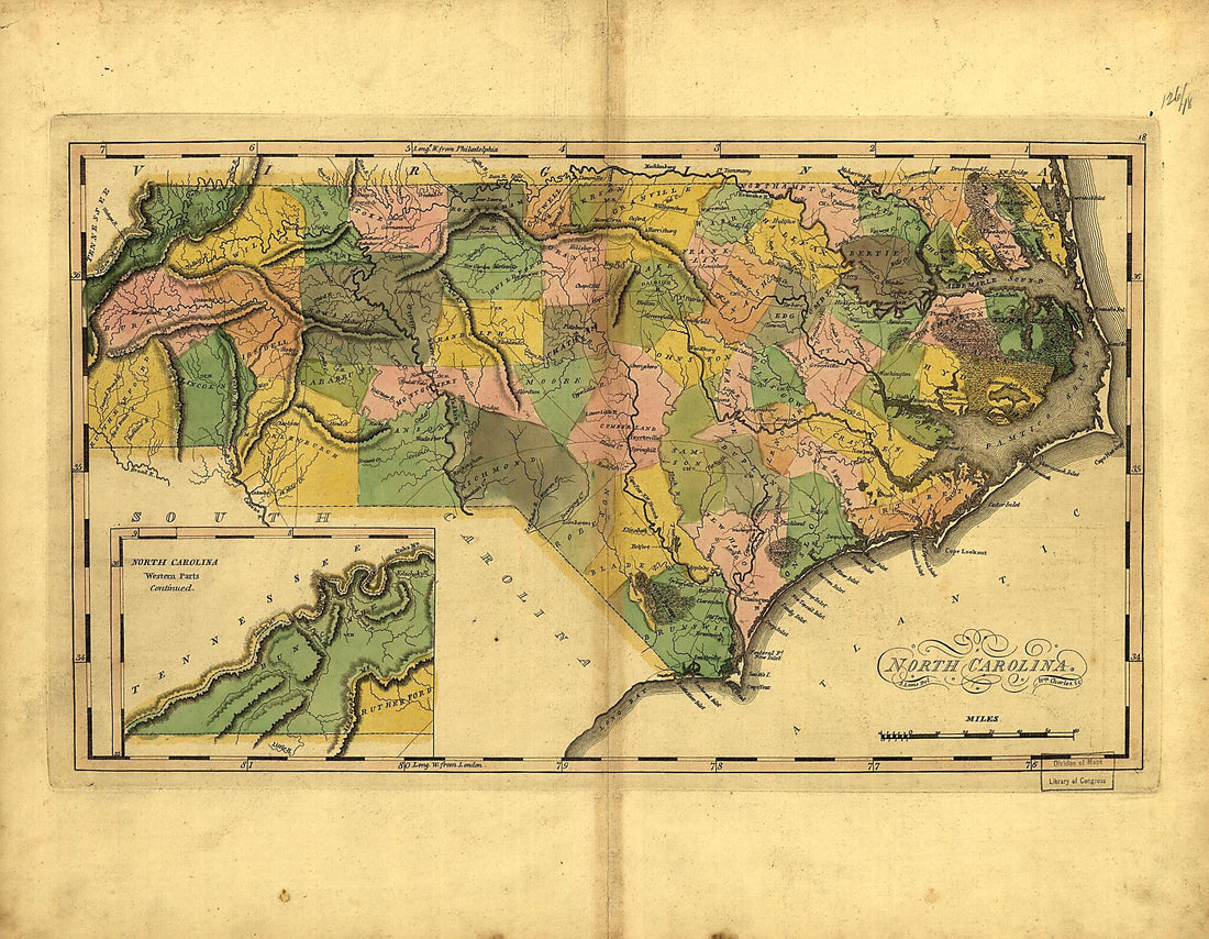 North Carolina 1814North Carolina 1814
- Regular price
-
$39.95 $83.95 - Regular price
-
$34.95 - Sale price
-
$39.95 $83.95
-
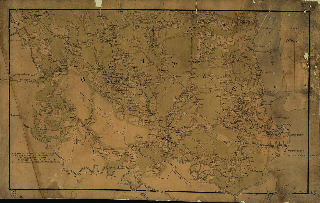 Map of Bertie County, North Carolina : No. 2 1863Map of Bertie County, North Carolina : No. 2 1863
- Regular price
-
$46.95 $151.95 - Regular price
-
$41.95 - Sale price
-
$46.95 $151.95
-
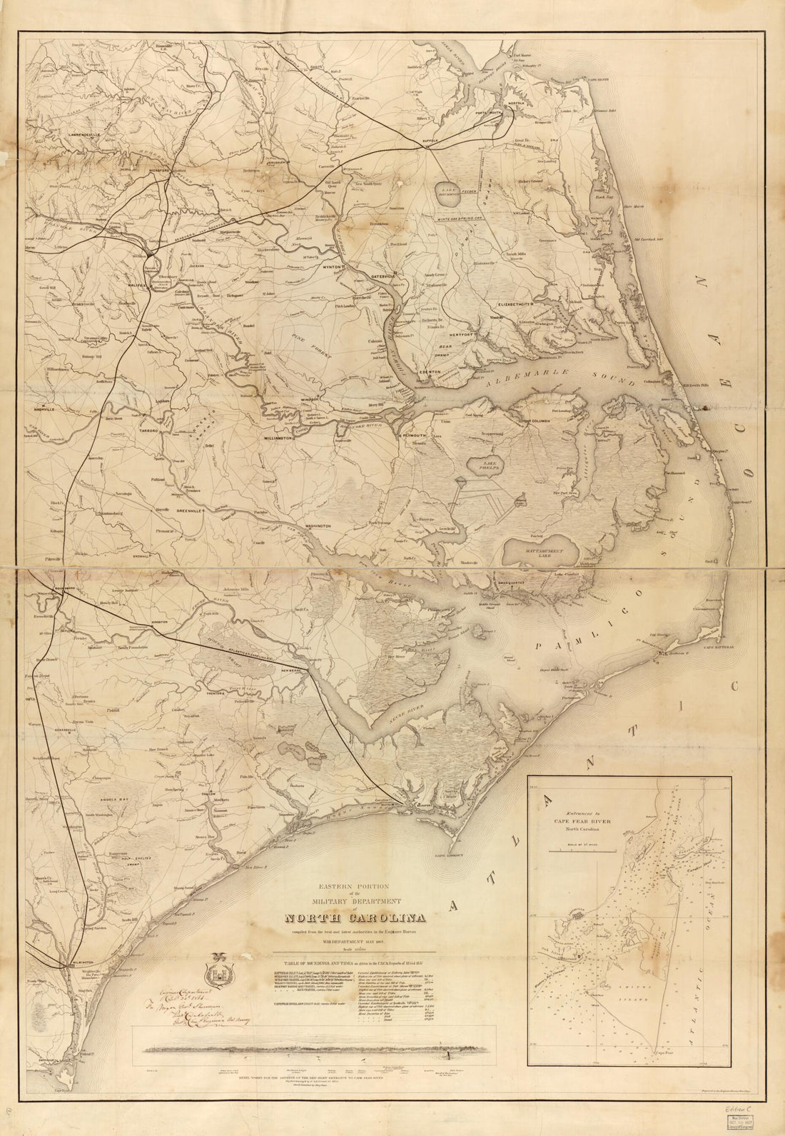 Eastern Portion of the Military Department of North Carolina 1862Eastern Portion of the Military Department of North Carolina 1862
- Regular price
-
$46.95 $137.95 - Regular price
-
$41.95 - Sale price
-
$46.95 $137.95
-
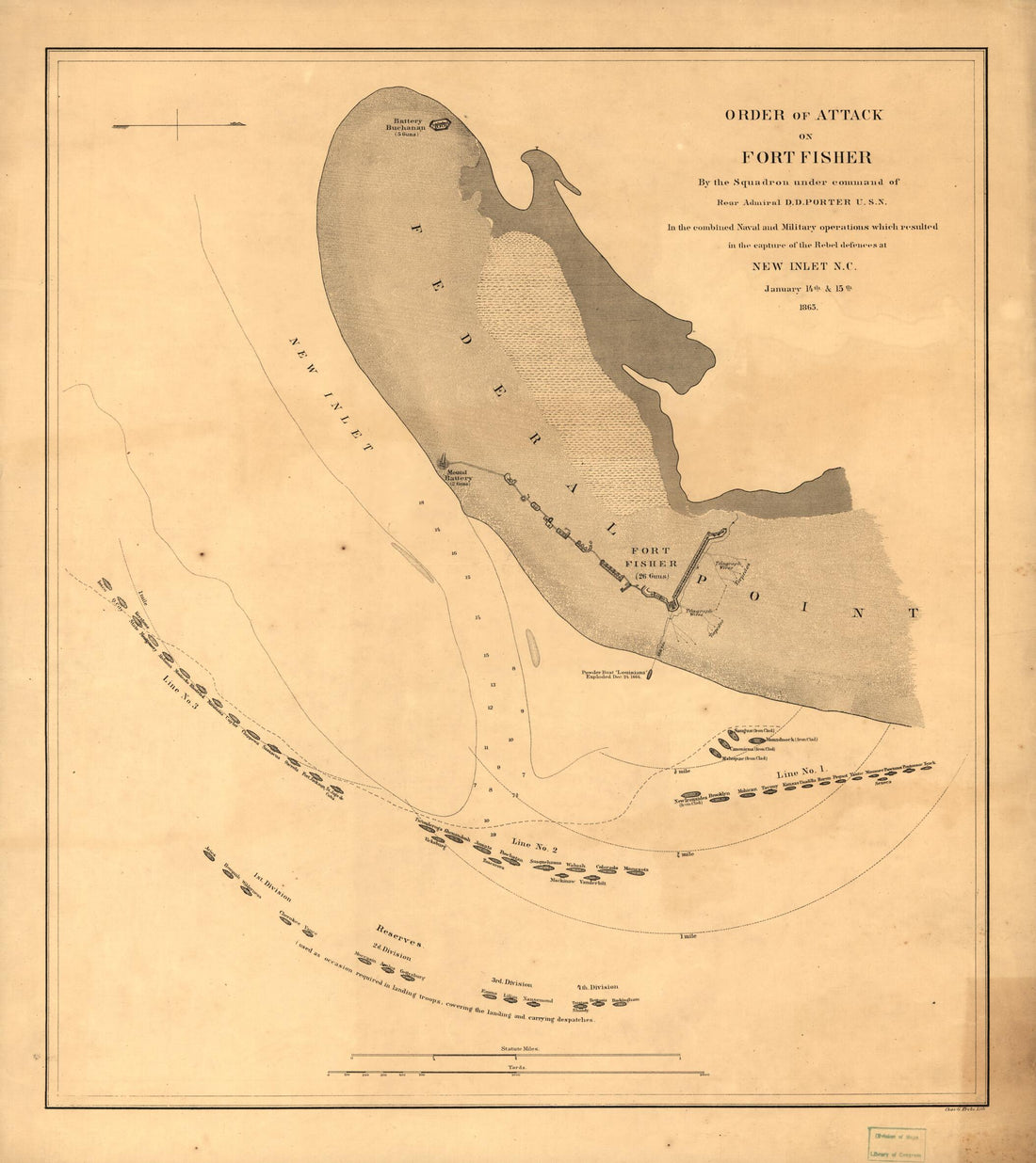 Order of Attack On Fort Fisher by the Squadron Under Command of Rear Admiral D. D. Porter, U.S.N. In the Combined Naval and Military Operations Which Resulted In the Capture of the Rebel Defences at New Inlet, N.C. January 14th & 15th 1865Order of Attack On Fort Fisher by the Squadron Under Command of Rear Admiral D. D. Porter, U.S.N. In the Combined Naval and Military Operations Which Resulted In the Capture of the Rebel Defences at New Inlet, N.C. January 14th & 15th 1865
- Regular price
-
$39.95 $83.95 - Regular price
-
$34.95 - Sale price
-
$39.95 $83.95
-
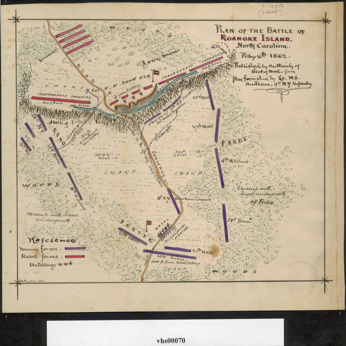 Plan of the Battle of Roanoke Island. North Carolina. Feby 8th 1862 02-08Plan of the Battle of Roanoke Island. North Carolina. Feby 8th 1862 02-08
- Regular price
-
$39.95 $83.95 - Regular price
-
$29.95 - Sale price
-
$39.95 $83.95
-
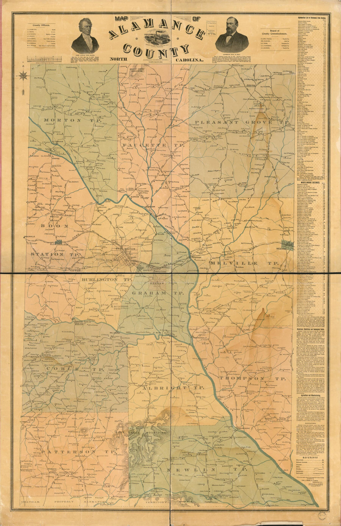 Map of Alamance County, North Carolina in 1893Map of Alamance County, North Carolina in 1893
- Regular price
-
$46.95 $210.95 - Regular price
-
$41.95 - Sale price
-
$46.95 $210.95
-
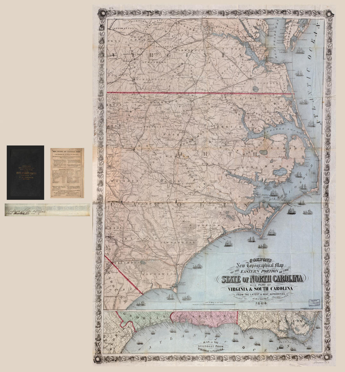 Colton's New Topographical Map of the Eastern Portion of the State of North Carolina With Part of Virginia & South Carolina from the Latest & Best Authorities 1864Colton's New Topographical Map of the Eastern Portion of the State of North Carolina With Part of Virginia & South Carolina from the Latest & Best Authorities 1864
- Regular price
-
$39.95 $164.95 - Regular price
-
$34.95 - Sale price
-
$39.95 $164.95
-
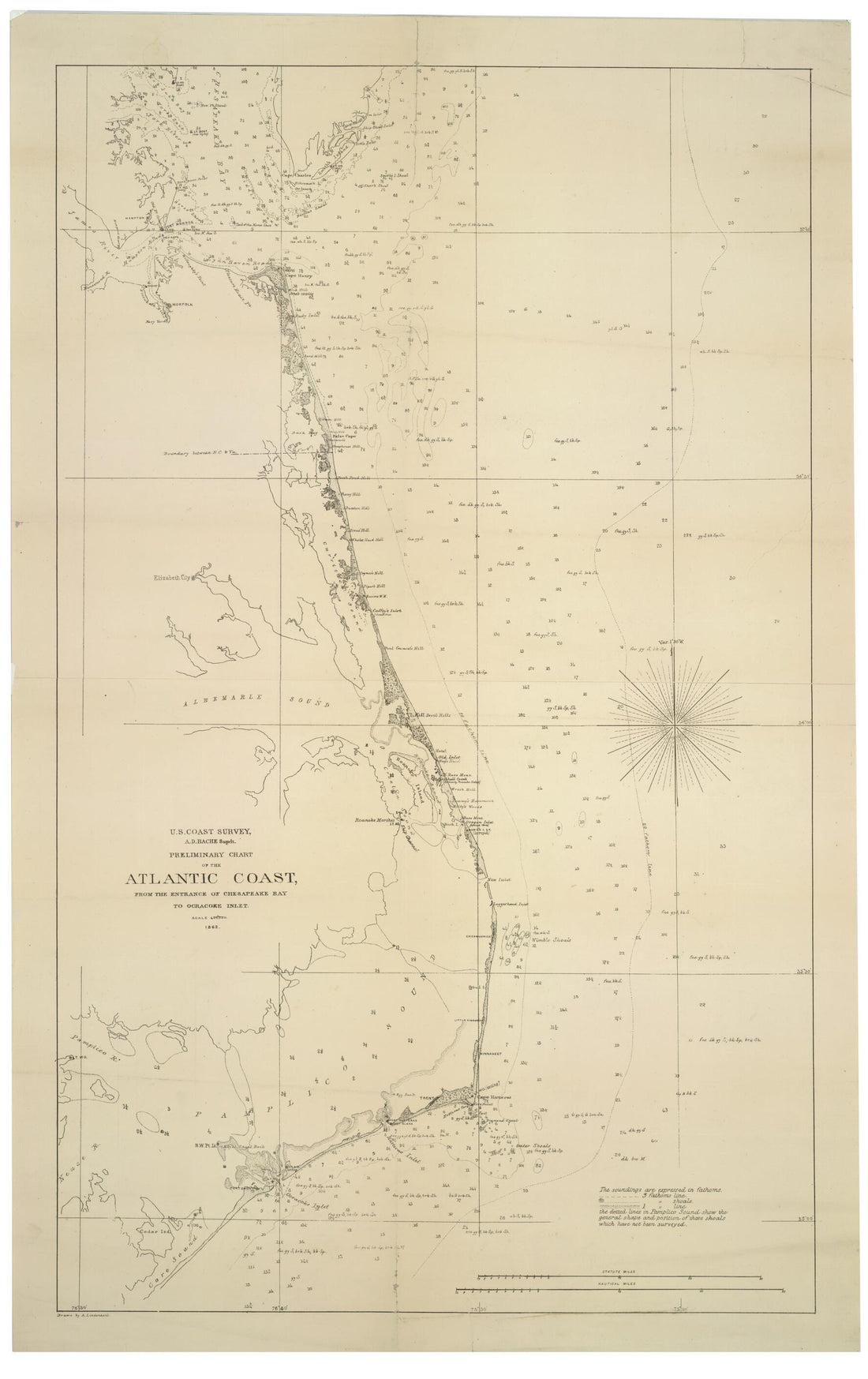 Preliminary Chart of the Atlantic Coast : from the Entrance of Chesapeake Bay to Ocracoke Inlet (U.S. Coast Survey, A.D. Bache Supdt.) 1862Preliminary Chart of the Atlantic Coast : from the Entrance of Chesapeake Bay to Ocracoke Inlet (U.S. Coast Survey, A.D. Bache Supdt.) 1862
- Regular price
-
$46.95 $99.95 - Regular price
-
$41.95 - Sale price
-
$46.95 $99.95
-
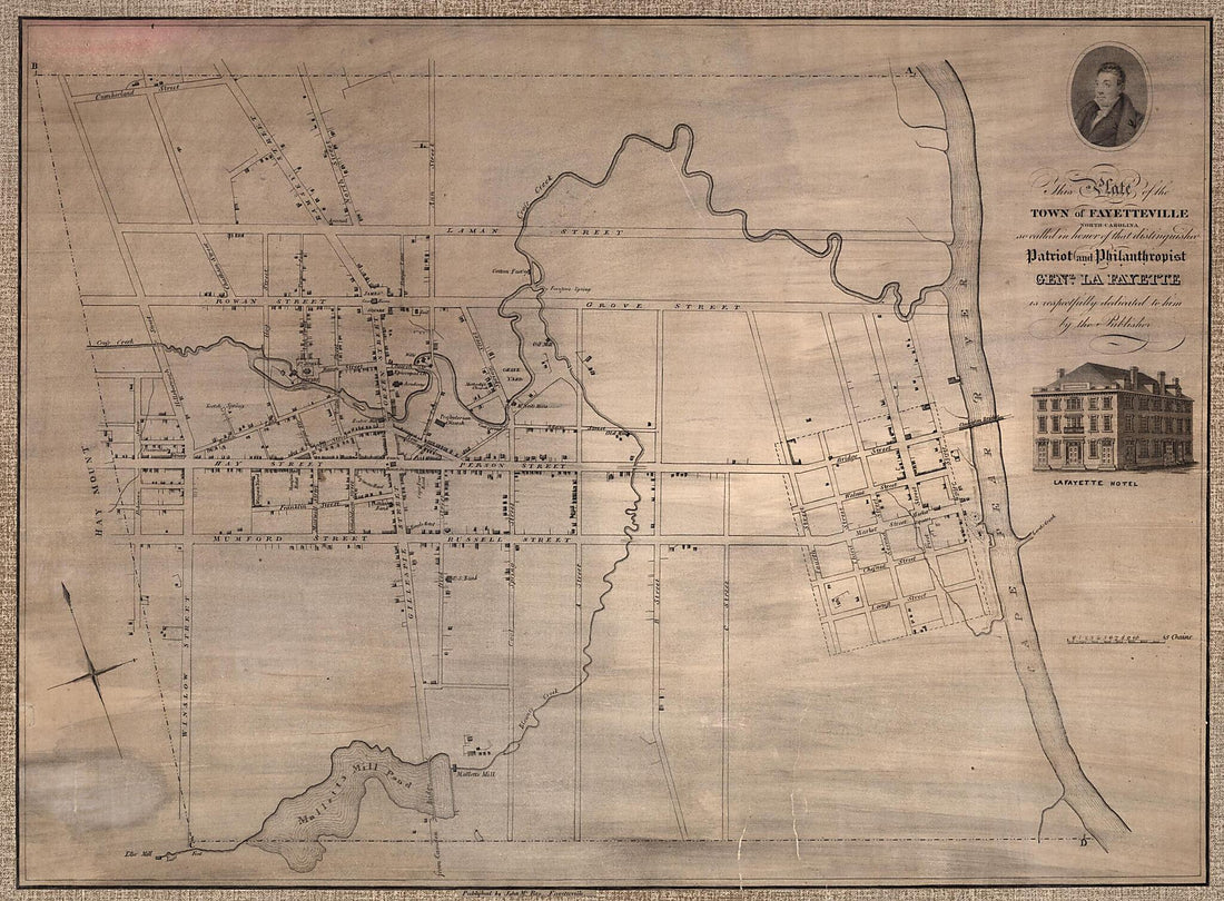 This Plate of the Town of Fayetteville North Carolina, So Called In Honor of That Distinguished Patriot and Philanthropist, Gen'l La Fayette, Is Respectfully Dedicated to Him by the Publisher 1822This Plate of the Town of Fayetteville North Carolina, So Called In Honor of That Distinguished Patriot and Philanthropist, Gen'l La Fayette, Is Respectfully Dedicated to Him by the Publisher 1822
- Regular price
-
$43.95 $144.95 - Regular price
-
$32.95 - Sale price
-
$43.95 $144.95
-
 North Carolina 1895North Carolina 1895
- Regular price
-
$39.95 $83.95 - Regular price
-
$34.95 - Sale price
-
$39.95 $83.95
-
 Pictorial Map of the Seat of War, Showing Parts of the States of Maryland, Delaware, Virginia, and North Carolina, and Also the Coast Line from Cape Henry to Fort Pickens, With the United States Blockading Fleet 1861Pictorial Map of the Seat of War, Showing Parts of the States of Maryland, Delaware, Virginia, and North Carolina, and Also the Coast Line from Cape Henry to Fort Pickens, With the United States Blockading Fleet 1861
- Regular price
-
$43.95 $88.95 - Regular price
-
$32.95 - Sale price
-
$43.95 $88.95
-
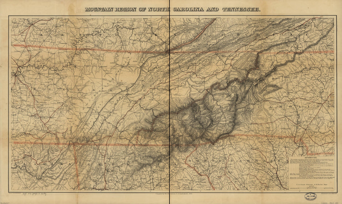 Mountain Region of North Carolina and Tennessee 1863Mountain Region of North Carolina and Tennessee 1863
- Regular price
-
$46.95 $99.95 - Regular price
-
$41.95 - Sale price
-
$46.95 $99.95


