181 products
-
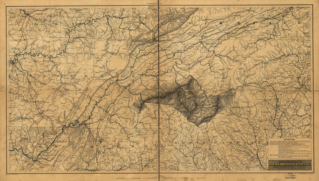 Mountain Region of North Carolina and Tennessee 1863Mountain Region of North Carolina and Tennessee 1863
- Regular price
-
$46.95 $99.95 - Regular price
-
$41.95 - Sale price
-
$46.95 $99.95
-
 Bird's Eye View of Confederate Prison Pen at Salisbury, N.C., Taken In 1864Bird's Eye View of Confederate Prison Pen at Salisbury, N.C., Taken In 1864
- Regular price
-
$43.95 $208.95 - Regular price
-
$38.95 - Sale price
-
$43.95 $208.95
-
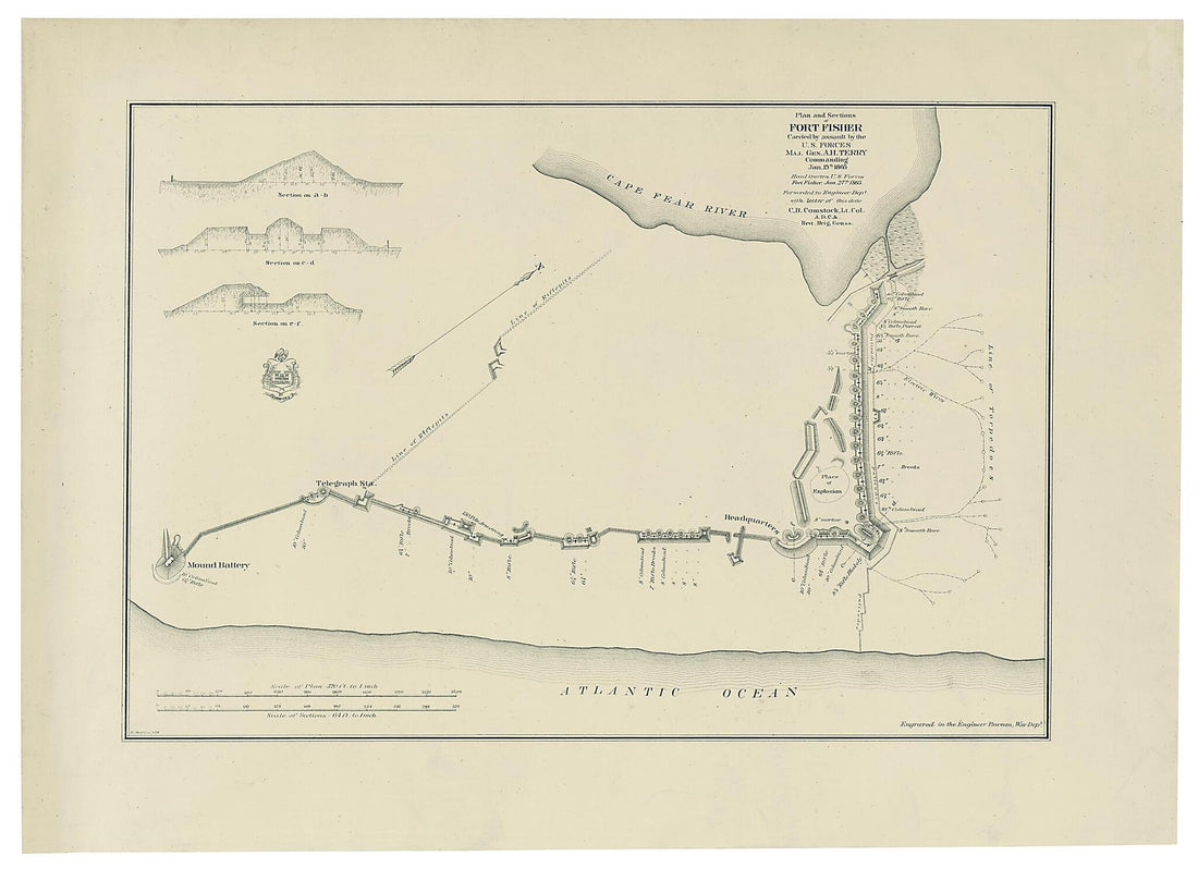 Plan and Sections of Fort Fisher, Carried by Assault by the U.S. Forces, Maj. Gen. A.H. Terry Commanding, Jan. 15th, 1865Plan and Sections of Fort Fisher, Carried by Assault by the U.S. Forces, Maj. Gen. A.H. Terry Commanding, Jan. 15th, 1865
- Regular price
-
$43.95 $88.95 - Regular price
-
$31.95 - Sale price
-
$43.95 $88.95
-
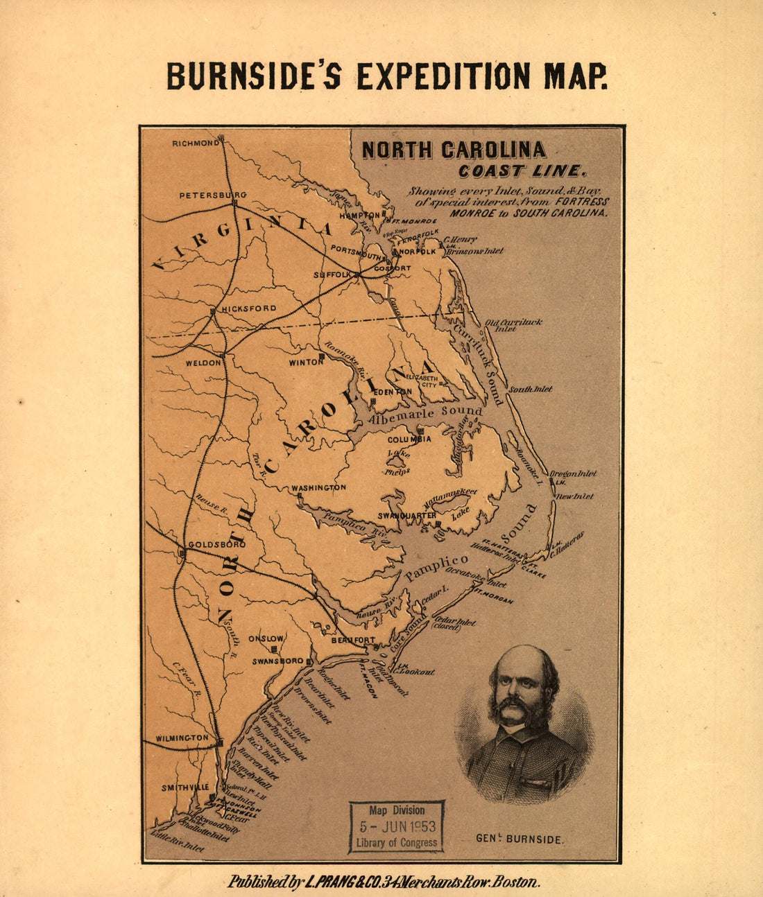 North Carolina Coast Line. Showing Every Inlet, Sound & Bay of Special Interest, from Fortress Monroe to South Carolina 1862North Carolina Coast Line. Showing Every Inlet, Sound & Bay of Special Interest, from Fortress Monroe to South Carolina 1862
- Regular price
-
$39.95 $83.95 - Regular price
-
$34.95 - Sale price
-
$39.95 $83.95
-
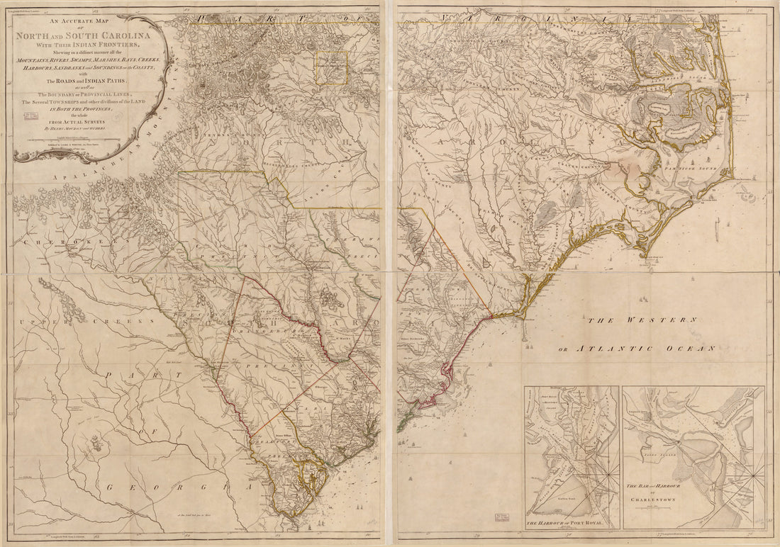 An Accurate Map of North and South Carolina With Their Indian Frontier, Shewing In a Distinct Manner All the Mountains, Rivers, Swamps, Arshes, Bays, Creeks, Harbours, Sandbanks and Soundings On the Coasts With the Roads and Indian Paths As Well As th...An Accurate Map of North and South Carolina With Their Indian Frontier, Shewing In a Distinct Manner All the Mountains, Rivers, Swamps, Arshes, Bays, Creeks, Harbours, Sandbanks and Soundings On the Coasts With the Roads and Indian Paths As Well As th...
- Regular price
-
$43.95 $219.95 - Regular price
-
$38.95 - Sale price
-
$43.95 $219.95
-
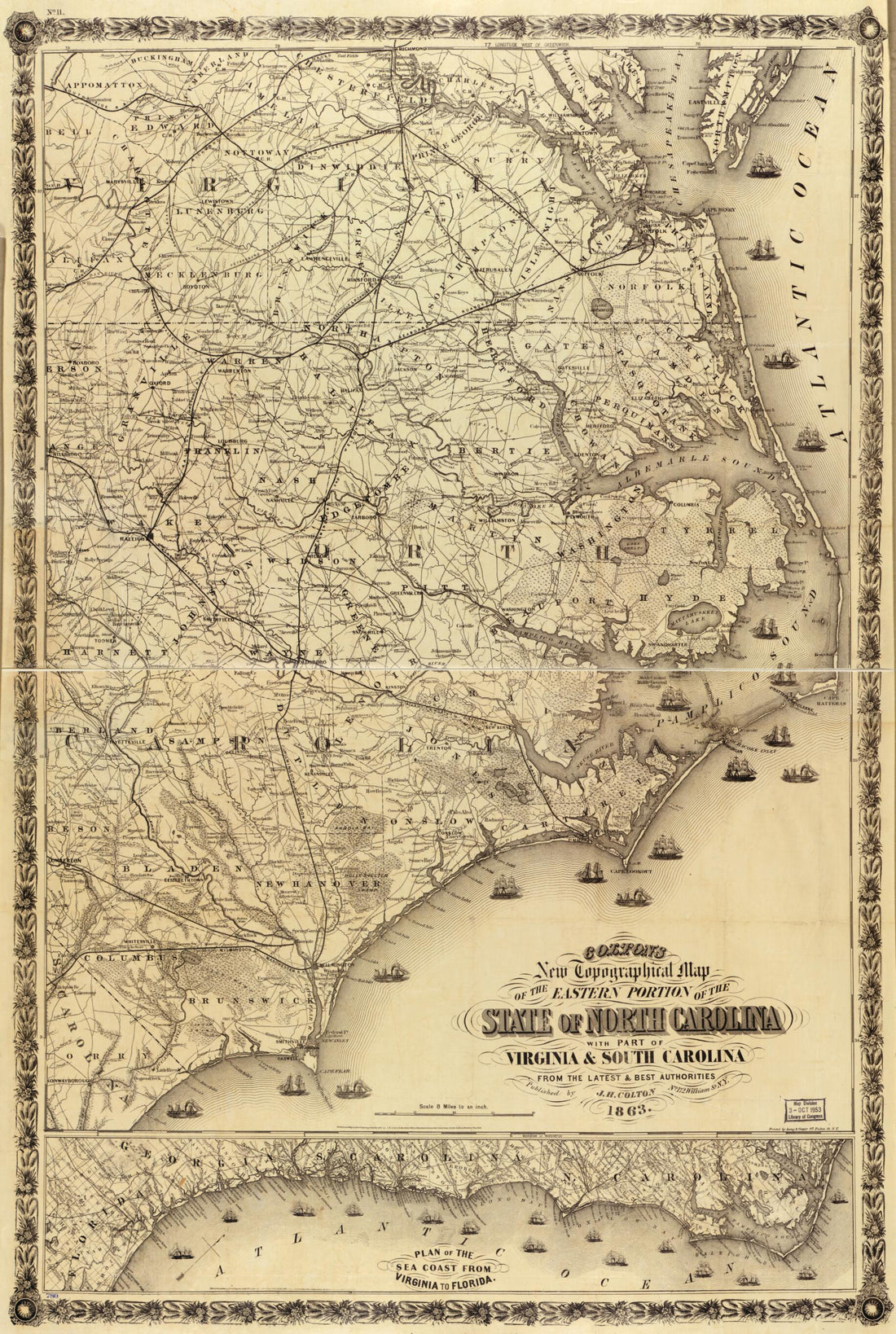 Colton's New Topographical Map of the Eastern Portion of the State of North Carolina : With Part of Virginia & South Carolina, From the Latest & Best Authorities in 1863Colton's New Topographical Map of the Eastern Portion of the State of North Carolina : With Part of Virginia & South Carolina, From the Latest & Best Authorities in 1863
- Regular price
-
$46.95 $122.95 - Regular price
-
$41.95 - Sale price
-
$46.95 $122.95
-
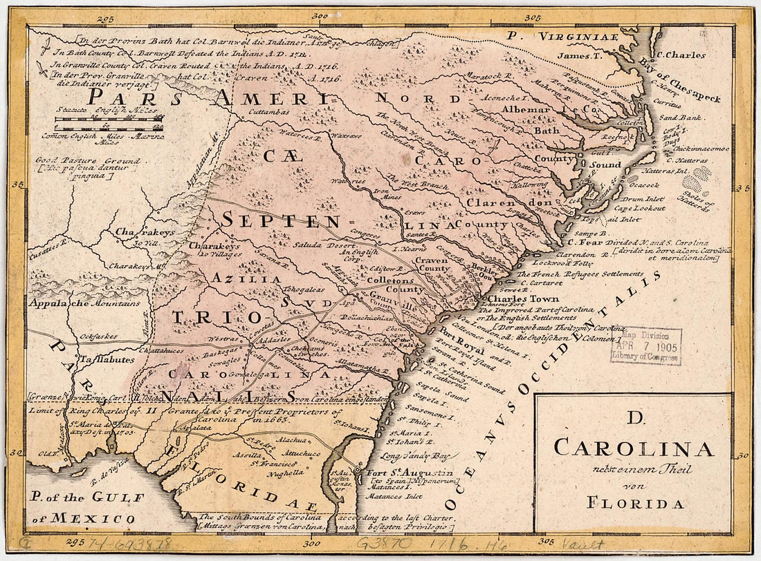 D. Carolina, Nebst Einem Theil Von Florida 1759D. Carolina, Nebst Einem Theil Von Florida 1759
- Regular price
-
$39.95 $88.95 - Regular price
-
$34.95 - Sale price
-
$39.95 $88.95
-
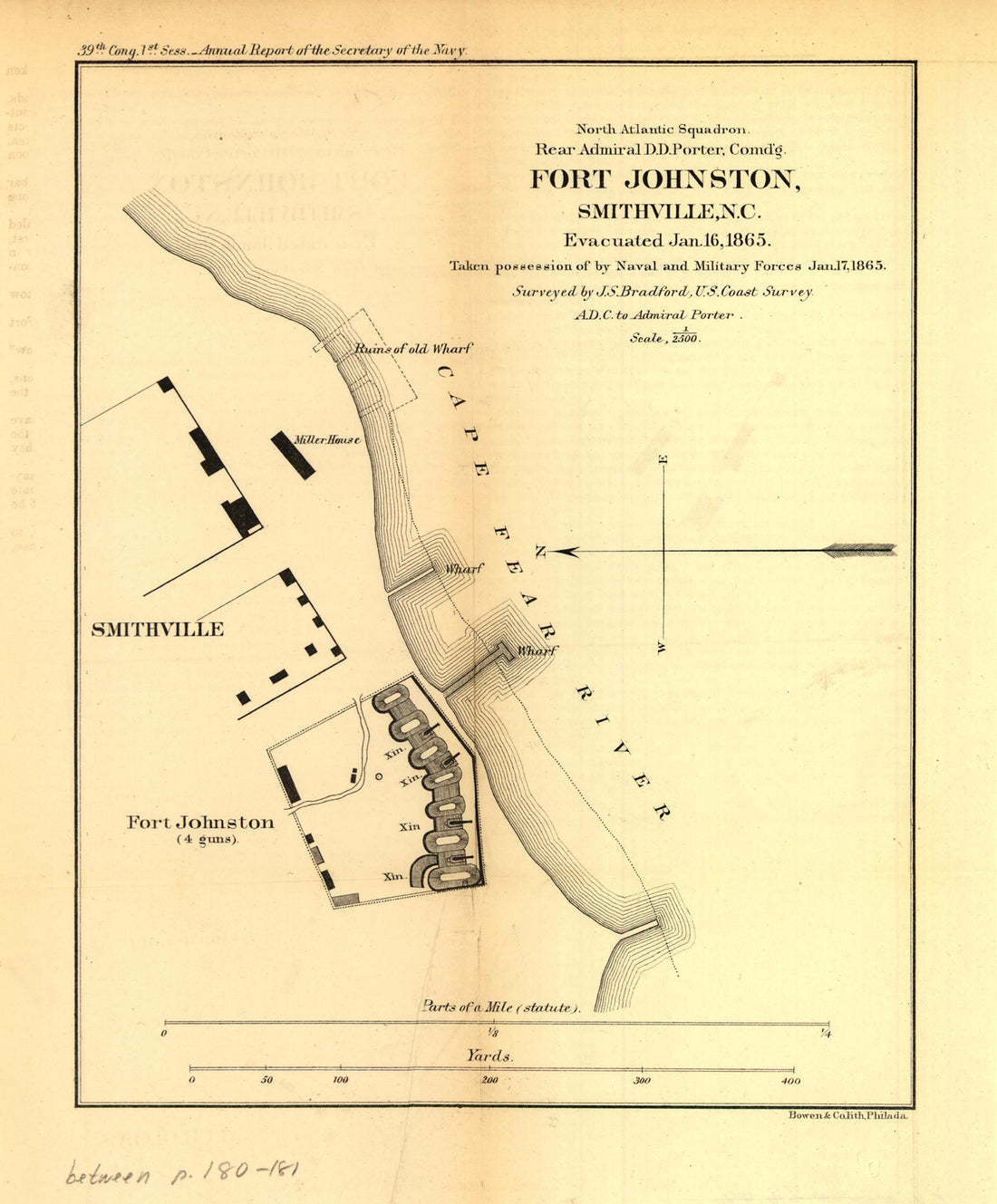 Fort Johnston, Smithville, N.C. Evacuated Jan 16, 1865. Taken Possession of by Naval and Military Forces Jan. 17, 1865Fort Johnston, Smithville, N.C. Evacuated Jan 16, 1865. Taken Possession of by Naval and Military Forces Jan. 17, 1865
- Regular price
-
$39.95 $83.95 - Regular price
-
$34.95 - Sale price
-
$39.95 $83.95
-
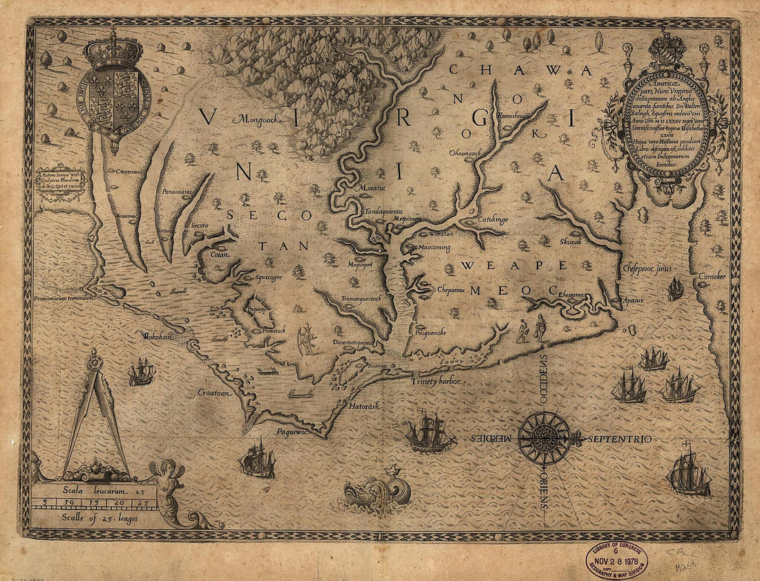 Americæ Pars, Nunc Virginia Dicta : Primum Ab Anglis Inuenta, Sumtibus Dn. Walteri Raleigh, Equestris Ordinis Viri, Anno Dn̄i. MDLXXXV Regni Vero Sereniss. Nostræ Reginæ Elisabethæ XXVII, Hujus Vero Historia Peculiari Libro Descripta Est, Additis...Americæ Pars, Nunc Virginia Dicta : Primum Ab Anglis Inuenta, Sumtibus Dn. Walteri Raleigh, Equestris Ordinis Viri, Anno Dn̄i. MDLXXXV Regni Vero Sereniss. Nostræ Reginæ Elisabethæ XXVII, Hujus Vero Historia Peculiari Libro Descripta Est, Additis...
- Regular price
-
$39.95 $88.95 - Regular price
-
$34.95 - Sale price
-
$39.95 $88.95
-
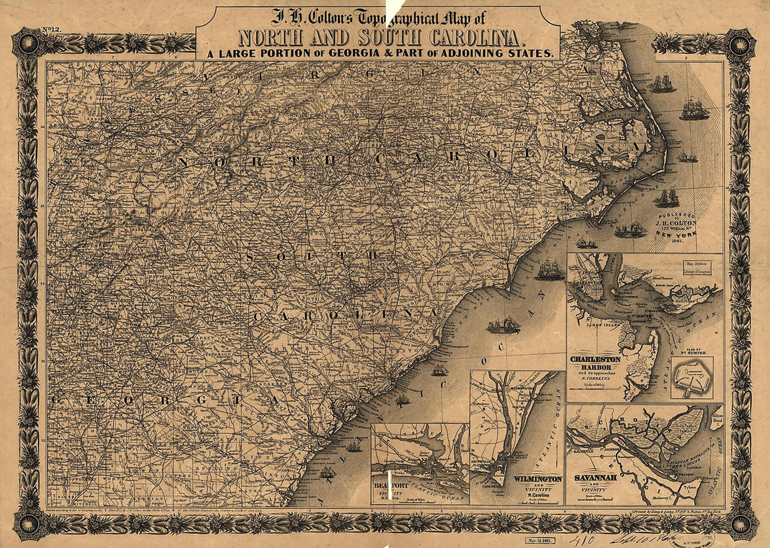 J. H. Colton's Topographical Map of North and South Carolina. a Large Portion of Georgia & Part of Adjoining States. Entered According to Act of Congress In the Year 1861 by J.H. ColtonJ. H. Colton's Topographical Map of North and South Carolina. a Large Portion of Georgia & Part of Adjoining States. Entered According to Act of Congress In the Year 1861 by J.H. Colton
- Regular price
-
$43.95 $126.95 - Regular price
-
$38.95 - Sale price
-
$43.95 $126.95
-
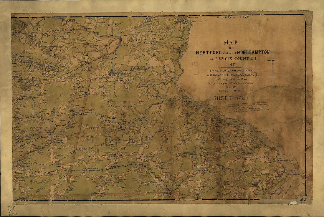 Map of Hertford and Part of Northampton and Bertie Counties, N.C. : Surveyed Under the Direction of A.H. Campbell, Capt. of Engineers & Ch'f. Topog'l Dep't N.D. Va 1863Map of Hertford and Part of Northampton and Bertie Counties, N.C. : Surveyed Under the Direction of A.H. Campbell, Capt. of Engineers & Ch'f. Topog'l Dep't N.D. Va 1863
- Regular price
-
$46.95 $157.95 - Regular price
-
$41.95 - Sale price
-
$46.95 $157.95
-
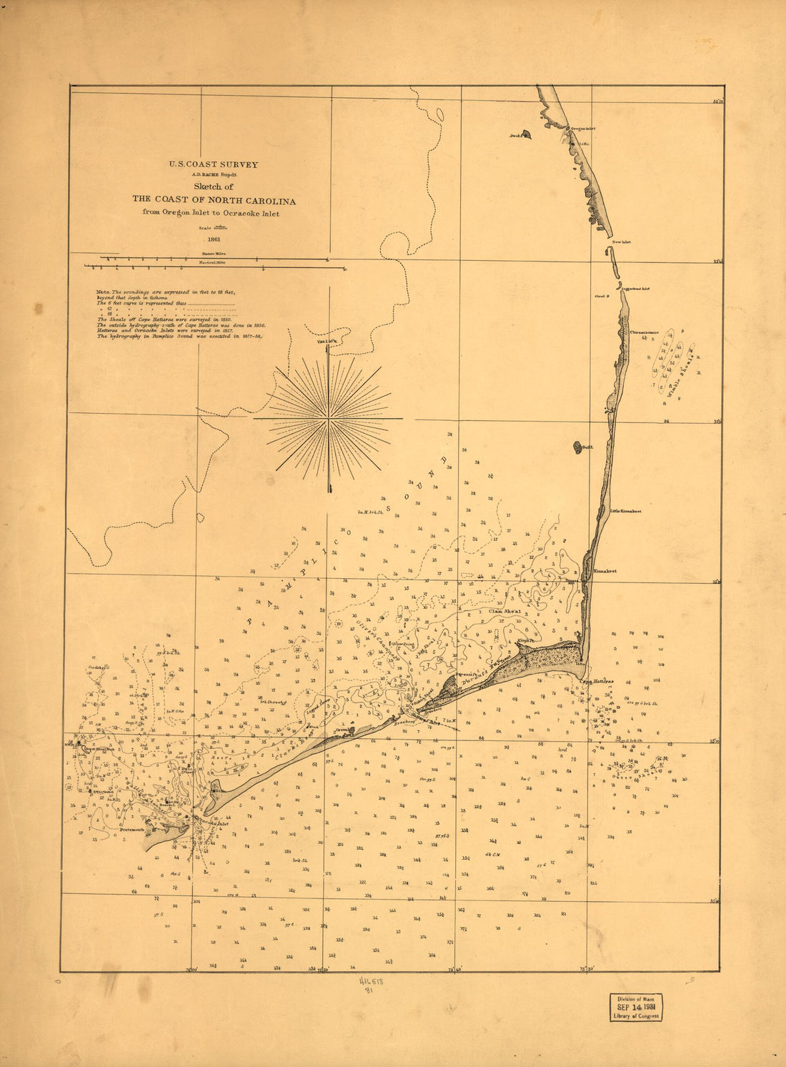 Sketch of the Coast of North Carolina from Oregon Inlet to Ocracoke Inlet 1861Sketch of the Coast of North Carolina from Oregon Inlet to Ocracoke Inlet 1861
- Regular price
-
$43.95 $88.95 - Regular price
-
$38.95 - Sale price
-
$43.95 $88.95


