96 products
-
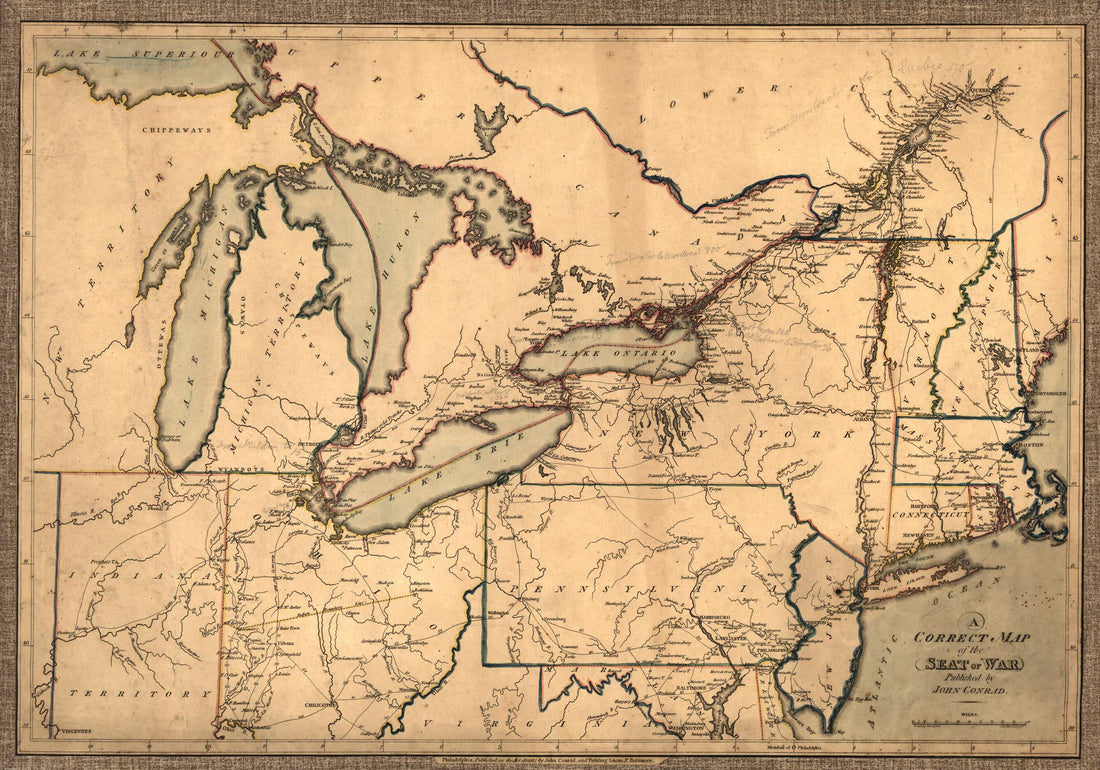 A Correct Map of the Seat of War in 1812A Correct Map of the Seat of War in 1812
- Regular price
-
$46.95 $99.95 - Regular price
-
$41.95 - Sale price
-
$46.95 $99.95
-
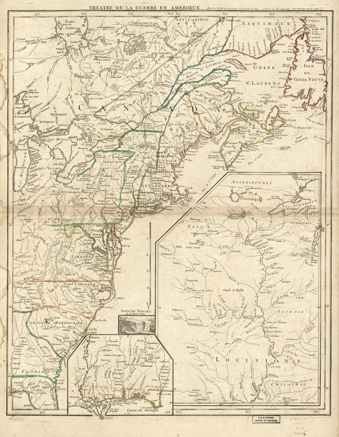
 Carte Du Théatre De La Guerre Entre Les Anglais Et Les Américains: in 1782Carte Du Théatre De La Guerre Entre Les Anglais Et Les Américains: in 1782
- Regular price
-
$46.95 $99.95 - Regular price
-
$41.95 - Sale price
-
$46.95 $99.95
-
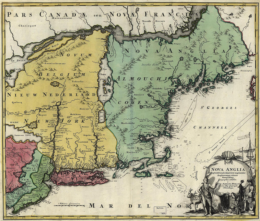 Nova Anglia 1759Nova Anglia 1759
- Regular price
-
$39.95 $104.95 - Regular price
-
$34.95 - Sale price
-
$39.95 $104.95
-
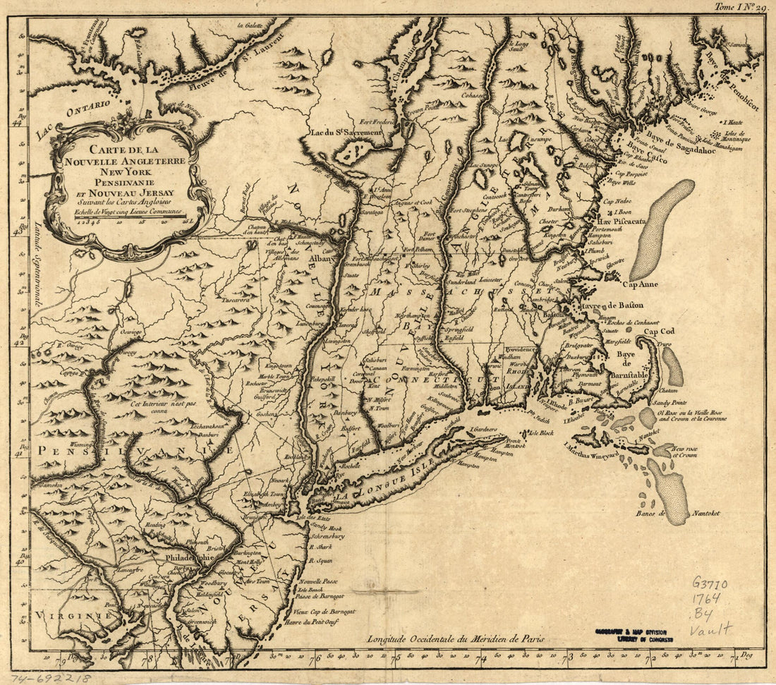 Carte De La Nouvelle Angleterre, New York, Pensilvanie Et Nouveau Jersay Suivant Les Cartes Angloises 1764Carte De La Nouvelle Angleterre, New York, Pensilvanie Et Nouveau Jersay Suivant Les Cartes Angloises 1764
- Regular price
-
$39.95 $83.95 - Regular price
-
$29.95 - Sale price
-
$39.95 $83.95
-
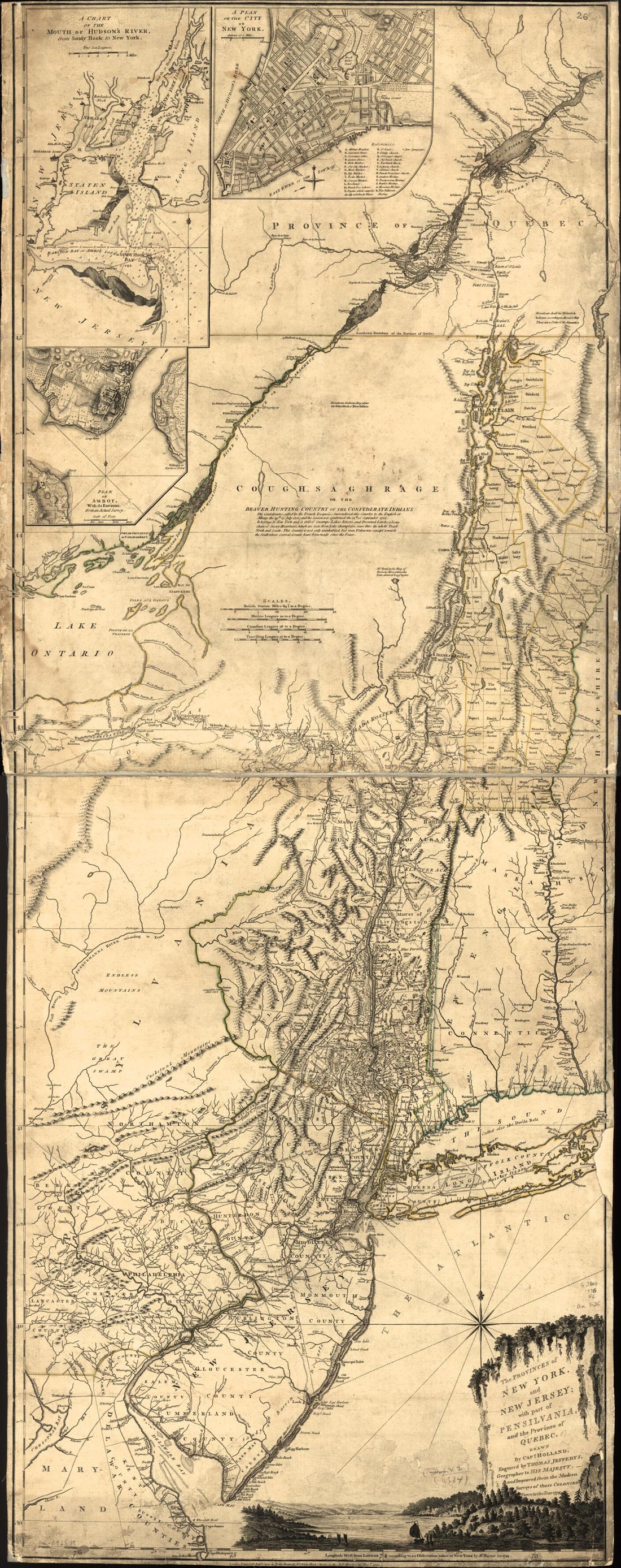 The Provinces of New York and New Jersey; With Part of Pensilvania, and the Province of Quebec in 1776The Provinces of New York and New Jersey; With Part of Pensilvania, and the Province of Quebec in 1776
- Regular price
-
$46.95 $348.95 - Regular price
-
$41.95 - Sale price
-
$46.95 $348.95
-
 York, Reduc'd from the Large Drawing of That Province, Compiled from Actual Surveys by Order of His Excellency William Tryon, Esqr. Captain General & Governor of the Same 1776York, Reduc'd from the Large Drawing of That Province, Compiled from Actual Surveys by Order of His Excellency William Tryon, Esqr. Captain General & Governor of the Same 1776
- Regular price
-
$39.95 $104.95 - Regular price
-
$34.95 - Sale price
-
$39.95 $104.95
-
 Map Shewing the Several Routes Proposed for the Passage of Gunboats to the Lakes Via: Erie and Oswego Canal; Champlain Canal; Illinois River and Chicago Canal; Wisconsin, Green Bay Canal 1862Map Shewing the Several Routes Proposed for the Passage of Gunboats to the Lakes Via: Erie and Oswego Canal; Champlain Canal; Illinois River and Chicago Canal; Wisconsin, Green Bay Canal 1862
- Regular price
-
$46.95 $107.95 - Regular price
-
$41.95 - Sale price
-
$46.95 $107.95
-
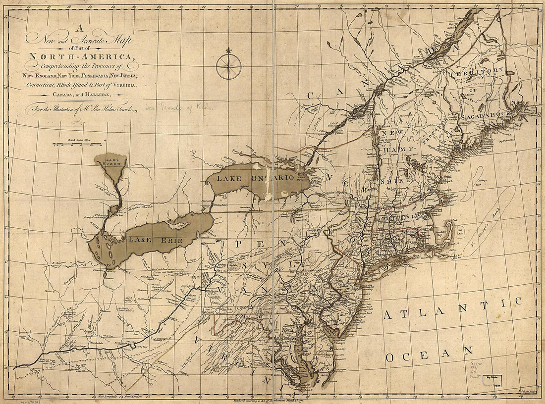 America, Comprehending the Provinces of New England, New York, Pensilvania, New Jersey, Connecticut, Rhode Island & Part of Virginia, Canada and Hallifax, for the Illustration of Mr. Peter Kalms Travels 1771America, Comprehending the Provinces of New England, New York, Pensilvania, New Jersey, Connecticut, Rhode Island & Part of Virginia, Canada and Hallifax, for the Illustration of Mr. Peter Kalms Travels 1771
- Regular price
-
$43.95 $163.95 - Regular price
-
$32.95 - Sale price
-
$43.95 $163.95
-
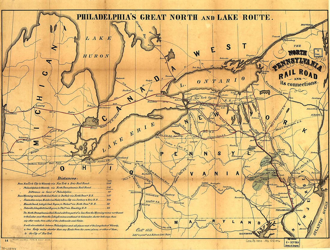 The North Pennsylvania Rail Road and Its Connections, Octr. 1853The North Pennsylvania Rail Road and Its Connections, Octr. 1853
- Regular price
-
$43.95 $109.95 - Regular price
-
$32.95 - Sale price
-
$43.95 $109.95
-
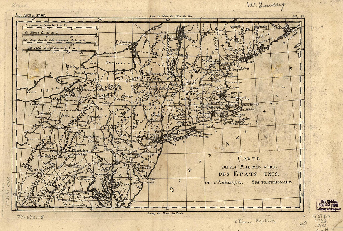 Carte De La Partie Nord, Des États Unis De L'Amérique Septentrionale 1783Carte De La Partie Nord, Des États Unis De L'Amérique Septentrionale 1783
- Regular price
-
$39.95 $99.95 - Regular price
-
$29.95 - Sale price
-
$39.95 $99.95
-
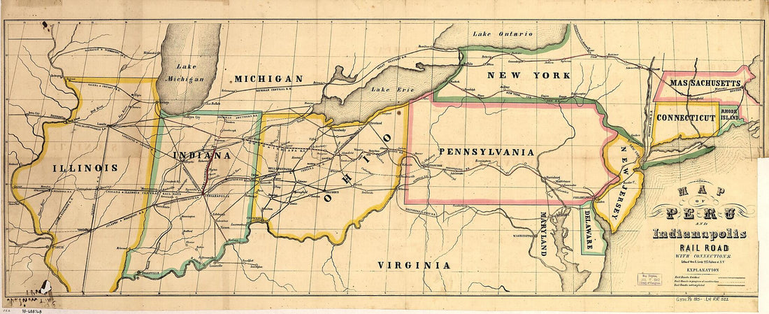 Map of Peru and Indianapolis Rail Road With Connections 1850Map of Peru and Indianapolis Rail Road With Connections 1850
- Regular price
-
$46.95 $119.95 - Regular price
-
$41.95 - Sale price
-
$46.95 $119.95
-
 Carte De L'Amérique Septle. Pour Servir à L'intelligence De La Guerre Entre Les Anglois Et Les Insurgents 1777Carte De L'Amérique Septle. Pour Servir à L'intelligence De La Guerre Entre Les Anglois Et Les Insurgents 1777
- Regular price
-
$43.95 $88.95 - Regular price
-
$32.95 - Sale price
-
$43.95 $88.95


