77 products
-
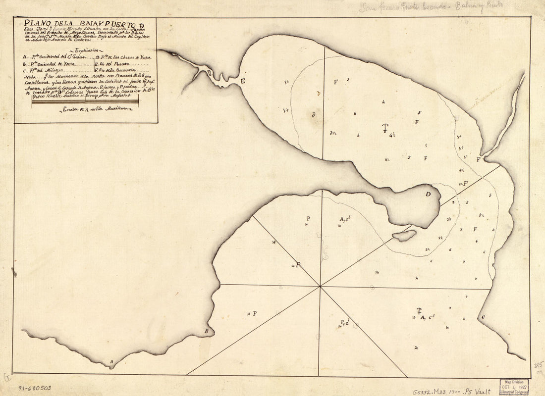 Plano De La Baia Y Puerto De San Josef O Fuerte Escudo Situado En La Costa Septentrional Del Estrecho De Magallanes 1700Plano De La Baia Y Puerto De San Josef O Fuerte Escudo Situado En La Costa Septentrional Del Estrecho De Magallanes 1700
- Regular price
-
$39.95 $88.95 - Regular price
-
$29.95 - Sale price
-
$39.95 $88.95
-
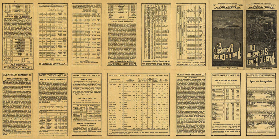 Map Showing Routes of the Pacific Coast Steamship Company 1891Map Showing Routes of the Pacific Coast Steamship Company 1891
- Regular price
-
$46.95 $99.95 - Regular price
-
$41.95 - Sale price
-
$46.95 $99.95
-
 Plano De La Bahía De Estuardo Situado En La Costa Meridional Del Estreche De Magallanes Por Latd. S. De 53⁰23ʹ Y Longd. De 67⁰8ʺ sic 20ʺ Occidental De Cádiz 1786Plano De La Bahía De Estuardo Situado En La Costa Meridional Del Estreche De Magallanes Por Latd. S. De 53⁰23ʹ Y Longd. De 67⁰8ʺ sic 20ʺ Occidental De Cádiz 1786
- Regular price
-
$39.95 $88.95 - Regular price
-
$29.95 - Sale price
-
$39.95 $88.95
-
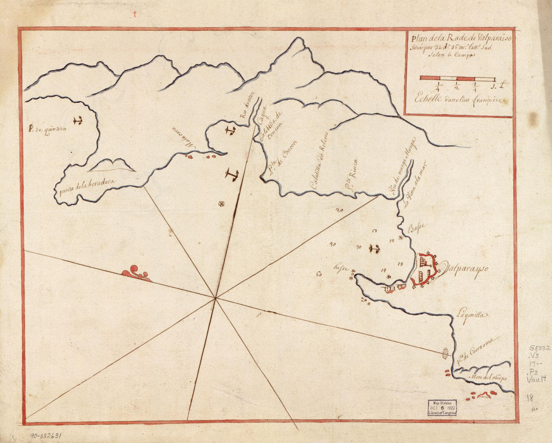 Plan De La Rade De Valparaiso Situé Par 32 Ds. 56 Ms. Lattd. Sud Selon Le Compas 1700Plan De La Rade De Valparaiso Situé Par 32 Ds. 56 Ms. Lattd. Sud Selon Le Compas 1700
- Regular price
-
$39.95 $83.95 - Regular price
-
$32.95 - Sale price
-
$39.95 $83.95
-
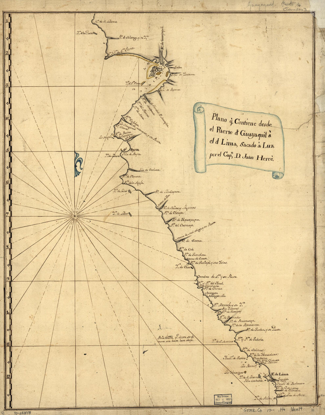 Plano Q. Contiene Desde El Puerto D. Guayaquil a El D. Lima, Sacado a Luz 1700Plano Q. Contiene Desde El Puerto D. Guayaquil a El D. Lima, Sacado a Luz 1700
- Regular price
-
$39.95 $83.95 - Regular price
-
$34.95 - Sale price
-
$39.95 $83.95
-
 Plan Du Port De Gouasco a La Côtte Du Chily Par Les 28 Degréz 30 M. Sud Selon Le Compas 1700Plan Du Port De Gouasco a La Côtte Du Chily Par Les 28 Degréz 30 M. Sud Selon Le Compas 1700
- Regular price
-
$39.95 $83.95 - Regular price
-
$29.95 - Sale price
-
$39.95 $83.95
-
 Plano De La Cala De Tomaseo Cituada En La Costa Septeentrional sic Del Estrecho De Magallans. Pr. Lattd. S. De 53⁰27 1/2ʹ Y Longd. De 66⁰45ʹ Occidental De Cádiz 1700Plano De La Cala De Tomaseo Cituada En La Costa Septeentrional sic Del Estrecho De Magallans. Pr. Lattd. S. De 53⁰27 1/2ʹ Y Longd. De 66⁰45ʹ Occidental De Cádiz 1700
- Regular price
-
$43.95 $88.95 - Regular price
-
$32.95 - Sale price
-
$43.95 $88.95
-
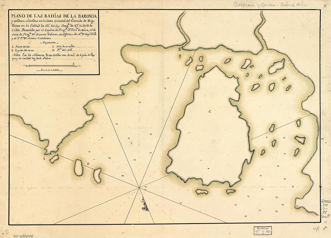 Plano De Las Bahías De La Baronesa Y Condesa Situadas En La Costa Oriental Del Estrecho De Magallanes En La Latitud De 53⁰24ʹS Y Longd. De 67⁰10ʹ Del O. De Cádiz 1700Plano De Las Bahías De La Baronesa Y Condesa Situadas En La Costa Oriental Del Estrecho De Magallanes En La Latitud De 53⁰24ʹS Y Longd. De 67⁰10ʹ Del O. De Cádiz 1700
- Regular price
-
$39.95 $88.95 - Regular price
-
$29.95 - Sale price
-
$39.95 $88.95
-
 Map Showing Coast of Northwestern Portion of Vancouver Island in 1786Map Showing Coast of Northwestern Portion of Vancouver Island in 1786
- Regular price
-
$39.95 $83.95 - Regular price
-
$34.95 - Sale price
-
$39.95 $83.95
-
 Map of the Far East and Adjacent Pacific. (with-ship) 1290Map of the Far East and Adjacent Pacific. (with-ship) 1290
- Regular price
-
$39.95 $99.95 - Regular price
-
$29.95 - Sale price
-
$39.95 $99.95
-
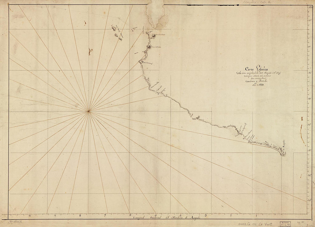 Carta Esferica De La Costa Comprehendida Desde Acapulco a Sn. Blas Trabajada Abordo De Las Corberas De La Marina Real Descubierta Y Atrevida, Año De 1791Carta Esferica De La Costa Comprehendida Desde Acapulco a Sn. Blas Trabajada Abordo De Las Corberas De La Marina Real Descubierta Y Atrevida, Año De 1791
- Regular price
-
$43.95 $147.95 - Regular price
-
$32.95 - Sale price
-
$43.95 $147.95
-
 Plano De La Bahía De Compcessión De Chile Situado En Los 36 Gs. 40 Ms. De Latd. S Y En Longd. De 297 Gs. 40 Ms. Mro. the sic Thenerife 1770Plano De La Bahía De Compcessión De Chile Situado En Los 36 Gs. 40 Ms. De Latd. S Y En Longd. De 297 Gs. 40 Ms. Mro. the sic Thenerife 1770
- Regular price
-
$39.95 $88.95 - Regular price
-
$29.95 - Sale price
-
$39.95 $88.95


