428 products
-
 Delaware - Continued, Maryland from Historical Hand-atlas, Illustrated, Containing Large Scale Copper Plate Maps of Each State and Territory of the United States, and the Provinces of Canada, Together With a Complete Reference Map of the World, … 1882Delaware - Continued, Maryland from Historical Hand-atlas, Illustrated, Containing Large Scale Copper Plate Maps of Each State and Territory of the United States, and the Provinces of Canada, Together With a Complete Reference Map of the World, … 1882
- Regular price
-
$49.95 $88.95 - Regular price
-
$22.95 - Sale price
-
$49.95 $88.95
-
 History of Wood County - Continued from Historical Hand-atlas, Illustrated, Containing Large Scale Copper Plate Maps of Each State and Territory of the United States, and the Provinces of Canada, Together With a Complete Reference Map of the World, �...History of Wood County - Continued from Historical Hand-atlas, Illustrated, Containing Large Scale Copper Plate Maps of Each State and Territory of the United States, and the Provinces of Canada, Together With a Complete Reference Map of the World, �...
- Regular price
-
$49.95 $88.95 - Regular price
-
$24.95 - Sale price
-
$49.95 $88.95
-
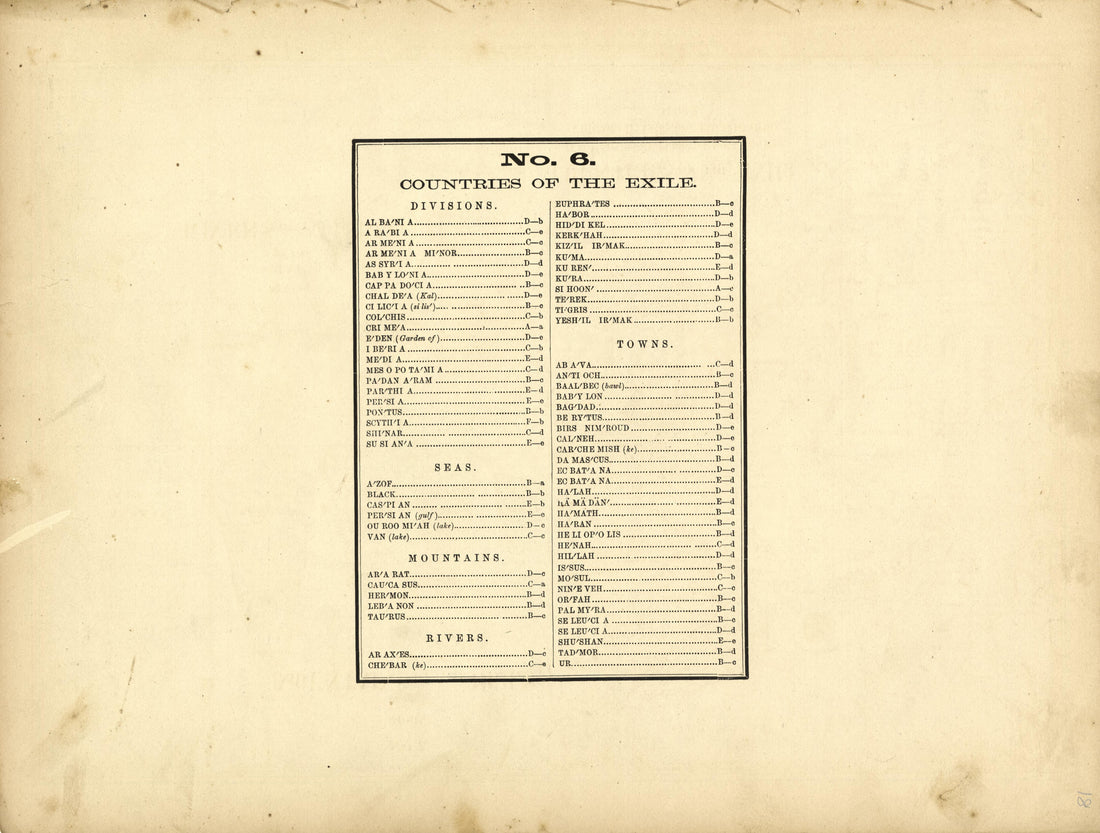 No. 6 Countries of the Exile from Historical Hand-atlas, Illustrated, Containing Large Scale Copper Plate Maps of Each State and Territory of the United States, and the Provinces of Canada, Together With a Complete Reference Map of the World, … 1882No. 6 Countries of the Exile from Historical Hand-atlas, Illustrated, Containing Large Scale Copper Plate Maps of Each State and Territory of the United States, and the Provinces of Canada, Together With a Complete Reference Map of the World, … 1882
- Regular price
-
$49.95 $88.95 - Regular price
-
$25.95 - Sale price
-
$49.95 $88.95
-
 History of the Virginias - Continued from Historical Hand-atlas, Illustrated, Containing Large Scale Copper Plate Maps of Each State and Territory of the United States, and the Provinces of Canada, Together With a Complete Reference Map of the World, ...History of the Virginias - Continued from Historical Hand-atlas, Illustrated, Containing Large Scale Copper Plate Maps of Each State and Territory of the United States, and the Provinces of Canada, Together With a Complete Reference Map of the World, ...
- Regular price
-
$49.95 $88.95 - Regular price
-
$24.95 - Sale price
-
$49.95 $88.95
-
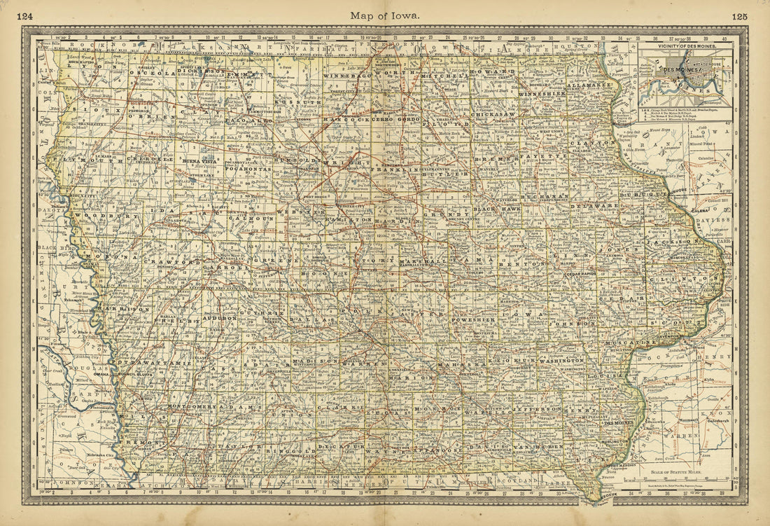 Map of Iowa from Historical Hand-atlas, Illustrated, Containing Large Scale Copper Plate Maps of Each State and Territory of the United States, and the Provinces of Canada, Together With a Complete Reference Map of the World, … 1882Map of Iowa from Historical Hand-atlas, Illustrated, Containing Large Scale Copper Plate Maps of Each State and Territory of the United States, and the Provinces of Canada, Together With a Complete Reference Map of the World, … 1882
- Regular price
-
$49.95 $99.95 - Regular price
-
$36.95 - Sale price
-
$49.95 $99.95
-
 Personal History Department of Wood County - Continued from Historical Hand-atlas, Illustrated, Containing Large Scale Copper Plate Maps of Each State and Territory of the United States, and the Provinces of Canada, Together With a Complete Reference ...Personal History Department of Wood County - Continued from Historical Hand-atlas, Illustrated, Containing Large Scale Copper Plate Maps of Each State and Territory of the United States, and the Provinces of Canada, Together With a Complete Reference ...
- Regular price
-
$49.95 $88.95 - Regular price
-
$24.95 - Sale price
-
$49.95 $88.95
-
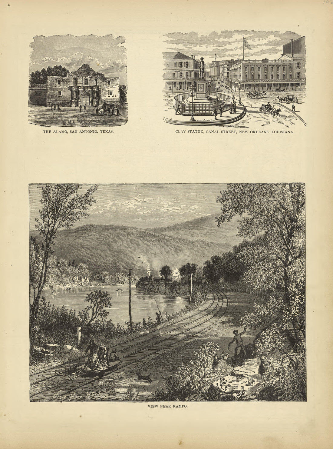 The Alamo - San Antonio TX, Clay Statue - Canal Street New Orleans LA and Other from Historical Hand-atlas, Illustrated, Containing Large Scale Copper Plate Maps of Each State and Territory of the United States, and the Provinces of Canada, Together W...The Alamo - San Antonio TX, Clay Statue - Canal Street New Orleans LA and Other from Historical Hand-atlas, Illustrated, Containing Large Scale Copper Plate Maps of Each State and Territory of the United States, and the Provinces of Canada, Together W...
- Regular price
-
$49.95 $88.95 - Regular price
-
$24.95 - Sale price
-
$49.95 $88.95
-
 Vermont - Continued, Massachusetts from Historical Hand-atlas, Illustrated, Containing Large Scale Copper Plate Maps of Each State and Territory of the United States, and the Provinces of Canada, Together With a Complete Reference Map of the World, �...Vermont - Continued, Massachusetts from Historical Hand-atlas, Illustrated, Containing Large Scale Copper Plate Maps of Each State and Territory of the United States, and the Provinces of Canada, Together With a Complete Reference Map of the World, �...
- Regular price
-
$49.95 $88.95 - Regular price
-
$23.95 - Sale price
-
$49.95 $88.95
-
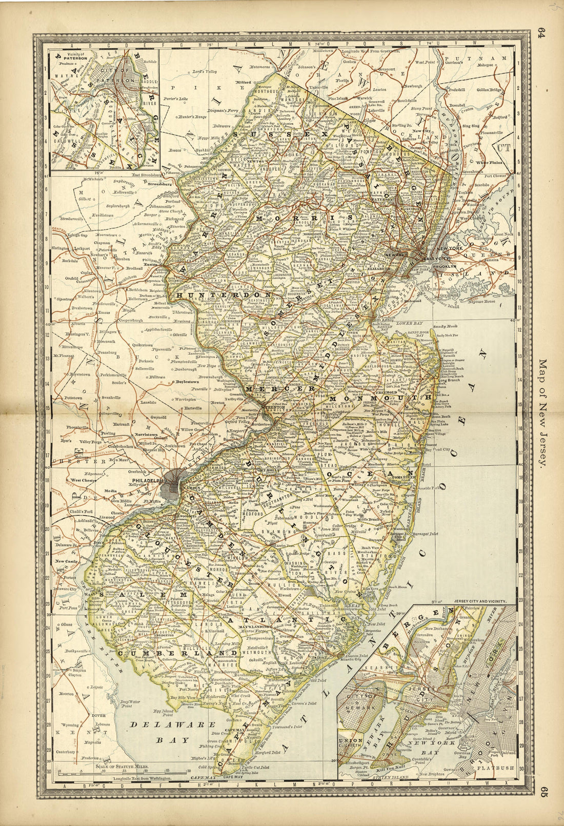 Map of New Jersey from Historical Hand-atlas, Illustrated, Containing Large Scale Copper Plate Maps of Each State and Territory of the United States, and the Provinces of Canada, Together With a Complete Reference Map of the World, … 1882Map of New Jersey from Historical Hand-atlas, Illustrated, Containing Large Scale Copper Plate Maps of Each State and Territory of the United States, and the Provinces of Canada, Together With a Complete Reference Map of the World, … 1882
- Regular price
-
$49.95 $99.95 - Regular price
-
$36.95 - Sale price
-
$49.95 $99.95
-
 History of the Virginias - Continued from Historical Hand-atlas, Illustrated, Containing Large Scale Copper Plate Maps of Each State and Territory of the United States, and the Provinces of Canada, Together With a Complete Reference Map of the World, ...History of the Virginias - Continued from Historical Hand-atlas, Illustrated, Containing Large Scale Copper Plate Maps of Each State and Territory of the United States, and the Provinces of Canada, Together With a Complete Reference Map of the World, ...
- Regular price
-
$49.95 $88.95 - Regular price
-
$23.95 - Sale price
-
$49.95 $88.95
-
 Tennessee - Continued, Kentucky from Historical Hand-atlas, Illustrated, Containing Large Scale Copper Plate Maps of Each State and Territory of the United States, and the Provinces of Canada, Together With a Complete Reference Map of the World, … 1882Tennessee - Continued, Kentucky from Historical Hand-atlas, Illustrated, Containing Large Scale Copper Plate Maps of Each State and Territory of the United States, and the Provinces of Canada, Together With a Complete Reference Map of the World, … 1882
- Regular price
-
$49.95 $88.95 - Regular price
-
$22.95 - Sale price
-
$49.95 $88.95
-
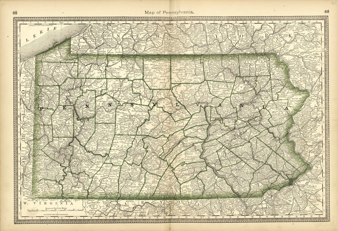 Map of Pennsylvania from Historical Hand-atlas, Illustrated, Containing Large Scale Copper Plate Maps of Each State and Territory of the United States, and the Provinces of Canada, Together With a Complete Reference Map of the World, … 1882Map of Pennsylvania from Historical Hand-atlas, Illustrated, Containing Large Scale Copper Plate Maps of Each State and Territory of the United States, and the Provinces of Canada, Together With a Complete Reference Map of the World, … 1882
- Regular price
-
$49.95 $99.95 - Regular price
-
$36.95 - Sale price
-
$49.95 $99.95


