428 products
-
 Indiana - Continued, Michigan from Historical Hand-atlas, Illustrated, Containing Large Scale Copper Plate Maps of Each State and Territory of the United States, and the Provinces of Canada, Together With a Complete Reference Map of the World, … 1882Indiana - Continued, Michigan from Historical Hand-atlas, Illustrated, Containing Large Scale Copper Plate Maps of Each State and Territory of the United States, and the Provinces of Canada, Together With a Complete Reference Map of the World, … 1882
- Regular price
-
$49.95 $99.95 - Regular price
-
$22.95 - Sale price
-
$49.95 $99.95
-
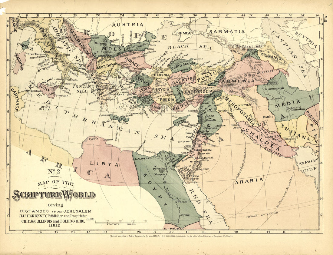 No. 2 Map of the Scripture World from Historical Hand-atlas, Illustrated, Containing Large Scale Copper Plate Maps of Each State and Territory of the United States, and the Provinces of Canada, Together With a Complete Reference Map of the World, … 1882No. 2 Map of the Scripture World from Historical Hand-atlas, Illustrated, Containing Large Scale Copper Plate Maps of Each State and Territory of the United States, and the Provinces of Canada, Together With a Complete Reference Map of the World, … 1882
- Regular price
-
$49.95 $88.95 - Regular price
-
$25.95 - Sale price
-
$49.95 $88.95
-
 History of the United States Brought Down to July 1882 - Continued from Historical Hand-atlas, Illustrated, Containing Large Scale Copper Plate Maps of Each State and Territory of the United States, and the Provinces of Canada, Together With a Complet...History of the United States Brought Down to July 1882 - Continued from Historical Hand-atlas, Illustrated, Containing Large Scale Copper Plate Maps of Each State and Territory of the United States, and the Provinces of Canada, Together With a Complet...
- Regular price
-
$49.95 $88.95 - Regular price
-
$23.95 - Sale price
-
$49.95 $88.95
-
 Kentucky - Continued, Ohio from Historical Hand-atlas, Illustrated, Containing Large Scale Copper Plate Maps of Each State and Territory of the United States, and the Provinces of Canada, Together With a Complete Reference Map of the World, … 1882Kentucky - Continued, Ohio from Historical Hand-atlas, Illustrated, Containing Large Scale Copper Plate Maps of Each State and Territory of the United States, and the Provinces of Canada, Together With a Complete Reference Map of the World, … 1882
- Regular price
-
$49.95 $88.95 - Regular price
-
$23.95 - Sale price
-
$49.95 $88.95
-
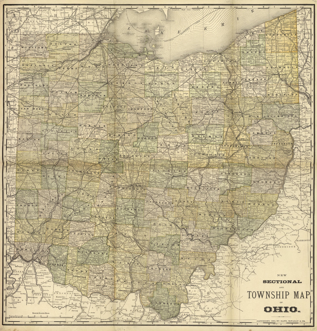 New Sectional and Township Map of Ohio from Historical Hand-atlas, Illustrated, Containing Large Scale Copper Plate Maps of Each State and Territory of the United States, and the Provinces of Canada, Together With a Complete Reference Map of the World...New Sectional and Township Map of Ohio from Historical Hand-atlas, Illustrated, Containing Large Scale Copper Plate Maps of Each State and Territory of the United States, and the Provinces of Canada, Together With a Complete Reference Map of the World...
- Regular price
-
$49.95 $92.95 - Regular price
-
$36.95 - Sale price
-
$49.95 $92.95
-
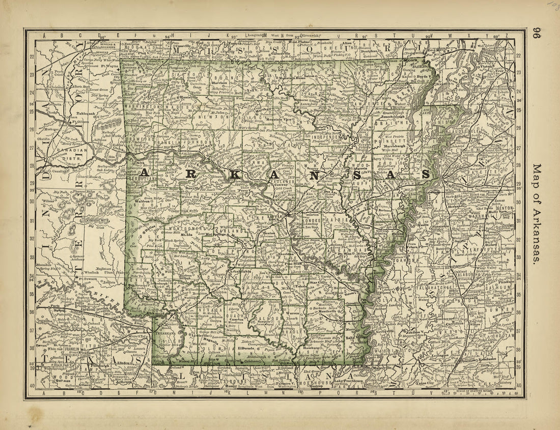 Map of Arkansas from Historical Hand-atlas, Illustrated, Containing Large Scale Copper Plate Maps of Each State and Territory of the United States, and the Provinces of Canada, Together With a Complete Reference Map of the World, … 1882Map of Arkansas from Historical Hand-atlas, Illustrated, Containing Large Scale Copper Plate Maps of Each State and Territory of the United States, and the Provinces of Canada, Together With a Complete Reference Map of the World, … 1882
- Regular price
-
$49.95 $88.95 - Regular price
-
$24.95 - Sale price
-
$49.95 $88.95
-
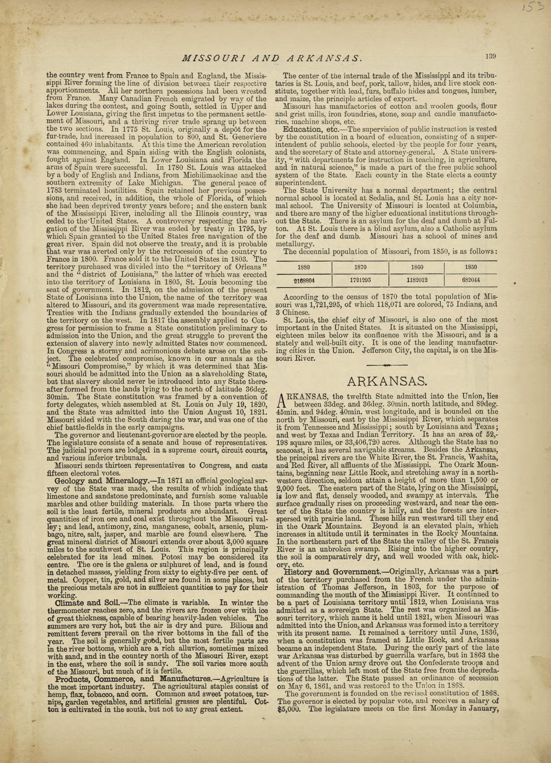 Missouri - Continued, Arkansas from Historical Hand-atlas, Illustrated, Containing Large Scale Copper Plate Maps of Each State and Territory of the United States, and the Provinces of Canada, Together With a Complete Reference Map of the World, … 1882Missouri - Continued, Arkansas from Historical Hand-atlas, Illustrated, Containing Large Scale Copper Plate Maps of Each State and Territory of the United States, and the Provinces of Canada, Together With a Complete Reference Map of the World, … 1882
- Regular price
-
$49.95 $88.95 - Regular price
-
$24.95 - Sale price
-
$49.95 $88.95
-
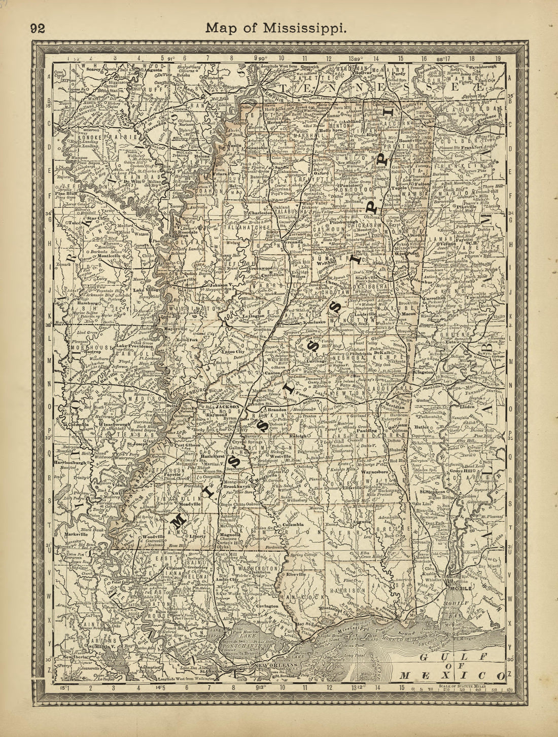 Map of Mississippi from Historical Hand-atlas, Illustrated, Containing Large Scale Copper Plate Maps of Each State and Territory of the United States, and the Provinces of Canada, Together With a Complete Reference Map of the World, … 1882Map of Mississippi from Historical Hand-atlas, Illustrated, Containing Large Scale Copper Plate Maps of Each State and Territory of the United States, and the Provinces of Canada, Together With a Complete Reference Map of the World, … 1882
- Regular price
-
$49.95 $88.95 - Regular price
-
$24.95 - Sale price
-
$49.95 $88.95
-
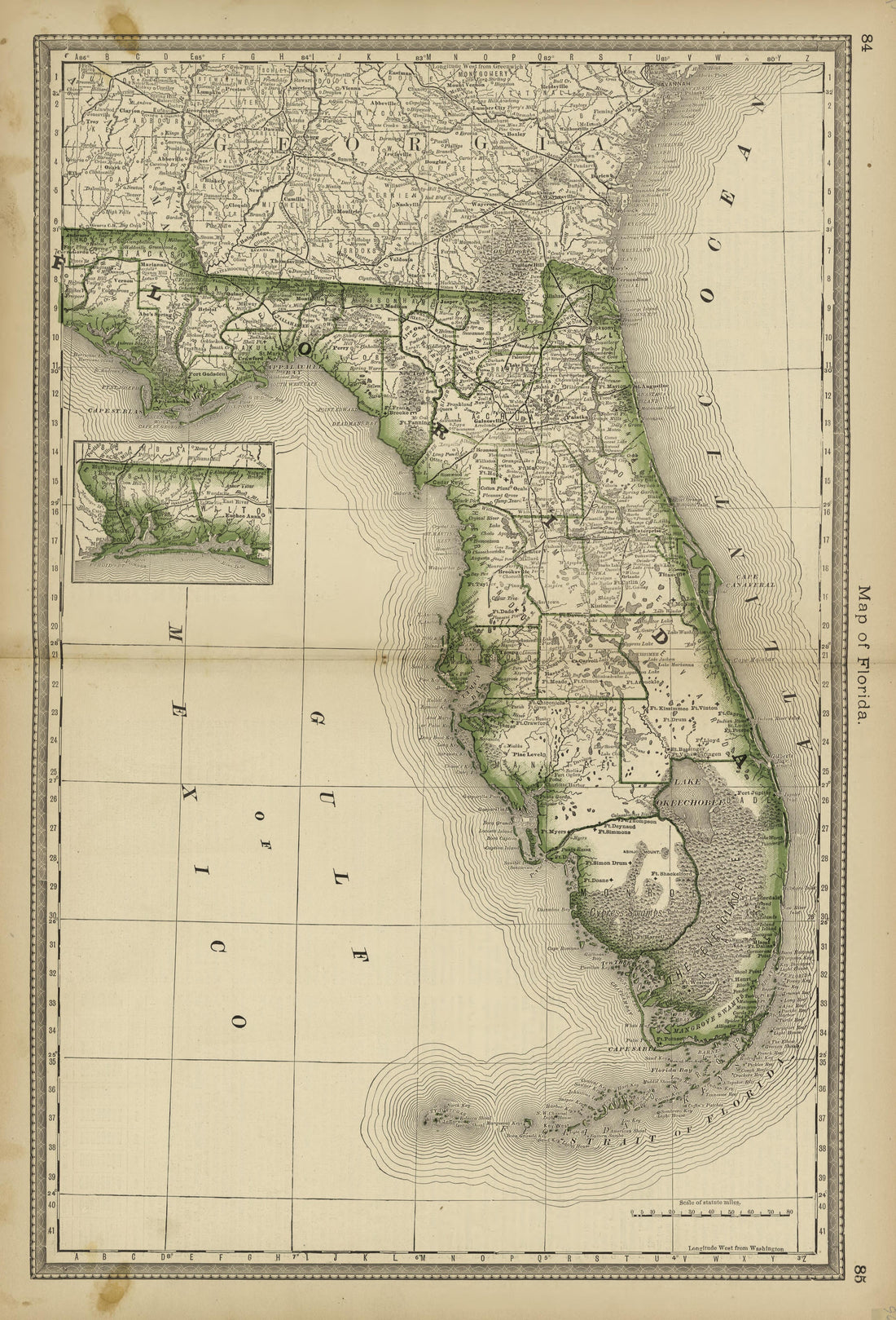 Map of Florida from Historical Hand-atlas, Illustrated, Containing Large Scale Copper Plate Maps of Each State and Territory of the United States, and the Provinces of Canada, Together With a Complete Reference Map of the World, … 1882Map of Florida from Historical Hand-atlas, Illustrated, Containing Large Scale Copper Plate Maps of Each State and Territory of the United States, and the Provinces of Canada, Together With a Complete Reference Map of the World, … 1882
- Regular price
-
$49.95 $99.95 - Regular price
-
$36.95 - Sale price
-
$49.95 $99.95
-
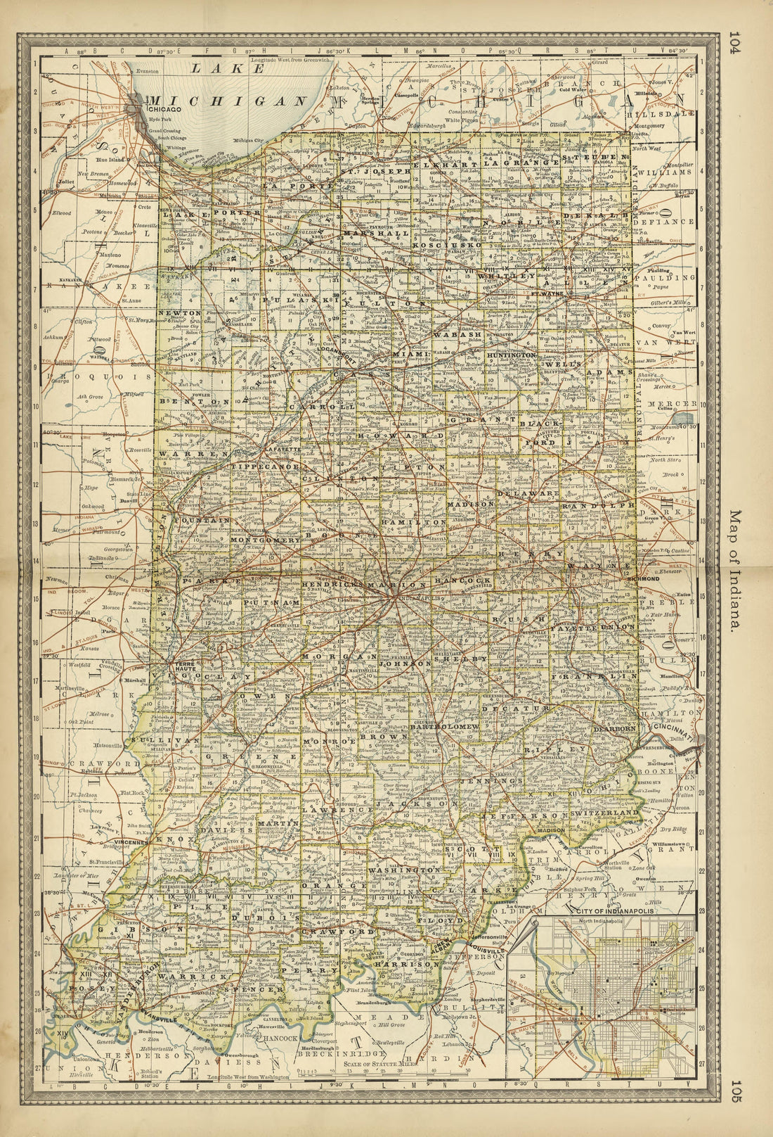 Map of Indiana from Historical Hand-atlas, Illustrated, Containing Large Scale Copper Plate Maps of Each State and Territory of the United States, and the Provinces of Canada, Together With a Complete Reference Map of the World, … 1882Map of Indiana from Historical Hand-atlas, Illustrated, Containing Large Scale Copper Plate Maps of Each State and Territory of the United States, and the Provinces of Canada, Together With a Complete Reference Map of the World, … 1882
- Regular price
-
$49.95 $99.95 - Regular price
-
$36.95 - Sale price
-
$49.95 $99.95
-
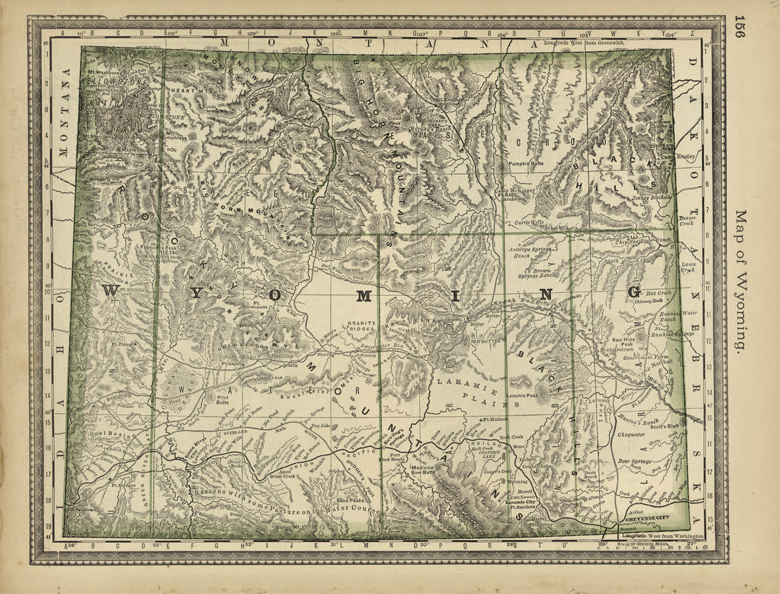 Map of Wyoming from Historical Hand-atlas, Illustrated, Containing Large Scale Copper Plate Maps of Each State and Territory of the United States, and the Provinces of Canada, Together With a Complete Reference Map of the World, … 1882Map of Wyoming from Historical Hand-atlas, Illustrated, Containing Large Scale Copper Plate Maps of Each State and Territory of the United States, and the Provinces of Canada, Together With a Complete Reference Map of the World, … 1882
- Regular price
-
$49.95 $88.95 - Regular price
-
$25.95 - Sale price
-
$49.95 $88.95
-
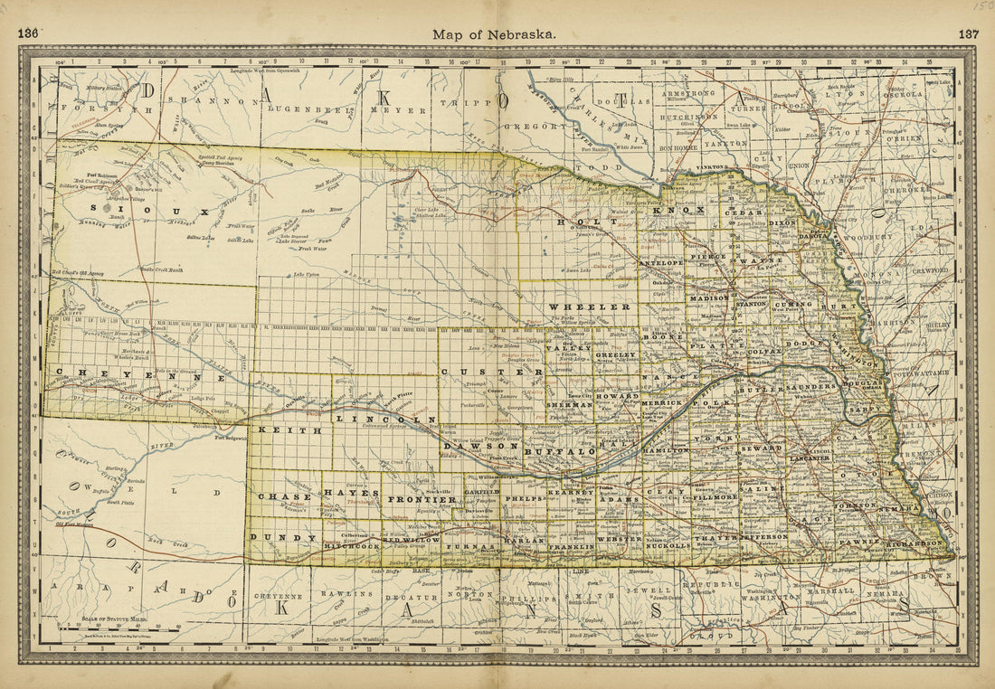 Map of Nebraska from Historical Hand-atlas, Illustrated, Containing Large Scale Copper Plate Maps of Each State and Territory of the United States, and the Provinces of Canada, Together With a Complete Reference Map of the World, … 1882Map of Nebraska from Historical Hand-atlas, Illustrated, Containing Large Scale Copper Plate Maps of Each State and Territory of the United States, and the Provinces of Canada, Together With a Complete Reference Map of the World, … 1882
- Regular price
-
$49.95 $99.95 - Regular price
-
$36.95 - Sale price
-
$49.95 $99.95


