428 products
-
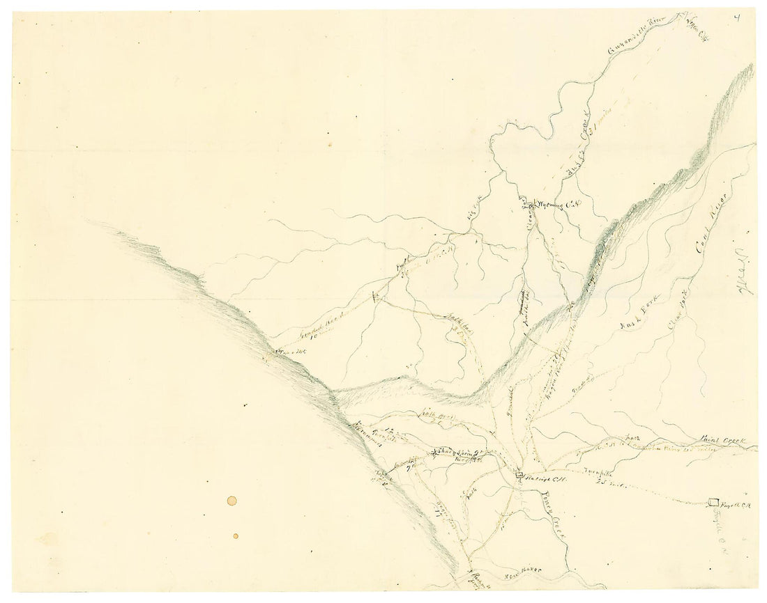
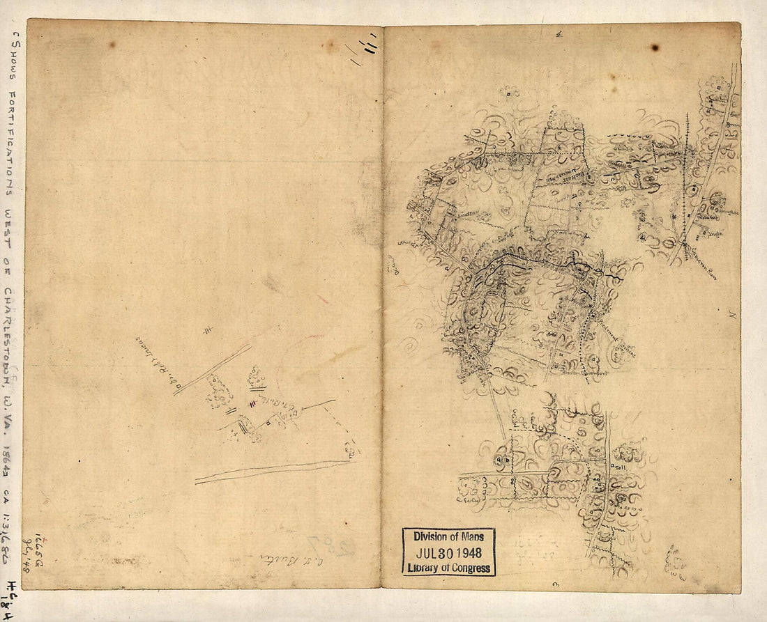 Sketch of the Region West of Charlestown, West Virginia, Showing Fortifications 1864Sketch of the Region West of Charlestown, West Virginia, Showing Fortifications 1864
- Regular price
-
$49.95 $83.95 - Regular price
-
$34.95 - Sale price
-
$49.95 $83.95
-
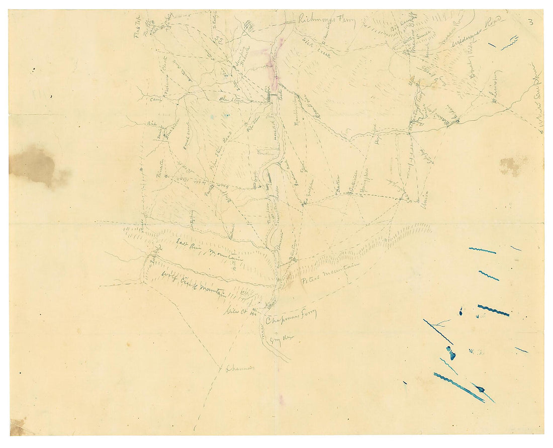 Map of Mercer, Summers, Greenbrier and Monroe Counties, West Virginia 1862Map of Mercer, Summers, Greenbrier and Monroe Counties, West Virginia 1862
- Regular price
-
$49.95 $83.95 - Regular price
-
$34.95 - Sale price
-
$49.95 $83.95
-
 Military Map Showing the Topographical Features of the Country Adjacent to Harper's Ferry, Va.; Including Maryland, Loudoun, and Bolivar Heights, and Portions of South and Short Mountains, With the Positions of the Defensive Works, Also the Junction o...Military Map Showing the Topographical Features of the Country Adjacent to Harper's Ferry, Va.; Including Maryland, Loudoun, and Bolivar Heights, and Portions of South and Short Mountains, With the Positions of the Defensive Works, Also the Junction o...
- Regular price
-
$54.95 $201.95 - Regular price
-
$38.95 - Sale price
-
$54.95 $201.95
-
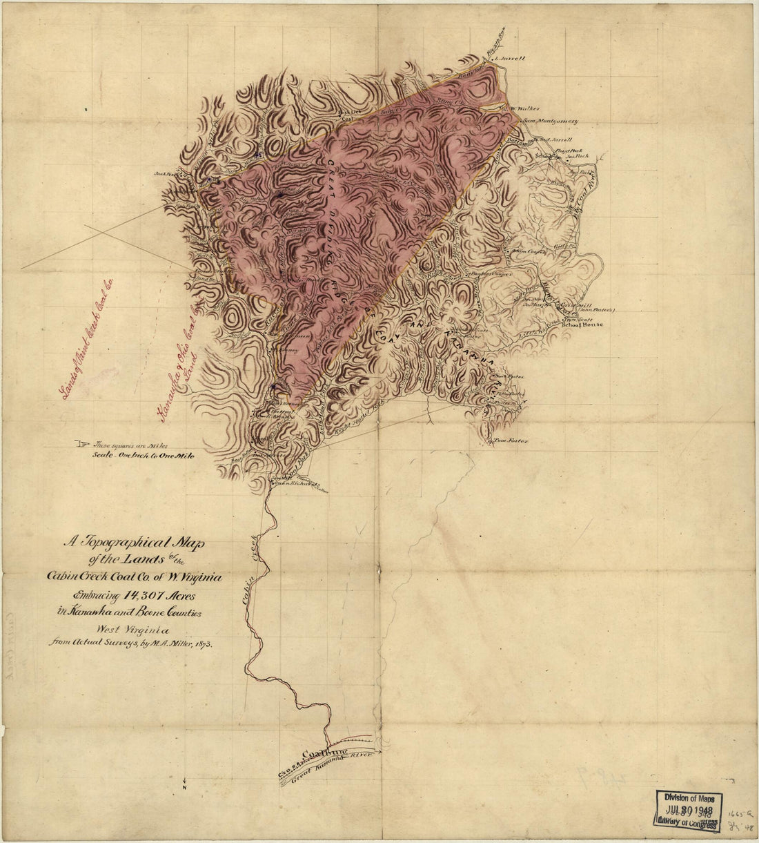 A Topographical Map of the Lands of the Cabin Creek Coal Co. of W. Virginia Embracing 14,307 Acres In Kanawha and Boone Counties, West Virginia in 1873A Topographical Map of the Lands of the Cabin Creek Coal Co. of W. Virginia Embracing 14,307 Acres In Kanawha and Boone Counties, West Virginia in 1873
- Regular price
-
$54.95 $83.95 - Regular price
-
$31.95 - Sale price
-
$54.95 $83.95
-
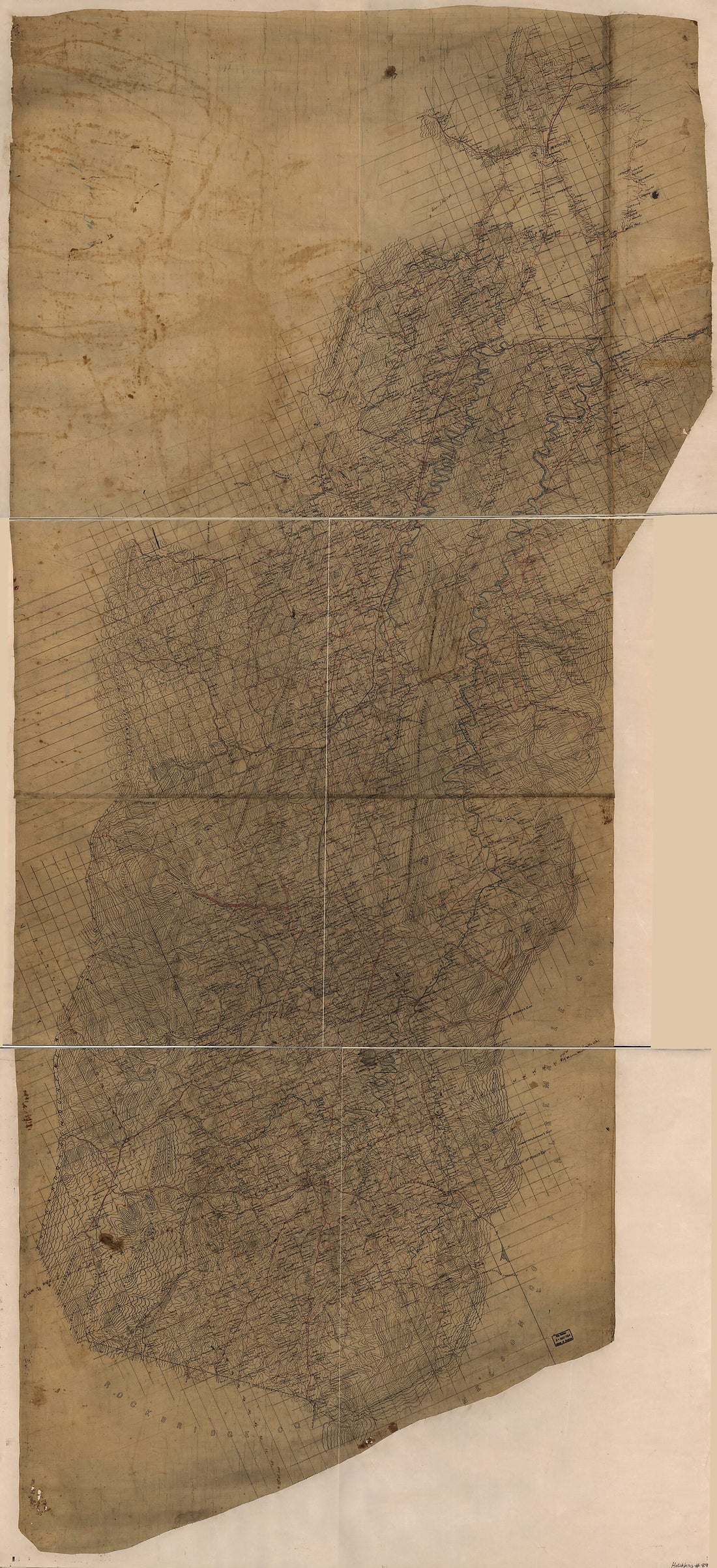 Map of the Shenandoah Valley 1862Map of the Shenandoah Valley 1862
- Regular price
-
$58.95 $355.95 - Regular price
-
$41.95 - Sale price
-
$58.95 $355.95
-
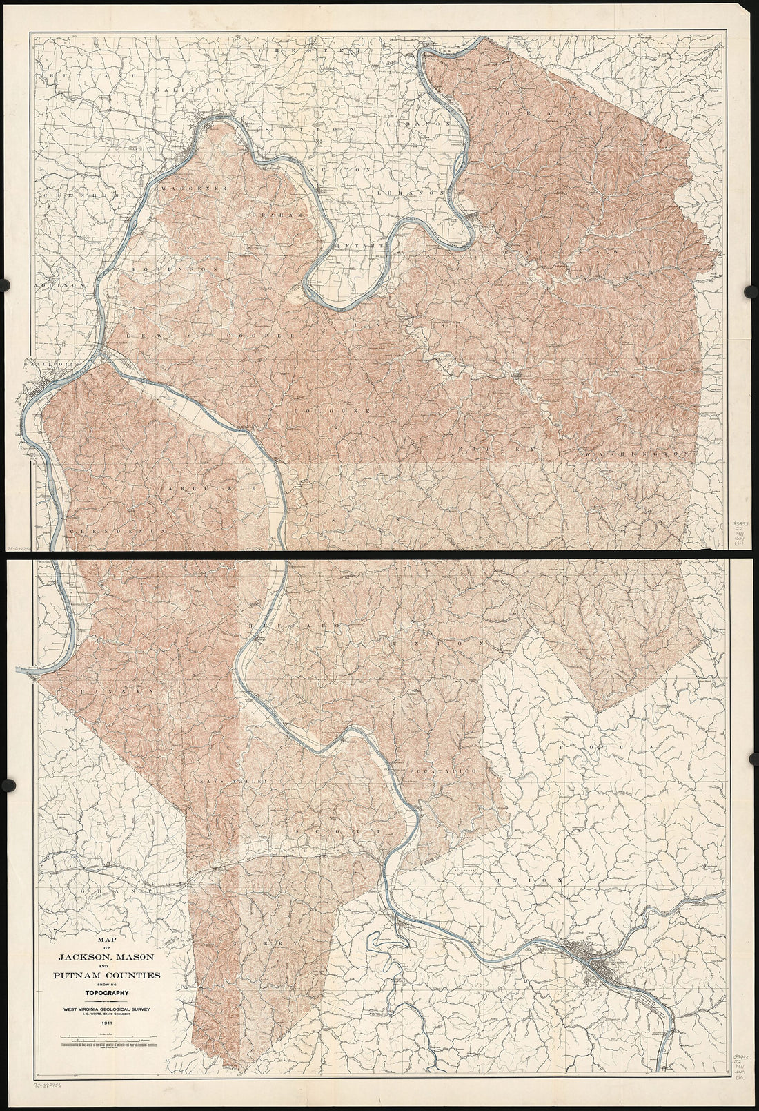 Map of Jackson, Mason, and Putnam Counties Showing Topography 1911Map of Jackson, Mason, and Putnam Counties Showing Topography 1911
- Regular price
-
$58.95 $213.95 - Regular price
-
$41.95 - Sale price
-
$58.95 $213.95
-
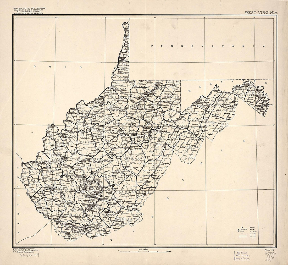 West Virginia 1914West Virginia 1914
- Regular price
-
$53.95 $83.95 - Regular price
-
$37.95 - Sale price
-
$53.95 $83.95
-
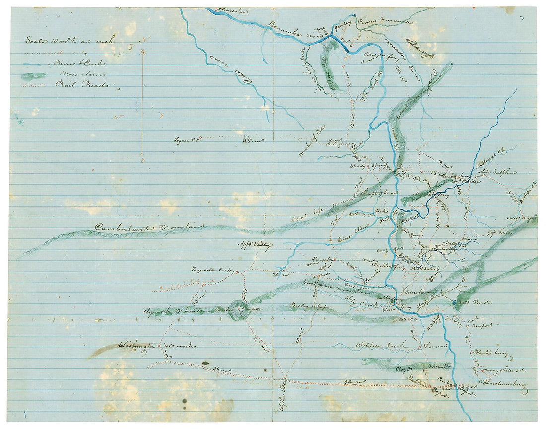 Map of Kanawha, Boone, Logan, Wyoming, McDowell, Mercer, Raleigh, Fayette, Nicholas, Greenbrier, Summers and Monroe Counties, West Va., and Tazewell, Smyth, Washington, Bland, Giles, Craig, Montgomery, Pulaski and Wythe Counties, Va 1862Map of Kanawha, Boone, Logan, Wyoming, McDowell, Mercer, Raleigh, Fayette, Nicholas, Greenbrier, Summers and Monroe Counties, West Va., and Tazewell, Smyth, Washington, Bland, Giles, Craig, Montgomery, Pulaski and Wythe Counties, Va 1862
- Regular price
-
$49.95 $83.95 - Regular price
-
$34.95 - Sale price
-
$49.95 $83.95
-
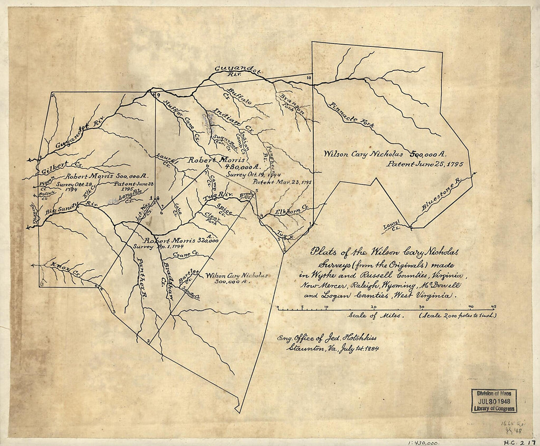 Plats of the Wilson Cary Nicholas Surveys (from the Originals) Made In Wythe and Russell Counties, Virginia, Now Mercer, Raleigh, Wyoming, McDowell, and Logan Counties, West Virginia 1795Plats of the Wilson Cary Nicholas Surveys (from the Originals) Made In Wythe and Russell Counties, Virginia, Now Mercer, Raleigh, Wyoming, McDowell, and Logan Counties, West Virginia 1795
- Regular price
-
$49.95 $83.95 - Regular price
-
$34.95 - Sale price
-
$49.95 $83.95
-
 Map of Wyoming, Fayette and Raleigh Counties, West Va in 1862Map of Wyoming, Fayette and Raleigh Counties, West Va in 1862
- Regular price
-
$49.95 $89.95 - Regular price
-
$34.95 - Sale price
-
$49.95 $89.95
-
 Map of the Counties of Greene, Madison, Page, and Rockingham, and Parts of the Counties of Albemarle, Augusta, Culpeper, Louisa, Orange, and Rappahannock, Va. 1864Map of the Counties of Greene, Madison, Page, and Rockingham, and Parts of the Counties of Albemarle, Augusta, Culpeper, Louisa, Orange, and Rappahannock, Va. 1864
- Regular price
-
$51.95 $208.95 - Regular price
-
$38.95 - Sale price
-
$51.95 $208.95
-
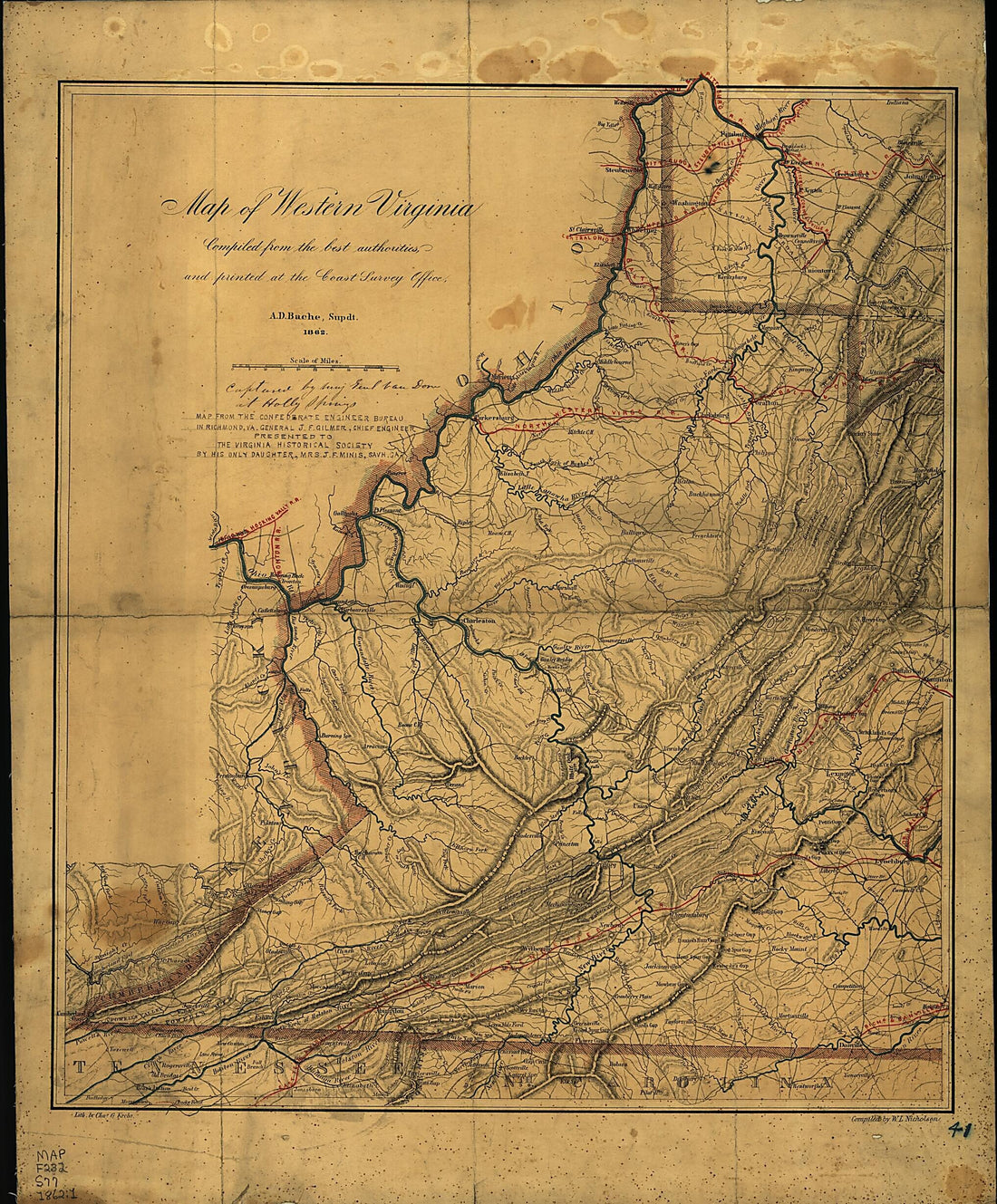 Map of Western Virginia 1862Map of Western Virginia 1862
- Regular price
-
$54.95 $129.95 - Regular price
-
$38.95 - Sale price
-
$54.95 $129.95


