455 products
-
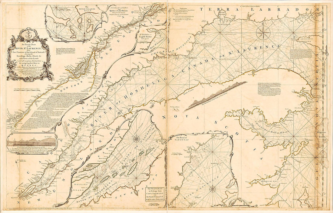 An Exact Chart of the River St. Laurence, from Fort Frontenac to the Island of Anticosti Shewing the Soundings, Rocks, Shoals &c With Views of the Lands and All Necessary Instructions for Navigating That River to Quebec 1757An Exact Chart of the River St. Laurence, from Fort Frontenac to the Island of Anticosti Shewing the Soundings, Rocks, Shoals &c With Views of the Lands and All Necessary Instructions for Navigating That River to Quebec 1757
- Regular price
-
$46.95 $218.95 - Regular price
-
$41.95 - Sale price
-
$46.95 $218.95
-
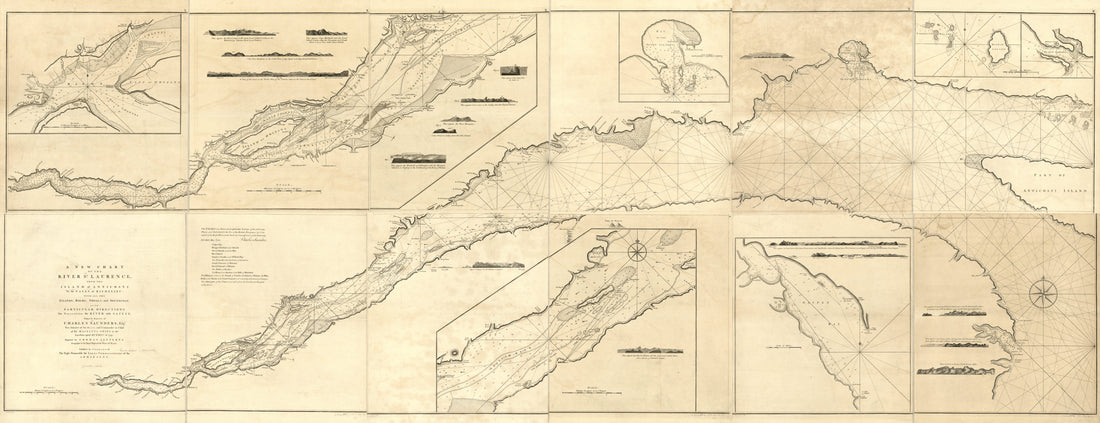 A New Chart of the River St. Laurence, From the Island of Anticosti to the Falls of Richelieu: With All the Islands, Rocks, Shoals, and Soundings, Also Particular Directions for Navigating the River With Safety. Taken by the Order of Charles Saunders,...A New Chart of the River St. Laurence, From the Island of Anticosti to the Falls of Richelieu: With All the Islands, Rocks, Shoals, and Soundings, Also Particular Directions for Navigating the River With Safety. Taken by the Order of Charles Saunders,...
- Regular price
-
$46.95 $286.95 - Regular price
-
$41.95 - Sale price
-
$46.95 $286.95
-
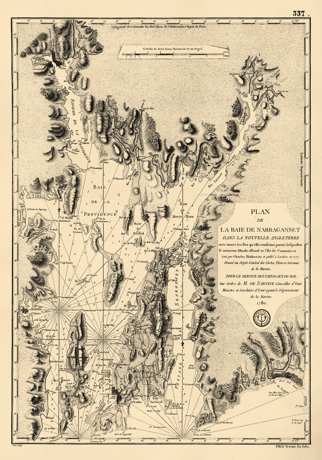 Island Et L'île De Connonicut 1780Island Et L'île De Connonicut 1780
- Regular price
-
$46.95 $101.95 - Regular price
-
$41.95 - Sale price
-
$46.95 $101.95
-
 York Et De La Nouvelle Angleterre, Celles De L'Acadie Ou Nouvelle Ecosse De L'Île Royale De L'Île St. Jean Avec L'intérieur Du Pays 1780York Et De La Nouvelle Angleterre, Celles De L'Acadie Ou Nouvelle Ecosse De L'Île Royale De L'Île St. Jean Avec L'intérieur Du Pays 1780
- Regular price
-
$46.95 $210.95 - Regular price
-
$41.95 - Sale price
-
$46.95 $210.95
-
 A Chart of the Gulf of St. Laurence, Composed From a Great Number of Actual Surveys and Other Materials, Regulated and Connected by Astronomical Observations in 1775A Chart of the Gulf of St. Laurence, Composed From a Great Number of Actual Surveys and Other Materials, Regulated and Connected by Astronomical Observations in 1775
- Regular price
-
$43.95 $88.95 - Regular price
-
$38.95 - Sale price
-
$43.95 $88.95
-
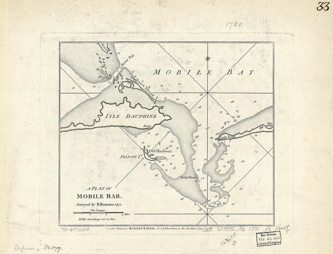 A Plan of Mobile Bar 1788A Plan of Mobile Bar 1788
- Regular price
-
$39.95 $88.95 - Regular price
-
$34.95 - Sale price
-
$39.95 $88.95
-
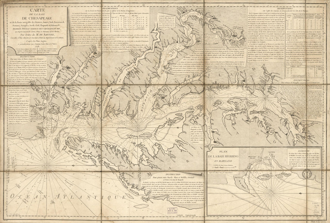 East, Choptank Et Pokomack in 1778East, Choptank Et Pokomack in 1778
- Regular price
-
$46.95 $99.95 - Regular price
-
$41.95 - Sale price
-
$46.95 $99.95
-
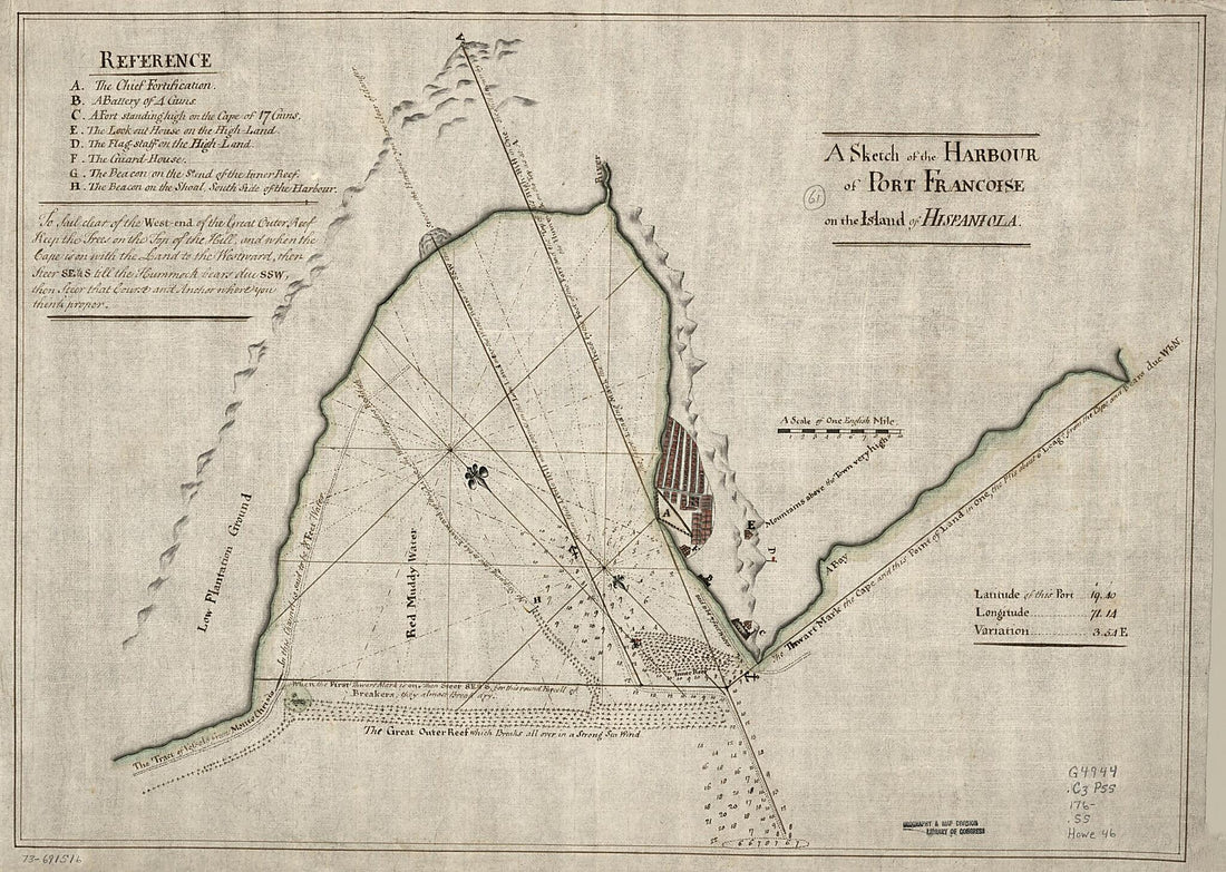 A Sketch of the Harbour of Port Francoise On the Island of Hispaniola 1760A Sketch of the Harbour of Port Francoise On the Island of Hispaniola 1760
- Regular price
-
$43.95 $150.95 - Regular price
-
$38.95 - Sale price
-
$43.95 $150.95
-
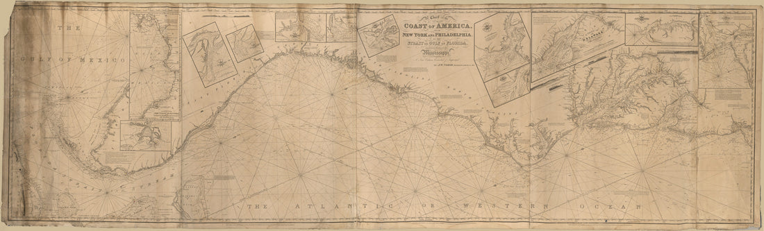 A Chart of the Coast of America : From New York and Philadelphia to the Strait Or Gulf of Florida, and From Thence to the Mississippi in 1837A Chart of the Coast of America : From New York and Philadelphia to the Strait Or Gulf of Florida, and From Thence to the Mississippi in 1837
- Regular price
-
$46.95 $285.95 - Regular price
-
$41.95 - Sale price
-
$46.95 $285.95
-
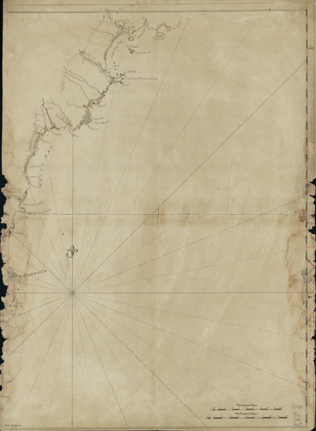 Coast of New England From Cape Elizabeth, Maine to Newburyport, Mass in 1776Coast of New England From Cape Elizabeth, Maine to Newburyport, Mass in 1776
- Regular price
-
$43.95 $88.95 - Regular price
-
$38.95 - Sale price
-
$43.95 $88.95
-
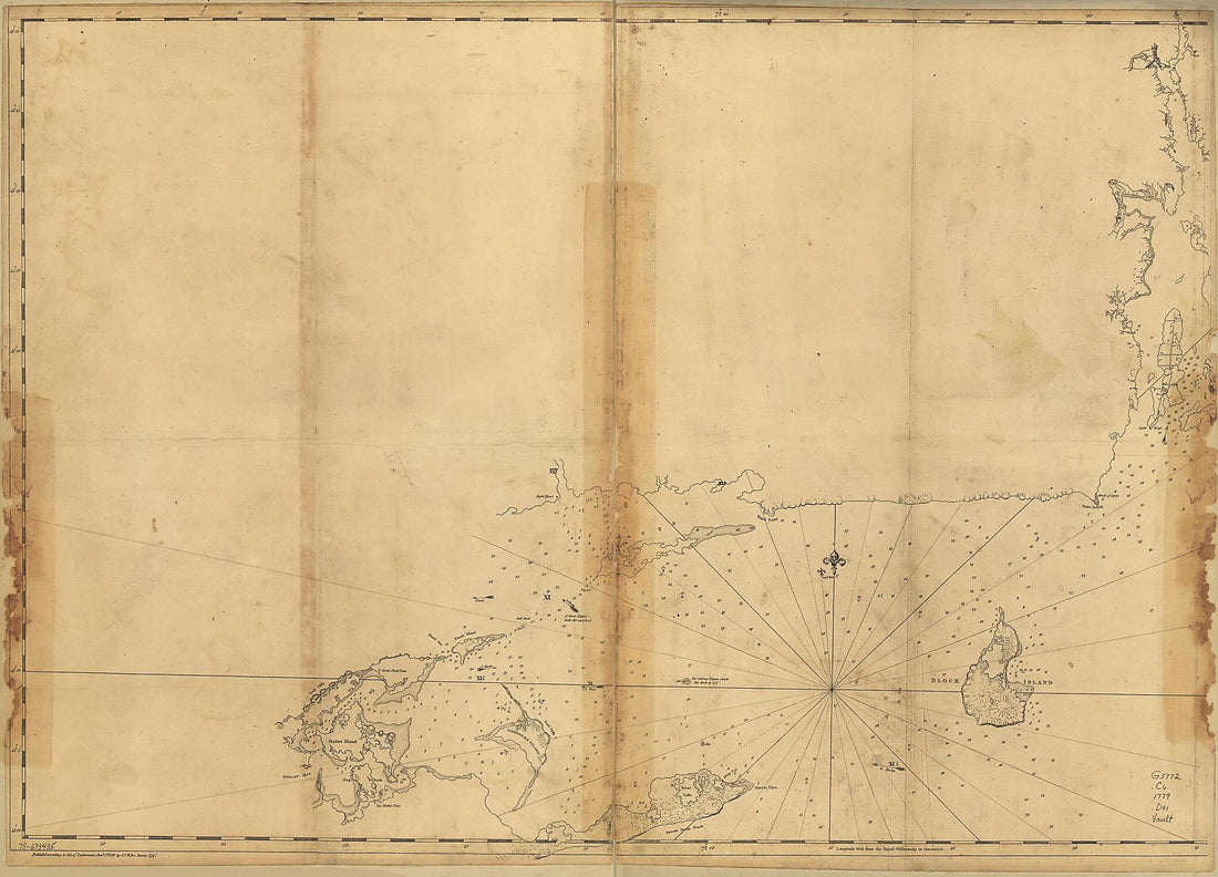 Coast of Rhode Island and Long Island from Narragansett Bay to Peconic Bay 1779Coast of Rhode Island and Long Island from Narragansett Bay to Peconic Bay 1779
- Regular price
-
$43.95 $132.95 - Regular price
-
$38.95 - Sale price
-
$43.95 $132.95
-
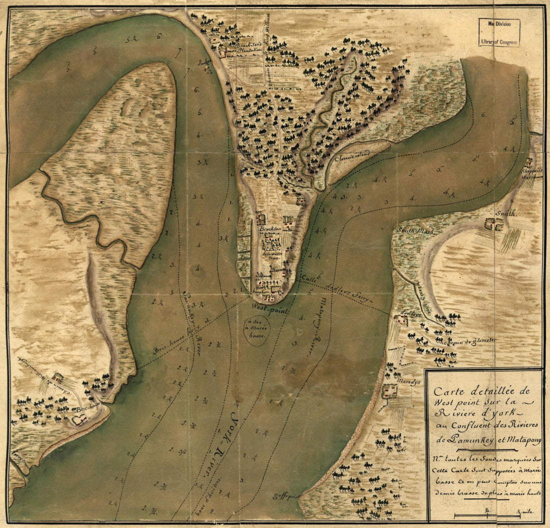 Carte Detaillée De West Point Sur La Rivière D'York Au Confluent Des Rivières De Pamunkey Et Matapony in 1781Carte Detaillée De West Point Sur La Rivière D'York Au Confluent Des Rivières De Pamunkey Et Matapony in 1781
- Regular price
-
$39.95 $83.95 - Regular price
-
$34.95 - Sale price
-
$39.95 $83.95


