455 products
-
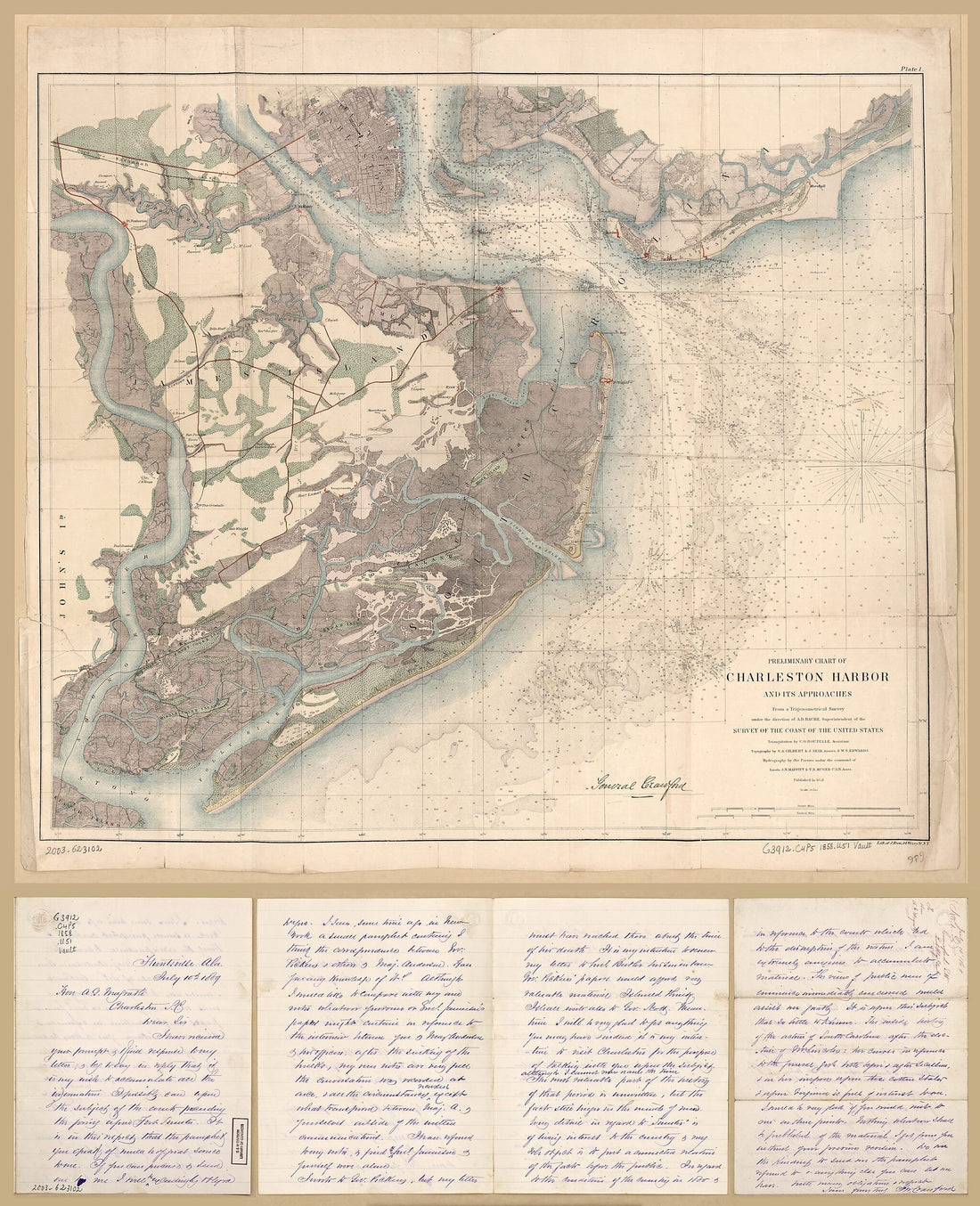 Preliminary Chart of Charleston Harbor and Its Approaches 1858Preliminary Chart of Charleston Harbor and Its Approaches 1858
- Regular price
-
$43.95 $218.95 - Regular price
-
$38.95 - Sale price
-
$43.95 $218.95
-
 Map of Coast From Southern Florida to Central New Jersey in 1780Map of Coast From Southern Florida to Central New Jersey in 1780
- Regular price
-
$46.95 $105.95 - Regular price
-
$41.95 - Sale price
-
$46.95 $105.95
-
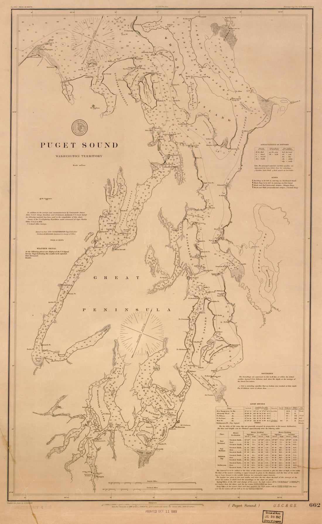 Puget Sound, Washington Territory in 1889Puget Sound, Washington Territory in 1889
- Regular price
-
$46.95 $99.95 - Regular price
-
$41.95 - Sale price
-
$46.95 $99.95
-
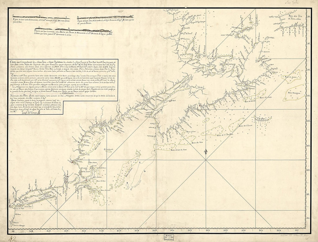 Carta Que Comprehende La Neuva York, Nueva Ynglaterra, La Acadia ò Neuva Escocia La Ysla Real, La De Sn. Juan, Con Parte De La De Terra Noba: 1781Carta Que Comprehende La Neuva York, Nueva Ynglaterra, La Acadia ò Neuva Escocia La Ysla Real, La De Sn. Juan, Con Parte De La De Terra Noba: 1781
- Regular price
-
$43.95 $184.95 - Regular price
-
$38.95 - Sale price
-
$43.95 $184.95
-
 A Chart Exhibiting the Lighthouses and Lightvessels On the Coasts of the United States of America : from Virginia Exclusive to Texas Inclusive (Chart Exhibiting the Lighthouses and Lightvessels from Virginia Exclusive to Texas Inclusive) 1848A Chart Exhibiting the Lighthouses and Lightvessels On the Coasts of the United States of America : from Virginia Exclusive to Texas Inclusive (Chart Exhibiting the Lighthouses and Lightvessels from Virginia Exclusive to Texas Inclusive) 1848
- Regular price
-
$46.95 $258.95 - Regular price
-
$41.95 - Sale price
-
$46.95 $258.95
-
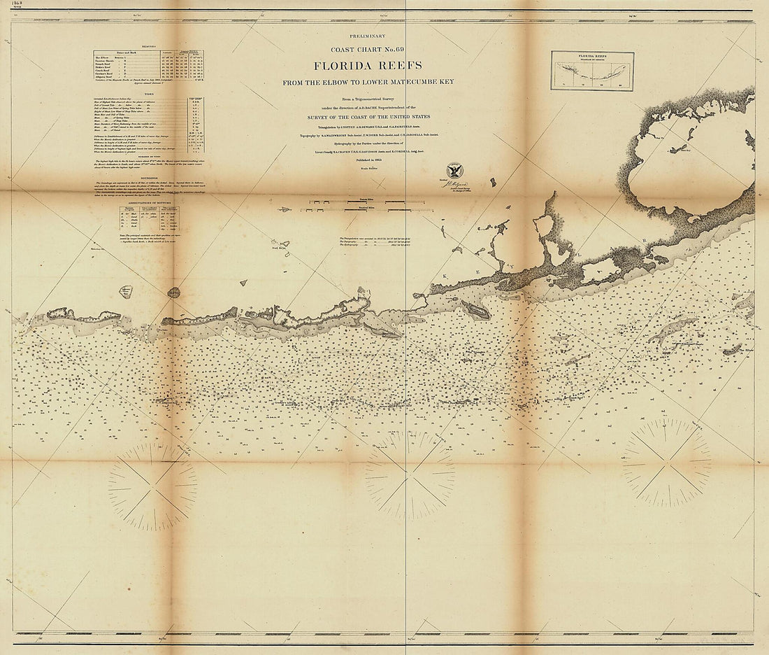 Preliminary Coast Chart ... Florida Reefs on Four Sheets in 1864Preliminary Coast Chart ... Florida Reefs on Four Sheets in 1864
- Regular price
-
$46.95 $441.95 - Regular price
-
$41.95 - Sale price
-
$46.95 $441.95
-
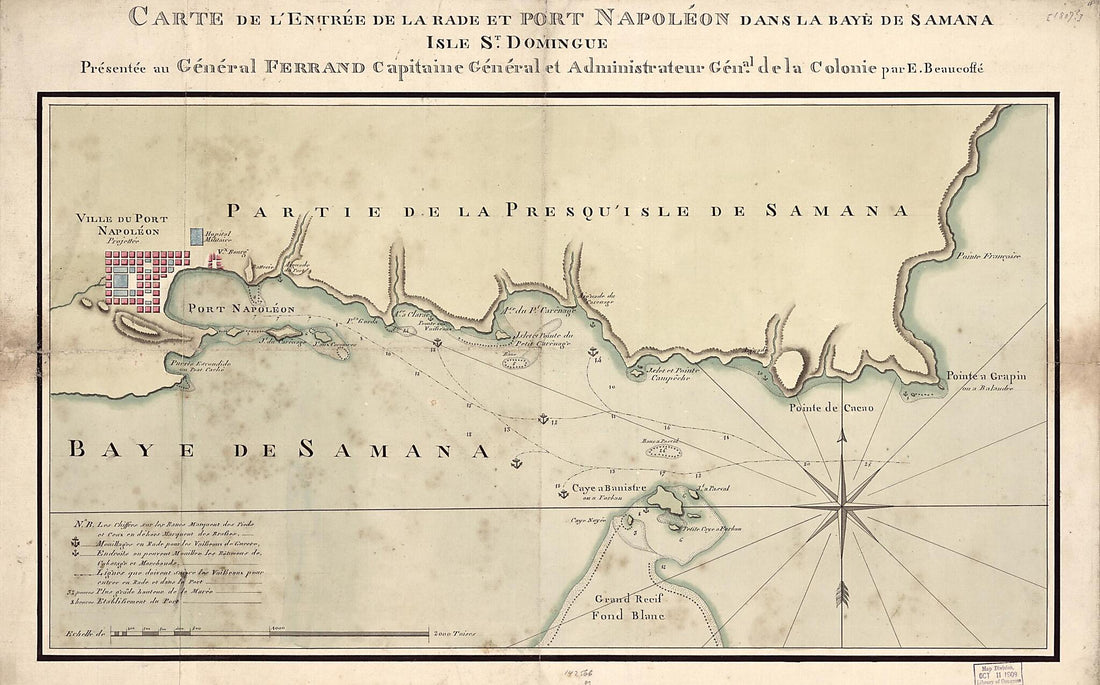 Carte De L'entrée De La Rade Et Port Napoléon Dans La Baye De Samana, Isle St. Domingue 1807Carte De L'entrée De La Rade Et Port Napoléon Dans La Baye De Samana, Isle St. Domingue 1807
- Regular price
-
$46.95 $152.95 - Regular price
-
$41.95 - Sale price
-
$46.95 $152.95
-
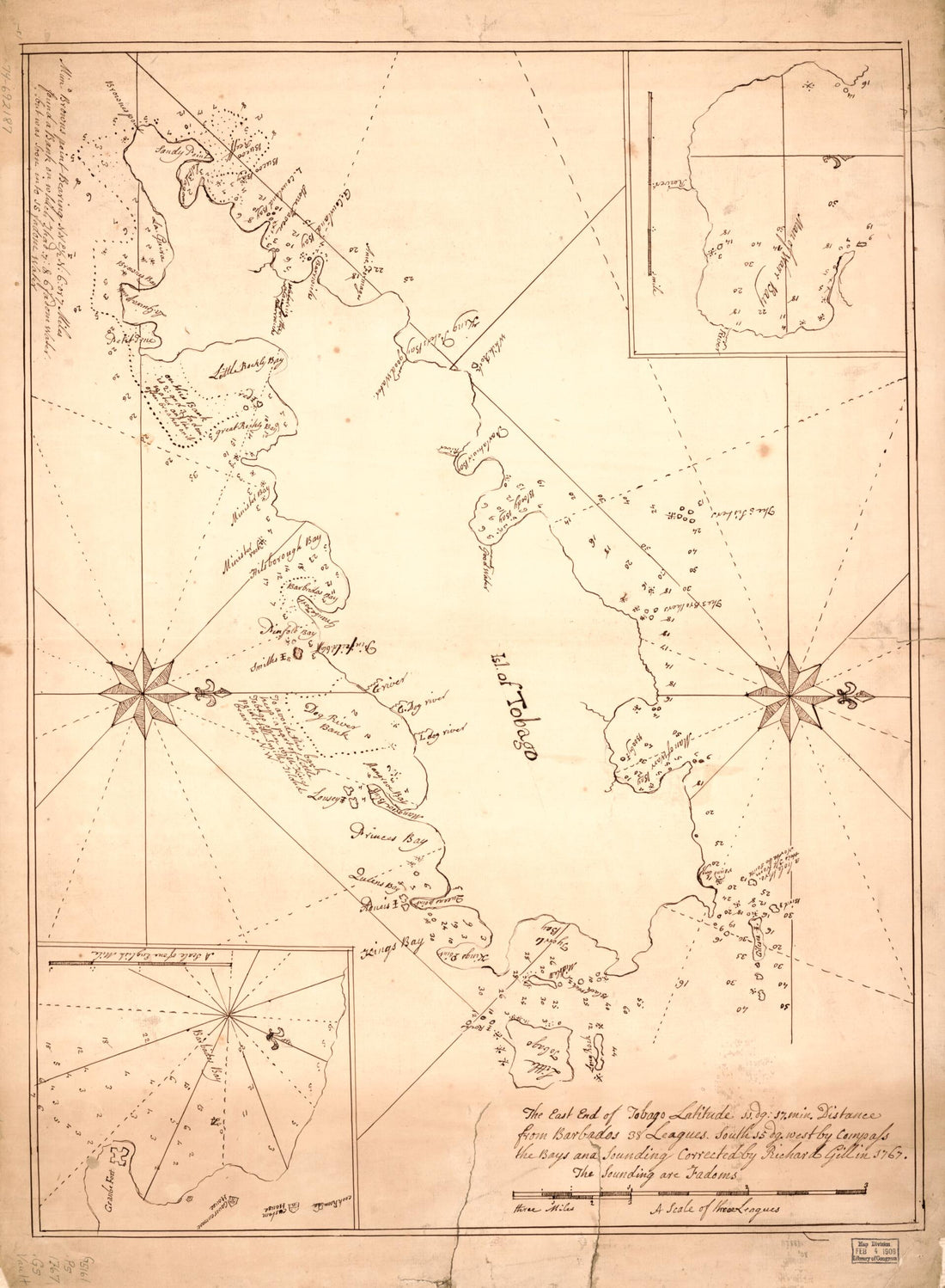 Chart of the Coast of Tobago 1767Chart of the Coast of Tobago 1767
- Regular price
-
$43.95 $88.95 - Regular price
-
$38.95 - Sale price
-
$43.95 $88.95
-
 Carte Du Cours Du Fleuve De Saint Laurent Depuis Quebec Jusqu'a La Mer En Deux Feuilles. 1re. Feuille Depuis Quebec Jusqu'a Matane Et Rivere Des Outardes, 1761 1791Carte Du Cours Du Fleuve De Saint Laurent Depuis Quebec Jusqu'a La Mer En Deux Feuilles. 1re. Feuille Depuis Quebec Jusqu'a Matane Et Rivere Des Outardes, 1761 1791
- Regular price
-
$46.95 $221.95 - Regular price
-
$41.95 - Sale price
-
$46.95 $221.95
-
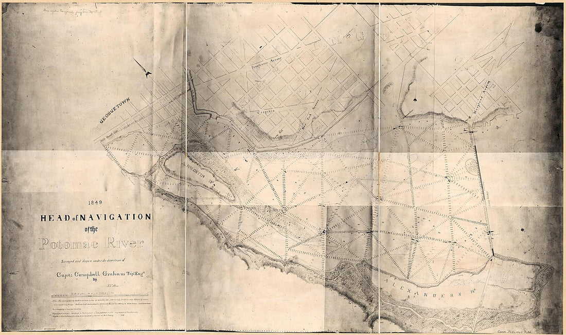 Head of Navigation of the Potomac River in 1849Head of Navigation of the Potomac River in 1849
- Regular price
-
$46.95 $152.95 - Regular price
-
$41.95 - Sale price
-
$46.95 $152.95
-
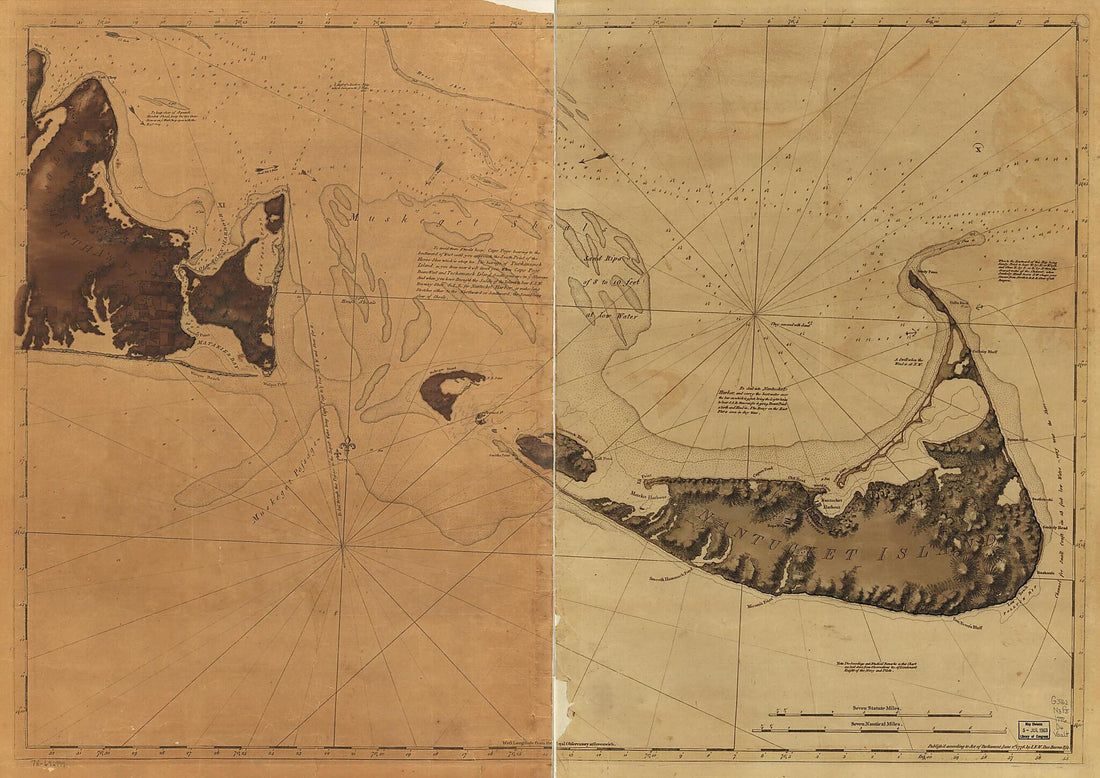 Chart of Nantucket Island and the Eastern Half of Martha's Vineyard 1776Chart of Nantucket Island and the Eastern Half of Martha's Vineyard 1776
- Regular price
-
$43.95 $139.95 - Regular price
-
$38.95 - Sale price
-
$43.95 $139.95
-
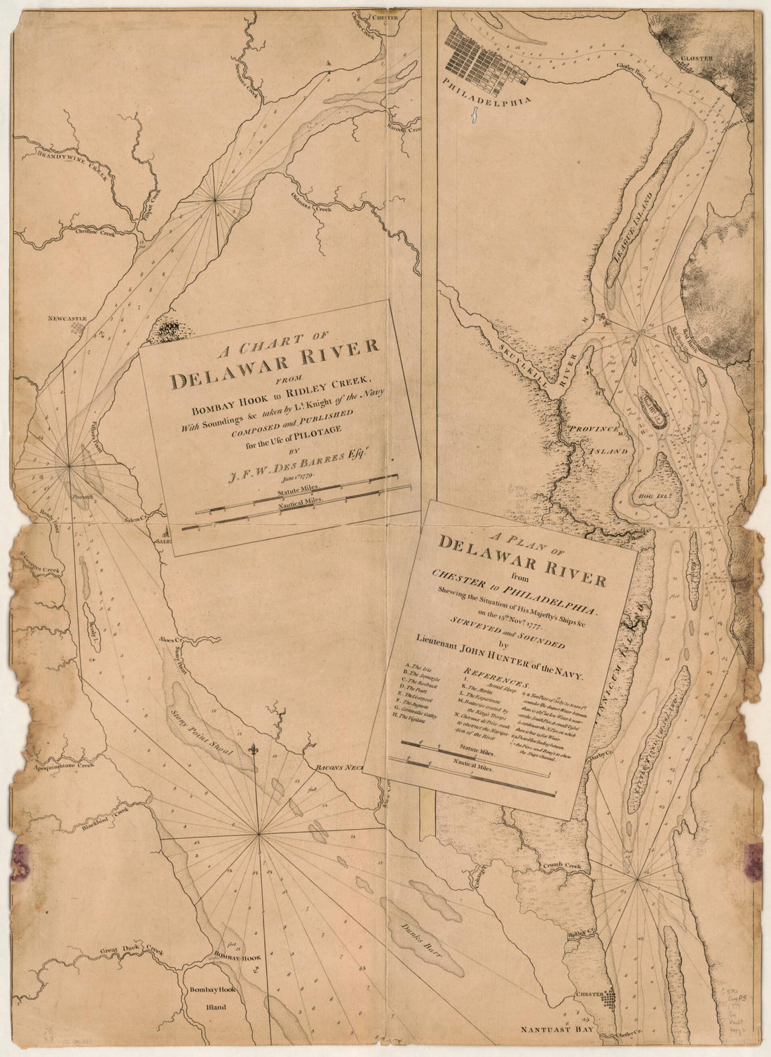 A Chart of Delawar River from Bombay Hook to Ridley Creek, With Soundings &c Taken by Lt. Knight of the Navy 1779A Chart of Delawar River from Bombay Hook to Ridley Creek, With Soundings &c Taken by Lt. Knight of the Navy 1779
- Regular price
-
$43.95 $88.95 - Regular price
-
$38.95 - Sale price
-
$43.95 $88.95


