949 products
-
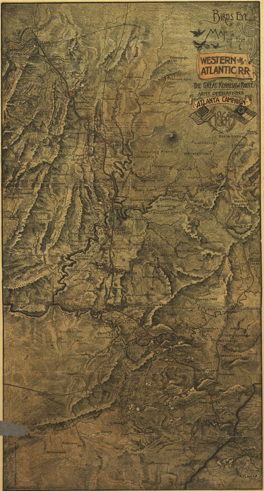 Bird's Eye View of the Western and Atlantic R.R., the Great Kennesaw Route; Army Operations, Atlanta Campaign, 1864 in 1887Bird's Eye View of the Western and Atlantic R.R., the Great Kennesaw Route; Army Operations, Atlanta Campaign, 1864 in 1887
- Regular price
-
$46.95 $99.95 - Regular price
-
$41.95 - Sale price
-
$46.95 $99.95
-
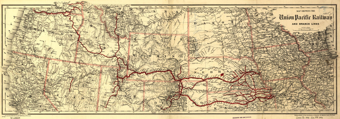 Map Showing the Union Pacific Railway and Branch Lines in 1888Map Showing the Union Pacific Railway and Branch Lines in 1888
- Regular price
-
$46.95 $99.95 - Regular price
-
$41.95 - Sale price
-
$46.95 $99.95
-
 Map of the Hudson River Rail Road from New York to Albany 1848Map of the Hudson River Rail Road from New York to Albany 1848
- Regular price
-
$46.95 $404.95 - Regular price
-
$41.95 - Sale price
-
$46.95 $404.95
-
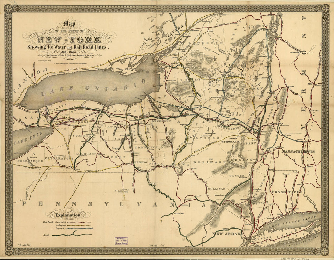 York Showing Its Water and Rail Road Lines. Jan in 1855, by Direction of John T. Clark State Engineer & SurveyorYork Showing Its Water and Rail Road Lines. Jan in 1855, by Direction of John T. Clark State Engineer & Surveyor
- Regular price
-
$43.95 $83.95 - Regular price
-
$38.95 - Sale price
-
$43.95 $83.95
-
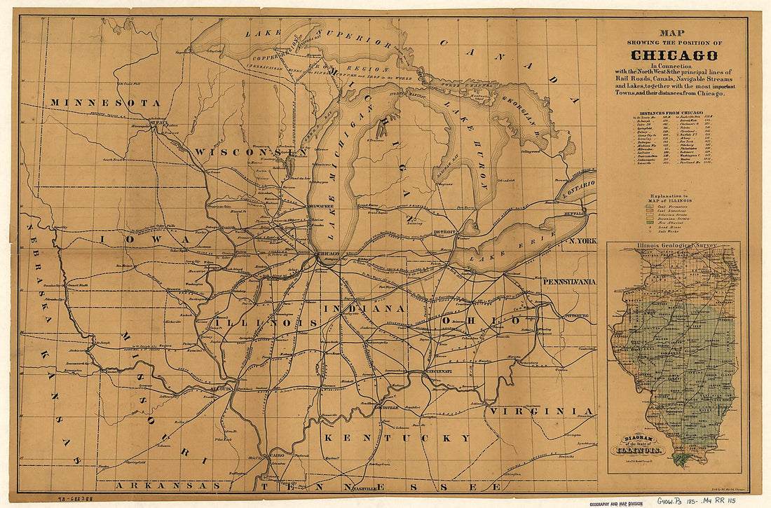 Map Showing the Position of Chicago In Connection With the North West & the Principal Lines of Rail Roads, Canals, Navigable Streams and Lakes, Together With the Most Important Towns, and Their Distances from Chicago 1850Map Showing the Position of Chicago In Connection With the North West & the Principal Lines of Rail Roads, Canals, Navigable Streams and Lakes, Together With the Most Important Towns, and Their Distances from Chicago 1850
- Regular price
-
$46.95 $111.95 - Regular price
-
$41.95 - Sale price
-
$46.95 $111.95
-
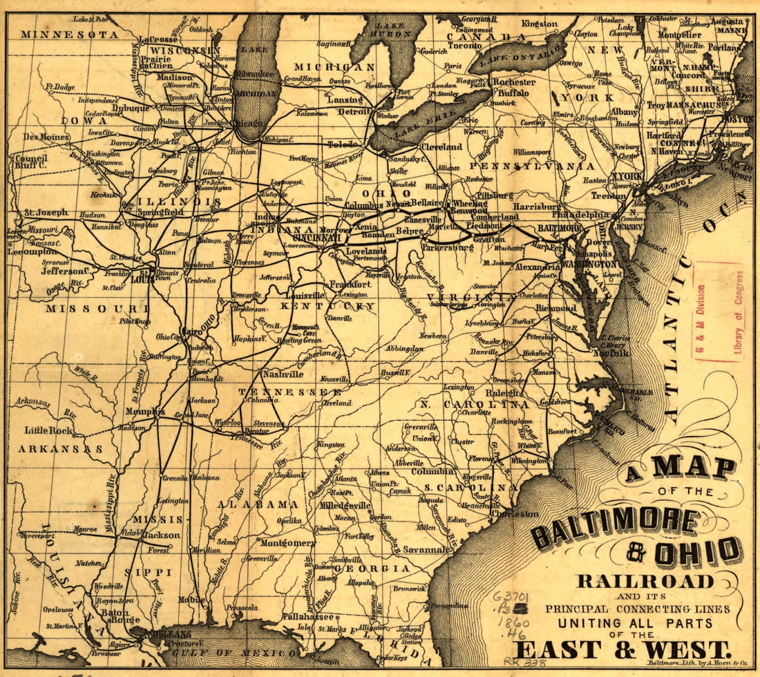 A Map of the Baltimore & Ohio Railroad and Its Principal Connecting Lines Uniting All Parts of the East & West in 1860A Map of the Baltimore & Ohio Railroad and Its Principal Connecting Lines Uniting All Parts of the East & West in 1860
- Regular price
-
$39.95 $83.95 - Regular price
-
$34.95 - Sale price
-
$39.95 $83.95
-
 Map Showing the Jacksonville North Western and South Eastern Railway and Its Connections in 1850Map Showing the Jacksonville North Western and South Eastern Railway and Its Connections in 1850
- Regular price
-
$43.95 $83.95 - Regular price
-
$38.95 - Sale price
-
$43.95 $83.95
-
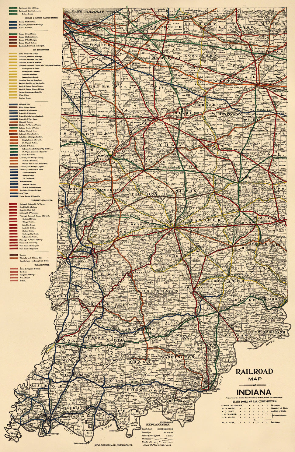 Railroad Map of Indiana in 1896Railroad Map of Indiana in 1896
- Regular price
-
$46.95 $99.95 - Regular price
-
$41.95 - Sale price
-
$46.95 $99.95
-
 New York, New Jersey, Pennsylvania, Delaware, Maryland, Ohio and Canada, With Parts of Adjoining States in 1860New York, New Jersey, Pennsylvania, Delaware, Maryland, Ohio and Canada, With Parts of Adjoining States in 1860
- Regular price
-
$43.95 $99.95 - Regular price
-
$38.95 - Sale price
-
$43.95 $99.95
-
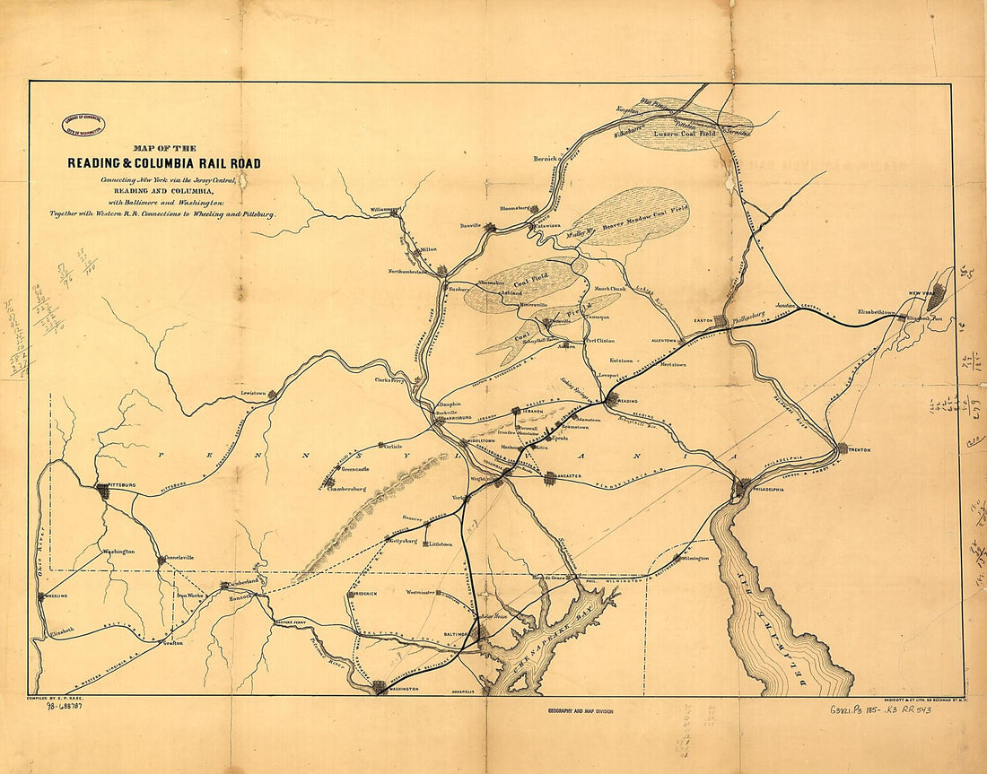 Map of the Reading & Columbia Rail Road Connecting New York Via the Jersey Central, Reading and Columbia, With Baltimore and Washington, Together With Western Railroad Connections to Wheeling and Pittsburg sic; Compiled by S. P. Kase 1850Map of the Reading & Columbia Rail Road Connecting New York Via the Jersey Central, Reading and Columbia, With Baltimore and Washington, Together With Western Railroad Connections to Wheeling and Pittsburg sic; Compiled by S. P. Kase 1850
- Regular price
-
$43.95 $140.95 - Regular price
-
$38.95 - Sale price
-
$43.95 $140.95
-
 A Section of Colton's Large Map of Indiana With the Fort Wayne and Southern Rail Road Marked Upon It, As Located Also a Map of the United States Showing Road and Its Connections Together With a Profile of the Ohio River and Lands Adjoining and a Secti...A Section of Colton's Large Map of Indiana With the Fort Wayne and Southern Rail Road Marked Upon It, As Located Also a Map of the United States Showing Road and Its Connections Together With a Profile of the Ohio River and Lands Adjoining and a Secti...
- Regular price
-
$43.95 $138.95 - Regular price
-
$38.95 - Sale price
-
$43.95 $138.95
-
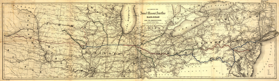 Map Showing the Iowa & Missouri State Line Railroad and Its Connections in 1868Map Showing the Iowa & Missouri State Line Railroad and Its Connections in 1868
- Regular price
-
$46.95 $140.95 - Regular price
-
$41.95 - Sale price
-
$46.95 $140.95


