949 products
-
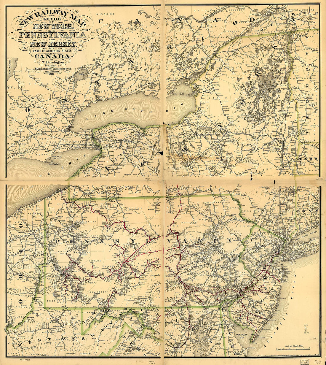 New Railway Map and Guide of New York, Pennsylvania and New Jersey With Parts of Adjoining States and Canada, 1881New Railway Map and Guide of New York, Pennsylvania and New Jersey With Parts of Adjoining States and Canada, 1881
- Regular price
-
$43.95 $220.95 - Regular price
-
$38.95 - Sale price
-
$43.95 $220.95
-
 Map Showing the Line of the Milwaukee & St. Paul Railroad and Its Western and North Western Connections 1865Map Showing the Line of the Milwaukee & St. Paul Railroad and Its Western and North Western Connections 1865
- Regular price
-
$43.95 $103.95 - Regular price
-
$38.95 - Sale price
-
$43.95 $103.95
-
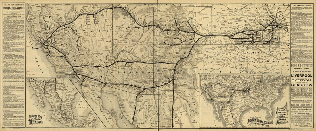 The Santa Fé Route Atchison, Topeka & Santa Fé R.R. 3 Lines Between the Missouri River and the Pacific Coast to the City of Mexico Via the A.T.&S. and Mexican Central R.R 1884The Santa Fé Route Atchison, Topeka & Santa Fé R.R. 3 Lines Between the Missouri River and the Pacific Coast to the City of Mexico Via the A.T.&S. and Mexican Central R.R 1884
- Regular price
-
$46.95 $99.95 - Regular price
-
$41.95 - Sale price
-
$46.95 $99.95
-
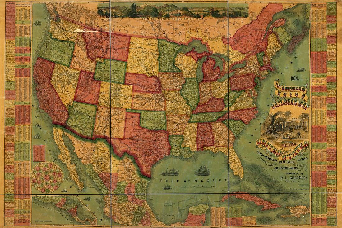 The American Union Railroad Map of the United States, British Possessions. West Indies, Mexico, and Central America in 1874The American Union Railroad Map of the United States, British Possessions. West Indies, Mexico, and Central America in 1874
- Regular price
-
$46.95 $206.95 - Regular price
-
$41.95 - Sale price
-
$46.95 $206.95
-
 Map of the Philadelphia, Wilmington, & Baltimore Railroad Shewing sic Its Connections 1850Map of the Philadelphia, Wilmington, & Baltimore Railroad Shewing sic Its Connections 1850
- Regular price
-
$39.95 $99.95 - Regular price
-
$34.95 - Sale price
-
$39.95 $99.95
-
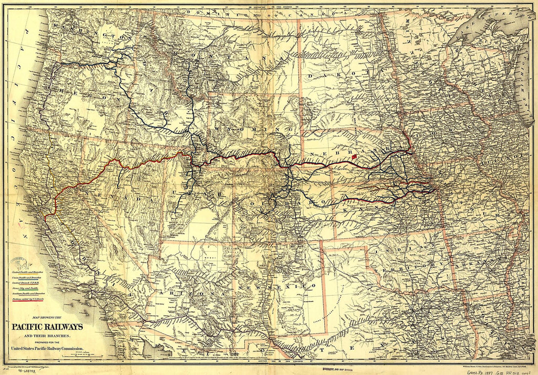 Map Showing the Pacific Railroads and Their Branches; Prepared for the United States Pacific Railway Commission 1887Map Showing the Pacific Railroads and Their Branches; Prepared for the United States Pacific Railway Commission 1887
- Regular price
-
$46.95 $176.95 - Regular price
-
$41.95 - Sale price
-
$46.95 $176.95
-
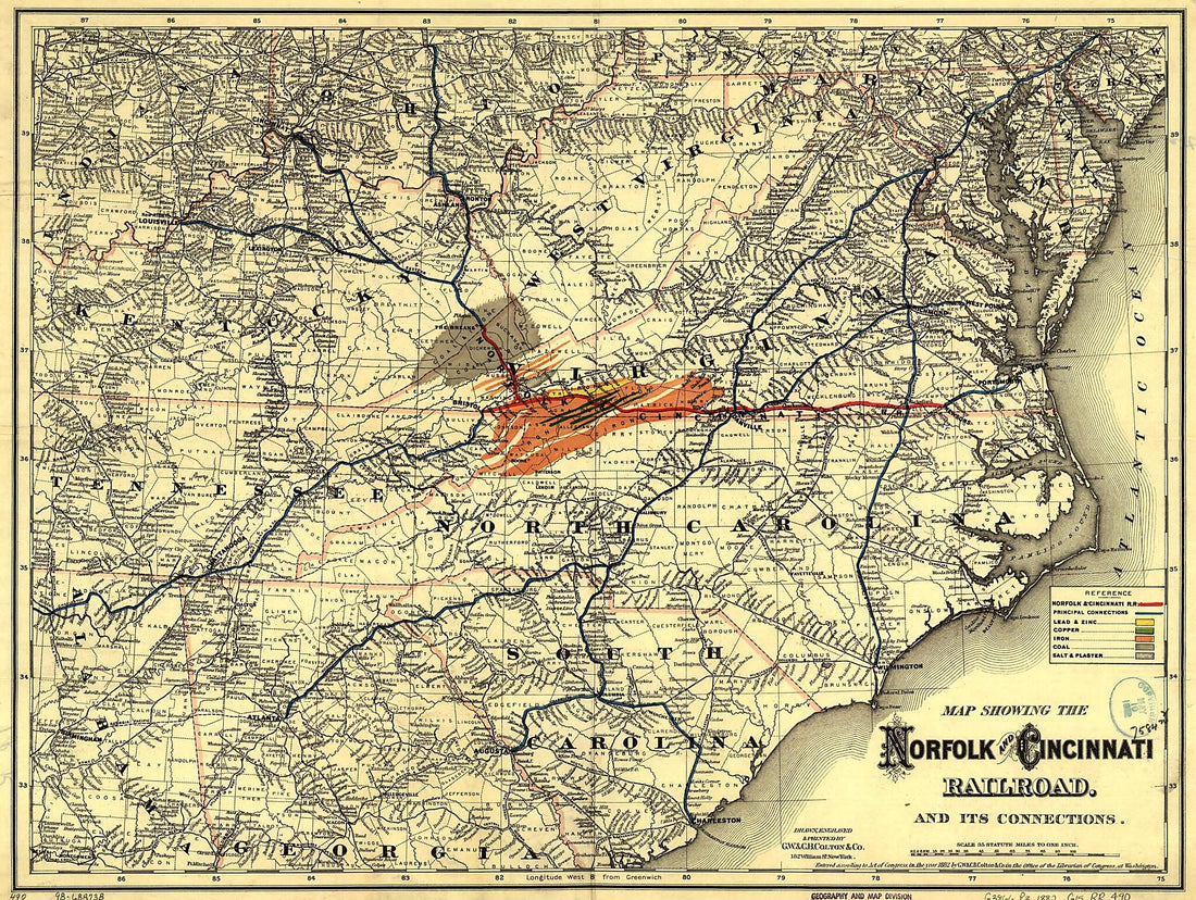 Map Showing the Norfolk and Cincinnati Railroad, and Its Connections 1882Map Showing the Norfolk and Cincinnati Railroad, and Its Connections 1882
- Regular price
-
$42.95 $88.95 - Regular price
-
$37.95 - Sale price
-
$42.95 $88.95
-
 Map of the Proposed Lock Haven & Tyrone Rail Road, by J. M. McMinn, Esqr. Civil Engineer in 1858Map of the Proposed Lock Haven & Tyrone Rail Road, by J. M. McMinn, Esqr. Civil Engineer in 1858
- Regular price
-
$46.95 $151.95 - Regular price
-
$41.95 - Sale price
-
$46.95 $151.95
-
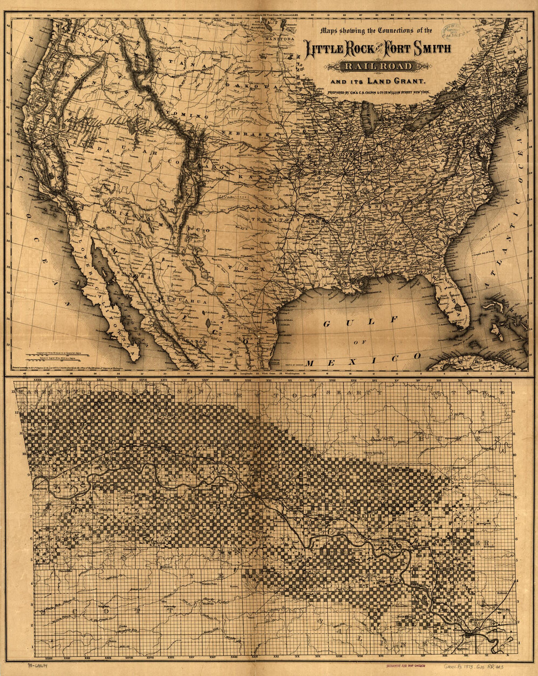 Maps Showing the Connections of the Little Rock and Fort Smith Railroad and Its Land Grant 1873Maps Showing the Connections of the Little Rock and Fort Smith Railroad and Its Land Grant 1873
- Regular price
-
$43.95 $87.95 - Regular price
-
$38.95 - Sale price
-
$43.95 $87.95
-
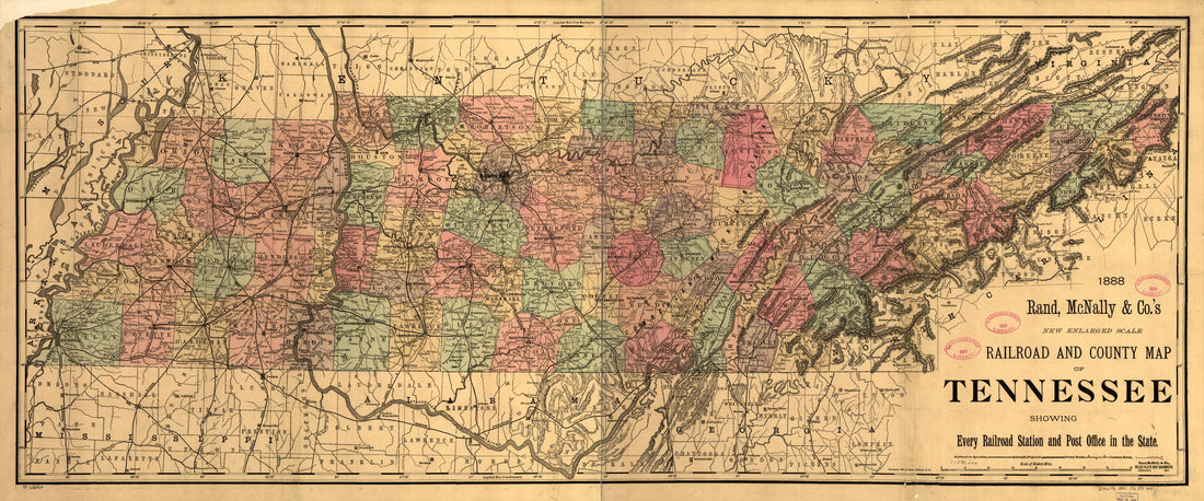 New Enlarged Scale Railroad and County Map of Tennessee Showing Every Railroad Station and Post Office In the State, in 1888New Enlarged Scale Railroad and County Map of Tennessee Showing Every Railroad Station and Post Office In the State, in 1888
- Regular price
-
$46.95 $124.95 - Regular price
-
$41.95 - Sale price
-
$46.95 $124.95
-
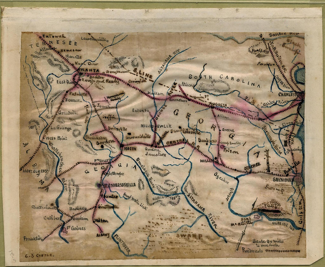 Map of South Carolina, Georgia, Alabama, and Tennessee. 1861Map of South Carolina, Georgia, Alabama, and Tennessee. 1861
- Regular price
-
$39.95 $83.95 - Regular price
-
$34.95 - Sale price
-
$39.95 $83.95
-
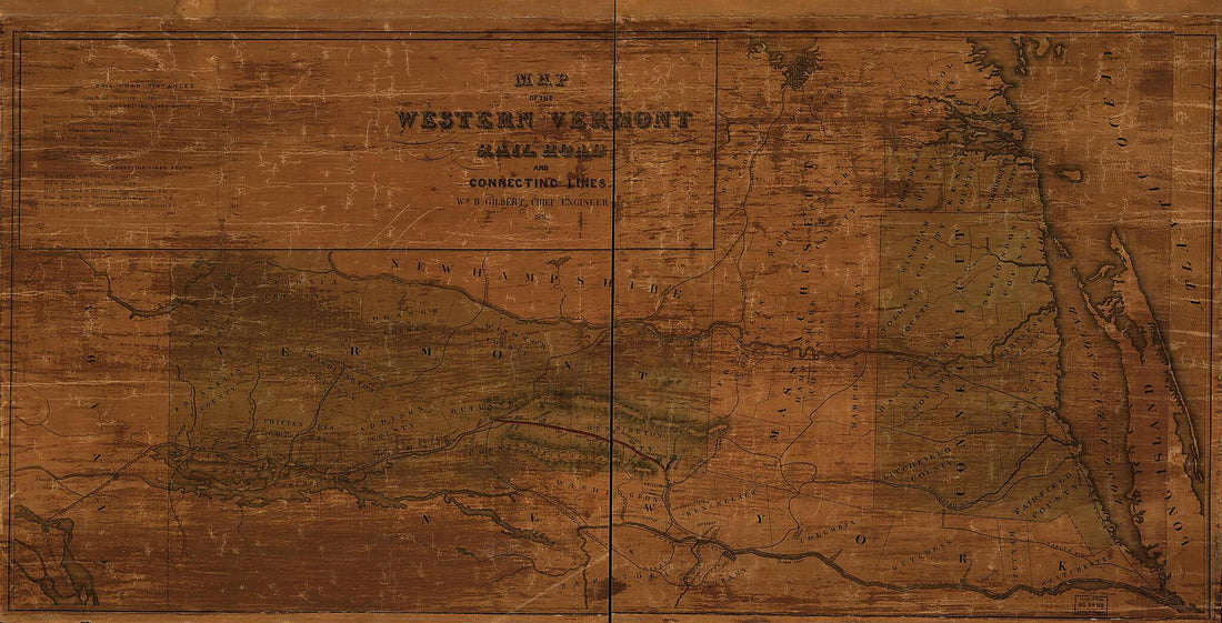 Map of the Western Vermont Rail Road and Connecting Lines, Wm. B. Gilbert, Chief Engineer 1851Map of the Western Vermont Rail Road and Connecting Lines, Wm. B. Gilbert, Chief Engineer 1851
- Regular price
-
$46.95 $201.95 - Regular price
-
$41.95 - Sale price
-
$46.95 $201.95


