949 products
-
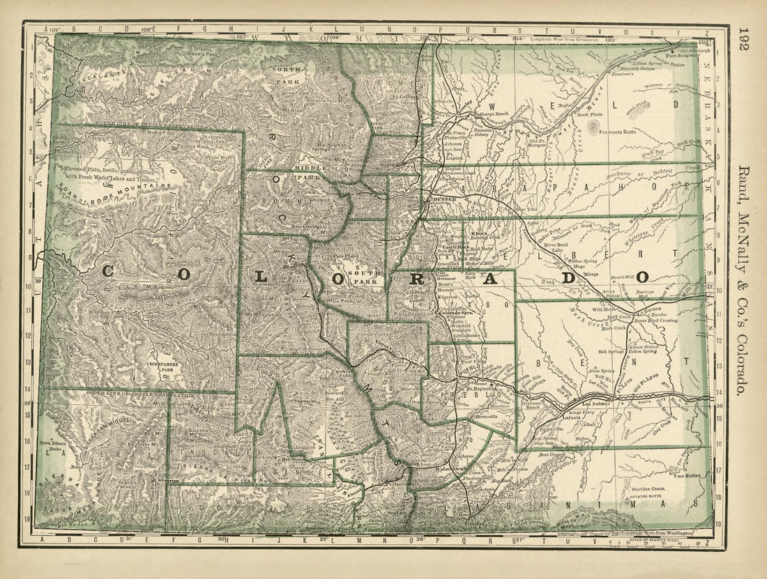 Rand, McNally & County's Colorado from Rand McNally & Co's Business Atlas : Containing Large Scale Maps of Each State and Territory of the United States, the Provinces of Canada, West India Islands, Etc., Etc., Together With a … 1878Rand, McNally & County's Colorado from Rand McNally & Co's Business Atlas : Containing Large Scale Maps of Each State and Territory of the United States, the Provinces of Canada, West India Islands, Etc., Etc., Together With a … 1878
- Regular price
-
$39.95 $88.95 - Regular price
-
$22.95 - Sale price
-
$39.95 $88.95
-
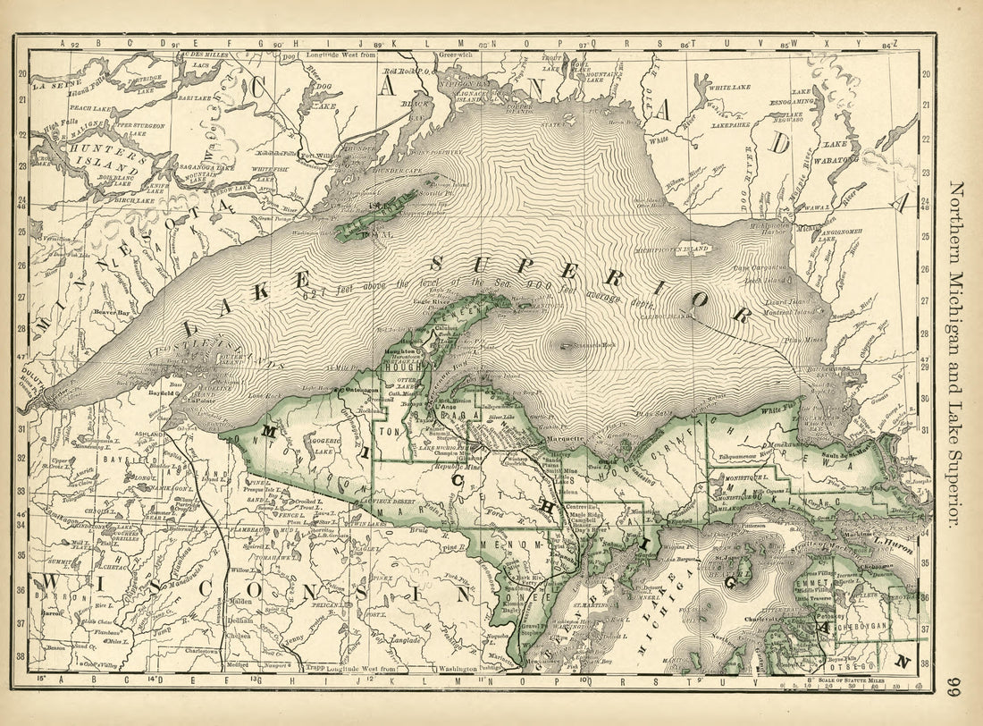 Northern Michigan and Lake Superior from Rand McNally & Co's Business Atlas : Containing Large Scale Maps of Each State and Territory of the United States, the Provinces of Canada, West India Islands, Etc., Etc., Together With a … 1878Northern Michigan and Lake Superior from Rand McNally & Co's Business Atlas : Containing Large Scale Maps of Each State and Territory of the United States, the Provinces of Canada, West India Islands, Etc., Etc., Together With a … 1878
- Regular price
-
$39.95 $88.95 - Regular price
-
$22.95 - Sale price
-
$39.95 $88.95
-
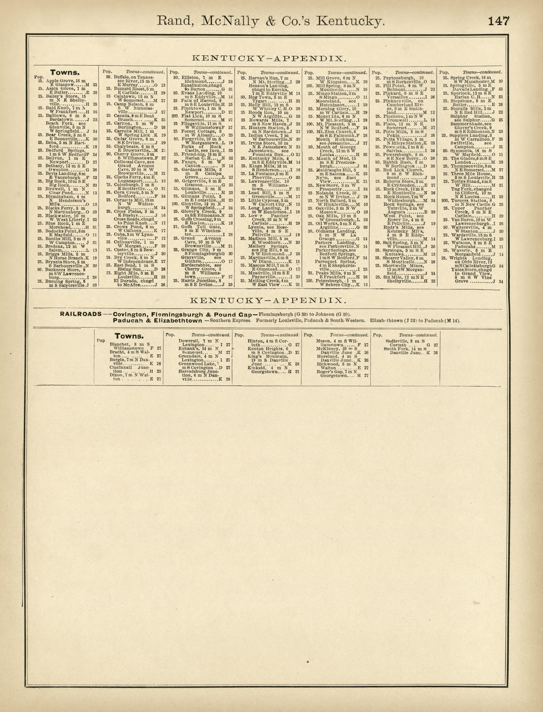 Rand, McNally & County's Kentucky from Rand McNally & Co's Business Atlas : Containing Large Scale Maps of Each State and Territory of the United States, the Provinces of Canada, West India Islands, Etc., Etc., Together With a … 1878Rand, McNally & County's Kentucky from Rand McNally & Co's Business Atlas : Containing Large Scale Maps of Each State and Territory of the United States, the Provinces of Canada, West India Islands, Etc., Etc., Together With a … 1878
- Regular price
-
$39.95 $88.95 - Regular price
-
$22.95 - Sale price
-
$39.95 $88.95
-
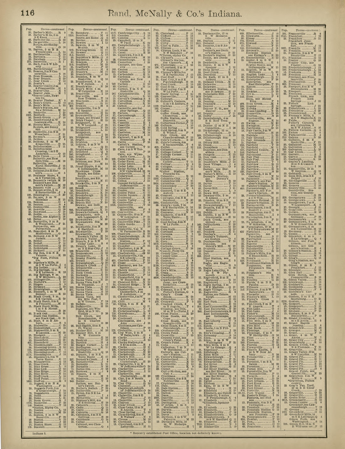 Rand, McNally & County's Indiana from Rand McNally & Co's Business Atlas : Containing Large Scale Maps of Each State and Territory of the United States, the Provinces of Canada, West India Islands, Etc., Etc., Together With a … 1878Rand, McNally & County's Indiana from Rand McNally & Co's Business Atlas : Containing Large Scale Maps of Each State and Territory of the United States, the Provinces of Canada, West India Islands, Etc., Etc., Together With a … 1878
- Regular price
-
$39.95 $88.95 - Regular price
-
$22.95 - Sale price
-
$39.95 $88.95
-
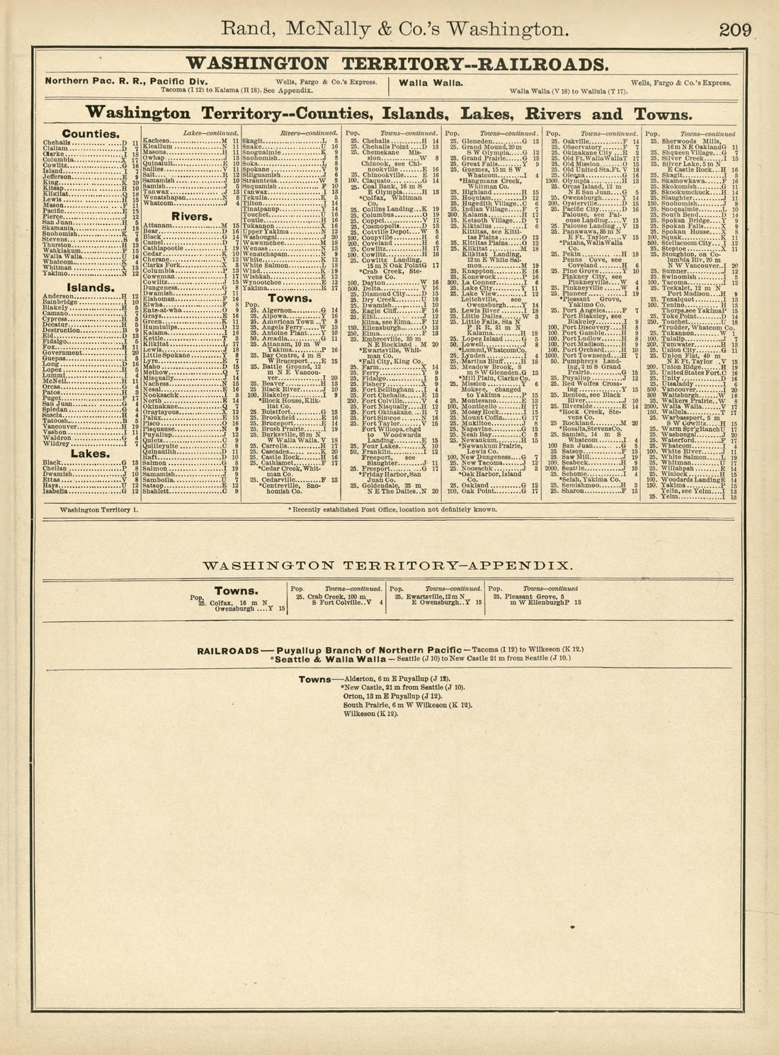 Rand, McNally & County's Washington from Rand McNally & Co's Business Atlas : Containing Large Scale Maps of Each State and Territory of the United States, the Provinces of Canada, West India Islands, Etc., Etc., Together With a … 1878Rand, McNally & County's Washington from Rand McNally & Co's Business Atlas : Containing Large Scale Maps of Each State and Territory of the United States, the Provinces of Canada, West India Islands, Etc., Etc., Together With a … 1878
- Regular price
-
$39.95 $88.95 - Regular price
-
$22.95 - Sale price
-
$39.95 $88.95
-
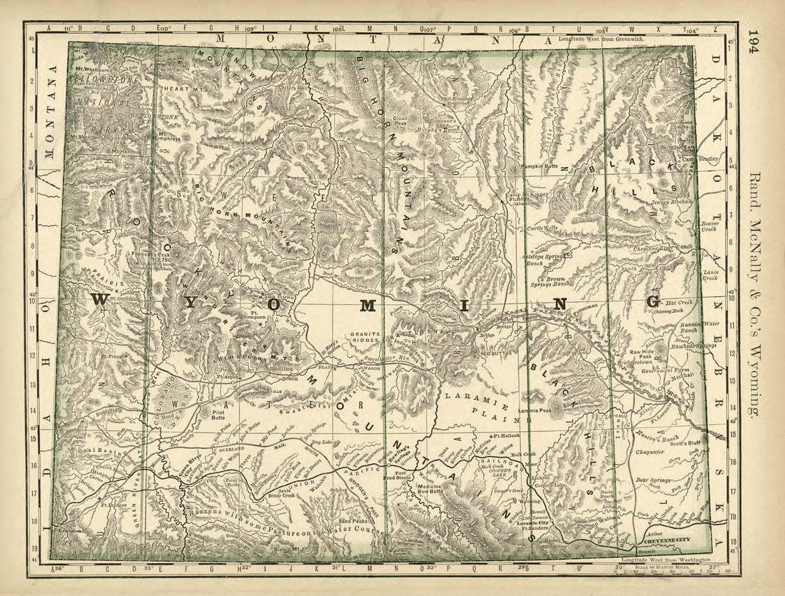 Rand, McNally & County's Wyoming from Rand McNally & Co's Business Atlas : Containing Large Scale Maps of Each State and Territory of the United States, the Provinces of Canada, West India Islands, Etc., Etc., Together With a … 1878Rand, McNally & County's Wyoming from Rand McNally & Co's Business Atlas : Containing Large Scale Maps of Each State and Territory of the United States, the Provinces of Canada, West India Islands, Etc., Etc., Together With a … 1878
- Regular price
-
$39.95 $88.95 - Regular price
-
$22.95 - Sale price
-
$39.95 $88.95
-
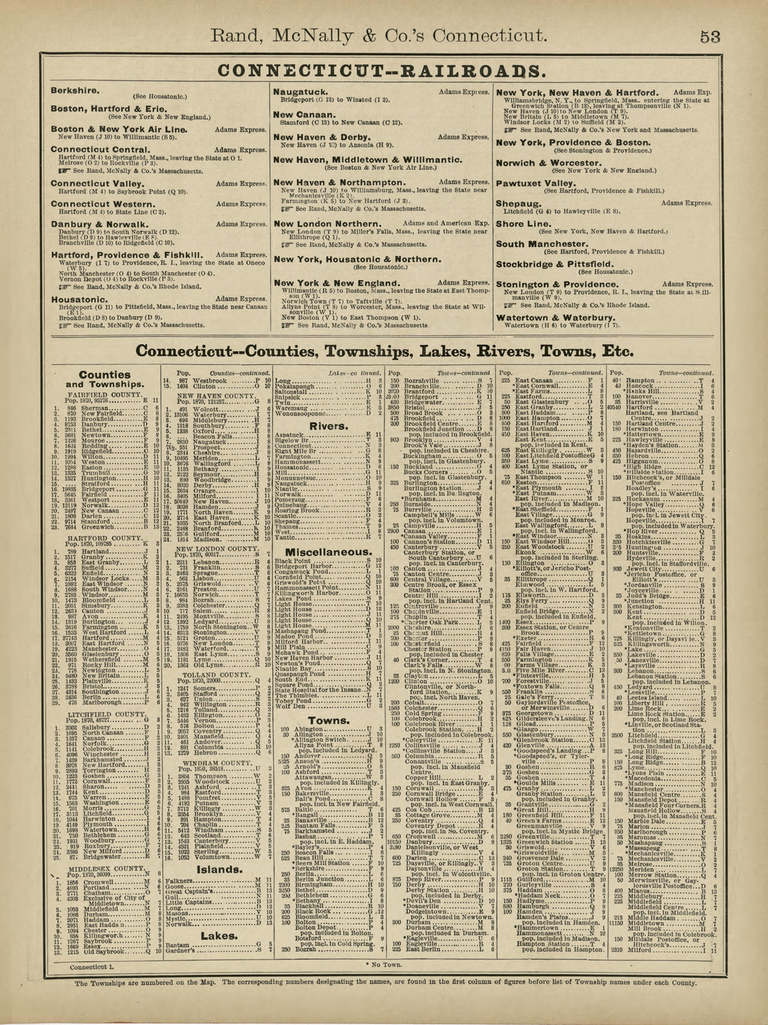 Rand, McNally & County's Connecticut from Rand McNally & Co's Business Atlas : Containing Large Scale Maps of Each State and Territory of the United States, the Provinces of Canada, West India Islands, Etc., Etc., Together With a … 1878Rand, McNally & County's Connecticut from Rand McNally & Co's Business Atlas : Containing Large Scale Maps of Each State and Territory of the United States, the Provinces of Canada, West India Islands, Etc., Etc., Together With a … 1878
- Regular price
-
$39.95 $88.95 - Regular price
-
$23.95 - Sale price
-
$39.95 $88.95
-
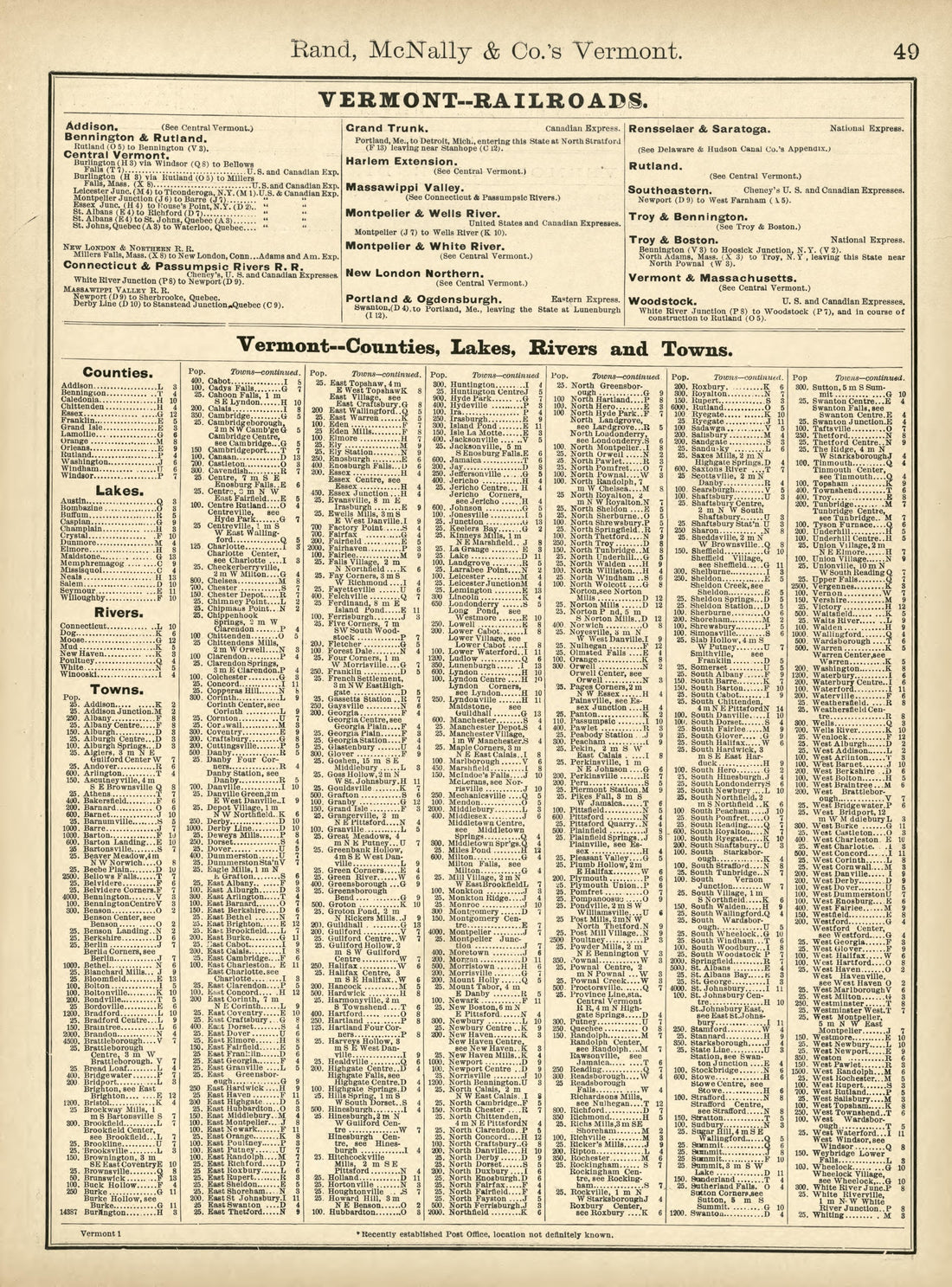 Rand, McNally & County's Vermont from Rand McNally & Co's Business Atlas : Containing Large Scale Maps of Each State and Territory of the United States, the Provinces of Canada, West India Islands, Etc., Etc., Together With a … 1878Rand, McNally & County's Vermont from Rand McNally & Co's Business Atlas : Containing Large Scale Maps of Each State and Territory of the United States, the Provinces of Canada, West India Islands, Etc., Etc., Together With a … 1878
- Regular price
-
$39.95 $88.95 - Regular price
-
$22.95 - Sale price
-
$39.95 $88.95
-
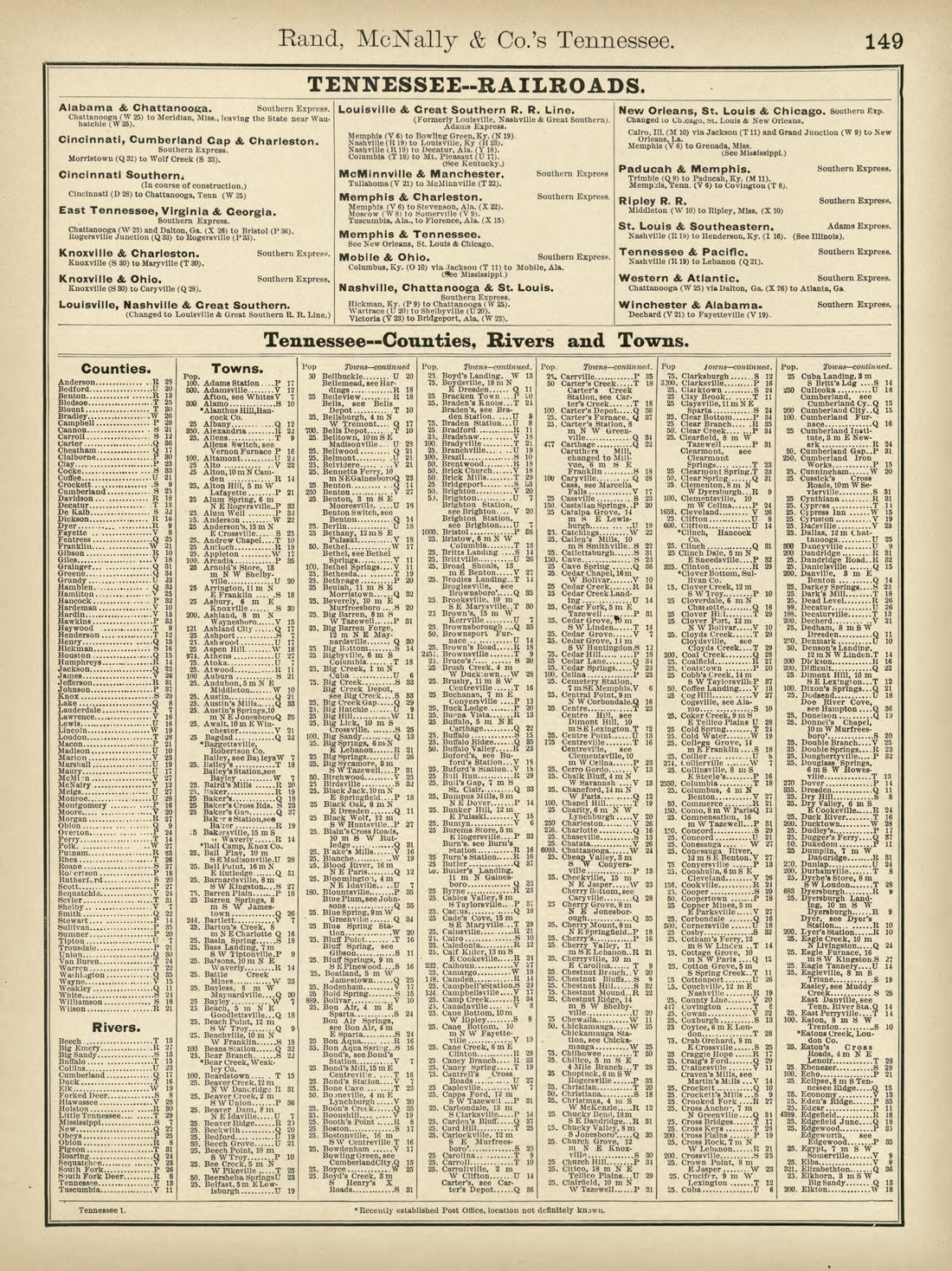 Rand, McNally & County's Tennessee from Rand McNally & Co's Business Atlas : Containing Large Scale Maps of Each State and Territory of the United States, the Provinces of Canada, West India Islands, Etc., Etc., Together With a … 1878Rand, McNally & County's Tennessee from Rand McNally & Co's Business Atlas : Containing Large Scale Maps of Each State and Territory of the United States, the Provinces of Canada, West India Islands, Etc., Etc., Together With a … 1878
- Regular price
-
$39.95 $88.95 - Regular price
-
$22.95 - Sale price
-
$39.95 $88.95
-
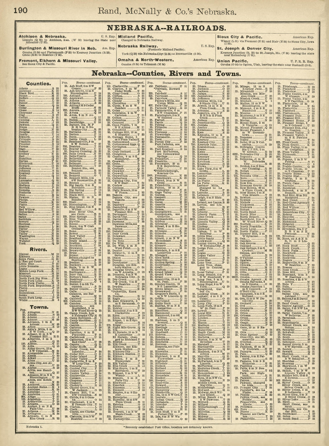 Rand, McNally & County's Nebraska from Rand McNally & Co's Business Atlas : Containing Large Scale Maps of Each State and Territory of the United States, the Provinces of Canada, West India Islands, Etc., Etc., Together With a … 1878Rand, McNally & County's Nebraska from Rand McNally & Co's Business Atlas : Containing Large Scale Maps of Each State and Territory of the United States, the Provinces of Canada, West India Islands, Etc., Etc., Together With a … 1878
- Regular price
-
$39.95 $88.95 - Regular price
-
$21.95 - Sale price
-
$39.95 $88.95
-
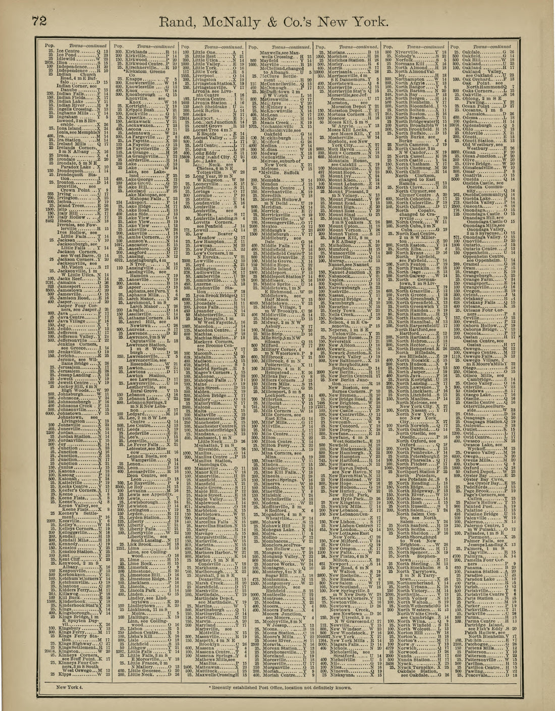 Rand, McNally & County's New York from Rand McNally & Co's Business Atlas : Containing Large Scale Maps of Each State and Territory of the United States, the Provinces of Canada, West India Islands, Etc., Etc., Together With a … 1878Rand, McNally & County's New York from Rand McNally & Co's Business Atlas : Containing Large Scale Maps of Each State and Territory of the United States, the Provinces of Canada, West India Islands, Etc., Etc., Together With a … 1878
- Regular price
-
$39.95 $83.95 - Regular price
-
$22.95 - Sale price
-
$39.95 $83.95
-
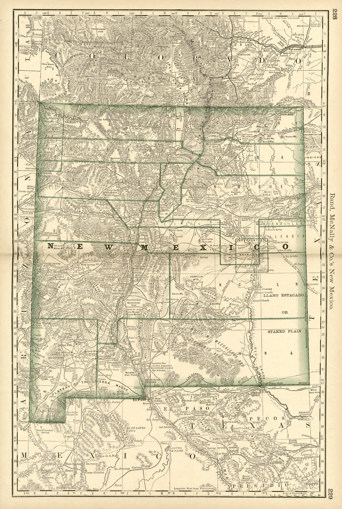 Rand, McNally & County's New Mexico from Rand McNally & Co's Business Atlas : Containing Large Scale Maps of Each State and Territory of the United States, the Provinces of Canada, West India Islands, Etc., Etc., Together With a … 1878Rand, McNally & County's New Mexico from Rand McNally & Co's Business Atlas : Containing Large Scale Maps of Each State and Territory of the United States, the Provinces of Canada, West India Islands, Etc., Etc., Together With a … 1878
- Regular price
-
$39.95 $99.95 - Regular price
-
$36.95 - Sale price
-
$39.95 $99.95


