125 products
-
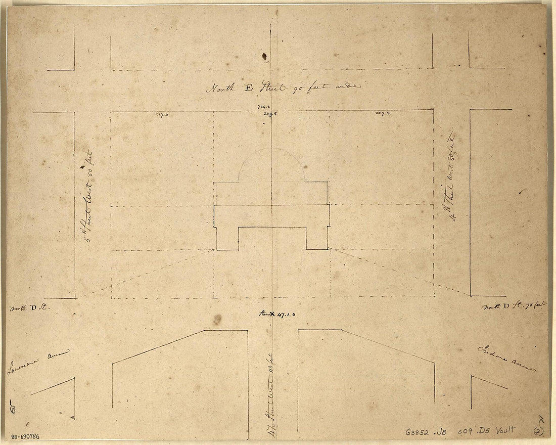 Plan of the Present Situation of the City Hall On the Square Between North D & E Streets & Between 4th & 5th Streets West 1826Plan of the Present Situation of the City Hall On the Square Between North D & E Streets & Between 4th & 5th Streets West 1826
- Regular price
-
$49.95 $83.95 - Regular price
-
$34.95 - Sale price
-
$49.95 $83.95
-
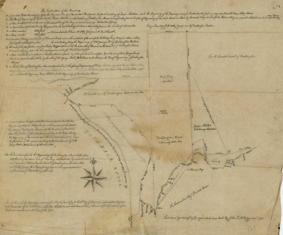 Cadastral Survey Map of Charles Carroll Jr.'s Land In Central Washington D.C. In 1793Cadastral Survey Map of Charles Carroll Jr.'s Land In Central Washington D.C. In 1793
- Regular price
-
$49.95 $83.95 - Regular price
-
$34.95 - Sale price
-
$49.95 $83.95
-
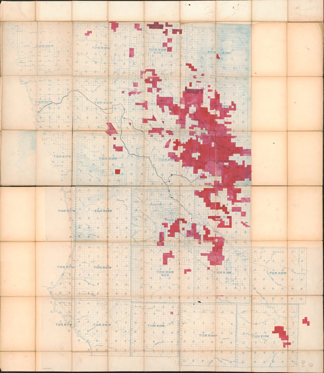 Blueprint Map of South Mendocino Co., CA, Ca. in 1896Blueprint Map of South Mendocino Co., CA, Ca. in 1896
- Regular price
-
$54.95 $220.95 - Regular price
-
$38.95 - Sale price
-
$54.95 $220.95
-
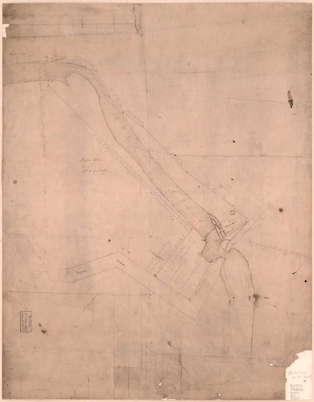 Mill Tract : on Rock Creek, N.W. Washington D.C. 1849Mill Tract : on Rock Creek, N.W. Washington D.C. 1849
- Regular price
-
$54.95 $83.95 - Regular price
-
$38.95 - Sale price
-
$54.95 $83.95
-
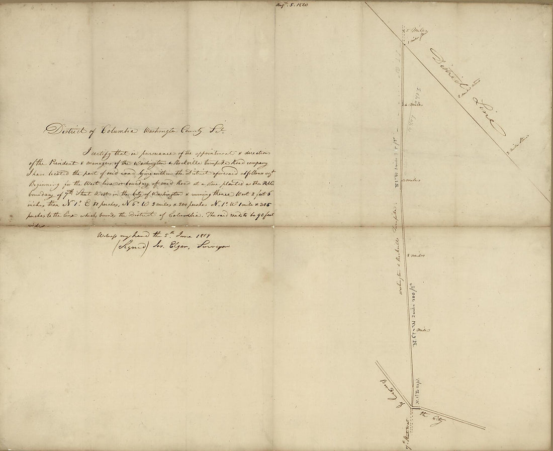 Plat of That Part of the Washington & Rockville Turnpike Road Lying Within the District of Columbia 1819Plat of That Part of the Washington & Rockville Turnpike Road Lying Within the District of Columbia 1819
- Regular price
-
$54.95 $83.95 - Regular price
-
$33.95 - Sale price
-
$54.95 $83.95
-
 Plat of Survey of Wm. M. Rapley's Property Fronting Square West of Sq. 471 : Showing the Docks and Wharves Described In Lease and Also the Part Occupied by Stephenson & Bro. : Washington D.C. 1887Plat of Survey of Wm. M. Rapley's Property Fronting Square West of Sq. 471 : Showing the Docks and Wharves Described In Lease and Also the Part Occupied by Stephenson & Bro. : Washington D.C. 1887
- Regular price
-
$58.95 $225.95 - Regular price
-
$41.95 - Sale price
-
$58.95 $225.95
-
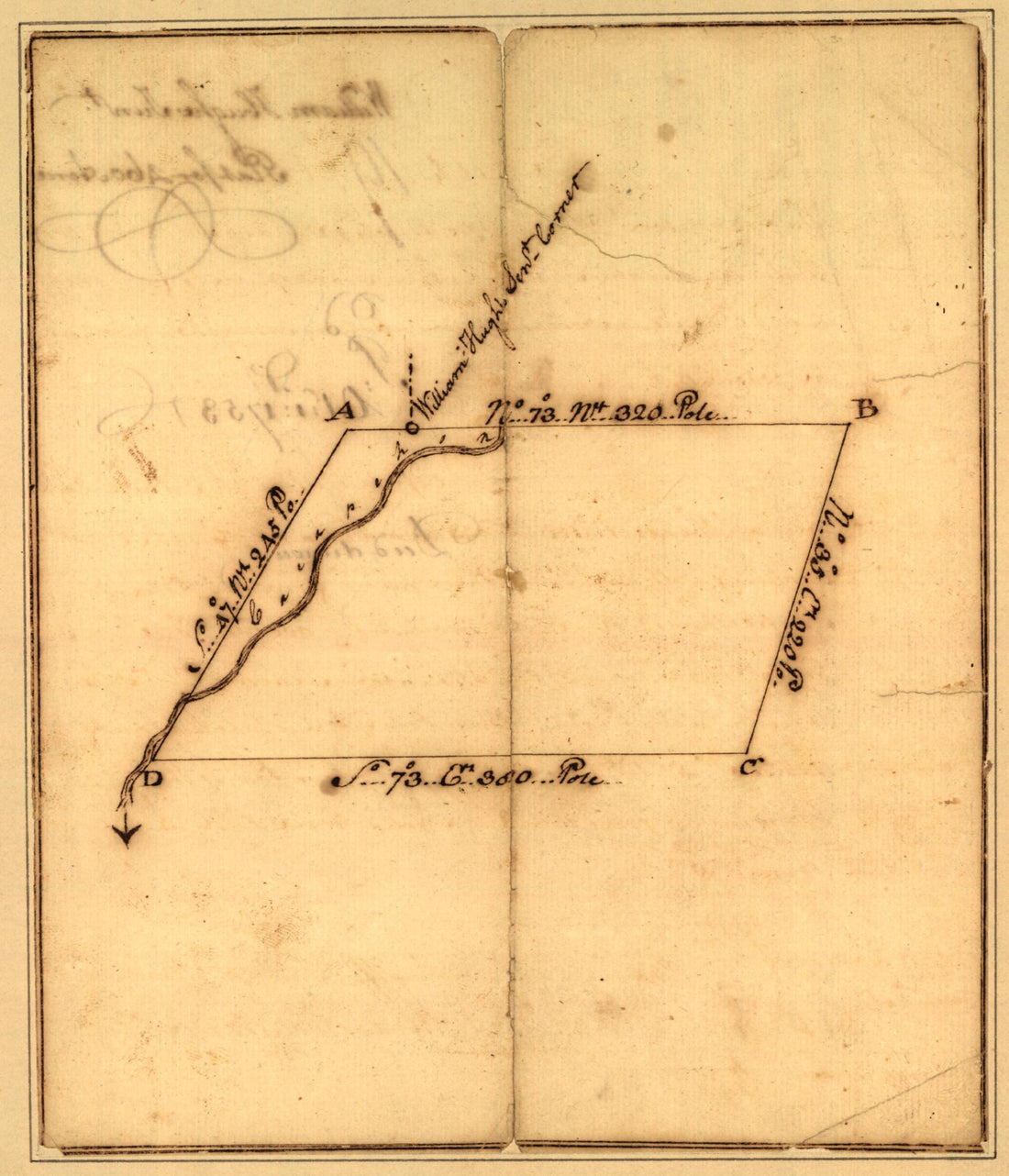 Plat of a Survey for William Hughes, Jr. of 460 Acres In Frederick County, Va. On the Cacapon River 1750Plat of a Survey for William Hughes, Jr. of 460 Acres In Frederick County, Va. On the Cacapon River 1750
- Regular price
-
$49.95 $83.95 - Regular price
-
$34.95 - Sale price
-
$49.95 $83.95
-
 A Plan of Mr. Clifton's Neck Land Platted by a Scale of 50 Poles to the Inch (Plan of Mr. Clifton's Neck Land Platted by a Scale of 50 Poles to the Inch. Old Plat of the Grounds In the NE Part of the Pasture of Mount Vernon from the Summit of the Hill...A Plan of Mr. Clifton's Neck Land Platted by a Scale of 50 Poles to the Inch (Plan of Mr. Clifton's Neck Land Platted by a Scale of 50 Poles to the Inch. Old Plat of the Grounds In the NE Part of the Pasture of Mount Vernon from the Summit of the Hill...
- Regular price
-
$51.95 $148.95 - Regular price
-
$38.95 - Sale price
-
$51.95 $148.95
-
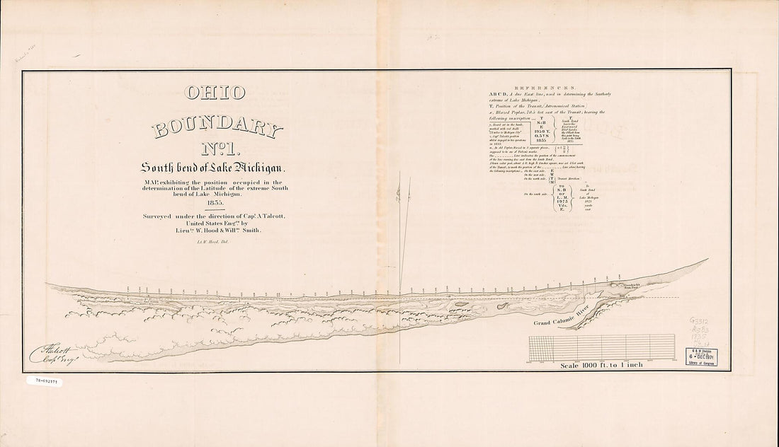 Ohio Boundary, No. 1, South Bend of Lake Michigan; Map Exhibiting the Position Occupied In the Determination of the Latitude of the Extreme South Bend of Lake Michigan 1835Ohio Boundary, No. 1, South Bend of Lake Michigan; Map Exhibiting the Position Occupied In the Determination of the Latitude of the Extreme South Bend of Lake Michigan 1835
- Regular price
-
$58.95 $136.95 - Regular price
-
$41.95 - Sale price
-
$58.95 $136.95
-
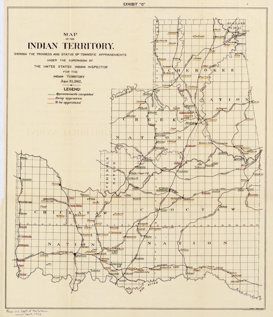 Map of the Indian Territory : Showing the Progress and Status of Townsite Appraisements, Under the Supervision of the United States Indian Inspector for the Indian Territory, June 30, 1902Map of the Indian Territory : Showing the Progress and Status of Townsite Appraisements, Under the Supervision of the United States Indian Inspector for the Indian Territory, June 30, 1902
- Regular price
-
$50.95 $83.95 - Regular price
-
$38.95 - Sale price
-
$50.95 $83.95
-
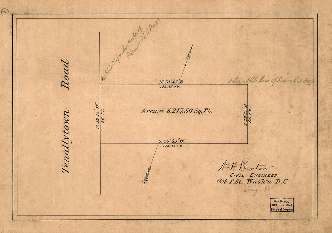 Cadastral Survey Map of a Land Tract Fronting Tennallytown Road North of Pierce's Mill Road, Tenleytown, Washington D.C. 1891Cadastral Survey Map of a Land Tract Fronting Tennallytown Road North of Pierce's Mill Road, Tenleytown, Washington D.C. 1891
- Regular price
-
$49.95 $88.95 - Regular price
-
$33.95 - Sale price
-
$49.95 $88.95
-
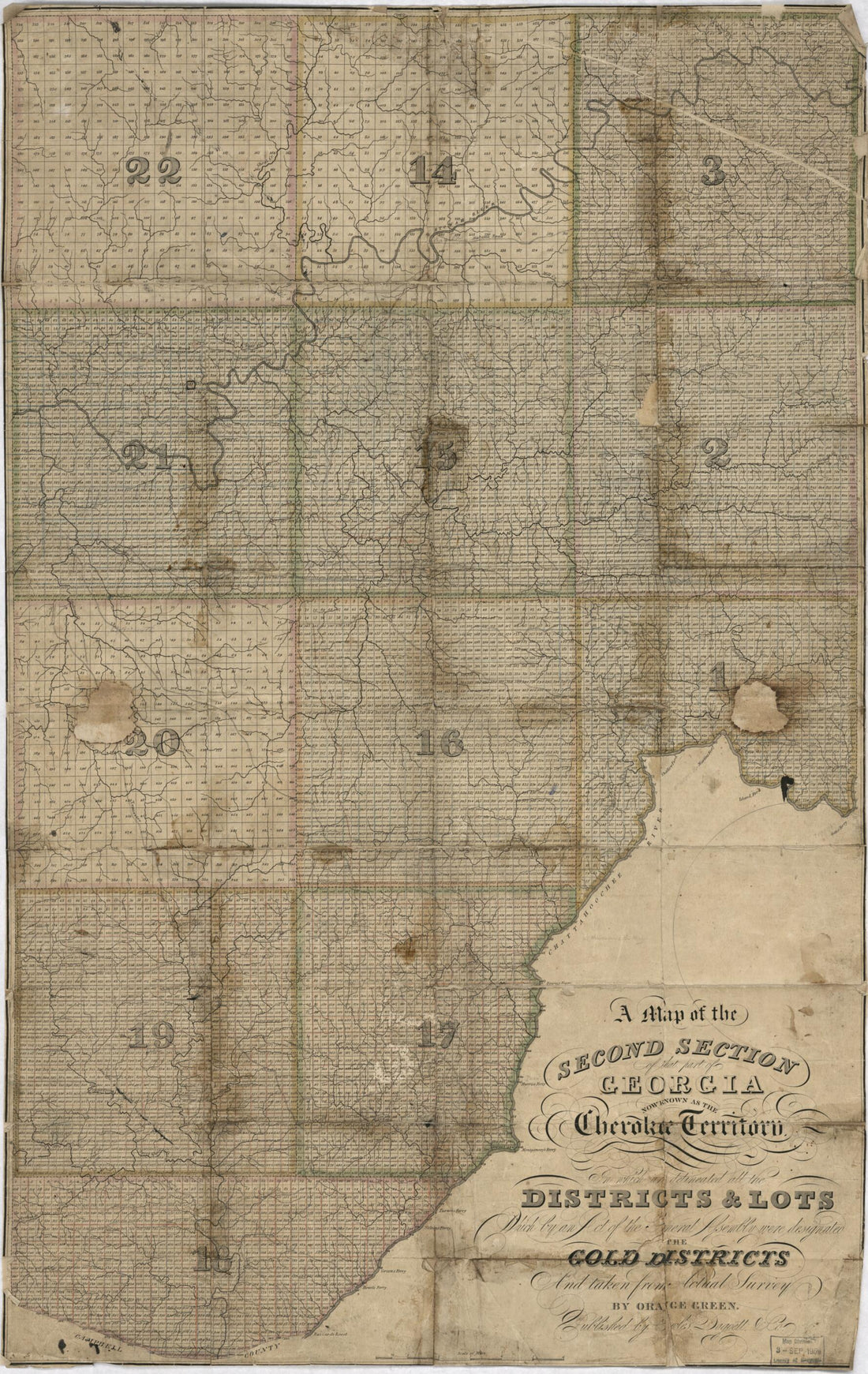 A Map of the Second Section of That Part of Georgia Now Known As the Cherokee Territory In Which Are Delineated All the Districts & Lots Which by an Act of the General Assembly Were Designated the Gold Districts and Taken from Actual Survey 1830A Map of the Second Section of That Part of Georgia Now Known As the Cherokee Territory In Which Are Delineated All the Districts & Lots Which by an Act of the General Assembly Were Designated the Gold Districts and Taken from Actual Survey 1830
- Regular price
-
$58.95 $107.95 - Regular price
-
$41.95 - Sale price
-
$58.95 $107.95


