467 products
-
 Carta Esférica De La Parte Meridional De La Ysla De Cuba 1804Carta Esférica De La Parte Meridional De La Ysla De Cuba 1804
- Regular price
-
$43.95 $117.95 - Regular price
-
$32.95 - Sale price
-
$43.95 $117.95
-
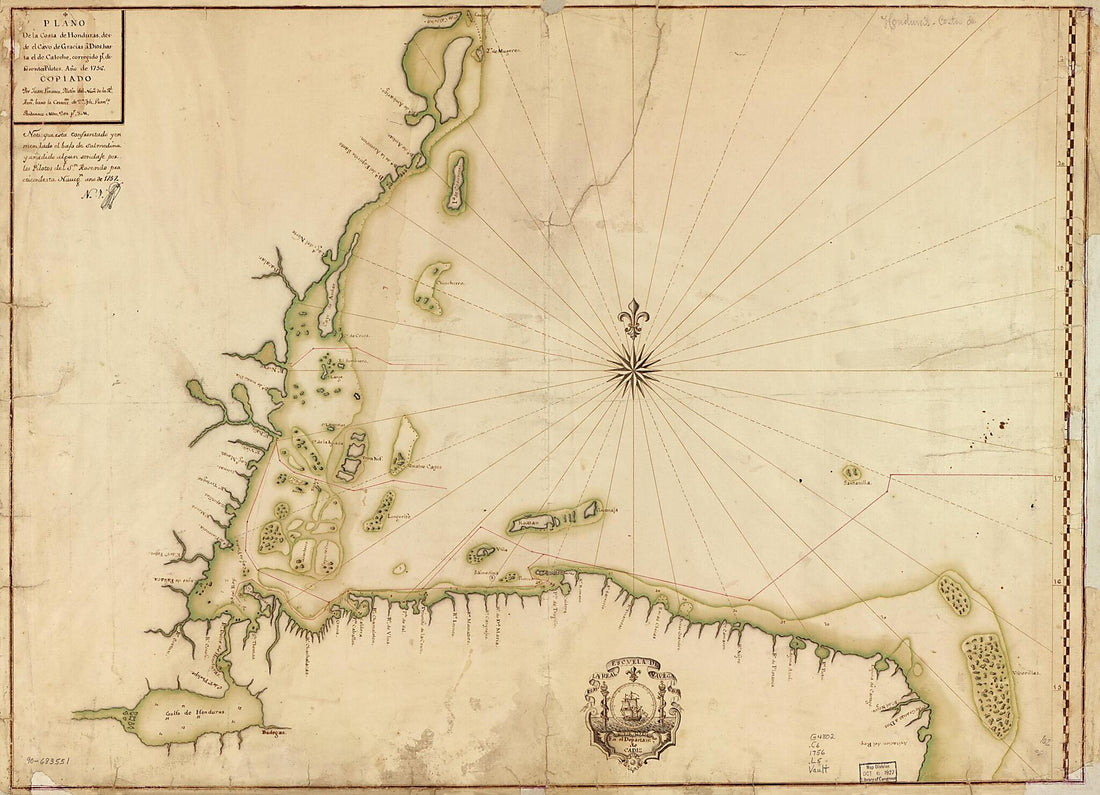 Plano De La Costa De Honduras Desde El Cavo De Gracias a Dios Hasta El De Catoche, Corregido Pr. Diferentes Pilotos, Año De 1756Plano De La Costa De Honduras Desde El Cavo De Gracias a Dios Hasta El De Catoche, Corregido Pr. Diferentes Pilotos, Año De 1756
- Regular price
-
$43.95 $149.95 - Regular price
-
$32.95 - Sale price
-
$43.95 $149.95
-
 Map Showing Coast of Argentina from 42⁰S to 53⁰S (Chubut River to Strait of Magellan Including Falkland Islands) 1700Map Showing Coast of Argentina from 42⁰S to 53⁰S (Chubut River to Strait of Magellan Including Falkland Islands) 1700
- Regular price
-
$43.95 $88.95 - Regular price
-
$32.95 - Sale price
-
$43.95 $88.95
-
 Insvlæ Americanæ In Oceano Septentrionali Cum Terris Adjacentibus. (Insulæ Americanæ In Oceano Septentrionali Cum Terris Adjacentibus) 1634Insvlæ Americanæ In Oceano Septentrionali Cum Terris Adjacentibus. (Insulæ Americanæ In Oceano Septentrionali Cum Terris Adjacentibus) 1634
- Regular price
-
$39.95 $105.95 - Regular price
-
$34.95 - Sale price
-
$39.95 $105.95
-
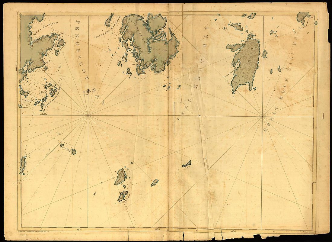 Coast of Maine Showing Entrances of Blue Hill Bay, Isle of Haut Bay, and Penobscot Bay, With Owls Head, Vinalhaven Island, Isle Au Haut, and Other Islands in 1776Coast of Maine Showing Entrances of Blue Hill Bay, Isle of Haut Bay, and Penobscot Bay, With Owls Head, Vinalhaven Island, Isle Au Haut, and Other Islands in 1776
- Regular price
-
$43.95 $156.95 - Regular price
-
$32.95 - Sale price
-
$43.95 $156.95
-
 Carta Plana Que Contiene El Estrecho De Sonda Con Una Parte De La Ysla De Jaba Y Otra De La De Sumatra Arreglada Segn. La Moderna De Mr. Dapres Exsepto Los Numeros De Sonda Qe. Son Los Mismos Qe. Hallo El Navio Español Nombrado El Buen Consejo 1770Carta Plana Que Contiene El Estrecho De Sonda Con Una Parte De La Ysla De Jaba Y Otra De La De Sumatra Arreglada Segn. La Moderna De Mr. Dapres Exsepto Los Numeros De Sonda Qe. Son Los Mismos Qe. Hallo El Navio Español Nombrado El Buen Consejo 1770
- Regular price
-
$43.95 $139.95 - Regular price
-
$32.95 - Sale price
-
$43.95 $139.95
-
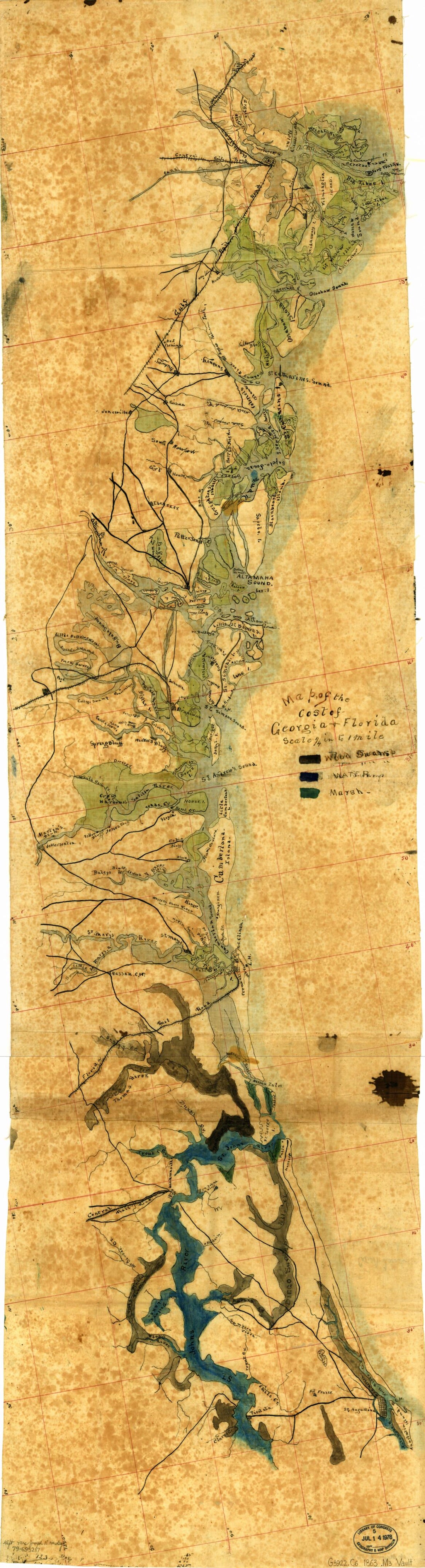 Map of the Cost sic of Georgia & Florida in 1863Map of the Cost sic of Georgia & Florida in 1863
- Regular price
-
$46.95 $99.95 - Regular price
-
$41.95 - Sale price
-
$46.95 $99.95
-
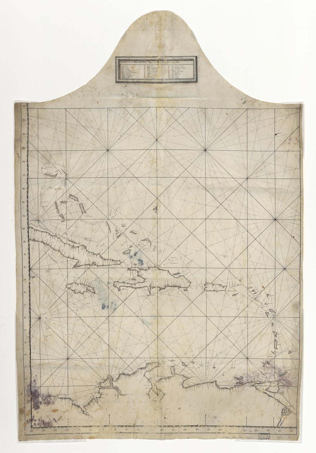 Map Showing Caribbean Area Including West Indies and Gulf of Mexico 1730Map Showing Caribbean Area Including West Indies and Gulf of Mexico 1730
- Regular price
-
$46.95 $117.95 - Regular price
-
$41.95 - Sale price
-
$46.95 $117.95
-
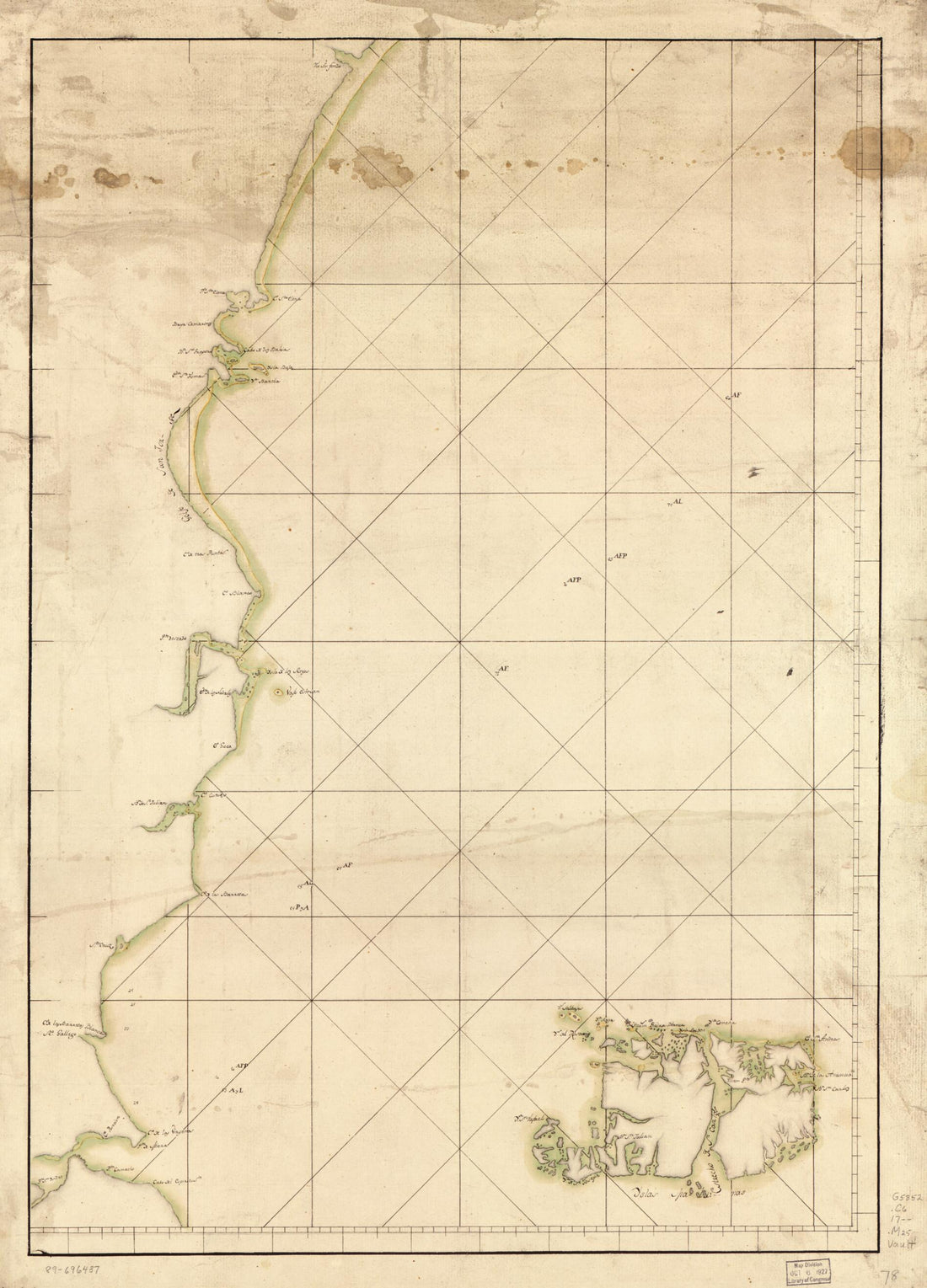
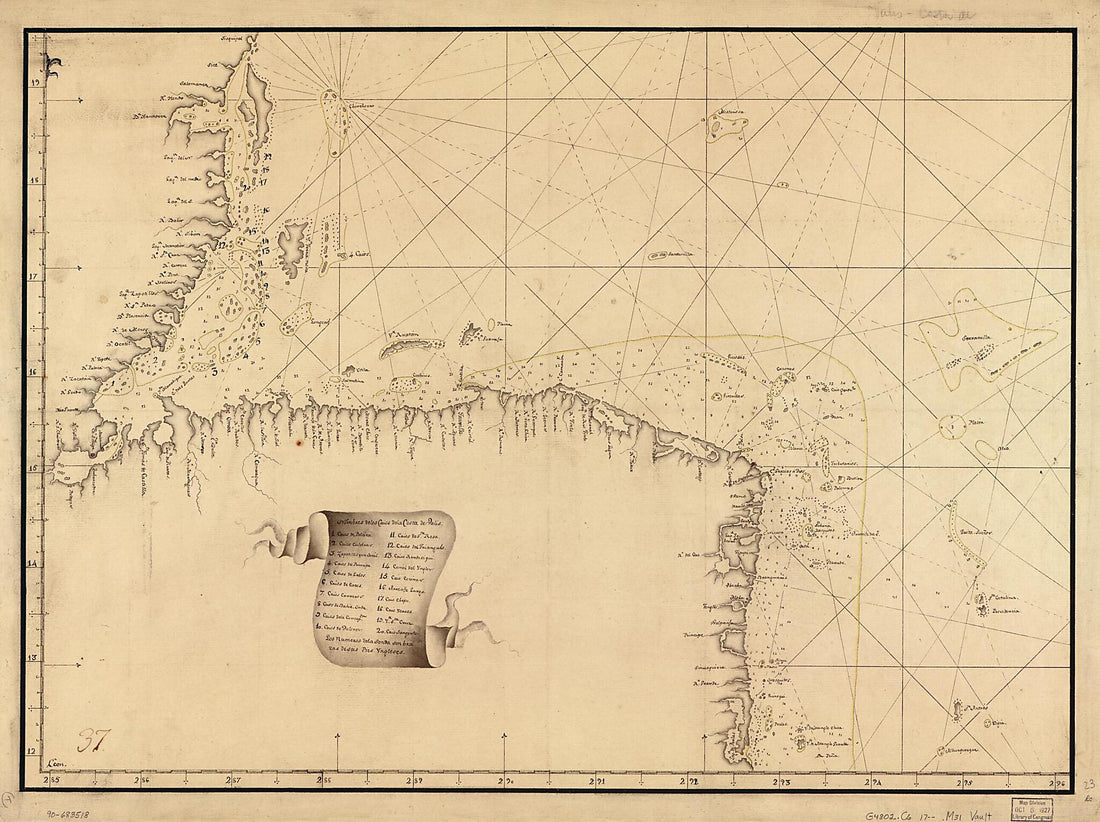 Map Showing Caribbean Coast of Central America from Belize to Nicaragua 1700Map Showing Caribbean Coast of Central America from Belize to Nicaragua 1700
- Regular price
-
$43.95 $122.95 - Regular price
-
$32.95 - Sale price
-
$43.95 $122.95
-
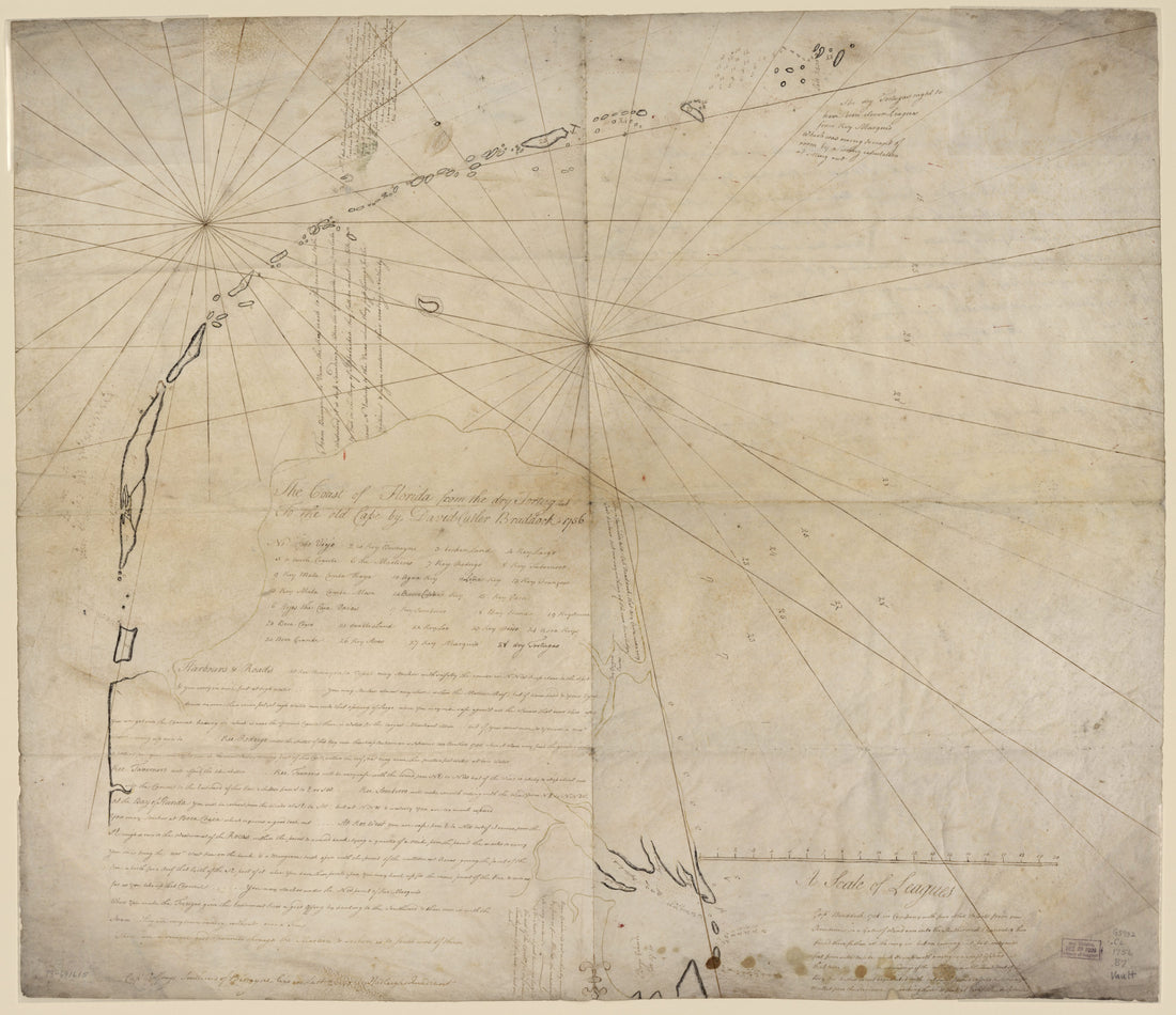 The Coast of Florida from the Dry Tortugas to the Old Cape 1756The Coast of Florida from the Dry Tortugas to the Old Cape 1756
- Regular price
-
$39.95 $165.95 - Regular price
-
$34.95 - Sale price
-
$39.95 $165.95
-
 Plano Del Puerto De Cabañas, Situado En La Costa Dl. N. De La Ysla De Cuba, 12 Leguas Al O. De La Havana 1700Plano Del Puerto De Cabañas, Situado En La Costa Dl. N. De La Ysla De Cuba, 12 Leguas Al O. De La Havana 1700
- Regular price
-
$39.95 $88.95 - Regular price
-
$32.95 - Sale price
-
$39.95 $88.95
-
 This Survey of Part of the South Coast of China (South Coast of China) 1807This Survey of Part of the South Coast of China (South Coast of China) 1807
- Regular price
-
$46.95 $221.95 - Regular price
-
$41.95 - Sale price
-
$46.95 $221.95


