251 products
-
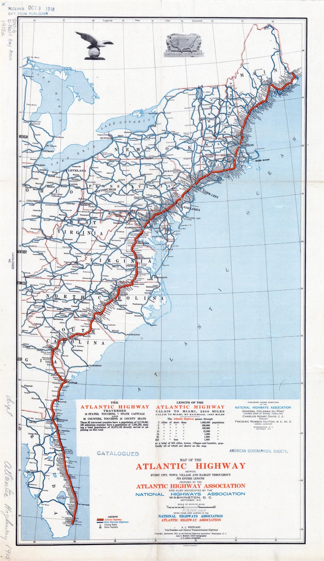 Map of the Atlantic Highway: Showing Every City, Town, Village and Hamlet Throughout Its Entire Length in 1915Map of the Atlantic Highway: Showing Every City, Town, Village and Hamlet Throughout Its Entire Length in 1915
- Regular price
-
$43.95 $99.95 - Regular price
-
$31.95 - Sale price
-
$43.95 $99.95
-
 Map of Oxford County, Maine in 1858Map of Oxford County, Maine in 1858
- Regular price
-
$43.95 $204.95 - Regular price
-
$38.95 - Sale price
-
$43.95 $204.95
-
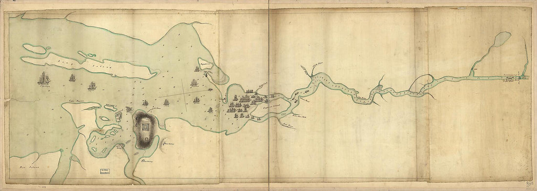
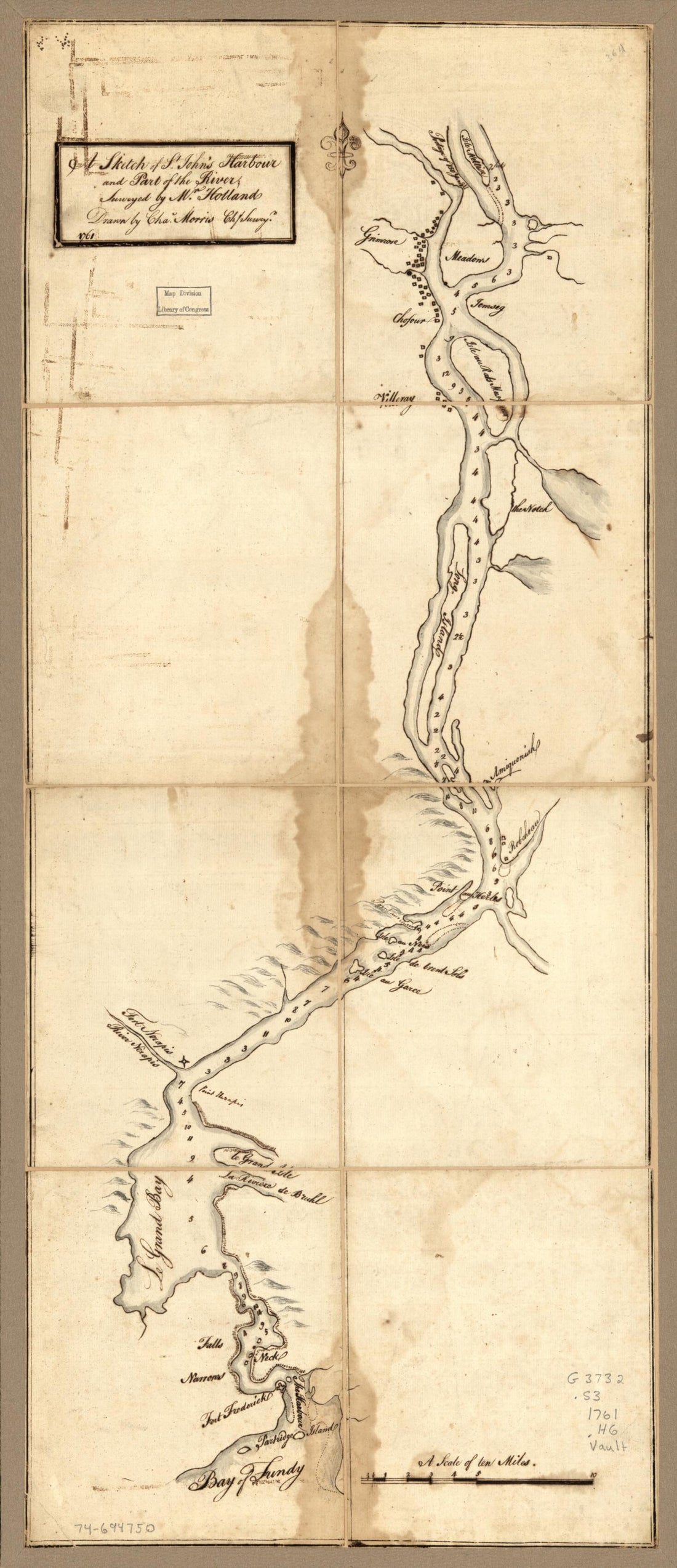 A Sketch of St. John's Harbour and Part of the River; in 1761A Sketch of St. John's Harbour and Part of the River; in 1761
- Regular price
-
$43.95 $99.95 - Regular price
-
$38.95 - Sale price
-
$43.95 $99.95
-
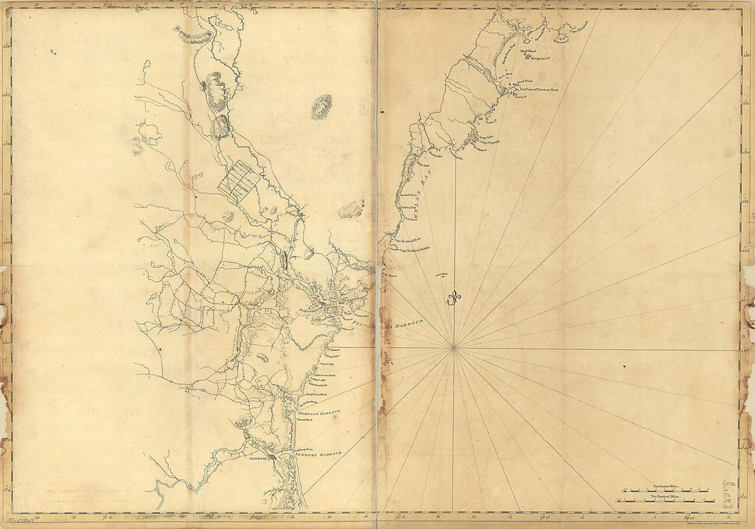 Coast of New England from Cape Elizabeth, Maine to Newburyport, Mass 1776Coast of New England from Cape Elizabeth, Maine to Newburyport, Mass 1776
- Regular price
-
$46.95 $129.95 - Regular price
-
$41.95 - Sale price
-
$46.95 $129.95
-
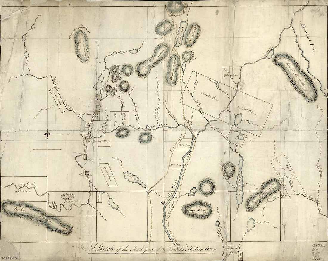 A Sketch of the North Part of the Kennebec Million Acres 1827A Sketch of the North Part of the Kennebec Million Acres 1827
- Regular price
-
$43.95 $83.95 - Regular price
-
$38.95 - Sale price
-
$43.95 $83.95
-
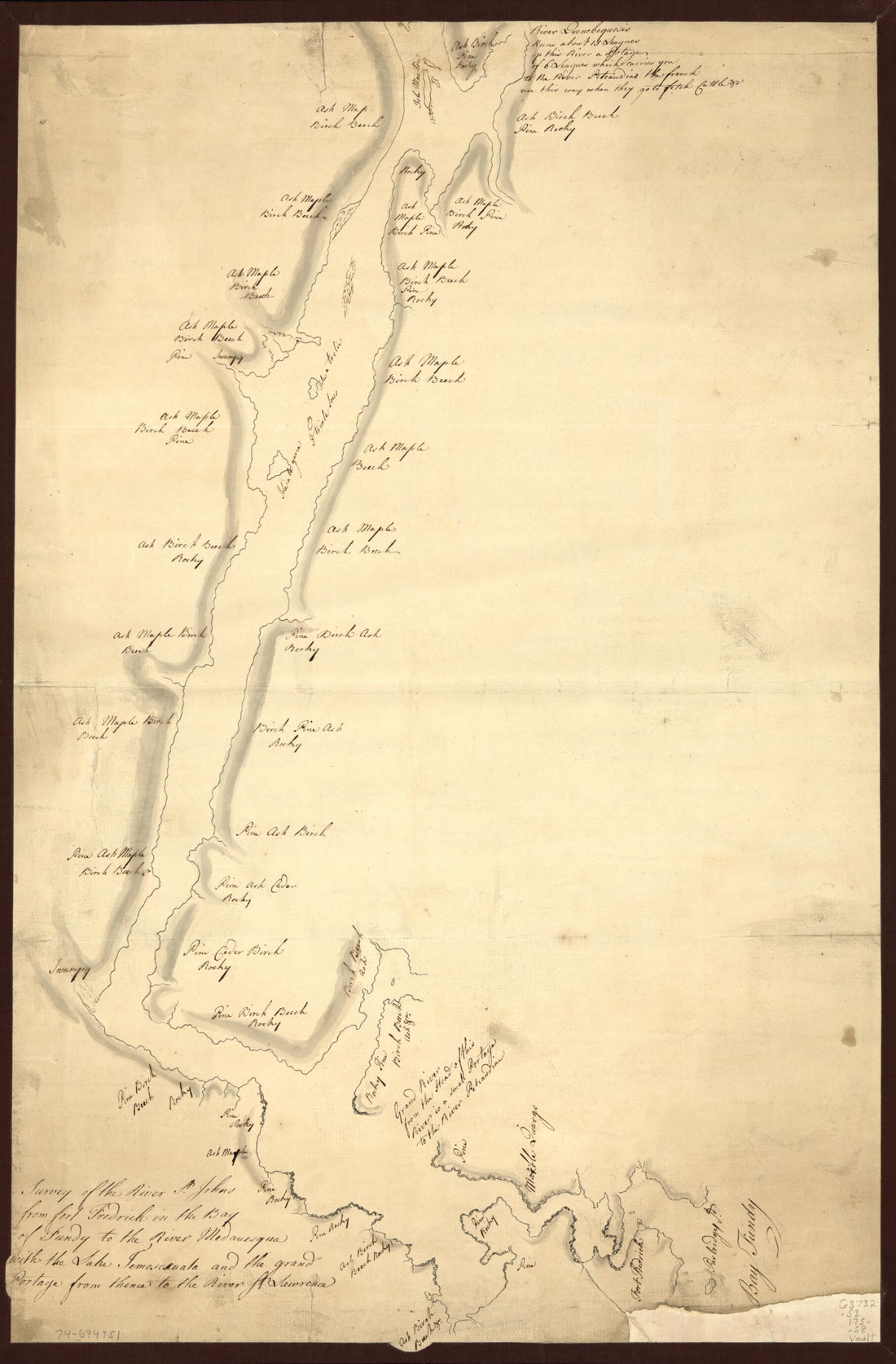 Survey of the River St. Johns From Fort Frederick In the Bay of Fundy to the River Medauesqua With the Lake Temesecuala and the Grand Portage From Thence to the River St. Lawrence in 1750Survey of the River St. Johns From Fort Frederick In the Bay of Fundy to the River Medauesqua With the Lake Temesecuala and the Grand Portage From Thence to the River St. Lawrence in 1750
- Regular price
-
$46.95 $99.95 - Regular price
-
$41.95 - Sale price
-
$46.95 $99.95
-
 Map of the Eastern Portion of British North America : Including the Gulf of St. Lawrence, and Part of the New England States 1852Map of the Eastern Portion of British North America : Including the Gulf of St. Lawrence, and Part of the New England States 1852
- Regular price
-
$46.95 $247.95 - Regular price
-
$41.95 - Sale price
-
$46.95 $247.95
-
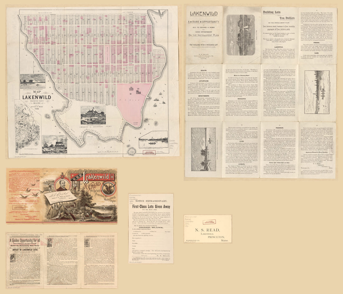 Map of Lakenwild, Washington County, Maine : Owned by Nathan S. Read : in 1886Map of Lakenwild, Washington County, Maine : Owned by Nathan S. Read : in 1886
- Regular price
-
$43.95 $207.95 - Regular price
-
$38.95 - Sale price
-
$43.95 $207.95
-
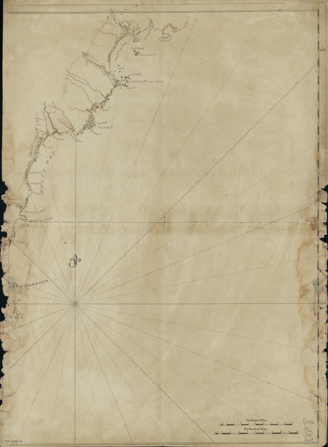 Coast of New England From Cape Elizabeth, Maine to Newburyport, Mass in 1776Coast of New England From Cape Elizabeth, Maine to Newburyport, Mass in 1776
- Regular price
-
$43.95 $88.95 - Regular price
-
$38.95 - Sale price
-
$43.95 $88.95
-
 Map of Waldo County, Maine 1859Map of Waldo County, Maine 1859
- Regular price
-
$43.95 $229.95 - Regular price
-
$38.95 - Sale price
-
$43.95 $229.95
-
 Penobscot River and Bay, With the Operations of the English Fleet, Under Sir George Collyer, Against the Division of Massachusetts Troops Acting Against Fort Castine, August 1779; With Full Soundings Up to the Present Site of BangorPenobscot River and Bay, With the Operations of the English Fleet, Under Sir George Collyer, Against the Division of Massachusetts Troops Acting Against Fort Castine, August 1779; With Full Soundings Up to the Present Site of Bangor
- Regular price
-
$46.95 $214.95 - Regular price
-
$41.95 - Sale price
-
$46.95 $214.95
-
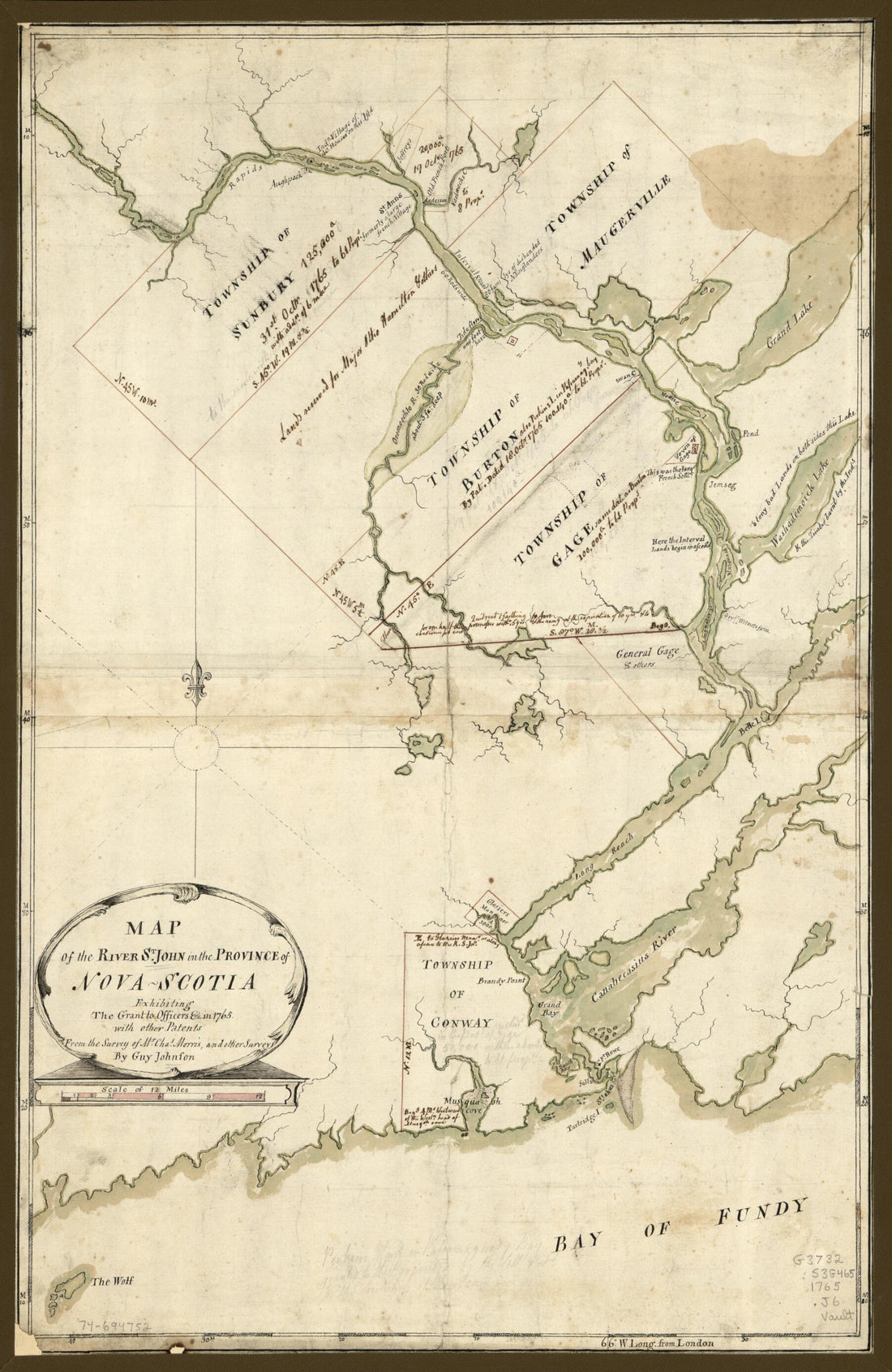 Map of the River St. John In the Province of Nova Scotia, Exhibiting the Grant to Officers &c. In 1765, With Other PatentsMap of the River St. John In the Province of Nova Scotia, Exhibiting the Grant to Officers &c. In 1765, With Other Patents
- Regular price
-
$46.95 $99.95 - Regular price
-
$41.95 - Sale price
-
$46.95 $99.95


