487 products
-
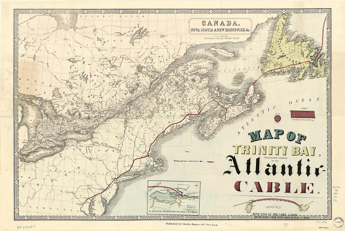 Cable 1901Cable 1901
- Regular price
-
$46.95 $159.95 - Regular price
-
$41.95 - Sale price
-
$46.95 $159.95
-
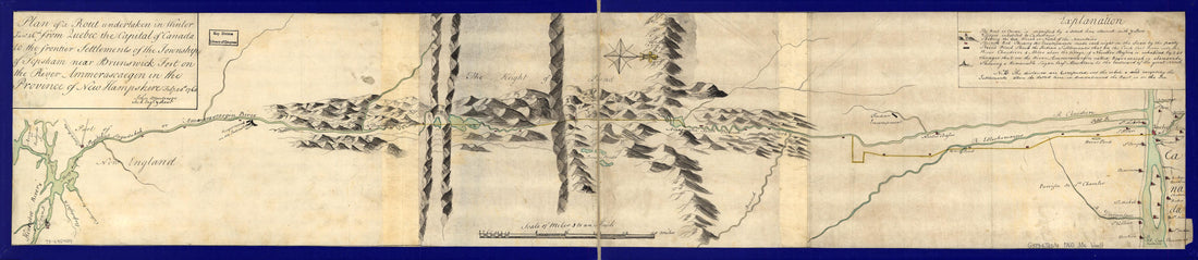 Plan of a Rout Undertaken In Winter, Jany. 26th, from Quebec, the Capital of Canada, to the Frontier Settlements of the Township of Topsham Near Brunswick Fort On the River Ammerascaegun In the Province of New Hampshire, Feby. 20th 1760Plan of a Rout Undertaken In Winter, Jany. 26th, from Quebec, the Capital of Canada, to the Frontier Settlements of the Township of Topsham Near Brunswick Fort On the River Ammerascaegun In the Province of New Hampshire, Feby. 20th 1760
- Regular price
-
$45.95 $99.95 - Regular price
-
$40.95 - Sale price
-
$45.95 $99.95
-
 Isothermal Chart of the Region North of the 36th Parallel &c. &c. Between the Atlantic & Pacific Oceans; Compiled Under the Direction of Isaac I. Stevens, Govnr. of Washington Territory 1859Isothermal Chart of the Region North of the 36th Parallel &c. &c. Between the Atlantic & Pacific Oceans; Compiled Under the Direction of Isaac I. Stevens, Govnr. of Washington Territory 1859
- Regular price
-
$46.95 $99.95 - Regular price
-
$41.95 - Sale price
-
$46.95 $99.95
-
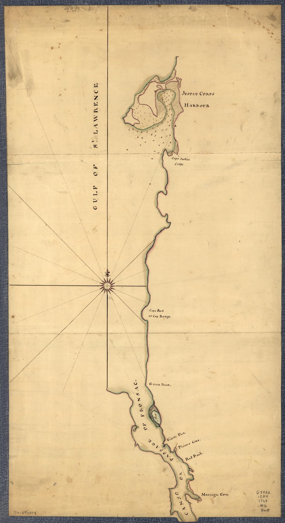 Northern Part of the Gut of Canso, Part of the Island of Cape Bocton in 1764Northern Part of the Gut of Canso, Part of the Island of Cape Bocton in 1764
- Regular price
-
$46.95 $99.95 - Regular price
-
$41.95 - Sale price
-
$46.95 $99.95
-
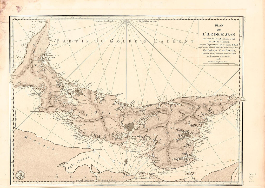 Plan De L'île De St. Jean Au Nord De L'Acadie Et Dans Le Sud Du Golfe De St. Laurent 1778Plan De L'île De St. Jean Au Nord De L'Acadie Et Dans Le Sud Du Golfe De St. Laurent 1778
- Regular price
-
$43.95 $112.95 - Regular price
-
$32.95 - Sale price
-
$43.95 $112.95
-
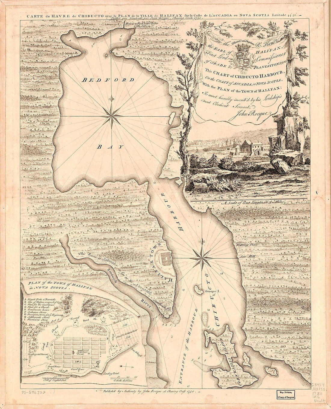 This Chart of Chibucto Harbour, On the Coast of Accadia, Or Nova Scotia, With the Plan of the Town of Halifax. Carte Du Havre De Chibucto Avec Le Plan De La Ville De Halifax Fur La Coste De L'Accadia Ou Nova Scotia Latitude 44⁰.31ʹ 1750This Chart of Chibucto Harbour, On the Coast of Accadia, Or Nova Scotia, With the Plan of the Town of Halifax. Carte Du Havre De Chibucto Avec Le Plan De La Ville De Halifax Fur La Coste De L'Accadia Ou Nova Scotia Latitude 44⁰.31ʹ 1750
- Regular price
-
$39.95 $109.95 - Regular price
-
$34.95 - Sale price
-
$39.95 $109.95
-
 Plan Du Cap Breton, Dit Louisbovrg Avec Ces Environs Pries (Plan Du Cap Breton, Dit Louisbourg Avec Ces Environs Pries) 1758Plan Du Cap Breton, Dit Louisbovrg Avec Ces Environs Pries (Plan Du Cap Breton, Dit Louisbourg Avec Ces Environs Pries) 1758
- Regular price
-
$46.95 $329.95 - Regular price
-
$41.95 - Sale price
-
$46.95 $329.95
-
 Map Showing Coast of Northwestern Portion of Vancouver Island in 1786Map Showing Coast of Northwestern Portion of Vancouver Island in 1786
- Regular price
-
$39.95 $83.95 - Regular price
-
$34.95 - Sale price
-
$39.95 $83.95
-
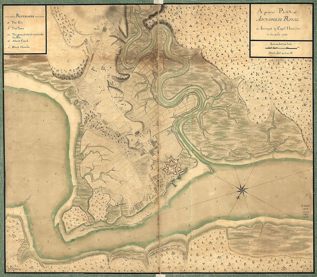 A General Plan of Annapolis Royal 1753A General Plan of Annapolis Royal 1753
- Regular price
-
$39.95 $182.95 - Regular price
-
$34.95 - Sale price
-
$39.95 $182.95
-
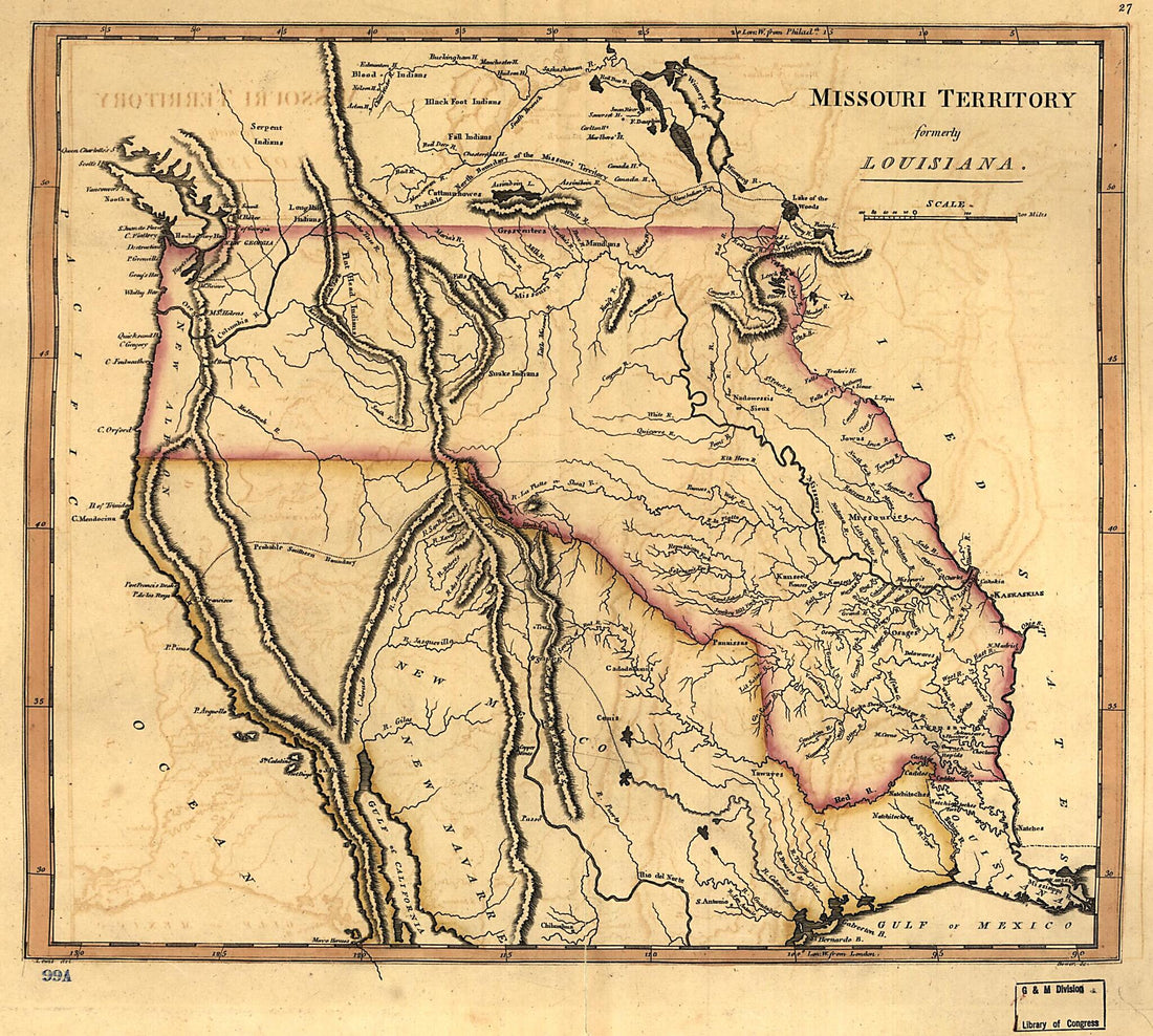 Missouri Territory Formerly Louisiana 1814Missouri Territory Formerly Louisiana 1814
- Regular price
-
$39.95 $83.95 - Regular price
-
$29.95 - Sale price
-
$39.95 $83.95
-
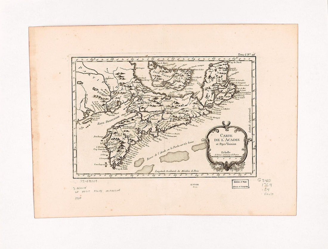 Carte De L'Acadie Et Pays Voisins 1764Carte De L'Acadie Et Pays Voisins 1764
- Regular price
-
$43.95 $88.95 - Regular price
-
$32.95 - Sale price
-
$43.95 $88.95
-
 A New & Accurate Map of the Islands of Newfoundland, Cape Breton, St. John and Anticosta; Together With the Neighbouring Countries of Nova Scotia, Canada, &c 1752A New & Accurate Map of the Islands of Newfoundland, Cape Breton, St. John and Anticosta; Together With the Neighbouring Countries of Nova Scotia, Canada, &c 1752
- Regular price
-
$39.95 $88.95 - Regular price
-
$34.95 - Sale price
-
$39.95 $88.95


