584 products
-
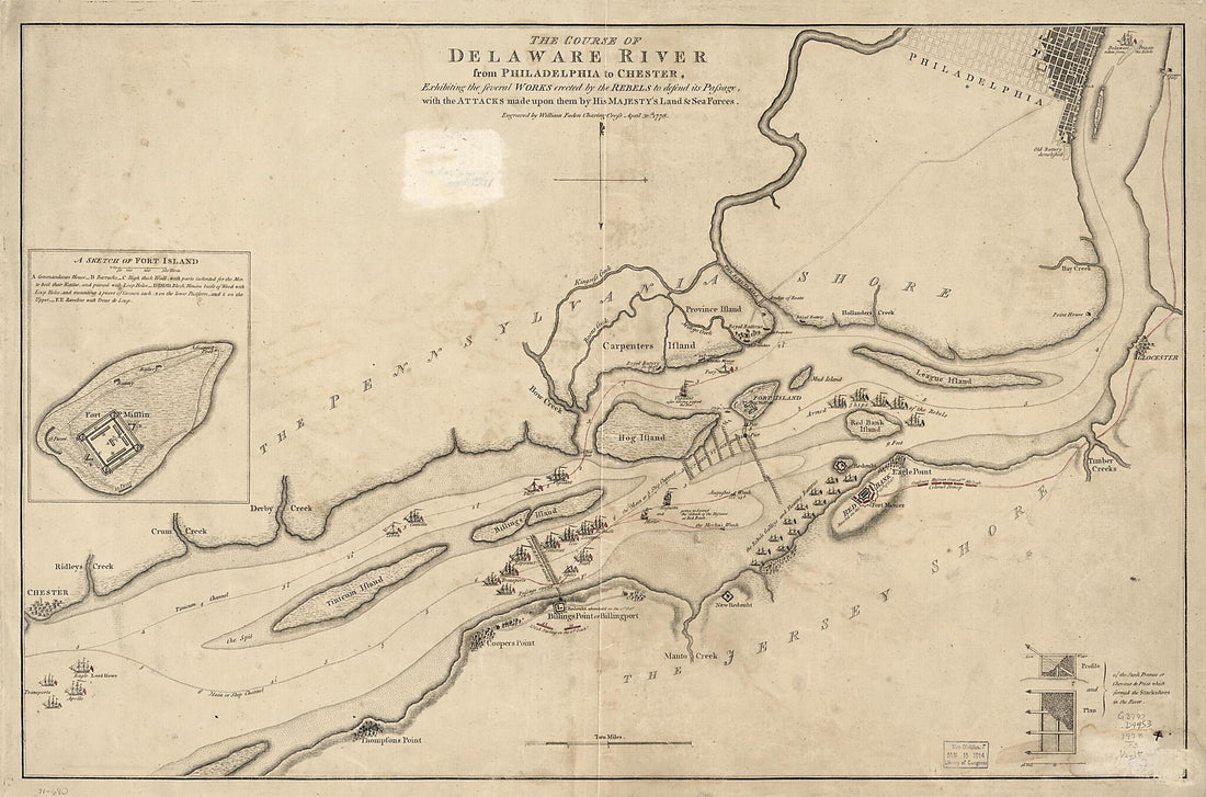 The Course of Delaware River from Philadelphia to Chester, Exhibiting the Several Works Erected by the Rebels to Defend Its Passage, With the Attacks Made Upon Them by His Majesty's Land & Sea Forces 1778The Course of Delaware River from Philadelphia to Chester, Exhibiting the Several Works Erected by the Rebels to Defend Its Passage, With the Attacks Made Upon Them by His Majesty's Land & Sea Forces 1778
- Regular price
-
$46.95 $208.95 - Regular price
-
$41.95 - Sale price
-
$46.95 $208.95
-
 Sonds, Sables Et Les Gissements Des Marques Les Plus Considérables Du Pays, Depuis Les Caps James Et May Jusqu'à Philadelphie, Suivant La Carte Originale 1778Sonds, Sables Et Les Gissements Des Marques Les Plus Considérables Du Pays, Depuis Les Caps James Et May Jusqu'à Philadelphie, Suivant La Carte Originale 1778
- Regular price
-
$43.95 $98.95 - Regular price
-
$32.95 - Sale price
-
$43.95 $98.95
-
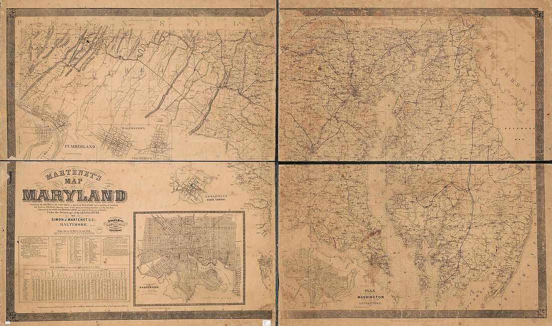 Martenet's Map of Maryland : Including the District of Columbia, a Sketch of Delaware, and a Portion of Northern and Eastern Virginia Showing Some of the Most Interesting Localities of the Late War in 1865Martenet's Map of Maryland : Including the District of Columbia, a Sketch of Delaware, and a Portion of Northern and Eastern Virginia Showing Some of the Most Interesting Localities of the Late War in 1865
- Regular price
-
$46.95 $261.95 - Regular price
-
$41.95 - Sale price
-
$46.95 $261.95
-
 Pictorial Map of the Seat of War, Showing Parts of the States of Maryland, Delaware, Virginia, and North Carolina, and Also the Coast Line from Cape Henry to Fort Pickens, With the United States Blockading Fleet 1861Pictorial Map of the Seat of War, Showing Parts of the States of Maryland, Delaware, Virginia, and North Carolina, and Also the Coast Line from Cape Henry to Fort Pickens, With the United States Blockading Fleet 1861
- Regular price
-
$43.95 $88.95 - Regular price
-
$32.95 - Sale price
-
$43.95 $88.95
-
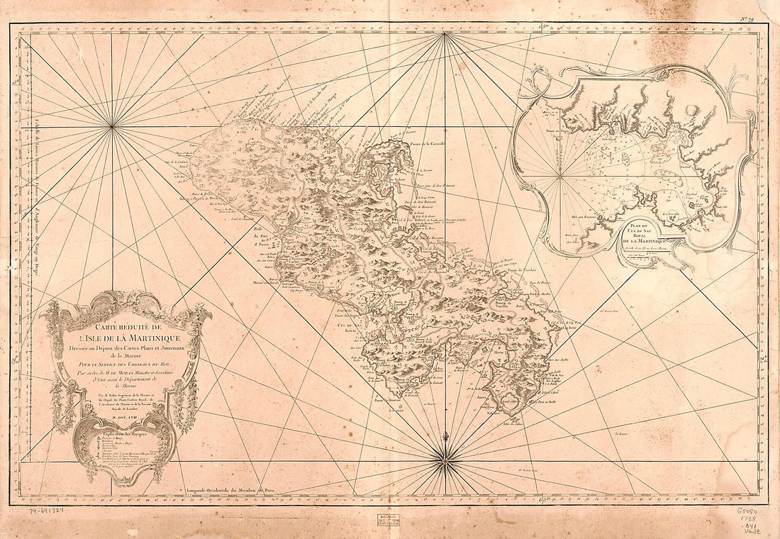 Carte Réduite De L'isle De La Martinique 1758Carte Réduite De L'isle De La Martinique 1758
- Regular price
-
$46.95 $199.95 - Regular price
-
$41.95 - Sale price
-
$46.95 $199.95
-
 Plano De Philadelphia 1756Plano De Philadelphia 1756
- Regular price
-
$43.95 $141.95 - Regular price
-
$32.95 - Sale price
-
$43.95 $141.95
-
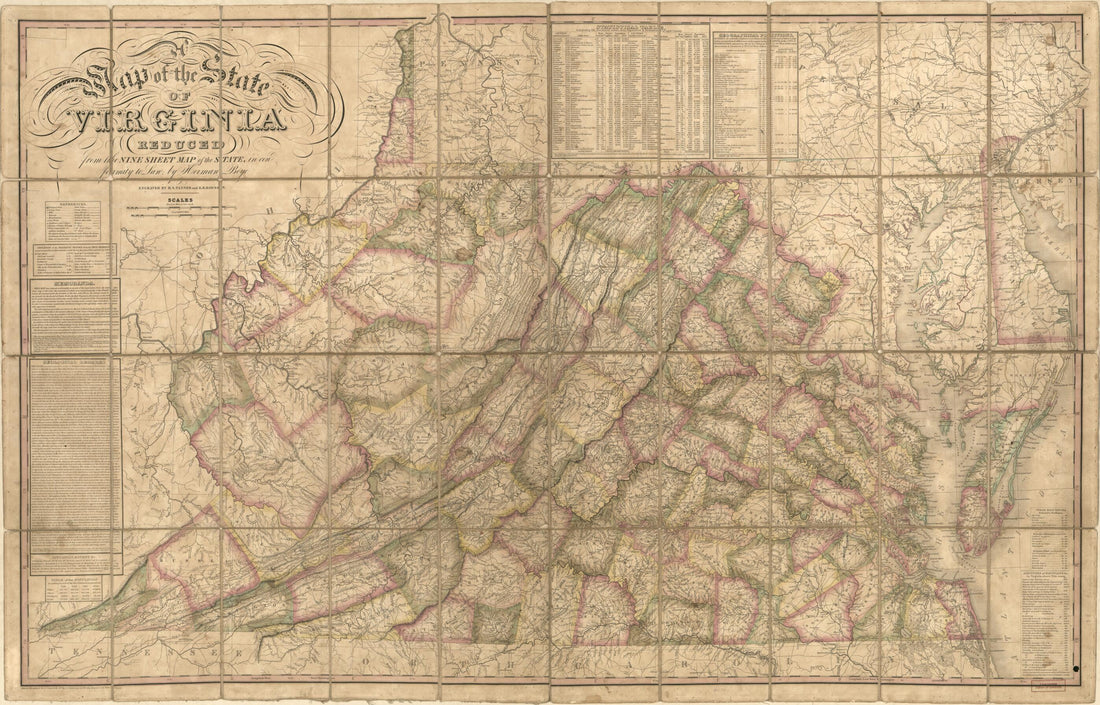 A Map of the State of Virginia : Reduced from the Nine Sheet Map of the State In Conformity to Law (Map of Virginia) 1827A Map of the State of Virginia : Reduced from the Nine Sheet Map of the State In Conformity to Law (Map of Virginia) 1827
- Regular price
-
$46.95 $162.95 - Regular price
-
$41.95 - Sale price
-
$46.95 $162.95
-
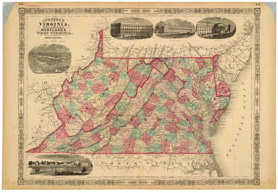 Johnson's Virginia, Delaware, Maryland & West Virginia 1864Johnson's Virginia, Delaware, Maryland & West Virginia 1864
- Regular price
-
$46.95 $254.95 - Regular price
-
$41.95 - Sale price
-
$46.95 $254.95
-
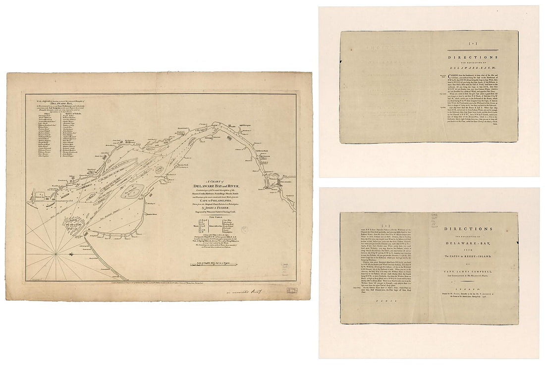 A Chart of Delaware Bay and River, Containing a Full & Exact Description of the Shores, Creeks, Harbours, Soundings, Shoals, Sands, and Bearings of the Most Considerable Land Marks, from the Cape to Philadelphia 1776A Chart of Delaware Bay and River, Containing a Full & Exact Description of the Shores, Creeks, Harbours, Soundings, Shoals, Sands, and Bearings of the Most Considerable Land Marks, from the Cape to Philadelphia 1776
- Regular price
-
$46.95 $326.95 - Regular price
-
$41.95 - Sale price
-
$46.95 $326.95
-
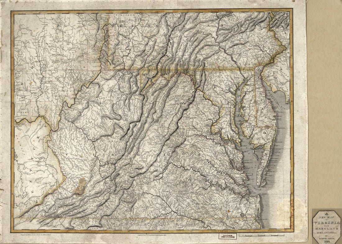 A New Map of Virginia With Maryland, Delaware & V 1814A New Map of Virginia With Maryland, Delaware & V 1814
- Regular price
-
$43.95 $88.95 - Regular price
-
$32.95 - Sale price
-
$43.95 $88.95
-
 Map of New Castle County, Delaware : from Original Surveys 1849Map of New Castle County, Delaware : from Original Surveys 1849
- Regular price
-
$43.95 $182.95 - Regular price
-
$32.95 - Sale price
-
$43.95 $182.95
-
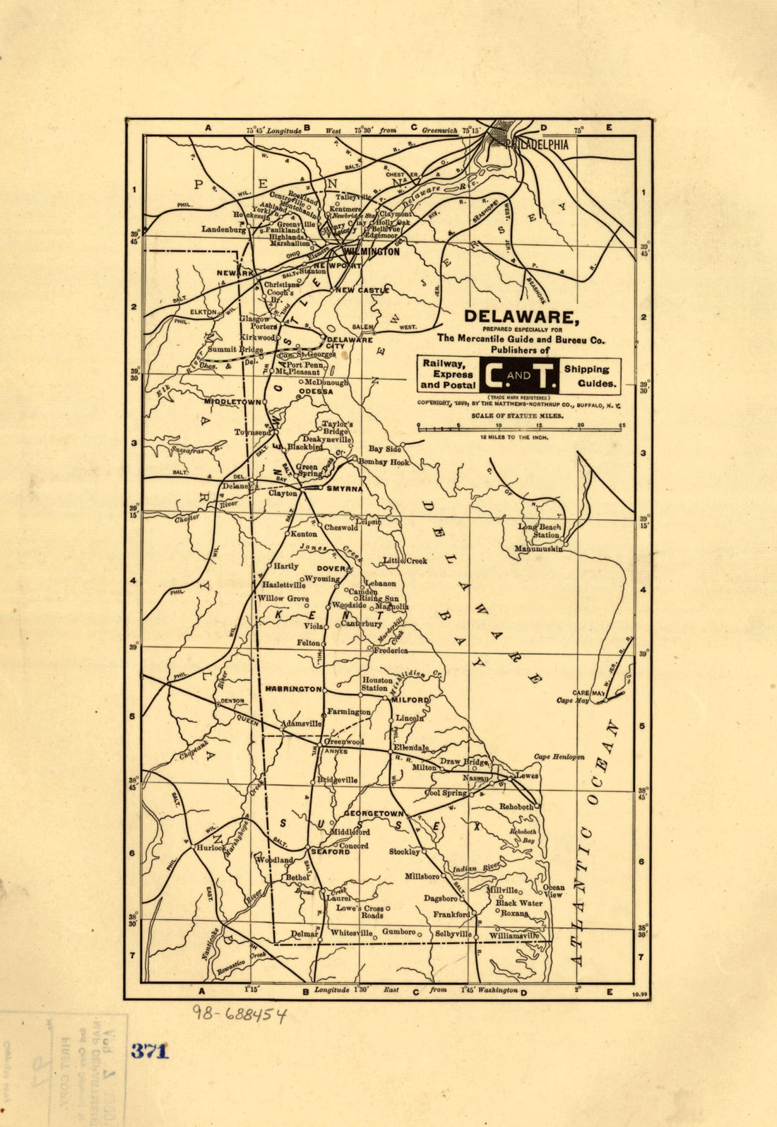 Delaware, Prepared Especially for the Mercantile Guide and Bureau Co. Publishers of Railway, Express and Postal Shipping Guides 1899Delaware, Prepared Especially for the Mercantile Guide and Bureau Co. Publishers of Railway, Express and Postal Shipping Guides 1899
- Regular price
-
$39.95 $99.95 - Regular price
-
$29.95 - Sale price
-
$39.95 $99.95


